Report
On the ascent to the summit of Pik Zvezdny 2265 m via the western wall, Balezin's route, 5B category of difficulty, by the team from the Republic of Khakassia on August 8, 2024.
I. Ascent Passport
| 1. General Information | ||
|---|---|---|
| 1.1 | Full name, sports rank of the leader | Ivanov Timofey Pavlovich, CMS |
| 1.2 | Full name, sports rank of participants | Zhigalov Alexander Vladimirovich, MS |
| 1.3 | Full name of coach | Zhigalov Alexander Vladimirovich, MS |
| 1.4 | Organization | Federation of Alpinism and Rock Climbing of the Republic of Khakassia |
| 2. Characteristics of the Ascent Object | ||
| 2.1 | Region | Sayans |
| 2.2 | Valley | Western Sayan, Ergaki ridge |
| 2.3 | Number of section according to the 2013 classification table | 6.2 |
| 2.4 | Name and height of the summit | Pik Zvezdny – 2265 m |
| 2.5 | Geographical coordinates of the summit | 52.82969760570086, 93.4152349486929 |
| 3. Route Characteristics | ||
| 3.1 | Route name | Via the western wall |
| 3.2 | Proposed category of difficulty | 5B |
| 3.3 | Degree of route exploration | Explored |
| 3.4 | Relief characteristics of the route | Rocky |
| 3.5 | Height difference of the route | 400 m |
| 3.6 | Route length | 505 m |
| 3.7 | Technical elements of the route (total length of sections of varying difficulty with indication of relief character (ice-snow, rocky)) | 5th cat. diff. Rocks – 180 m. 6th cat. diff. Rocks – 250 m. |
| 3.8 | Average steepness of the route, ° | 67° |
| 3.9 | Average steepness of the main part of the route, ° | 82° |
| 3.10 | Descent from the summit | Descent via the "Kant" route 5A |
| 3.11 | Additional route characteristics | At the start of the route, overgrown, dirty, and wet after rains |
| 4. Characteristics of Team Actions | ||
| :--: | :-- | :-- |
| 4.1 | Time of movement (team's walking hours, indicated in hours and days) | 9 h |
| 4.2 | Overnight stays | No |
| 4.3 | Route processing time | No |
| 4.4 | Exit to the route — start of work on the route | 5:20 August 8, 2024 10:00 August 8, 2024 |
| 4.5 | Reach the summit | 19:00 August 8, 2024 |
|---|---|---|
| 4.6 | Return to base camp | 1:00 August 9, 2024 |
| 5. Meteorological Conditions | ||
| 5.1 | Temperature, °C | +10–+15 °C |
| 5.2 | Wind force, m/s | 5–10 m/s |
| 5.3 | Precipitation | Yes |
| 5.4 | Visibility, m | Full |
| 6. Person responsible for the report | ||
| 6.1 | Full name, e-mail | Ivanov Timofey Pavlovich timofey_ivp@mail.ru |
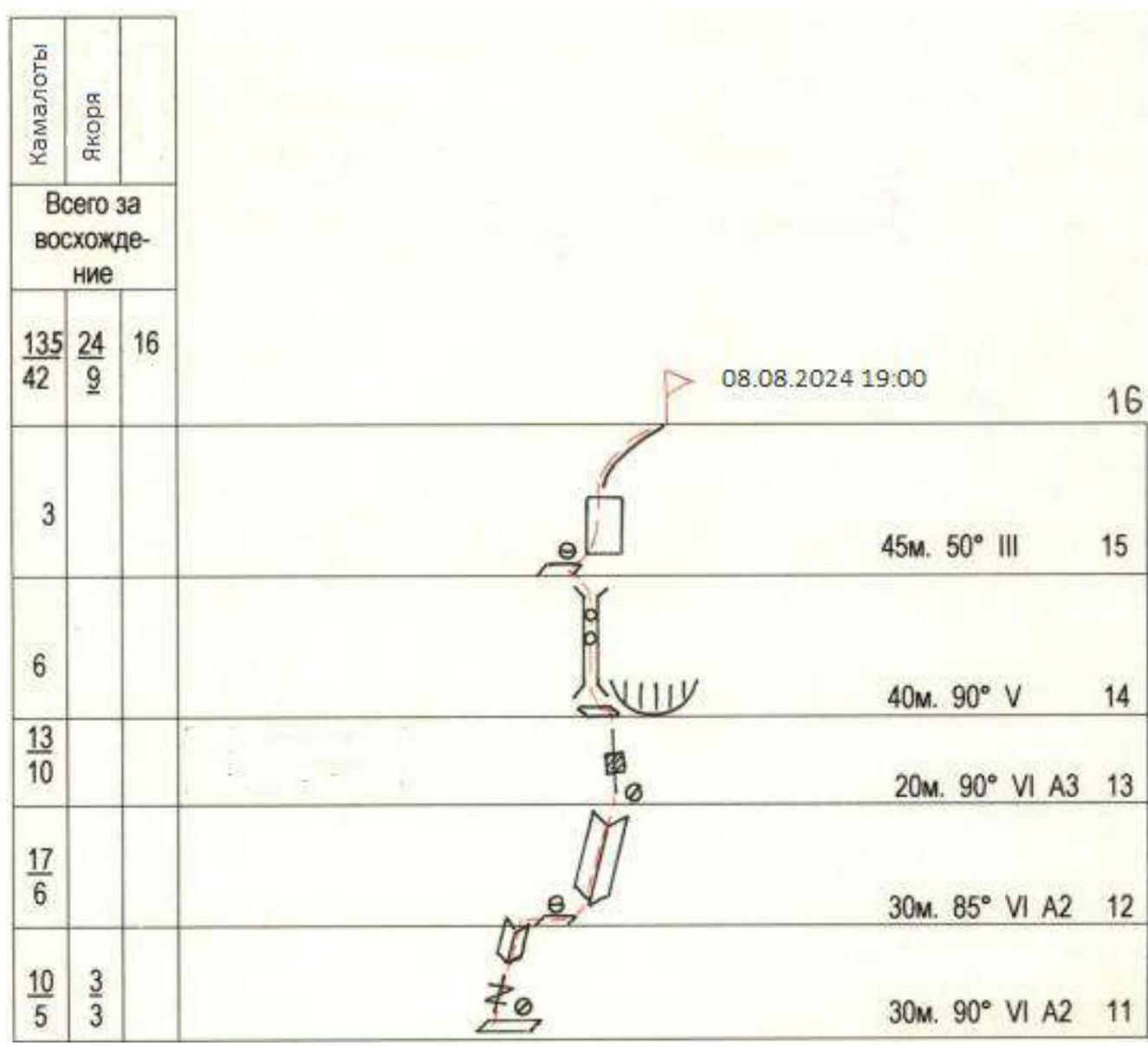
Photo of the route profile.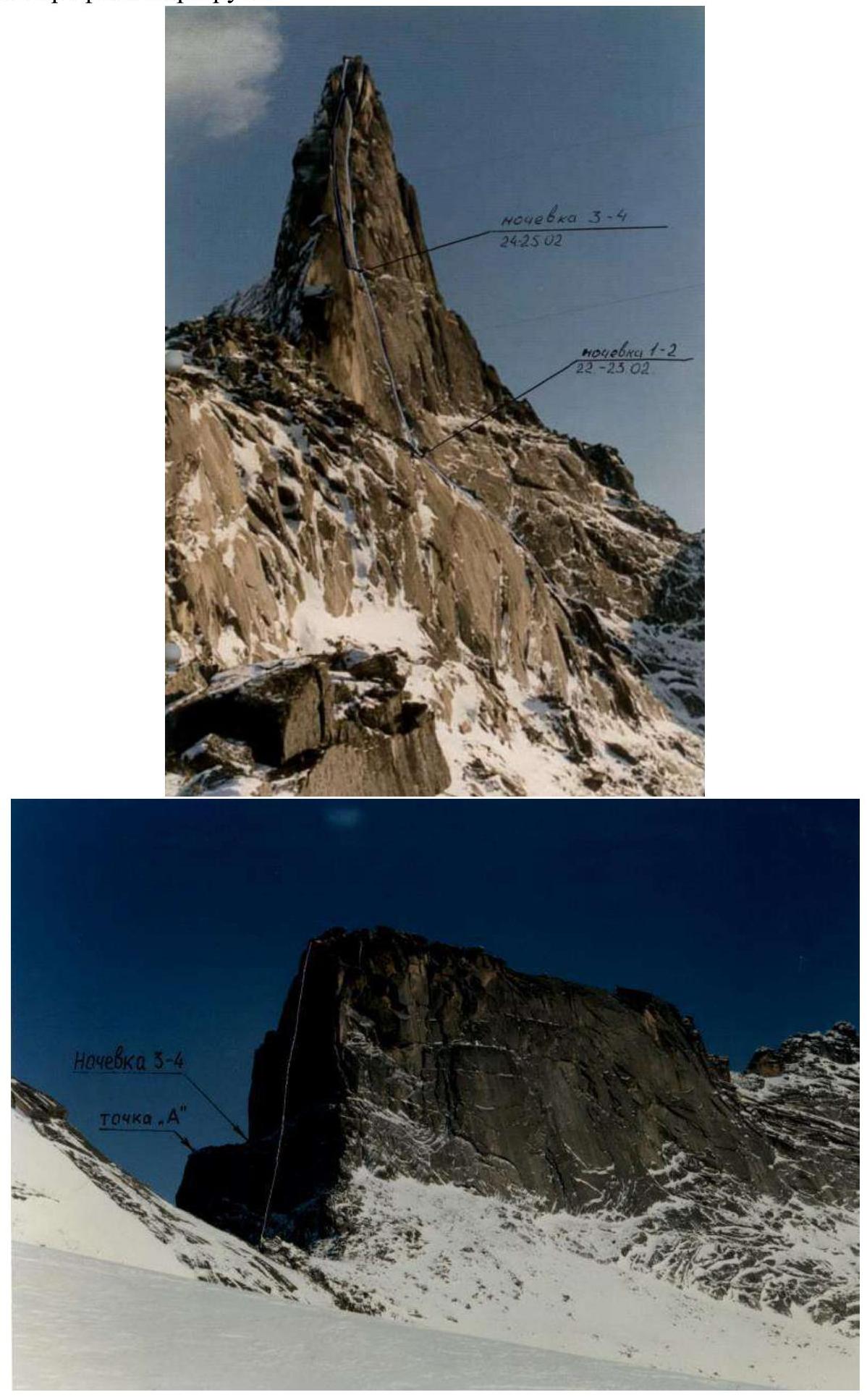 Photos taken from V.V. Balezin's report. There were no overnight stays during this ascent.
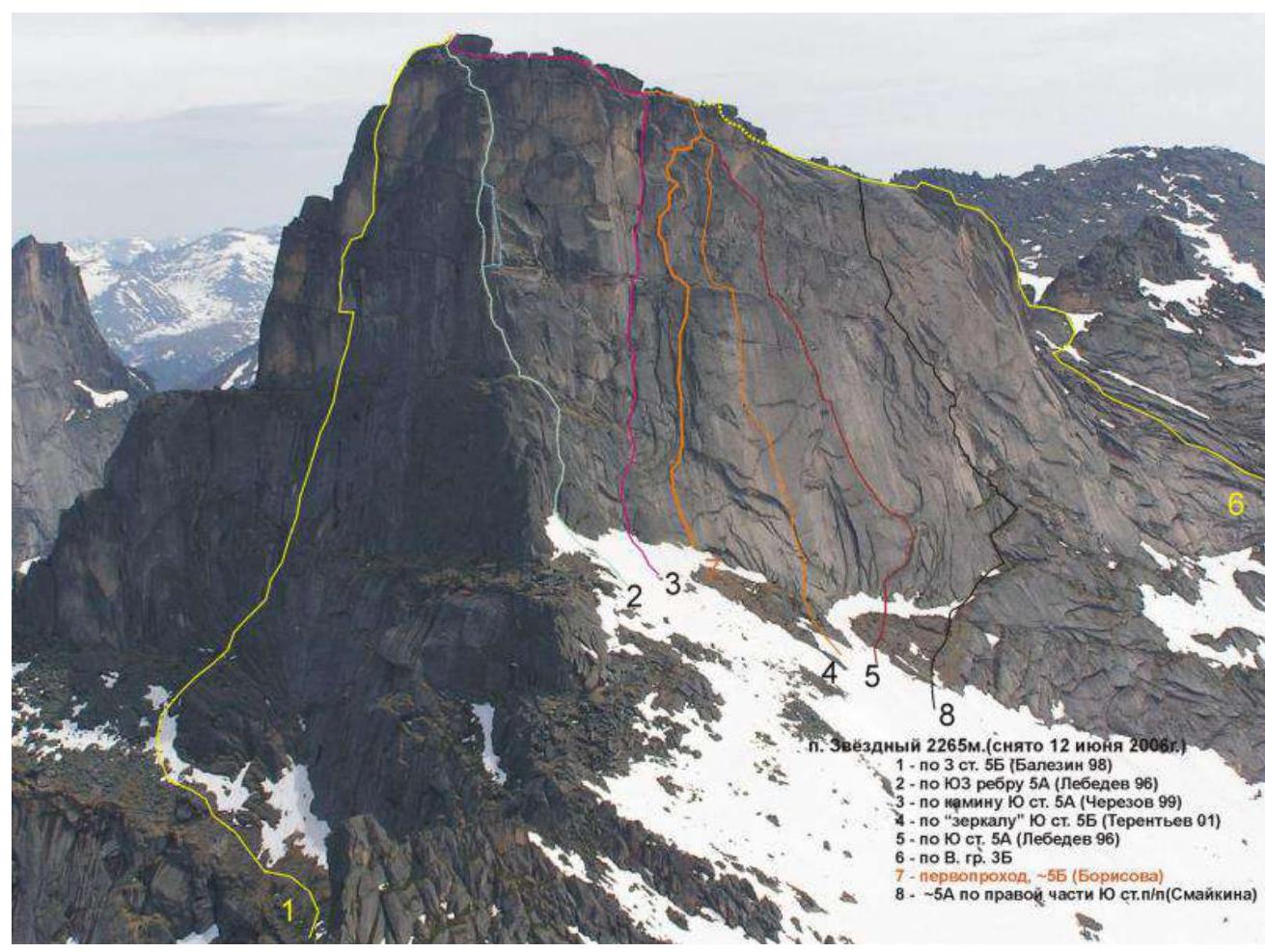 Photo taken from the "Guide to Ergaki", route No. 1. Route diagram in UIAA symbols.
Tactical Actions of the Team
- The route was completed without prior processing, overnight stays, or leaving equipment behind.
- The first half of the day was cloudy, and the route was damp due to rain.
- The first half of the route was led by Timofey Ivanov. On the R7–R8 section, Alexander Zhigalov became the leader.
- They used a simultaneous scheme, two ropes (dynamic and static), and a standard set of equipment.
- 60% of the route was completed using free climbing. The second participant used jumar ascenders.
- The route is monolithic and convenient, recommended for future teams.
- The route started from the very bottom, with a rappel down from the Zvezdny pass.
- Ropes left by previous teams were found and marked.
- Descent was made along the "Kant" route using their own ropes.
- The event was conducted as part of the "Sayanskaya Vertikal 2024" event organized by the Krasnoyarsk Alpinism Federation.
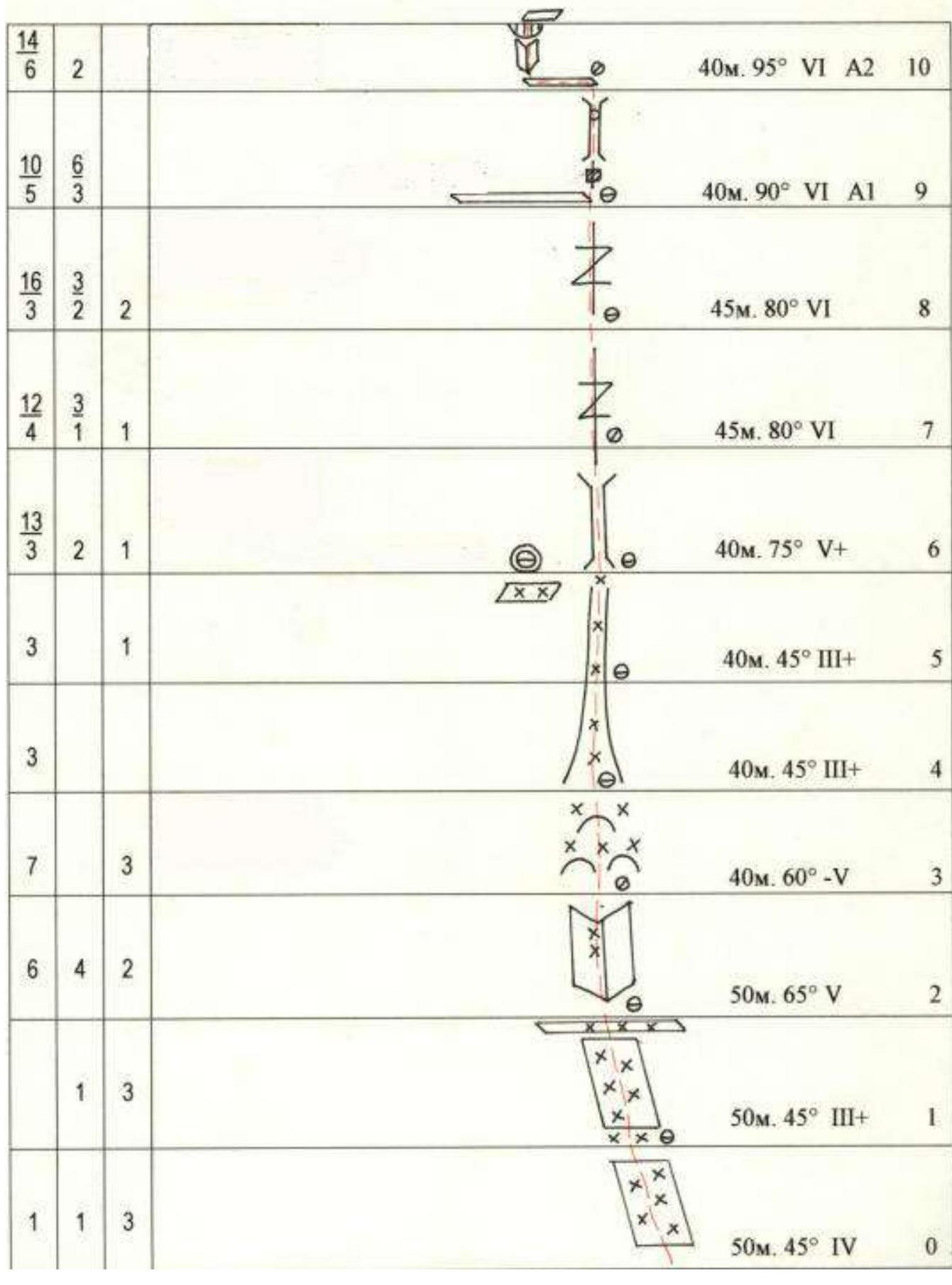
Brief Description of Route Passage
| Section No. | Description | Photo No. |
|---|---|---|
| R1–R2 | Section traversed using free climbing. Belay points mostly camalots. | |
| R2–R3 | Internal corner with smoothed rocks like "ram's foreheads". Anchor belays, anchors with bend, camalots. Section traversed using free climbing. | |
| R3–R4 | Smoothed monolithic "ram's foreheads". Belay points mostly camalots. Section traversed using free climbing. | 1 |
| R4–R6 | Couloir, exit under the wall part of the route. Belay points mostly camalots, rarely anchors. Section traversed using free climbing. | 2 |
| R6–R7 | Large internal corner. Inside which is a chimney that gradually turns into a crack about 10–15 cm wide. Climbing is difficult. Belay points mostly camalots, anchors. | 3,4 |
| R7–R8 | Vertical crack 10–20 cm wide, poor relief. | |
| R8–R9 | Continuation of the wide crack, climbing is difficult, exit to a ledge. | |
| R9–R10 | Overhanging crack about 10 m, turning into a chimney in the upper part, followed by an exit to a ledge. Very difficult climbing. | |
| R10–R11 | Along the ledge, traverse left about 10 m, then along an overhanging internal corner under a 2-meter cornice, then along a crack to a small ledge. Upper part of the section is traversed using AID. | 5 |
| R11–R12 | Series of inclined corners and cracks from left to right. Exit to a ledge under a large internal corner. | 6 |
| R12–R13 | Large monolithic internal corner with a crack, at the beginning of the corner - a cornice. Part of the section is traversed using AID | |
| R13–R14 | Vertical crack leading under the left part of the cornice. Section traversed using AID. | 7 |
| R14–R15 | Further under the cornice, traverse left to a small ledge under the beginning of the chimney, then up the chimney with two stops to a ledge. | |
| R15–R16 | Small wall with a crack leading to the pre-summit ridge. Along the ridge about 30 m to the summit. |
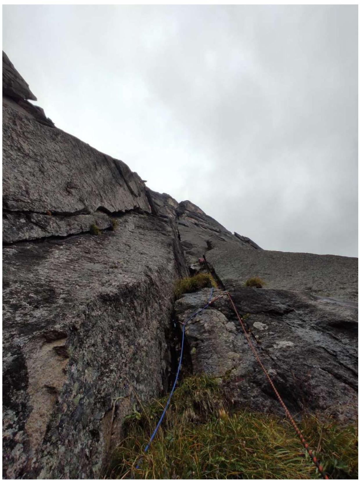 Photo 1. Section R3–R4
Photo 2. Section R5–R6
Photo 1. Section R3–R4
Photo 2. Section R5–R6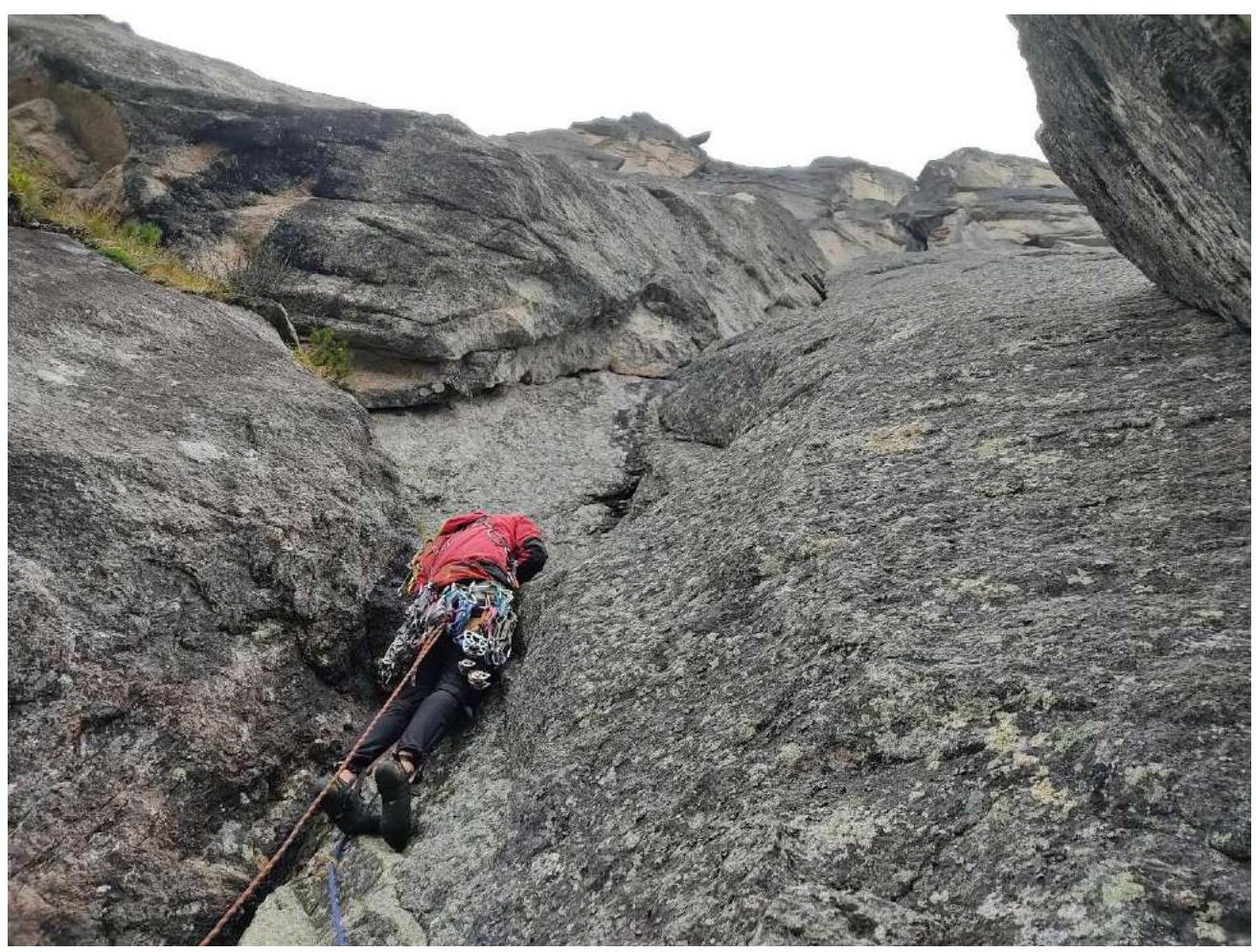 Photo 3. Section R6–R7
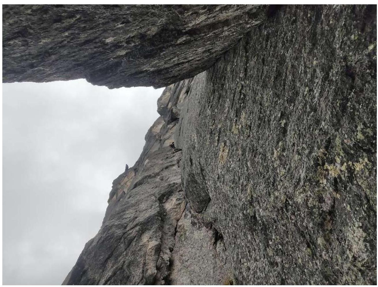 Photo 4. Section R6–R7
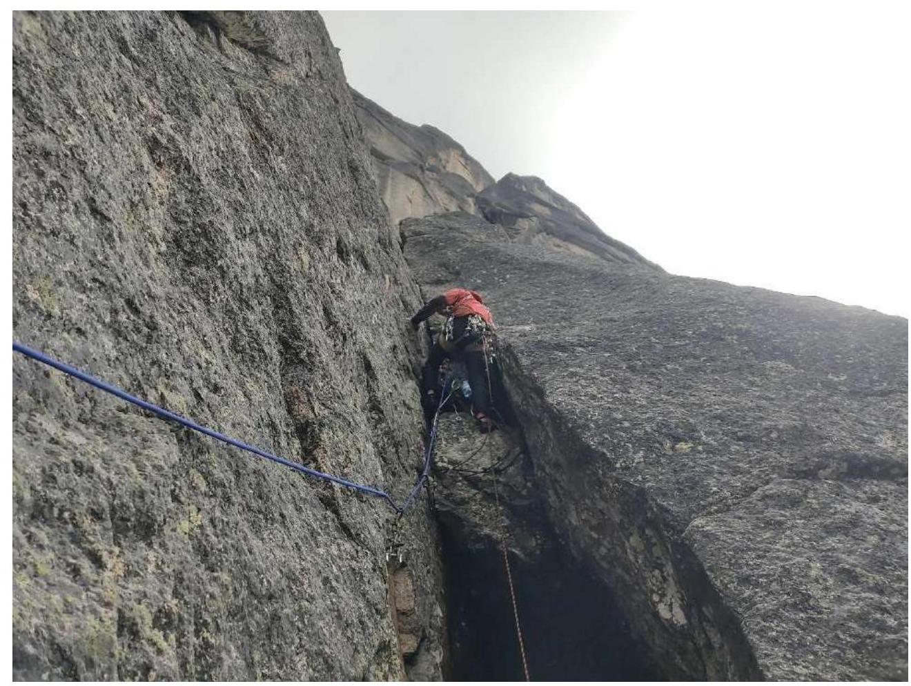 Photo 5. Section R10–R11
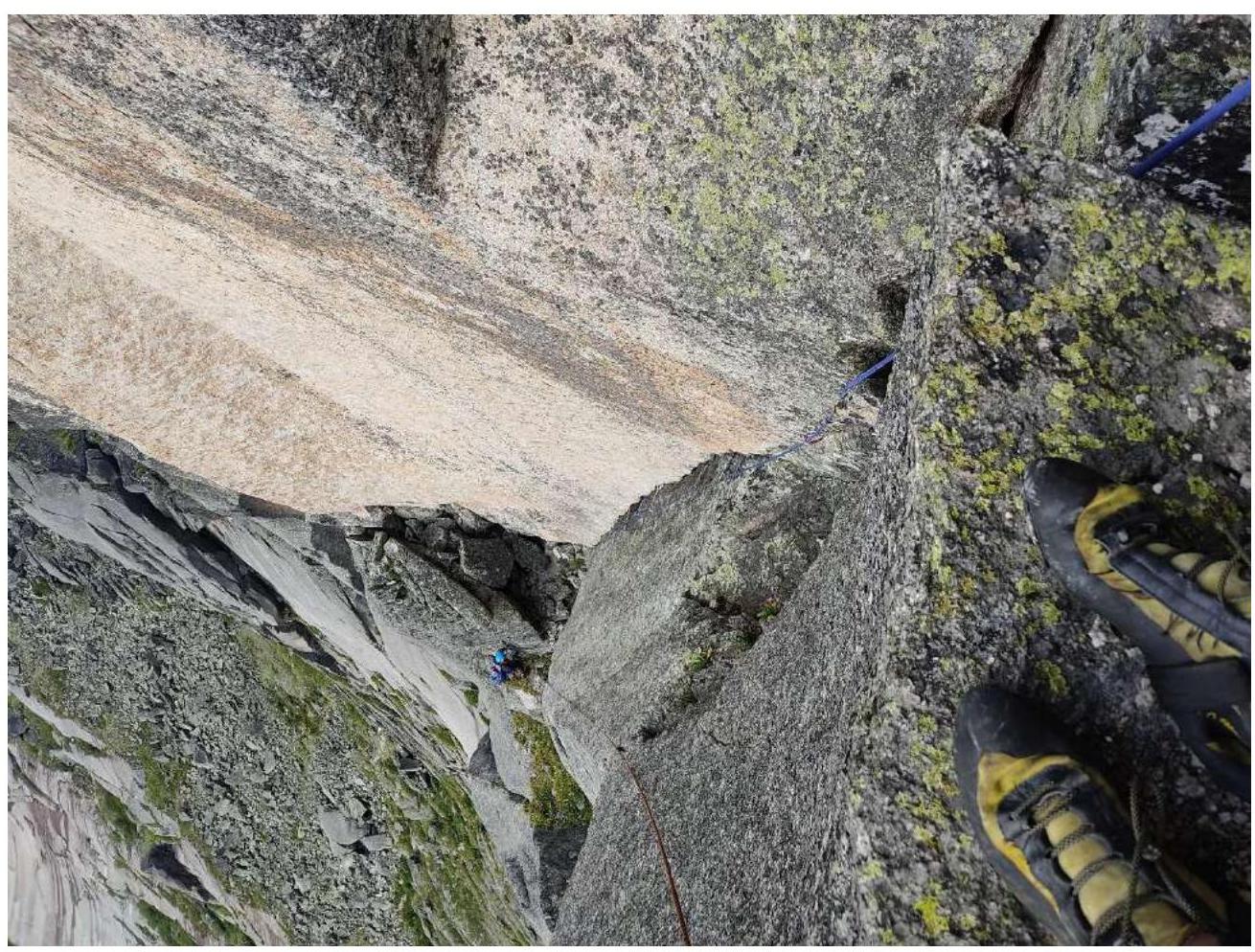 Photo 6. Section R11–R12
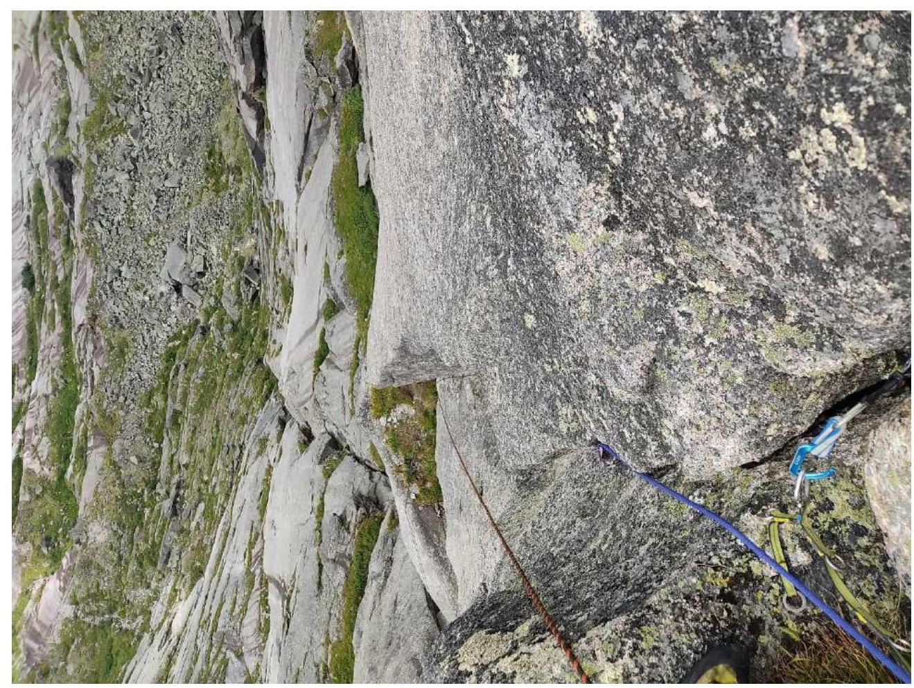 Photo 7. Section R13–R14
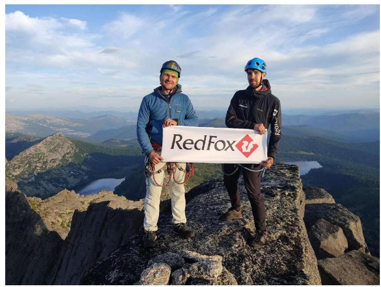
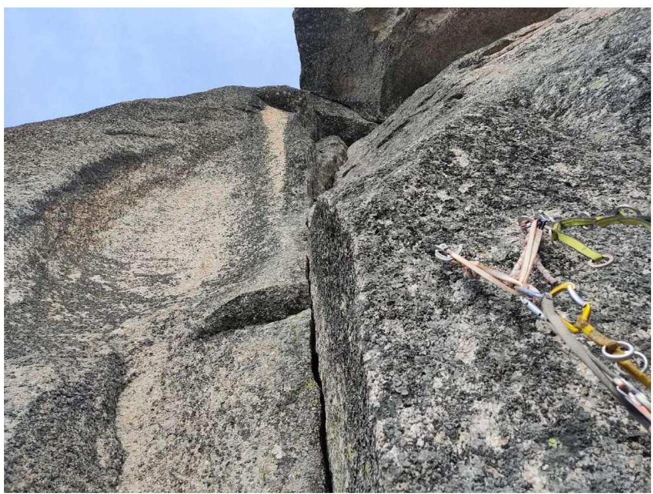 Photo 8. Photograph from the summit