ASCENT REPORT
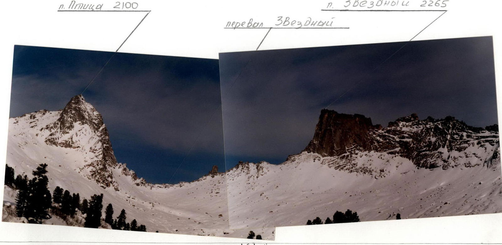
- Western Sayan, Ergaki ridge.
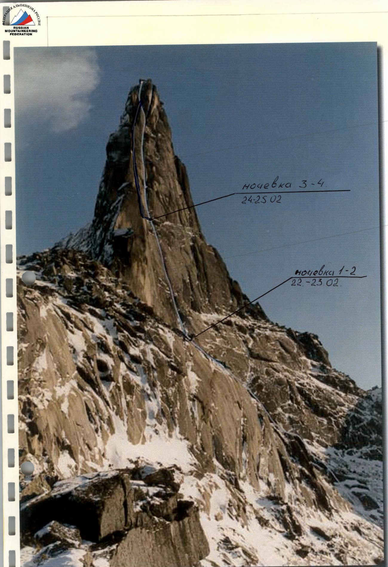
- Peak name: Zvezdny Peak, route name: via the left part of the West Face.
- Proposed category: 6A, variation.
- Route type: rock.
- Route height difference: 495 m (by altimeter).
Route length: 539 m.
Section length: 5th cat. diff.: 260 m, 6th cat. diff.: 239 m.
Average steepness:
- main part of the route: 83°
- entire route: 66°
- Pitons left on the route: total 7; including 7 bolted pitons. Pitons used on the route: stationary bolted pitons: 7, including for artificial aids. Removable bolted pitons: 6, including for artificial aids: 6. Total artificial aids (AIDs) used: 319.
- Team's travel time: 40 hours, days: 6.
- Leader: Morozov Daniil Vladimirovich, Candidate Master of Sports.
Team members:
- Tarnakin Yuriy Aleksandrovich, Candidate Master of Sports
- Ustyantsev Andrey Alekseyevich, 1st sports category
- Bakin Aleksey Vladimirovich, Candidate Master of Sports
- Coach: Bakin Aleksey Vladimirovich.
- Departure to the route: September 21, 2002.
Summit reached: November 26, 2002.
Return to Base Camp: December 26, 2002.
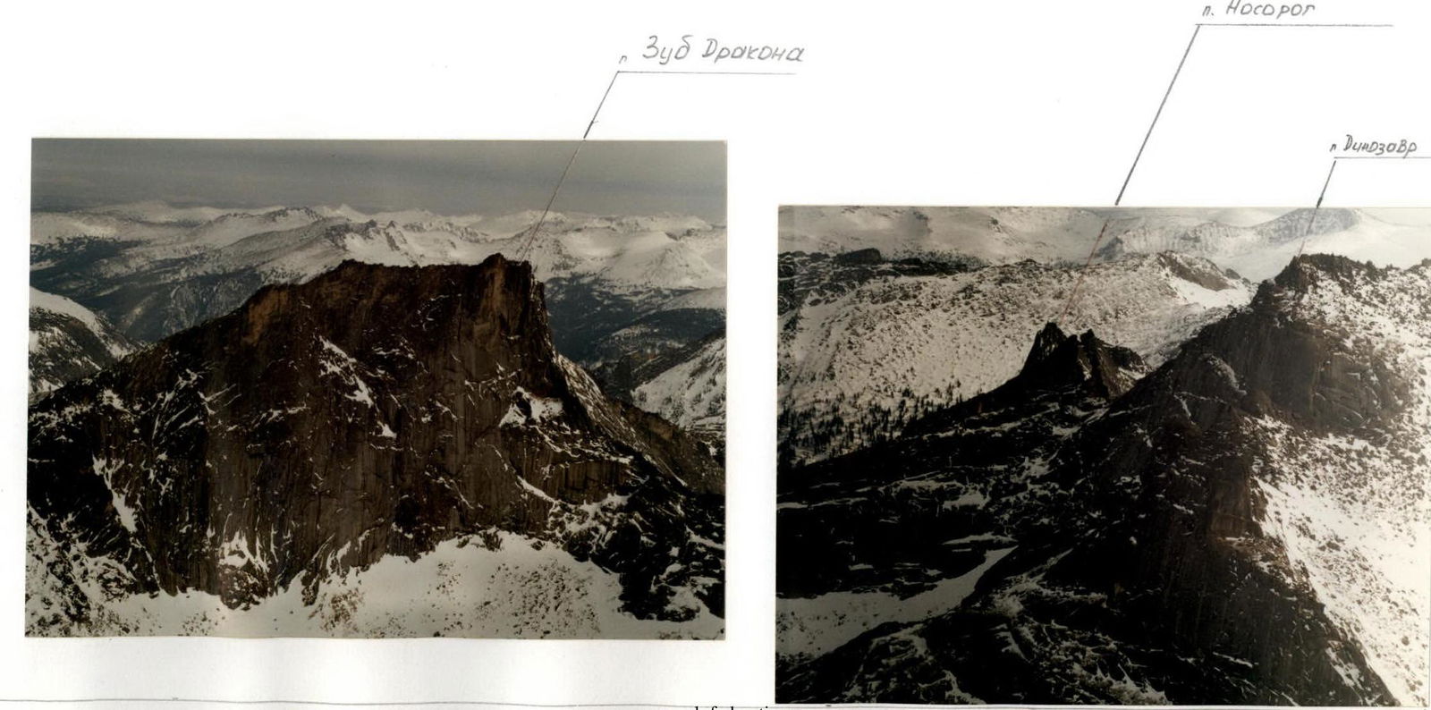
Area Photopanorama
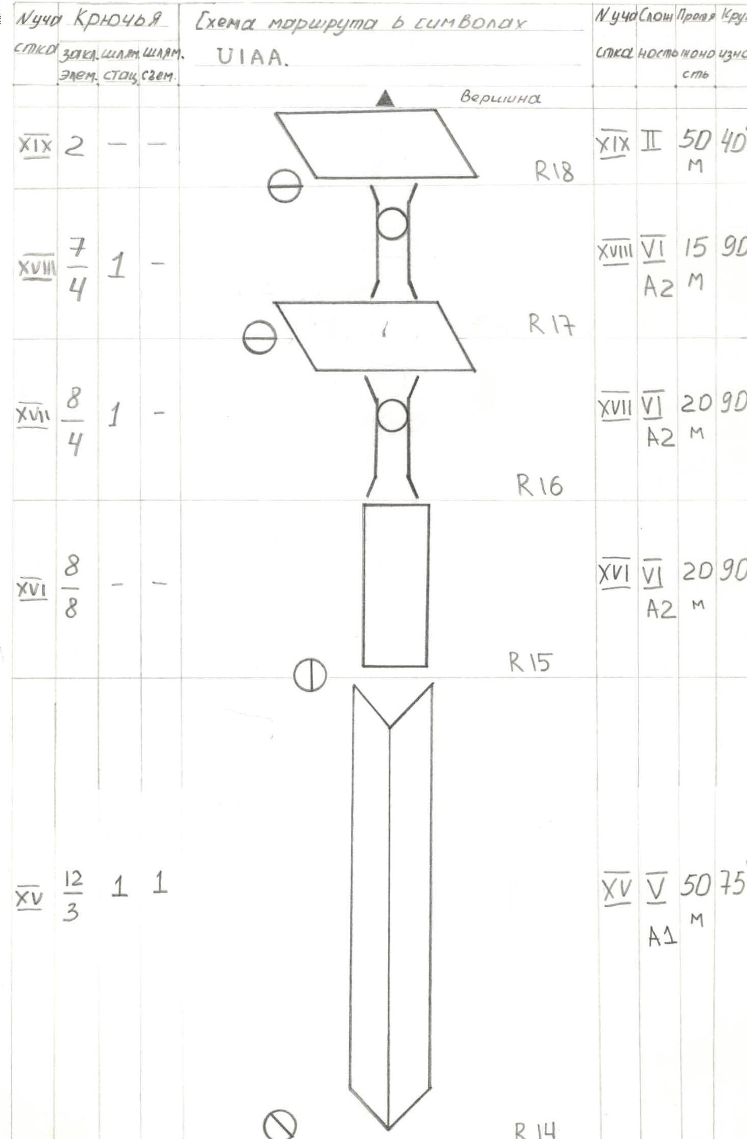
Route Diagram in UIAA Symbols
| Section # | Pitons (hanging/length) | Stationary bolted pitons | Removable bolted pitons |
|---|---|---|---|
| I | 70/20 | – | – |
| II | 22/10 | 1 | – |
| III | 80/75 | 1 | 5 |
| IV | 85/35 | 1 | – |
| V | 2 | – | – |
| VI | 60/60 | – | – |
| Section # | Difficulty | Length, m | Steepness, ° |
|---|---|---|---|
| R0 | 1 | 160 | 50 |
| R1 | 2 | 40 | 70 |
| R2 | 3 | 45 | 75 |
| R3 | 4 | 50 | 75 |
| R4 | 5 | 20 | 0 |
| R5 | traverse | ||
| R6 | 6 | 35 | 90 |
| Section # | Pitons (hanging/length) | Stationary bolted pitons | Removable bolted pitons |
|---|---|---|---|
| VII | 10/3 | 1 | – |
| VIII | 3 | – | – |
| IX | 12/12 | – | – |
| X | 4/4 | – | – |
| XI | 8/8 | – | – |
| XII | 3 | – | – |
| XIII | 27/27 | 1 | – |
| XIV | 5 | – | – |
| Section # | Difficulty | Length, m | Steepness, ° |
|---|---|---|---|
| R6 | 6 | 15 | 90 |
| R7 (control pitch) | 5 | 5 | 90 |
| R8 | 6 | 10 | 105 |
| R9 | 6 | 10 | 90 |
| R10 | 5 | 10 | 80 |
| R11 | 6 | 1 | 100 |
| R12 | |||
| R13 | 6 | 13 | 80 |
| R14 | traverse | 50 | 0 |
| Section # | Pitons (hanging/length) | Stationary bolted pitons | Removable bolted pitons |
|---|---|---|---|
| XV | 12/3 | 1 | 1 |
| XVI | 8/8 | – | – |
| XVII | 8/4 | 1 | – |
| XVIII | 7/4 | 1 | – |
| XIX | 2 | – | – |
| Section # | Difficulty | Length, m | Steepness, ° |
|---|---|---|---|
| R14 | 5 | 50 | 75 |
| R15 | 6 | 20 | 90 |
| R16 | 6 | 20 | 90 |
| R17 | 6 | 15 | 90 |
| R18 | 2 | 50 | 40 |
| Summit |
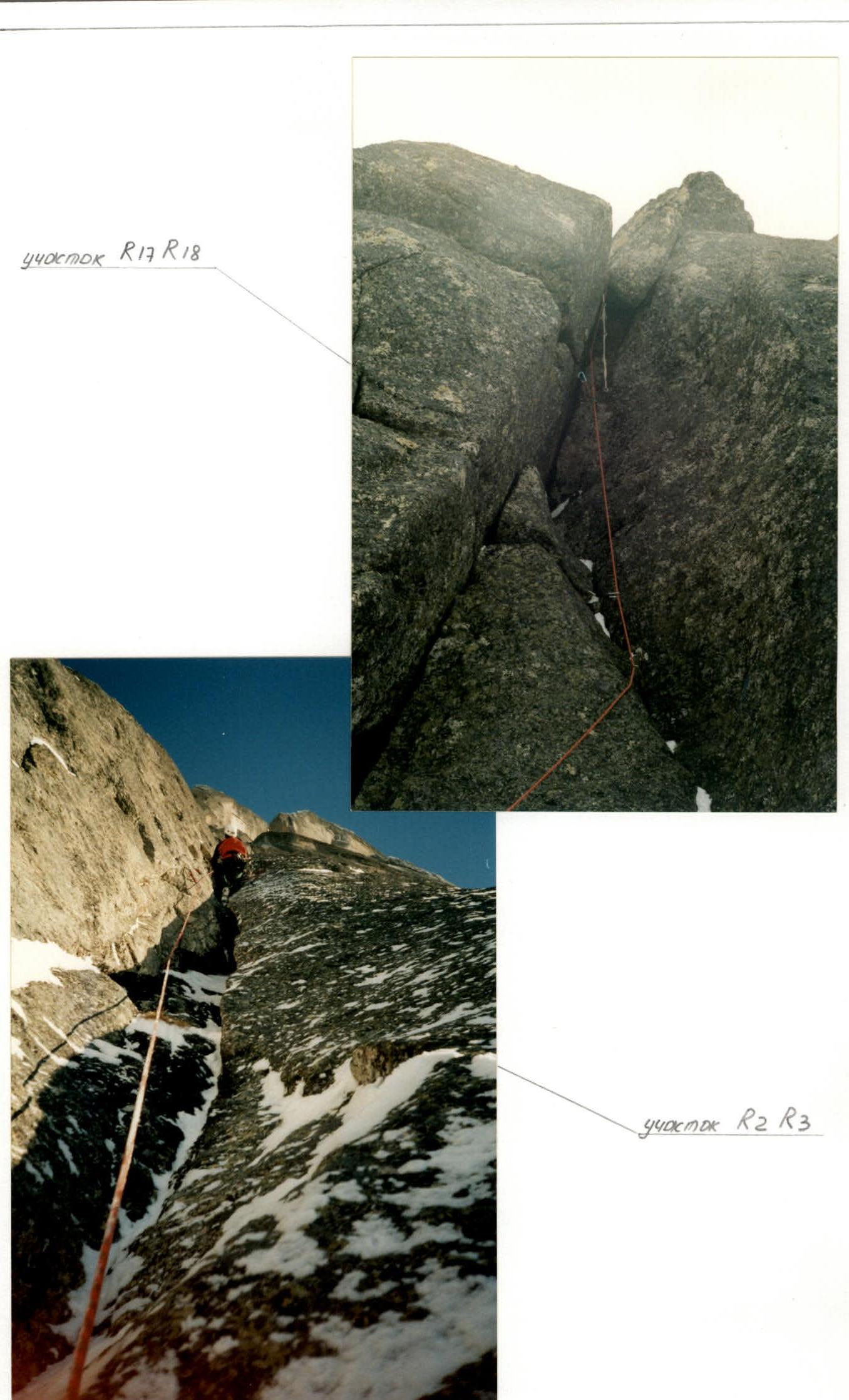
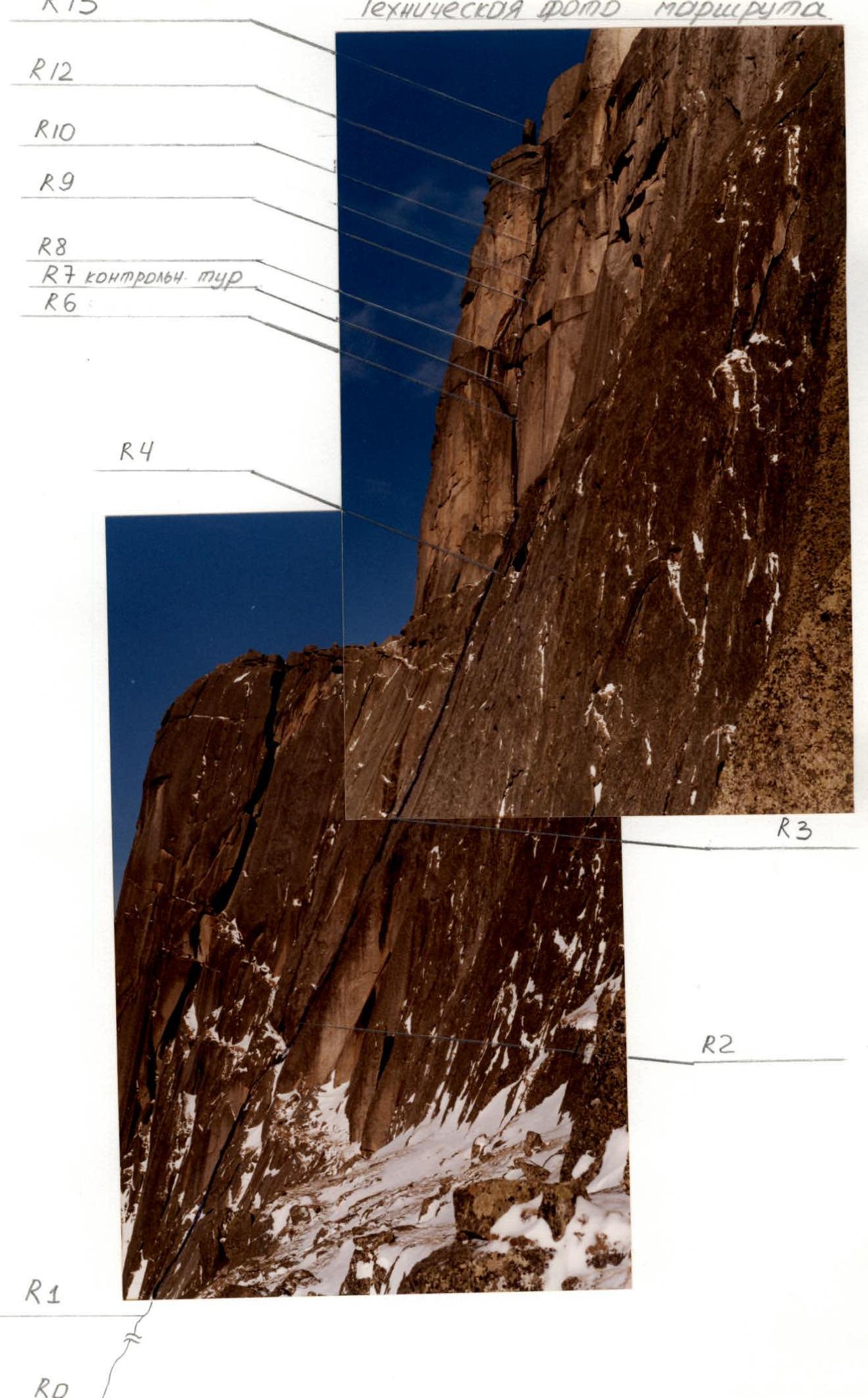
Technical Photos of the Route

Section R5 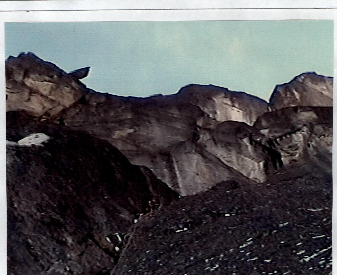 Team member
Section R3–R4
Team member
Section R3–R4 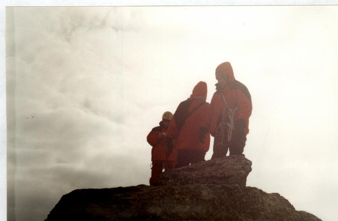
Summit photo (Morozov, Ustyantsev, Bakin)
Summit Photo
Explanatory Note
Due to low nighttime temperatures (down to –40 °C) during the team's work on the route, Zenit and Lomo cameras periodically malfunctioned. Therefore, the photo on sheet 1 was taken from the Internet (from a description by Balezina).
The route profile is not available. The remaining photographs were taken with a Sony Video 8 mm camcorder.
Due to the subtle relief (cornices, overhangs), the UIAA diagram is not to scale.