Ascent Passport
-
Ascent class — rock
-
Region — Western Sayan, Ergaki ridge
-
Peak — Zvezdny 2265 m via the western wall, rock
-
Proposed — 6A first ascent
-
Route characteristics:
height difference — 590 m. total length — 655 m. length of sections with 5th difficulty grade — 180 m. length of sections with 6th difficulty grade — 250 m. average steepness: entire route — 67°, main part — 82°
-
Equipment used on the route:
chocks rock pitons bolt anchors ice screws 135/42 24/9 1 16 -
Number of climbing hours — 51. Days — 6, including acclimatization.
-
Overnight stays — 4:
- 1–2 on a snow shelf in a tent, lying down
- 3–4 on a rock shelf in a tent, lying down
-
Team composition:
- Balezin Valery Viktorovich MSMK — team leader
- Alexandrov Vladimir Nikolaevich CMS
- Zakharov Nikolai Nikolaevich MSMK
- Zakrepa Andrey Evgenievich CMS
- Savinich Alexander Sergeevich CMS
- Kulagin Viktor Gennadievich CMS
-
Team coaches:
- Zakharov Nikolai Nikolaevich MSMK
- Balezin Valery Viktorovich MSMK
-
Departure dates:
onto the route — February 18, 1998 to the summit — February 23, 1998 return — February 24, 1998
-
Organization: Krasnoyarsk Committee for Physical Culture and Sports
1998 year
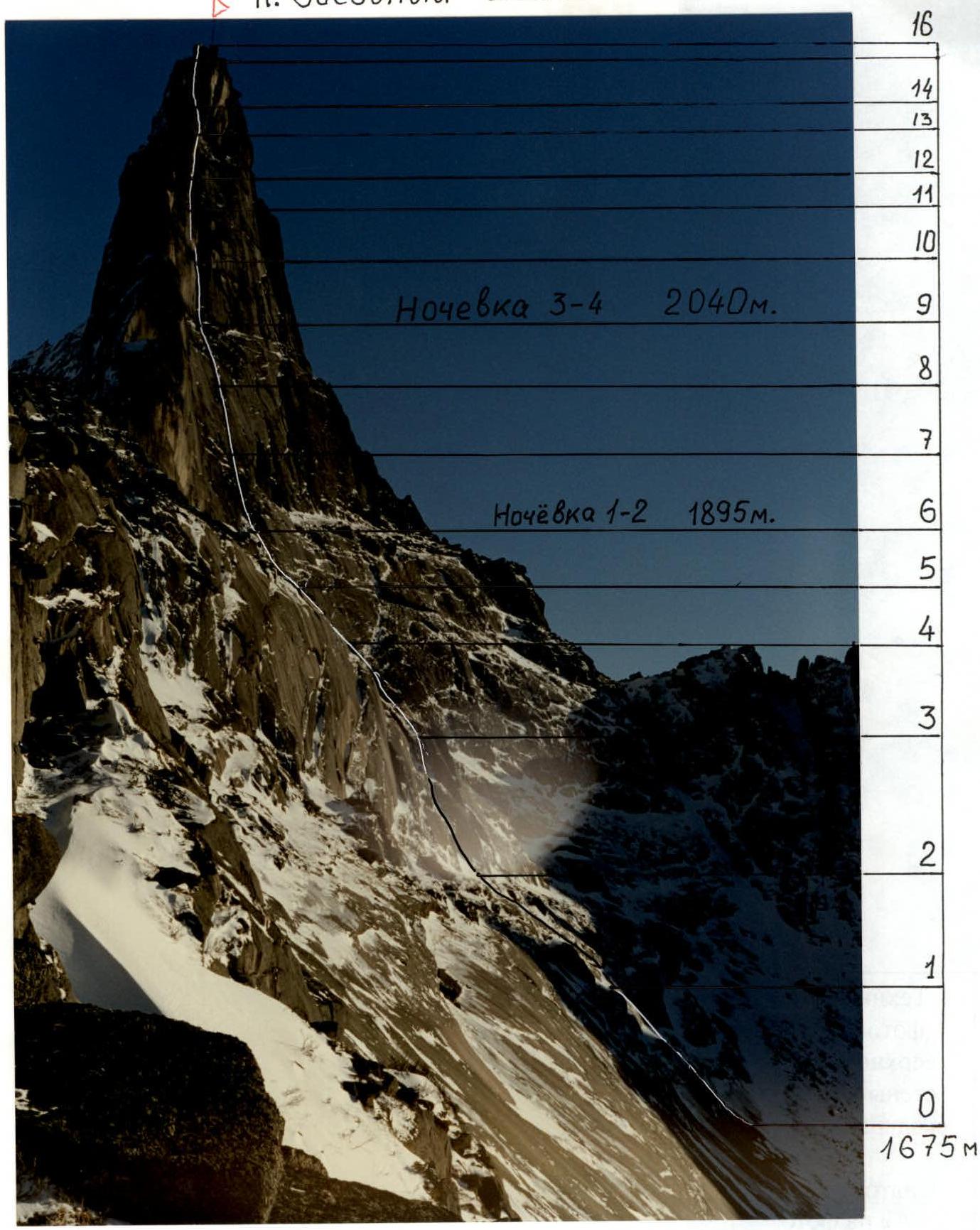
 General photo of the summit. Taken on February 17, 1998 at 16:00 from the C-3 ridge of p. Zvezdny. The height of the shooting point is approximately — 1800 m, distance — 1000 m. F = 50 mm.
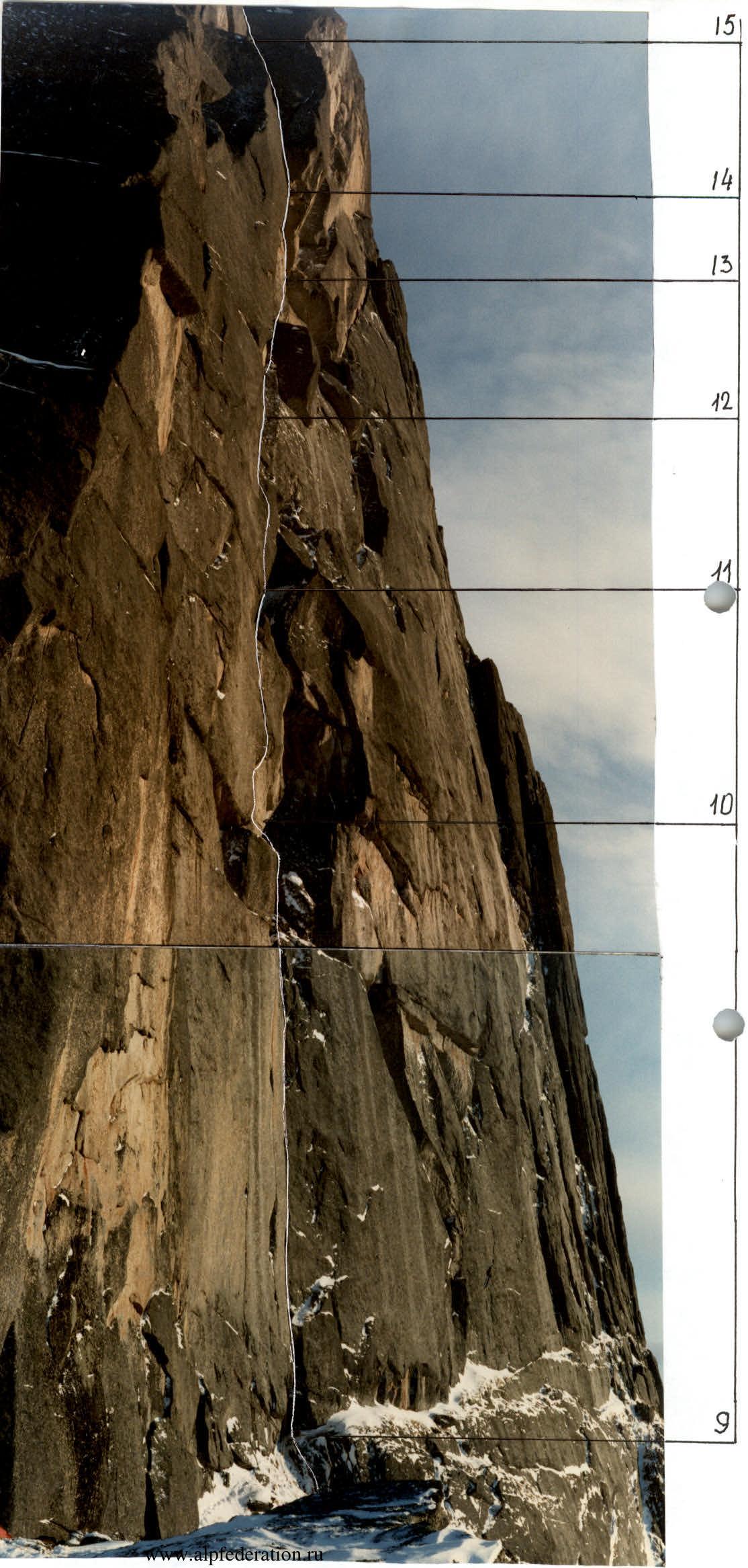
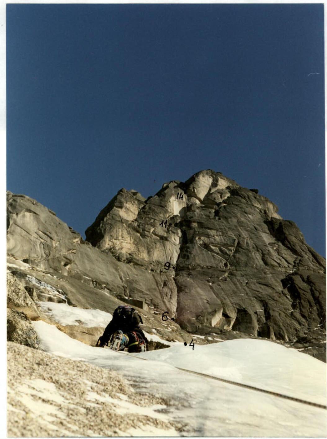
 Profile of the wall part of the route on the right. Taken on February 16, 1998 at 12:00 from the false ridge of Ptitsa. The height of the shooting point is 1750 m, distance 1200 m. F = 50 mm.
Tactical Actions of the Team
The western wall of peak Zvezdny drops to the west with a narrow, sheer wall, sandwiched between two steep ridges. The route can be conditionally divided into 4 parts: slabs, section R0–R2; the first rock belt, section R2–R6; the second rock belt, section R6–R9; and the third belt, section R9–R16. Each subsequent belt is steeper than the previous one, and the belts are separated by snow shelves.
On February 16, 1998, the team made a gear and food cache under the start of the route. On February 17, the team in full strength approached the route along with the rescue team.
On February 18 at 9:00, the pair Kulagin–Zakrepa started processing the lower part of the route. After lunch, the weather worsened, and a strong wind began to blow. They processed 4 ropes, sections R1–R4. Most of the processed route was traversed via ice "streams" with the help of ice climbing equipment. Kulagin led first.
On February 19, the team in full strength started on the route. After the processed part, the pair Alexandrov — Savinich moved forward, with Savinich leading first. Having passed a simple couloir, section R4–R6, the pair began processing the wall part, while the rest of the team organized an overnight stay. At 18:00, the pair descended to the overnight stay, having processed section R6–R7.
On February 20, a strong wind blows, frost. The pair Balezin–Zakharov processed two very difficult ropes, sections R7–R9, and descended to the overnight stay at 18:00. Zakharov led on the first rope, and Balezin on the second.
On February 21, the weather is clear, but a cold strong wind blows. The team in full strength passed the processed sections and reached the planned overnight stay #3–4, point 9. The overnight stay was set up on an excellent rock shelf 50 m to the left of the route line, and the pair Balezin — Zakharov continued processing the route, processing the key part of the route, sections R9–R11, with Balezin leading.
On February 22, the pair Kulagin–Zakrepa processed sections R11–R14. Zakrepa led first.
On February 23, snow fell at night. The pair Alexandrov — Savinich started on the route at 8:00. An hour later, the rest of the team followed and soon caught up with the leading pair on section R14–R15. At 13:00, the entire team was on the summit. A strong cold wind blows. Half an hour later, they began descending via the ascent route and were back in the tent by 17:00. The next day, the team descended to the start of the route and, together with the rescue team, headed to the base camp.
During the ascent, a winter tactics were employed, based on organizing comfortable overnight stays from which route processing was carried out. The tent was moved from one shelf to another as they were reached during processing, or when there was absolute confidence in reaching the next overnight stay in the shortest possible time. This tactic significantly increased the safety of the ascent, as at any moment, the pair could descend on rappel lines to the tent or call for help from the other four team members. The team used a double, six-person high-altitude tent and had a sufficient supply of fuel and food.
On the route, the team used the entire arsenal of modern climbing equipment. For belaying, they primarily tried to use chocks, and pitons were used only when chocks could not be used. On sections R6–R9, special expandable chocks like "jackhammer" were very useful. Throughout the route, "Friends" were used: in the lower part for ice climbing, and in the upper part as anchor points for climbing thin, ice-covered, and earth-filled cracks. For artificial climbing, they used "Krukonogi".
The first in the rope team typically went on a double rope, setting up a belay station. One rope was fixed to the station as a rappel line, and on the other, the second climber was taken with top-rope belay. Main belay points (stations) were organized on at least three belay points, blocked by a local loop; in the middle of the rappel lines, a blockage was made. There were no falls, injuries, or frostbite during the ascent, despite continuing route processing during bad weather rather than waiting it out.
Great attention was paid to organizing overnight stays, primarily their safety and comfort, as in winter conditions with low temperatures, a good overnight stay begins to play a decisive role in the success of the ascent. Overnight stay #1–2 was set up on a built snow shelf at point #6, 10 m to the left of the route line, under an overhanging wall. Overnight stay #3–4 was set up on a good rock shelf separating the 2nd and 3rd rock belts, 50 m to the left of the route line, and was absolutely safe. From both overnight stays, rappel lines were laid to the route.
The rescue team consisted of five people: Stepanov Yu. — CMS, rescue team leader; Antipin S. — MS, dispatcher; Roilka Yu. — 1st sports category; Cherezov S. — 1st sports category; and doctor Trzhebetovsky N. — CMS. During the ascent, they were in a forward camp under the route, and communication between the team and the rescue team was carried out using radios, and the rescue team had long-range radio communication with the EMERCOM team in Minusinsk.
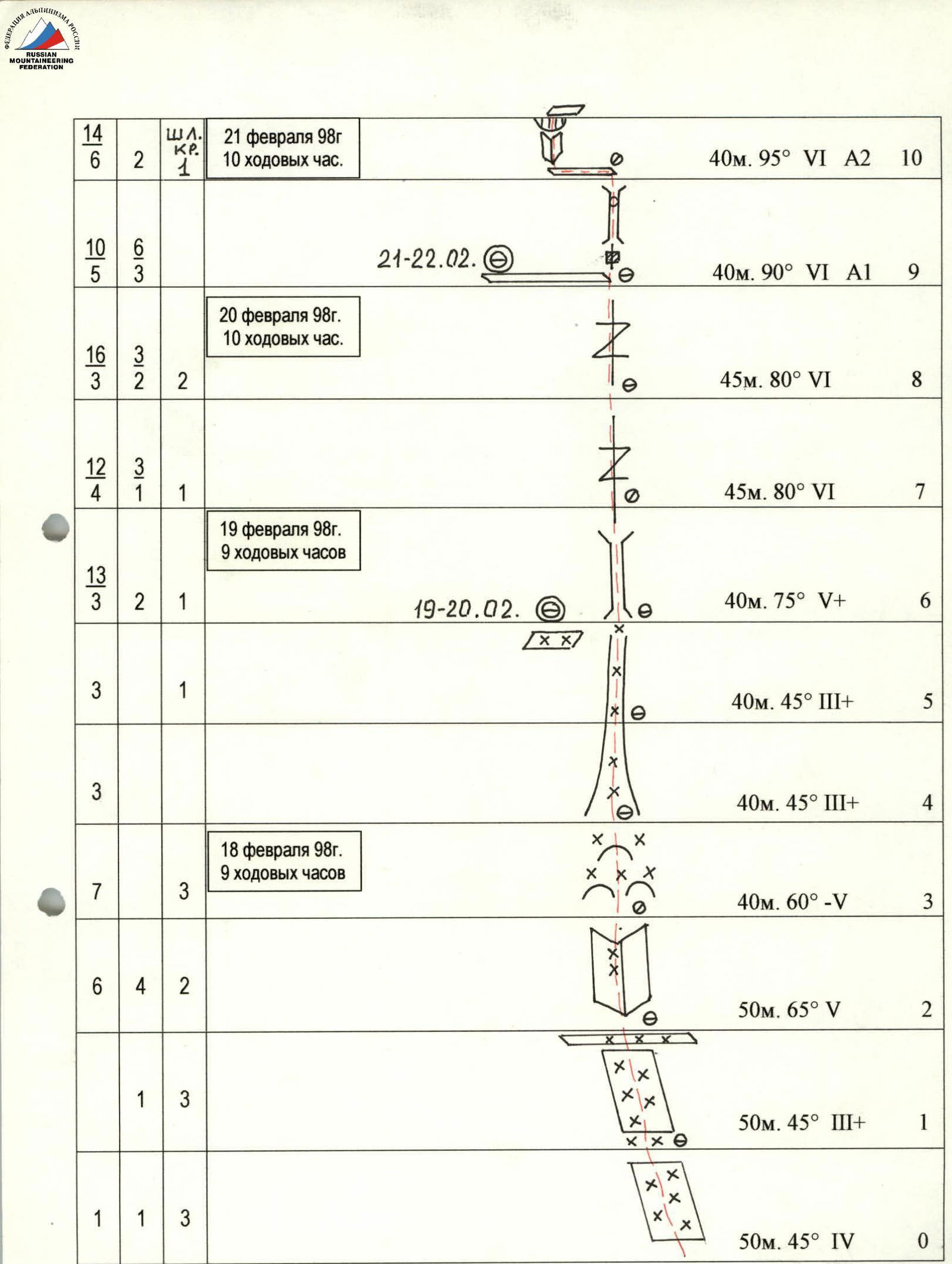
Route Description by Sections
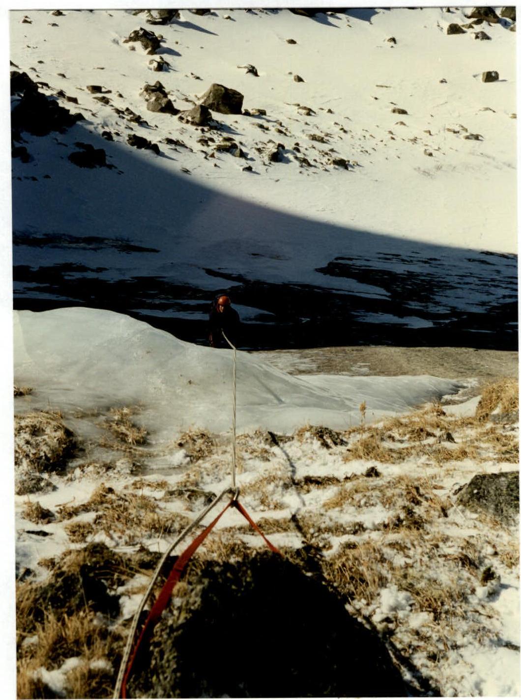
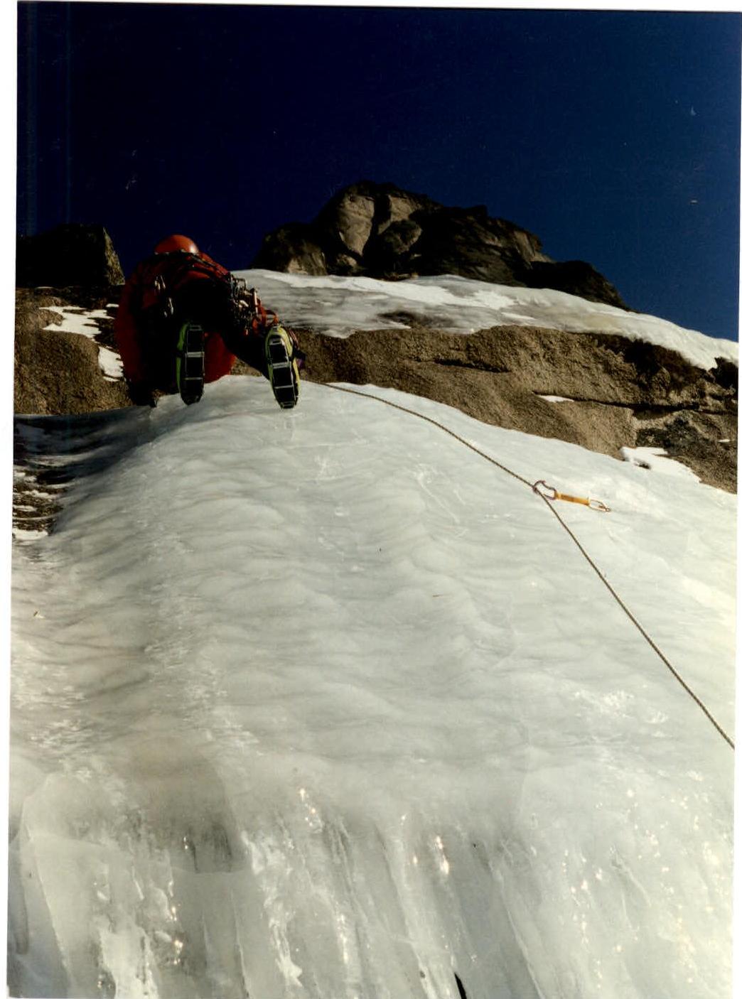
Section R0–R2. Smooth, icy monolithic slab covered with snow, traversed mainly via ice "streams" with the help of ice climbing equipment.
Section R2–R3. Inner corner with smoothed rocks like "sheep's foreheads", iced over in the upper part.
Section R3–R4. Smoothed monolithic "sheep's foreheads", iced over, leading to the start of a couloir.
Section R4–R6. Couloir is icy and snow-covered, leading to the wall part of the route. On the left in the upper part of the couloir, on a snow shelf, an overnight stay was organized.
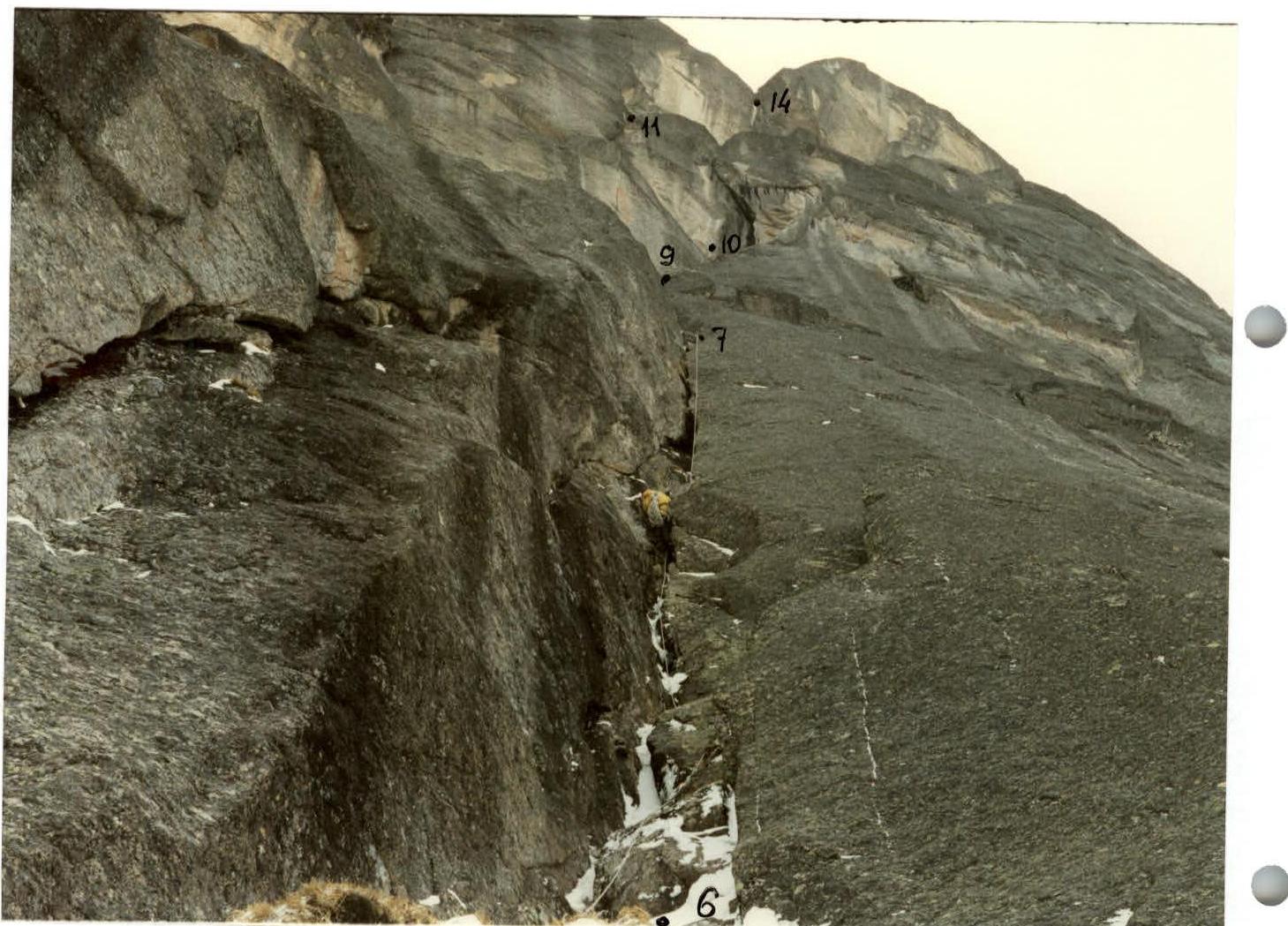
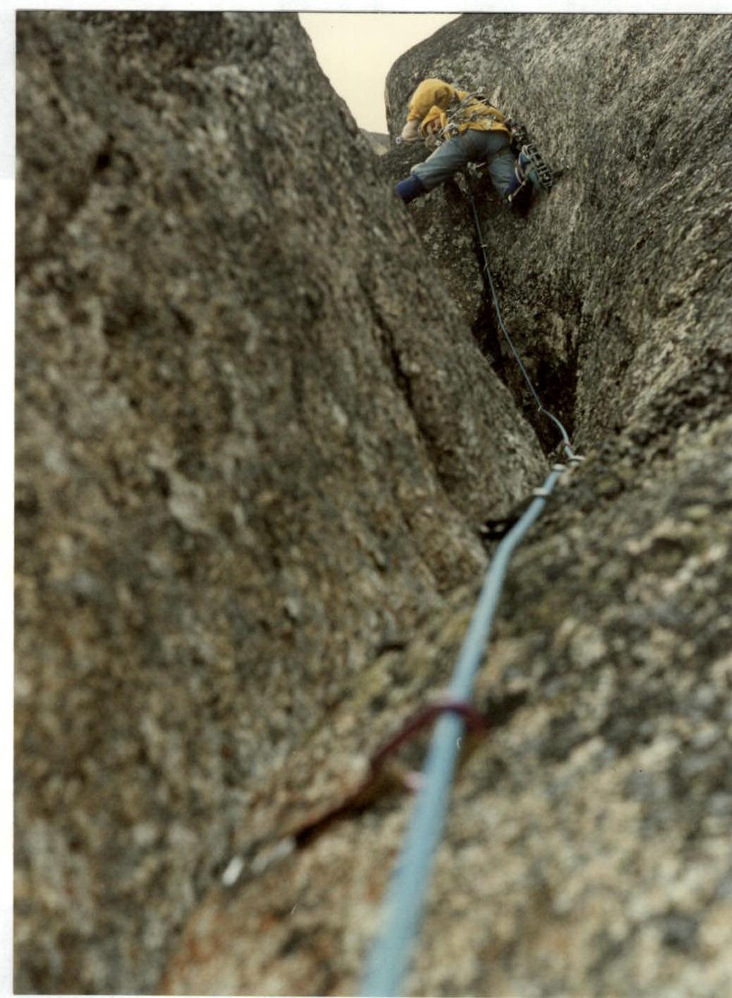
Section R6–R7. Large inner corner with a chimney inside, gradually turning into a 10 cm wide crack.
Section R7–R8. Vertical, 10–20 cm wide crack, partially iced over. Due to the scarcity of relief, it is very difficult to organize reliable belays. Expandable chocks like "jackhammer" were very useful for wide cracks.
Section R8–R9. Continuation of the wide crack. Very difficult climbing. Exit to a shelf separating the second and third rock belts. On the shelf, about 60 m to the left of the route line, a good overnight stay #3–4 was organized.
Section R9–R10. At the start, an overhanging 8 m crack — traversed on aid climbing, then a chimney with two plug-cornices in the upper part. Exit to a shelf.
Section R10–R11. Along the shelf, traverse left for 12 m. The traverse is difficult due to the overhanging wall above. Then, via an overhanging inner corner under a 2-meter cornice (aid climbing), further via a crack to a small shelf.
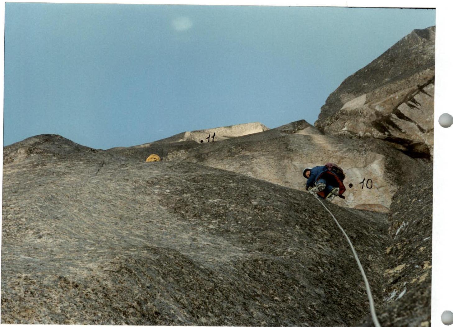
Section R11–R12. Series of inclined inner corners and cracks from left to right. Exit to a shelf under a large inner corner.
Section R12–R13. Large monolithic inner corner with a single thin crack, at the start of the corner — a cornice.
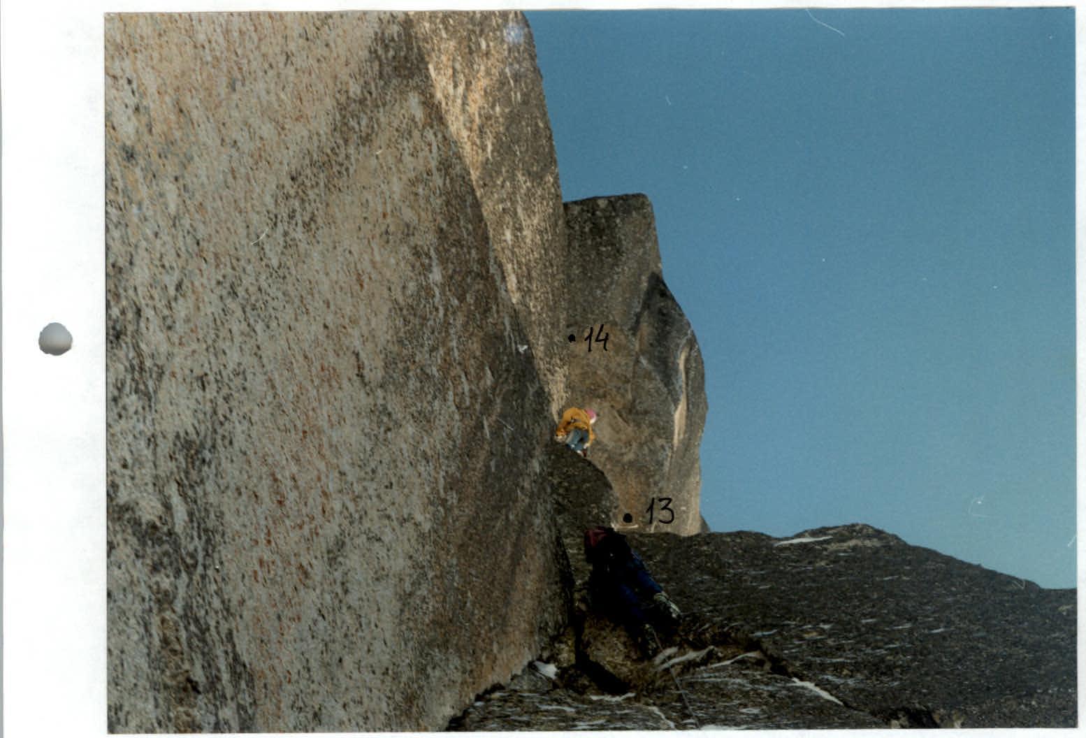
Section R13–R14. Vertical crack leading under the left part of a huge cornice (aid climbing).
Section R14–R15. Under the cornice, traverse left to a shelf under the start of a chimney. Then, via the chimney with two plugs — exit to a shelf.
Section R15–R16. Wall with a crack leading to the pre-summit ridge. Further along the snow-covered ridge of medium difficulty, about 30 m — exit to the summit.
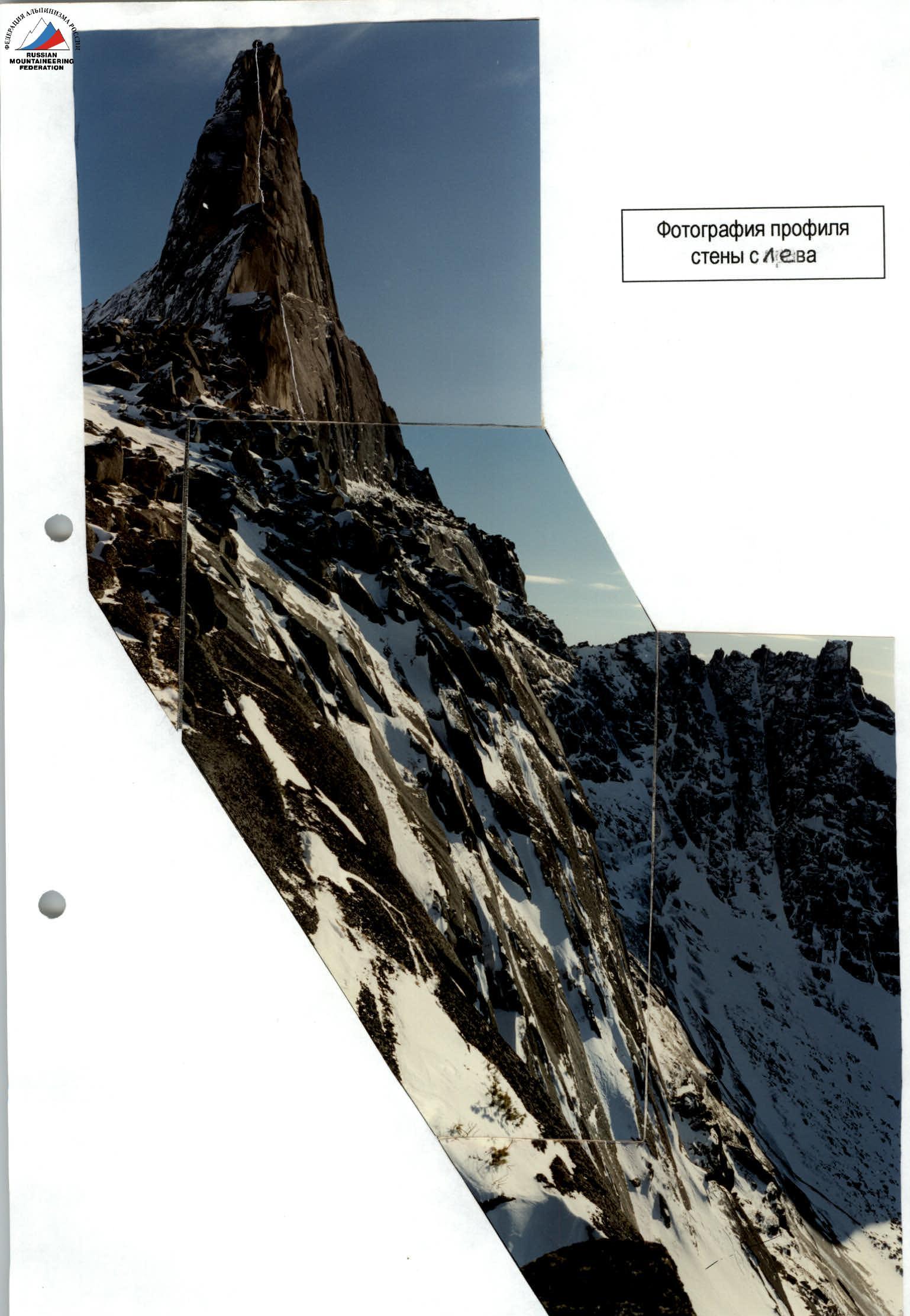 Photograph of the wall profile on the left.
 Technical photograph of the route.
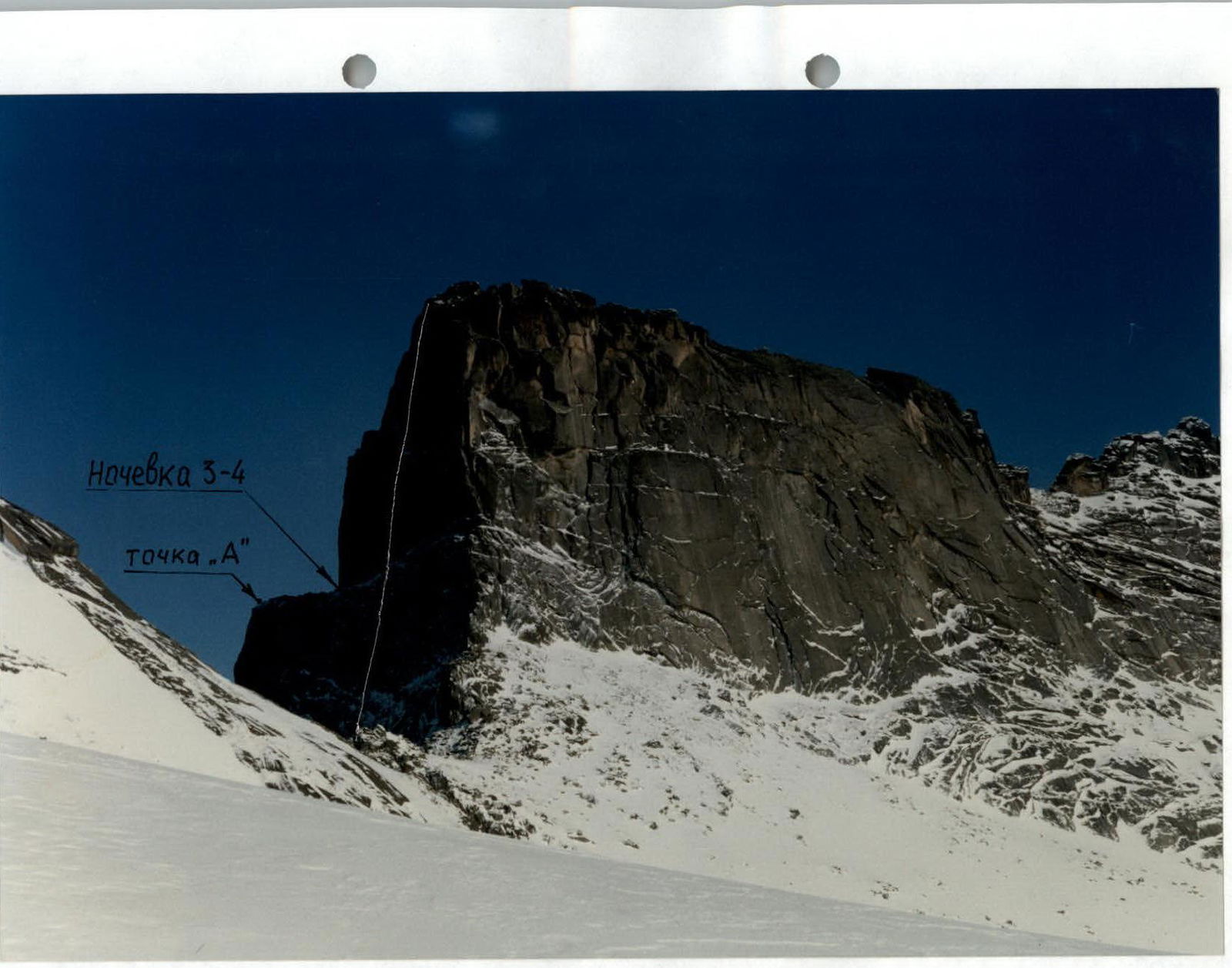
 Technical photograph of the upper part of the wall (third rock belt). Overnight stay 3–4 p.9, 2040 m. Taken from point "A" on the photo of the right route profile, with "Smena", F = 40 mm.
 Movement on rappel lines, section R1–R2.
 Upper part of section R2–R3.
 Section R3–R4.
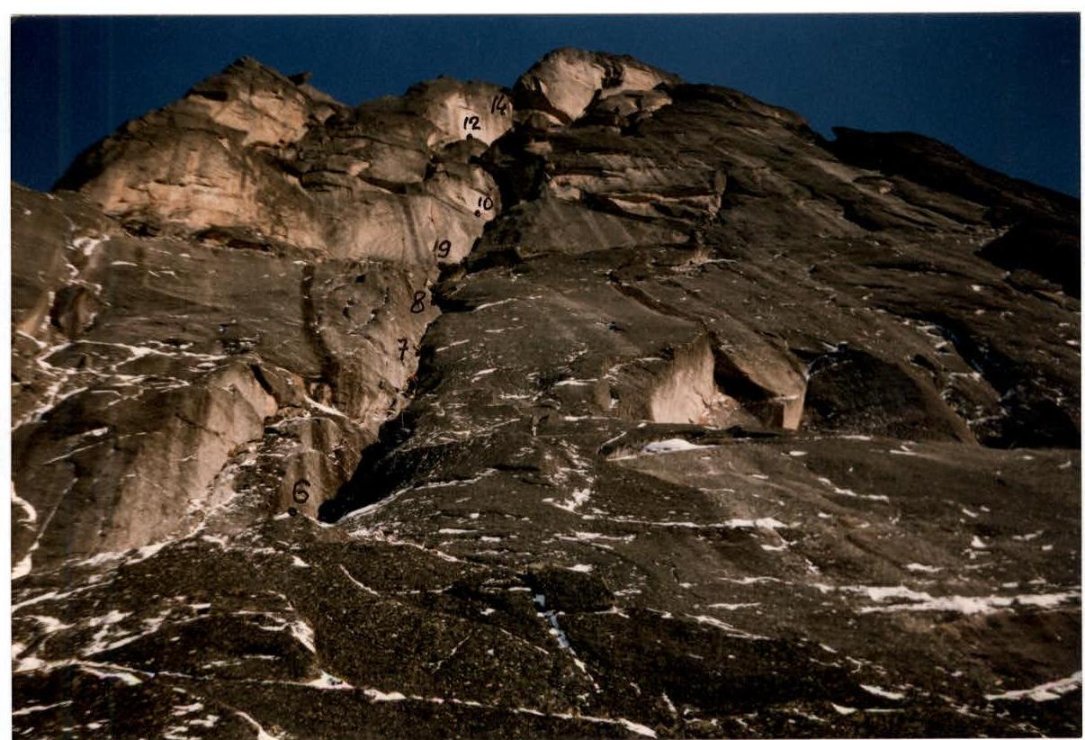
 View of sections R6–R14 from point R4.
 Section R7–R8.
 Start of section R6–R7.
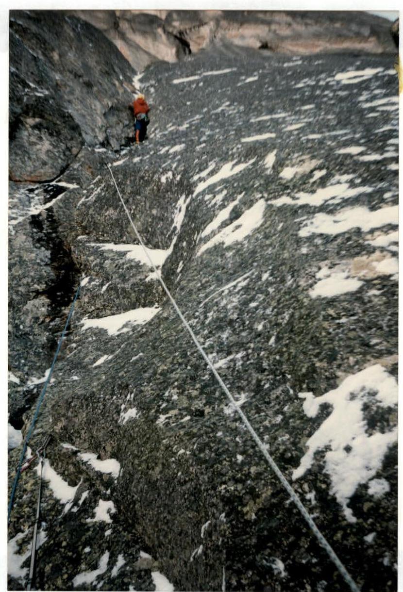
 Passing the inner corner on section R10–R11.
 Passing the traverse on section R10–R11.
End of the inner corner, section R12–R13, and start of section R13–R14. Above, a huge cornice is visible, bypassed on the left.