
Passport
- Rock class.
- Western Sayan, Ergaki ridge.
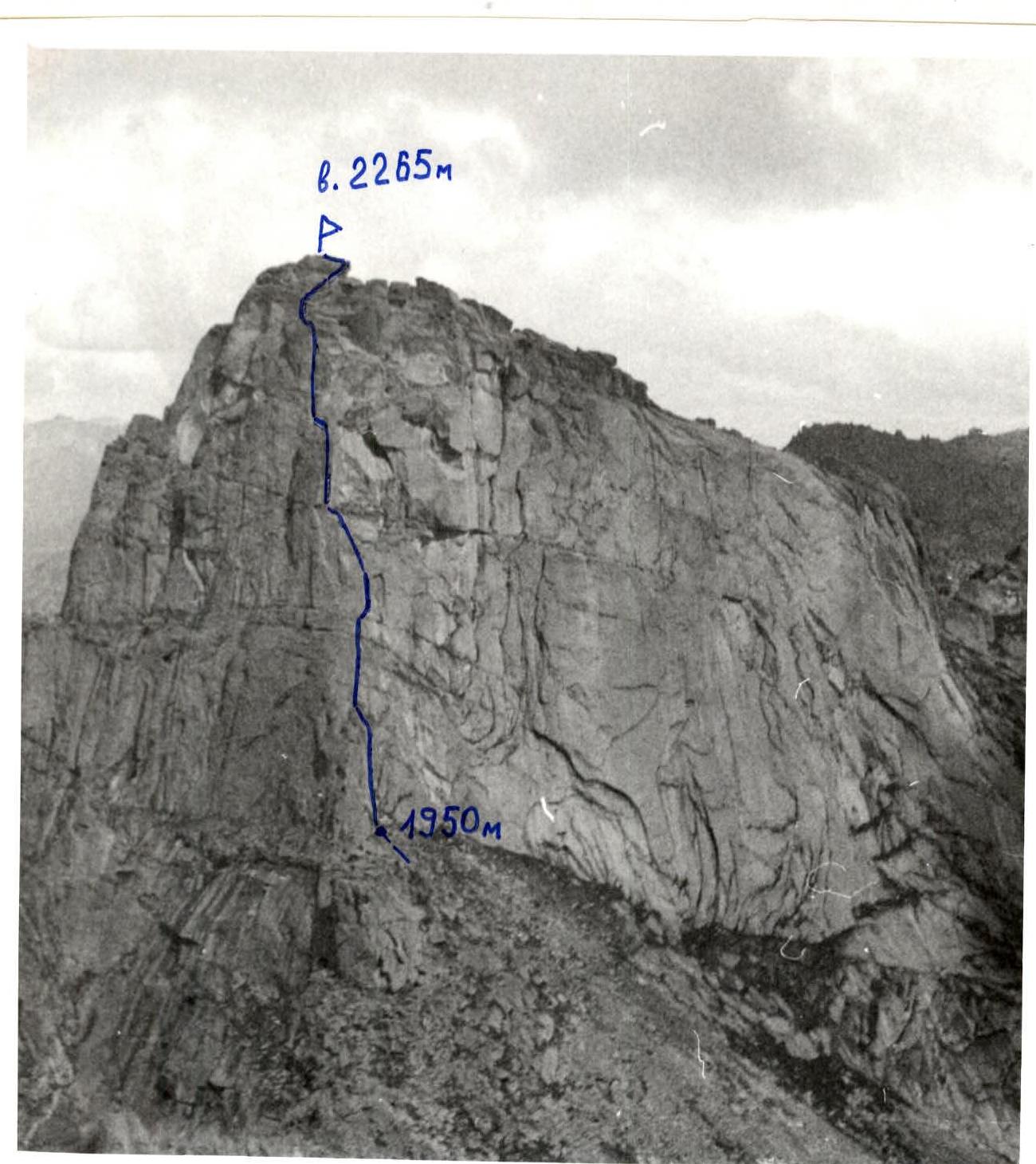
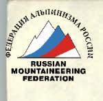
- Zvezdny Peak, 2265 m via the South-West edge.
- Proposed — 5A category of difficulty, first ascent.
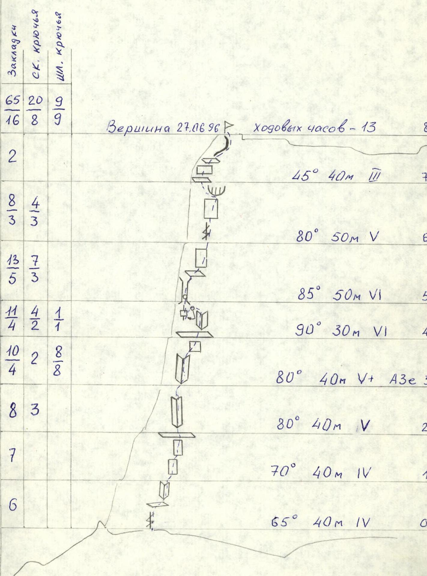
- Route characteristics: elevation gain 315 m, length 340 m, length of section 5–6 category of difficulty 210 m. Average steepness of the wall part of the route 78°: including 6 category of difficulty — 80 m (sections R4–R6).
- Pitons hammered: rock — 20 (8 left); chocks — 65 (16 left); bolted pitons — 9 (9 left).
- Climbing hours — 13; days — 1.
- Participants: Lebedev V. A. (MS); Bogdanov V. A. (CMS).
- Coach: Zakharov Nikolay Nikolayevich.
- Approach to the route: June 27, 1996; summit: June 27, 1996; return: June 27, 1996.
General photo of the summit. Taken in July from Ptitsa pass with "Smena".
-2-
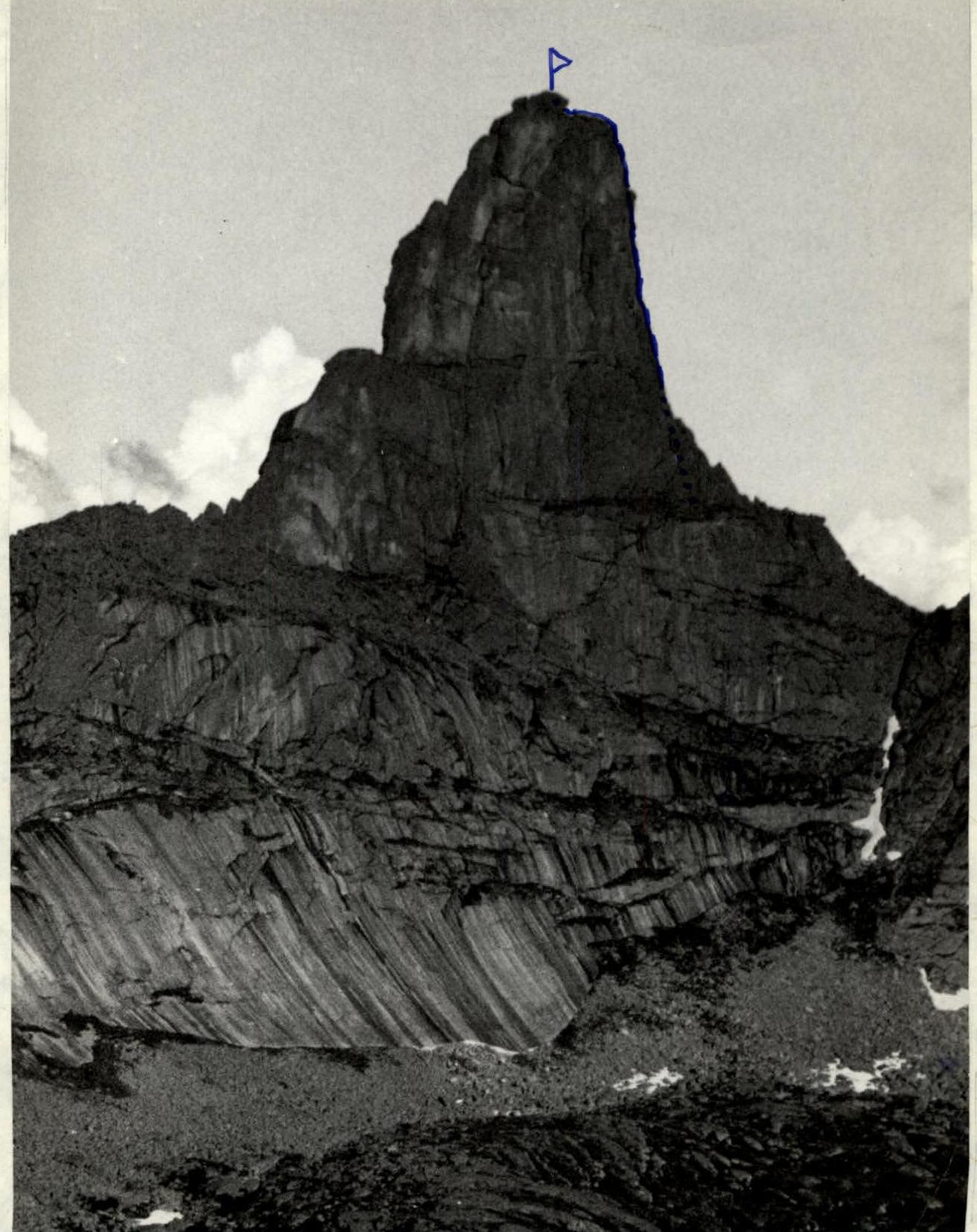
Route profile on the left.
Route profile.

Map of the area, scale 1:100 000.
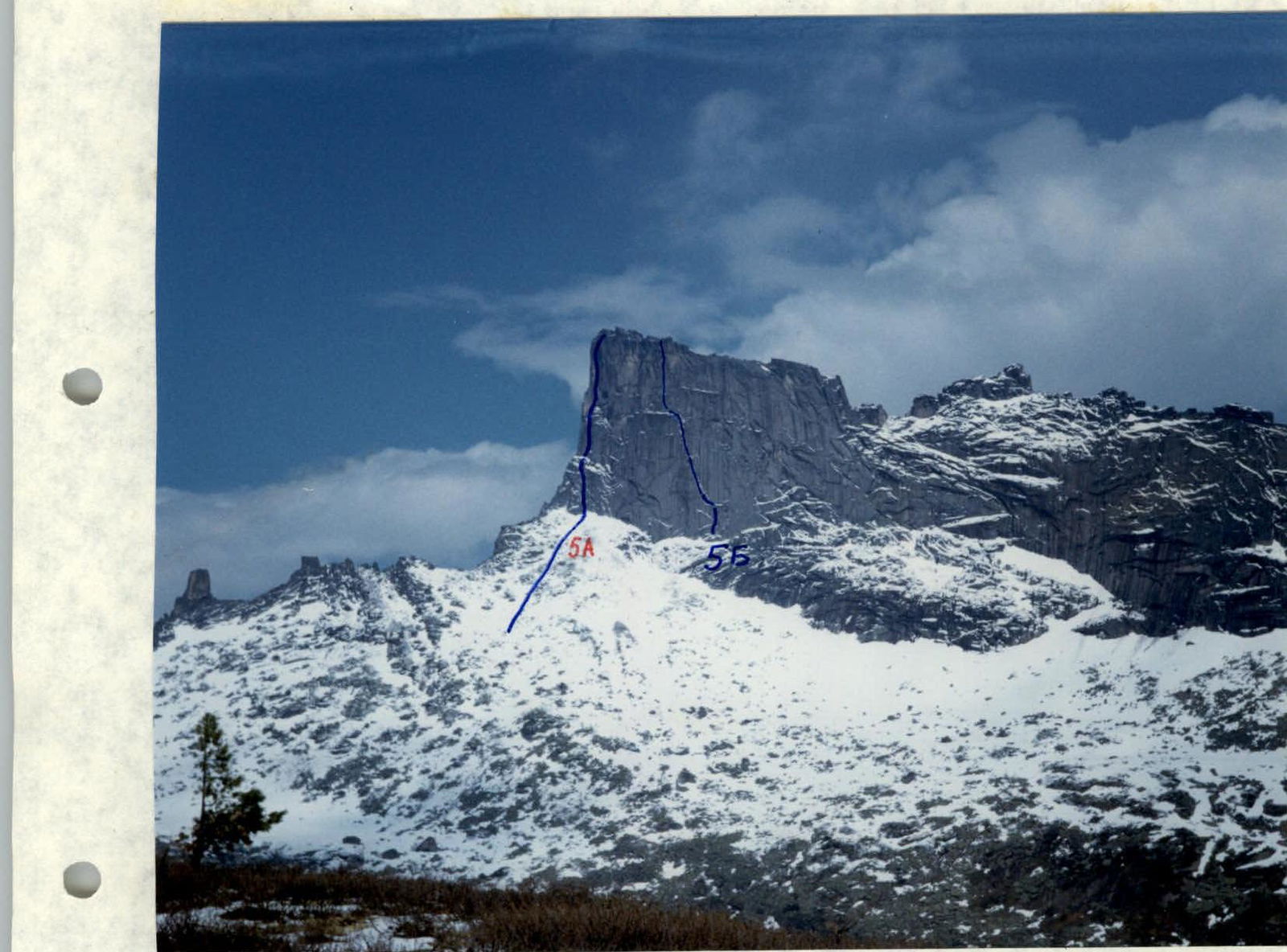
Photo of the route on the right.
Brief overview of the climbing area
Ergaki massif is located in the central part of Western Sayan. The length of the massif from west to east is about 80 km, width is about 60 km. Ergaki massif is heavily dissected, with many steep rock walls, deep river valleys and lakes. The terrain is mountain-taiga with a dense river network. The relief is mid-mountain, with prevailing heights of 1450–2100 m. The highest point is 2281 m. The weather in the area is very unstable, with high precipitation. This territory is characterized by an East Siberian type of climate with a long and harsh winter; snow in the highlands melts only by the end of June and falls again in late August. Summer is cool, with daytime temperatures in July ranging from +10°C to +15°C, and nighttime temperatures from +2°C to +6°C. In June, there are many midges and mosquitoes. Zvezdny Peak is the second highest summit (2265 m) and is considered the most difficult peak in the area. The area is very promising for alpinism, with steep rock walls having a height difference of up to 600 m.
Description of the route by sections
Section R0–R1. Wide crack leading to a small ledge, then rightwards along the inner corner to a grassy ledge (steepness 65°, length 40 m, difficulty 4). Section R1–R2. Monolithic wall ending at a good ledge (steepness 70°, length 40 m, difficulty 4). Section R2–R4. Inner corner leads under a sheer monolithic inner corner with a slit. 8 bolted pitons hammered. Exit to a good ledge (section R2–R3: steepness 80°, length 40 m, difficulty 5; section R3–R4: steepness 80°, length 40 m, difficulty 5, A3e). Section R4–R5. Monolithic wall, pendulum left on a bolted piton to a thin slit, which is climbed using artificial aids. Inner corner under an overhanging chimney with a plug. Climbing is very difficult (steepness 90°, length 30 m, difficulty 6). Section R5–R6. Very difficult narrow chimney with a plug in the lower part, then a steep monolithic wall with a thin slit, artificial aids (steepness 85°, length 50 m, difficulty 6). Section R6–R7. Wide crack, then a cornice is bypassed on the left, artificial aids. Exit to a ledge (steepness 80°, length 50 m, difficulty 5). Section R7–R8. Alternating sheer walls and ledges leading to the ridge, then to the summit (steepness 45°, length 40 m, difficulty 3).