Report
On the first ascent to the summit of Golova Sayana (1970 m) via the left part of the NW wall, category 5A, by a team from Krasnoyarsk Krai, from May 25, 2018, to May 26, 2018.
I. Ascent Passport
| 1. General Information | ||
|---|---|---|
| 1.1 | Full name, sports rank of the team leader | Ivanov Timofey Pavlovich, CMS |
| 1.2 | Full names, sports ranks of the participants | Zhigalov Alexander Vladimirovich, MS, Efremov Maxim Gennadievich, CMS |
| 1.3 | Full names of the coaches | Zakharov Nikolai Nikolaevich |
| Full names of the coaches | Balezin Valery Viktorovich | |
| 1.4 | Organization | Krasnoyarsk Krai Alpine Federation |
| 2. Characteristics of the Ascent Object | ||
| 2.1 | Region | Sayans, 6.2 |
| 2.2 | Valley | Western Sayan |
| 2.3 | Name and height of the summit | Golova Sayana, 1970 m |
| 3. Characteristics of the Route | ||
| 3.1 | Route name | Via the left part of the NW wall |
| 3.2 | Proposed category of difficulty | 5A |
| 3.3 | Degree of route exploration | First ascent |
| 3.4 | Relief characteristics of the route | Rock |
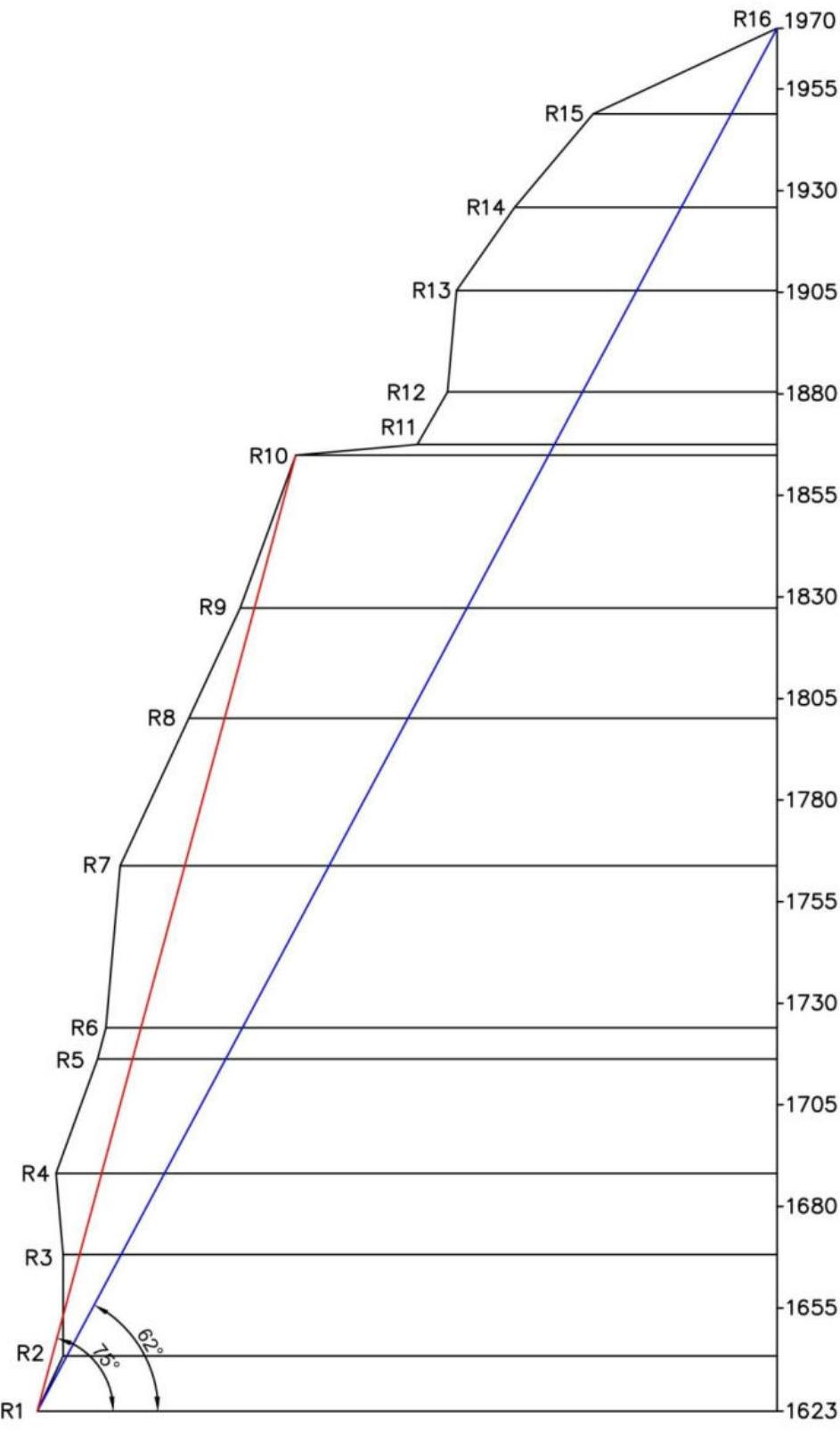
| 3.5 | Height difference of the route | 347 m |
| 3.6 | Route length (in meters) | 453 m |
| 3.7 | Technical elements of the route (total length of sections of various difficulty categories with indication of relief character) | Category I rock – 30 m. Category II rock – 50 m. Category IV rock – 140 m. Category V rock – 53 m. Category VI rock – 180 m. |
| 3.8 | Average steepness of the route, ° | 62° |
| 3.9 | Average steepness of the main part of the route, ° | 75° |
| 3.10 | Descent from the summit | Via route 3B category (Terentyev A. — not classified) towards Lake Raduzhnoe |
| 3.11 | Additional route characteristics | The route has water available in winter (snow, ice) |
| 4. Characteristics of Team Actions | ||
| 4.1 | Time of movement (team's walking hours, in hours and days) | 2 days (20 h 55 min) |
| 4.2 | Overnight stays | On a ledge in a tent |
| 4.3 | Route preparation time | - |
| 4.4 | Start of the route | May 25, 2018, 07:25 |
| 4.5 | Reaching the summit | May 26, 2018, 19:40 |
| 4.6 | Return to the base camp | May 26, 2018, 22:30 |
| 5. Meteorological Conditions | ||
| :--: | :----------------------------------------------------------: | :-----------------------------------------------------------: |
| 5.1 | Temperature, °C | May 25, 2018: Morning -2, Day +7, Evening -5, Night -7; May 26, 2018: Morning -4, Day 0, Evening 0, Night -3 |
| 5.2 | Wind force, m/s | May 25, 2018: Morning – Calm, Day – Calm, Evening – Moderate wind, Night – Strong wind; May 26, 2018: Morning – Strong wind, Day – Strong wind, Evening – Strong wind, Night – Light wind |
| 5.3 | Precipitation | May 25, 2018: from 7:25 to 17:30 – no precipitation; after 17:30 – snow. May 26, 2018: rain with snow from 8:00 to 16:00 |
| Visibility, m | Normal | |
| 6. Person Responsible for the Report | ||
| 6.1 | Full name, phone, e-mail | Ivanov Timofey Pavlovich, +7 (931) 598–76–42, timofey_vi@mail.ru; Zhigalov Alexander Vladimirovich, +7 (923) 322–62–25, 0jog@bk.ru |
II. Description of the Ascent
1. Characteristics of the Ascent Object
1.1. General photo of the summit
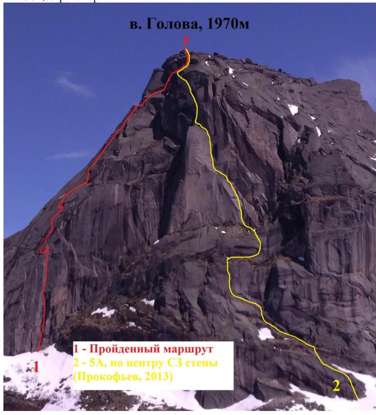
Photo taken from the Krasnoyarstev pass on May 27, 2018.
1.2. Photo of the route profile
1.2. Drawn profile of the route
Profile of the route via the left part of the NW wall to the summit Golova (1970 m)
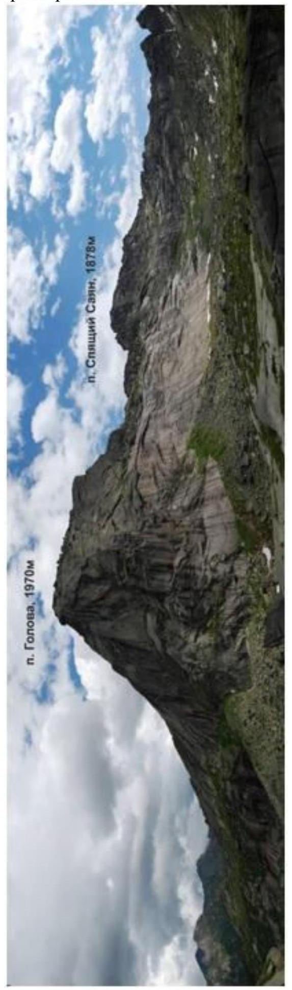
1.3. Photopanorama of the area
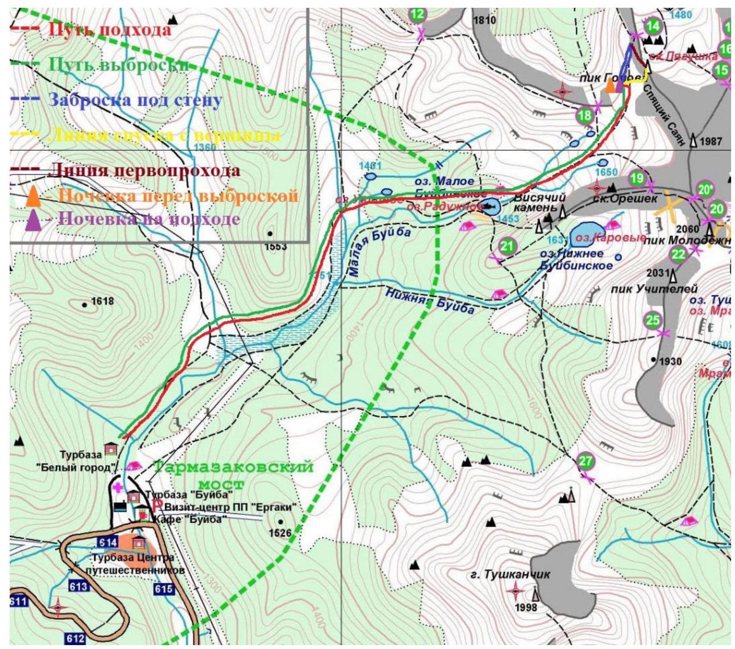
1.4. Map of the area
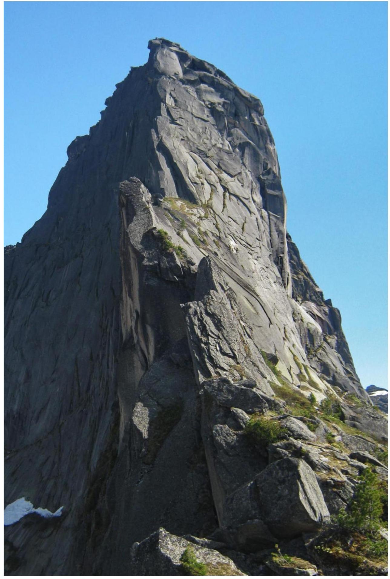
2.1. Technical photography
 2.2. Route diagram in UIAA symbols
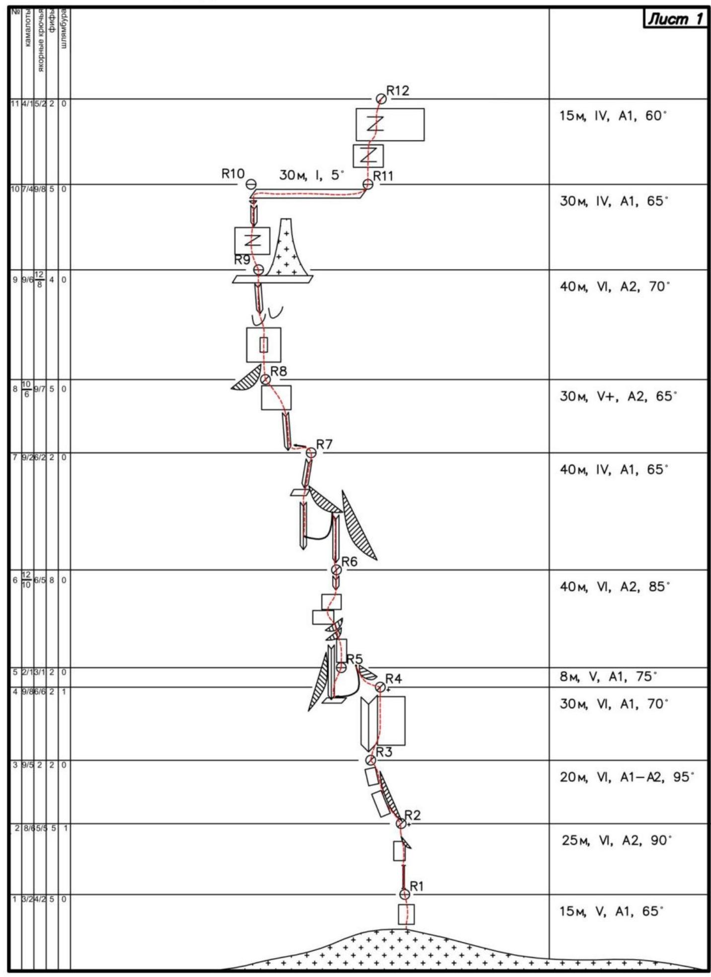
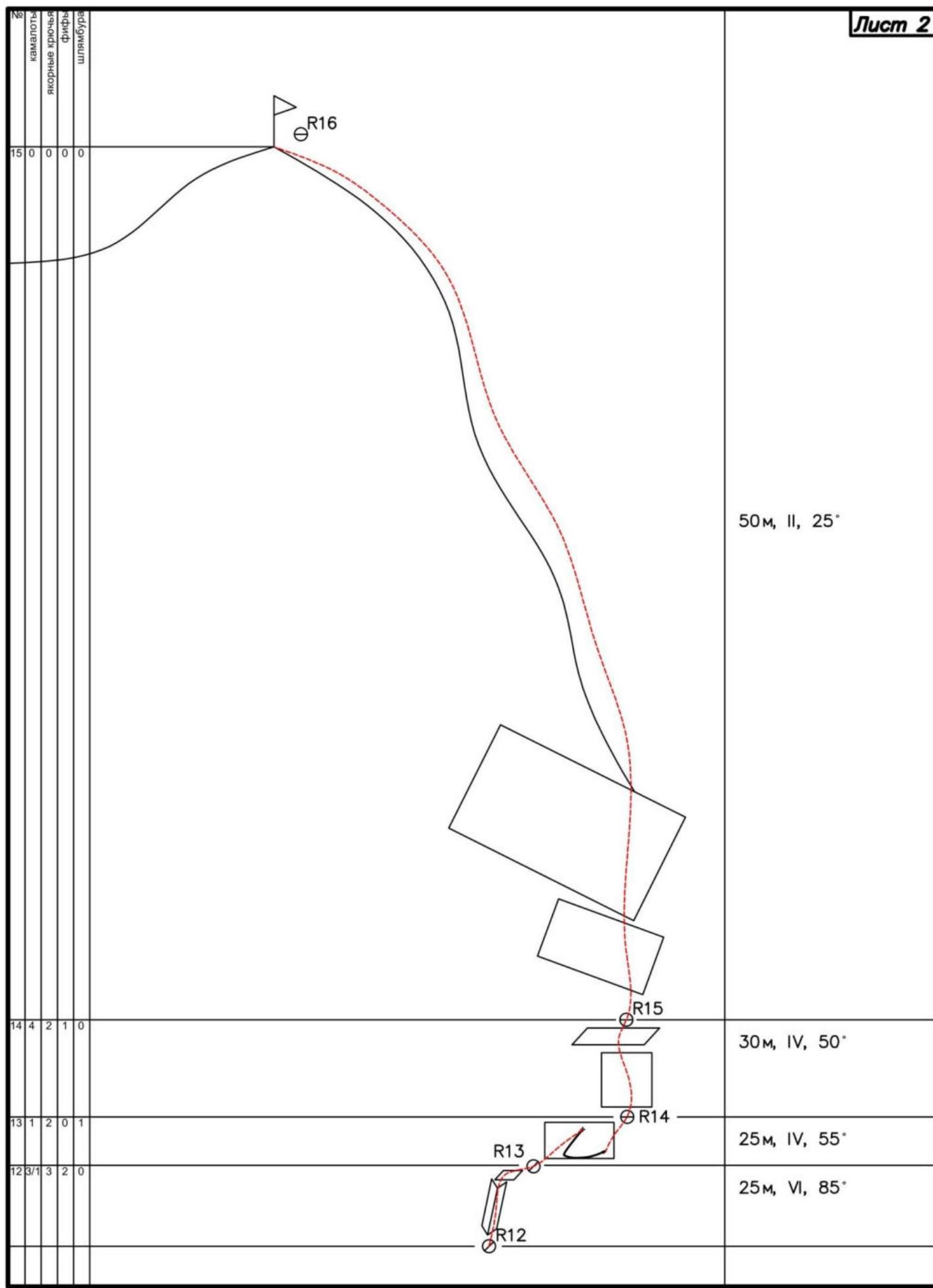
| 50 m, II, 25° |
|---|
| 30 m, IV, 50° |
| 25 m, IV, 55° |
| 25 m, VI, 85° |
3. Characteristics of Team Actions
| Section # | Description |
|---|---|
| R0–R1 | A small wall with a series of cracks filled with ice, passable on artificial holds, gaining steepness up to 90° at the end of the section. |
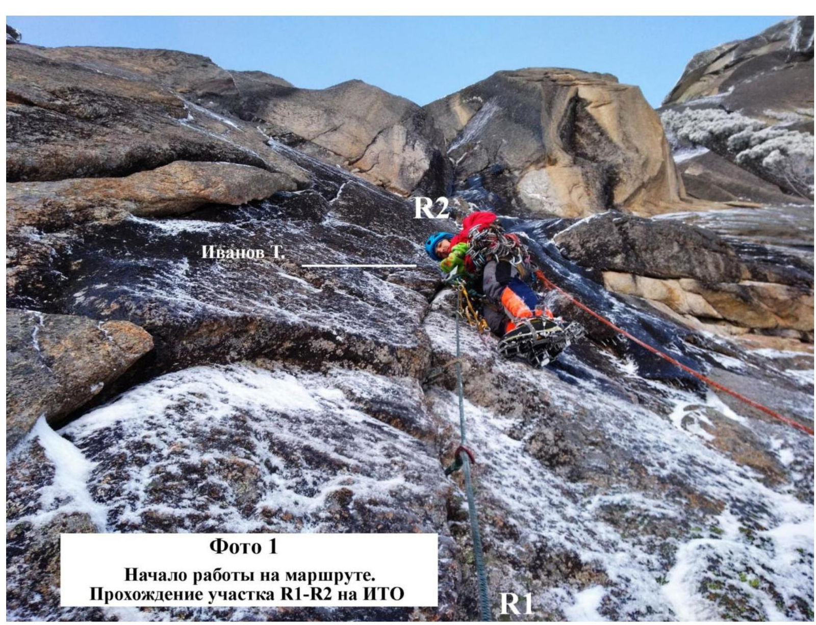
| R1–R2 | A small, narrow chimney, partly with an angle greater than 90°, 12 m long. The chimney turns into a wall where protection is organized in a crack between the wall and a cornice. Cracks are filled with ice. Passed on artificial holds. One of the key sections of the route. |
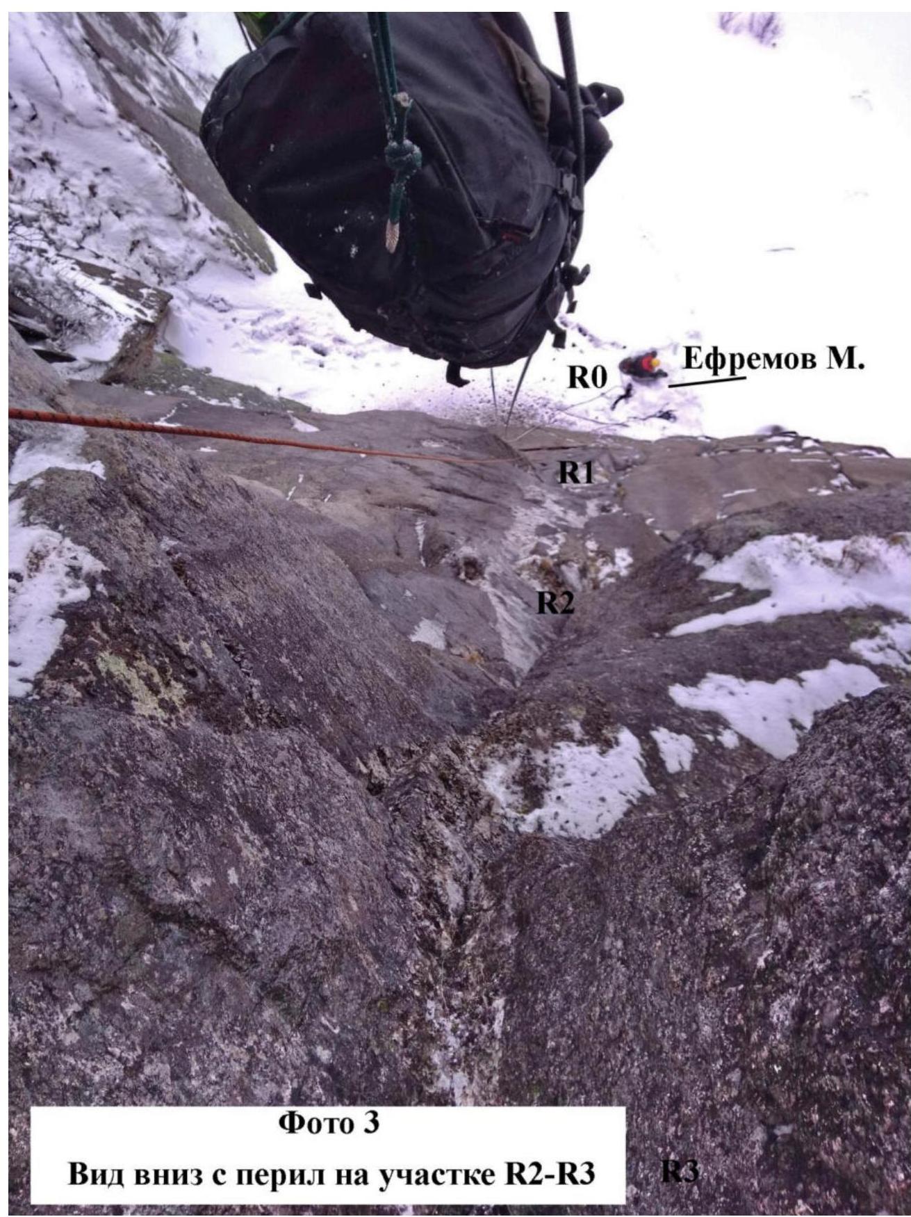
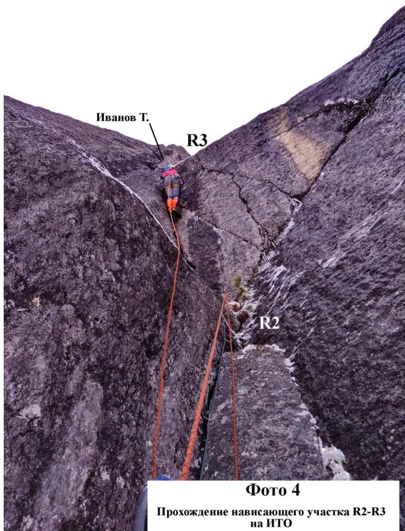
| R2–R3 | An overhanging section passed on artificial holds. A crack is formed between the wall and the cornices, where all types of protection are used (from anchors to the largest cams). |
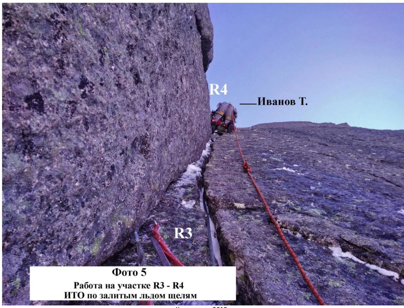
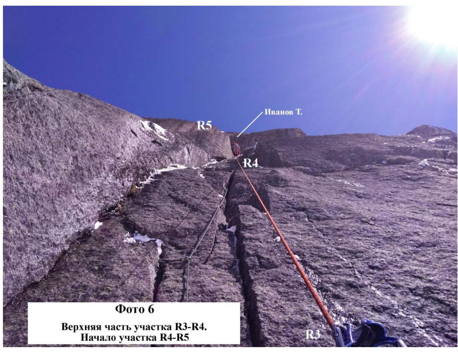
| R3–R4 | A series of cracks going upwards. The section is about 30–35 m. Mainly passed on cams. At the top before R4, there's a rocky section; anchor points may pop out when loaded. |
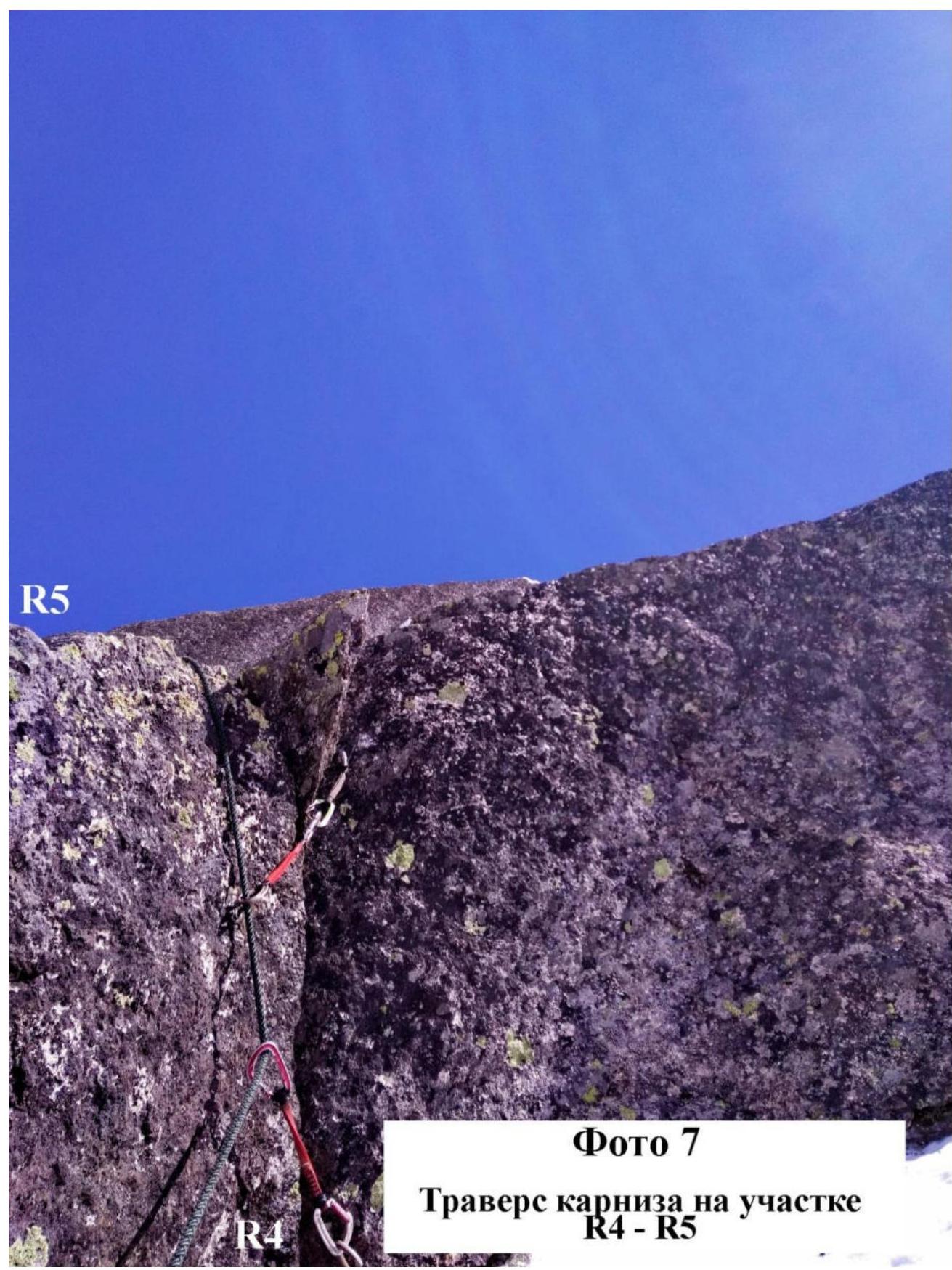
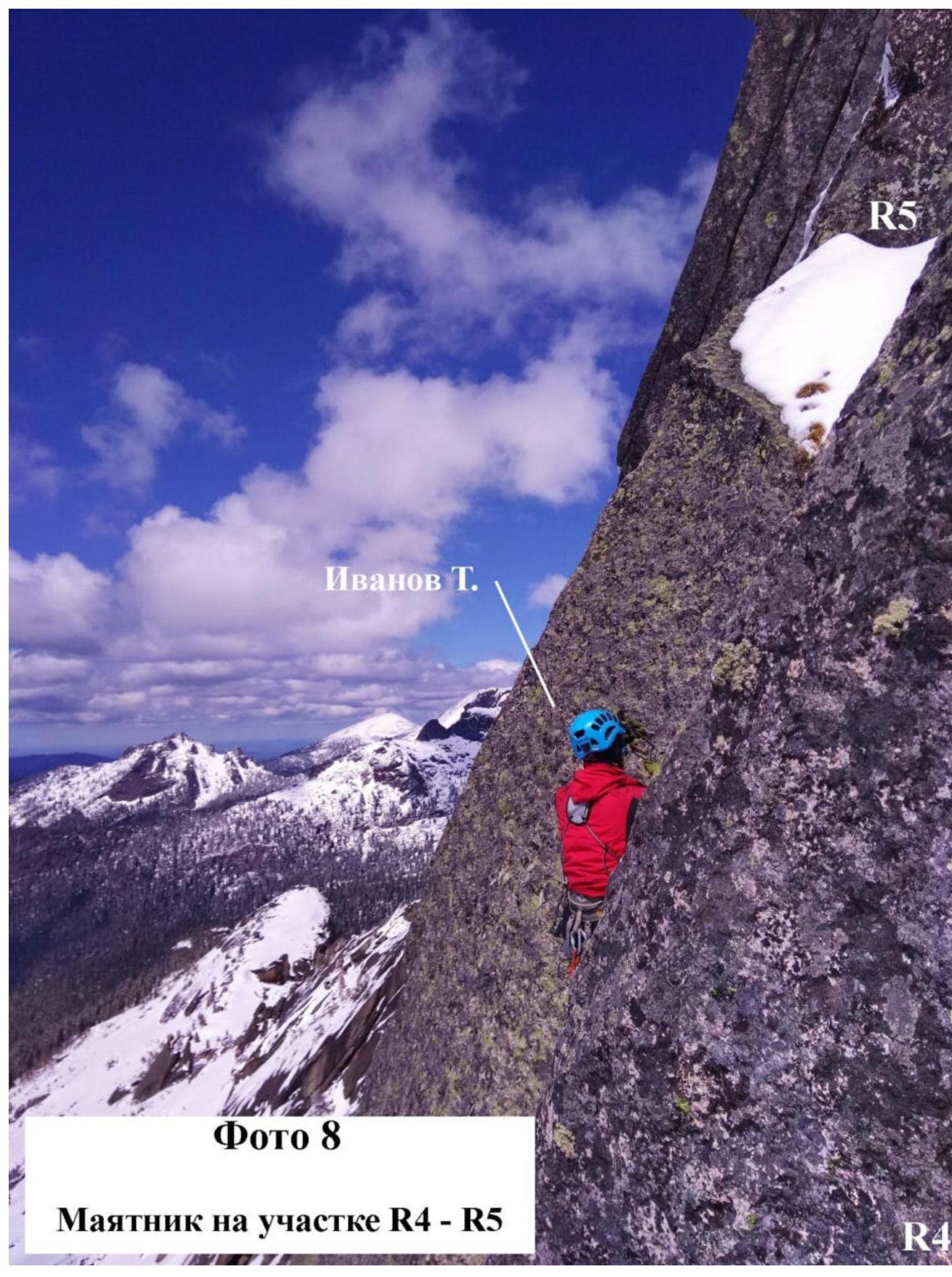
| R4–R5 | A cornice above which is a monolithic wall. Traverse to the inner corner 10–15 m to the left. Then up to R5 through the inner corner overgrown with grass and snow on top. Difficult to organize reliable protection. |
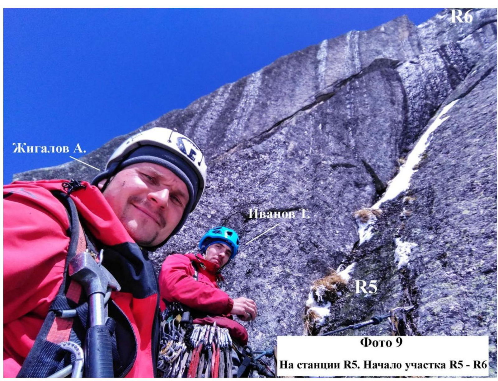
| R5–R6 | A key section of the route. A series of slots going up the wall, about 15 m. Then a series of two consecutive cornices. Protection when passing cornices is on the tips of anchors. After passing the cornice, there's a monolithic wall with suspicious protection points; anchors fall out when hammered. The wall turns into an inner corner up to R6. |
| R6–R7 | An inner corner going under a cornice. Then a traverse to the left into an inner corner overgrown with grass and filled with snow. Protection points are unreliable. Further, after a small ledge, there's an inner corner filled with snow and ice. |
| R7–R8 | Traverse to the left about 5–7 m, then an inner corner turning into a monolithic wall with protuberances. Protection is on the tips of anchors. The R8 station is under a cornice. |
| R8–R9 | A series of cracks going up a resonant slab, a 20 m section. Then a series of rounded rock formations turning into an inner corner leading to a small ledge where the R9 station is organized. |
| R9–R10 | A slab passable by free climbing in summer, filled with snow, partly covered with ice, turning into an inner corner. |
| R10–R11 | Traverse along a large convenient ledge to the right about 25–30 m. |
| R11–R12 | A series of slabs 60°, filled with snow, covered with ice. |
| R12–R13 | An inner corner, partly overhanging, covered with ice, leading to a sloping ledge, about 60°. |
| Section # | Description |
| :--: | :-- |
| R13–R14 | A sloping slab about 55–60°, filled with snow. Midway through the section, a bolt is hammered. At this point, the route connects with Prokofiev's route. |
| R14–R15 | A sloping slab passable by free climbing, about 30 m, leading to a small ledge. |
| R15–R16 | A series of sloping slabs leading to the summit. |
Photo 1. Beginning of work on the route. Passing section R1–R2 on artificial holds
 Krasnoyarsk 2018.
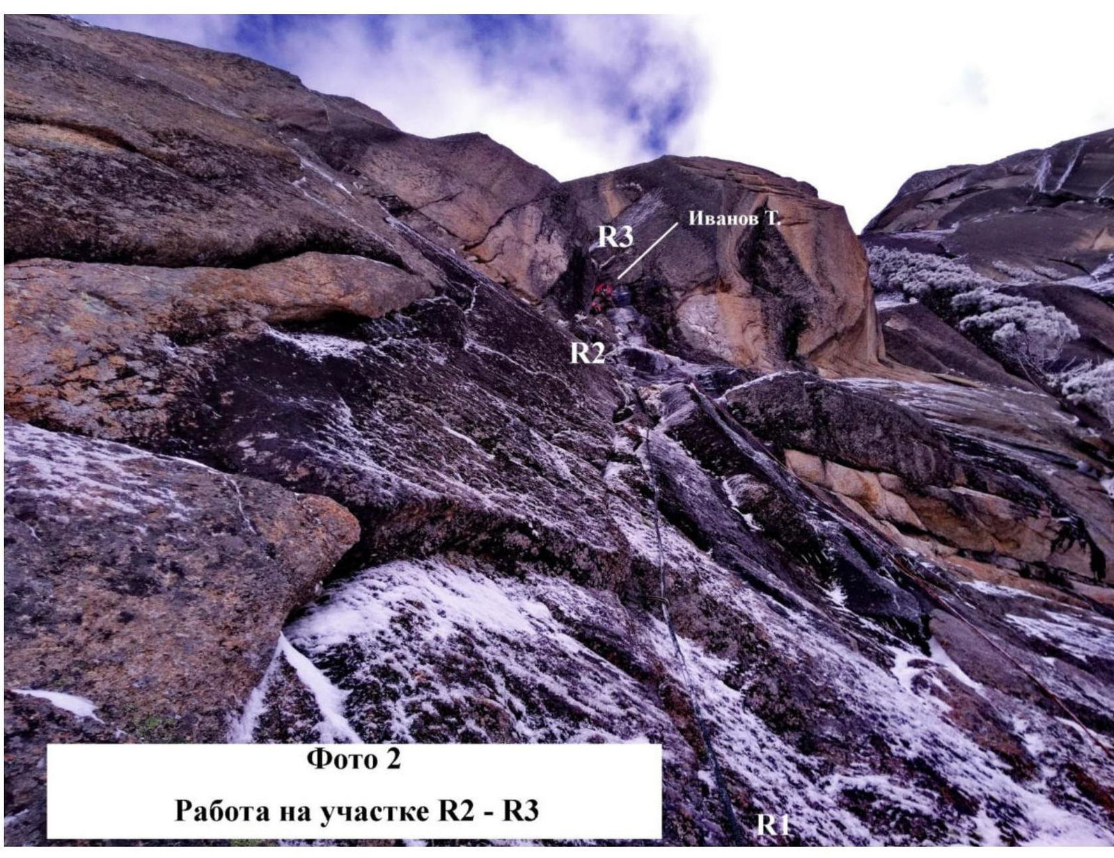
Photo 2. Work on section R2–R3
 Krasnoyarsk 2018.
Photo 3. View down from the fixed ropes on section R2–R3
 Krasnoyarsk 2018.
Photo 4. Passing the overhanging section R2–R3 on artificial holds
 Krasnoyarsk 2018.
Photo 5. Work on section R3–R4. Artificial holds on ice-filled cracks
 Krasnoyarsk 2018.
Photo 6. Upper part of section R3–R4. Beginning of section R4–R5
 Krasnoyarsk 2018.
Photo 7. Traversing the cornice on section R4–R5
 Krasnoyarsk 2018.
Photo 8. Pendulum on section R4–R5
 Krasnoyarsk 2018.
Photo 9. At station R5. Beginning of section R5–R6
 Krasnoyarsk 2018.
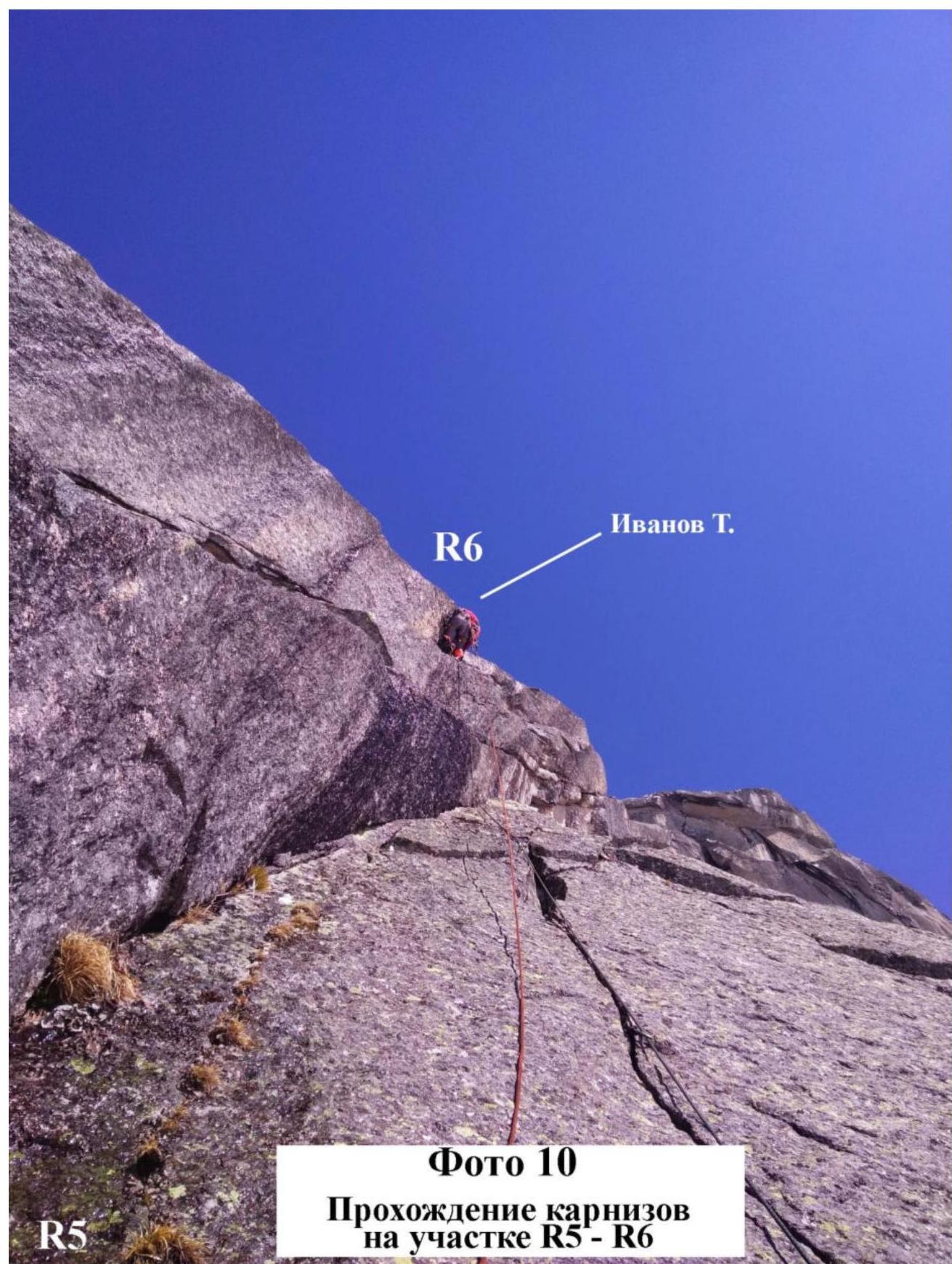
Photo 10. Passing cornices on section R5–R6
 Krasnoyarsk 2018.
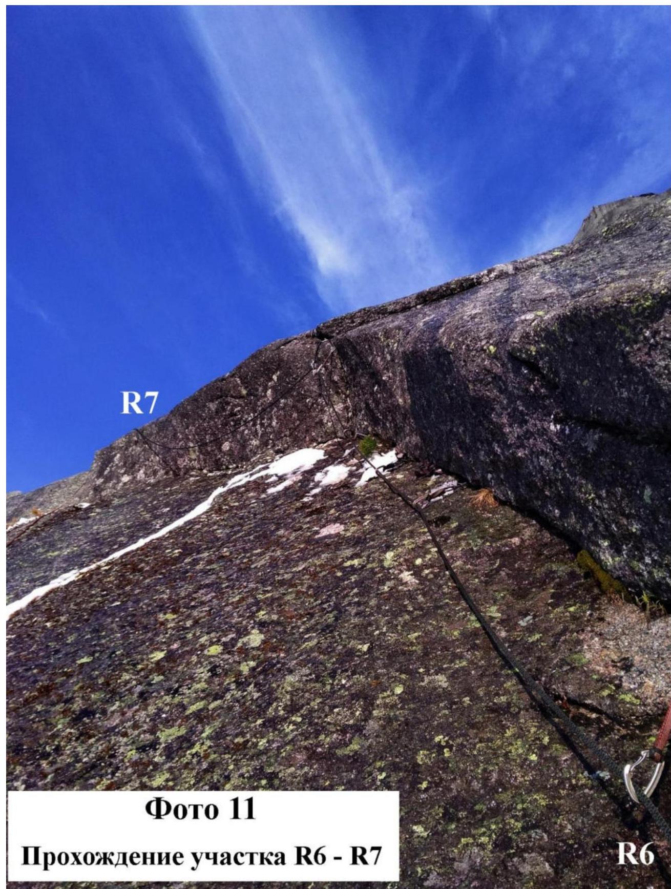
Photo 11. Passing section R6–R7
 Krasnoyarsk 2018.
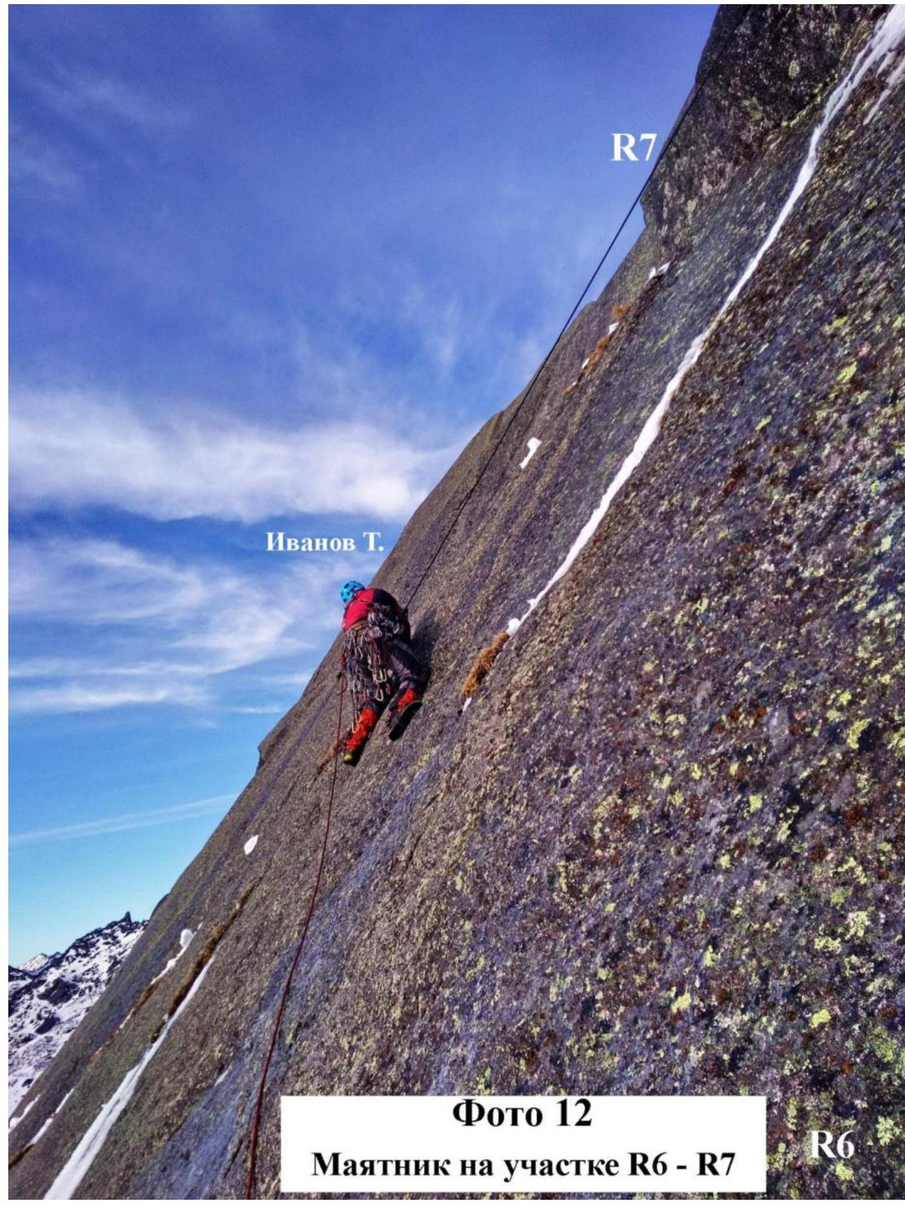
Photo 12. Pendulum on section R6–R7
 Krasnoyarsk 2018.
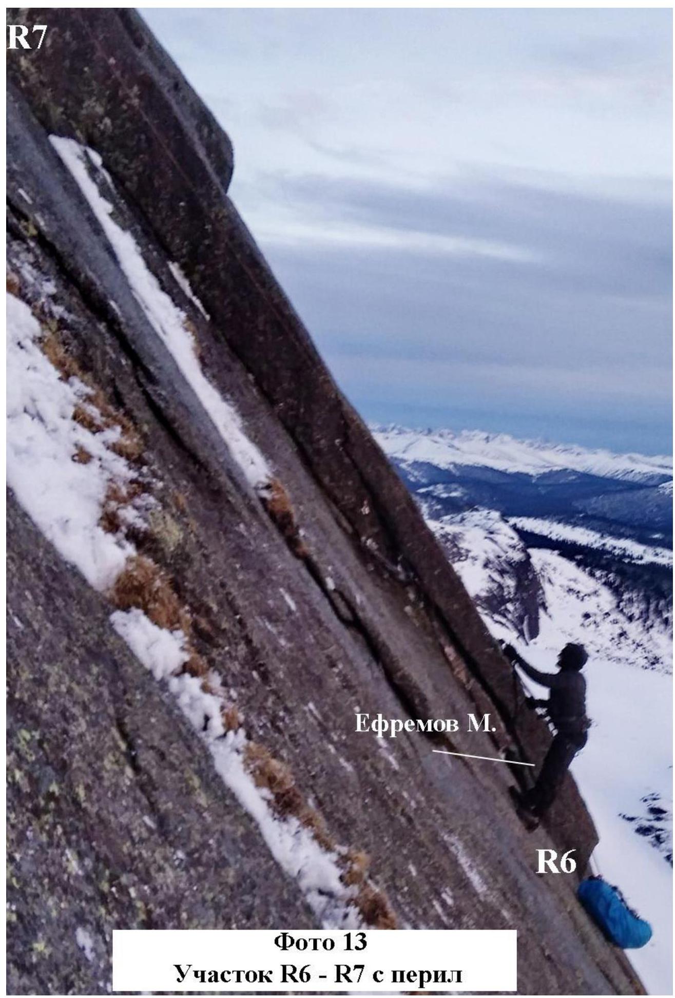
Photo 13. Section R6–R7 with fixed ropes
 Krasnoyarsk 2018.
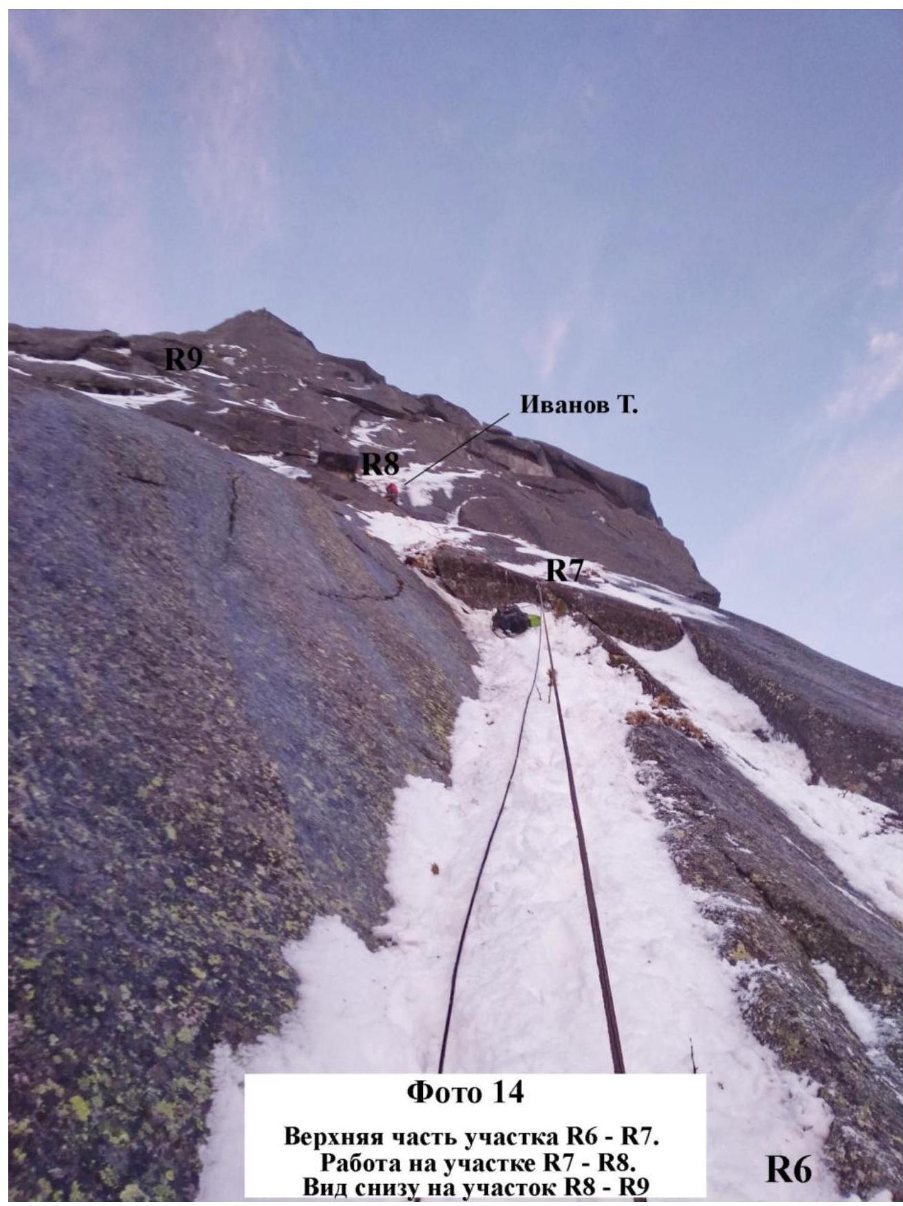
Photo 14.
- Upper part of section R6–R7.
- Work on section R7–R8.
- View from below on section R8–R9.
 Krasnoyarsk 2018.
Photo 15 (taken from Volosy pass). View of sections R8–R16. The team went pendulum from R8 to the ledge to organize an overnight stay in a tent on May 25–26, 2018. Detailed photos of sections R9–R16 and a general photo of the team on the summit could not be taken as all photo and video equipment failed on the morning after the overnight stay on May 26, 2018.
The route is potentially safe at any time of the year, as even in May, with sharp temperature fluctuations, there were no rockfalls. The route is considered safe by the team. Communication on the route was maintained via TELE2 local network and MTS. On this route, it is desirable to have: a pair of cam sets or friends, and 15–20 anchors (including those with bends).
The descent from the summit is done via Terentyev's route (Tred) towards Lake Raduzhnoe (5 rappels). The descent starts immediately from the summit. The entire descent is equipped with reliable stations with bolts.
In the opinion of the ascent participants, we believe that the route is much more complex compared to 5A "KANT" and also rivals 5B routes in terms of the length of the 6th pitch. We consider it fair to assign this route a 5A category.
Krasnoyarsk 2018.