
Ascent log for the summit of Glavny Topograf Mazurov, 3089 m, via the North slope.
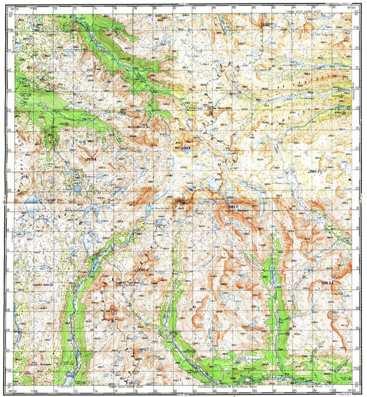
- Eastern Sayan, Pogranichny ridge, Charm-Taiga spur, Topografov massif, section 6.1.4.
- Summit Glavny Topograf Mazurov, 3089 m, via the North slope.
- Proposed category 1B, non-category.
- Route type — combined.
- Elevation gain — 280 m, distance — 500 m, average slope — 30°.
- Pitons hammered: rock and chock stones 2 pcs.
- Team's travel time — 5 hours.
- No overnight stays on the route.
- Group: Afanasyev A. E. MS Arsentyev A. V. topographer Terpelenkov M. A. topographer Cherepanov L. A. topographer Chernykh E. V. topographer
- Coach — Afanasyev A. E. MS.
- Ascent to the summit and return on September 14, 2006.
Description of the ascent route to the summit Glavny Topograf Mazurov, 3089 m, via the North slope, cat. 1B.
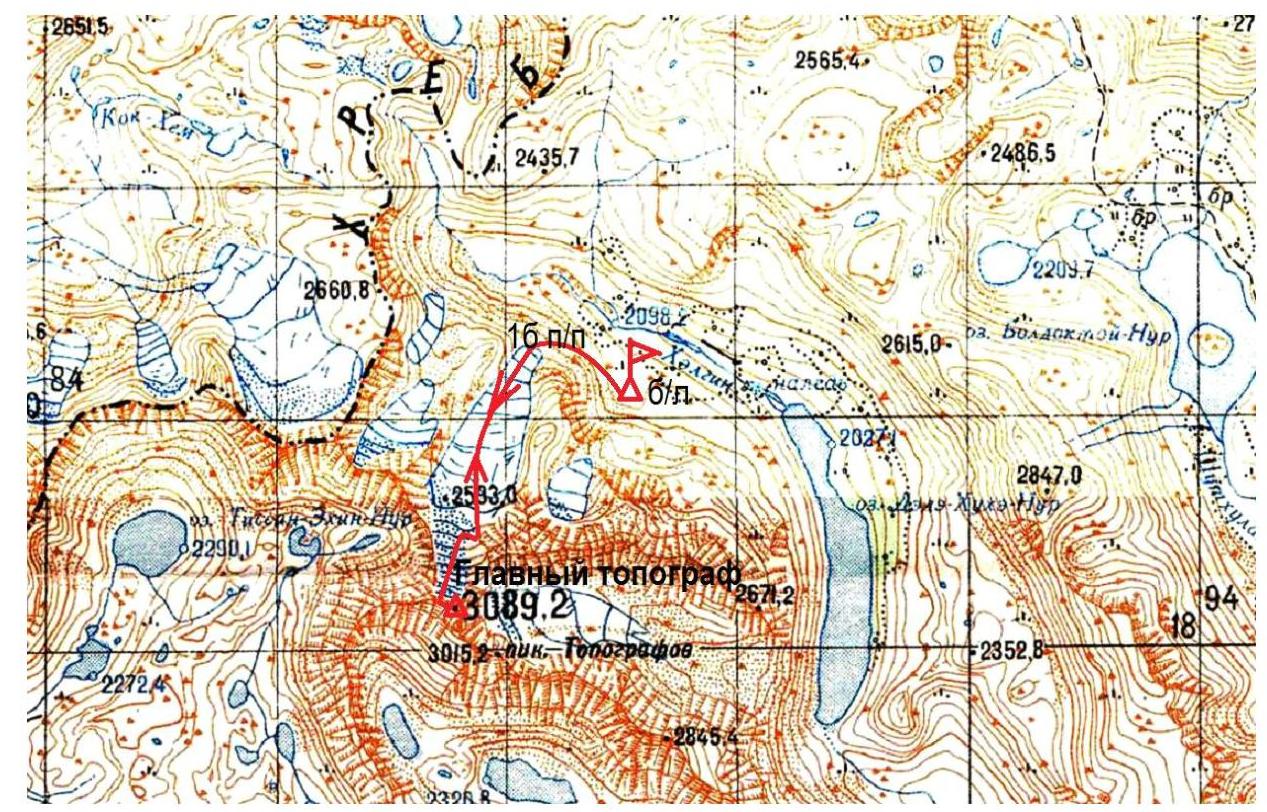
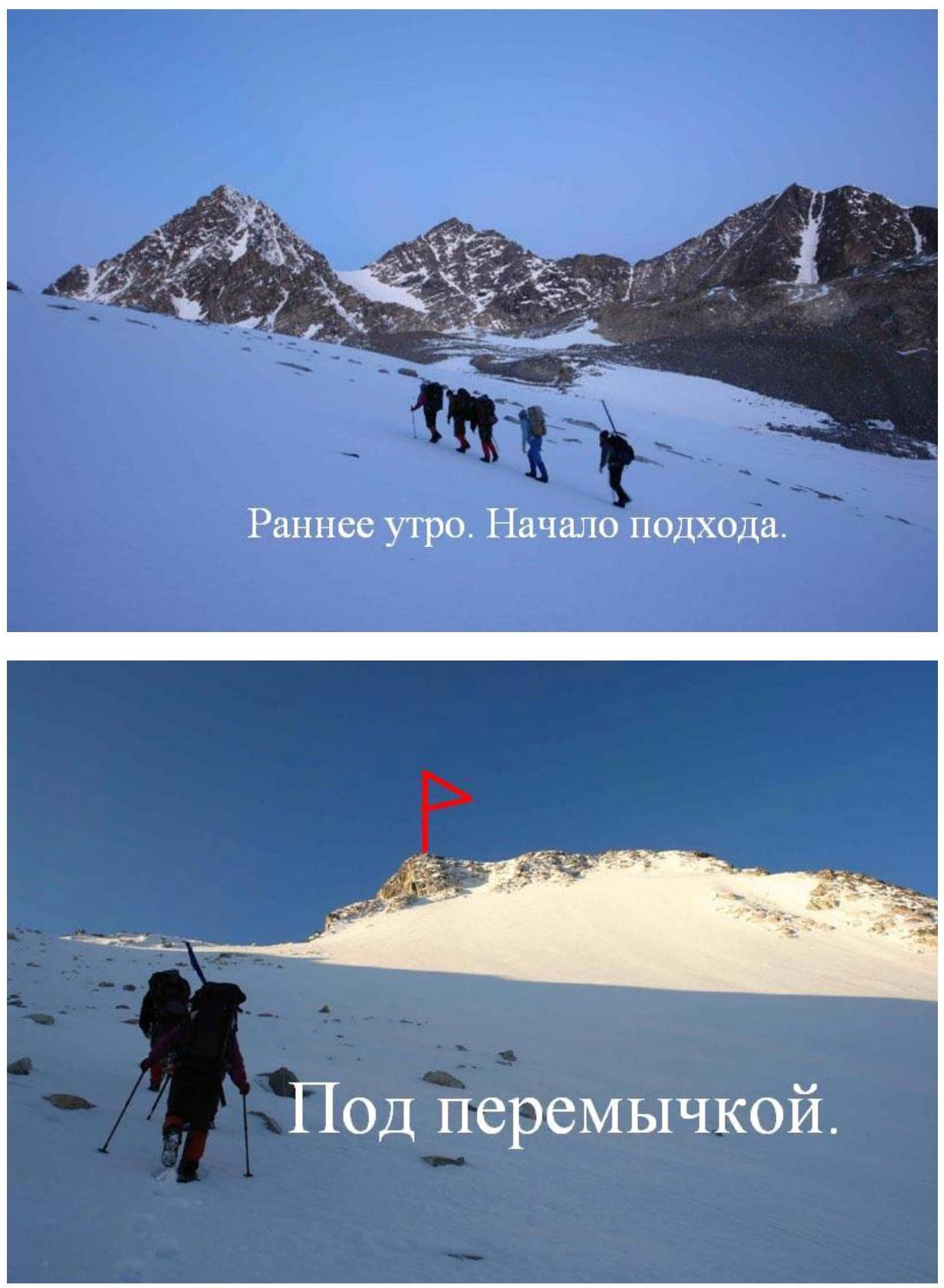
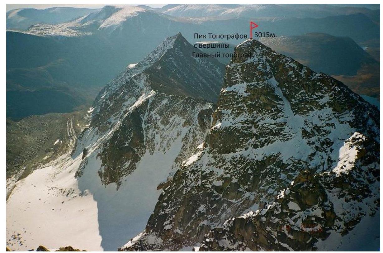
The approach starts from the source of the Khelgin river in a southerly direction along the cirque-valley glacier on the northern slope of Mt. Glavny Topograf Mazurov. Topografov peak, height 3044 m on a tourist map and 3015 m on a topographic map N-47-126 M 1:100 000, is located from the main summit to the southeast beyond a large depression:
- 700 meters according to the sign,
- 600 m in a straight line on the map.
The approach to Mt. Glavny Topograf Mazurov takes 3 hours to a saddle on the northeastern ridge, transitioning into the northern slope, where the route begins. Topographers regularly ascend via this route, and this report is the first description of the route, but not the first ascent.
R0–R1 100 m. 40° 1. Along the ridge among large stone blocks. R1–R2 300 m. 40° 1. To the right of the ridge along the snowy slope. R2–R3 50 m. 45° 1. Snowy slope on stone slabs. R3–R4 40 m. 50° 2. Via snow-covered rocks to the summit ridge. R4–R5 100 m. Left along the flat ridge. Exit to the summit. (100 meters to the right is the right summit with a large separate stone, which is slightly lower than the left one). Descent via the ascent route: two sports rappels and then a safe glissade to the foot of the mountain. The Topografov Glacier is even, gently sloping, without bergschrund or large crevices. The ascent was organized and conducted in honor of the 60th anniversary of the East Siberian Aerogeodetic Enterprise.
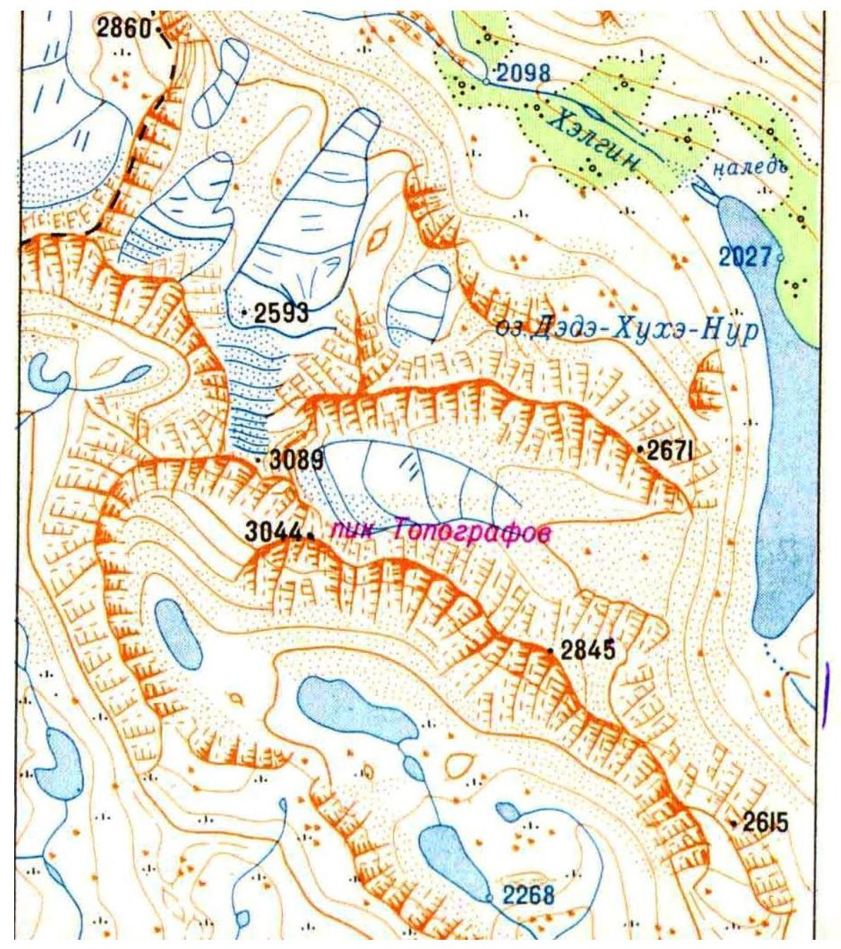
2860
2098
2027
2671
2615
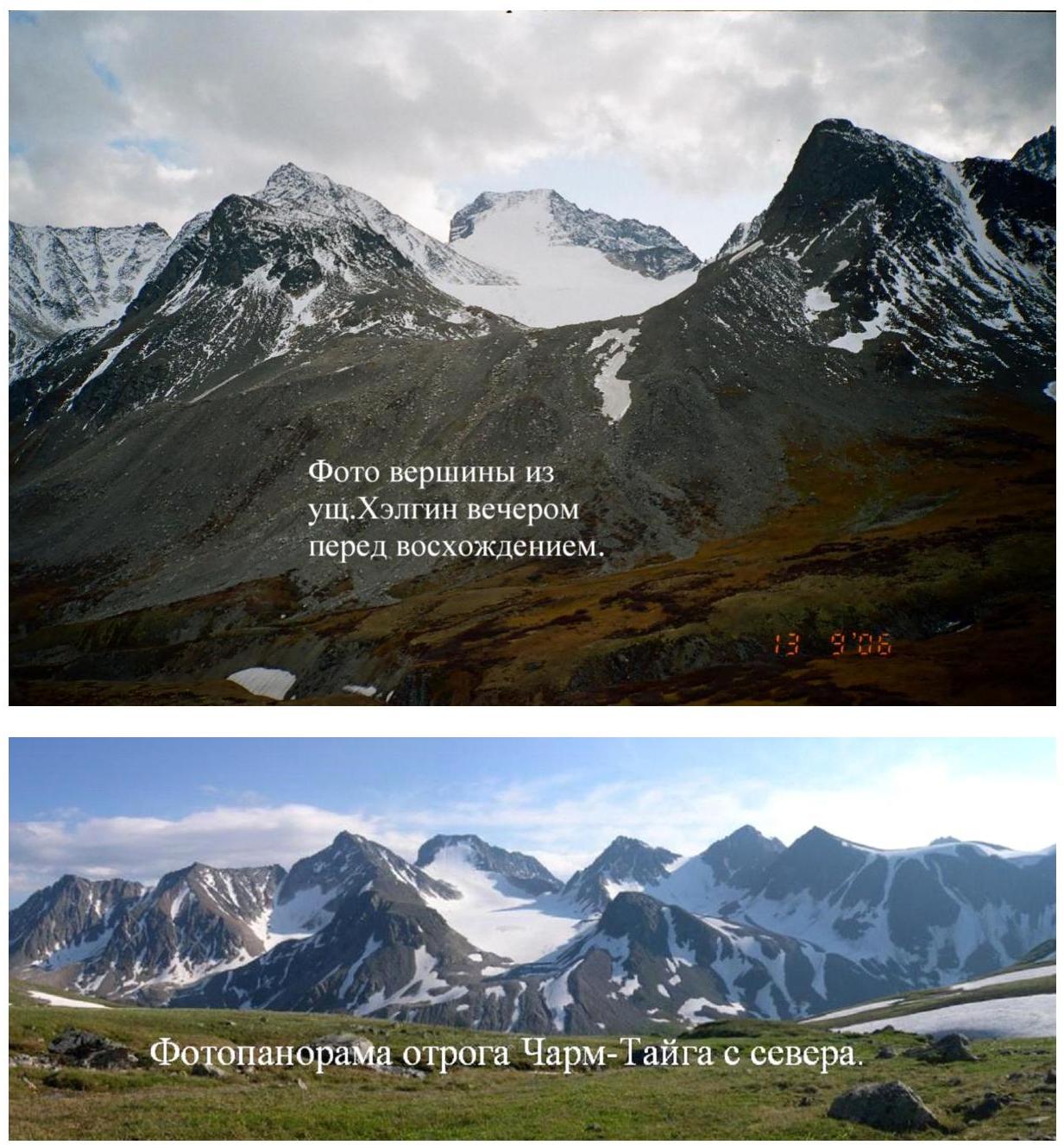
Photopanorama of the Charm-Taiga spur from the north.

3089 m, 3015 m. Topografov summit.
Photo of the Topografov massif from the northeast.

Technical photo
Glavny Topograf 1B
On the R1–R2 section.

On the eastern summit of Glavny Topograf.
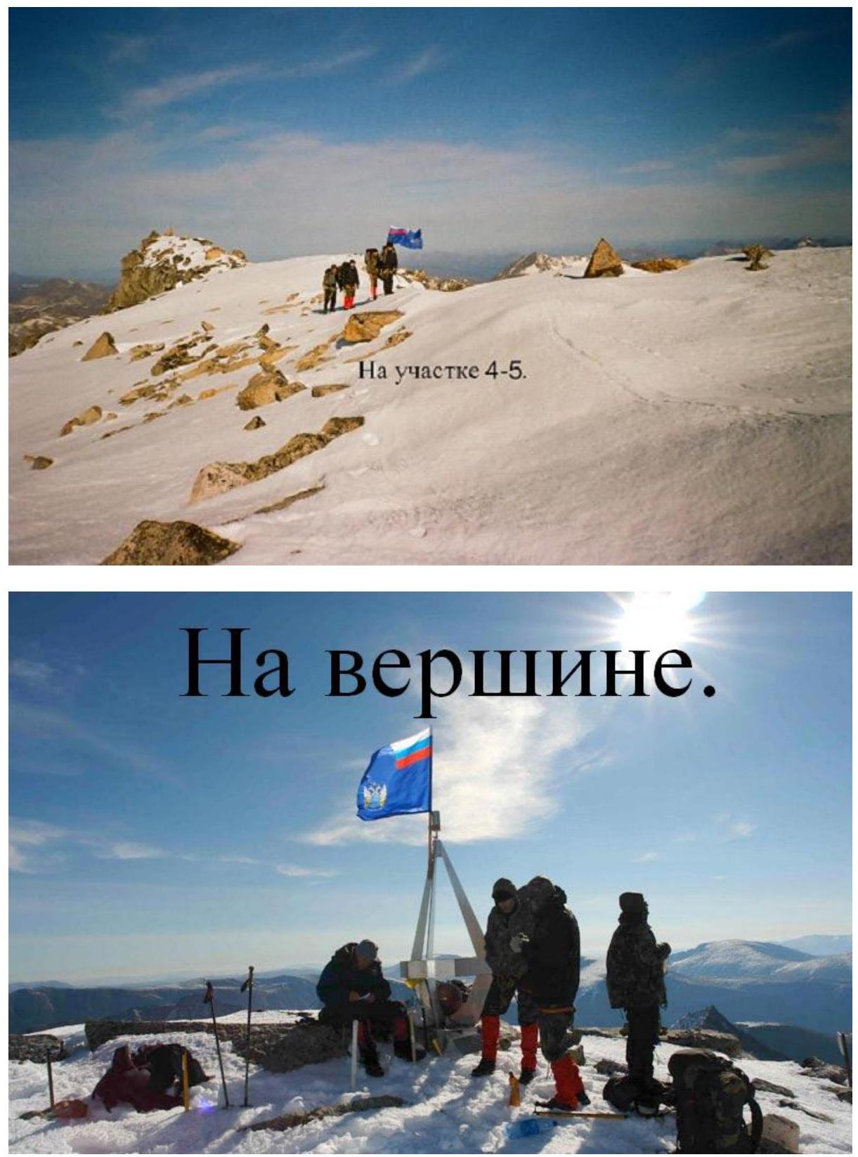
On the summit. On the R4–R5 section.
Mountain "chains" on the summit
of Glavny Topograf
Mountain "chains" on the summit of Glavny Topograf. TOLOMPAS EXPEDITION RASTATURYNKA. Naol 1984.
Descent from the mountain.

Comments
Sign in to leave a comment