
I. Climbing passport for v. VLKSM, 3396 m, via the North Ridge.
- Altai, Chikhachev Ridge, section 1.7. 2. Summit VLKSM (60th anniversary of VLKSM), 3396 m, via the North Ridge. 3. Proposed category 1B difficulty. First ascent. 4. Route characteristics: combined. 5. Route details:
Elevation gain 300 m, length 640 m, average slope 30°. 2 rock pitons driven; belay through rock outcrops. 7. Team's moving time: 6 hours. 8. Leader: Khlynovsky A.M., 1st sports category,
Participants:
- Afanasiev A.E., 1st sports category
- Kovalev G.V., 1st sports category
- Korzhov P.I., 2nd sports category
- Ryzhova T.A., 1st sports category
- Tenenev V.A., 1st sports category
- 4 novices. 10. Date of departure and return: May 11, 1978.
Description of the ascent to v. VLKSM, 3396 m, via the North Ridge.
The summit is located in the southwestern spur of the Chikhachev Ridge, branching off from v. Pogranichnik Zabaikalya. It is separated from the main watershed by a pass between the Nyryn-Gol and Pravaya Boguty valleys.
To the northeast of the summit, a glacier is situated below the rock cliffs.
The southeastern side of the mountain features destroyed rock cliffs with weakly pronounced counterforts.
The approach to the route from the base camp takes 1 hour. The Pravaya Boguty cirque is branched, divided into 5 smaller cirques. Each contains one to three lakes.
One needs to move north, straight in the direction from where they came to the base camp. Along the way, two lakes are passed, which in May are represented by snowfields. In the upper part of the cirque, there is a turn to the left, almost at a 90° angle.
The approach ends below the pass from Pravaya Boguty to the source of Naryn-Gol, between the summits of Pogranichnik Zabaikalya and VLKSM. The ascent to the pass is very steep, snowy. In snow-free periods, rock outcrops are possible.
The start of the route is approximately at an altitude of 3100 m, below the pass.
Sect. 0–1 25° 200 m I — Snow slope in the direction of the pass, slightly to the right of the middle.
Sect. 1–2 40° 150 m I+ — Steep snow slope. The snow is dense. In the left part, rock outcrops like "ram's foreheads" are visible. Exit to the pass ridge. Then, a turn to the left at 90 degrees.
Sect. 2–3 35° 150 m I — Rocky ridge, initially wide, then narrows and increases in steepness.
Sect. 3–4 50° 80 m II+ — Steep rocky ridge. Passed mainly on the left side. Two sections of ropes. Piton belay and belay on outcrops.
Sect. 4–5, 20°, 60 m, I+ — Rocky ridge with snow. Alternating movement. Exit to the VLKSM summit. No signs of human presence were noticed.
Descent via the ascent route. On the ridge — 2 rappels. The rest on foot.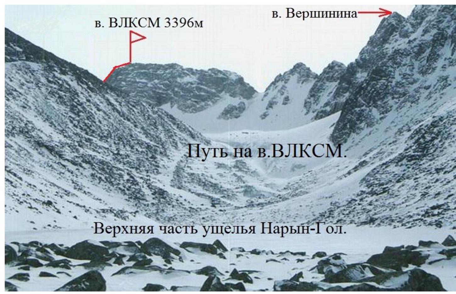
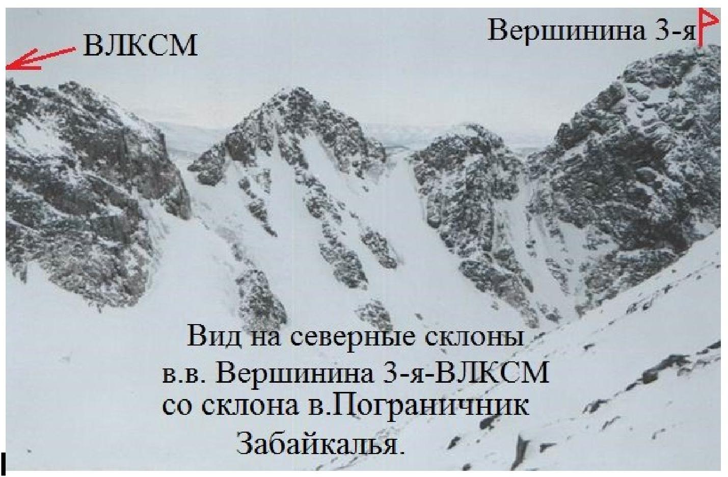
View of the northern slopes of vv. Vershinina 3-y — VLKSM from the slope of v. Pogranichnik Zabaikalya.
Comments
Sign in to leave a comment