
Report
On the first ascent
To the summit: Domashnyaya (2352 m) Via the route: Eastern wall of the Southern ridge Complexity category: 5A cat. sl. (proposed) By the team of Irkutsk region: Klepikov A.A., Ivanovsky A.V., Kazantseva E.V. The ascent was made on February 5, 2024.
I. Ascent Passport
| №№ p.p. | 1. General Information | |
|---|---|---|
| 1.1 | Full name, sports rank of the leader | Klepikov Alexander Alexandrovich, Master of Sports, 3rd cat. sl. |
| 1.2 | Full name, sports rank of the participants | Ivanovsky Anton Vladimirovich (2nd sports rank) Kazantseva Evgenia Vasilievna (2nd sports rank) |
| 1.3 | Full name of the coach | Afanasiev Andrey Evgenievich, Master of Sports, 1st cat. sl. |
| 1.4 | Organization | FASIО |
| 2. Characteristics of the ascent object | ||
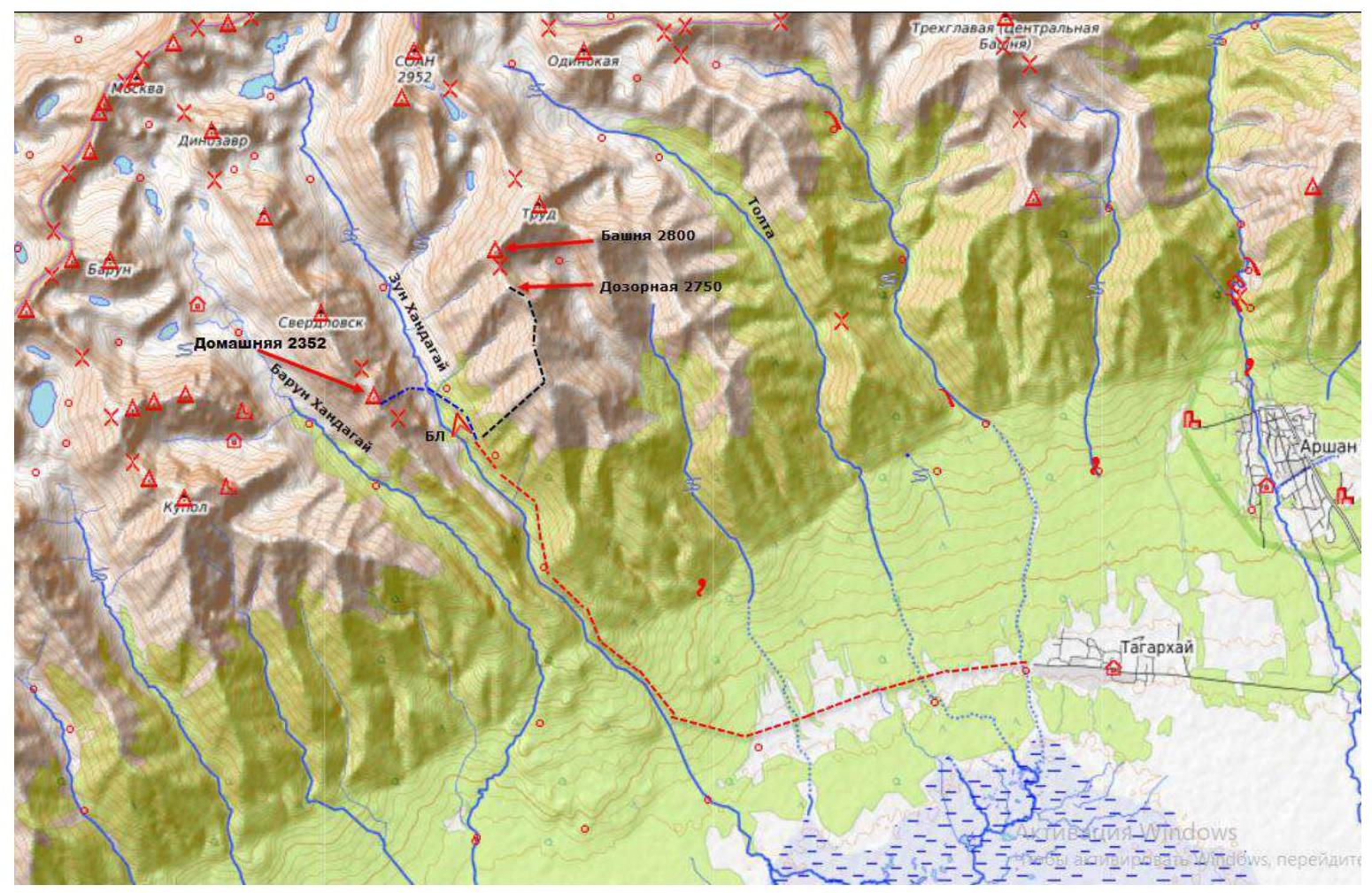
| 2.1 | Region | Sayan Mountains, Tunkin Goltsy |
| 2.2 | Valley | Zun Khandagai |
| 2.3 | Section number according to the 2020 classification table | 6.1.2 |
| 2.4 | Name and height of the summit | Domashnyaya (2352) |
| 3. Characteristics of the route | ||
| 3.1 | Route name | Eastern wall of the Southern ridge |
| 3.2 | Proposed complexity category | 5A |
| 3.3 | Degree of route development | First ascent |
| 3.4 | Route terrain character | Rock |
| 3.5 | Route height difference and main part | 602/445 m |
| 3.6 | Route length and main part | 1127/622 m |
| 3.7 | Technical elements of the route (total length of sections of varying complexity with terrain character indication (ice-snow, rock)) | I cat. sl. rocks - 30 m. II cat. sl. rocks - 600 m. III cat. sl. rocks - 140 m. IV cat. sl. rocks - 67 m. V cat. sl. rocks - 140 m. VI cat. sl. rocks - 150 m. |
| 3.8 | Average route steepness | 56 up to exit from the wall to a gentle ridge |
| 3.9 | Average steepness of the main part | 61 |
| 3.10 | Descent from the summit | To the Northeast via a descent couloir |
| 3.11 | Additional route characteristics | In summer, there is no water on the route under normal conditions |
| 4. Characteristics of the team's actions | ||
| 4.1 | Movement time (team's travel hours, indicated in hours and days) | 20 h 20 min travel hours to the summit, 1 day processing, 1 day ascent |
| 4.2 | Overnights | No |
| 4.3 | Route processing time | 3 h 30 min, 1 day February 4, 2024 |
| 4.4 | Route start | 08:30 February 5, 2024 |
| 4.5 | Summit attainment | 01:20 February 6, 2024 |
| 4.6 | Return to the base camp | 05:00 February 6, 2024 |
| 5. Responsible for the report | ||
| 5.1 | Full name, e-mail | Klepikov A.A., Baikalteam@gmail.com |
1.1 General photo of the Domashnyaya summit 2352. (Photo taken from the summit of Dozornyaya, shooting height 2750 m, shooting date April 2021)
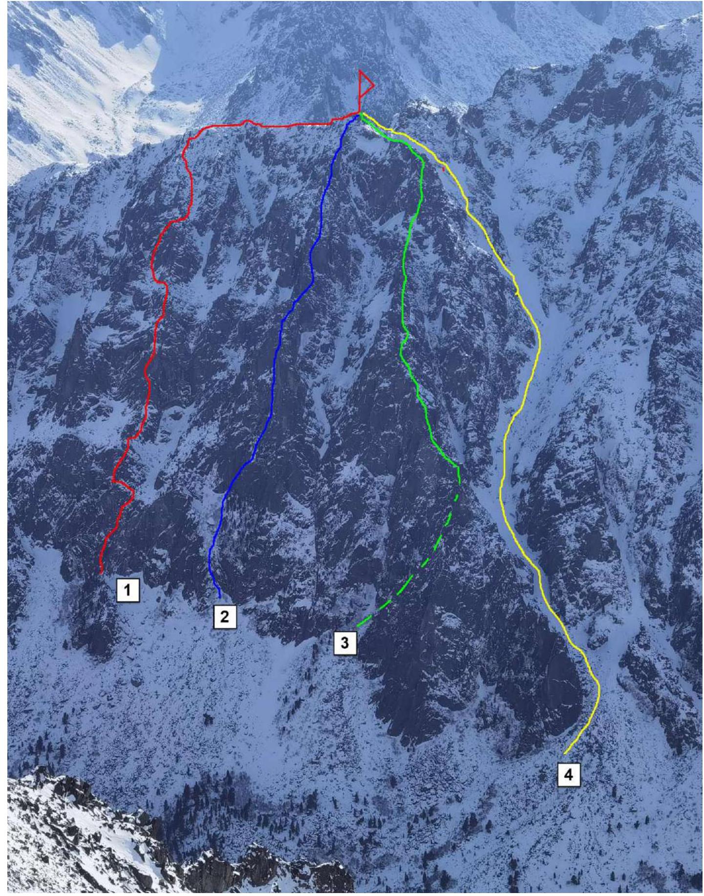
-
- team's route via Eastern wall of the Southern ridge 5A cat. sl., first ascent 2024
- Eastern wall 5A (Glazunov 2011)
- Eastern couloir 4A (Afanasiev A.E. 1979)
- Northeast descent couloir, first ascent
1.2. Photo of the route profile from the left
(Photo taken from the Zun Khandagai river valley from the area of Spartakovskie standing camps, distance approximately 1500 m, shooting height 1500 m above sea level)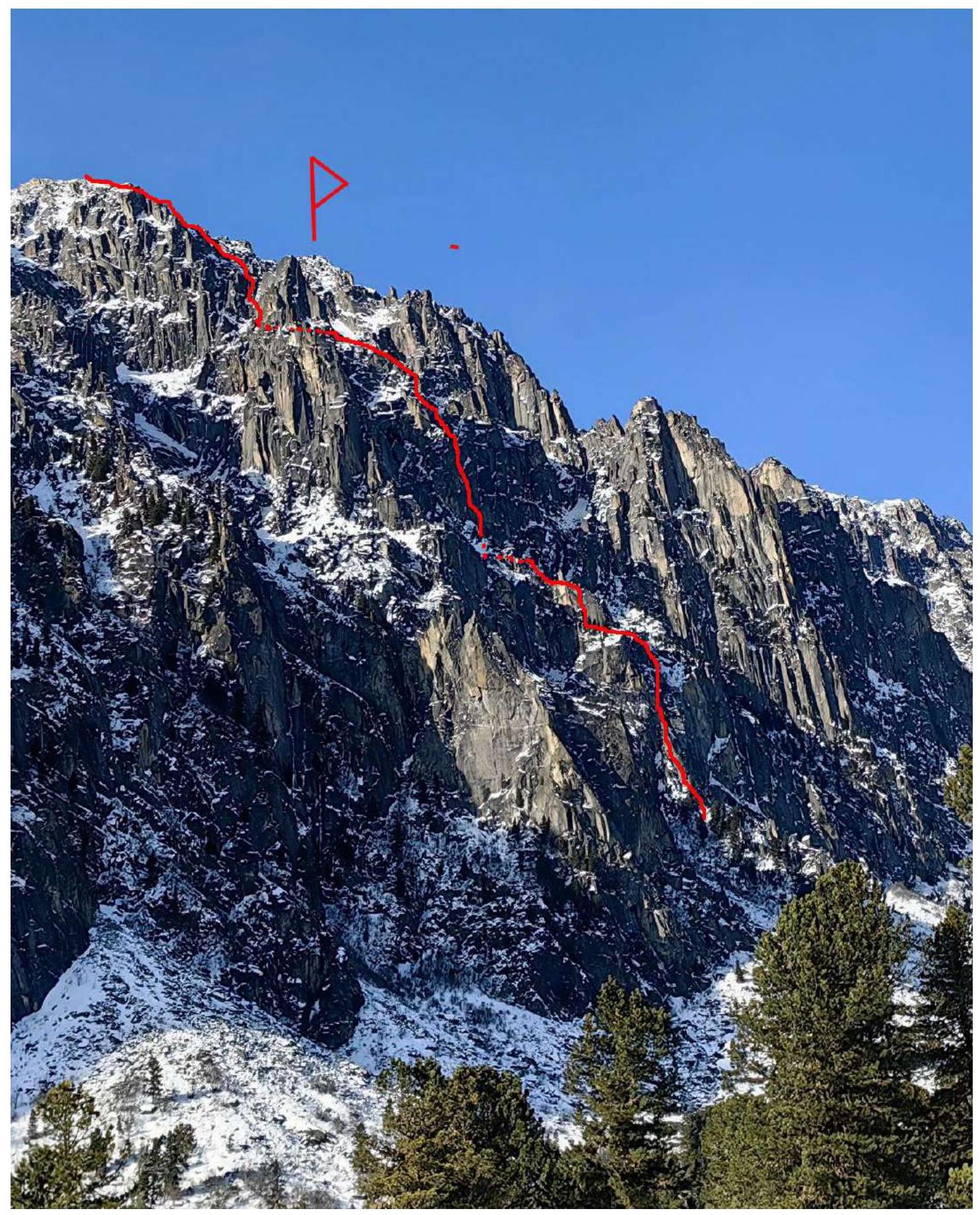
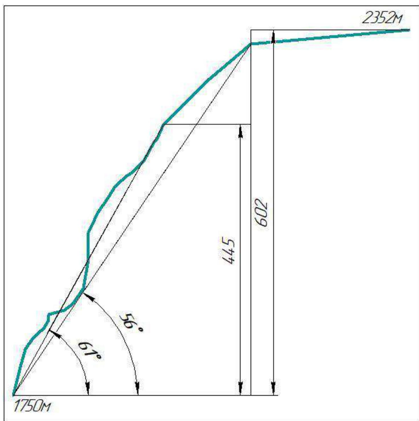
1.3. Drawn route profile
1.4. Photopanorama of the summits of the right bank of the Zun Khandagai valley and the subsequent Barun Khandagai valley
(Photo taken from the ridge of the Dozornyaya summit, shooting height about 2600 m)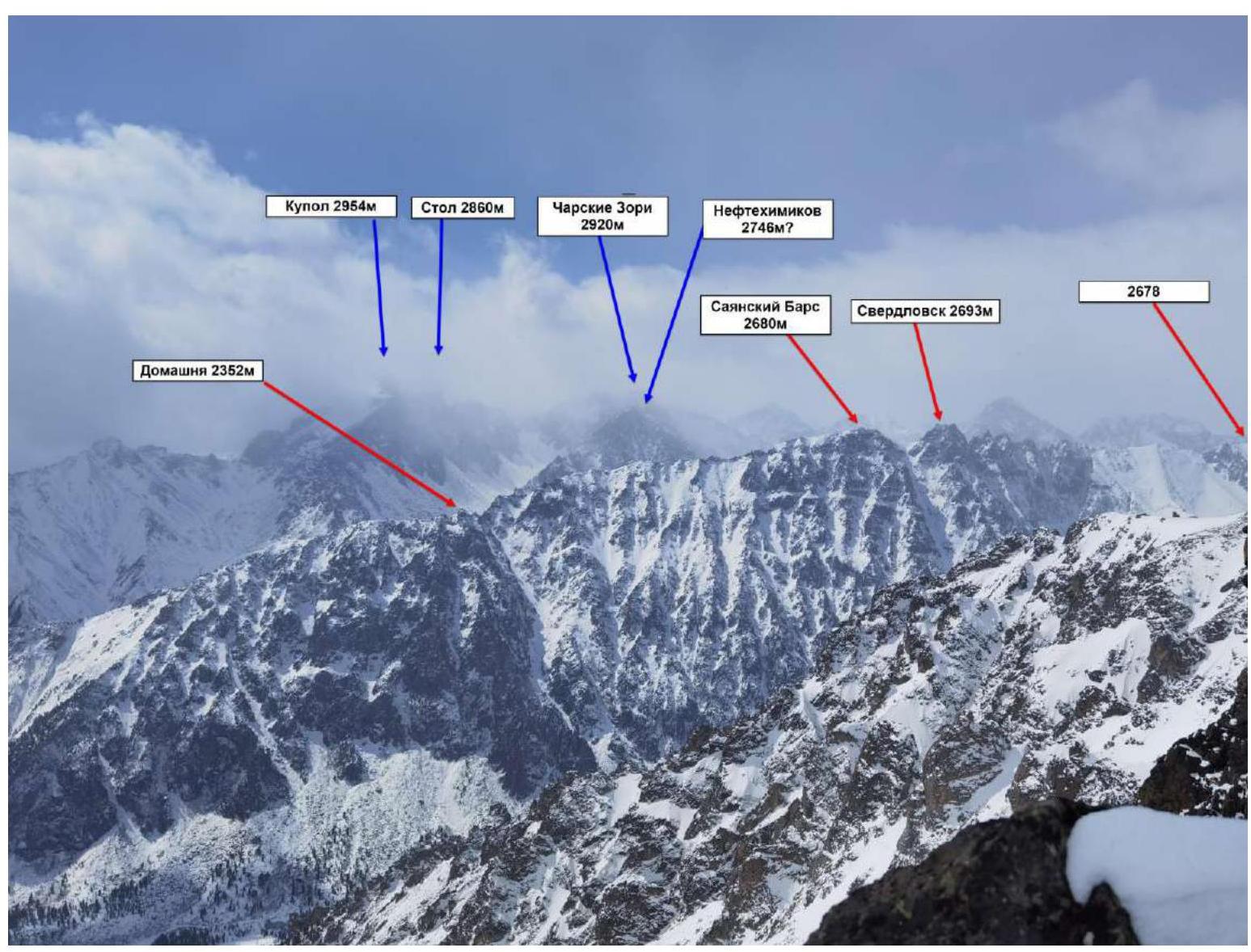
1.5. Map-scheme of the Zun Khandagai valley
2.1. Technical photo of the route
(Photo taken from the opposite bank of the valley, shooting height 1700 m, shooting date February 4, 2024)
Description and characteristics of the terrain
The route begins at the upper part of the rocky outcrop to the right of the couloir, which goes up to the left through the entire wall and to the left of the 5A Glazunov route.
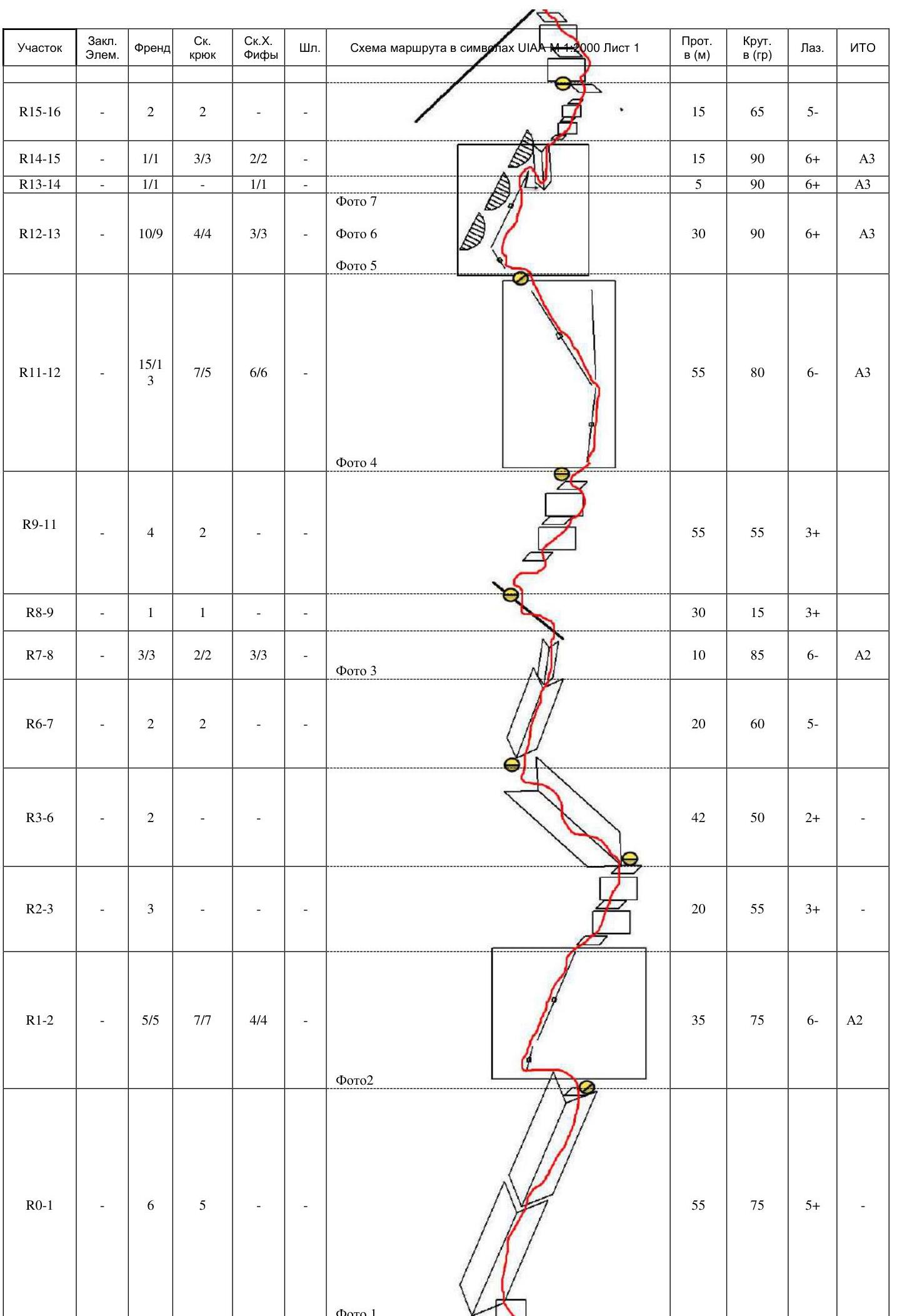
Rope 1 R0–R1 55 m, 75°, 5, First crux. Start from a shoulder above the rocky outcrop, initially a 5 m wall, then along a small destroyed angle to the right of a large angle, exit to a shelf above the angle. Friends.
Rope 2 R1–R2 35 m, 75°, 6, A2. Initially along a narrow crevice to the left of the station. With a passage through a small tree on anchors. To a cedar. From the cedar, a wide crevice along friends up to the 3rd cam. R2–R3 20 m, 55°, 3. Series of shelves and walls with an exit to a station on a large shelf with a cedar.
Rope 3 R3–R4 30 m, 50°, 2. To the left along a wide oblique shelf with small walls. To a bend. R4–R5 2 m, 60°, 4. Descent to a shelf to a tree. R5–R6 10 m, 30°, 1. To the right along a shelf to a tree in front of an internal angle.
Rope 4 R6–R7 20 m, 60°, 5. Along an internal angle with grass. R7–R8 10 m, 85°, 6, A2. Internal angle approaches vertical, one wall overhangs. R8–R9 30 m, 15°, 3. Along a ridge upwards, unwinding the terrain.
Rope 5 R9–R10 20 m, 40°, 2. Through a ridge to the right and further approach under an internal form to the right of the ridge. R9–R11 35 m, 55°, 3. Along a series of walls/shelves, approach under the main wall, which has no simple passage options in the observable space.
Rope 6 R11–R12 55 m, 80°, 6, A3. Along crevices and internal angles slightly to the left, crevices are partially overgrown with grass and iced, complicating belay organization. First rope of the second crux. Station on a shelf, not exiting to a shoulder, further route to the left of the station along angles/crevices on the outer edge.
Rope 7 R12–R13 30 m, 90°, 6, A3. Start from the station with a small pendulum. Small internal angle under an overhanging wall, leading to the right. R13–R14 5 m, 90°, 6, A3. From the outer edge, to which the previous section leads, pendulum to the right through an internal angle to a wall with crumbling "tiles". Station is located behind a bend, so nothing falls on the participants. Main difficulty - securing after the pendulum. R14–R15 15 m, 90°, 6, A3. Tense climbing/pegging along tiles. Sufficient number of places for reliable belay. R15–R16 15 m, 65°, 5. Along a series of walls, alternating with small shelves, we exit to a monolithic wall, in which the station is in a crevice on anchors. In general, the rope resembles a good, working rope from a 6th category, maybe even a crux.
Rope 8 R16–R17 25 m, 65°, 5. Walls, alternating with shelves, upwards. R17–R18 35 m, 55°, 3. Transition through a ridge to the left, through a slab to a slope, along it slightly to the right under a chimney with a "spout". Station in a horizontal crevice.
Rope 9 R18–R19 25 m, 60°, 5. Grotto-cave through with an exit to a "spool". R19–R20 30 m, 40°, 2. Around a gendarme to the right and exit to a gentle ridge.
Rope 10 R20–R21 10 m, 30°, 1. Horizontal traverse to a couloir to the left. R21–R22 30 m, 45°, 2. Along a snowy couloir under walls. To the right remains a bastion of characteristic rectilinear forms. R22–R23 20 m, 60°, 3. Walls with grass on a ridge to the left.
Rope 11 R23–R24 20 m, 65°, 4. Along an internal angle on a counterfort. R24–R25 10 m, 45°, 1. Traverse to the left under an internal angle. R25–R26 30 m, 65°, 4. Along an internal angle, exit to a shoulder.
Further simultaneously R26–R27 120 m, 45°, 2. Through a ridge to the right, exit to a couloir, along it upwards to a ridge. R27–R28 100 m, 40°, 2. Along the Southeastern ridge to the Southern ridge. R28–R29 300 m, 70°, 2. Along the Southern ridge to the summit. Descent along the Northeast couloir, from the summit abseil 30 m, further on foot.
2.3.1. UIAA Scheme Part 2
| Section | Protection Elem. | Friend | Rock Hook | Rock. X. Fiffis | Bolts | Route scheme in UIAA M 1:2000 symbols Sheet 1 | Length in (m) | Steepness in (°) | Climbing | Pegging |
|---|---|---|---|---|---|---|---|---|---|---|
| R28–R29 | - | - | - | - | - | Photo 11 | 300 | 10 | 2 | - |
| R27–R28 | - | - | - | - | - | 100 | 40 | 2 | - | |
| R26–R27 | - | - | - | - | - |  | 120 | 45 | 2 | - |
| R25–R26 | - | 1 | 1 | - | - | 30 | 65 | 4 | - | |
| R24–R25 | - | - | - | - | - | 10 | 45 | 1 | - | |
| R23–R24 | - | 3 | 2 | - | - | Photo 10 | 20 | 65 | 4 | - |
| R22–R23 | - | 2 | 3 | - | - | Photo 9 | 20 | 60 | 3 | - |
| R21–R22 | - | - | - | - | - | 30 | 45 | 2 | - | |
| R20–R21 | - | - | - | - | - | 10 | 30 | 1 | - | |
| R19–R20 | - | - | - | - |  | 30 | 40 | 2 | - | |
| R18–R19 | - | 2 | - | - | - | Photo 8 | 25 | 60 | 5 | - |
| R17–R18 | - | 4 | 1 | - | - | 35 | 55 | 3 | - | |
| R16–R17 | - | 3 | 1 | - | - | 25 | 65 | 5 | - |
2.3.2. UIAA Scheme Part 1
Characteristics of the route and the team's actions
The Eastern wall of Domashnyaya mountain has a considerable length and includes a series of counterforts with fairly logical and relatively safe lines along the external forms of the terrain. Prior to our ascent, there were only two routes from this side: Afanasiev's 4A and Glazunov's 5A. We chose the next counterfort after Glazunov's route, leading to the Southern ridge.
Due to harsh winter conditions and short daylight, it was decided to make a short processing of the first crux on the first day. Ivanovsky A.V. worked as the leader. On the day of the ascent, Ivanovsky A.V. worked as the leader for the first half of the day, completing the first crux and approaching the second crux. Then, until the summit, Klepikov A.A. worked as the leader. The second crux has a length of two full ropes, saturated with various technical obstacles, characteristic rather of 5B/6A, however, due to the monolithic nature of the terrain, it does not pose an objective danger for passage.
No piton equipment or bolts were used on the route. Descent from the summit is made to the Northeast via a classic descent route, one abseil from the summit, and further on foot, without abseils. According to the leader, the route is a strong 5A even in the summer period.
Experience of routes of the 5th category of complexity for the author: 39 ascents in the Sayan Mountains and the Caucasus, Gissar-Alai and mountains of Transbaikalia.
Photo 1. Section R0–R1. Internal angle on the first rope. Taken during the passage of previously processed perils.
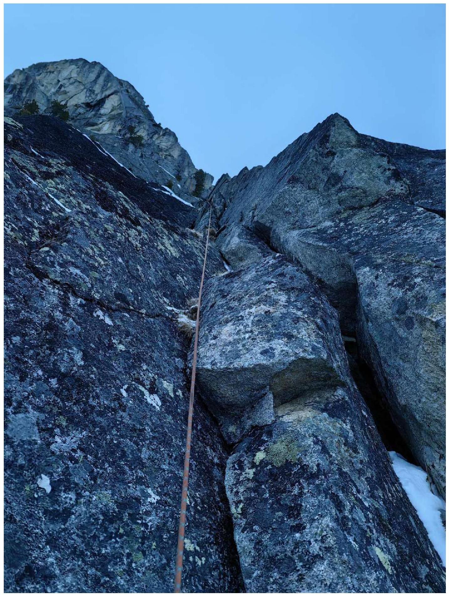
Photo 2. Section R1–R2. Second rope, upper part of the first crux.
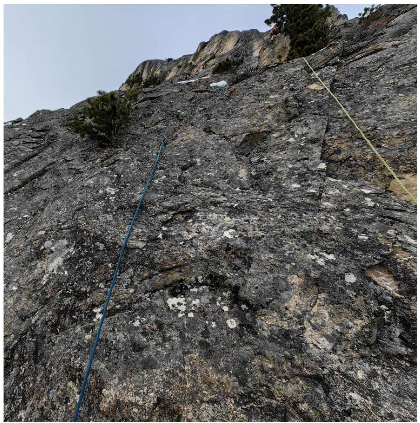
Photo 3. Leader at point R7. Angles with crevices overgrown with grass.
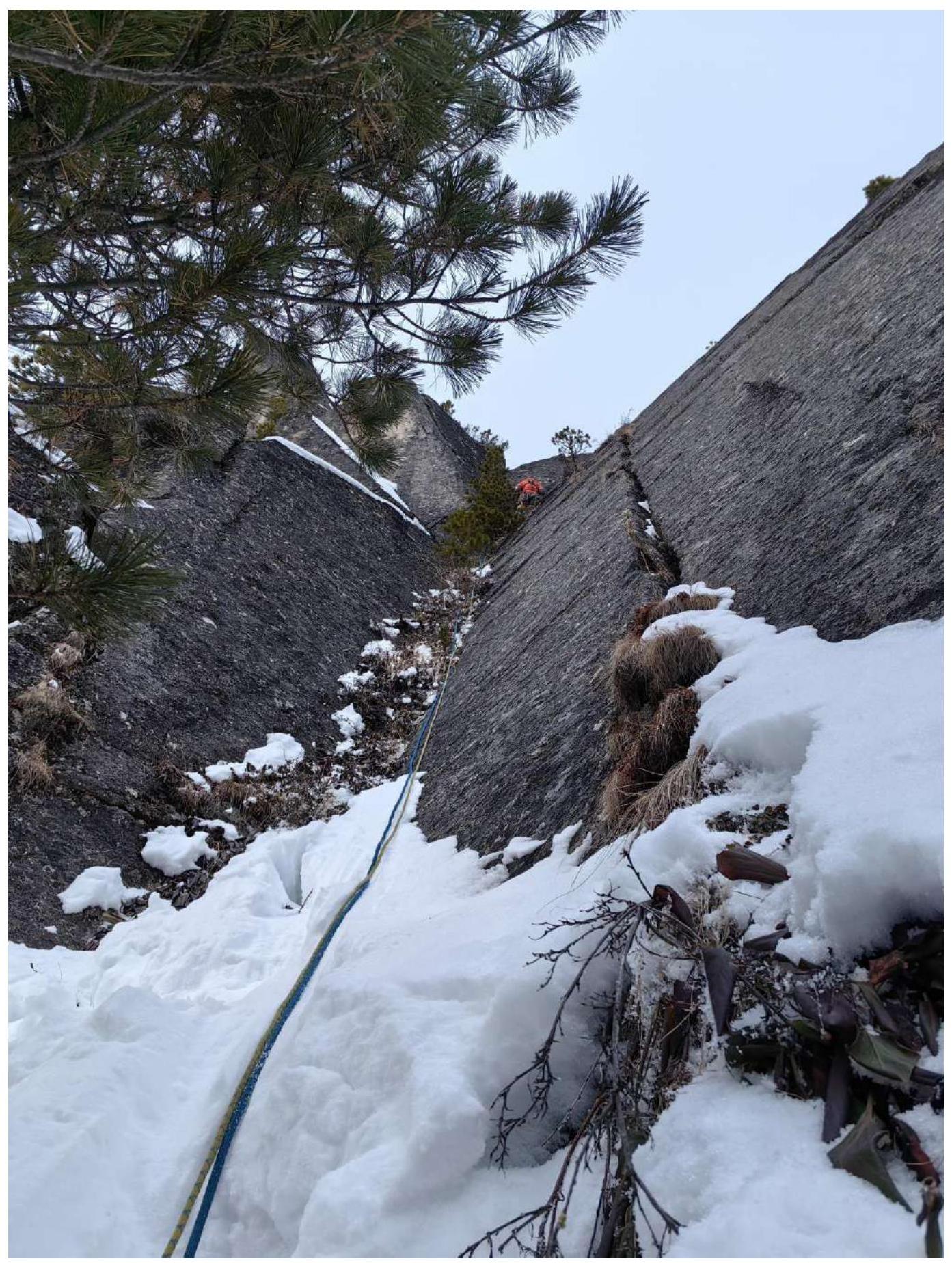
Photo 4. Section R11–R12. Wall with crevices, start of the second crux, belay complicated by icing of crevice walls and frozen earth in crevices.
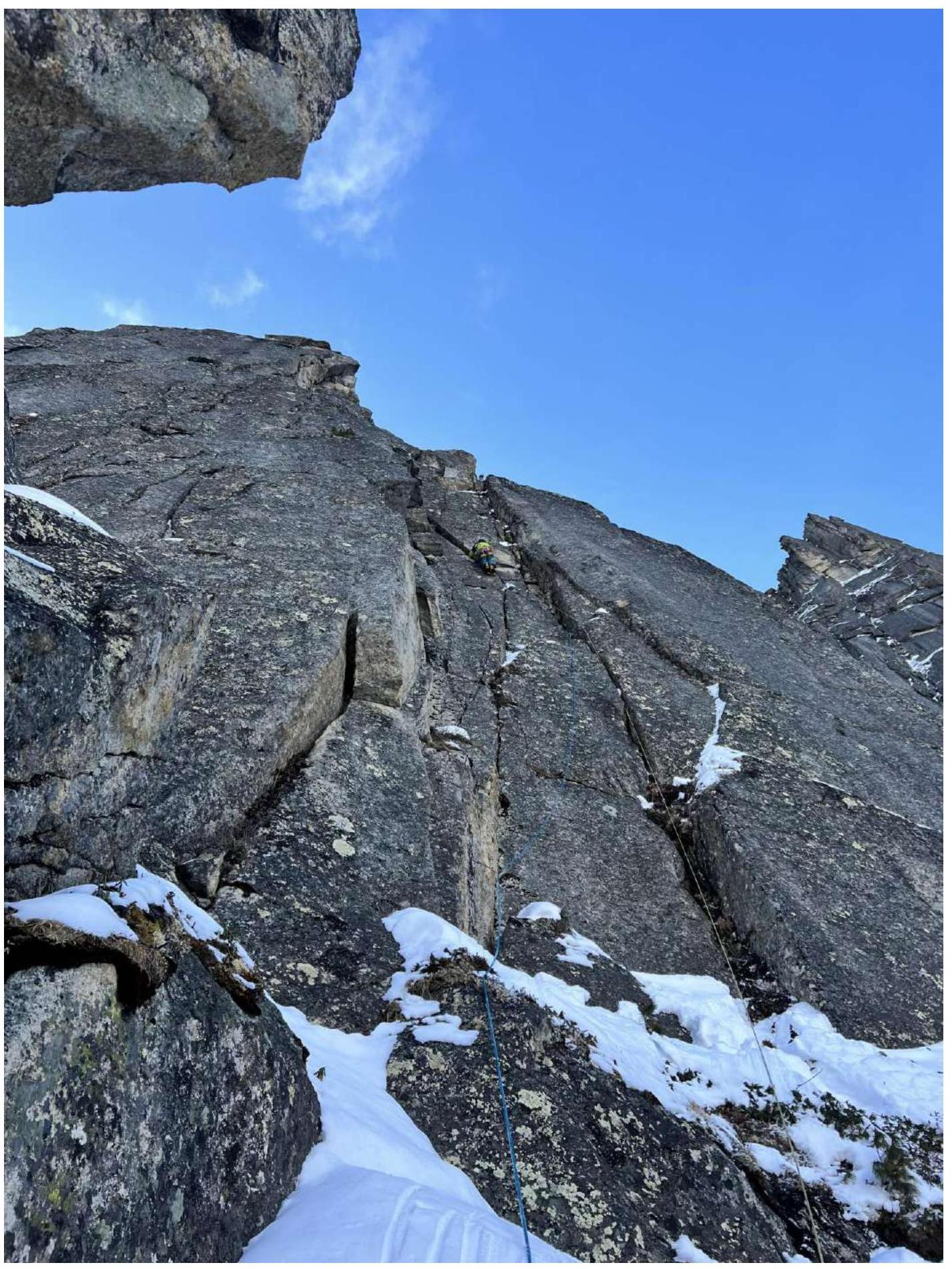
Photo 5. Start of section R12–R13. Exit under an overhanging cornice and movement under it to the right.
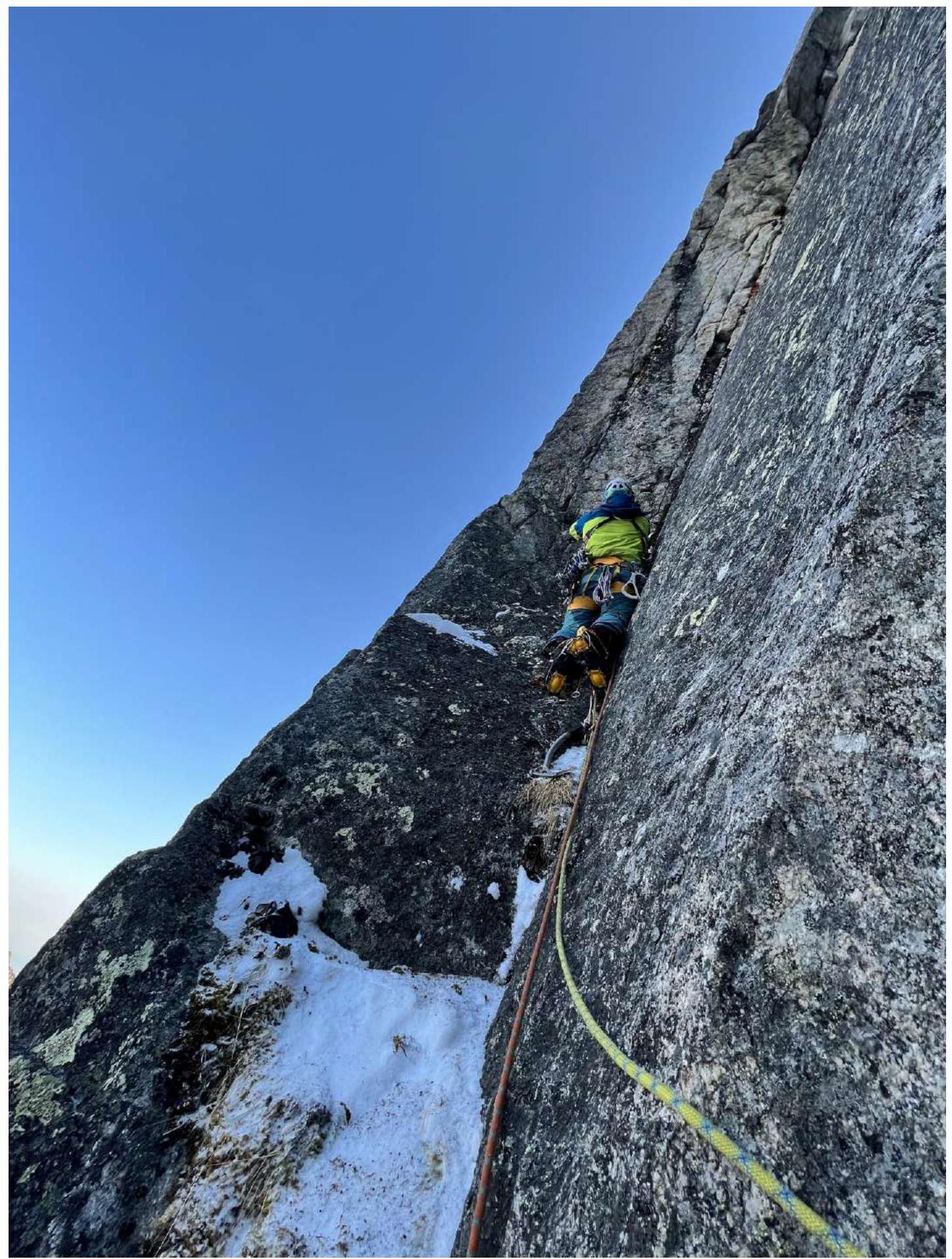
Photo 6. End of section R12–R13. Approach to the upcoming pendulum to the right.
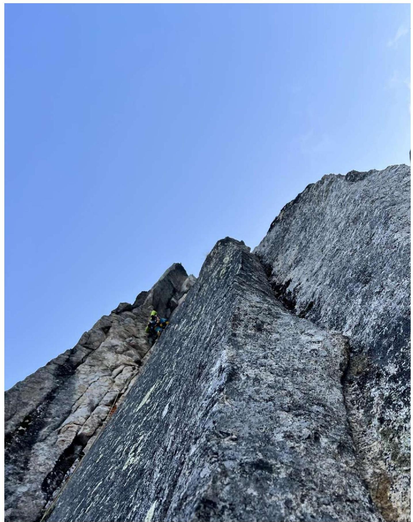
Photo 7. Section R12–R13. Photo downwards from the section.
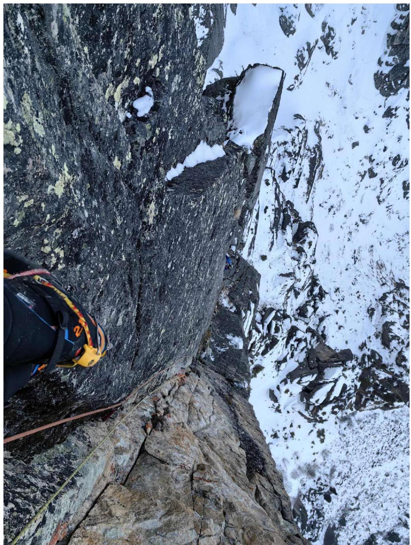
Photo 8. Section R18–R19. Climbing inside a deep chimney (cave) with a series of "plugs".
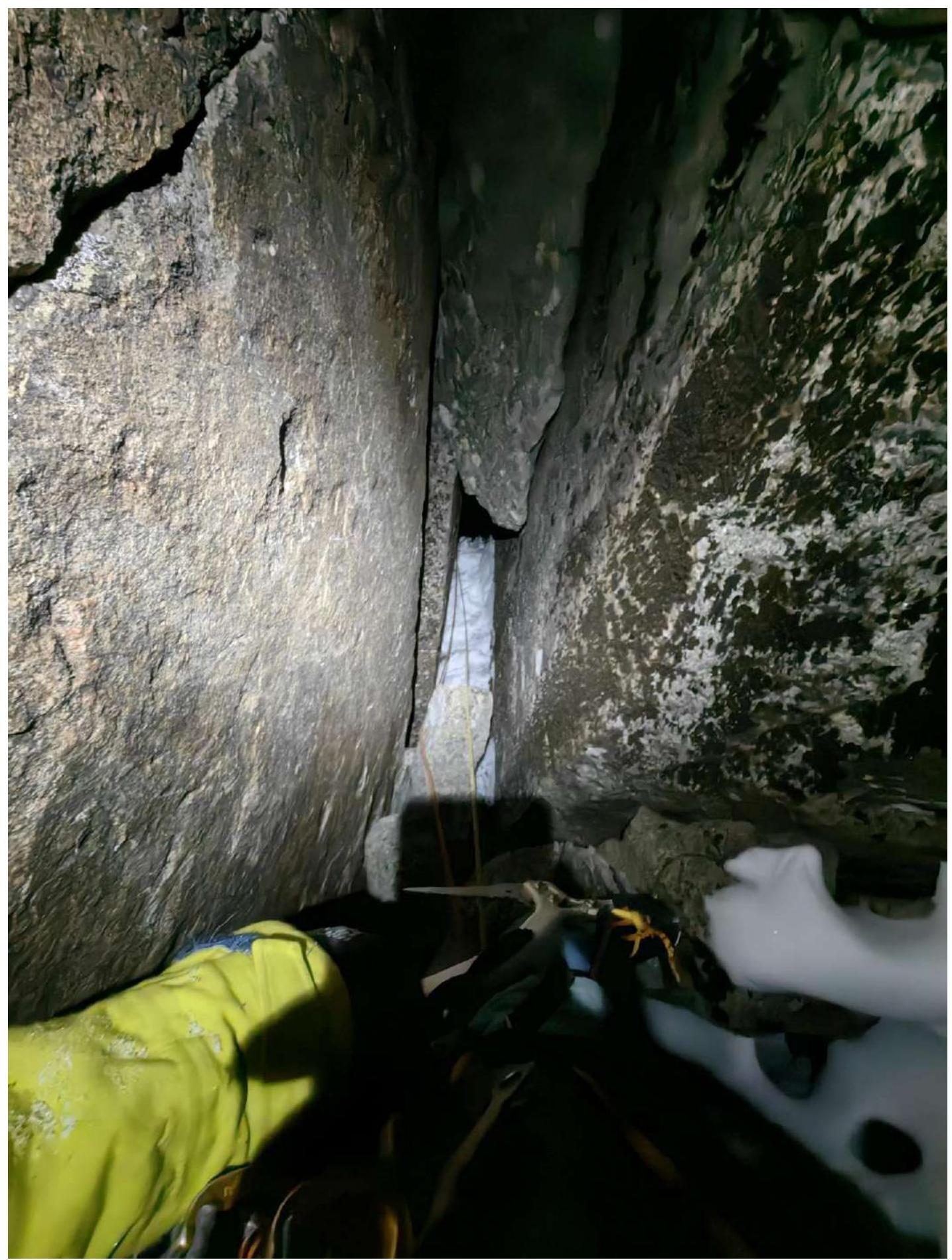
Photo 9. Section R22–R23.
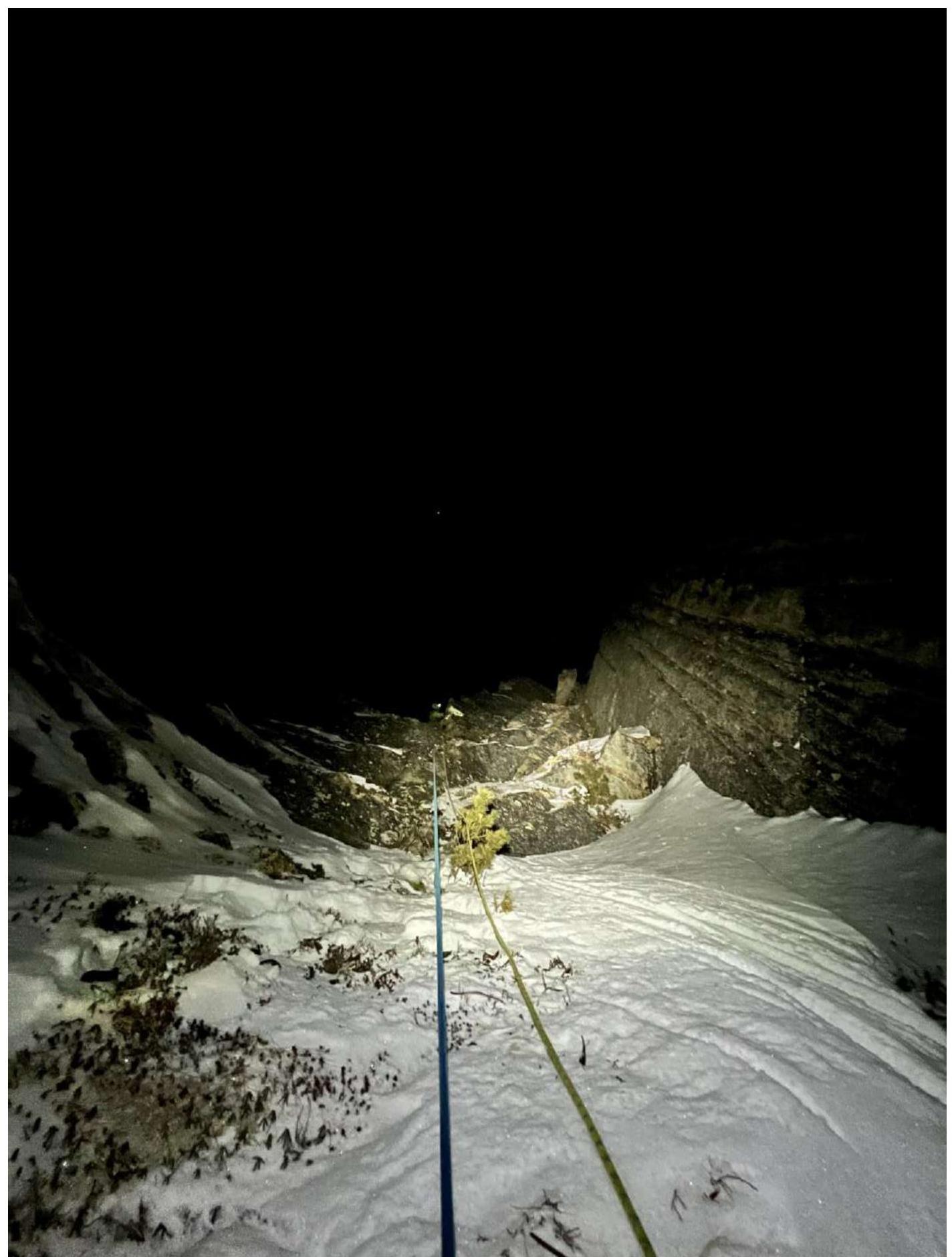
Photo 10. Section R23–R24.
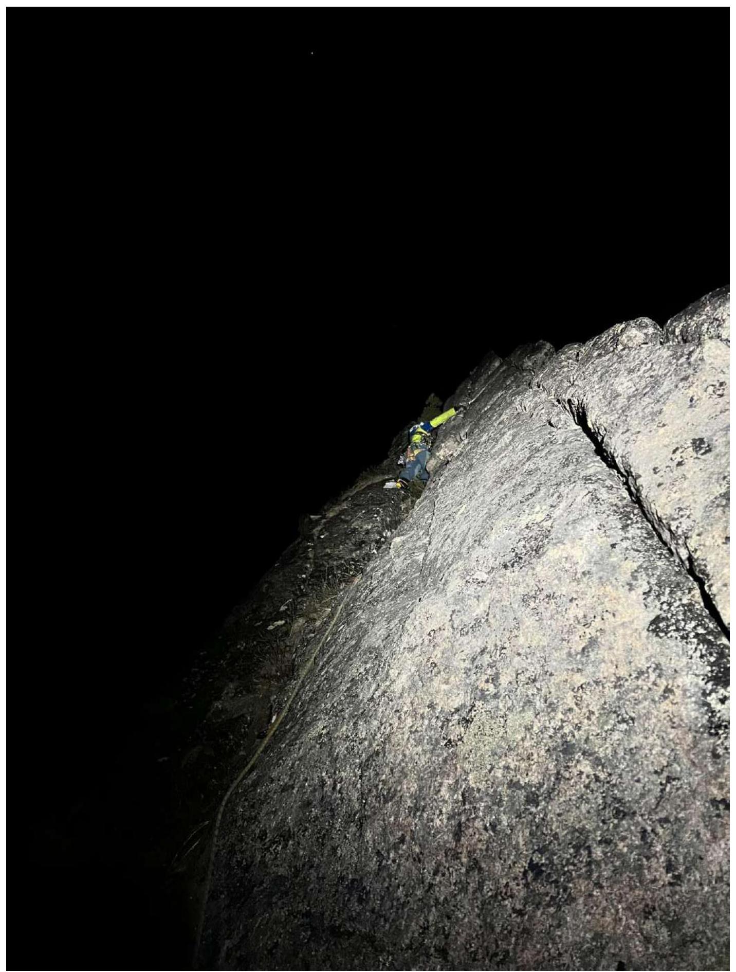
Photo at the summit: Kazantseva E.V., Ivanovsky A.V., Klepikov A.A.

Comments
Sign in to leave a comment