
First Ascent Report
About the First Ascent
Yanichara Peak (2520 m) — Southwest Ridge — 3A category route (proposed), first ascent — Eastern Sayan, Tunskinskie Goltsy ridge, Kharimta valley, 6.1.2
Leader: Klepikov A.A. Participants:
- Kuzmenko I.M.
- Kolosov A.D.
- Kazantseva E.V.
- Pechenin K.V.
I. Ascent Passport
| № | 1. General Information | |
|---|---|---|
| 1.1 | Full name, sports rank of the leader | Klepikov Alexander Alexandrovich, Master of Sports, 3rd category |
| 1.2 | Full name, sports rank of participants | Kuzmenko Ivan Mikhailovich (Candidate for Master of Sports) Kolosov Alexander Dmitrievich (2nd sports rank) Kazantseva Evgenia Vasilievna (2nd sports rank) Pechenin Kirill Vadimovich (3rd sports rank) |
| 1.3 | Full name of the coach | Afanasiev Andrey Evgenievich, Master of Sports, 1st category |
| 1.4 | Organization | Baikal Alpine School |
| 2. Characteristics of the Ascent Object | ||
| 2.1 | Region | Eastern Sayan, Tunskinskie Goltsy ridge |
| 2.2 | Valley | Kharimta valley |
| 2.3 | Section number according to the 2020 classification table | 6.1.2 |
| 2.4 | Name and height of the peak | Yanichar (2520 m) |
| 2.5 | Geographic coordinates of the peak (latitude/longitude), GPS coordinates (1) | 51°57′02.81″N 102°34′16.11″E |
| 3. Characteristics of the Route | ||
| 3.1 | Route name | SW ridge |
| 3.2 | Proposed category of difficulty | 3A |
| 3.3 | Degree of route development | First ascent |
| 3.4 | Relief characteristics of the route | Rocky |
| 3.5 | Height difference of the route and main part | 432 m |
| 3.6 | Length of the route and main part | 1210 m |
| 3.7 | Technical elements of the route (total length of sections of various difficulty categories with indication of relief character (ice-snow, rocky)) | I category rocky — 460 m. II category rocky — 470 m. III category rocky — 150 m. IV category rocky — 60 m. Rapel 10 m on R4, rapel 60 m on R8. Descent by rapel (on descent) — (1 rope 30 m) |
| 3.8 | Descent from the peak | Down the Western couloir into the Kharimta valley |
| 3.9 | Additional route characteristics | In summer, there is usually no water on the route |
| 4. Characteristics of the Team's Actions | ||
| 4.1 | Time of movement (team's working hours, indicated in hours and days) | 6 hours 05 minutes to the peak, 1 day |
| 4.2 | Overnights | No |
| 4.3 | Exit to the route | 09:00 August 11, 2022 |
| 4.4 | Reach the peak | 15:05 August 11, 2022 |
| 4.5 | Return to base camp | 19:00 August 11, 2022 |
| 5. Person Responsible for the Report | ||
| 5.1 | Full name, e-mail | Klepikov A.A., Baikalteam@gmail.com |
Photo of the general view of Yanichar mountain 2520. (Photo taken from the ridge between Strazh and Grenader peaks, approximately 2400 m a.s.l., distance from the object 1500–2000 m)
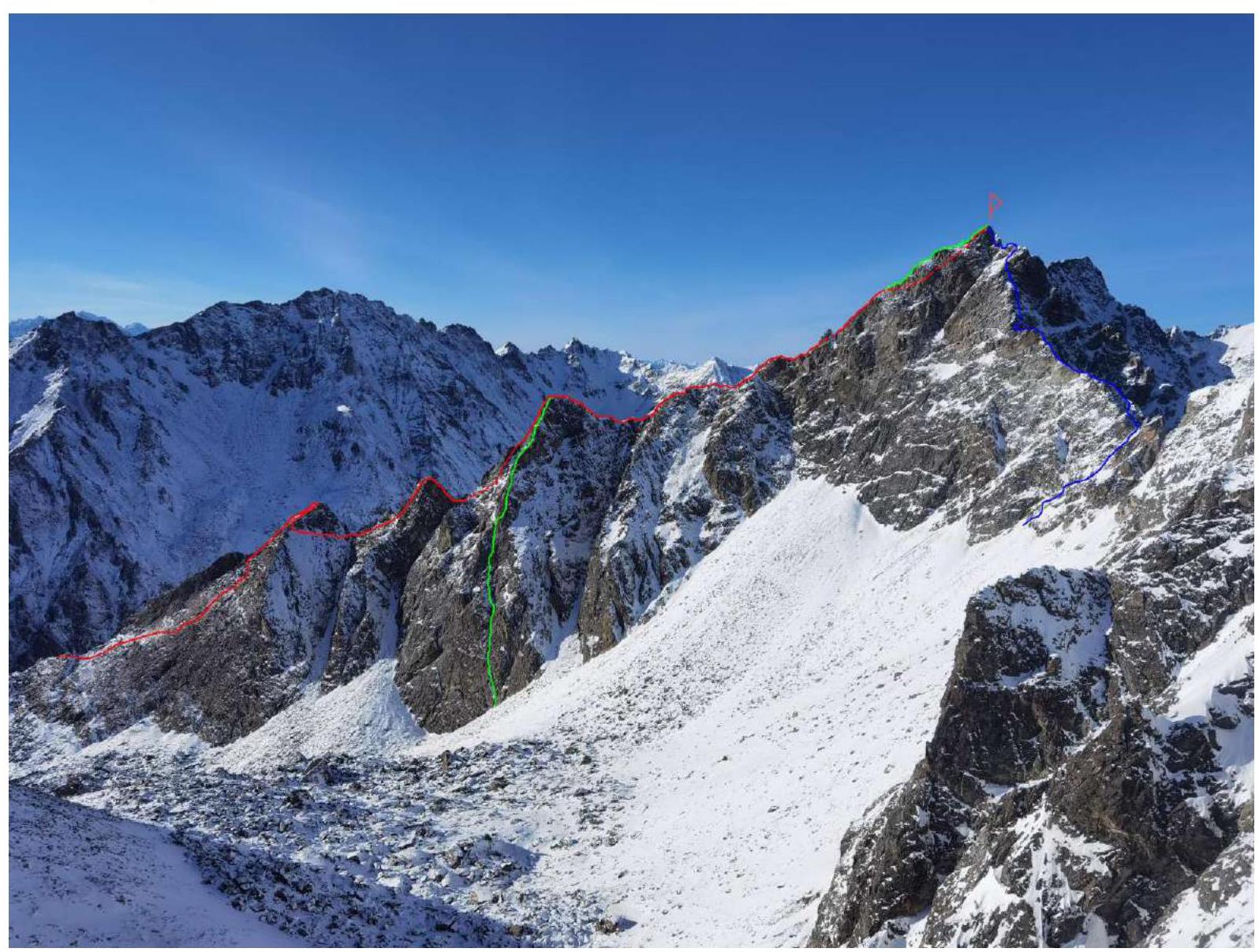
RED — team's 3A route GREEN — S ridge from S of SW ridge 4A category, first ascent (Klepikov A.A., 2022) BLUE — SE ridge 3B category, first ascent (Klepikov A.A., 2022)
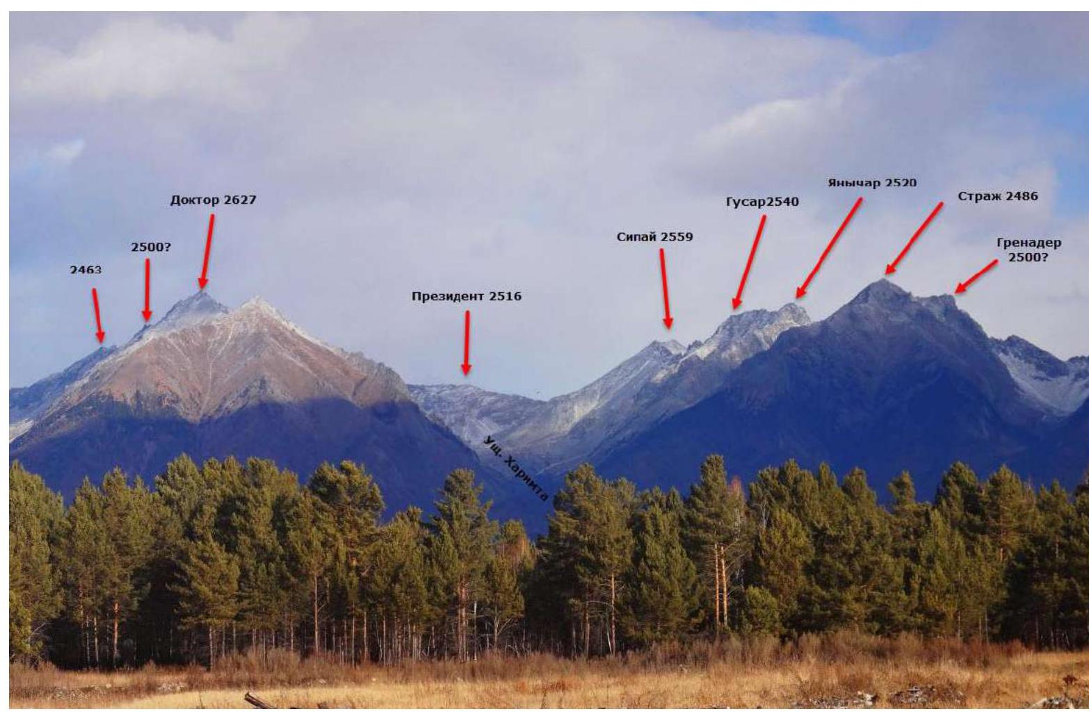
Panorama of the peaks of the Tunskinskie Goltsy ridge in the Kharimta valley area. (Photo taken from the Tunka valley, distance approximately 10 km)
Map-scheme of the Kharimta valley
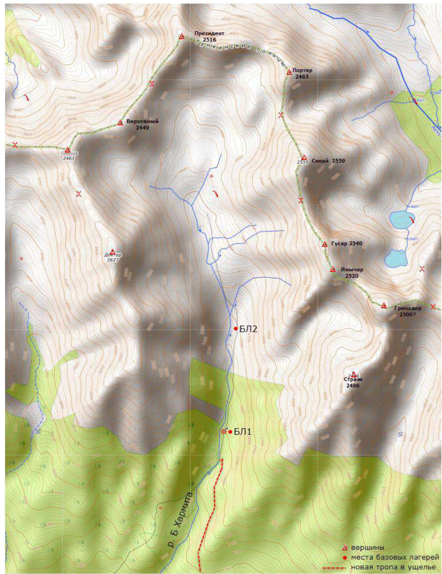
Description of the Kharimta valley
The Kharimta valley is located in the Tunskinskie Goltsy ridge near the Arshan settlement and faces the Tunka valley. The valley is a rather interesting polygon for alpine development due to its rich relief, size, and height differences of about 1000 m, as well as its transport accessibility. The Kharimta valley is morphologically the only true valley in the Tunskinskie Goltsy ridge to the right of the Arshan settlement and mountain, while the other valleys are actually hanging valleys — cirques, breaking off into the Tunka valley. Kharimta has a deeply incised valley with a branched system of cirques in its upper reaches and on the left side in the middle part.
The nearest large settlement is the Arshan village. Access is done by driving to the entrance of the valley. A car can deliver to an elevation of 1200 m a.s.l. The time taken to drive from Arshan village to the trail is no more than 1 hour. The time taken to walk along the trail to the base camp near the forest boundary is about 2–3 hours.
The average time to approach the described route can be estimated as follows:
- Arshan village — trail: 1 hour
- trail — hunter's lodge BC1: 2 hours
- hunter's lodge BC1 — start of the technical part of the route: 1 hour 30 minutes
The valley has potential for ascents and classification of routes up to 4B/5A category. As of the end of 2022, more than 10 routes from 1B to 4A category have been laid out in the valley.
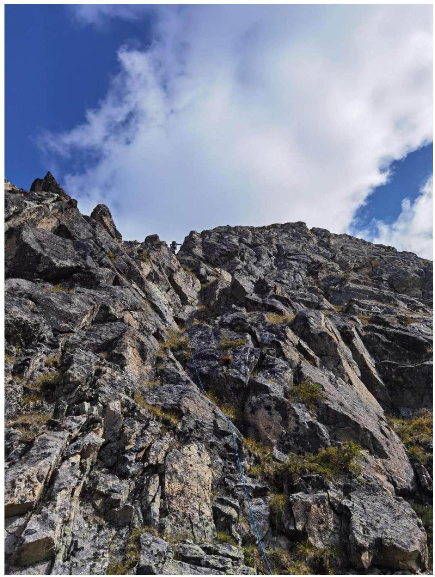
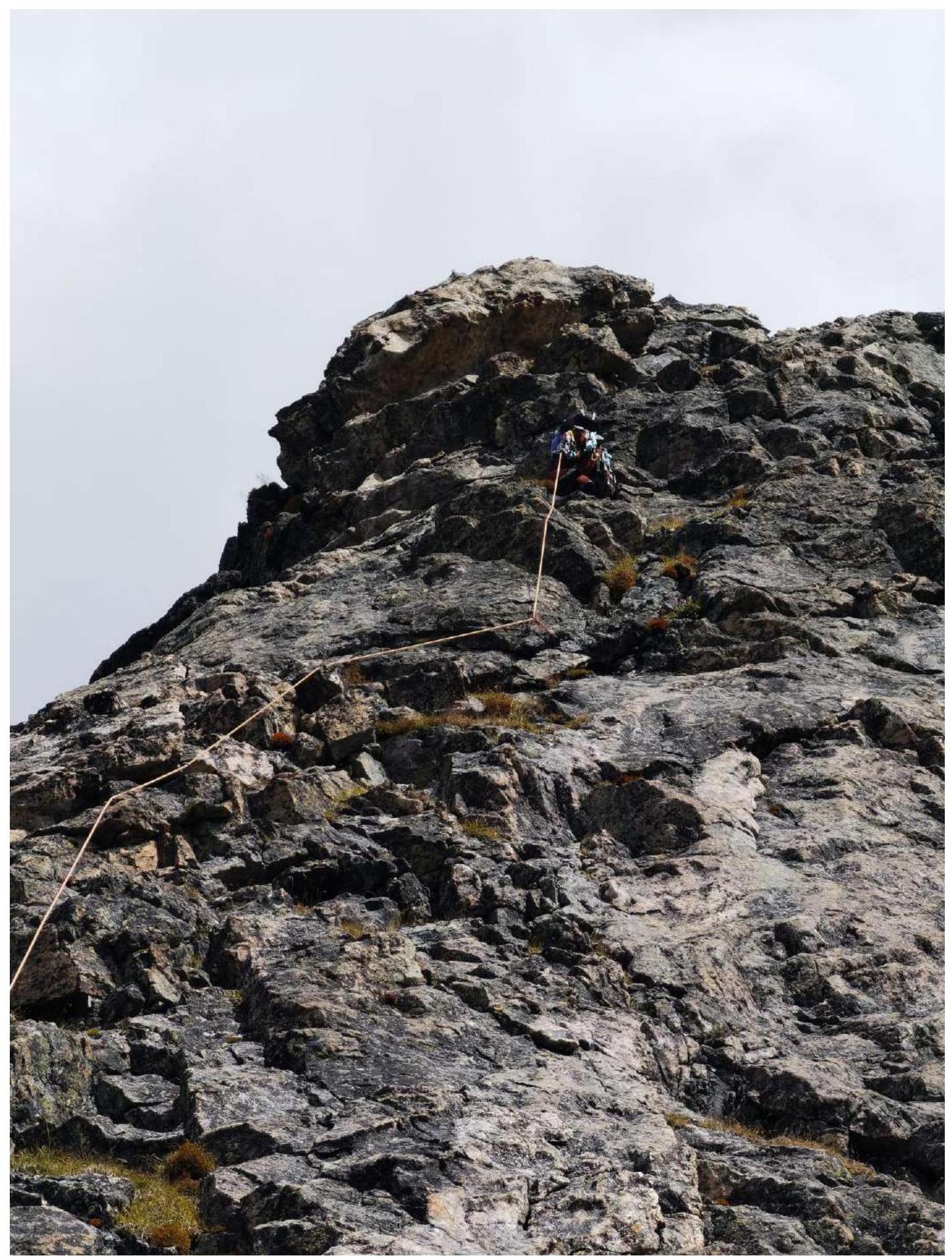
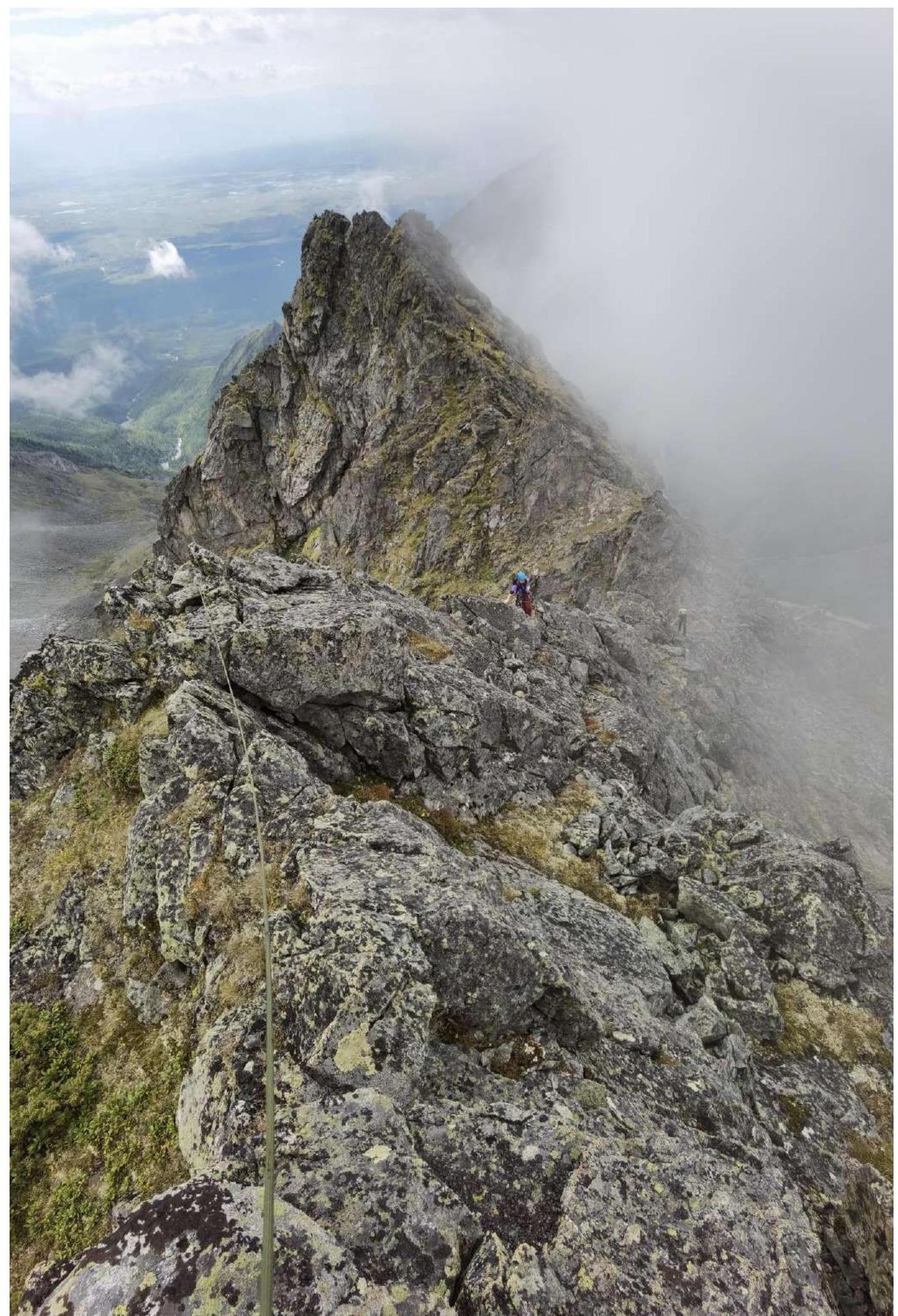
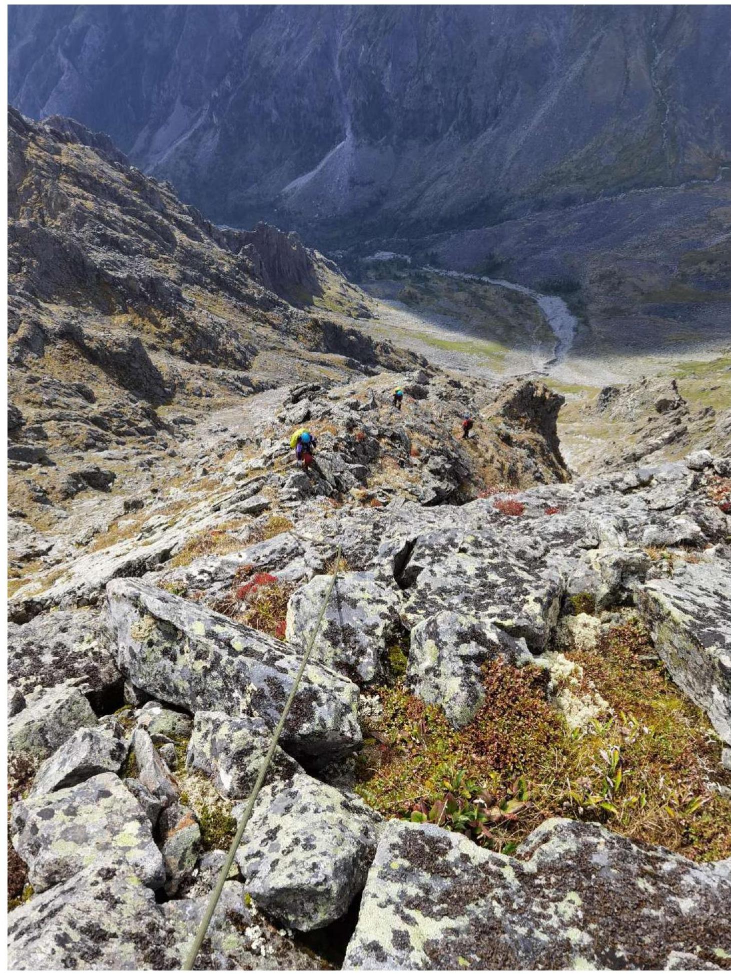
Technical Photo of the Route
Photo taken from the Strazh peak 2486 m, distance 1500 m.
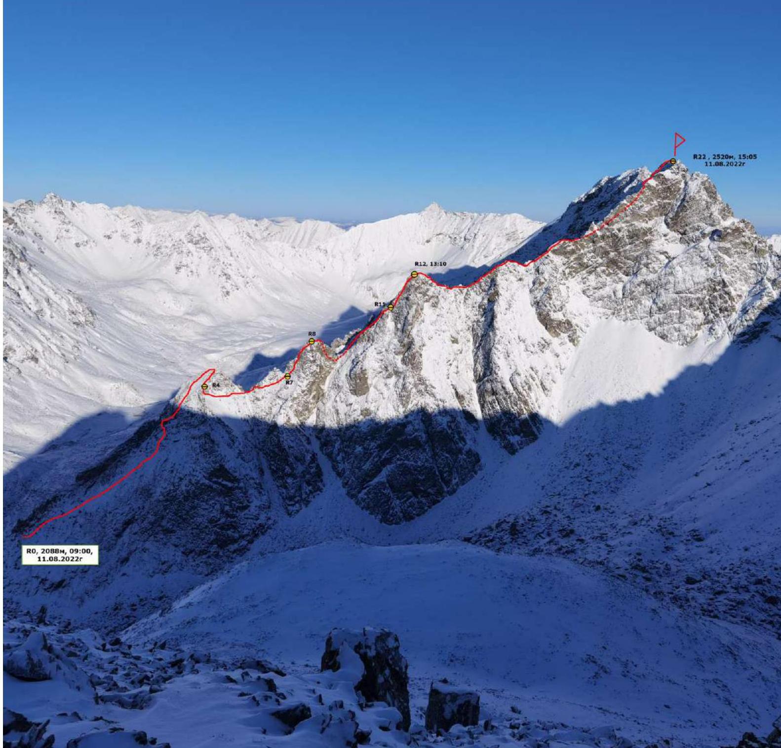 R0, 2088 m, 09:00, August 11, 2022
R12, 13:10
R22, 2520 m, 15:05 August 11, 2022
R0, 2088 m, 09:00, August 11, 2022
R12, 13:10
R22, 2520 m, 15:05 August 11, 2022
Description and Relief Characteristics
The starting point of the route is the ridge branching off from the beginning of the cirque and running from Southwest to Northeast. The beginning of the route is at an altitude of 2088 m.
- R0–R1: 200 m, 55°, traverse, 1+/2 — to the right of the rocky ridge. There is a high probability of slipping down the slope to the right, so careful belaying is necessary. If in doubt, it is recommended to follow the more complex but safer ridge.
- R1–R2: 40 m, 50°, 1+/2 — along the ridge.
- R2–R3: 60 m, 40°, 1 — along a wide internal form, exit to the first pillar.
- R3–R4: 40 m, 45°, 1+ — descent towards the cirque to the lowest height for a rapel.
- R4–R5: 10 m, 75° — rapel.
- R5–R6: 50 m, 55°, 1+ — traverse to the saddle, bypassing the first pillar.
- R6–R7: 50 m, 50°, 1+ — traverse along the ridge with a slight gain in height, approaching under the tower of the second pillar.
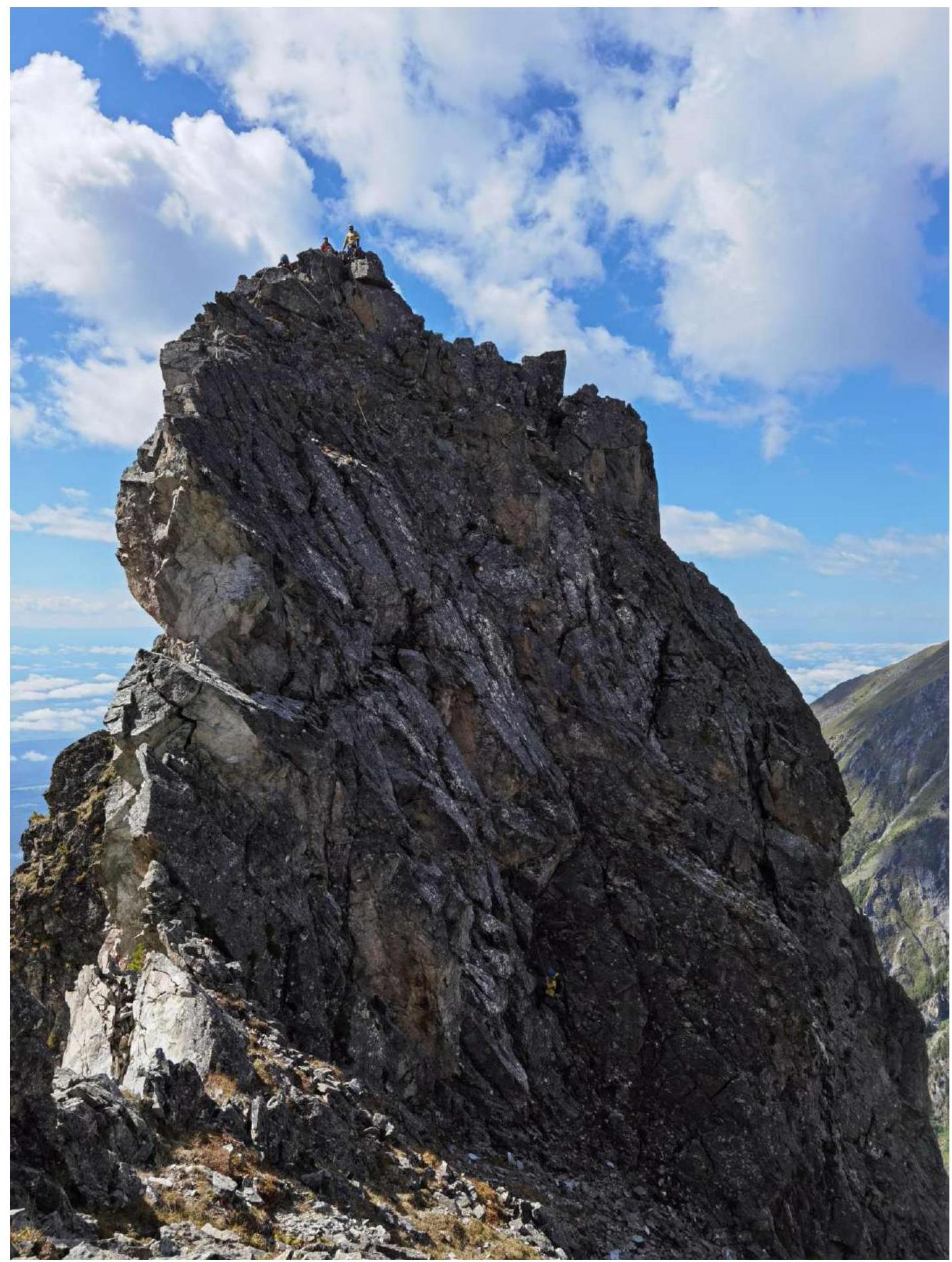
- R7–R8: 60 m, 65°, 3+/4 — wall of the second pillar. 5 friends, 2 anchors.
- R8–R9: 60 m, 75° — rapel to the left.
- R9–R10: 40 m, 40°, 1 — approach along a grassy slope with rock outcrops to a more complex section. To the left of the ridge.
- R10–R11: 60 m, 55°, 3 — along an internal form, unwinding along grassy ledges. 2 anchors, 2 friends.
- R11–R12: 60 m, 70°, 3+/4 — to the top of the third pillar. Anchor, 6 friends.
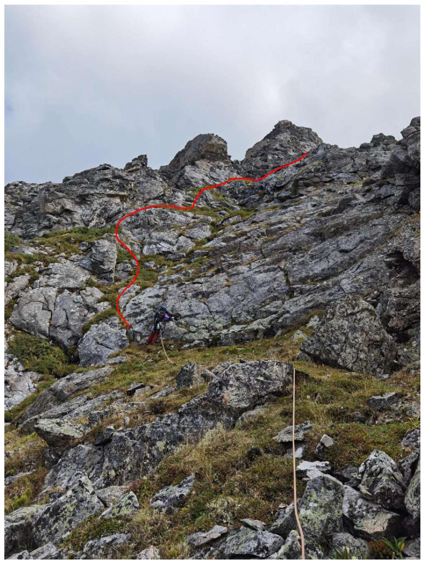
- R12–R13: 20 m, 0°, 2+ — horizontal ridge.
- R13–R14: 60 m, 55° down, 2+ — descent from the ridge to the saddle, unwinding the ridge.
- R14–R15: 30 m, 0°, 1+/2 — 15 m to the right, then 15 m to the left of the ridge.
- R15–R16: 90 m, 45°, 2+ — ridge leading to a small pillar.
- R16–R17: 20 m, 40°, 2 — down from the pillar.
- R17–R18: 40 m, 45°, 2 — traverse, bypassing the next pillar.
- R18–R19: 60 m, 45°, 2+ — also to the left, bypassing another pillar along ledges.
- R19–R20: 100 m, 40°, 1 — along the same configuration of ledges, exit to the Western rib.
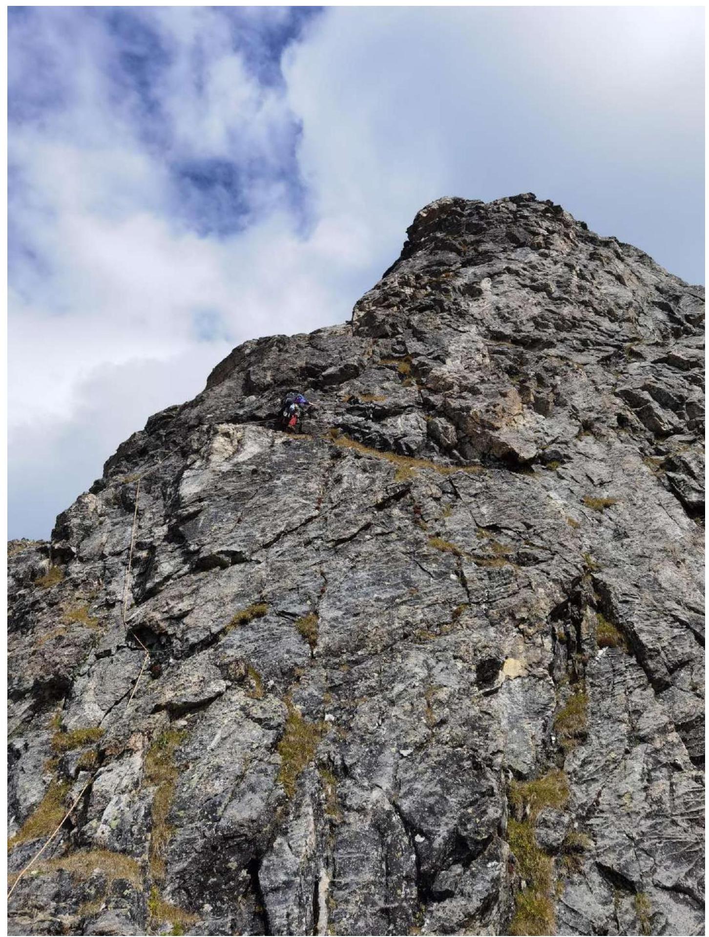
- R20–R21: 30 m, 60°, 2+ — up along the Western rib.
- R21–R22: 30 m, 0°, 3 — ridge to the right to the peak.
Route Characteristics and Team Actions
The route taken by the team is the first route to the Yanichar peak. The most logical and scenic line was chosen for the ascent.
The SW ridge has steep walls on both sides of the ridge, and the simplest path goes along the knife-edge ridge, only in the upper, more gentle part is a path visible to the left of the ridge. The route is quite safe in terms of rockfall; the line follows the external forms of the relief, the relief is quite strong and relatively monolithic. Special attention should be paid to rockfall danger on the descent in snow-free conditions; for this, the team unwound ledges on the descent so that the rope teams were not one above the other on hazardous sections. In winter, rockfall danger is minimal throughout the area. The avalanche danger of the route is an objective factor only at the very beginning of the route on the traverse of the first section of the ridge. If there is unstable snow cover, it is recommended to climb directly along the ridge, which will slightly complicate the route overall but make it safer. Also, in winter, attention should be paid to the descent couloir, having previously "cleared" it.
The route has two key sections in the first third and middle of the route.
The route has significant length, requiring participants to work in a coordinated and clear manner to complete the route within daylight hours.
It is not recommended as a first 3A route due to its length and complexity.
The descent from the peak is done to the west towards the Kharimta valley along the Western couloir; the descent is unwound by feet along ledges, belaying is necessary, there is room to fall, and there is something to organize belay on even in winter. In the lower part of the descent, there is a 25 m rapel, after which the descent is relatively safe by foot without belaying.
The author's experience with 3A routes: 32 ascents on 28 routes in the Sayan Mountains, Caucasus, and Transbaikalia. In terms of technical complexity, this route occupies a middle position among them, standing out for its length; for a 3B category, it lacks only a characteristic key section of such complexity.
There is cellular connection (Tele2) along almost the entire route.
- First key section, R7–R8 along the wall, sticking to the external form of the relief, up to the second pillar.
- Rapel, R8–R9 section.
- Approach to the second key section, R10–R11 section: internal form, unwound along ledges.
- Beginning of R11–R12 section. Second key, wall of the third pillar.
- End of R11–R12 section. Second key, wall of the third pillar.
- Ridge on R15–R16 section.
- R19–R20 section. Transition from SW ridge to 3rd rib.

- R20–R21 section. Along the 3rd rib to the peak's North ridge.
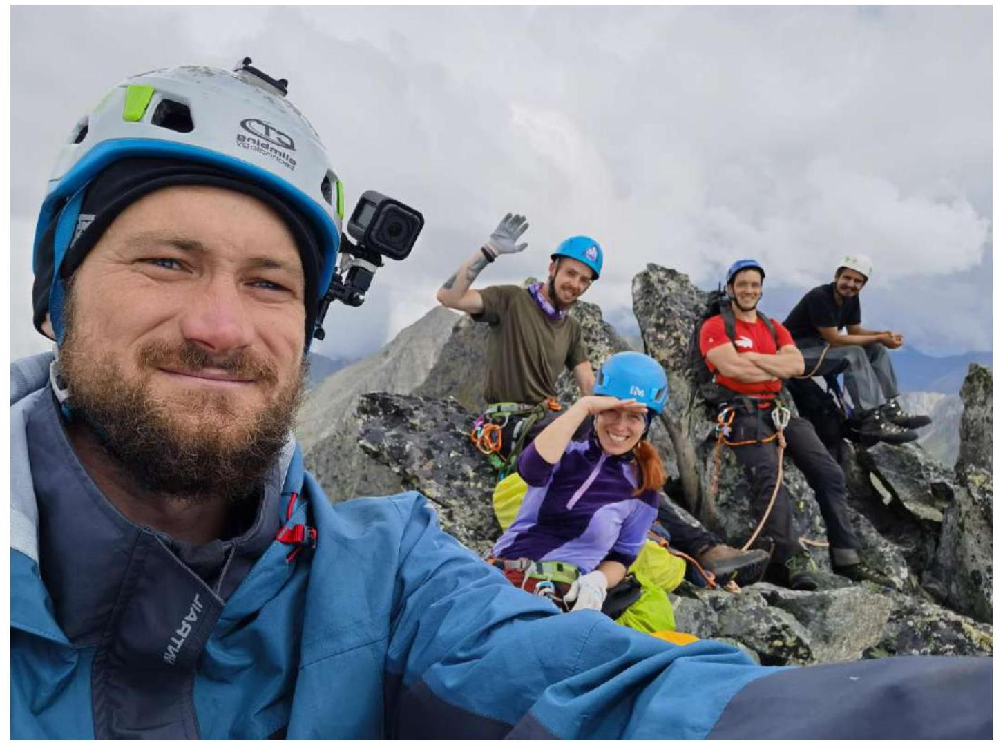
- Photo at the peak, from left to right: Klepikov A.A., Kazantseva E.V., Pechenin K.V., Kolosov A.D., Kuzmenko I.M.
Comments
Sign in to leave a comment