Report
On the first ascent to the summit of Plastun via the South couloir of the East ridge, approximately category 2B, by the team of the Baikal Alpine School on October 30, 2020.
Irkutsk 2020
I. Ascent Report
| No. | 1. General Information | |
|---|---|---|
| 1.1 | Full name, sports rank of the leader | Afanasiev A.E. — Master of Sports |
| 1.2 | Full name, sports rank of participants | Lisov M.A. — 2nd sports rank, Novikov I.V. — 3rd sports rank, Mordovin A.A. — 2nd sports rank |
| 1.3 | Full name of the coach | Afanasiev A.E. — Master of Sports |
| 1.4 | Organization | Baikal Alpine School |
| 2. Characteristics of the Ascent Object | ||
| 2.1 | Region | Eastern Sayan, Tunkin Goltsy ridge, Vetreny area |
| 2.2 | Valley | Serebryanoe |
| 2.3 | Section number according to the 2013 classification table | 6.1.2 |
| 2.4 | Name and height of the summit | v. Plastun, 2374 m |
| 2.5 | Geographical coordinates of the summit (latitude/longitude), GPS coordinates | |
| 3. Characteristics of the Route | ||
| 3.1 | Name of the route | S couloir of E ridge |
| 3.2 | Proposed category of difficulty | 2B |
| 3.3 | Degree of route exploration | First ascent |
| 3.4 | Character of the route relief | Combined |
| 3.5 | Height difference of the route (altimeter or GPS data) | 300 |
| 3.6 | Length of the route (in meters) | 640 |
| 3.7 | Technical elements of the route (total length of sections with different difficulty categories, indicating relief character (ice-snow, rocky)) | 1st cat. snow – 200 m 2nd cat. ice/rock – 365 m 3rd cat. rock – 65 m rappel descent (on descent) – 130 meters sports descent (on descent) – 300 meters |
| 3.8 | Descent from the summit | via the ascent route to Serebryanoe valley |
| 3.9 | Additional characteristics of the route | Snow. No water in summer. |
| 4. Characteristics of Team Actions | ||
| 4.1 | Time of movement (team's walking hours, in hours and days) | 1 day: 5 hours |
| 4.2 | Overnights | none |
| 4.3 | Departure on the route | 10:30, October 30, 2020 |
| 4.4 | Reaching the summit | 15:30, October 30, 2020 |
| 4.5 | Return to the base camp | 18:30, October 30, 2020 |
| 5. Responsible for the Report | ||
| 5.1 | Full name, e-mail | Afanasiev A.E. anevg09@mail.ru |
II. Description of the Ascent
1. Characteristics of the Ascent Object
1.1. General photo of the summit with a size of at least 13 × 18 cm, indicating the date (day/month/year) and location of the photo. The route taken by the team and the nearest classified routes on the right and left should be marked on the photo with a legend.
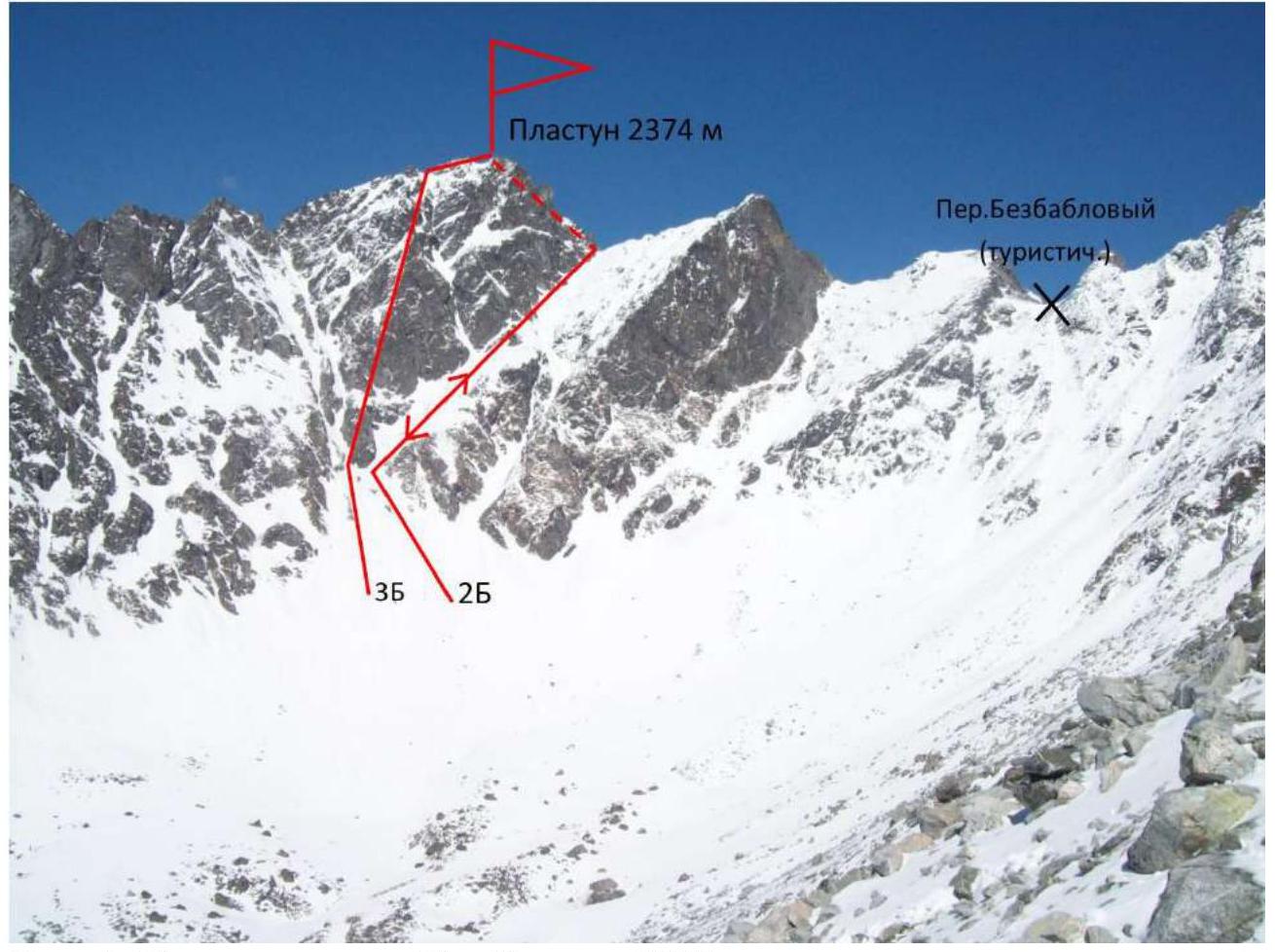
Photo 1. Taken from Serebryanoe valley in 2018.
1.3. Photopanorama of the area.
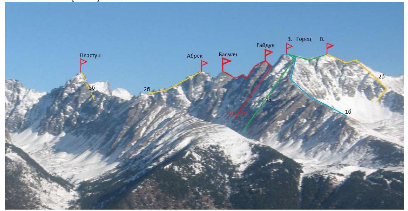
Photo 2.
1.4. Map of the area.
The approach from Irkutsk to the area is 200 km on a good road to the village of Hurai-Hobok. Then, along a logging road, approximately 10 km to an altitude of 1200 on an all-terrain vehicle. From the end of the road, 2 hours uphill on a well-trodden path to the base camp, slightly below Serebryanoe Lake, in the forest near Vesennee Lake.
Further:
- From the base camp on Serebryanoe Lake to the foot of the mountain — 1 hour walk on snowshoes through Serebryanoe valley.
- The start of the route is at the foot of the mountain, at the base of the snow slope under the wall of southeast exposure at an altitude of 2020 m above sea level.
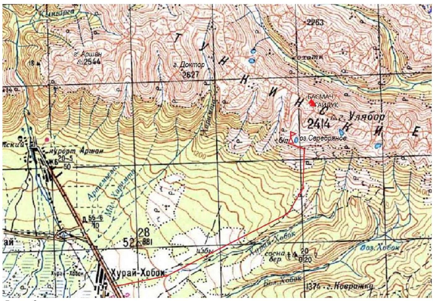
Photo 3.
1.4a. Route map.
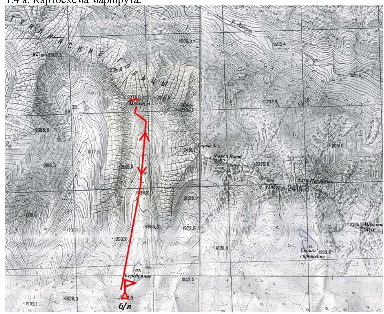
Photo 4.
2. Characteristics of the Route
2.1. Technical photograph of the route.
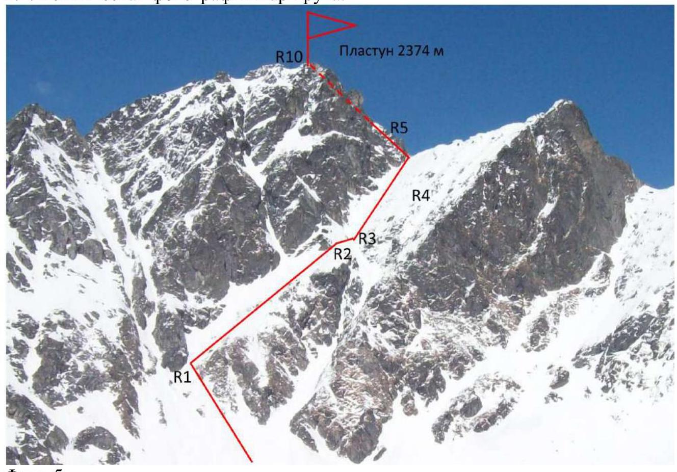
Photo 5.
2.3. Technical characteristics of the route sections.
| Section | Character of relief | Category of difficulty | Length, m, slope angle ° | Type and number of hooks |
|---|---|---|---|---|
| R0–R1 | Snow couloir. | 1 | 200, 35 | |
| R1–R2 | Oblique inclined ledge. | 2 | 150, 40 | |
| R2–R3 | Traverse transition to the right. | 2 | 40, 55 | |
| R3–R4 | Oblique inclined ledge to the ridge. | 2 | 120, 45 | |
| R4–R5 | Wall. | 3 | 15, 70 | 3 rock |
| R5–R6 | Ridge. | 2 | 15, 50 | 2 rock |
| R6–R7 | Right of the ridge. | 2 | 40, 50 | 3 cam, 2 rock |
| R7–R8 | Bridging. | 2 | 10, 0 | 1 rock |
| R8–R9 | Wall left of the edge. | 3 | 30, 70 | 3 cam, 2 rock |
| R9–R10 | Sharp ridge to the summit. | 3 | 20, 15 | 2 cam |
3. Characteristics of Team Actions
3.1. Brief description of the route passage.
The approach to the route from the base camp takes 1 hour. The route begins at the lower part of the couloir on the eastern side of the mountain, on the icy crust of a descended avalanche, in the direction of the SE wall, where the 3B category difficulty route passes.
| Section | Description | Photo number |
|---|---|---|
| R0–R1 | Snow couloir. Approach to the wall. 200 m, 35°, 1st cat. Approach to the lower rocky outcrop of the SE wall of Plastun mountain along the avalanche snow slope to an altitude of 2150 m. | 6 |
| R1–R2 | Oblique inclined ledge from left to right. The lower rocky outcrop is bypassed on the right. | |
| R2–R3 | Traverse transition to the right. | 7 |
| R3–R4 | Oblique inclined ledge to the ridge. | 8 |
| R4–R5 | Wall on the ridge. | 9 |
| R5–R6 | Ridge is passed on the right side. | 10 |
| R6–R7 | Right of the ridge on slabs. | 11 |
| R7–R8 | Sharp rocky bridging. | 12 |
| R8–R9 | Wall left of the edge. | 13, 14 |
| R9–R10 | Sharp ridge to the summit. |
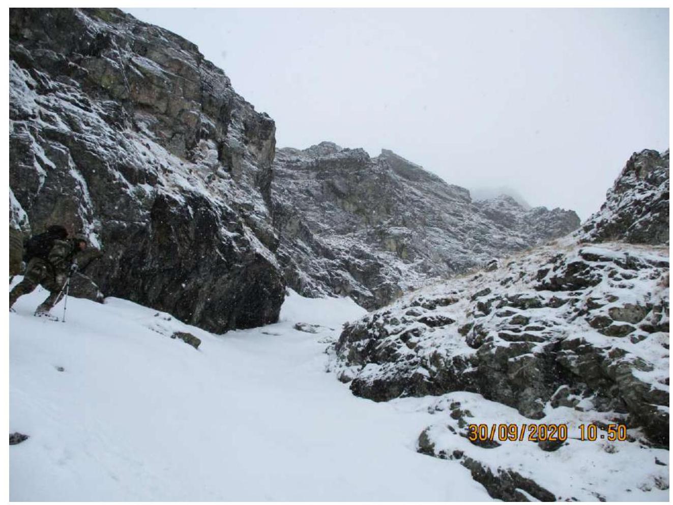
Photo 6. Section R1–R2.
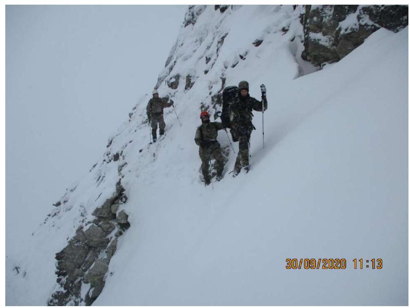
Photo 7. Section R2–R3.

Photo 8. Section R4–R5.
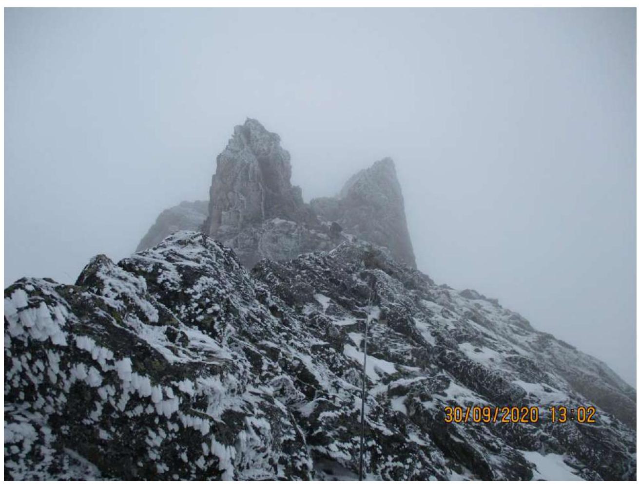
Photo 9. Section R5–R6.

Photo 10. Section R6–R7.
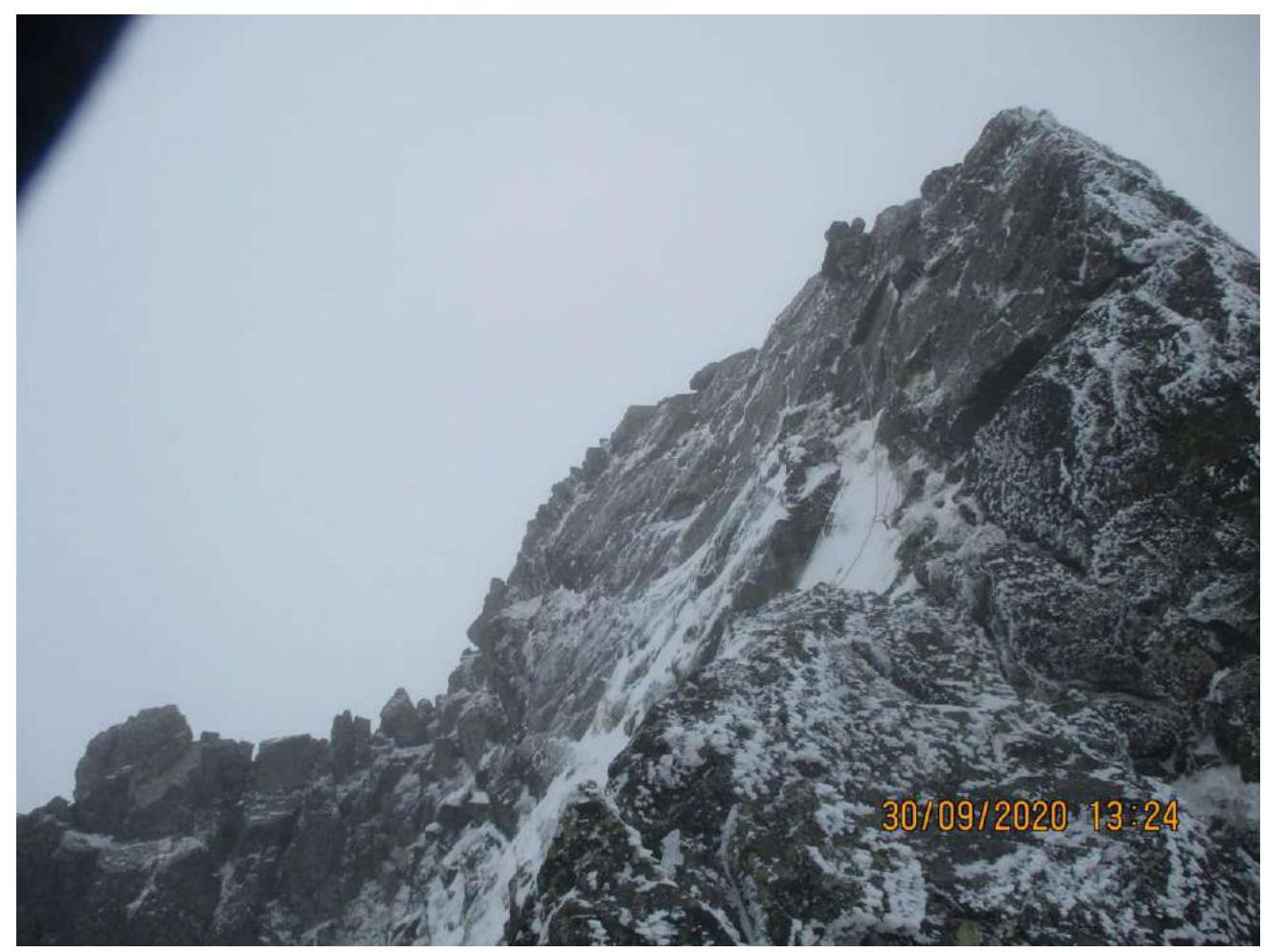
Photo 11. Section R8–R9.
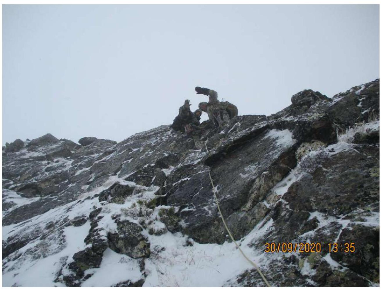
Photo 12. Section R9.

Photo 13. Section R9–R10.
3.2. Photo of the team at the summit cairn.
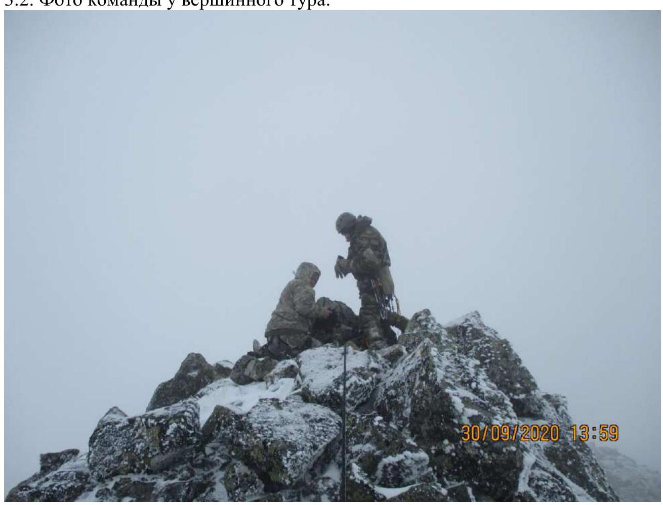
Photo 14.
3.3. The route is safe. There is cellular coverage throughout.
Possible route variations:
- From Bezbablovy pass (tourist) approx. 3rd cat. diff.
- Via the middle oblique couloir approx. 3rd cat. diff.
Descent is via the ascent route: 3 rappel descents on rocks to the bridging and 6 sports descents on the snow couloir.
Depending on the snow conditions, there is a possibility of avalanche danger.
In the summer, the complexity of the relief in the couloir increases — this is a characteristic feature of Sayan routes passing through internal forms.