
Report
ON THE FIRST ASCENT TO THE SUMMIT ULA-GOL VIA THE ROUTE ASCENT ALONG THE WESTERN SLOPE OF THE SOUTHERN RIDGE, CATEGORY 2B, BY THE TEAM OF MOUNTAIN WORLD CLUB WITHIN THE FRAMEWORK OF THE PROJECT "IMPOSSIBLE IS NOT FOREVER…" FROM MARCH 28, 2020, TO MARCH 28, 2020.
I. Climbing Report
| № | 1. General Information | |
|---|---|---|
| 1.1 | Full name, sports rank of the team leader | Glazunov Evgeny Vladimirovich, Master of Sports |
| 1.2 | Full name, sports rank of the participants | Starodubov Anton Nikolaevich, badge; Penkin Polina Vadimovna, 2nd sports rank; Tarabrikov Mikhail Sergeevich, badge; Matveeva Arina Andreevna, badge |
| 1.3 | Full name of the coach | Glazunov Evgeny Vladimirovich |
| 1.4 | Organization | Mountain World |
| 2. Characteristics of the Climbing Object | ||
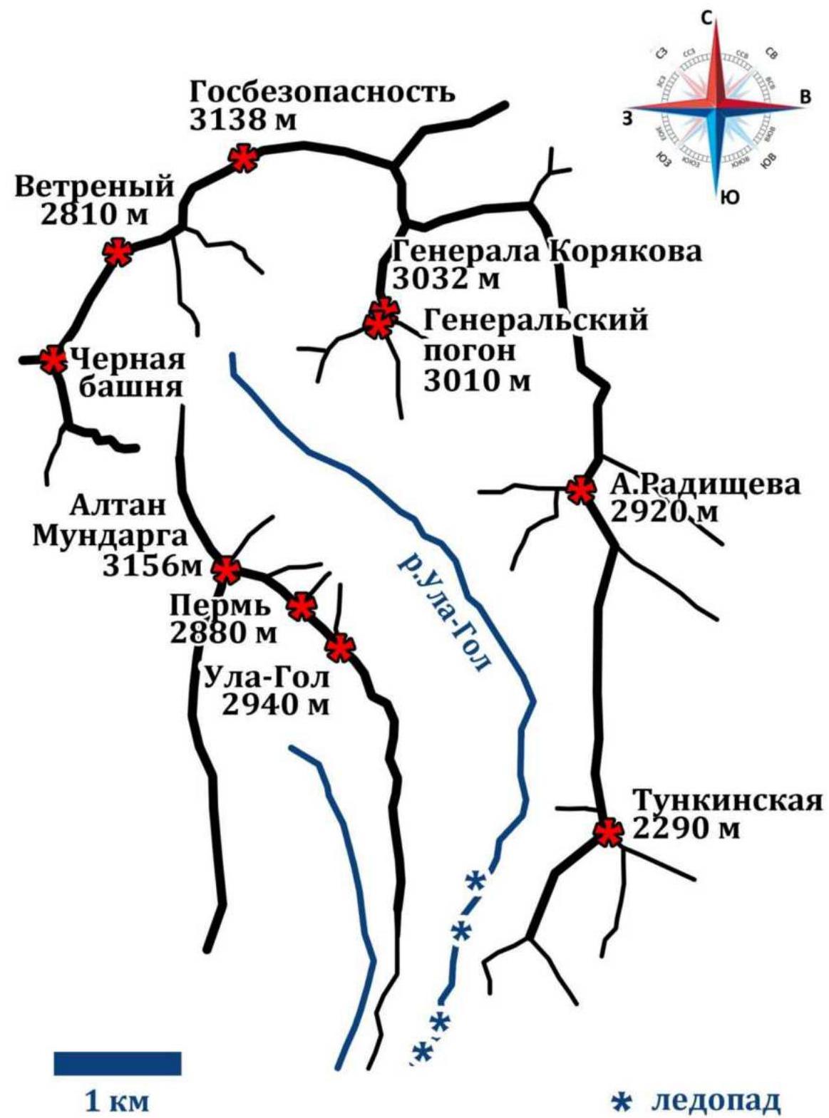
| 2.1 | Region | Eastern Sayan, Tunkin Goltsy |
| 2.2 | Valley | Ula-Gol |
| 2.3 | Number according to the 2013 classification table | 6.1.2 |
| 2.4 | Name and height of the summit | Ula-Gol, 2940 m |
| 2.5 | Geographical coordinates of the summit (latitude/longitude), GPS coordinates | N 51°47.585′ E 101°26.466′ |
| 3. Characteristics of the Route | ||
| 3.1 | Name of the route | Ascent along the western slope of the southern ridge |
| 3.2 | Proposed category of difficulty | 2B |
| 3.3 | Degree of route exploration | First ascent |
| 3.4 | Nature of the route terrain | Rocky |
| 3.5 | Elevation gain of the route (data from altimeter or GPS) | 1493 m (from 1447 m to 2940 m) |
| 3.6 | Length of the route (in meters) | 4340 |
| 3.7 | Technical elements of the route (total length of sections with different categories of difficulty, indicating the nature of the terrain) | Category I rocky terrain — 2510 m; Category II rocky terrain — 1850 m; Category III rocky terrain — 10 m |
| 3.8 | Descent from the summit | Descent into the Ula-Gol valley to the river via the couloir on the eastern slope, starting 160 m north of the summit |
| 3.9 | Additional characteristics of the route | Lack of water |
| 4. Characteristics of the Team's Actions | ||
| 4.1 | Time of movement (team's walking hours, in hours and days) | 7 hours 30 minutes |
| 4.2 | Overnights | No |
| 4.3 | Start of the route | 6:00 AM, March 28, 2020 |
| 4.4 | Reaching the summit | 3:00 PM, March 28, 2020 |
| 4.5 | Return to the base camp | 7:00 PM, March 28, 2020 |
| 5. Responsible for the Report | ||
| 5.1 | Full name, e-mail | Starodubov Anton Nikolaevich, stariyshuler@gmail.com; Matveeva Arina Andreevna, Arina150117@mail.ru |
Valley scheme
II. Climbing Description
1. Characteristics of the Climbing Object
The region is located in the Eastern Sayan Mountains. The nearest settlement is the ulus Khoyto-Gol. Transportation from Irkutsk was done using personal vehicles to the village of Kyren (218 km, 3 hours), and from Kyren to the Ula-Gol River using a GAZ-3309 vehicle (60 km, 2 hours). The team walked to the base camp along the frozen Ula-Gol River (12 km, 6 hours). There are several icefalls on the river, which were bypassed on the right (orographic) bank. The base camp was set up in a forest zone on the right bank between the first and second icefalls. The coordinates of the camp are N 51°45.892′ E 101°26.953′. The approach to the route from the base camp was done by going down the river to the second icefall, then turning right towards the slope until reaching the edge of the vegetation and the ridge. The start of the route is at an altitude of 1447 m. The approach from the base camp took 1 hour and 20 minutes.
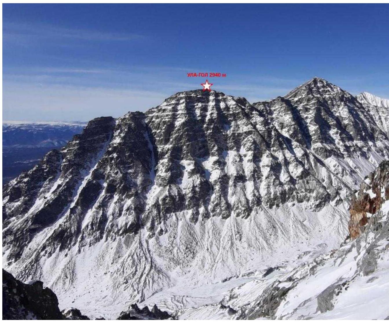
Photo 1.1. General photo of the mountain from the summit of A. Radishchev. Date taken: March 28, 2020.
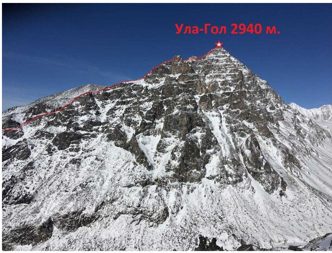
Photo 1.2. Route profile from the side of Tunkinskaya summit. Date taken: March 28, 2020.
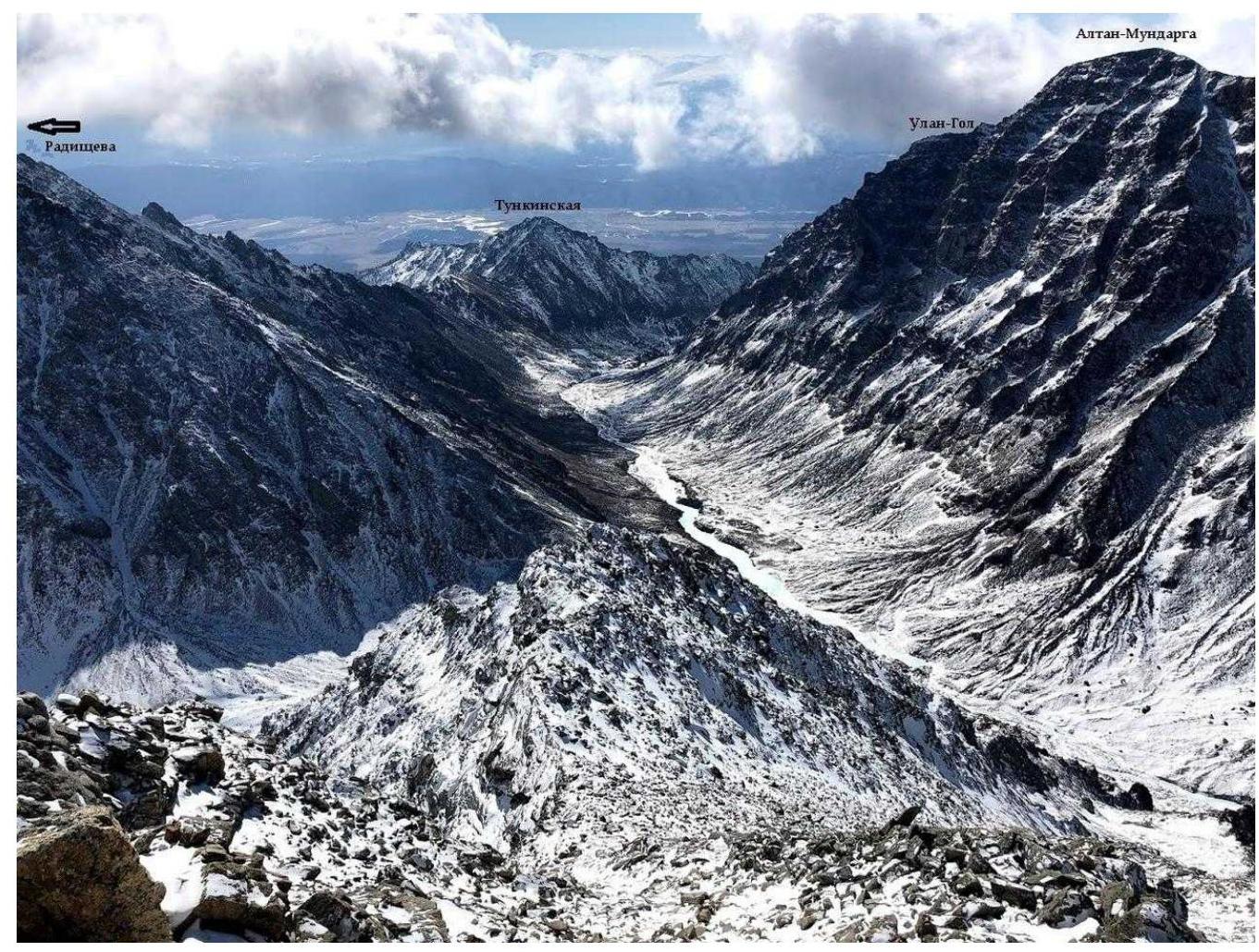
Photo 1.3. Photopanorama of the Ula-Gol valley
2. Characteristics of the Route
2.1. Technical photograph of the route
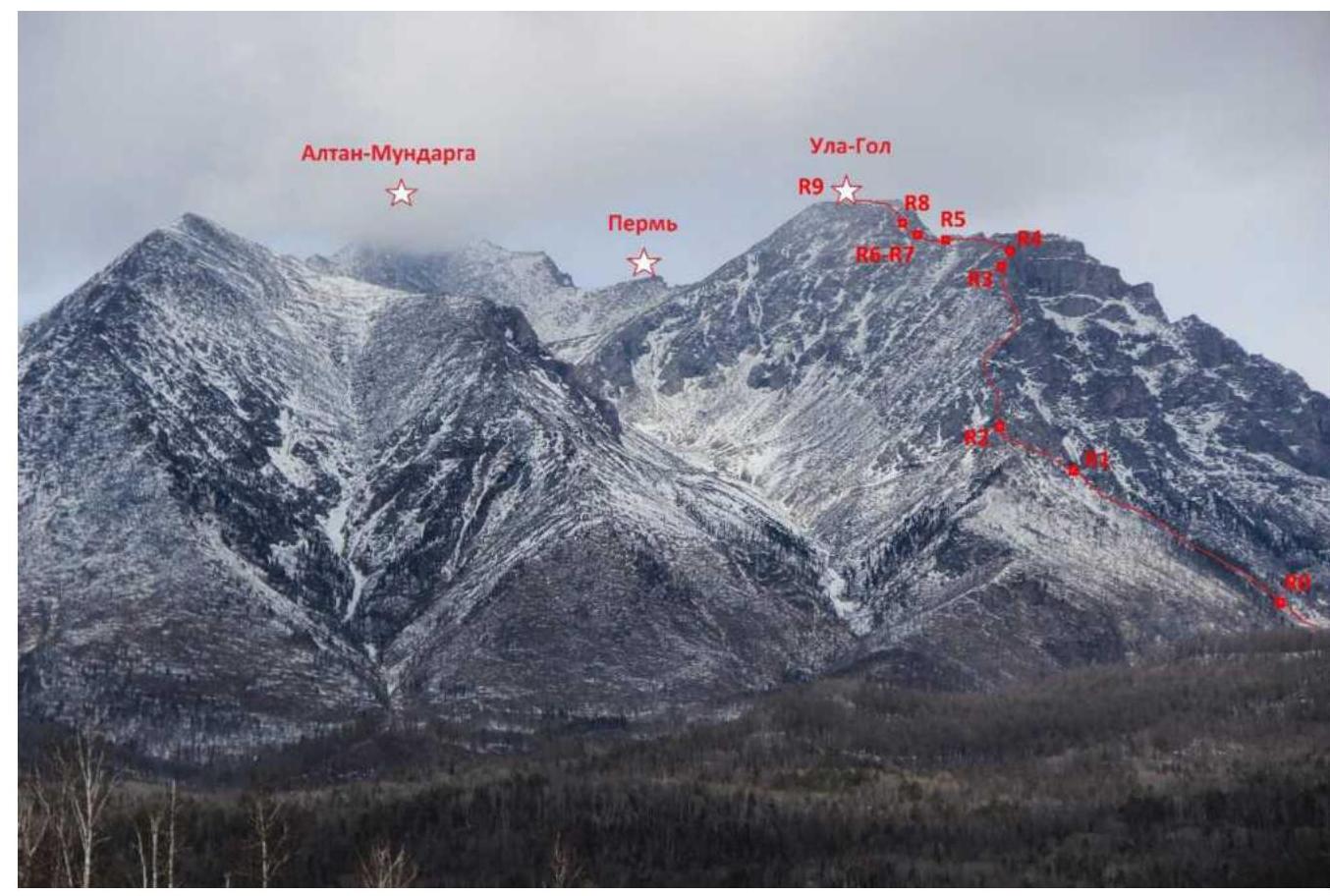
Photo 2.1. Technical photograph of the route. View from the unloading point of the high-passage vehicle.
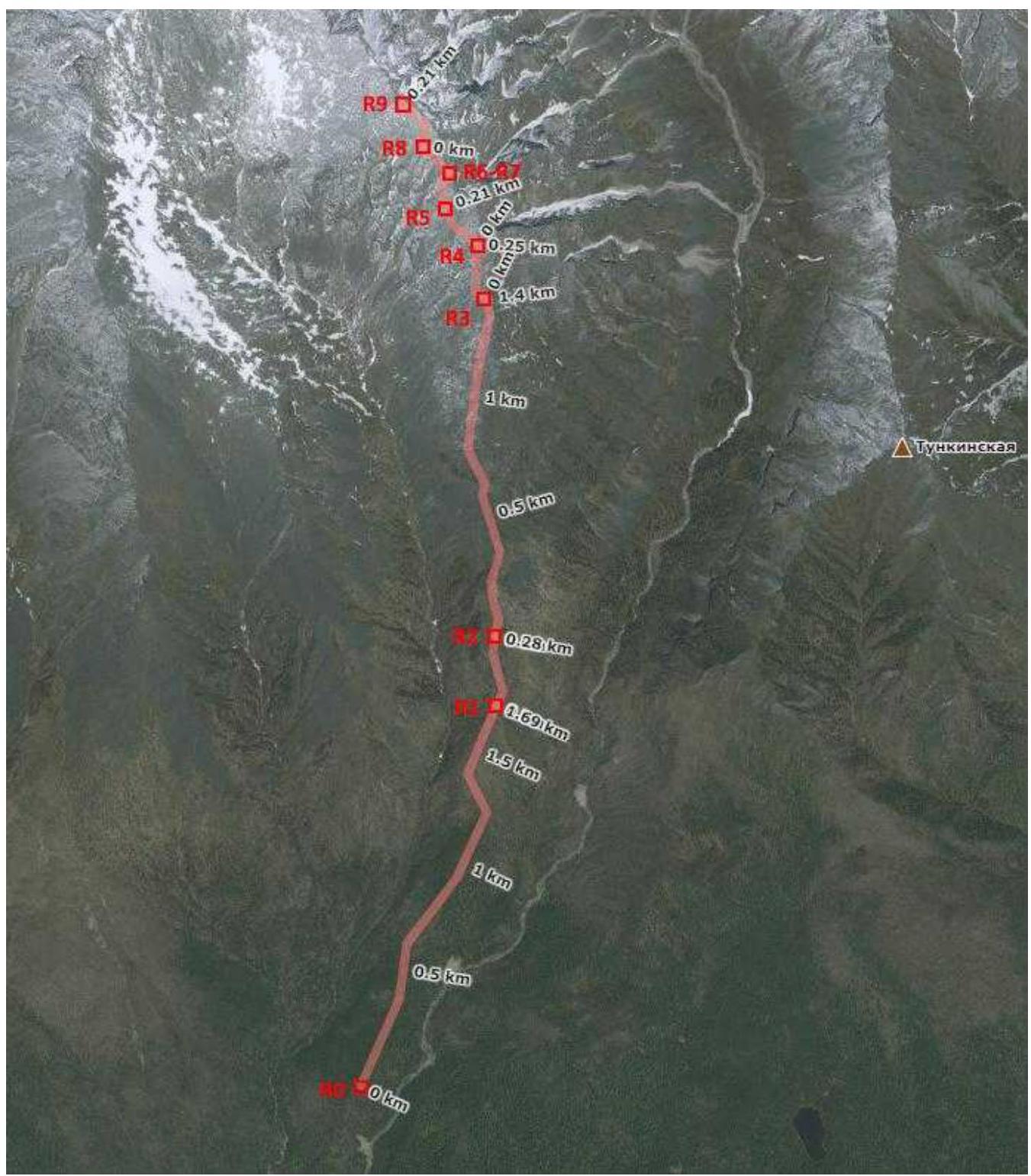
Photo 2.2. Route sections on the Bing Sat satellite image 2.2. Section numbers on the technical photograph correspond to the section numbers in paragraph 2.3.
2.3. Technical characteristics of the route sections
Pitons and other protection elements were not used; movement was primarily in rope teams with natural protection.
| Section | Nature of the terrain | Category of difficulty | Length, angle | Type and number of pitons |
|---|---|---|---|---|
| R0–R1 | Grassy slope | 1 | 1690 m, 10–30° | — |
| R1–R2 | Rocky-grassy slope | 2 | 280 m, 20–45° | — |
| R2–R3 | Movement along the ridge, talus | 1–2 | 1400 m, 25–35° | — |
| R3–R4 | Gendarme, traverse to the left | 2–2 | 250 m, 25–50° | — |
| R4–R5 | Talus, gendarme | 2 | 210 m, 15–30° | — |
| R5–R6 | Rocks and "ram's foreheads" | 2 | 130 m, 25–35° | — |
| R6–R7 | Internal corner | 3 | 10 m, 45° | — |
| R7–R8 | Wide rocky ridge, traversed left | 2–2 | 150 m, 30–45° | — |
| R8–R9 | Ridge, ascent to the summit | 1–2 | 210 m, 15–40° | — |
2.4. Route scheme in UIAA symbols
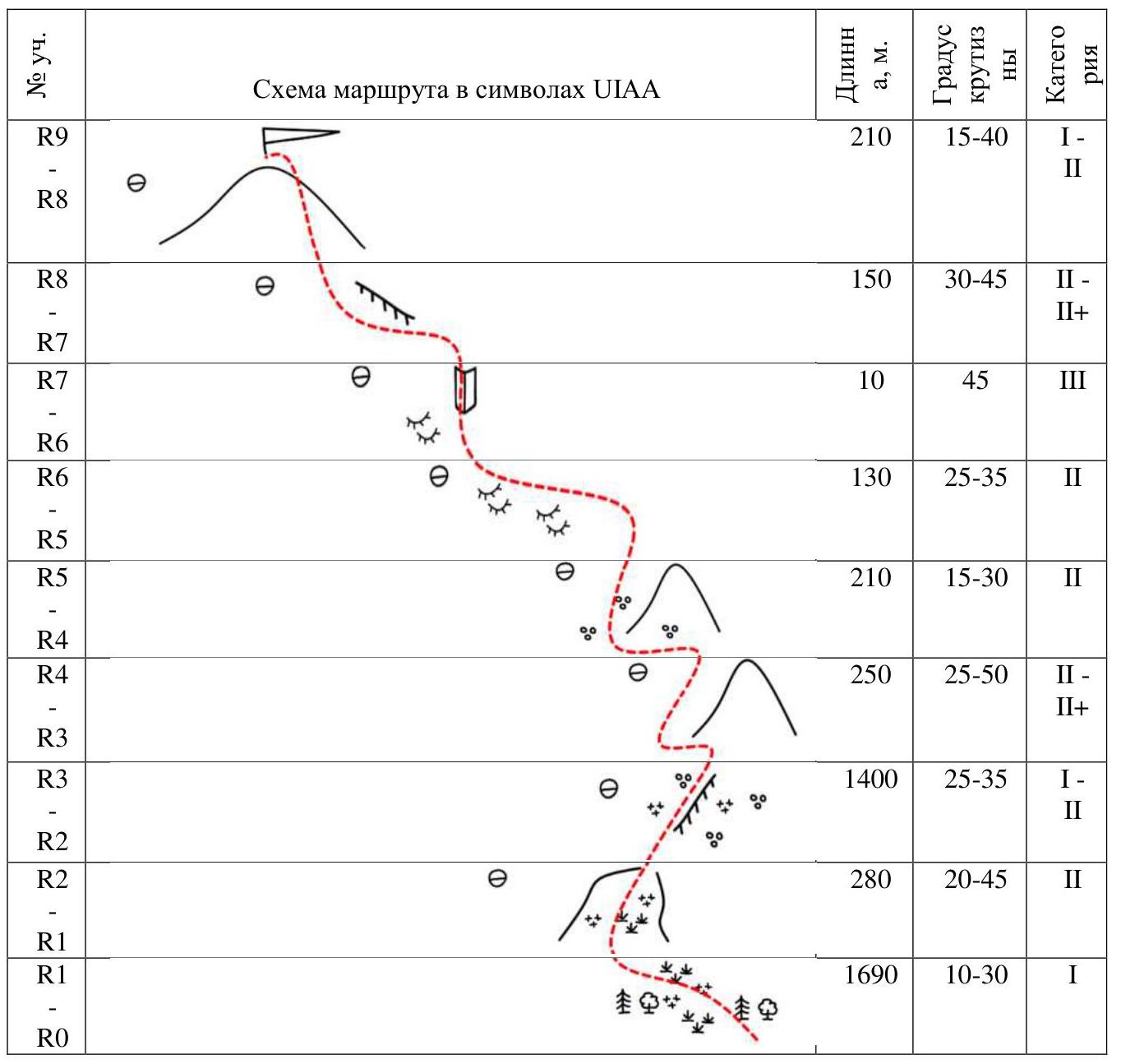
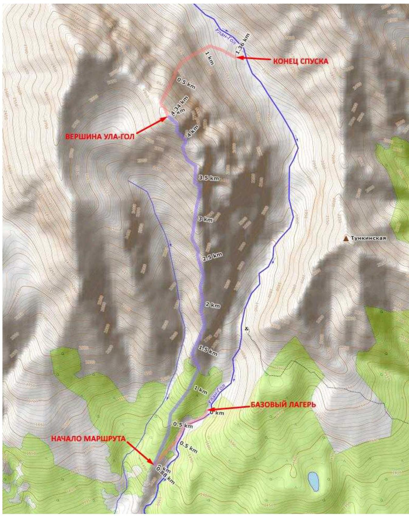
Photo 2.1. Route on the area map
Note 1. On the maps of the service https://nakarte.me/↗, the river is named Ulan-Gol. On the maps of the General Staff and others, it is named Ula-Gol. We adopted the second variant, but apparently, they are equivalent.
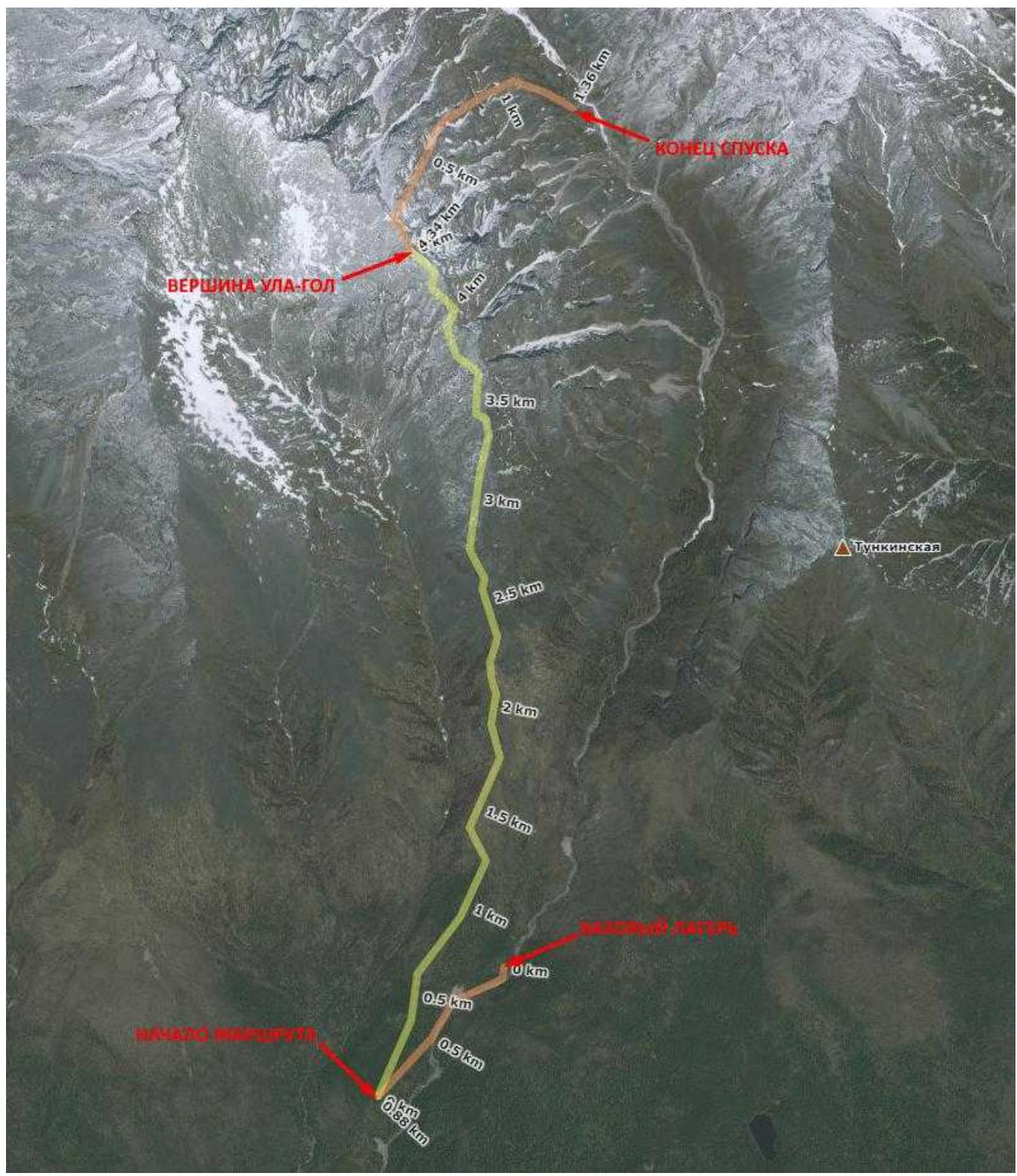
Photo 2.2. Route on the Bing Sat satellite image
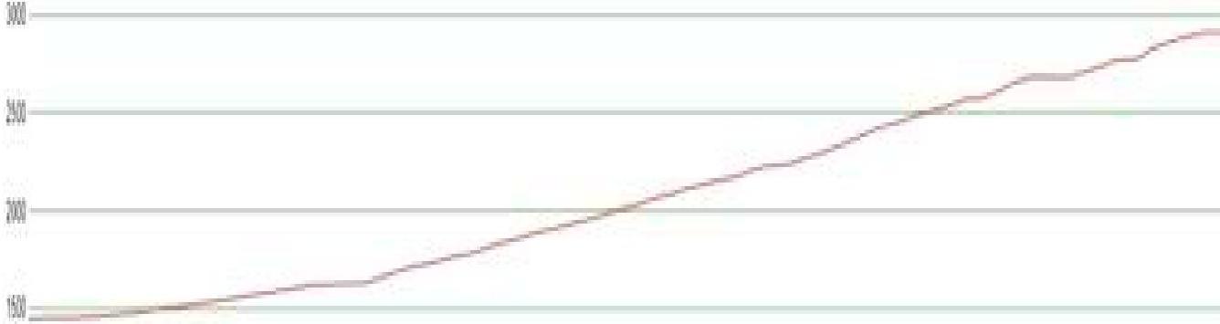
| Max elevation: | 2916 |
|---|---|
| Min elevation: | 1447 |
| Start elevation: | 1447 |
| Finish elevation: | 2916 |
| Start to finish elevation change: | 1469 |
| Avg / Max ascent inclination: | 20/50° |
| Avg / Max descent inclination: | 2/6° |
| Total ascent: | 1470 |
| Total descent: | 3 |
| Distance: | 4.3 km |
Photo 2.3–2.4. Characteristics of the route's length and elevation gain according to the https://nakarte.me/↗ service.
Note 2. According to the service maps, the height of the summit is 2916 m, which needs to be clarified. The altimeter reading at the summit is 2940 m.
3. Characteristics of the Team's Actions
| Section | Description | Photo number |
|---|---|---|
| R0–R1 | Approach to the route along a snowy-grassy slope with rocky outcrops. Further along the eastern side of the ridge through sparse forest. | |
| R1–R2 | Movement in rope teams up the slope; possible use of ice axe. | 3.1 |
| R2–R3 | Continuing movement along the ridge to the gendarme. | 3.2 |
| R3–R4 | Traverse of gendarmes to the east along an inclined wall. Warning! If the ledges are snowy, there is a risk of avalanches. | 3.3 |
| R4–R5 | Simultaneous movement along the talus to the gendarme (bypassed on the left). | |
| R5–R6 | Alternate movement. Live rocks encountered. | |
| R6–R7 | Upward movement along the internal corner. | 3.4 |
| R7–R8 | Wide ridge. On the left, there is a possibility to descend onto "ram's foreheads." Caution: many live rocks. | 3.5 |
| R8–R9 | Simultaneous movement. | 3.6 |
At the summit, a note from A. Boyko was found, indicating an ascent to the summit the day before via the eastern slope, category 4B. The lack of registered routes on the southern ridge, a cairn, or any other signs of human presence on the route allows us to consider the route as a first ascent. Our team also left a note about the ascent.
The route is relatively safe due to its ridge nature. Communication with the base camp was maintained using a radio station, and there is cellular coverage at the summit. The descent from the summit is done into the valley along a couloir. Movement is safer without a safety rope. The couloir is stony with many loose rocks. In winter, it can be avalanche-prone.
The proposed category of difficulty for the route is 2B, comparable in complexity and length to routes of this category in the Eastern Sayan.
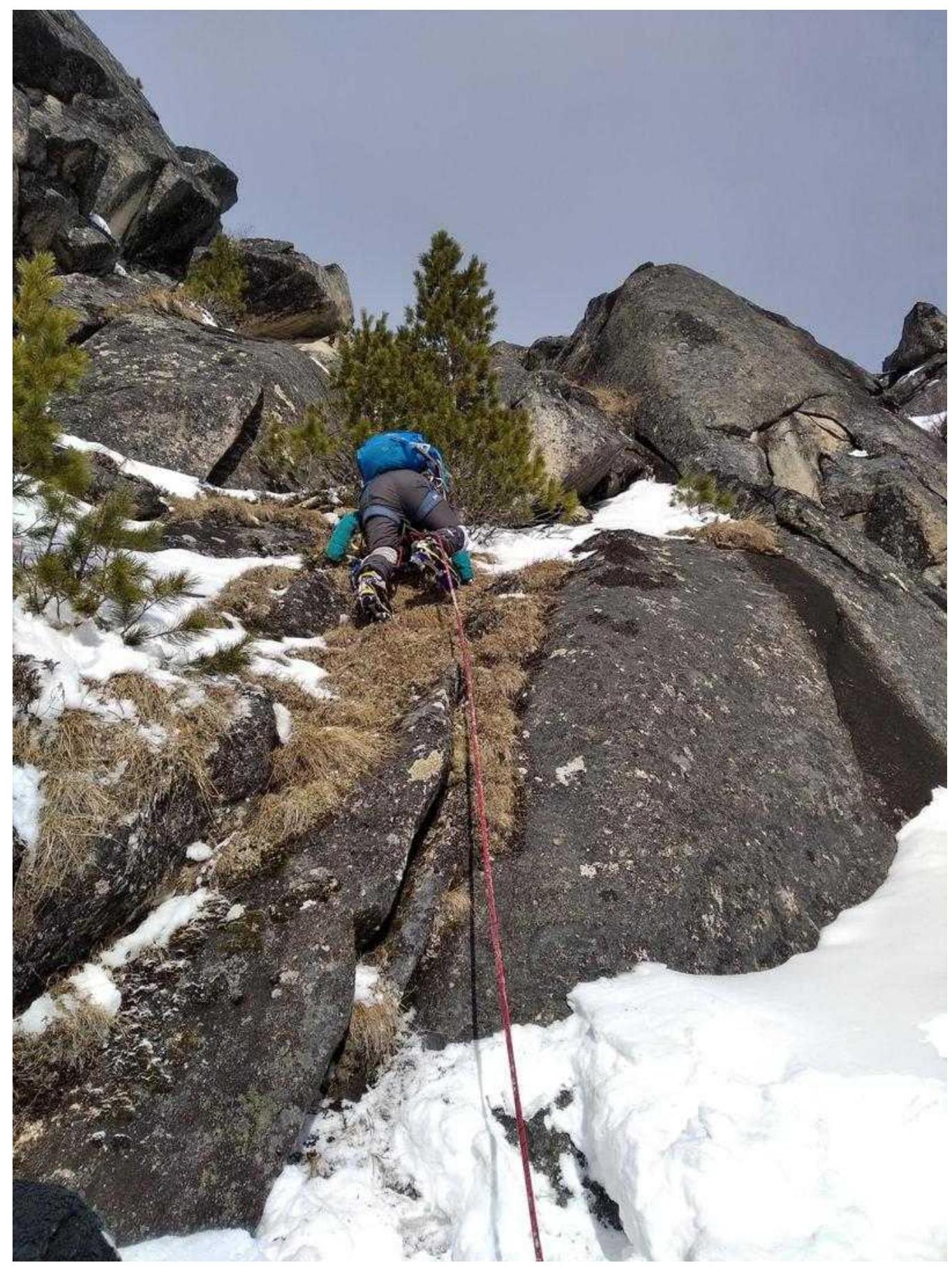
Photo 3.1. Start of the route, rocky-grassy slope, section R1–R2.

Photo 3.2. Ridge, section R2–R3.
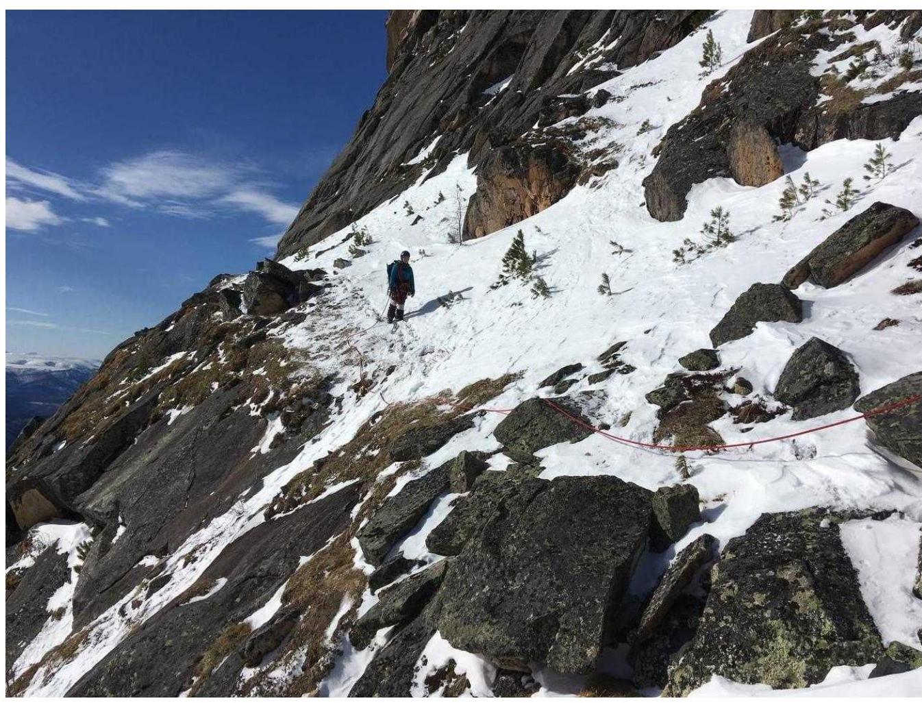
Photo 3.3. Traverse, section R3–R4.
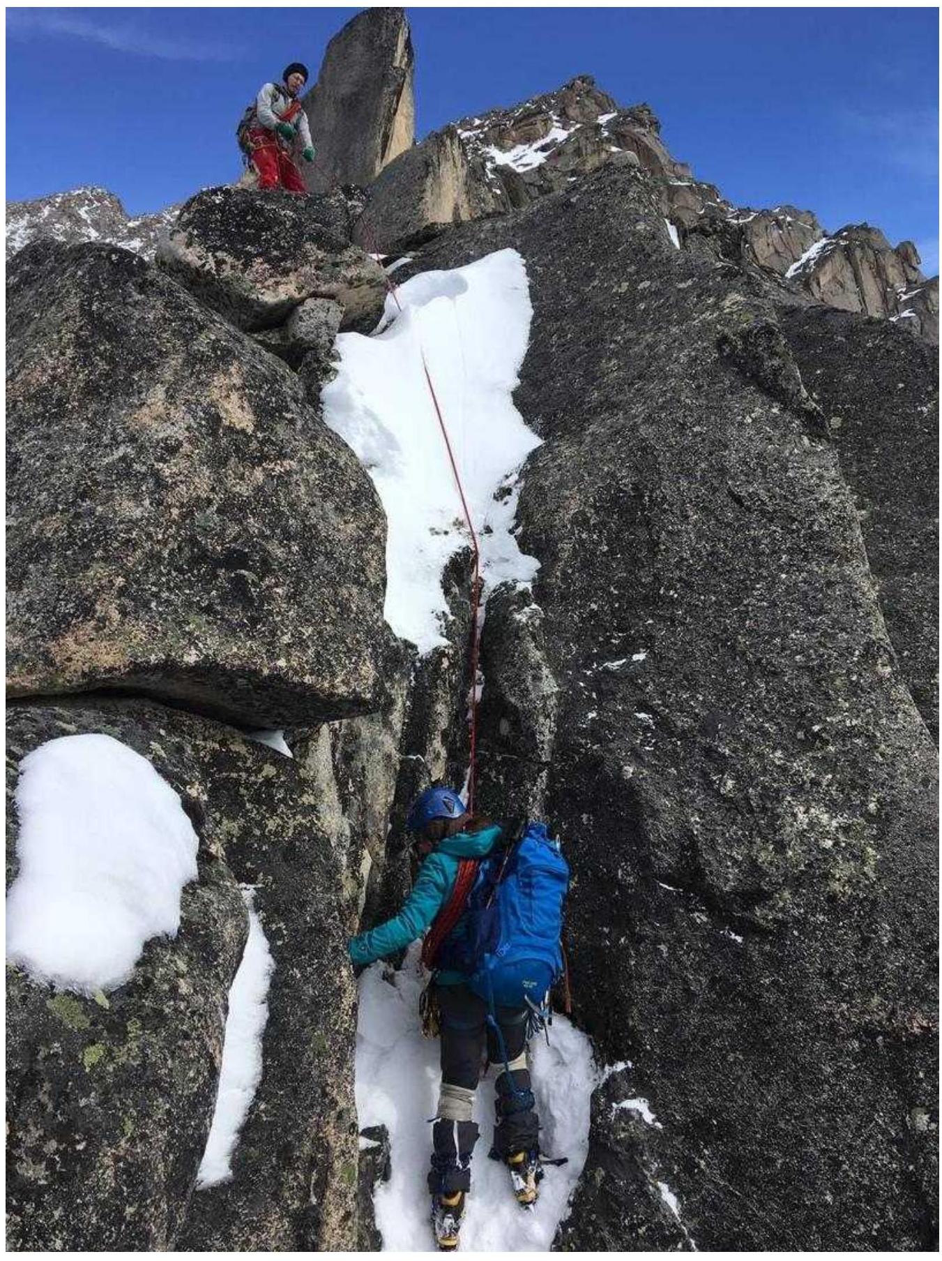
Photo 3.4. Internal corner, section R6–R7.
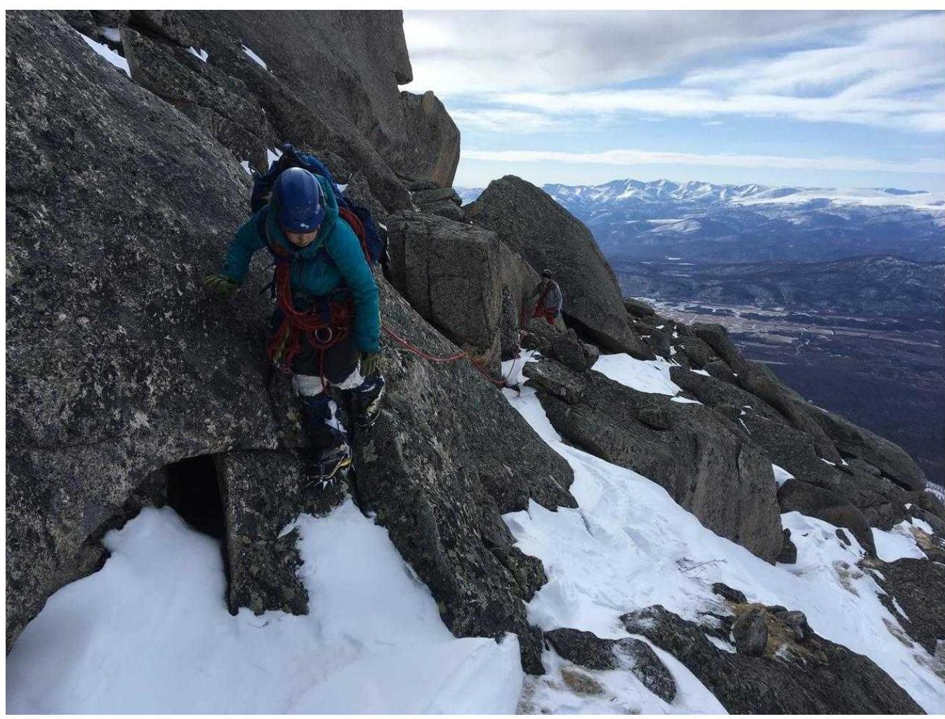
Photo 3.5. Section R7–R8.
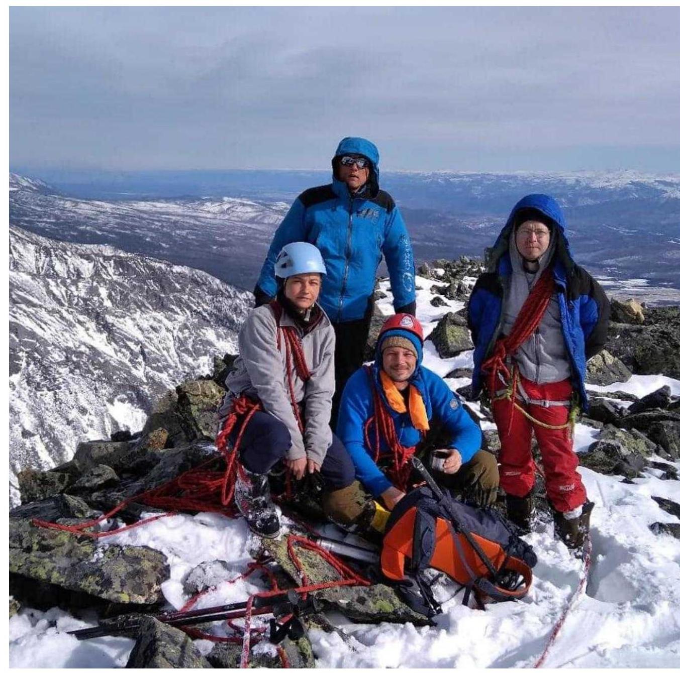
Photo 3.6. Team at the summit.