Report
On the first ascent to the summit of Tunkinskaya via the route along the North ridge, approximately category 1B, by the team of the "Mountains of Baikal" club within the framework of the "Impossible is not forever" project, for the period from March 25, 2019 to March 25, 2019.
Irkutsk 2019
I. Ascent Report
| № p/p | 1. General Information | |
|---|---|---|
| 1.1 | Full name, sports rank of the leader | Panova Alena Mikhailovna (Candidate for Master of Sports) |
| 1.2 | Full name, sports rank of the participants | Tsalman Igor Viktorovich, 3rd sports rank; Tsalman Polina Viktorovna, 3rd sports rank; Medvedeva Anna Gennadievna, badge; Mashtakova Natalia Gennadievna, badge; Desyatova Daria Nikolaevna, badge; Kiselnov Pavel Alexandrovich; Petko Andrey Pavlovich |
| 1.3 | Full name of the coach | Glazunov Evgeny Vladimirovich (Master of Sports) |
| 1.4 | Organization | Sports club "Mountains of Baikal", project "Impossible is not forever" |
| 2. Characteristics of the ascent object | ||
| 2.1 | Region | Eastern Sayan, Tunkinskie Goltsy ridge |
| 2.2 | Valley | Ula-Gol |
| 2.3 | Section number according to the 2013 classification table | 6.1.2 |
| 2.4 | Name and height of the summit | Tunkinskaya, 2290 m |
| 2.5 | Geographical coordinates of the summit (latitude/longitude), GPS coordinates | 51.78073 101.47029 |
| 3. Characteristics of the route | ||
| 3.1 | Name of the route | Along the northern ridge |
| 3.2 | Proposed category of complexity | 1B |
| 3.3 | Degree of route development | First ascent |
| 3.4 | Character of the route relief | Rocky |
| 3.5 | Height difference of the route (altimeter or GPS data) | 340 m |
| 3.6 | Length of the route (in meters) | 750 m |
| 3.7 | Technical elements of the route (total length of sections of various complexity categories with indication of relief character (ice-snow, rocky)) | non-category - 250 m Category I rocks - 450 m Category II rocks - 50 m |
| 3.8 | Descent from the summit | Via the ascent route |
| 3.9 | Additional characteristics of the route | Absence of water |
| 4. Characteristics of the team's actions | ||
| 4.1 | Time of movement (team's walking hours, in hours and days) | 3 hours |
| 4.2 | Overnights | - |
| 4.3 | Start of the route | 05:30, March 25, 2019 |
| 4.4 | Reaching the summit | 09:30, March 25, 2019 |
| 4.5 | Return to the base camp | 12:00, March 25, 2019 |
| 5. Responsible for the report | ||
| 5.1 | Full name, e-mail | Medvedeva Anna Gennadievna belochka83@mail.ru |
II. Description of the Ascent
1. Characteristics of the Ascent Object
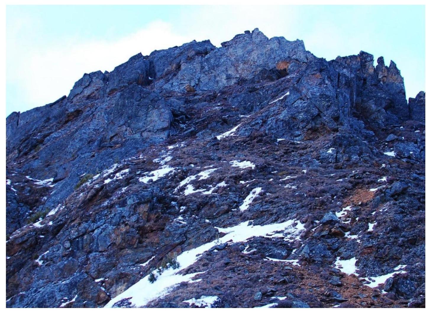
1.1. General photo of the Tunkinskaya summit
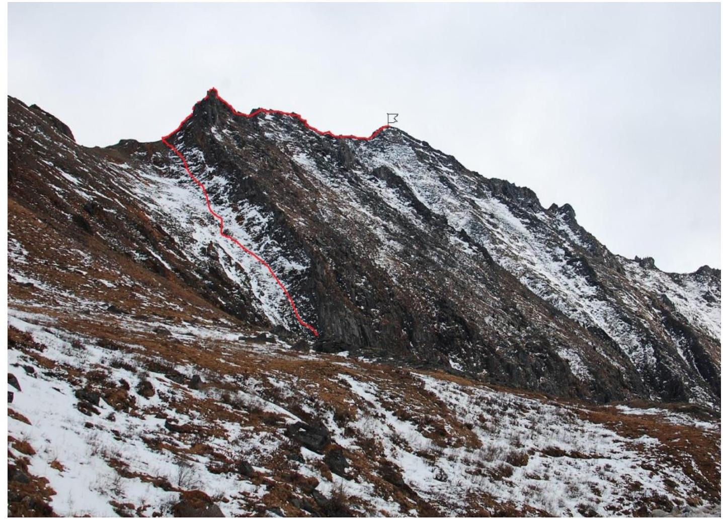 March 24, 2019 view from the Ula-Gol valley
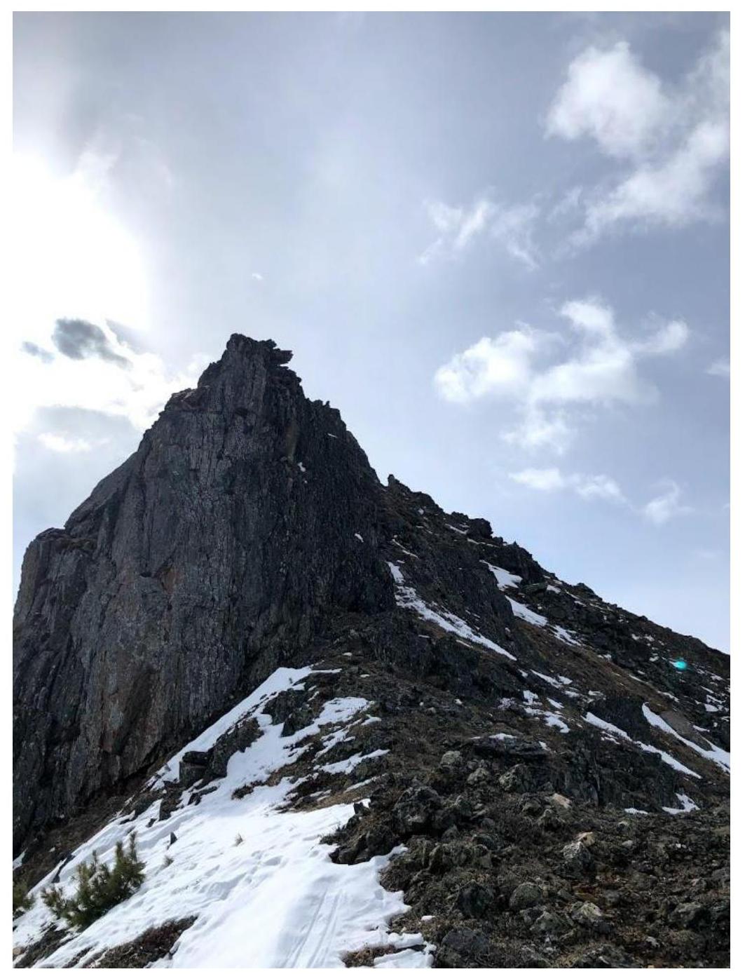
1.2. Photo of the route profile
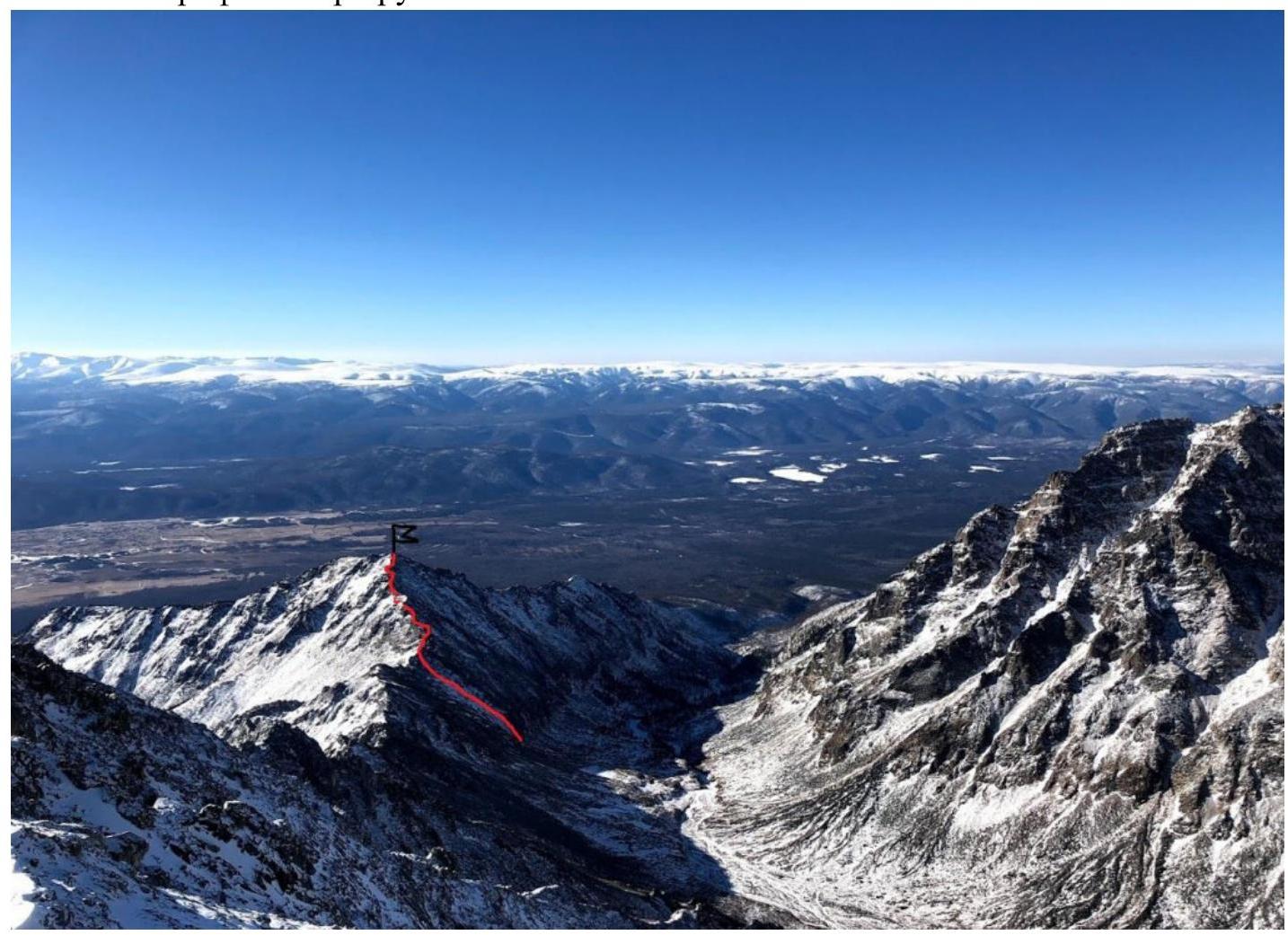 March 27, 2019 from the ascent to the summit Radishcheva
1.3. Photopanorama of the area
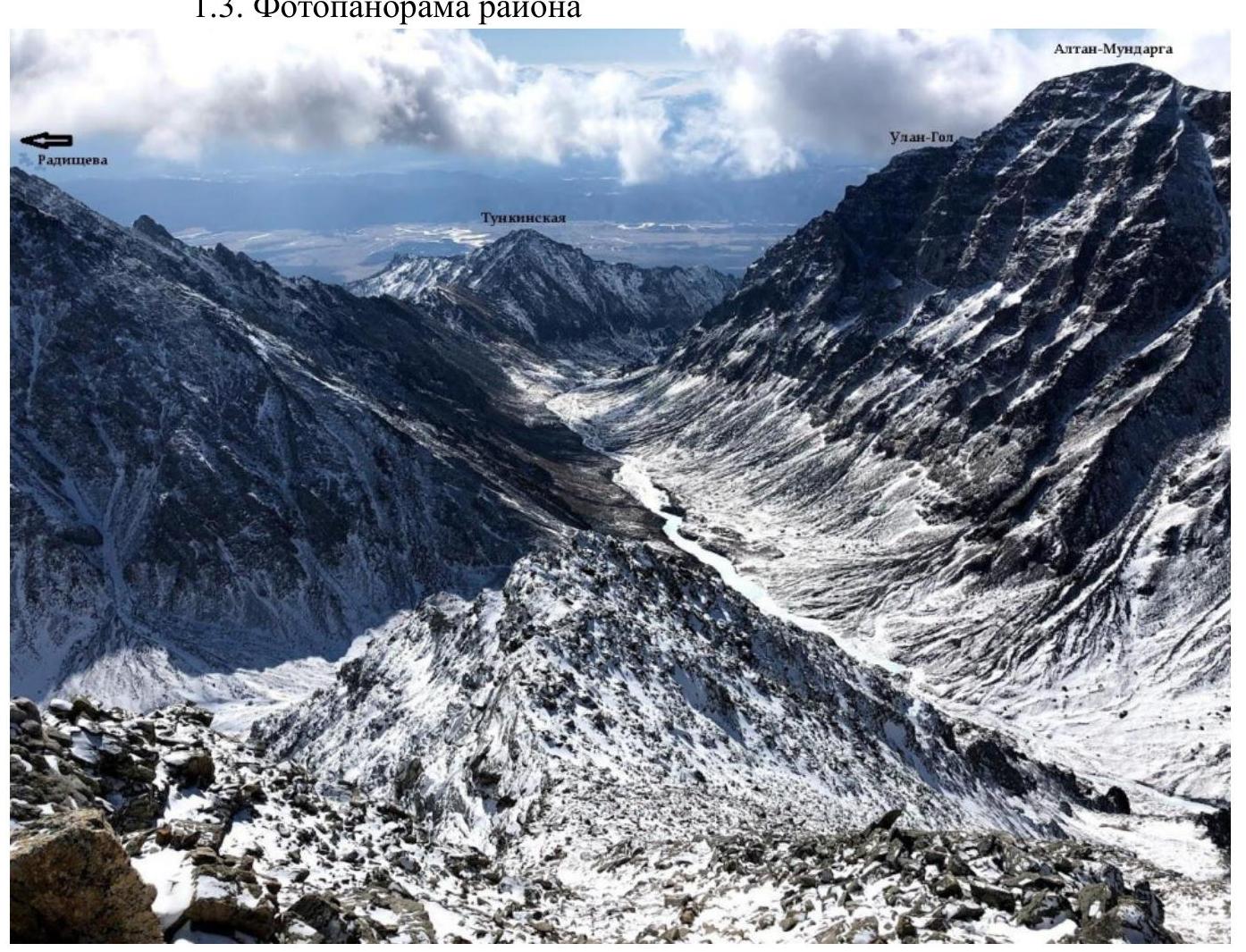 March 30, 2019 view from the route to the summit General'sky Pogon
1.4. Map of the summit
The summit is located in the Ula-Gol valley, Tunkinskie Goltsy ridge, Eastern Sayan.
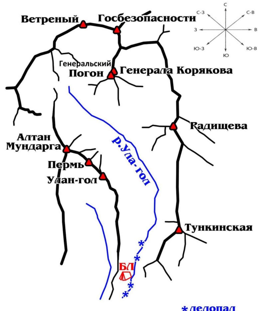
Approach: from the village of Nilova Pustyn (Tunkinsky district, Republic of Buryatia, district center - village Kyren) to the village of Khoito-Gol, then by forest road, a car (preferably high-passage) or on foot to the point of direct visibility to the mountain Altan-Mundarga, from where the direction to the valley is visible, and a horse trail can be seen.
Movement on foot to the Ula-Gol river. Then upstream along the river. In winter, the approach is more comfortable along the frozen river, the ice fall is bypassed on the left in the direction of the valley.
Approximate time: "point of direct visibility to the mountain Altan-Mundarga" - base camp 7-10 hours. Distance about 14 km.
For transportation, you can also try to agree with locals on horses.
From the base camp along the horse trail towards the valley to the place of approach to the start of the route about 1-2 hours, approximately 1.5 km. The mountain is the first on the right side of the valley.
2. Characteristics of the Route
2.1. Technical photograph of the route.
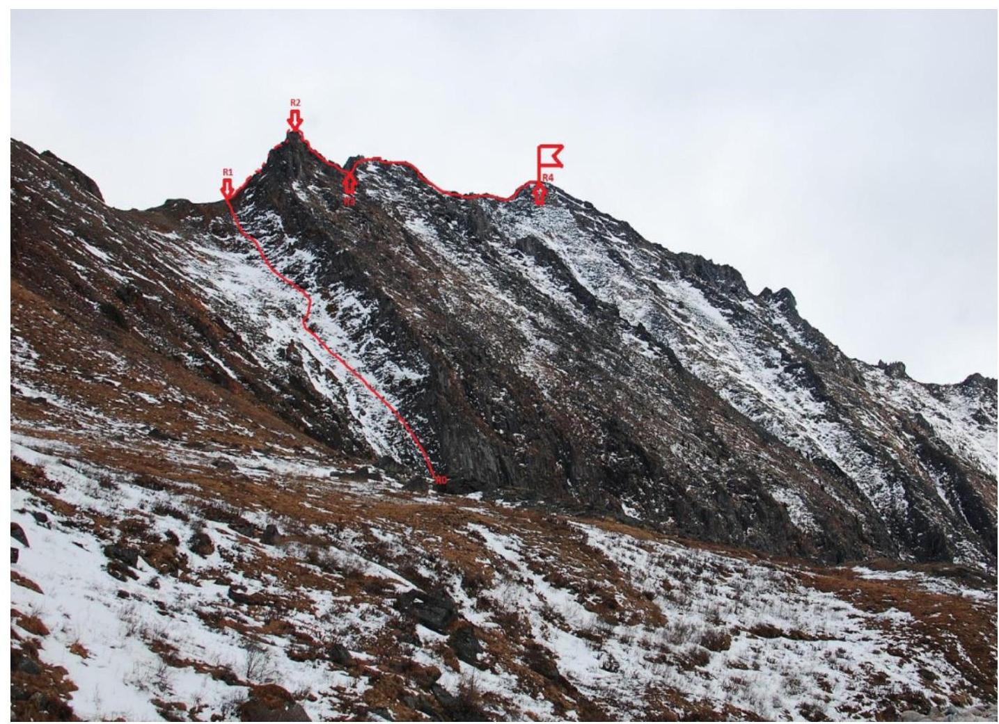 March 24, 2019 view from the Ula-Gol valley
2.2. Numbers of sections on the technical photograph correspond to the numbers of sections in paragraph 2.3.
2.3. Technical characteristics of the route sections
| № section | Character of relief | Category of complexity | Length, m | Type and number of hooks |
|---|---|---|---|---|
| R0–R1 | Grassy-rocky | non-category | 250 m | |
| R1–R2 | Rocky | I, II | 80 m | |
| R2–R3 | Rocky | I, II | 100 m | |
| R3–R4 | Rocky | I, II | 320 m |
Note: Rocky outcrops are bypassed on the left along the ascent path.
3. Characteristics of the Team's Actions
3.1. Brief description of the route passage
| № section | Description | Photo number |
|---|---|---|
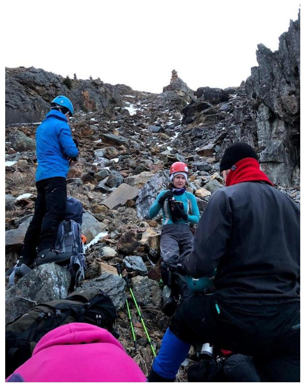
| R0–R1 | Ascent along the slope, without special equipment. Helmets are desirable. Movement at a safe distance from rocky outcrops that overhang on the right. | Photo 3.1.1. |
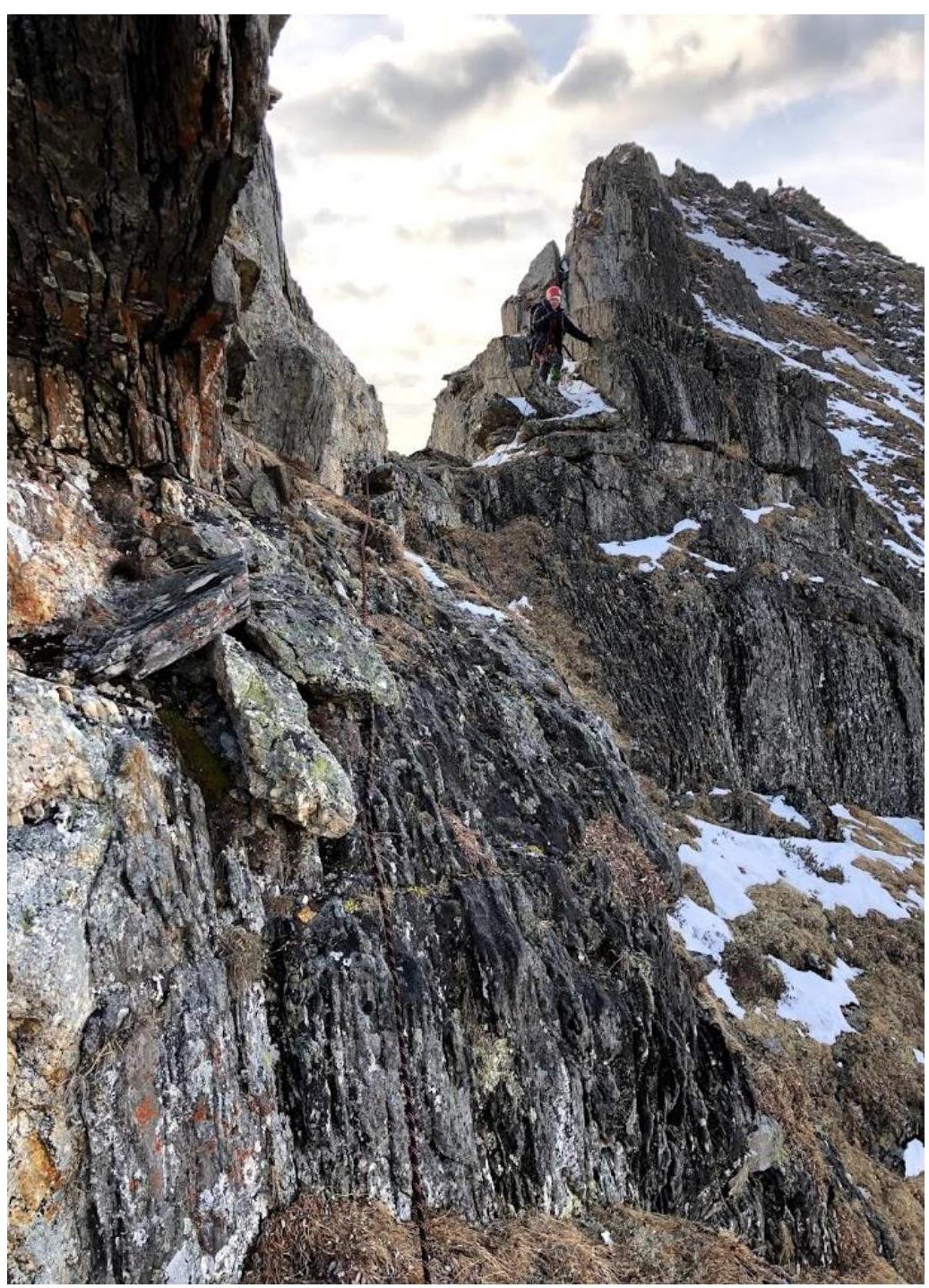
| R1–R2 | Further movement in rope teams. Ascent to the ridge directly via rocks. | Photo 3.1.2; Photo 3.1.3 |
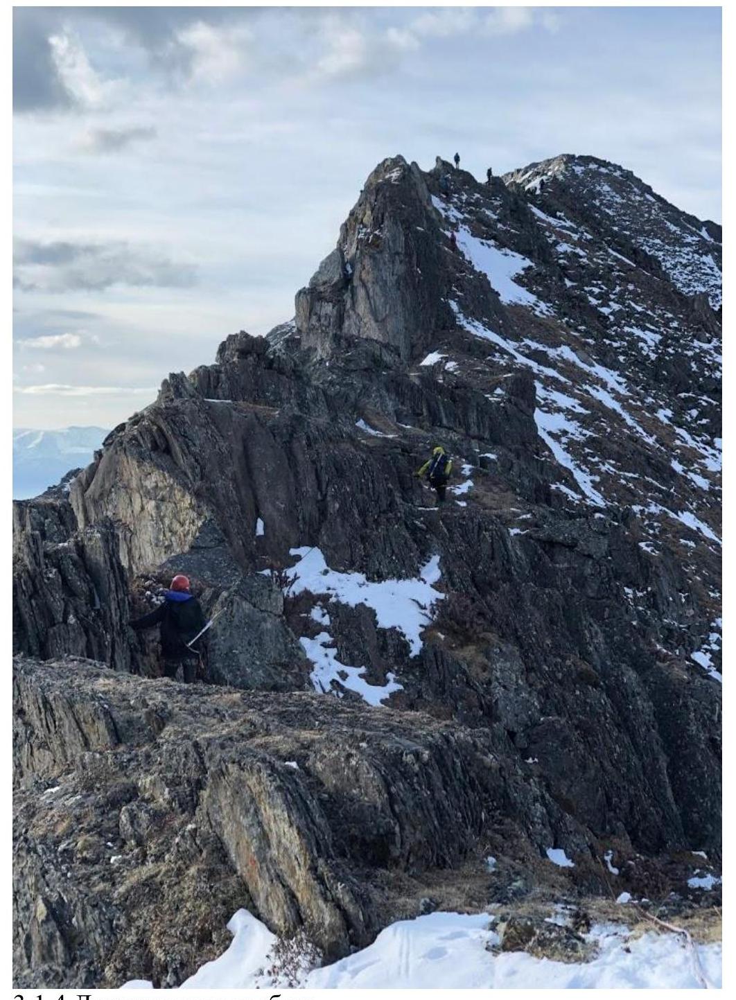
| R2–R3 | Movement along the ridge, in rope teams. | Photo 3.1.4 |
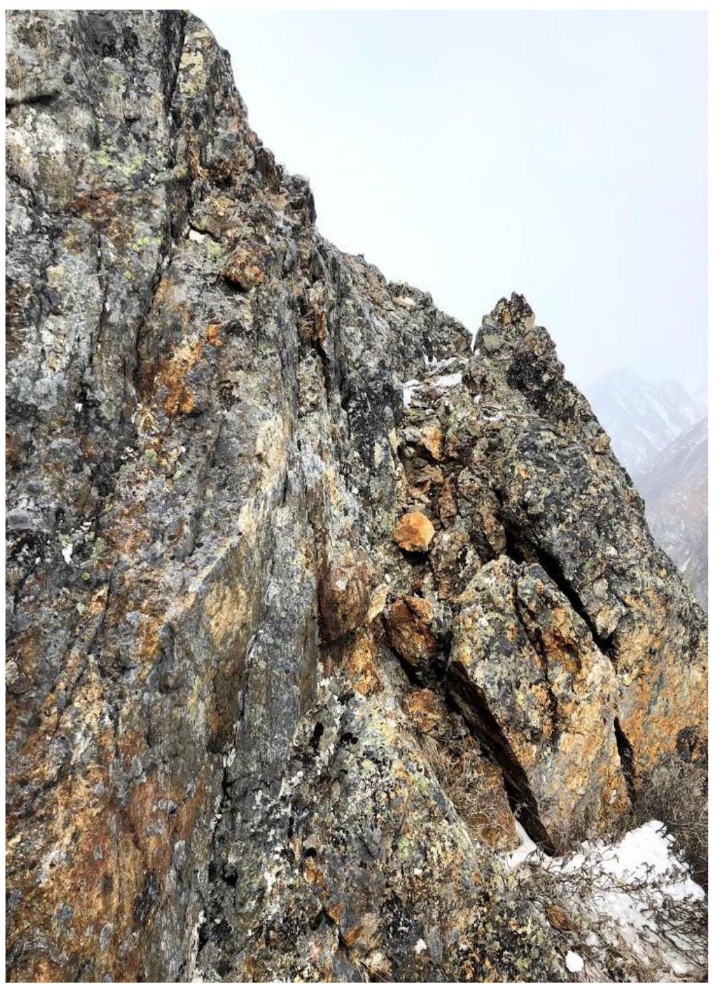
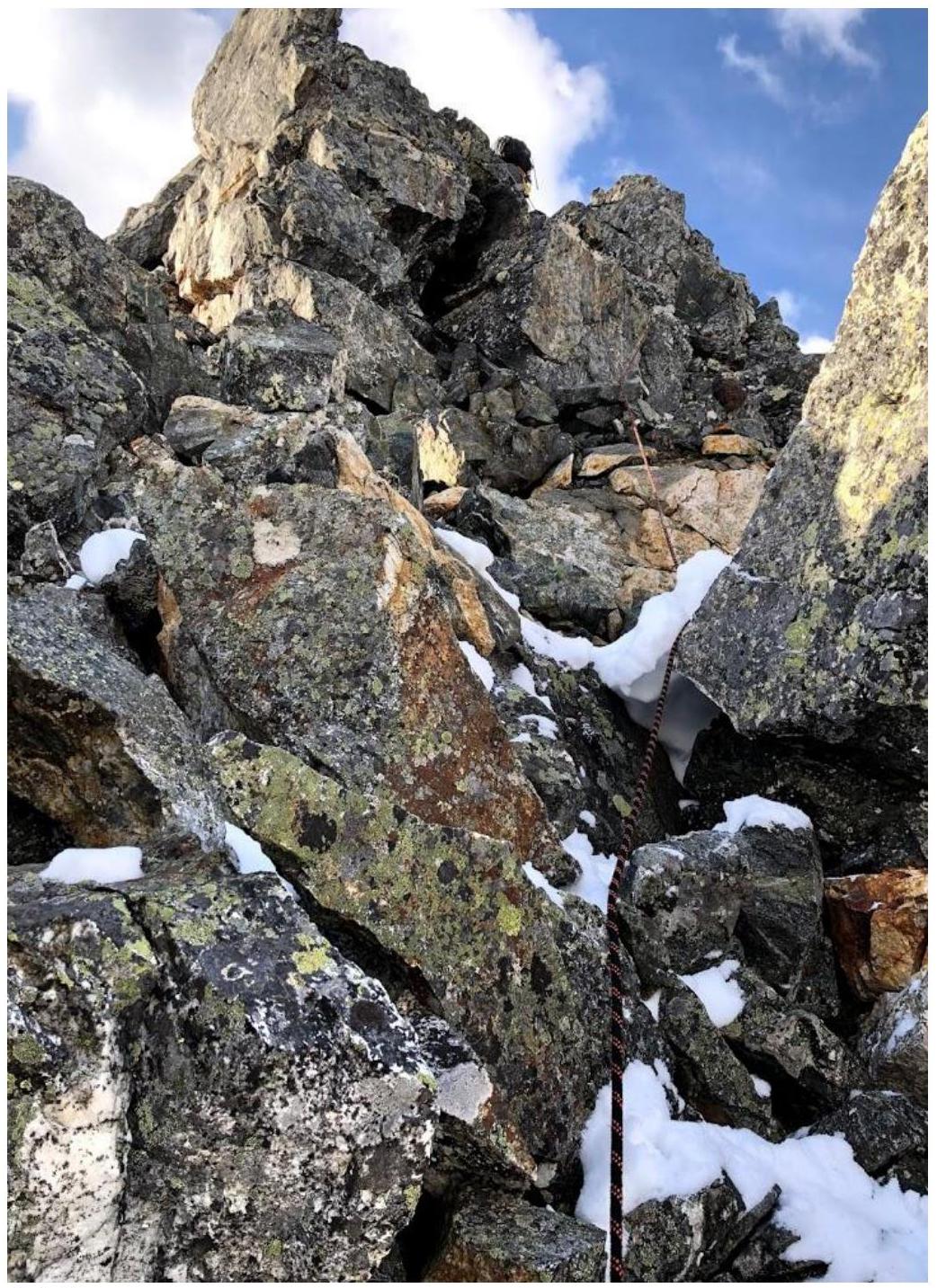
| R3–R4 | Gendarme. Bypassed on the right. Movement along the entire ridge mainly on the right. | Photo 3.1.5; Photo 3.1.6; Photo 3.1.7; Photo 3.1.8 |
3.1.1. Start of the route, ascent along the slope
3.1.2. Movement directly via rocks to the ridge
3.1.3. Section with exit to the ridge
3.1.4. Movement along the ridge
3.1.5. Gendarme. Approaching section R3–R4
3.1.6. View of section R2–R3 from section R3–R4
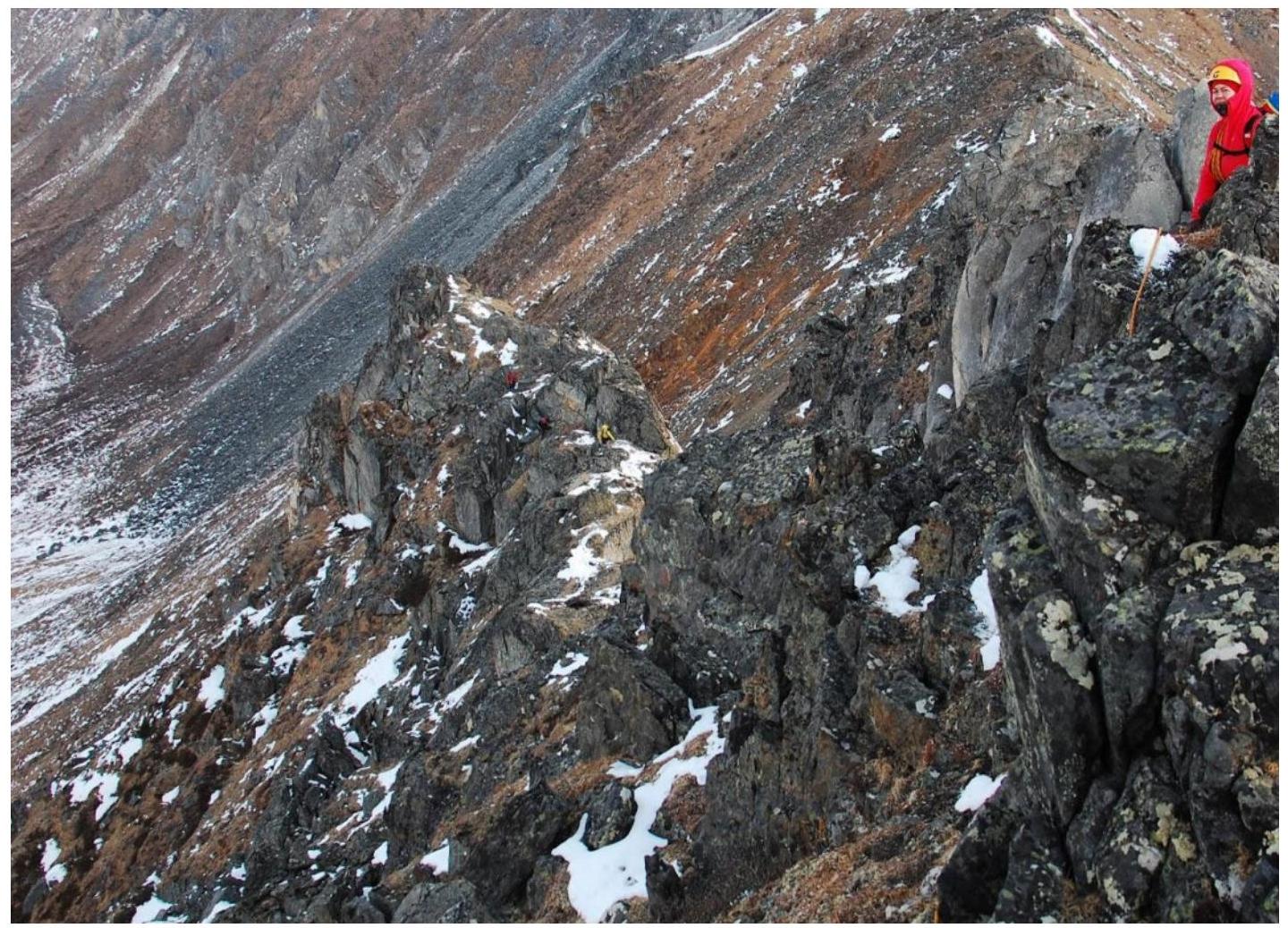
3.1.7. Section R3–R4
3.1.8. Reaching the summit
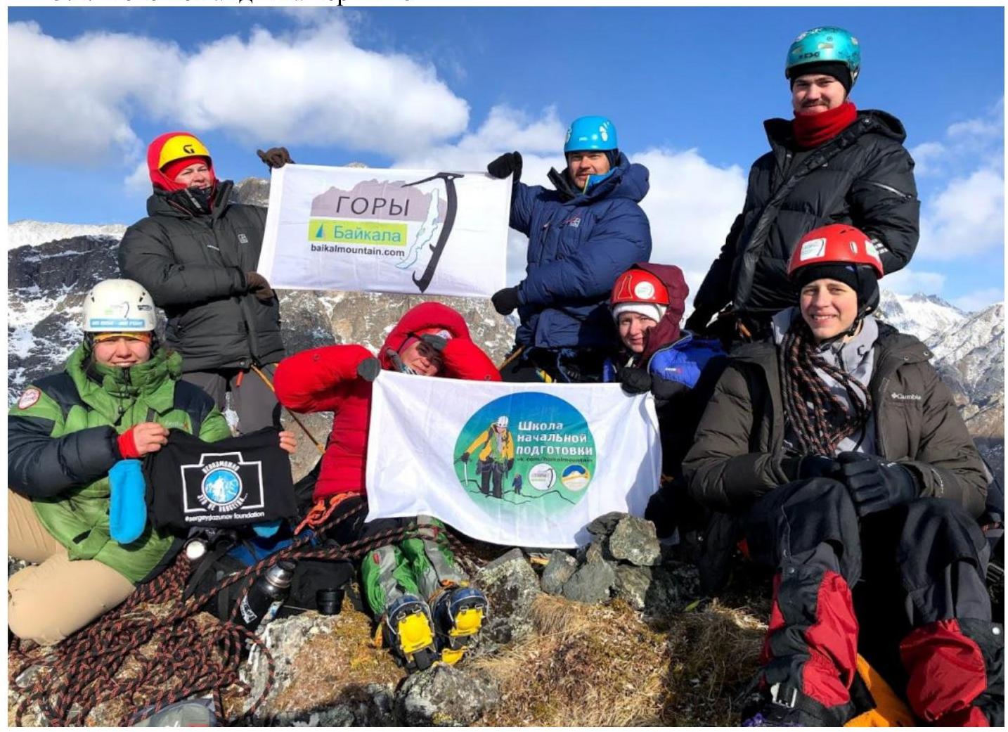
3.2. Photo of the team on the summit
3.3.
The absence of registered routes, a tour, notes, or any other signs of human presence on the summit allows the route to be called a first ascent. The summit has been named Tunkinskaya, and the first ascenders were the team of the "Mountains of Baikal" club within the framework of the "Impossible is not forever" project. Descent from the summit was via the ascent route. The category of complexity of the route is 1B, compared to other routes in the mountains of Eastern Sayan.