Route Diagram

Route Profile
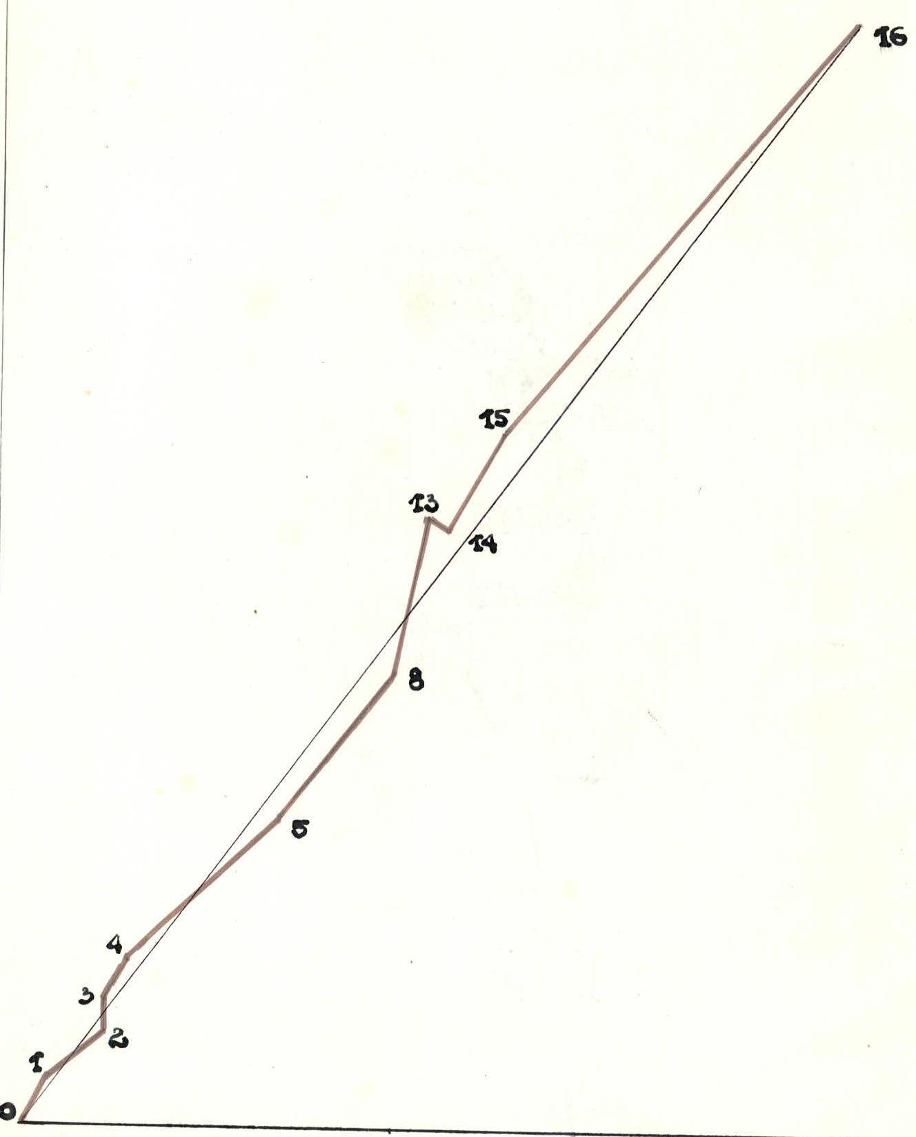
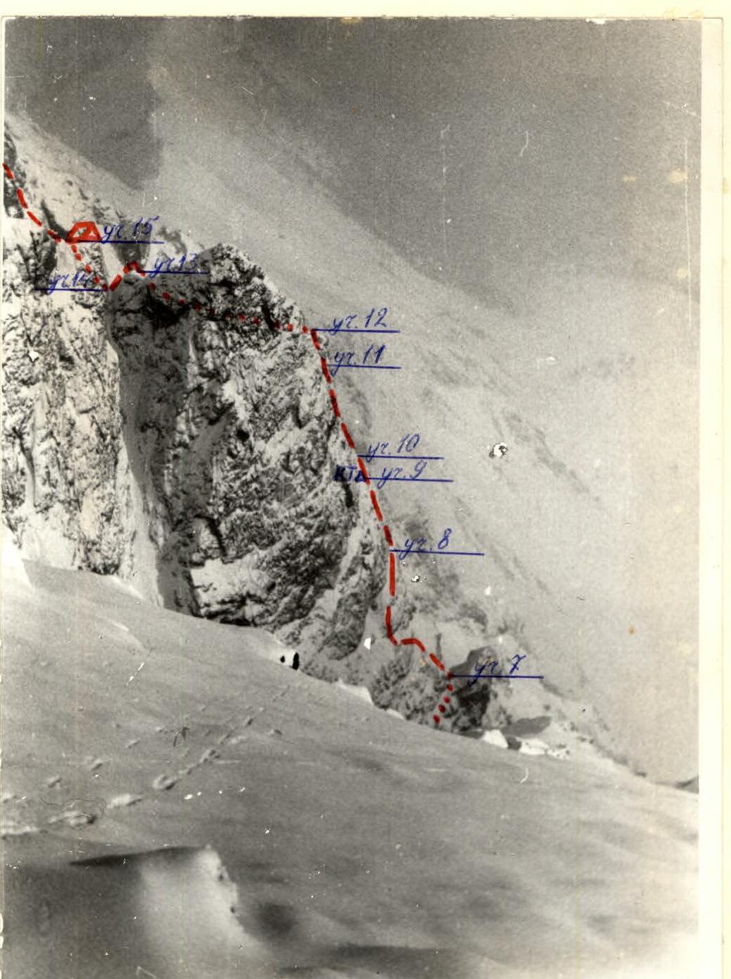
Photo of the Middle Part of the Route Profile
Trëkhglavaya. North Tower. 2511. Category 4B, 650 m, 52°, 66 pitons, 13 hours. Afanasiev A.E., Krasnukhin L.I. March 18, 1987.
View of the Key Bastion from the Key Section
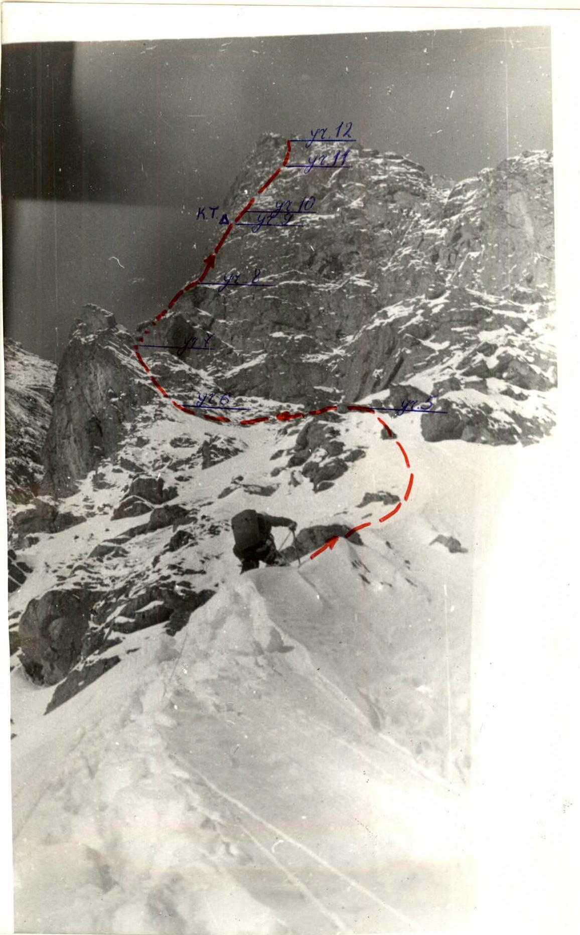
R2–R3 Section
Area Map
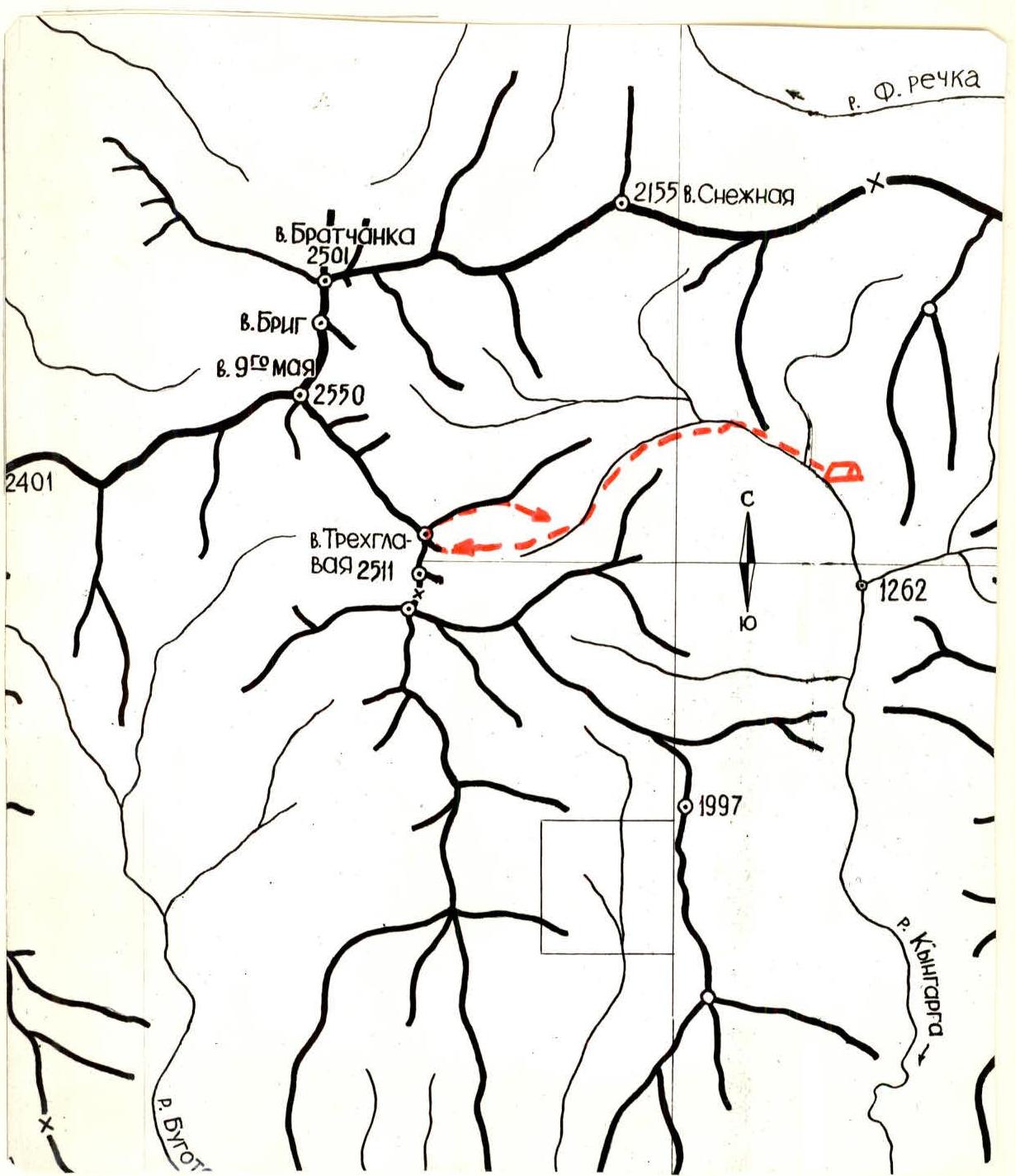
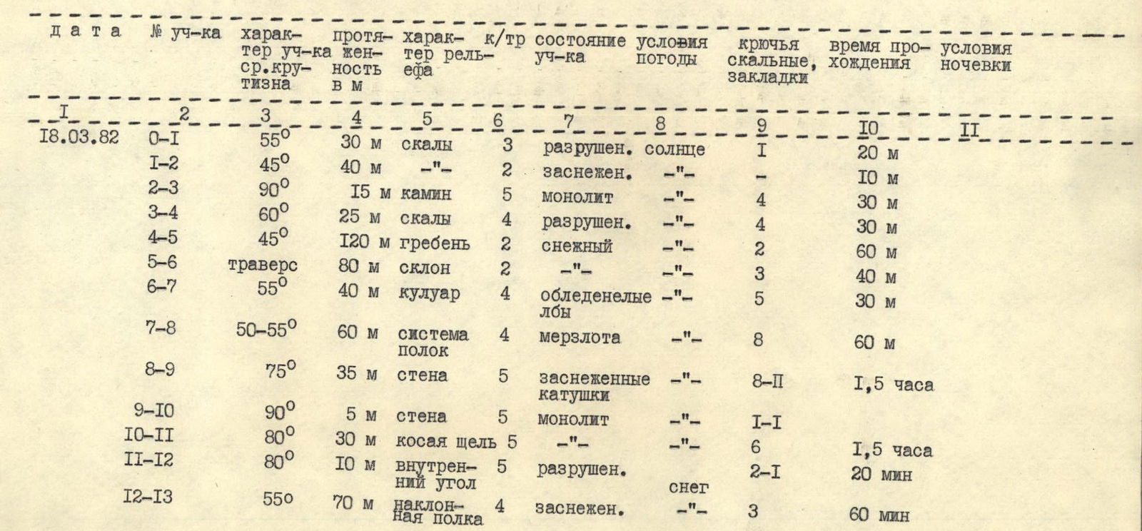
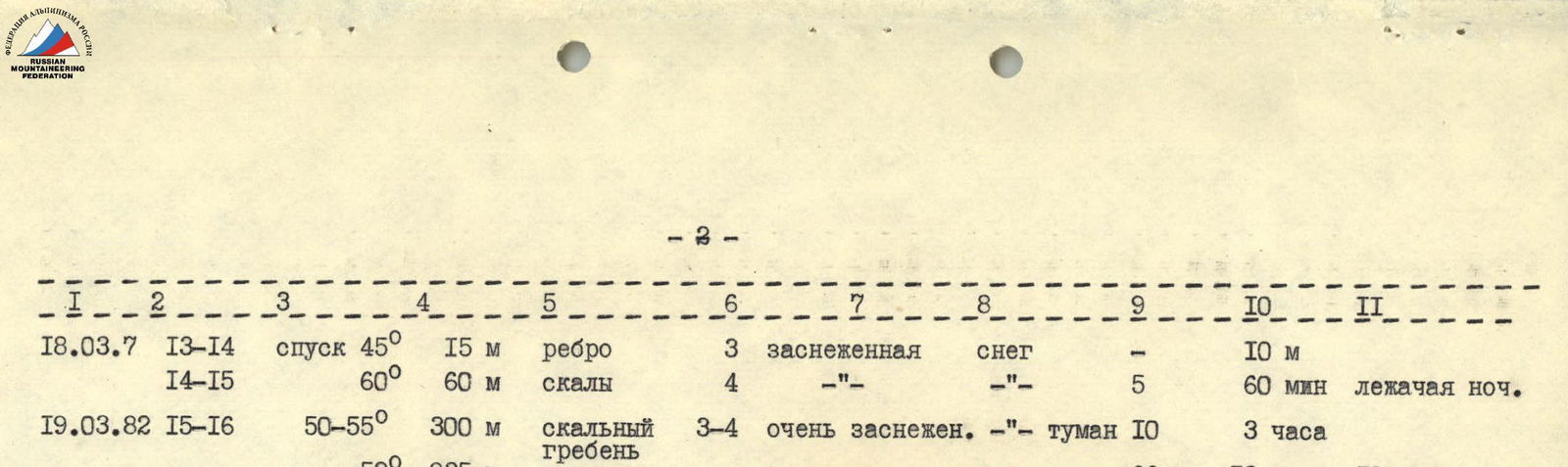
Table of Main Characteristics
Height difference — 650 m. Average steepness — 52°. Number of pitons — 66. Route length — 935 m. Climbing time — 13 hours 10 minutes.

Route Description
2 hours approach from the base camp to the route start. The route begins from the talus cone of the couloir separating North and Central towers of Trëkhglavaya, then goes rightward to the rocks of the North Tower's left buttress.
Start at 8:00 AM.
- R0–R1
- Medium-difficulty rocks, 30 m.
- 55°
- Exit to a snowy slope.
R1–R2 — up and right along a snowy, grassy slope under a sheer chimney, 15 m, 90°, difficult climbing with piton belay.
R3–R4. 25 m along broken rocks at 60° (fixed ropes), exit to a snowy ridge.
R4–R5 — 120 m, 45°, occasionally up to 50°, snowy ridge, very deep snow, 0.5–1 m. Exit under the base of a giant rock triangle.
R5–R6. 80 m, traverse left under the wall along the upper boundary of a snowfield, more snow than on the ridge, occasional rock climbing.
R6–R7. Couloir, 40 m, 55°, exit to a ledge. Snowy and icy rocks resembling "ram's foreheads".
R7–R8 — along snowy, steep, grassy, and frozen ledges:
- up 20 m,
- then left 15 m,
- up 10 m,
- right under the key section.
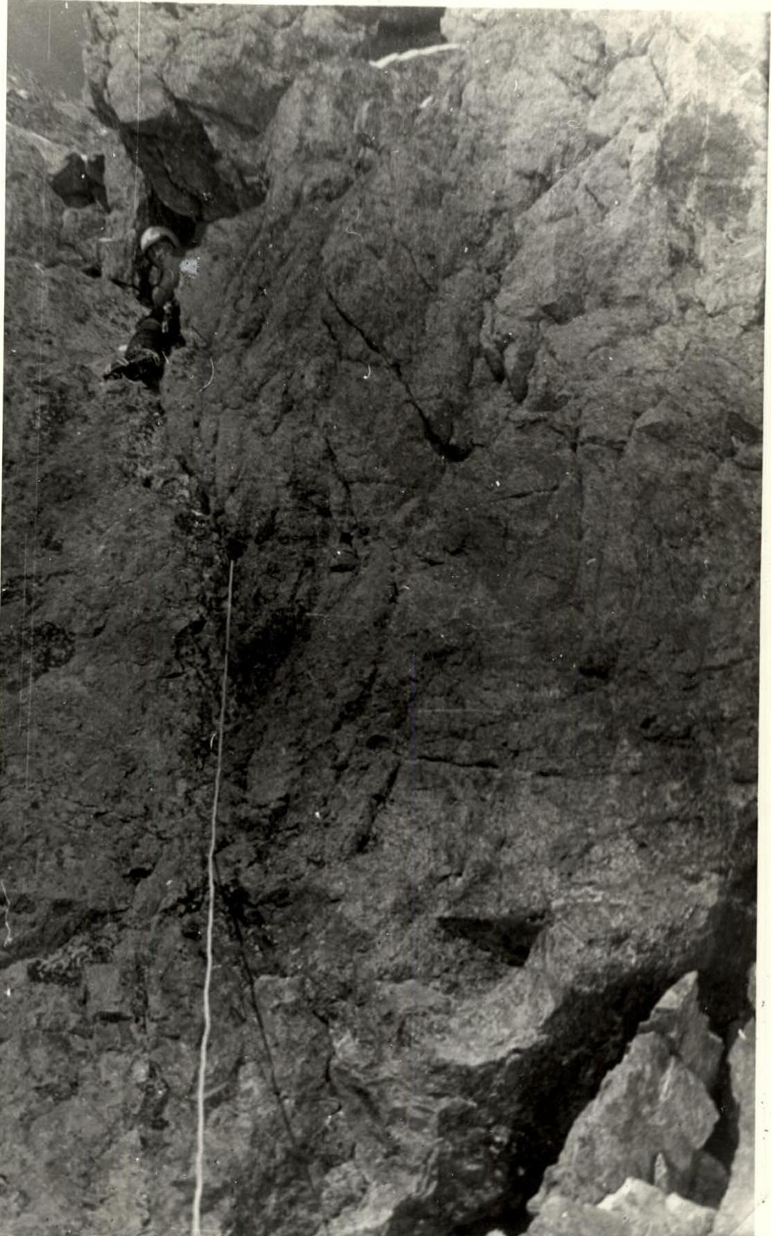
R8–R9. The ledge narrows and descends. From it, up and slightly left, 35 m, 75° along smooth rocks resembling "drums", with snow in places. Difficult climbing. Much time is spent finding places for intermediate belay points. Ladders were used when exiting to the wall. This is the most challenging section of the route. Further exit to a steep snowy ledge, very uncomfortable for rest. Overhangs on the right and left, a five-meter pitch into an inclined crack straight ahead. Under the right overhang, on a rope tied to a piton in the cornice, there is a control cairn.
R9–R10. 5 m, 90° up, good handholds.
R10–R11. 30 m, inclined crack at 75° on an almost vertical wall. Good climbing without snow.
R11–R12. 10 m, 80° snowy, broken internal corner. Exit to a ledge; traverse right of the rock triangle's summit along a ledge for 60 m — exit to the ridge behind the triangle's summit at 55°.
R13–R14. Descent into a gap, 15 m, 45° along a sharp edge.
R14–R15. 60° rocks of medium difficulty, exit to a ledge at 19:00. Overnight stay.
R15–R16. Departure from the bivouac at 10:00. Uniformly broken and heavily snowed rocky ridge with no distinct landmarks or logical path. Obstacles are generally bypassed on the right.
The path along the ridge may vary by 20 m in either direction depending on snow conditions. Ridge length is 300 m, steepness 50–55°; medium-difficulty climbing. Time to the summit is 3 hours. Summit. Descent route follows Category 2B route. From the summit to the base camp, 3 hours.
A.E. Afanasiev, L.I. Krasnukhin
Brief Description of the Approach to the Route and Sporting Characteristics of the Area
Trëkhglavaya peak is located in a spur of the Tunskinskie Gol'tsy ridge, which is a watershed between the Pravyi Bugotoy and Kyngarga gorges. The peak's height is 2511 meters above sea level. It is the most popular peak in the area. All three towers of the peak have classified routes of various categories: 1B, 2B, 3B — three routes each, and 4A — three routes. In March 1982, another first ascent was made on the "North Tower", approximately Category 4B.
The Kyngarga gorge, from which ascents to the peaks of this area are made, is the most visited by climbers and is close to a populated area.
At the exit of the gorge into the Tunka valley, there is the Arshan resort, from which it takes 3–4 hours to approach the routes on Trëkhglavaya. Most of the approach path goes through a cedar forest. The forest boundary in the Tunskinskie Gol'tsy area is generally at an altitude of 1700 m, sometimes up to 1800–1900 m above sea level. There is little snowfall. By spring, the snow cover reaches a thickness of 0.5–1 m. There are no glaciers in the area, but there are steep icings that persist until mid-June, where:
- ice training is conducted for all levels of training;
- modern ice climbing techniques are practiced;
- new ice climbing equipment is tested.