Ascent Passport
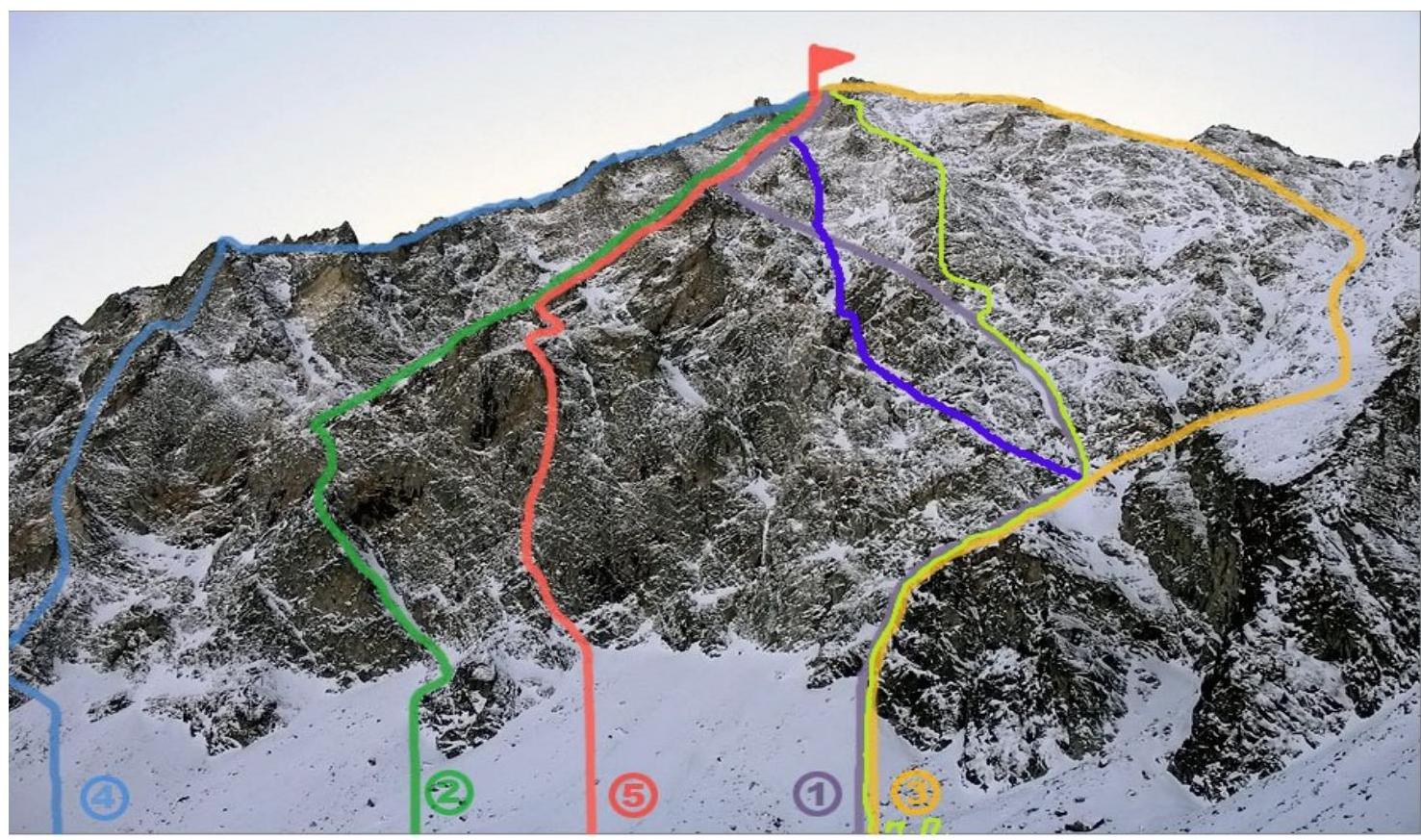
- Region — Eastern Sayan Mountains. Tunkin Goltsy;
- Peak — Trekhglaya Peak, North Peak via route: Right buttress of the North face
- Height: 2560 m.
- Category difficulty is expected, first ascent.
- Route type — combined.
- Height difference — 650 m.
Route length — 900 m. Average slope — 50°
- Number of placed cams (piton) — 20 (3).
- Team's total climbing hours — 12 h.
- No overnight stays.
- Team: Razorvin A. S. (Candidate for Master of Sports, team leader), Gulenko V. E. (2nd class), Sukhanova M. N. — (2nd class), Vinokurova E. A. — (3rd class), Zalesov K. G. (3rd class)
- Departure to and return from the route on August 30, 2012
1
Route description for the ascent to Trekhglaya Peak, North Peak via route: Right buttress of the North face, category difficulty.
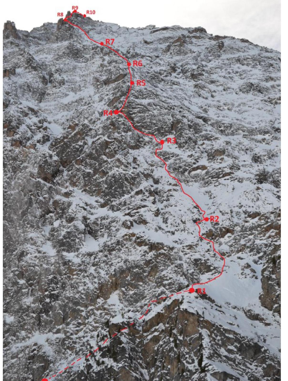
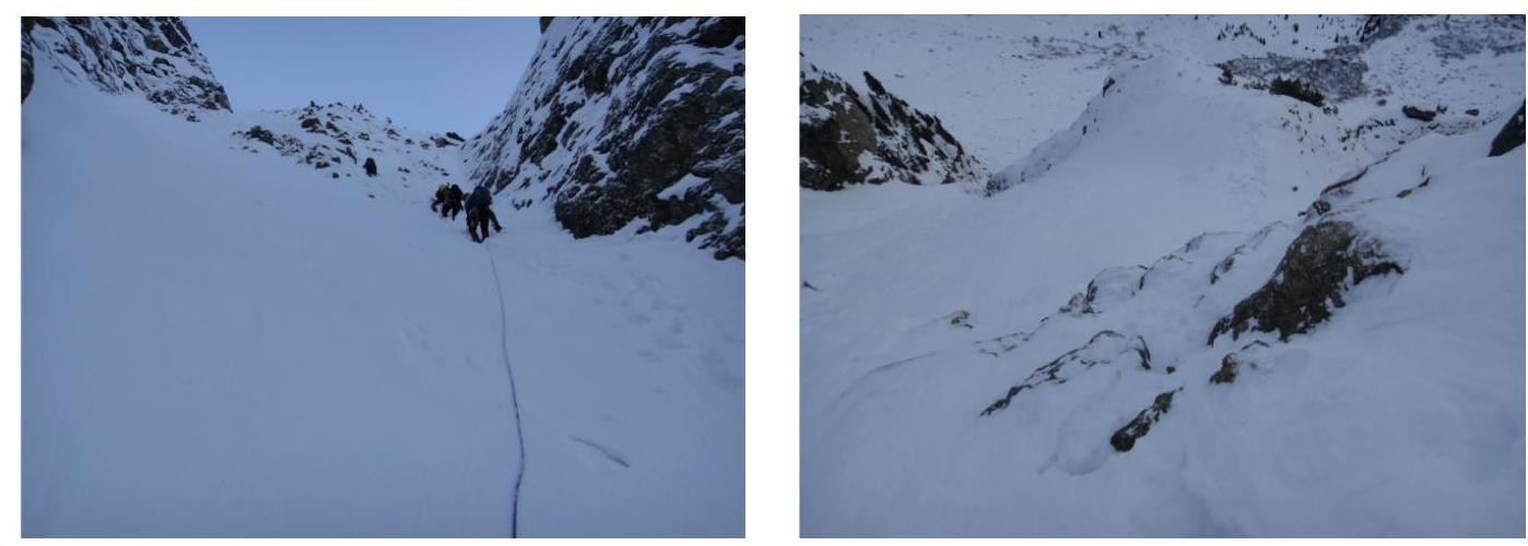
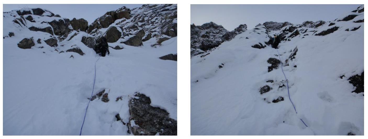
Section R0–R1:
Along the right side of the couloir. 2 ropes, 50 m each:
- First rope 40°
- Second rope 45°
Ends with a snow ledge. Simultaneous movement. 4 belay points in the right wall.
Section R1–R2:
Up 80 m along the rocky buttress at 55°, ends with a transition to the right into the couloir. Alternating belay. 2 cams placed.
Section R2–R3:
100 m ascent up the left part of the snowy couloir at 50°, with overcoming a
vertical 2x2-meter wall at 60°, bypassed on the right, then left for 20
m, followed by a narrow couloir. 2 belay points (cams) in the couloir. On the wall,
simultaneous movement, sometimes participants are chosen one by
one.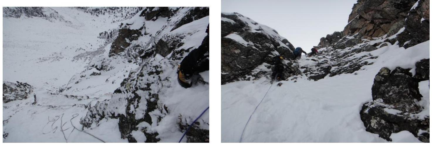
Section R3–R4:
Up along a narrow rocky groove (gully) at 55°, along a snow ledge, under a rock to the left
— transition into a snowy couloir, turning into a rocky one with a 3-meter wall at
65°. Movement along fixed ropes. During preparation, 2 cams were
placed. Section length is approximately 100 m. On the wall, 1 horizontal
piton was hammered in.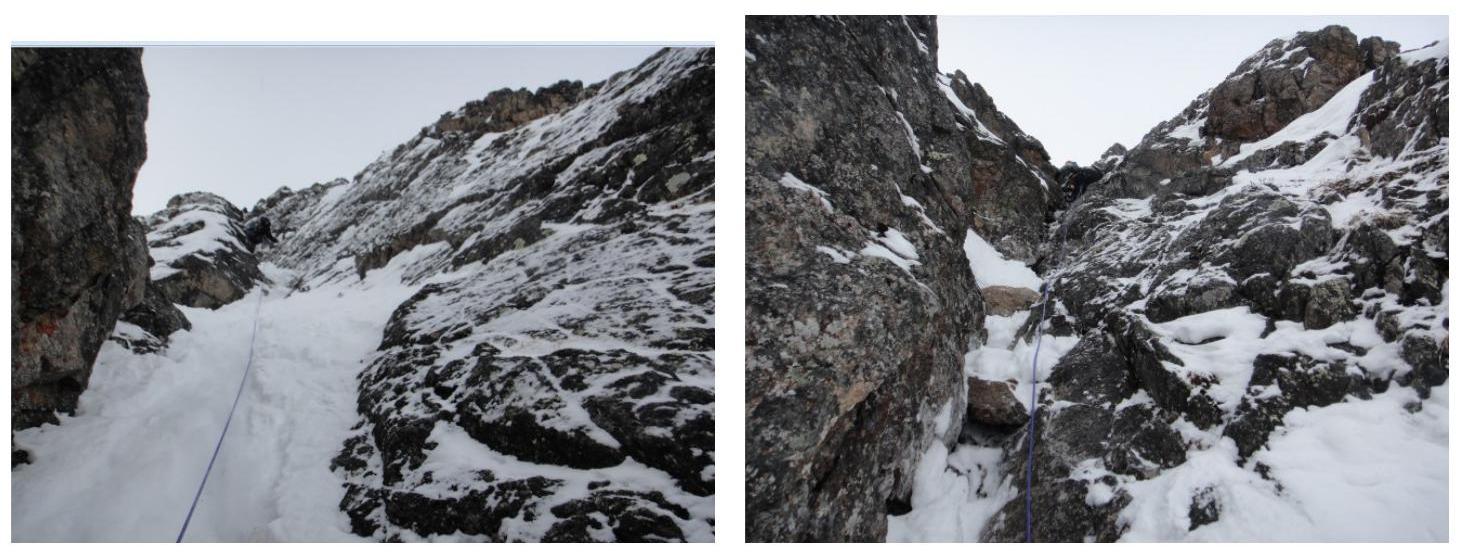
Section R4–R5:
Up at approximately 50°, sometimes 60° along a rocky gully for 80 m. Simultaneous movement, 5 cams were placed.
Section R5–R6:
Snowy areas with grassy knolls at 50°, 70 m long. Under a gundarm (rocky pinnacle) along rocky slabs with grassy knolls. Simultaneous movement. 2 anchors were hammered into knolls, 1 cam was placed.
Section R6–R7:
Along a rocky counterfort at 55–60°, up 100 m with an exit under a gundarm.
Simultaneous movement. Sometimes with alternating
belay.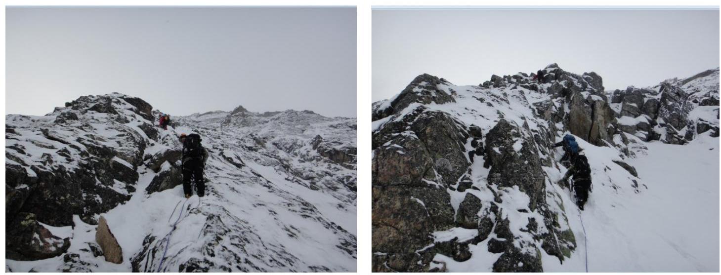
Section R7–R8:
Simultaneous movement for 120 m along snowy areas at 45°, with an exit under the
second gundarm. Further, a vertical 3-meter wall under the gundarm is bypassed
on the left. Under the gundarm, a steep slope at 55°, participants are chosen one by
one.
Section R8–R9:
Along a sharp ridge under the gundarm, which is bypassed on the right. Behind the gundarm along a
sloping crack on the left between rocks, onto the ridge through a vertical split. 2
cams in the crack. Fixed ropes were organized from the crack onto the ridge. Section slope is
65–70° and 100 m
long.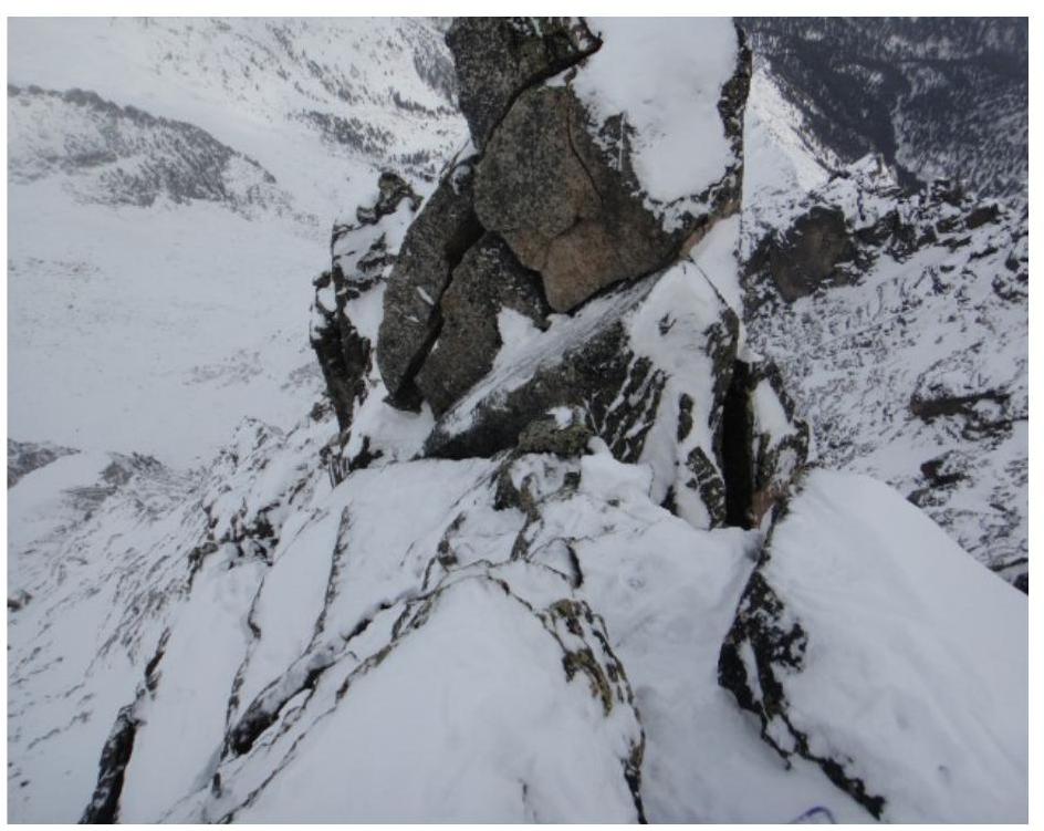
Section R9–R10:
Along the ridge for 50 m to a small gundarm, a 5-meter wall at 60°,
passed directly. 2 cams were placed on the wall. Participants are chosen one by
one. 1 rope along the ridge to the summit, simultaneous
movement.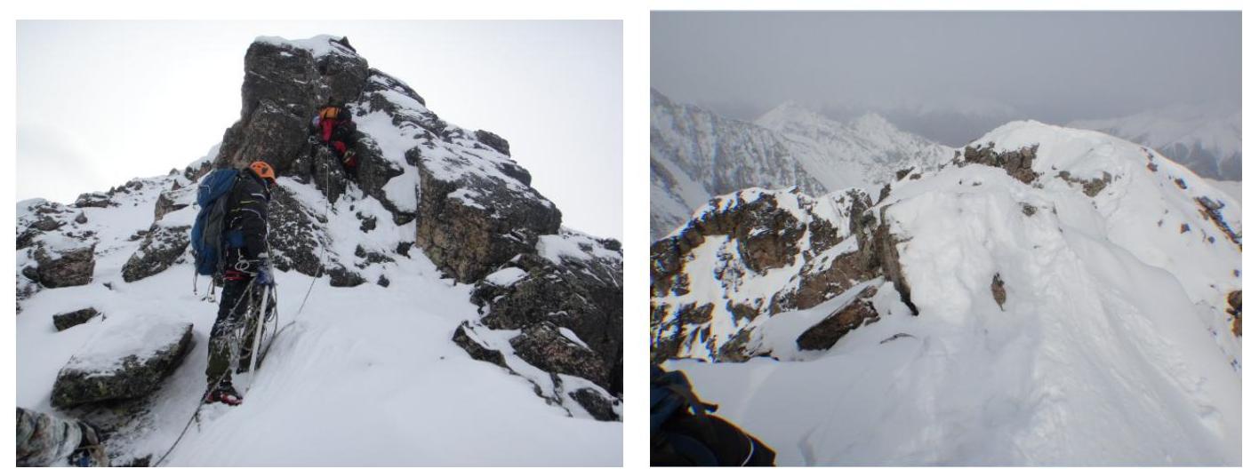
From North Peak, the further route goes through Central Peak with a descent to the saddle between Central Peak and South Peak.
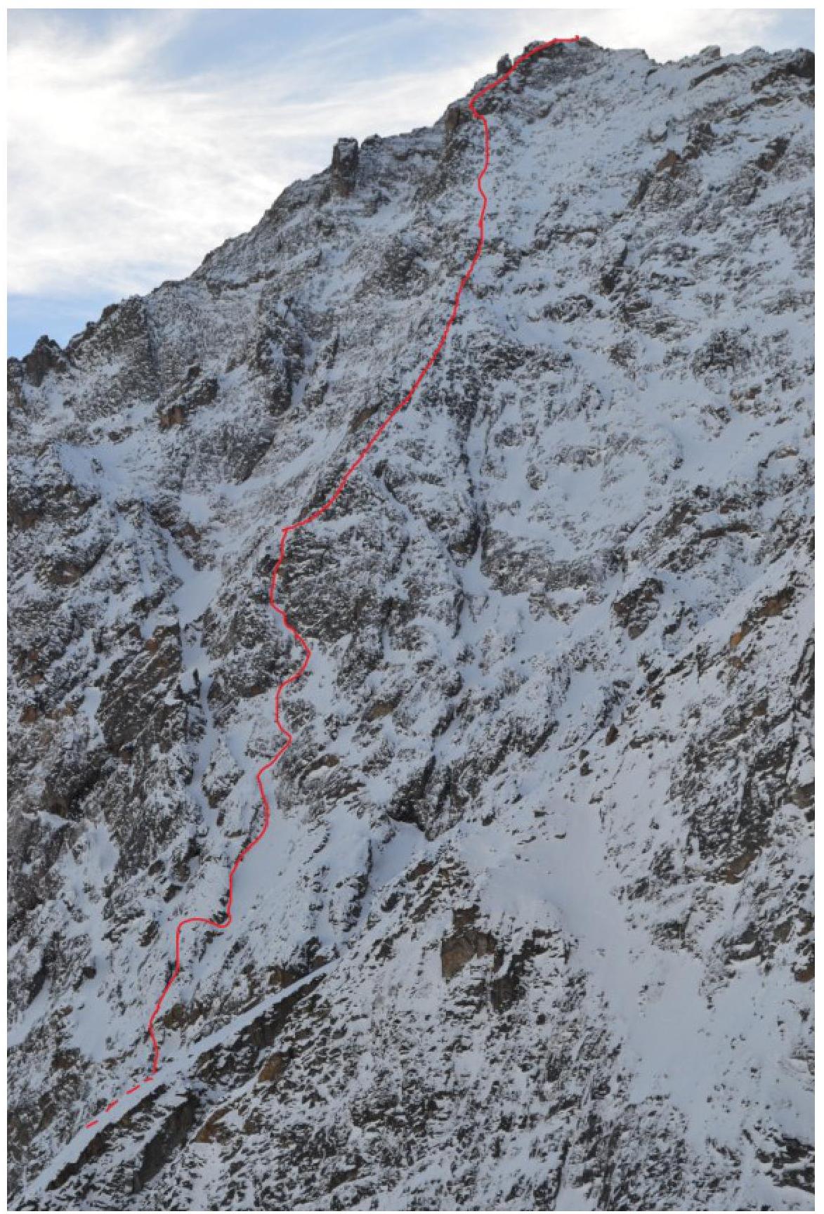
Brief route description. Sec. 0–1 100 m. 45° II Snowy couloir with an exit onto a snowy ledge.
Sec. 1–2 80 m. 55° II Rocky counterfort with a transition into the right couloir.
Sec. 2–3, 120 m, 55°, III — Snowy couloir with overcoming a steep wall. Then again into a narrow couloir.
Sec. 3–4, 100 m, 50°, II — Up along a narrow rocky groove. Transition into a couloir, then a wall at 65°.
Sec. 4–5, 80 m, 55°, III — Rocky gully. Sec. 5–6, 70 m, 50°, II — Snowy areas with grassy knolls, turning into rocky slabs.
Sec. 6–7, 100 m, 60°, III — Up along a rocky counterfort, with an exit onto a gundarm.
Sec. 7–8, 120 m, 50°, II — Snowy areas. On the ridge, a gundarm is bypassed on the left.
Sec. 8–9, 100 m, 70°, IV — Sharp ridge. Then a gundarm is bypassed on the right. Then to the left into a split between rocks. Exit onto the ridge.
Sec. 9–10, 50 m, 30°, II. Movement along the ridge with overcoming a rocky wall at 60°. Exit onto the summit.
Further descent along route 2B category difficulty with an exit into a descent couloir between Central Peak and South Peak.