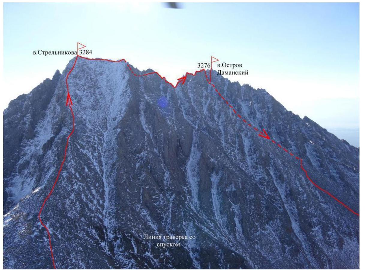
Ascent Certificate for the Strelnikov Peak 3284 m – Ostriv Damanskyi 3276 m traverse via the Western slope, category 3B.
-
Eastern Sayan, Tunkinskiye Goltsy ridge, Ganga Khairyim valley, section 6.1.2.
-
Strelnikov Peak 3284 m – Ostriv Damanskyi 3276 m traverse via the Western slope.
-
Proposed category 3B, first ascent.
-
The route is characterized by rocky terrain.
-
Elevation gain 400 m, distance 1130 m, traverse distance 0.5 km on the map, average slope — traverse.
-
27 rock and wired pitons used.
-
Team's total climbing time — 10 hours.
-
No overnight stays on the route.
-
Team members: Afanasyev A.E. Master of Sports Geydarov K.G. 2nd sports category Kovalyov A. 2nd sports category Krivosheyev K. 1st sports category Rozhin A.Yu. 2nd sports category
-
Coach Afanasyev A.E. Master of Sports
-
Summit ascent and return on September 2, 2014.
Description of the ascent route to Strelnikov Peak 3284 m – Ostriv Damanskyi 3276 m traverse via the Western slope, category 3B.
Approach along the Ganga-Khairyim valley, following the main stream directly north. At the stream's source, on the left (orographic) slope with a western exposure, there are 6 glacial patches, remnants of a relict glacier. The first three lenses along the path are small, with the fifth being the largest, measuring up to 20 meters. Further to the right, a gentle, shallow talus slope leads to the Irkutyanin pass, with a GPS elevation of 2918 m. From the base camp above the Biryuzovoye Lake Ganga, it takes 2 hours to reach the pass. The route begins at the pass. Along the western slope of Strelnikov Peak, to the right of the ridge, the path to the summit is relatively straightforward, corresponding to a low category 1B in summer and becoming hazardous with snow cover. This route is frequently used by tourists ascending the peak from the Irkutyanin pass.
The peak is named after Hero of the Soviet Union Senior Lieutenant Strelnikov, who perished on Damansky Island in 1969. The name was given by an Irkutsk group led by M. Tarakanov on May 1, 1969 (V. Bryansky "Kray Okrylennый").
On the summit, a cairn was found, but no triangulation marker was observed. A note from Irkutsk tourists who visited in 2012, commemorating the seven-time Olympic gymnastics champion Oxana Kostina, was retrieved.
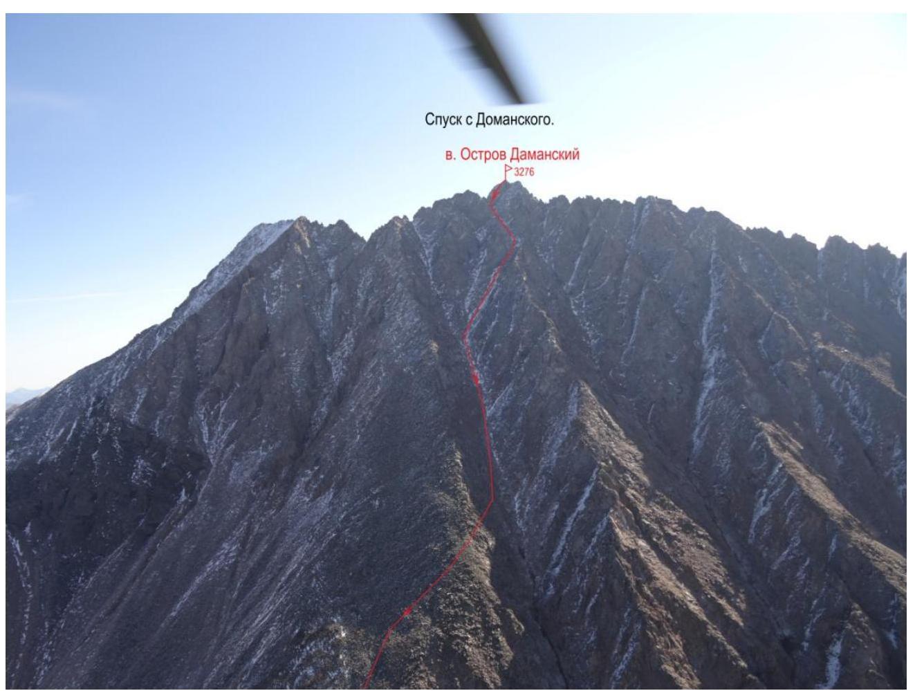
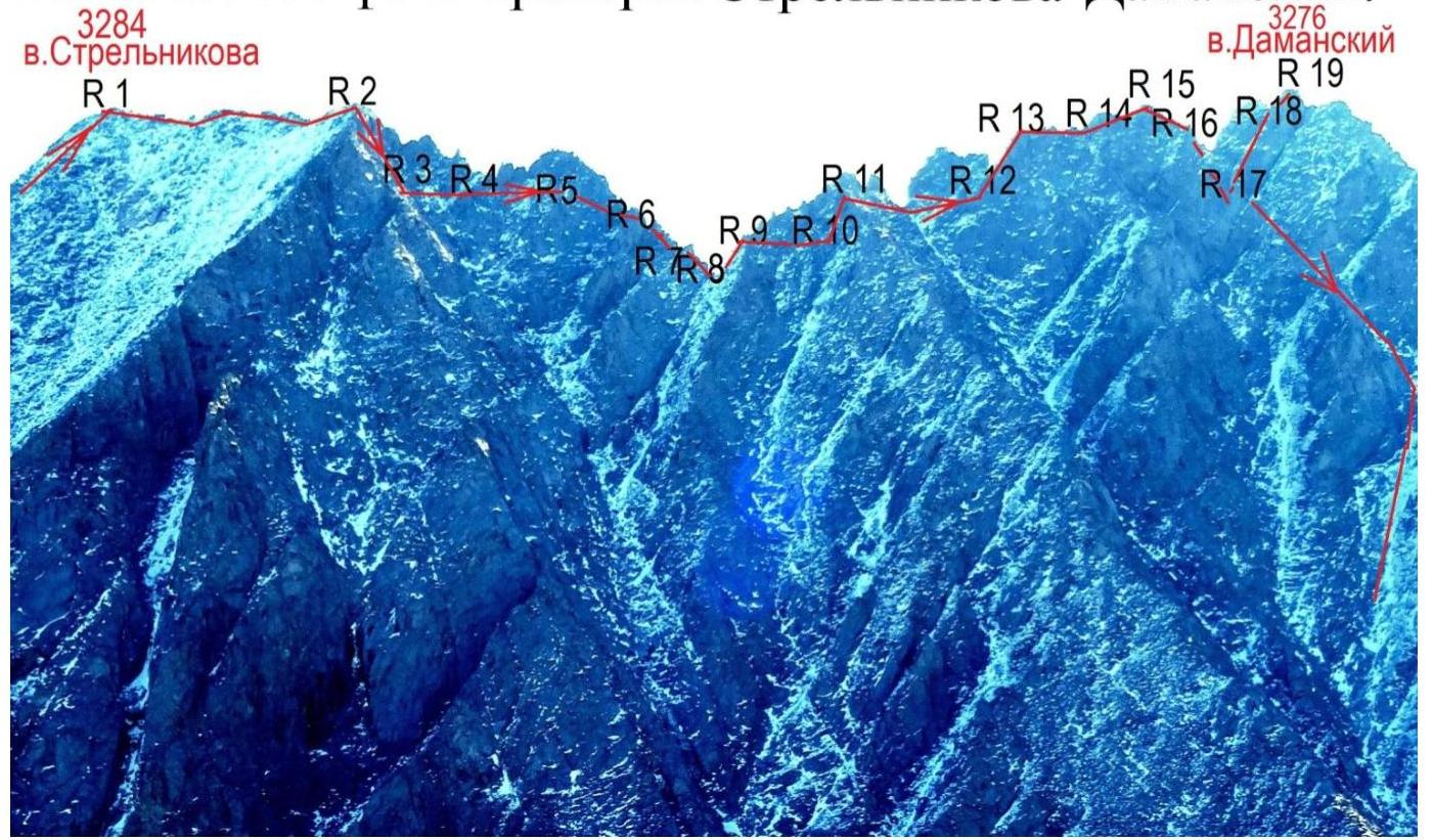
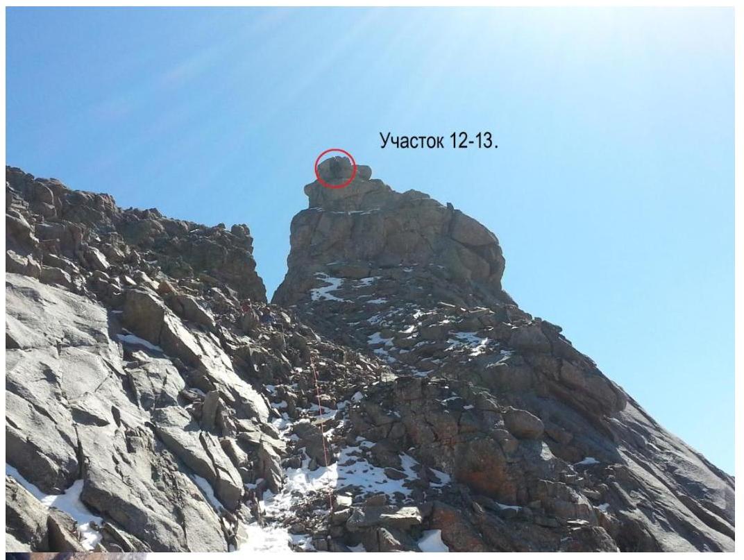
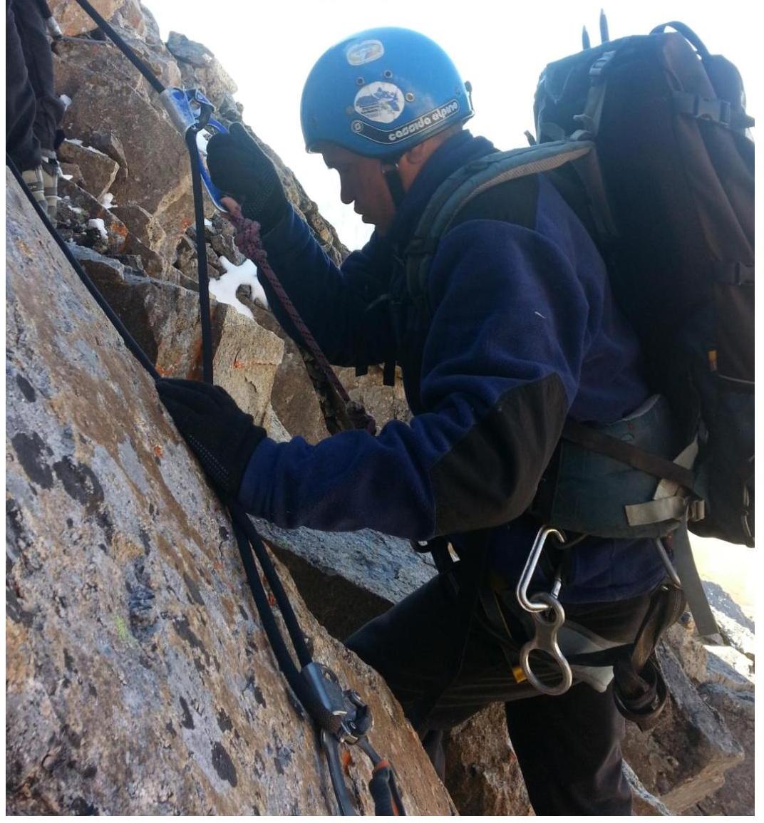
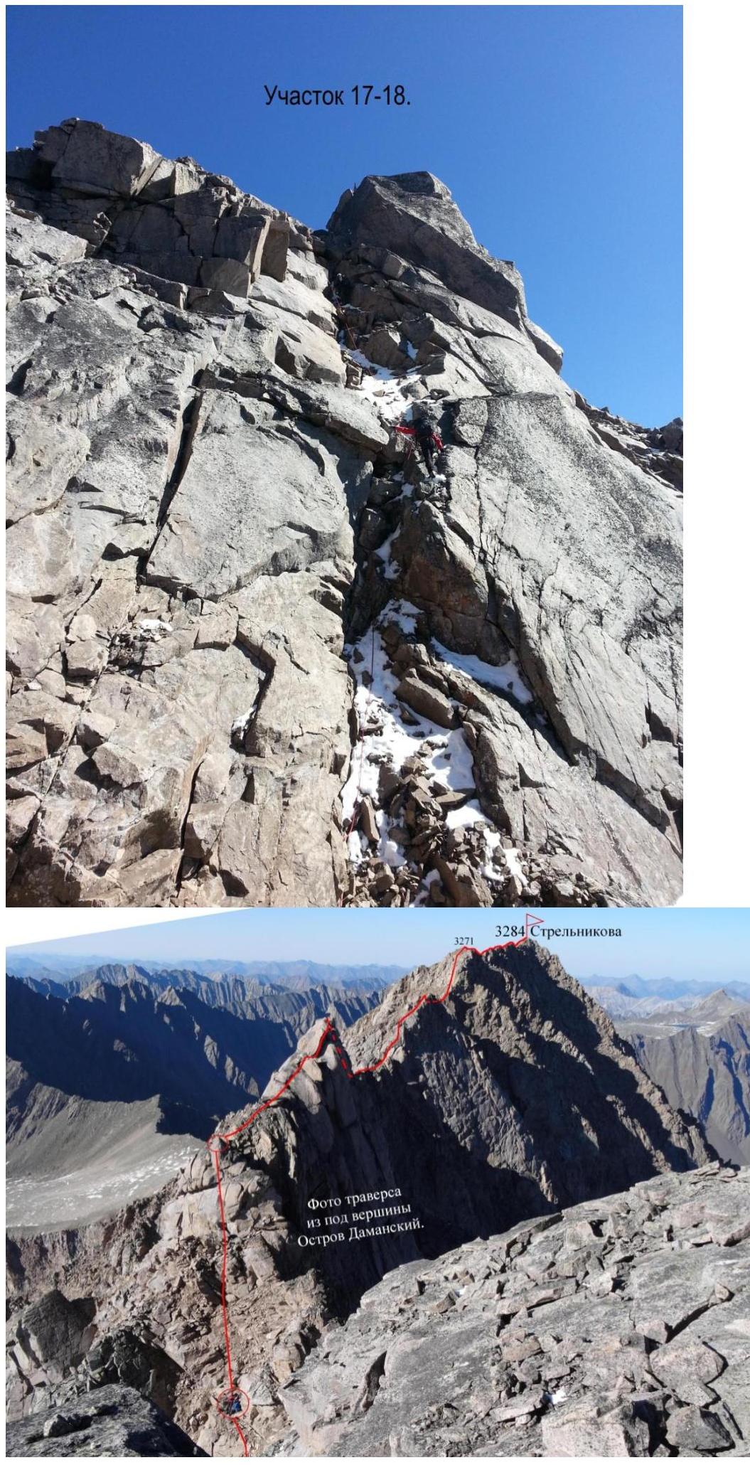
Section R0–R1 500 m, 40°–45°, 1–, 1+. Along the live rocky slope to the right of the ridge up to Strelnikov Peak. Elevation 3284 m on the map, 3279 m according to GPS. Section R1–R2 70 m, 1+. Along the ridge southward, slightly downward to a saddle and 10 m upward to a gendarme 3271 m. The first group descended from here via the ascent path. Section R2–R3 40 m, 4–. Rappelling: descent from the gendarme using a rope. The first 5 meters involve a degraded slope, followed by a vertical drop. Section R3–R4 60 m, 2+. Traverse to the right of the ridge along degraded rocks with a slope of 50°. Piton protection used. Section R4–R5 40 m, 4–. Traverse with a descent through a loop. Section R5–R6 12 m, 80°, 3+. Wall with large holds. Section R6–R7 30 m, 4–. Rappelling over an overhang. Section R7–R8 10 m, 2+. Descent along the ridge at 40° to a saddle. Section R8–R9 15 m, 50°, 2–. Along the ridge. Section R9–R10 35 m, 60°, 4+. Traverse to the right of the ridge along a wall. Section R10–R11 15 m, 50°, 3–. Upward to the right along the wall. Section R11–R12 90 m, 40°, 2–. Traverse along the slope. Section R12–R13 30 m, 70°, 4+. Large-block wall on the gendarme ridge. Section R13–R14 30 m, 0°, 2+. Horizontal ridge. Section R14–R15 50 m, 75°, 4+. To the right of the ridge along rocks with a slight ascent. Exit onto the large gendarme summit. Section R15–R16 15 m, 30°, 2+. Descent along the slope. Section R16–R17 35 m, 75°, 4–. Rappelling along rocks to a rocky ledge to the right of the ridge. Section R17–R18 50 m, 65°, 3+. Fracture in the slabs to the right of the ridge. Exit onto a saddle before the summit tower. Piton protection used. Section R18–R19 18 m, 80°, 5–. Icy wall transitioning into a cleft. Exit onto the summit of Ostriv Damanskyi 3276 m. The summit consists of a heap of precariously balanced blocks, causing some psychological discomfort. No cairn or signs of previous human presence were found. A new cairn was built on the highest block's platform. A note was left in a plastic vitamin container. The name honors the heroes who fulfilled their duty during the conflict on Damansky Island in March 1969. The Strelnikov–Damansky massif is extremely degraded. Traversing requires careful action during climbing and descents.
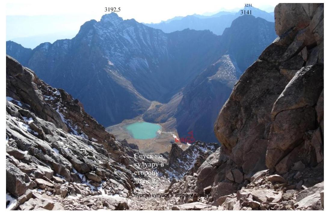
Descent followed the ascent path until section R17, then rappelling. Further descent involved 2 sports routes down the southwest couloir, transitioning into the west couloir, followed by 3 more sports descents. Then, on foot and with easy scrambling down the west couloir to the slabs before the drop-offs, followed by a traverse to the right along the rocks on the right slope — transitioning onto a gentle talus slope. And down the talus slope to the mossy cushions in the stream's floodplain. From the descent point in the valley, it takes 30 minutes to reach the base camp.


Technical photo of the Strelnikov–Damansky traverse.
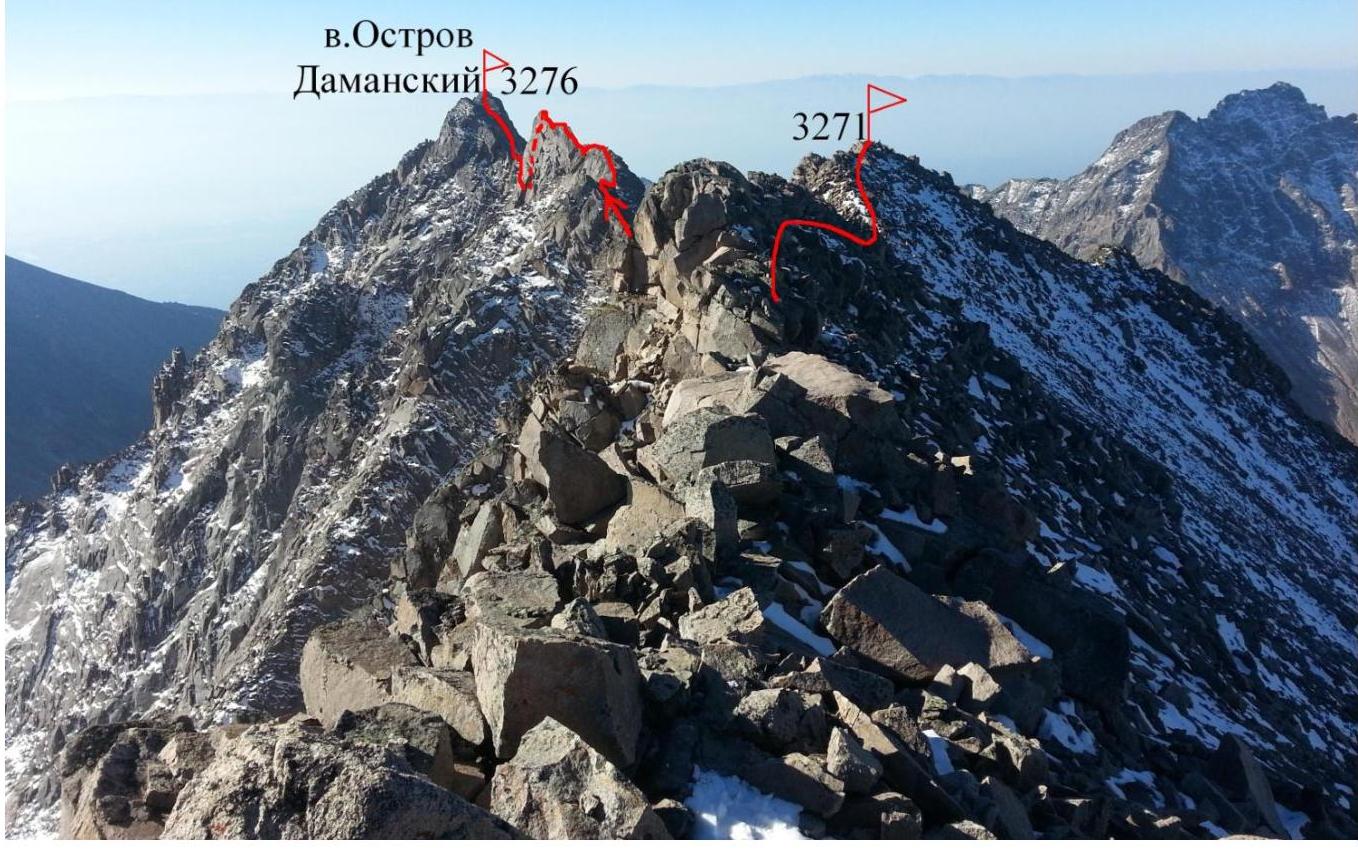
View of the traverse from Strelnikov Peak
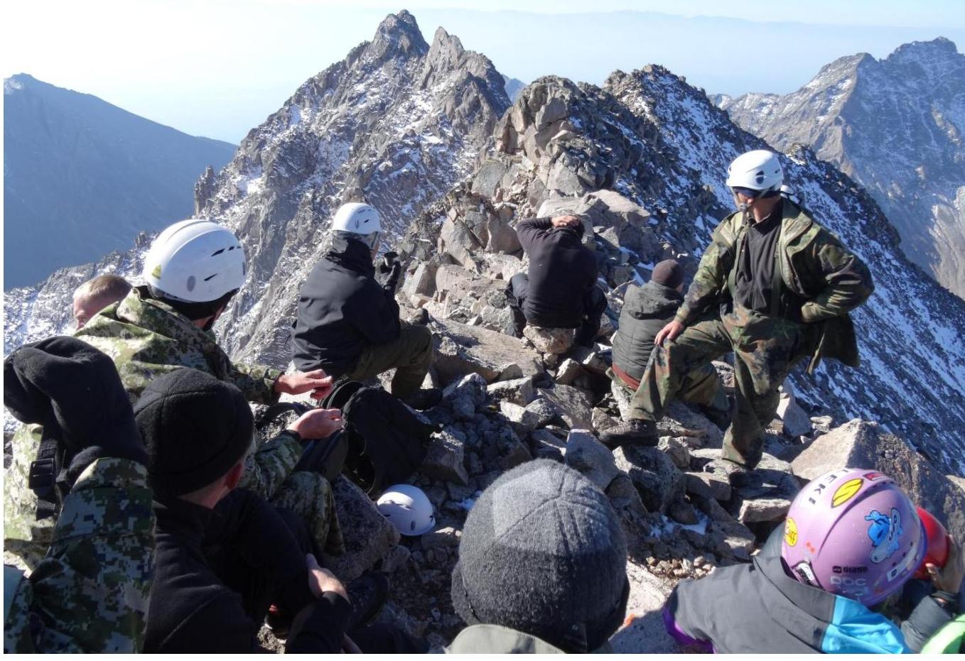
On Strelnikov Peak. Beginning of the traverse.
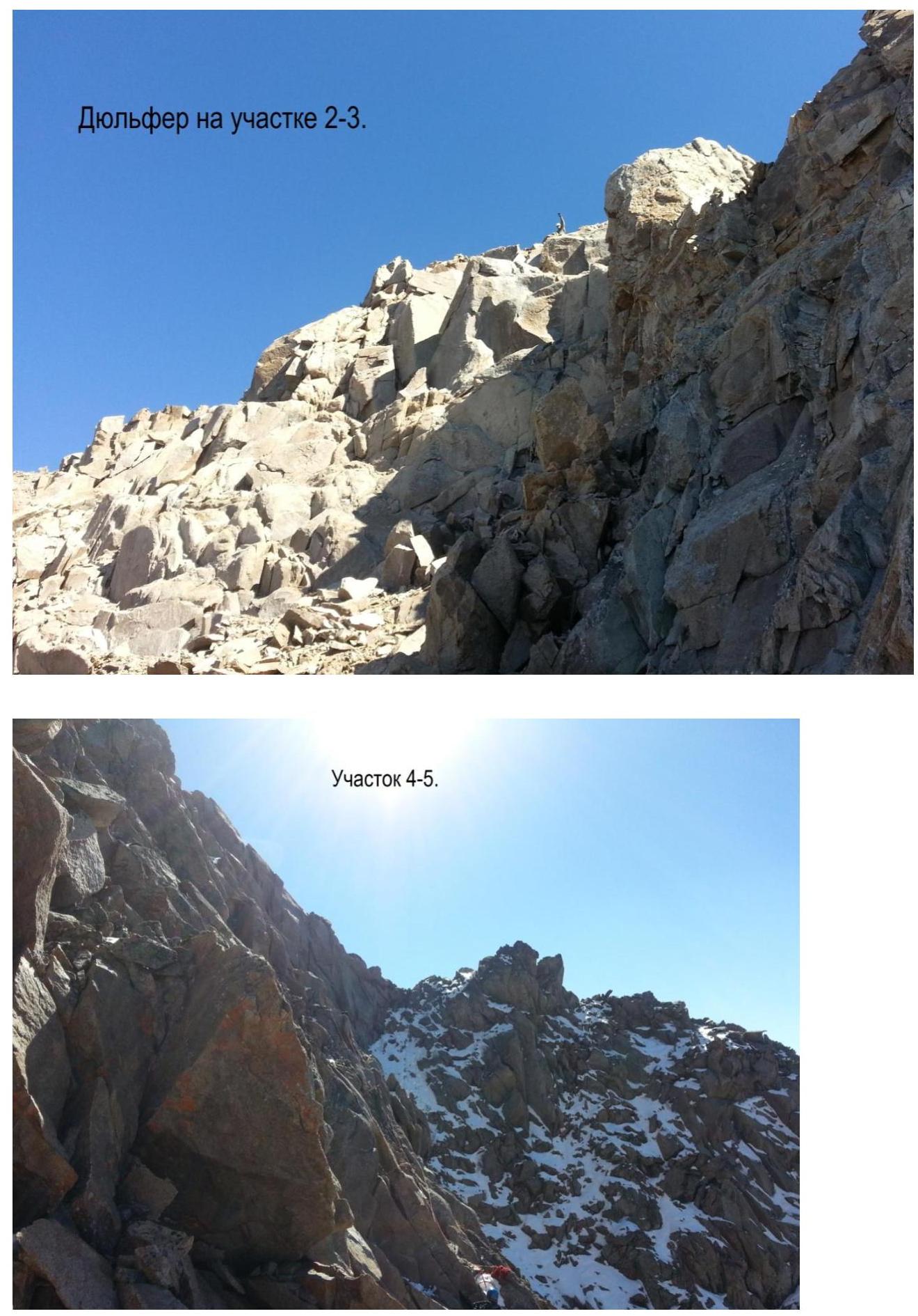
Section R4–R5.

Section R6–R7.

Section R10–R11.
Section R14–R15.
 Section R17–R18.
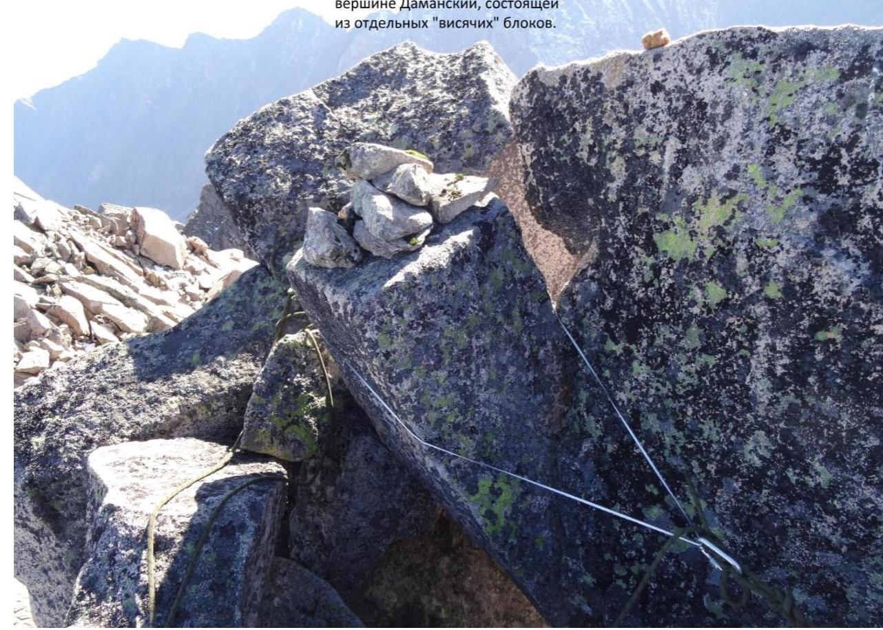
 Cairn and rappel sling on the summit of Damansky, composed of separate 'hanging' blocks.