Sheet 1
Passport
-
Technical category
-
East Sayan, Tunkinskiye Goltsy ridge, Barun-Khandagai gorge
-
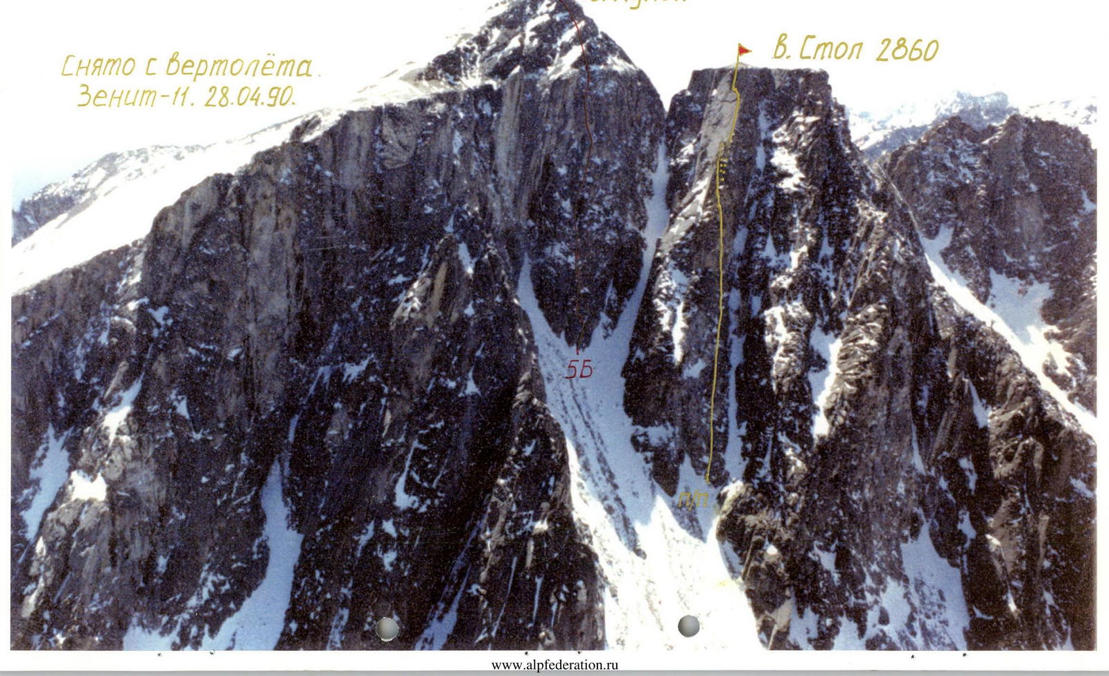
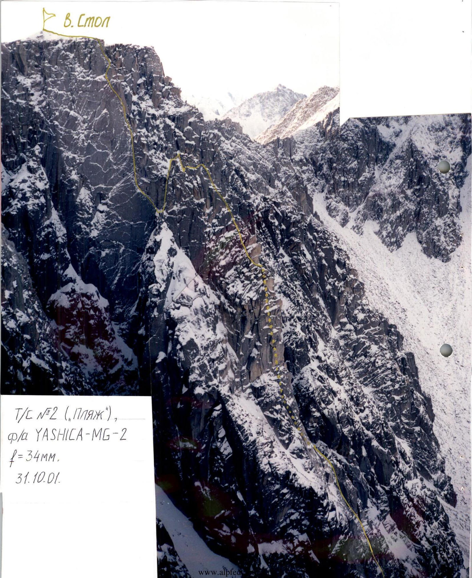
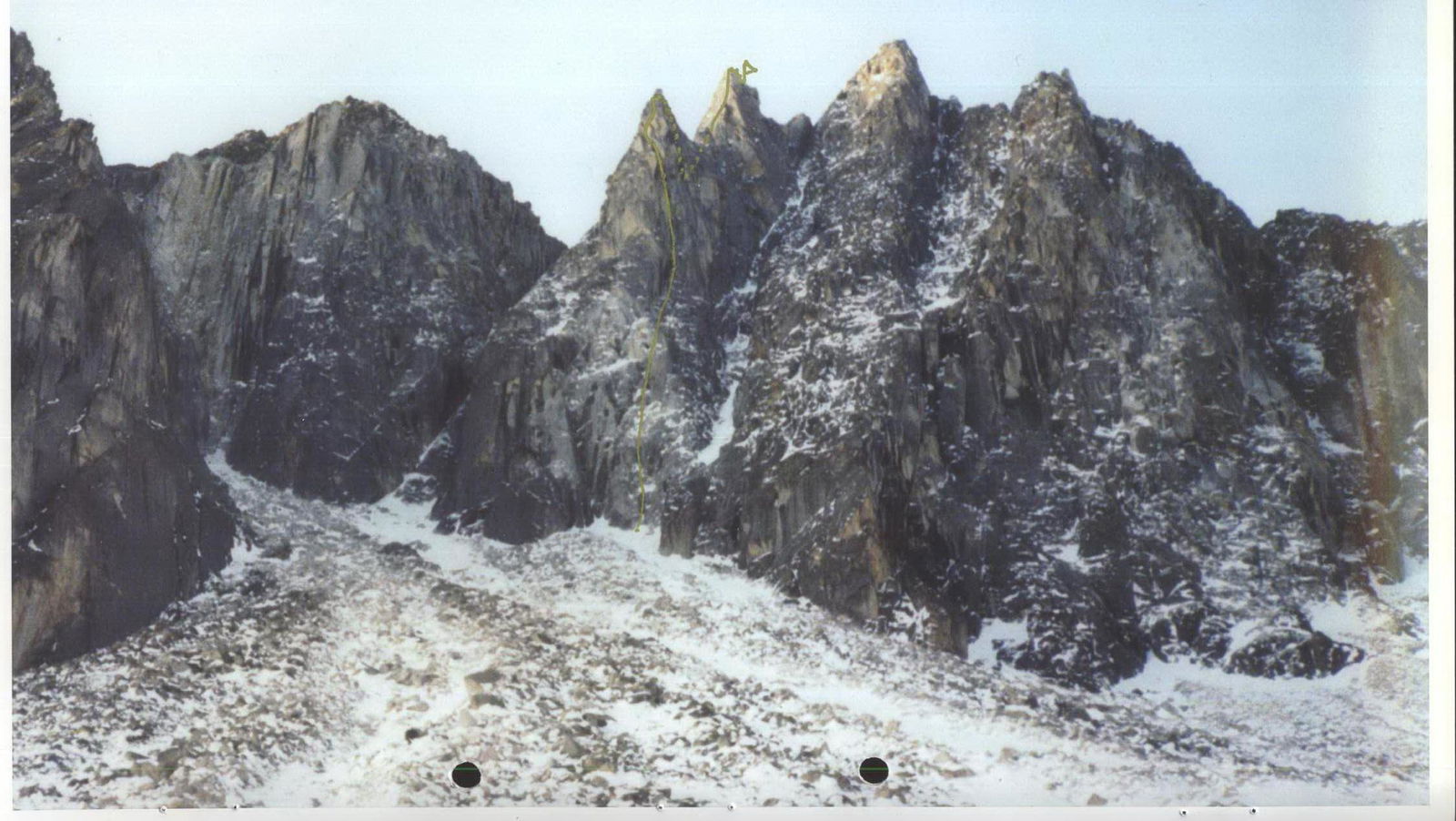
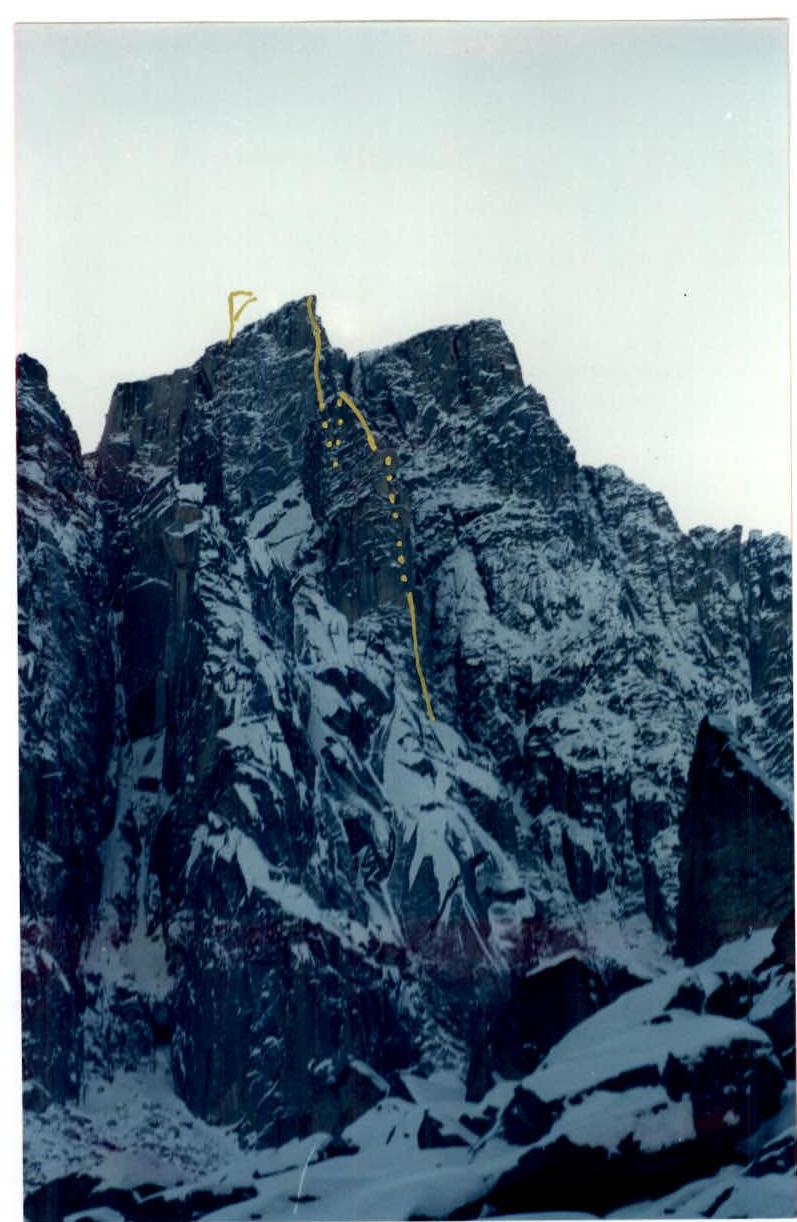
V. Stol, via the left buttress of the NE wall
-
Proposed 6A category. First ascent
-
Height difference — 460 m, length 700 m, sections with 6th category difficulty — 141 m, average steepness — 75°.
-
Pitons left on the route: 10 bolted, 2 "carrots", 1 "box", 3 stoppers.
-
Team's climbing hours: 77, days: 3 — preparation, 4 — ascent.
-
Overnights — 3 on snow ledges in a tent.
-
Leader Afanasiev Andrei Evgenevich MS
Participants:
- Bragin Eduard Viktorovich 1st sports category
- Trofimov Evgeny Yuryevich 1st sports category
- Khandazhapov Bair Alexandrovich 1st sports category
-
Coach Afanasiev A.E.
-
Preliminary preparation 23–26 October 2001. Departure on the route 27 October 2001. Summit 30 October 2001.
-
Organization SCA SibVO Irkutsk
General View Photo
Taken from a helicopter. "Zenit-11". 28 April 1990 5Б
Sheet 2
Right Wall Profile Photo
T/c №1, camera "Zenit-11", lens "Helios-44M-4", 2/58. 21 October 2001.

Sheet 2 (reverse)
Left Wall Profile Photo
T/c №2 ("Beach"), camera "YASHICA-MG-2", f=34 mm. 31 October 2001.
Sheet 3
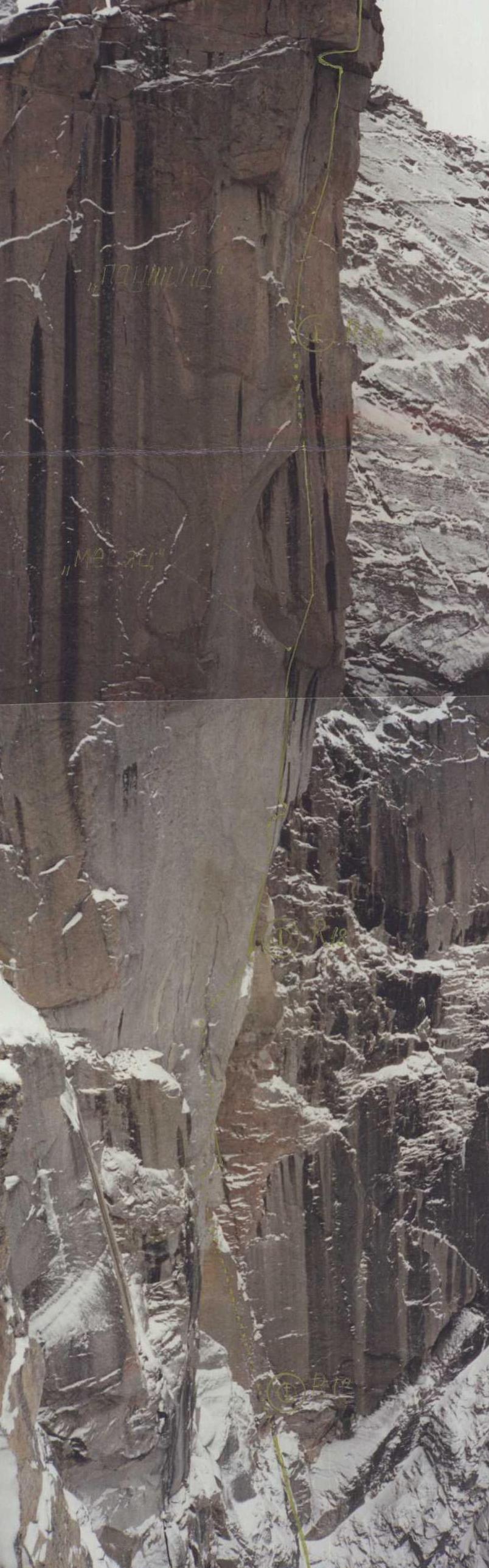
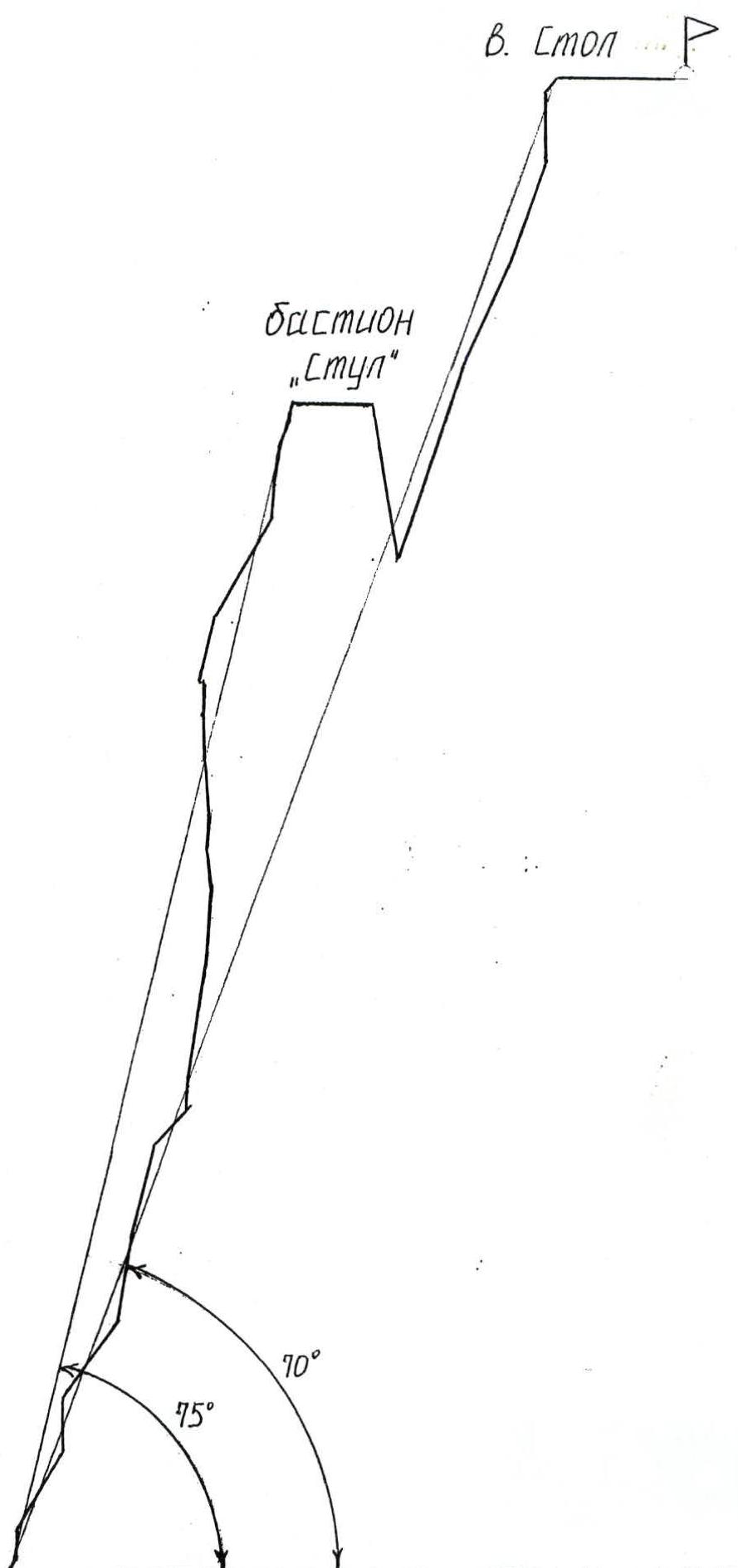
Route Profile Drawing M 1:2000
Sheet 3 (reverse)
Area Map

Sheet 5
Overview of the Climbing Area
V. Stol is located in the southern spur of the Tunkinskiye Goltsy ridge, between the Tunka and Barun-Khandagai gorges, near v. Kupol. The NE wall of v. Stol, the N wall of v. Kupol, and the N-facing walls of the NE shoulder of v. Kupol — "Beach" form a single ensemble and have potentially at least 10 independent routes of 5B–6A category. On v. Kupol, there is one classified route of 5B category.
The Barun-Khandagai gorge was first explored by climbers from the neighboring Zun-Khandagai gorge in the 1970s: v. Neftekhimik — 5A category, v. Barun — 3B category.
In the early 1990s, the former "Vityaz" club built a stationary camp in the tundra zone, consisting of 4 houses. Currently, only one remains intact. The "Vityazi" team made around 20 first ascents and first climbs in the area, named many peaks, and described routes, but did not classify any of their routes.
In the late 1990s, with the sponsorship of a private individual, A. Frolov, leading rock climbers from Irkutsk built a hut in the "Alaska" circus and developed several rock climbing routes. The routes were bolted using rappel techniques, typically on the lower parts of monolithic bastions, and largely do not coincide with potential mountaineering routes.
Also, rock climbers:
- improved and marked the trail from the road to Shmarik's winter quarters, which can be reached in one day with a medium-sized backpack;
- based their team in this winter quarters;
- the approach from the winter quarters to the start of the route takes one hour.
List of objects:
- NE wall of v. Stol
- N wall of v. Kupol
- N-facing walls of the NE shoulder of v. Kupol — "Beach"
On v. Kupol, there is one classified route of 5B category.
Panorama of the area
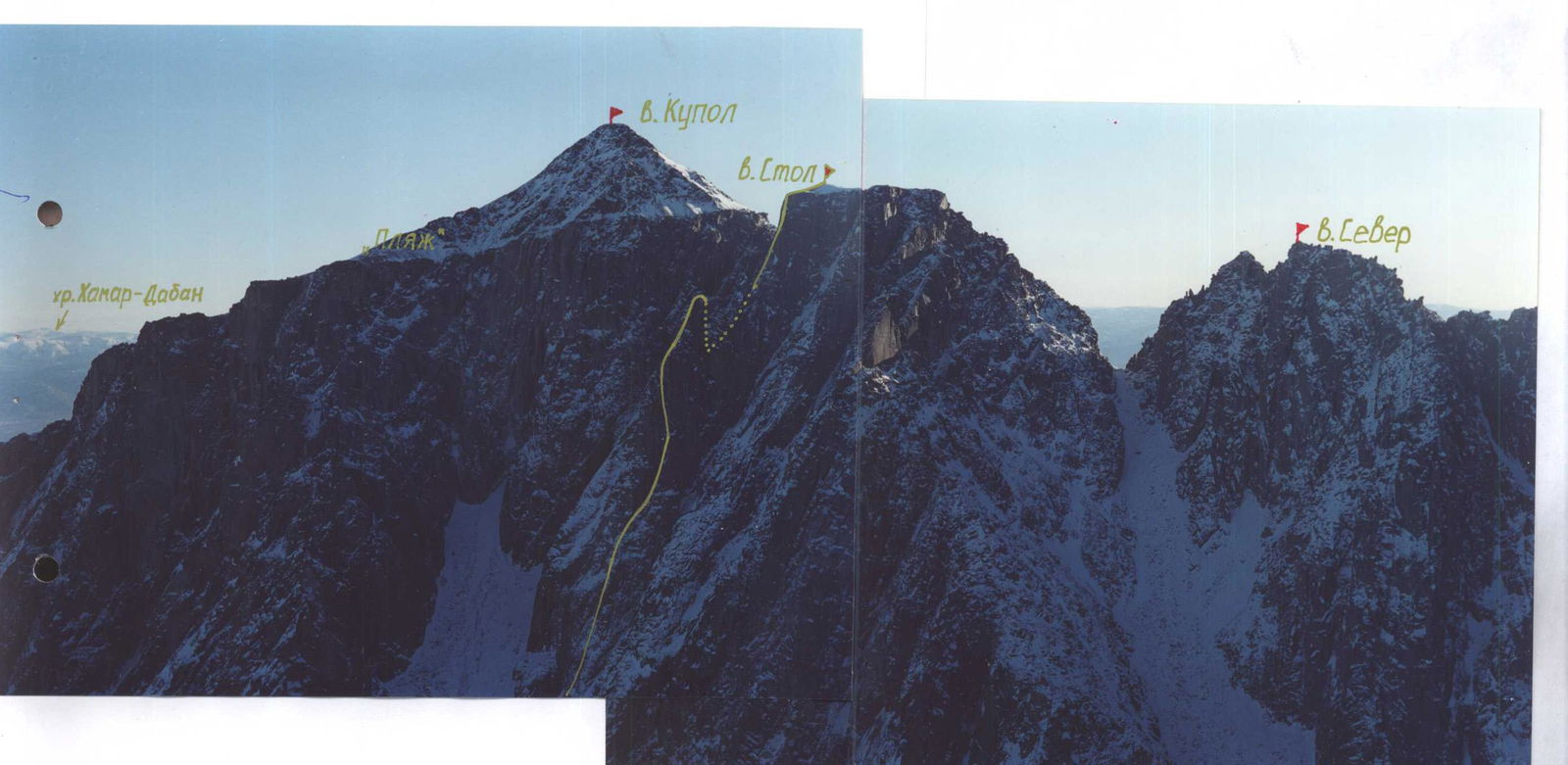
Shooting point №1 (v. Neftekhimik) camera "YASHICA" f=34 mm 21 October 2001.
Photo of the route from below. T/c №3, camera "Zenit-11", lens "Helios-44M-4", 2/58. 28 February 2001.
Sheet 7
Tactical Actions of the Team
During the ascent, the team adhered to the planned tactical plan, which was developed based on a specific reconnaissance in February 2001 and after plotting the intended route on a photograph. The route was conditionally divided into 5 sections:
- approach to the bastion wall via fractures
- bastion wall
- bastion ridge
- transition from the bastion to the main wall
- main wall of the summit
The "Gendarme", also known as the bastion, received the working name "Chair". The most problematic section was deemed to be R4, as the ridge of the saddle appeared monolithic and sharp on the photo; it was decided to rappel into the left side to a ledge and then ascend the wall of the main massif. The most rockfall-prone section was considered to be R1: it was planned to process and maximally clear it of "live" stones. The key section was R2: the bastion wall.
Over three full days of preparation, 6.5 ropes were climbed. The first 4 ropes of 40 m were ultimately dropped to the support team. 4 ropes of 50 m were taken on the route.
All known techniques and tools were used for the ascent. In addition to rock protection and pitons, ice "carrots" (for frozen ground and destroyed cracks), axes, skyhooks, and pitons, as well as ice screws (for "blind" cracks and rime ice) and angle pitons were used.
On the route, the following were hammered and left:
- 10 bolted pitons 8 mm in diameter:
- 2 on section R13–R14
- 2 on section R17–R18
- 1 on section R29
- 4 on section R31–R32
- 1 on section R35
- 1 "box" and 1 "carrot" on section R15–R16
- 2 stoppers, 1 "carrot" on section R19
- 1 stopper on section R31
- 1 loop made from the main rope on section R27 (rappel)
- 3 loops made from cordelette on sections R20, R28, R31 (for pendulum swings on the belay)
On section R26–R27, the last climber descended through a rock outcrop without leaving a loop.
Each team member took turns leading:
- sections R0–R8 — Bragin
- sections R8–R13 — Trofimov
- sections R13–R17 — Khandazhapov
- sections R17–R20 — Afanasiev
- sections R20–R27 — Bragin
- sections R27–R30 — Khandazhapov
- sections R30–R31 — Trofimov
- sections R31–R32 — Bragin
- sections R32–R38 — Khandazhapov
Overnights were in a reclining position in tents on uncomfortable ledges. The team planned to spend 4 days on the ascent (not counting preparation), so on 30 October, they had to finish the route under moonlight and with headlamps. The last participant reached the summit at 23:43. The team did not encounter any tactical issues during the ascent.
Sheet 8
Route Diagram in UIAA Symbols

Sheet 9
Route Description by Sections
V. Stol via the left buttress of the NE wall, through the bastion "Chair"
The route begins to the right of the internal angle with rime ice in the lower right part of the N side of the buttress.
Sections. Characteristics of the sections.
| Sections | Characteristics of the sections | Description |
|---|---|---|
| R0–R1 | 5 m, 55°, II- | Approach to the wall. |
| R1–R2 | 8 m, 90°, V- | Wall is passed on the right. |
| R2–R3 | 30 m, 60°, III+ | Destroyed rocks, rime ice. |
| R3–R4 | 15 m, 90°, V- | Chimney with ice. |
| R4–R5 | 30 m, 55°, III- | Destroyed snow-covered rocks of the fracture between the wall of the buttress on the left and the block of the outcrop on the right. |
| R5–R6 | 25 m, 80°, V- | Slab, ice. |
| R6–R7 | 30 m, 75°, IV+ | Series of snow-covered internal corners. Exit to the bend near the top of the outcrop. |
| R7–R8 | 15 m, 45°, I | Ledge behind the outcrop along the wall to the left upwards to the right. End of the 4th rope. |
| R8–R9 | 7 m, 85°, V+ | Wall. Passed under the overhang on the right. At the exit, "live" stones!!! |
| R9–R10 | 40 m, 80°, IV+ | Fracture — a series of snow-covered cracks among the monolith, passing upwards to the right. |
| R10–R11 | 20 m, 85°, V- | Beginning of the "Chair" wall, a system of internal corners. |
| R11–R12 | 10 m, 95°, V+, A1 | Overhanging crack to the right. Passed using ice screws. |
| R12–R13 | 15 m, 85°, V- | Triple crack with ledges. |
| R13–R14 | 15 m, 95°, VI, A4, e | Internal corner. In the corner — a wide crack and to the right a narrow chimney, converging after 8 m, transformed into a chimney passable in wedges — "pliers". The beginning of the section is passed along the crack using wide protection (tubes, hexes). On the left slab, 2 bolted pitons are hammered. A control cairn is hung on the lower one in a tin can. |
| R14–R15 | 15 m, 90°, VI, A4 | Internal corner, narrow crack. Exit to a small ledge of "live" stones. |
| R15–R16 | 5 m, 85°, V+, A2 | Wide fracture with "live" stones. |
| R16–R17 | 5 m, 95°, VI, A2 | Overhanging chimney. End of preliminary preparation. |
| R17–R18 | 2 m, 100°, VI, A2, e | Stepped cornice with a 1 m overhang. Transition to the left along the overhanging slab on "cliffs". Entry into the "vice". Key to the route. |
| R18–R19 | 5 m, 75°, VI, A1, e | Pendulum swing to the left over the cornice on a bolted piton. |
| R19–R20 | 20 m, 75–80°, VI, A4 | Slab, passed along vertical cracks on the left side. At the top of the left crack — hanging "live" stones. Pendulum swing into the right crack of the "vice" — 3 m. Exit to the ridge of the "Chair". Ledge for overnight stay — 8 m down behind the ridge. 1st overnight. |
| R20–R21 | 35 m, 60°, IV+ | Series of walls, ledges along the ridge. Good balcony for overnight stay. |
| R21–R22 | 10 m, 85°, VI, A4 | Crack with a small ledge in the middle, 3 m to the left of the edge of the ridge. Exit to the ledge. |
| R22–R23 | 12 m, 85°, VI, A4 | "Integral" crack. Exit to a balcony convenient for overnight stay. |
| R23–R24 | 7 m, 65°, V+, A3 | Gentle mirror, to the right — middle crack, ledge. |
| R24–R25 | 3 m, 70°, V-, A1 | Crack is passed on "fifis". |
| R25–R26 | 4 m, 75°, V-, A1 | After the ledge — a flake to the right of the ridge. Exit through the ridge to a ledge to the left of the ridge. |
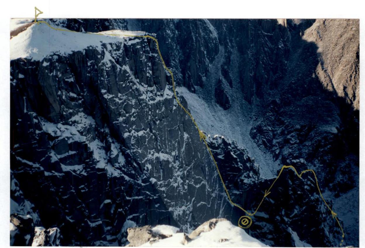
| R26–R27 | 25 m | Traverse along a ledge to the left of the summit of the gendarme "Chair". In the middle part of the ledge, descent 5 m. Exit to the ridge of the "Chair" near the summit from the other side. |
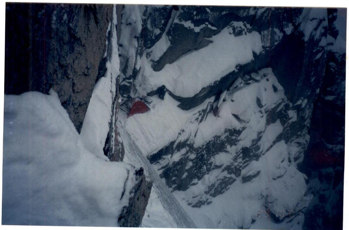
| R27–R28 | 45 m | Rappel, after 7 m — a saddle between the "Chair" and "Stol" and further down along the left vertical wall of the ridge with two cornices to a ledge. Pendulum swing to the left to a snow ledge convenient for overnight stay, 7 m. 2nd and 3rd overnights. Movement along the ridge requires the use of bolted technique and more time than rappel and bypass from the left. |
| R28–R29 | 30 m, 70°, VI, A4, e | To the left of the ridge: the right wall is overhanging, the left slab is 70°. Movement to the left upwards at an angle of 60°. Pendulum swing on the belay 12 m. |
| R29–R30 | 35 m, 70°, V+, A3 | Internal corner upwards. The left wall is 70°, the right wall is vertical. Exit to the second saddle of the ridge. |
| R30–R31 | 30 m, 65°, V-, A2 | Series of walls, ledges along the outer corner of the ridge to the monolith. In the middle of the section, the end of intermediate preparation on 29 October. 3rd overnight. |
| R31–R32 | 7 m, 70°, VI, A4, e | To the left along the slab, transition to the internal corner. Skyhooks, 4 bolted pitons. Pendulum swing of the last one 9 m. |
| R32–R33 | 20 m, 70°, V+ | Three internal corners with a slope to the right pass upwards to the left to exit to a ledge. |
| R33–R34 | 10 m, 70°, V+, A1 | Internal corner is passed along the right outer corner to the ridge. |
| R34–R35 | 5 m, 90°, VI, A2, e | Transition to the left along a flake on skyhooks. One bolted piton. |
| R35–R36 | 15 m, 90°, VI, A2 | Three "wells" are passed on ITO in the center and to the right along horizontal cracks. |
| R36–R37 | 5 m, 60°, III+ | Exit to the plateau. |
| R37–R38 | 40 m, I | Summit. |
Sheet 12
Equipment List
| № | Name | Quantity | Weight |
|---|---|---|---|
| 1 | Main rope | 4 × 50 m | 10.0 |
| 2 | Duralumin carabiners | 70 pcs. | 3.5 |
| 3 | Harness | 4 pcs. | 4.0 |
| 4 | Descent loops | 2 pcs. | 0.4 |
| 5 | Extension loops | 20 pcs. | 1.5 |
| 6 | Rock hammers | 3 pcs. | 2.6 |
| 7 | Crampons | 4 pairs | 2.4 |
| 8 | Chocks | 2 sets | 3.0 |
| 9 | Self-belay loops | 4 pcs. | 1.0 |
| 10 | Down blankets | 1 pc. | 1.8 |
| 11 | Down jackets | 4 pcs. | 3.6 |
| 12 | Protective helmets | 4 pcs. | 3.0 |
| 13 | Matches | 4 boxes | 0.1 |
| 14 | Candles | 1 pc. | 0.1 |
| 15 | First aid kit | 1 pc. | 0.3 |
| 16 | Tent | 1 pc. | 2.0 |
| 17 | Gas burner | 2 pcs. | 0.8 |
| 18 | Gas cylinders | 3 pcs. | 1.7 |
| 19 | Pressure cooker, pots | 2 pcs. | 0.6 |
| 20 | Lantern | 2 pcs. | 0.4 |
| 21 | Spare batteries | 4 pcs. | 0.2 |
| 22 | Rock pitons | 46 pcs. | 3.0 |
| 23 | Cliffhanger | 1 set | 0.4 |
| 24 | Food | 450 × 4 × 4 | 7.2 |
| 25 | Personal items | 10.0 | |
| 26 | Bolted pitons 15 pcs. Punch 2 pcs. TOTAL | 63.7 | |
| Initial weight of backpacks | 15.85 kg |
Technical photo of the route. Camera "Zenit-11", lens "Yupiter-37A", 3.5/135.
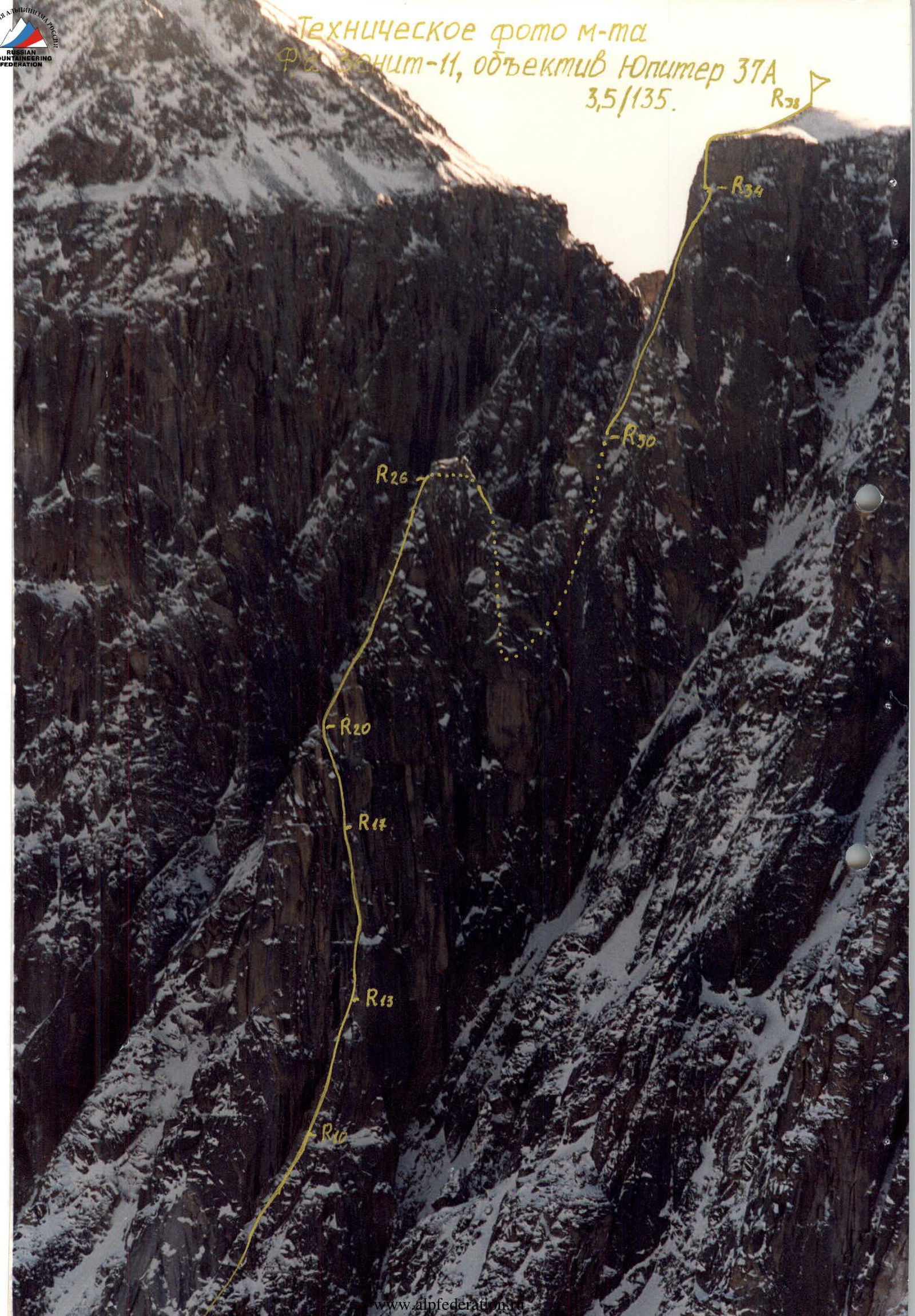
Photo of the upper part of the route, t/c "Chair". Camera "YASHICA-MG-2", f=34 mm, 28 October 2001.
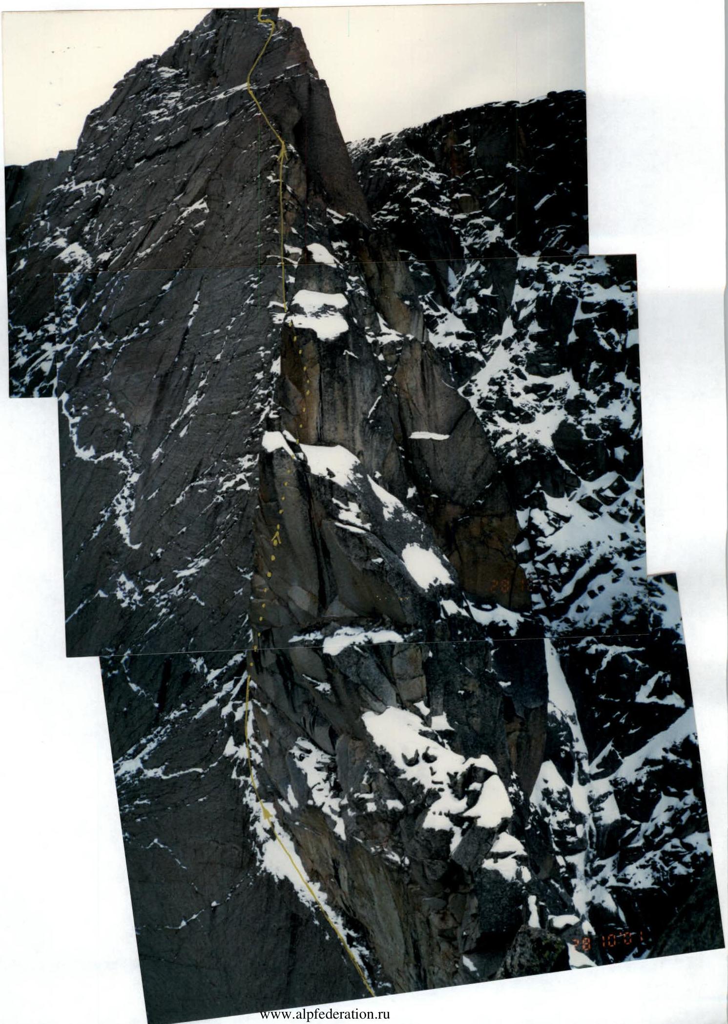
Photo of the profile of the upper part of the route. T/c "Roof" V. Kupol. Camera "YASHICA". 23 October 2001.
NE wall V. Stol. Taken from the approach to the circus. Camera "Zenit-11", lens "Helios-44M-4", 2/58. 21 October 2001.
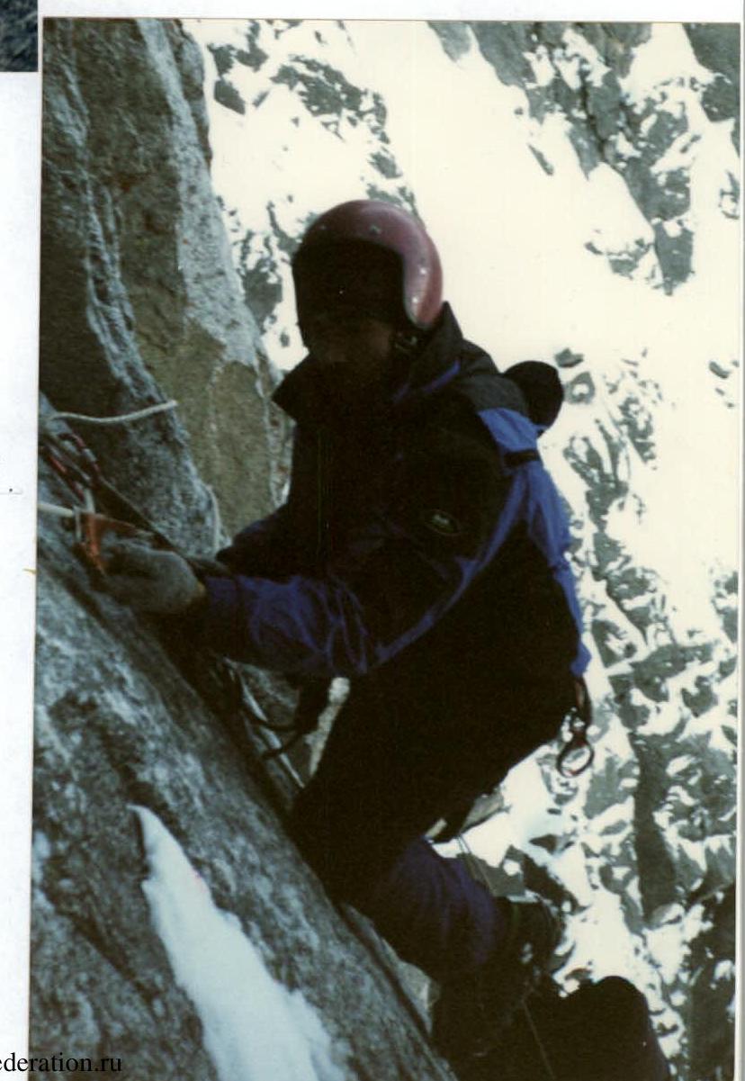
R8–R10. "Outcrop".
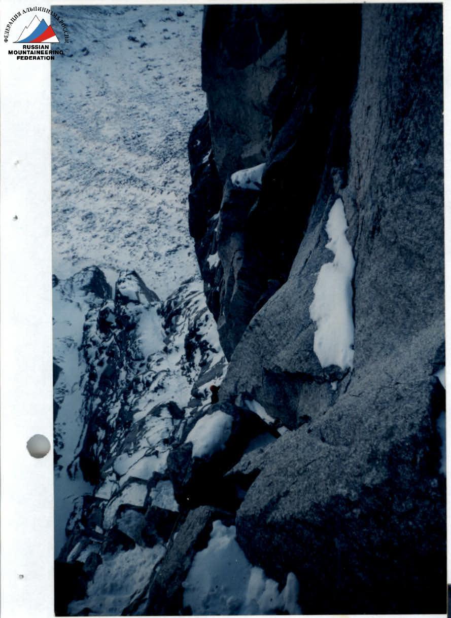
R10 — At the top "Vice". Camera "YASHICA" here and below.

R17. Key.
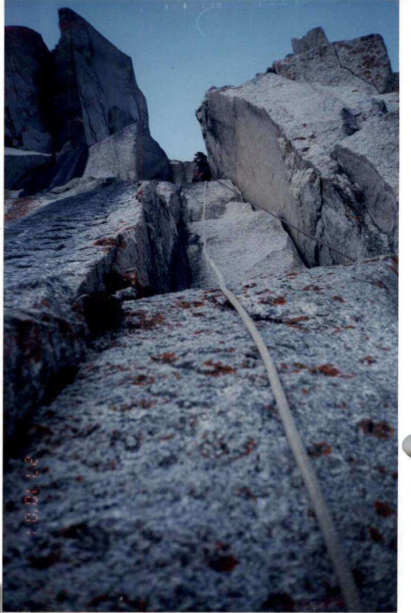
R13–R14. Entry into "pliers". Camera "Smena", 8 mm.
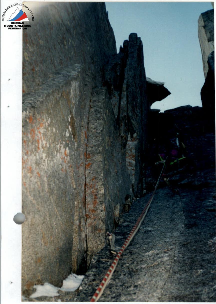
R18. Camera "Smena", 8 mm. R19–R20. "Vice". Camera "Smena", 8 mm.
R23–R25.
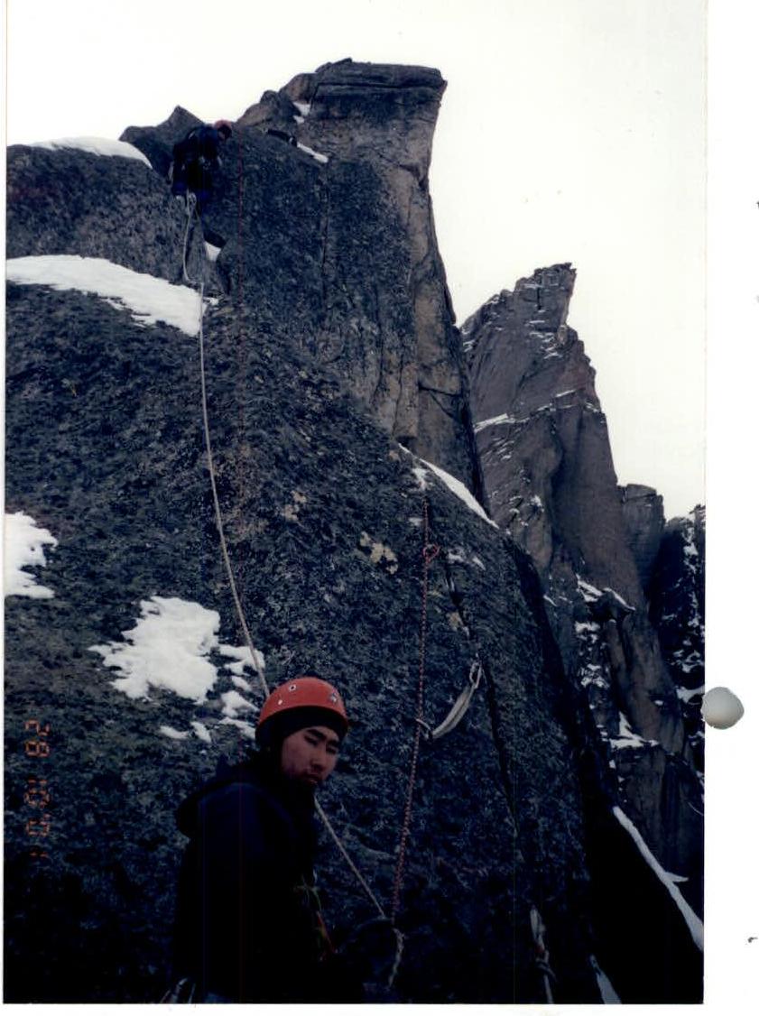
R21–R23. "Integral".
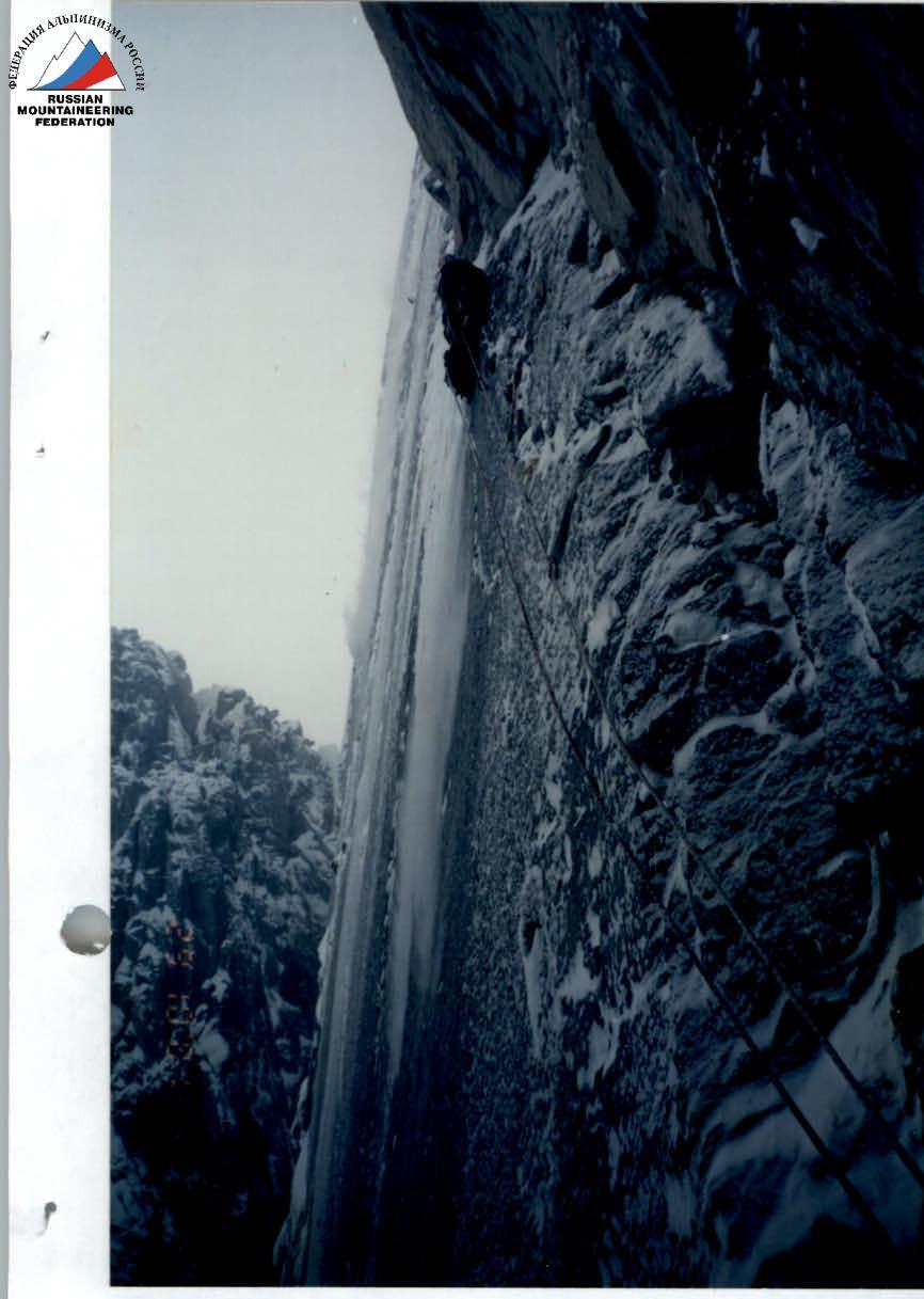
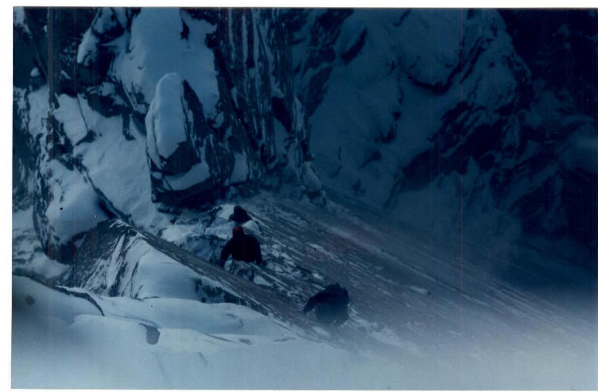
R28–R29. First.
R28–R29. Pendulum swing.
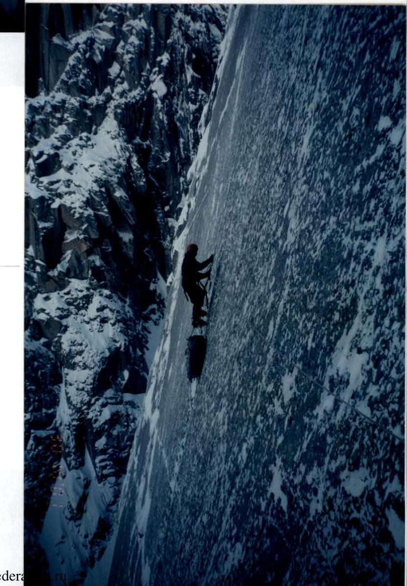
R30–R32. Taken by the support group on 30 October 2001. Camera "Zenit-11" from the summit plateau.
R28. 2nd–3rd overnights. "YASHICA".