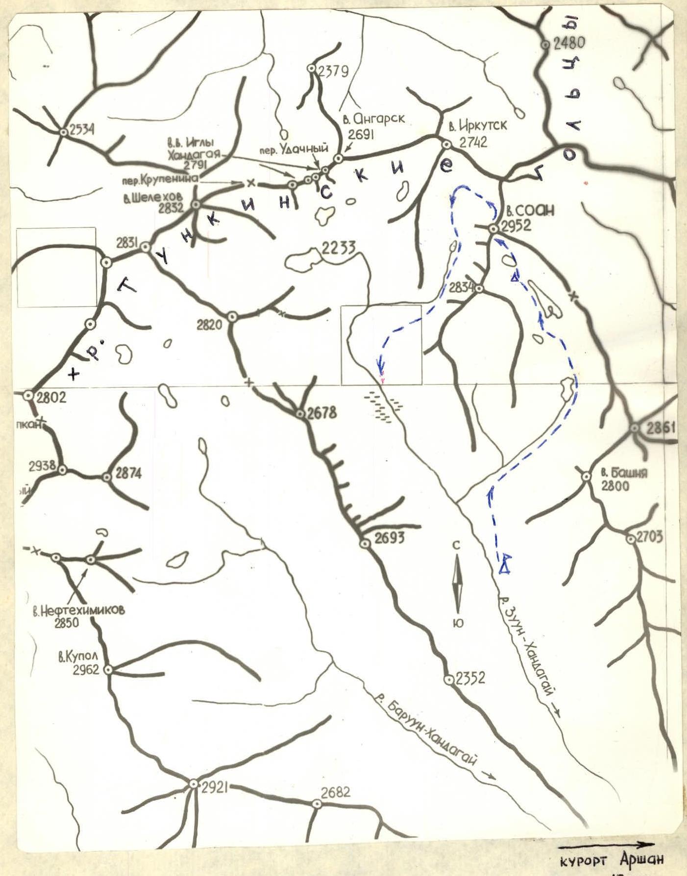
 Photo 2. Area map of the ascent
TABLE OF MAIN CHARACTERISTICS OF THE FIRST ASCENT ON V.SOAN
Photo 2. Area map of the ascent
TABLE OF MAIN CHARACTERISTICS OF THE FIRST ASCENT ON V.SOAN
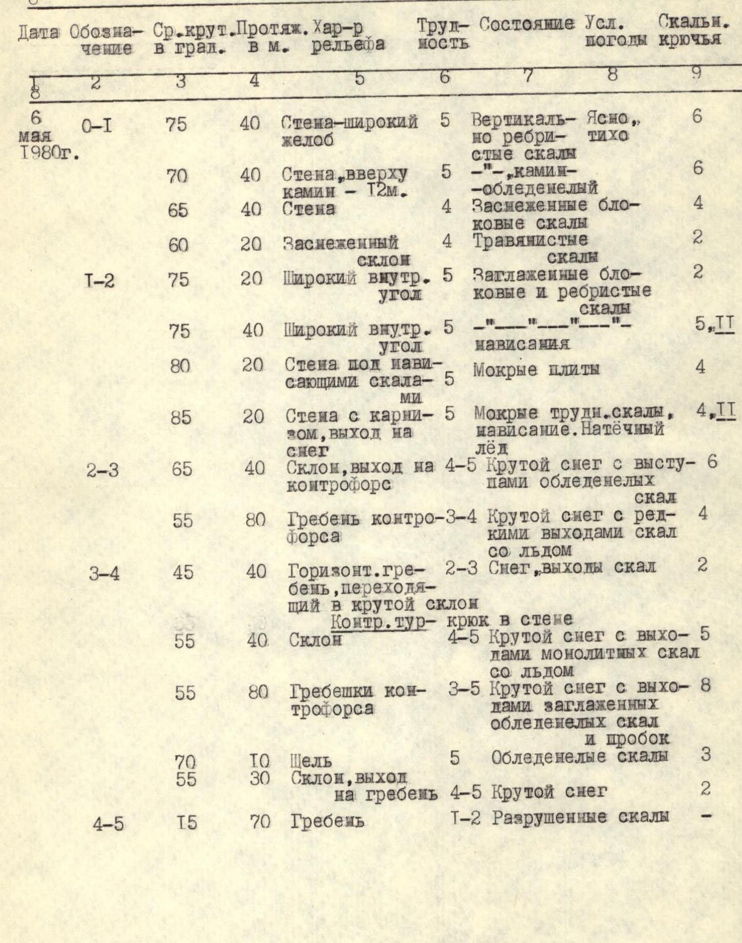
Brief explanation for the table
The route is a combined rock and snow route. Its first part is a rocky counterfort divided by a snowy horizontal belt into 2 bastions. The top of the 2nd bastion has overhanging rocks. The rocks are composed of gneisses with weak vertical jointing and a ribbed weathering surface with an external inclination of holds.
The second part of the route is a steep snow lying on icy rocks and slabs. The snow condition makes it impossible to use an ice axe for belay.
20 m to the right of the lower part of the counterfort, at the start of the route, is a clearly visible wide gully.
- R0–R1. 2 ropes of medium and difficult climbing, with overhangs in places (photos 3,4); at the top, there is an icy crack-chimney (2 m).
- R1 rope - deviating to the right - along snowy blocky rocks. Exit to steep snowy rocks.
- Moving slightly to the right - transition to the 2nd bastion of the counterfort - 20 m. Section R1–R2.
- 60 m - along the inner corner: ribbed rocks alternate with smoothed blocks. The rocks are wet, partially covered with ice (photo 5). Difficult, at the top - complex climbing. Overhang, ladder. Under the overhang - acute-angled rocks.
- 40 m - under them to the left - complex climbing along wet and icy slabs (photo 6).
- Further to the left upwards - complex climbing (2 m), overhanging cornice (1.5 m) - (photo 7).
- Exit to the top of the 2nd bastion of the counterfort, ice and snow. Section R2–R3.
- 40 m - steep snow lying on smoothed rocks. Piton belay on outcrops of icy rocks (photo 8). Here and further - to drive in pitons, it is necessary to dig deep snow and chip off ice.
- 80 m - steep ridges with deep snow and rare outcrops of icy rocks (photo 9). Section R3–R4.
- 100 m - horizontal ridge - the only place on the route for a good and safe overnight stay.
- 30 m - along steep snow. On R1 rocky outcrop - counter-pressure on a piton (photo 10).
- 120 m - straight up and after 1 rope, moving slightly to the right, or to the left side of the pre-summit tower. Along a steep slope and further along narrow snowy ridges, alternating with short slopes, with outcrops (3–5 m) of smoothed difficult rocks and "corks".
- 10 m - along a steep snowy rocky crack (photo 11) and 30 m - steep snow. Exit to the ridge.
- Section R4–R5. 70 m - simple climbing and walking to the summit.
Descent - along route 1Б кат. сл. - to the north along the ridge for about 300 m - then to the left downwards - 1 rope of sport climbing along a slit-like inner corner and further along a simple snowy couloir - along the bottom of the hanging valley, down to the Zuun-Khandagai river.
Recommendations: A diverse set of pitons (including channels, boxes, several petals). In the upper part of the route on icy rocks, ice pitons like VCSPC - "carrots" are recommended. Have ladders, bivouac equipment, spare warm clothes.
The group unanimously believes that the route corresponds to the 5A category of difficulty.
PROFILE OF THE ROUTE along the right counterfort of the SE wall SCALE 1:2000

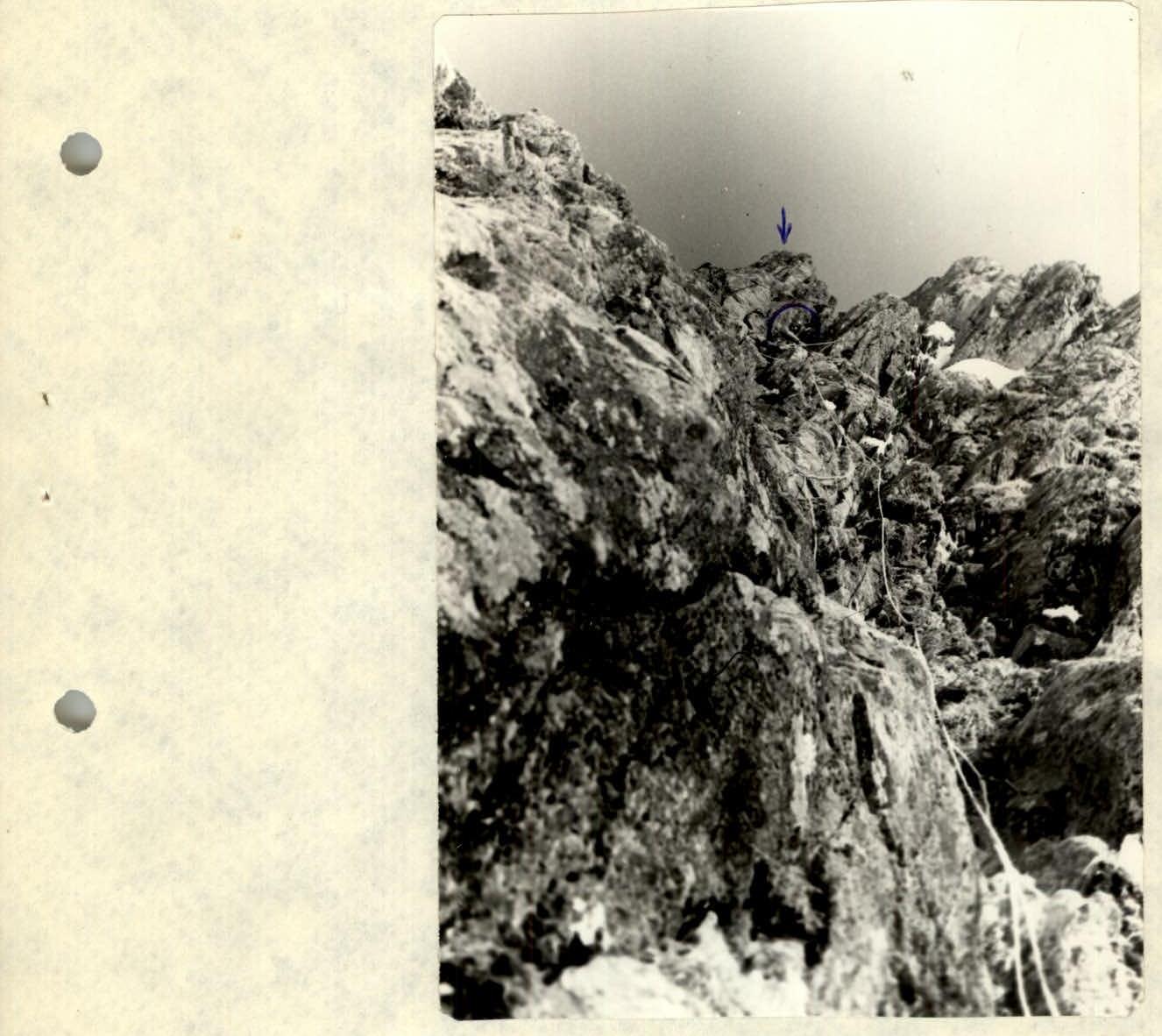
Photo 3. 1st rope of the route
Photo 10. Section R3–R4