Ascent Report
As part of the Siberian Federal District Alpine Championship. High-Altitude Technical Class 2024
Peak Sever (2826 m) via the center of the S wall, route 5Б cat. diff., Tunkinskie Goltsy ridge, Barun-Khandagai river valley, 6.1.2
Team Leader: Klepikov A.A. Participants:
- Panova A.M.
- Ivanovskiy A.V.
Ascent completed on August 3, 2024.
I. Ascent Passport
| 1. General Information | ||
|---|---|---|
| 1.1 | Full Name, sports rank of the team leader | Klepikov Aleksandr Aleksandrovich, MS, 3 cat. diff. |
| 1.2 | Full Name, sports rank of participants | Panova Alena Mikhailovna, CMS, Ivanovskiy Anton Vladimirovich, 1st sports rank |
| 1.3 | Full Name of coach | Afanasiev Andrey Evgenievich, MS, 1st sports rank |
| 1.4 | Organization | OO FASIО, Baikal Alpine School |
| 2. Characteristics of the Ascent Object | ||
| 2.1 | Region | Eastern Sayan, Tunkinskie Goltsy Ridge |
| 2.2 | Valley | Barun-Khandagai |
| 2.3 | Section number according to the 2013 classification table | 6.1.2 |
| 2.4 | Name and height of the peak | Sever, 2826 m |
| 2.5 | Geographical coordinates of the peak (latitude/longitude), GPS coordinates | 51°55′24.54″ N 102°10′90″ E |
| 3. Route Characteristics | ||
| 3.1 | Route Name | Via the center of the North Wall |
| 3.2 | Difficulty Category | 5Б |
| 3.3 | Degree of route exploration | - |
| 3.4 | Terrain characteristics | Rocky |
| 3.5 | Altitude difference (data from altimeter or GPS) | 400 |
| 3.6 | Route length (in meters) | 600 |
| 3.7 | Technical elements of the route (total length of sections with different difficulty categories, indicating terrain type: ice-snow, rocky)) | III cat. diff. rocks — 200 m IV cat. diff. rocks — 80 m V cat. diff. rocks — 200 m VI cat. diff. rocks — 120 m |
| 3.8 | Average steepness of the route, (°) | 60 |
| 3.9 | Average steepness of the main part of the route, (°) | 80 |
| 3.10 | Descent from the peak | Via 3А cat. diff. to Barun-Khandagai valley |
| 3.11 | Additional route characteristics | Absence of water |
| 4. Characteristics of Team Actions | ||
| 4.1 | Time of movement (team's walking hours, in hours and days) | 10 hours / 1 day |
| 4.2 | Overnight stays | - |
| 4.3 | Time of route preparation | - |
| 4.4 | Start of the route | 7:40, August 3, 2024 |
| 4.5 | Reaching the summit | 17:40, August 3, 2024 |
| 4.6 | Return to the base camp | Hour, date, month, year |
| 5. Weather Conditions | ||
| 5.1 | Temperature, °C | |
| 5.2 | Wind speed, m/s | |
| 5.3 | Precipitation | |
| 5.4 | Visibility, m | |
| 6. Person responsible for the report | ||
| 6.1 | Full Name, e-mail | aljonchik1905@mail.ru |
II. Ascent Description
1. Characteristics of the Ascent Object
1.1. General photo of the peak
 Peak Sever 2826 m
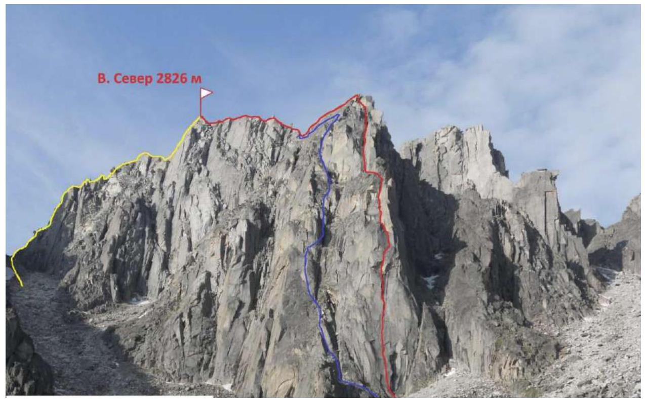
Yellow line — 3А Glazunov, Blue line — 4Б Klepikov, Red line — 5Б Glazunov, team route
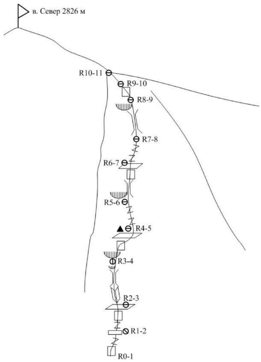
1.2. Photo of the route profile — red line, used from Klepikov A.A.'s 2012 report

1.3. Hand-drawn profile of the route

2. Route Characteristics
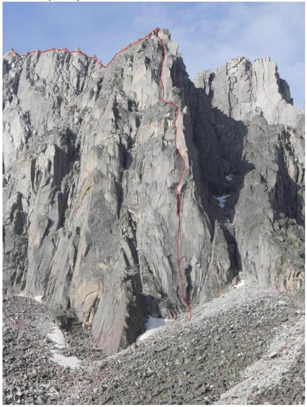
2.1. Technical photograph of the route

Taken from Glazunov E.V.'s first ascent report.
2.2. Route scheme in UIAA symbols
3. Characteristics of Team Actions
3.1. Brief description of the route passage.
For the route passage, the team used the technique of simultaneous movement on the terrain (Krasnoyarsk simultaneous movement) without prior route preparation. Sections R6–R7 and R7–R8 were passed with a variation to the left due to the presence of loose rocks on the terrain, which affected the safety of passage.
Technical characteristics were taken from Glazunov E.V.'s first ascent report of 2015. Supplemented with the team's variation.
| Section # | Description | Photo # |
|---|---|---|
| R0–R1 | Start of the route from the lowest part of the wall, from the cairn built below, approach a ledge to the left, to a standalone rock. From the rock upwards through a vertical crack. Challenging free climbing, placement of protection while climbing, requires a doubled set of cams. Station on a small sloping ledge on nuts and an anchor hook. (40 m, 85°, 6) | 1,2 |
| R1–R2 | From the station upwards and to the right is a crack, move with free climbing to the middle of the crack. Then on aid climbing almost to its end. Exit to a ledge at the base of a wet chimney with black streaks with free climbing. On the ledge, a station on anchors and a removable bolt M8. This section requires a doubled set of cams of all sizes up to #4. (35 m, 85°, 6 A1e) | 3,4 |
| R2–R3 | Then move along a narrow corner with a thin crack on aid climbing to the exit from it. Then free climbing to a vertical crack in the wet corner, curving to the right like a scimitar. Requires 2 cams #3. Pass the crack and through a small overhang, about half a meter, exit to a slab under a large overhang (first crux). Here is a hanging station on nuts and a bolt (a spike M8 is left, requires an eye and nut M13). "Attention! The half-meter overhang before the exit to the station consists of wedged, booming blocks and requires utmost attention when passing to avoid their fall." (40 m, 90°, 6 A2e) | 5 |
| R3–R4 | Traverse to the right, to a medium-sized crack. Through the crack, pass a one-sided overhang with a reach of up to 1.5 m (second crux). Behind the overhang is a flattening, through which exit to a ledge. On the ledge, on a rocky "Tooth" is a control cairn in a bottle. (25 m, 95°, 6 A2) | 5,6 |
| R4–R5 | From the ledge, an internal corner with a thin crack, then to the left to the exit to a large ledge, from which move upwards through a vertical corner to the base of a wide crack, where a station was organized. From the start of this section to the summit, sections of the route are passed without the use of aid climbing. (50 m, 75°, 5–6) | 7 |
| R5–R6 | Move through the wide crack (desirable to have a cam #5). The crack ends with wedged rocks, which are bypassed to the right on slabs. We exit to a wide terrace at the base of a large 9 m vertical internal corner. Station on the terrain. (40 m, 85°, 5–6) | 7 |
| R6–R7 | From the station through the corner with a wide crack to the entrance to the large internal corner. Further movement through the internal corner — chimney. Careful climbing, loose rocks are encountered, wedged in the corner. Requires careful movement to avoid dropping them. In the upper part of the section, the crack widens to the size of a cam #5. The corner leads to a saddle at the base of a wet chimney. (50 m, 85°, 5) Team's variation: From the station through the corner with a wide crack to the entrance to the large internal corner. Then move left and upwards through cracks in the direction of the main ridge. Station on a ledge, requires careful movement as small rocks are dislodged by the rope past the lower station. (50 m, 80°, 5) | 8,9 |
| R7–R8 | Through the chimney upwards very carefully, as loose rocks are encountered, wedged in the chimney. Through a small overhang, exit to a large ledge, from which move upwards to the base of an internal corner. Station on the terrain. (40 m, 70°, 4–5) Team's variation: From the station, continue movement through a series of inclined and horizontal cracks. Belay with anchors with awkward climbing in the first half of the section. Then exit to the ridge through a large-blocky terrain. (40 m, 70°, 4–5) | 10 |
| R8–R9 | Simultaneous movement on rocks of medium complexity in the direction of the ridge. In the middle of the section — a vertical wall, passed with climbing. Station on the terrain. (50 m, 60°, 3–4) | 11 |
| R9–R10 | Through the ridge simultaneously through small walls move towards the West ridge of Sever. In the middle of the section, descend slightly, bypassing to the right a monolithic pinnacle. To the right on ledges and terraces, exit to the main ridge. (120 m, 40°, 3) | |
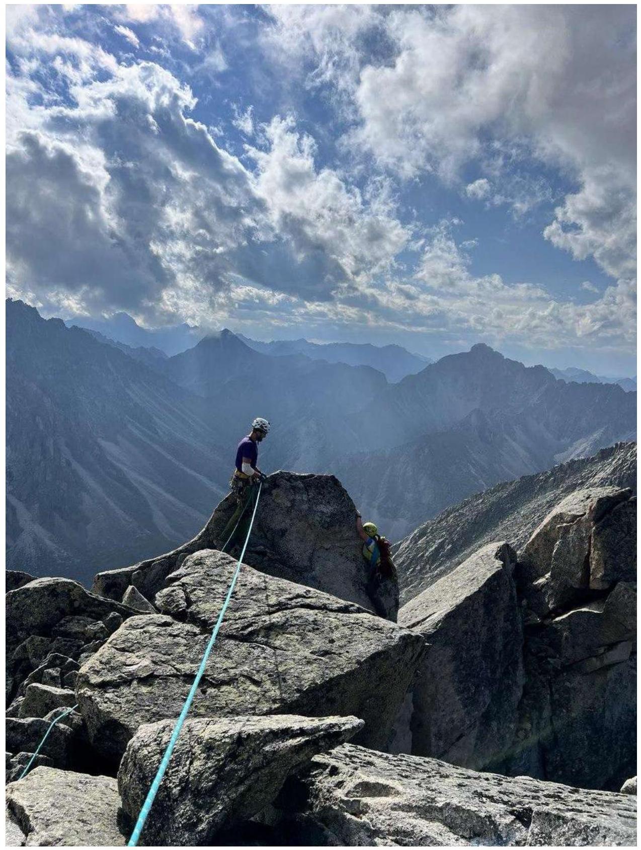
| R10–R11 | Through the ridge through a series of walls ascend to the summit of Sever. (100 m, 45°, 3) | 12 |
Photo 1. Klepikov A. at the start of the route on section R0–R1
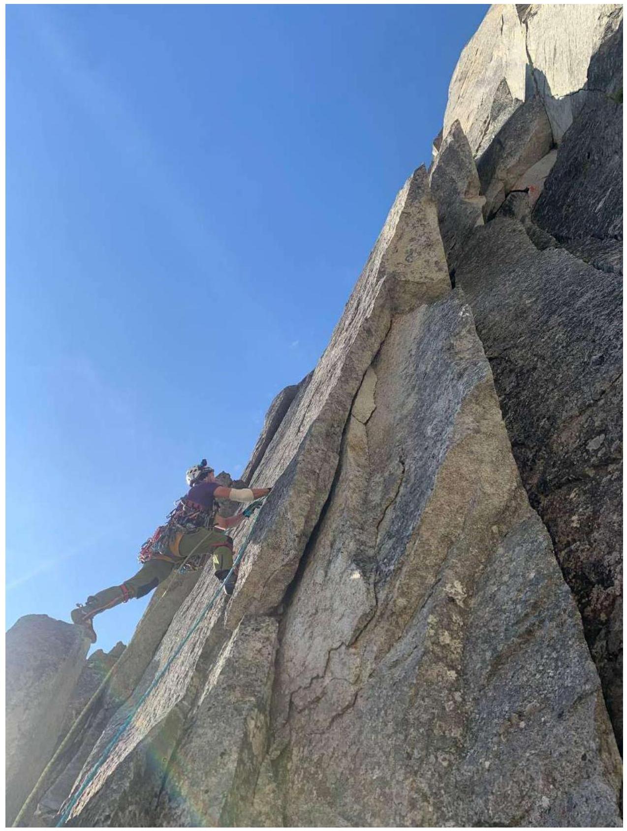
Photo 2. Section R0–R1. Ivanovskiy A. on station R1
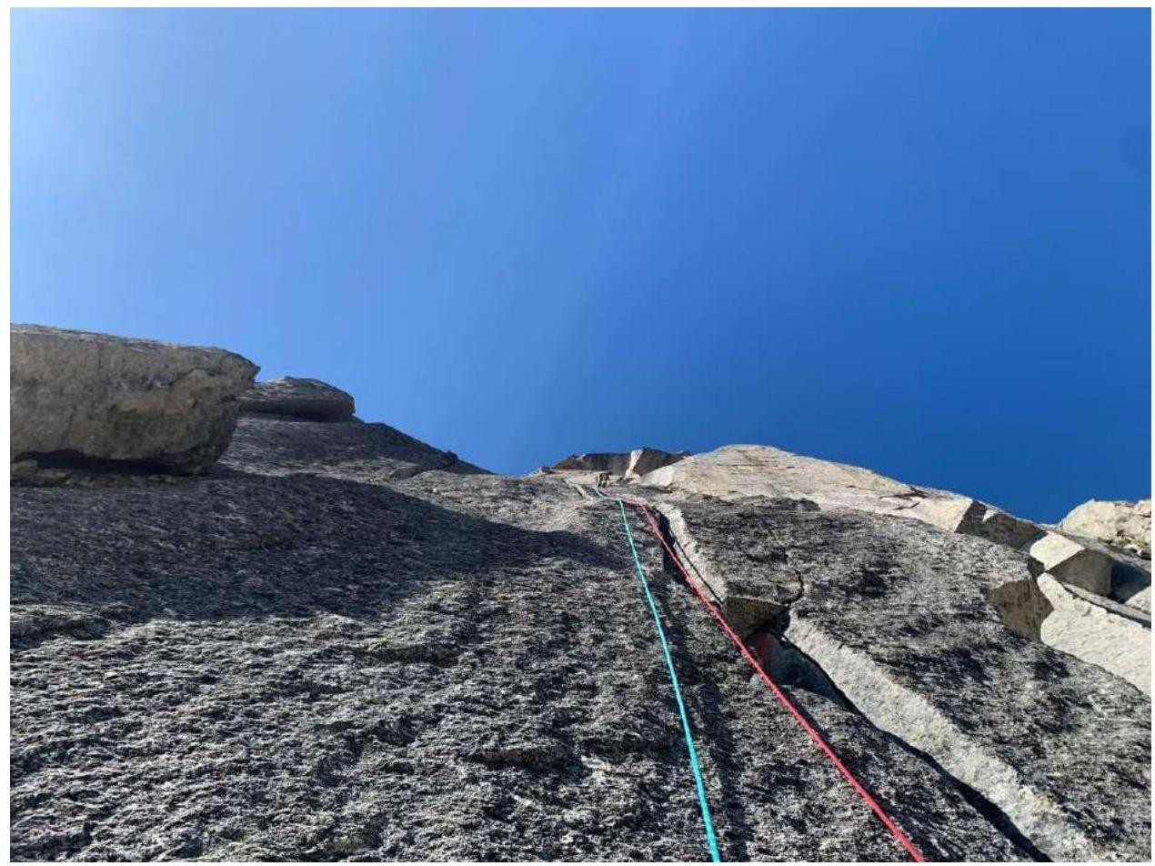
Photo 3. Section R1–R2

Photo 4. View of section R1–R2 from above
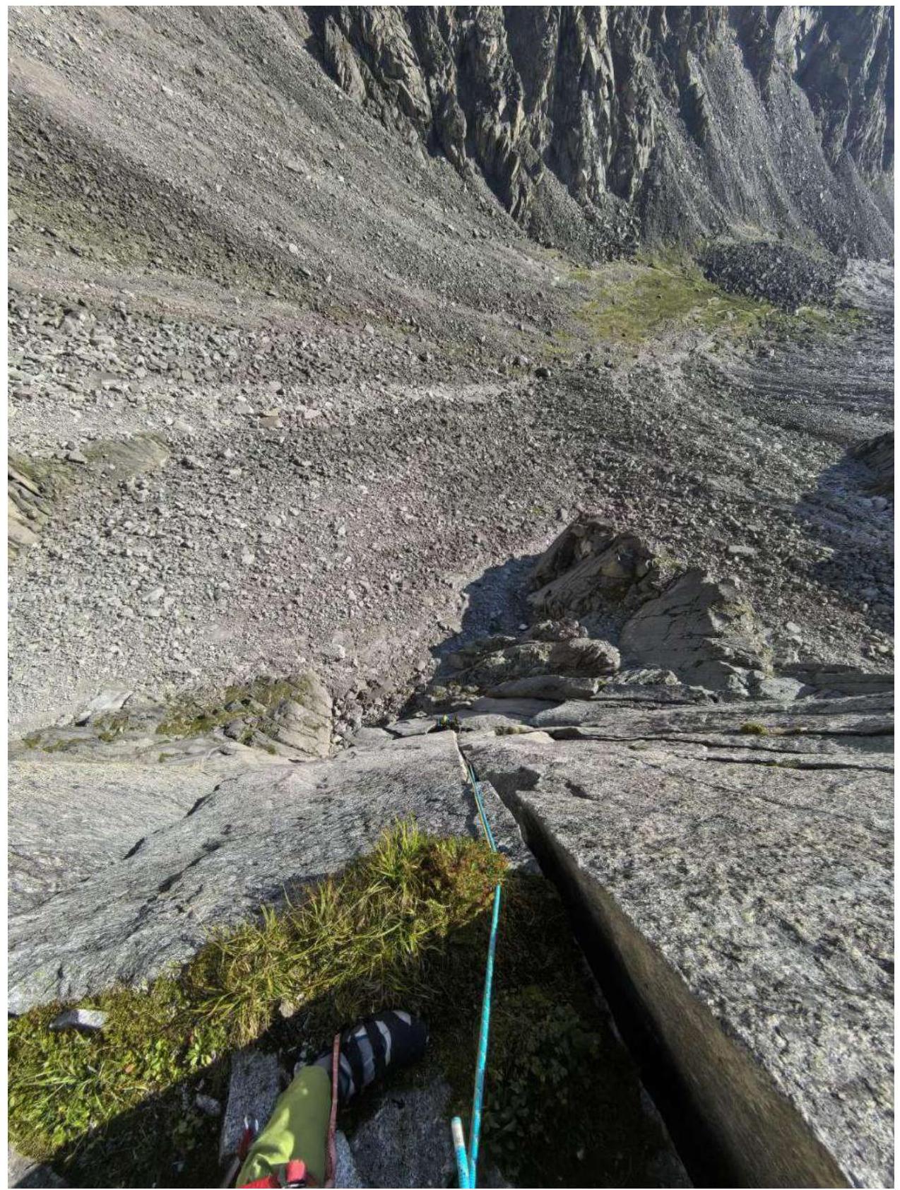
Photo 5. View from the station on section R2–R3, above the leader is the overhang of section R3–R4
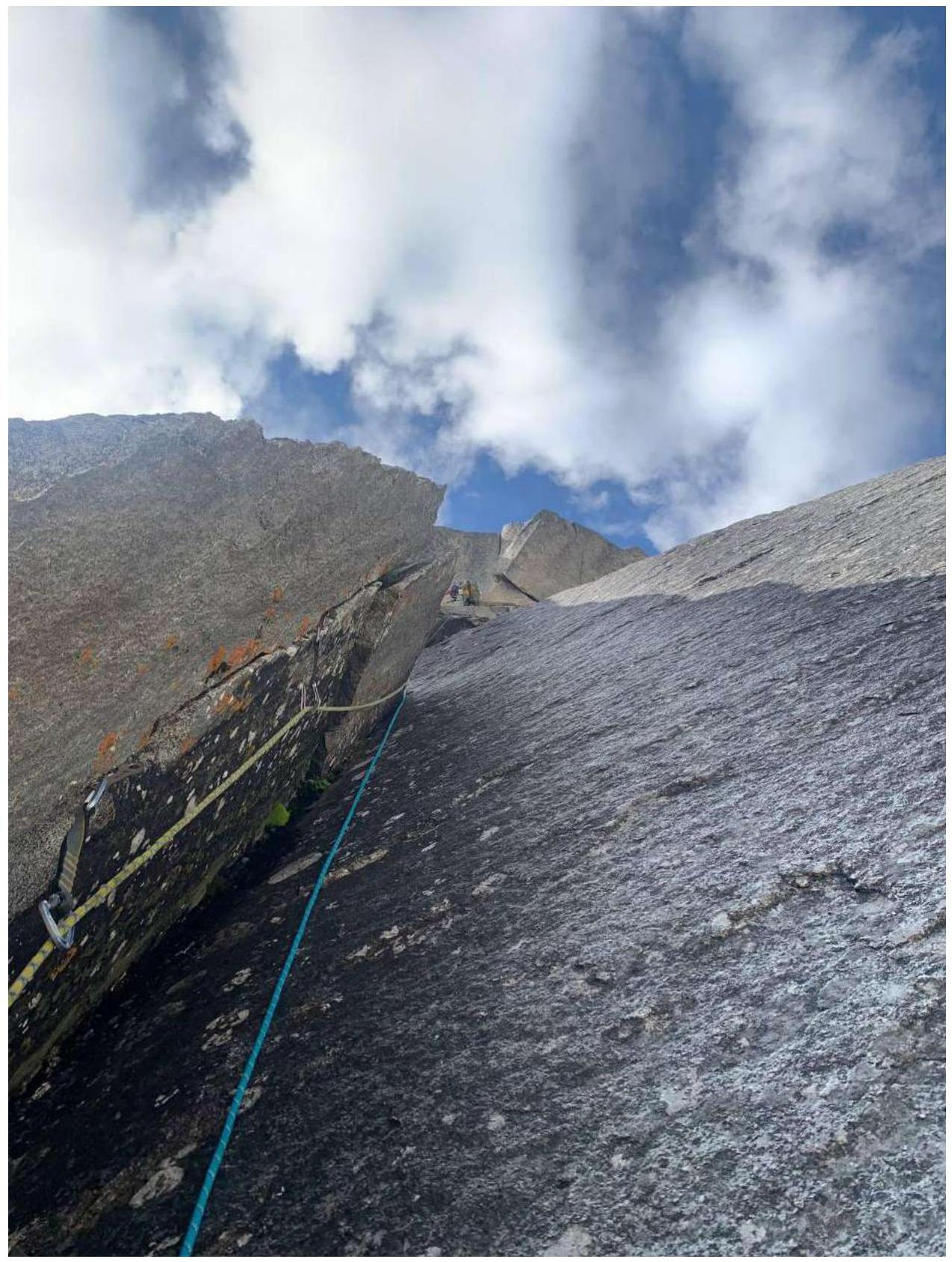
Photo 6. Leader starts passing the overhang on R3–R4
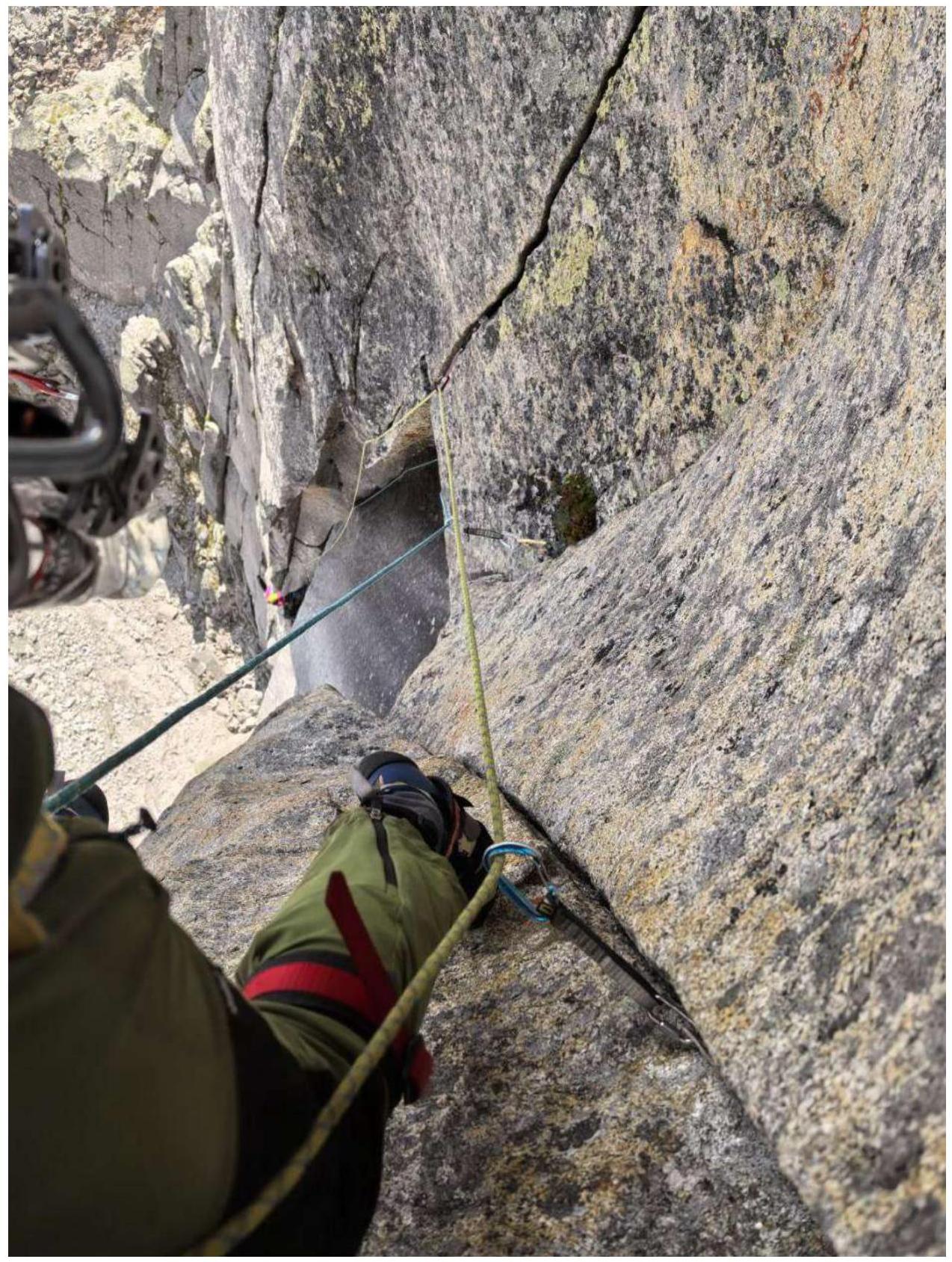
Photo 7. Completion of section R4–R5, start of section R5–R6 under the overhang to the right.
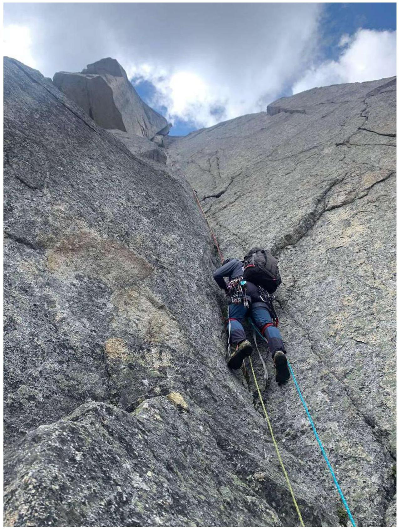
Photo 8. Leader (Klepikov A.) passes the variation of section R6–R7 to the left through a series of cracks. Ivanovskiy A. belays from station R6
](https://summitx.info/media/1/7xLURktklqoqWmBzpIVMCvFg3kk8J4ep/img-13.jpeg","id":64772990}↗)
Photo 9. Leader passes the variation of section R6–R7 to the left
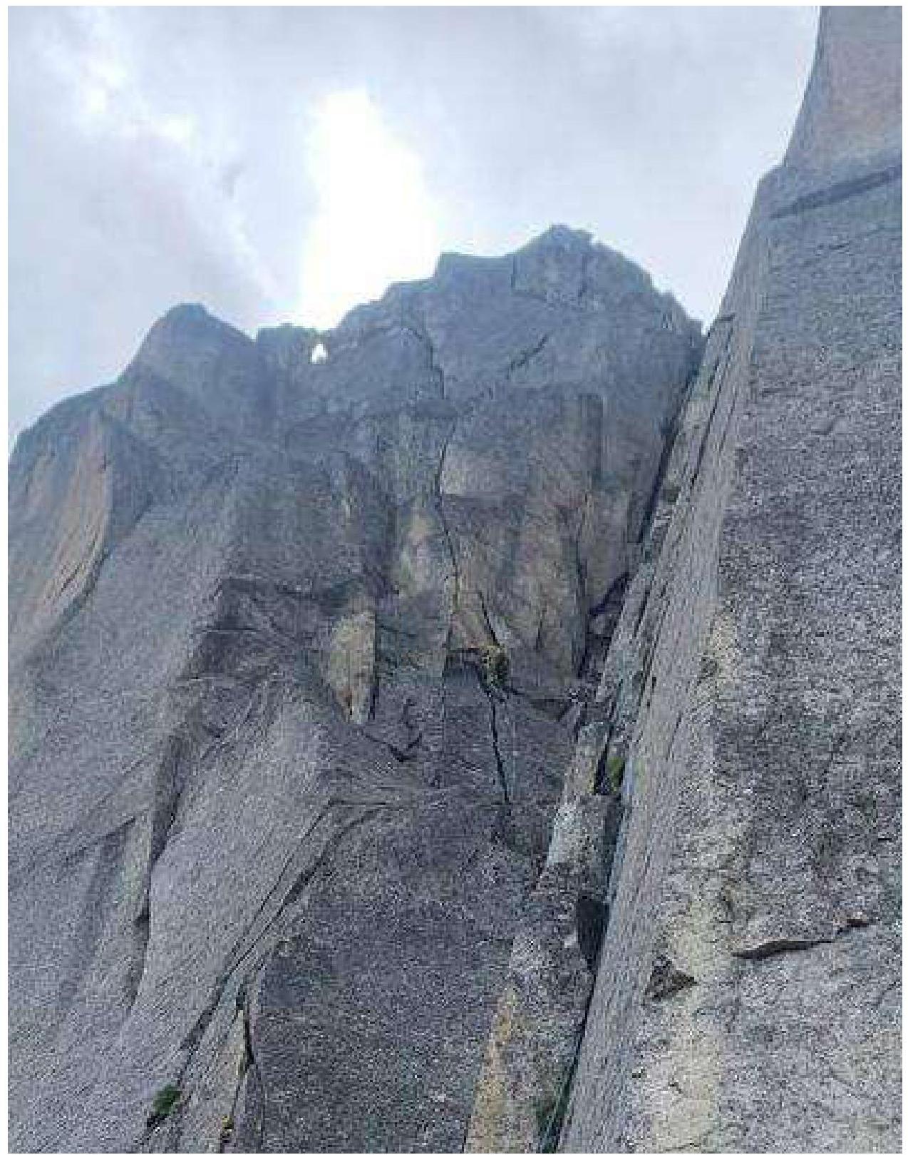
Photo 10. Left variation of section R7–R8

Photo 11. Simultaneous movement in a rope team to the summit.
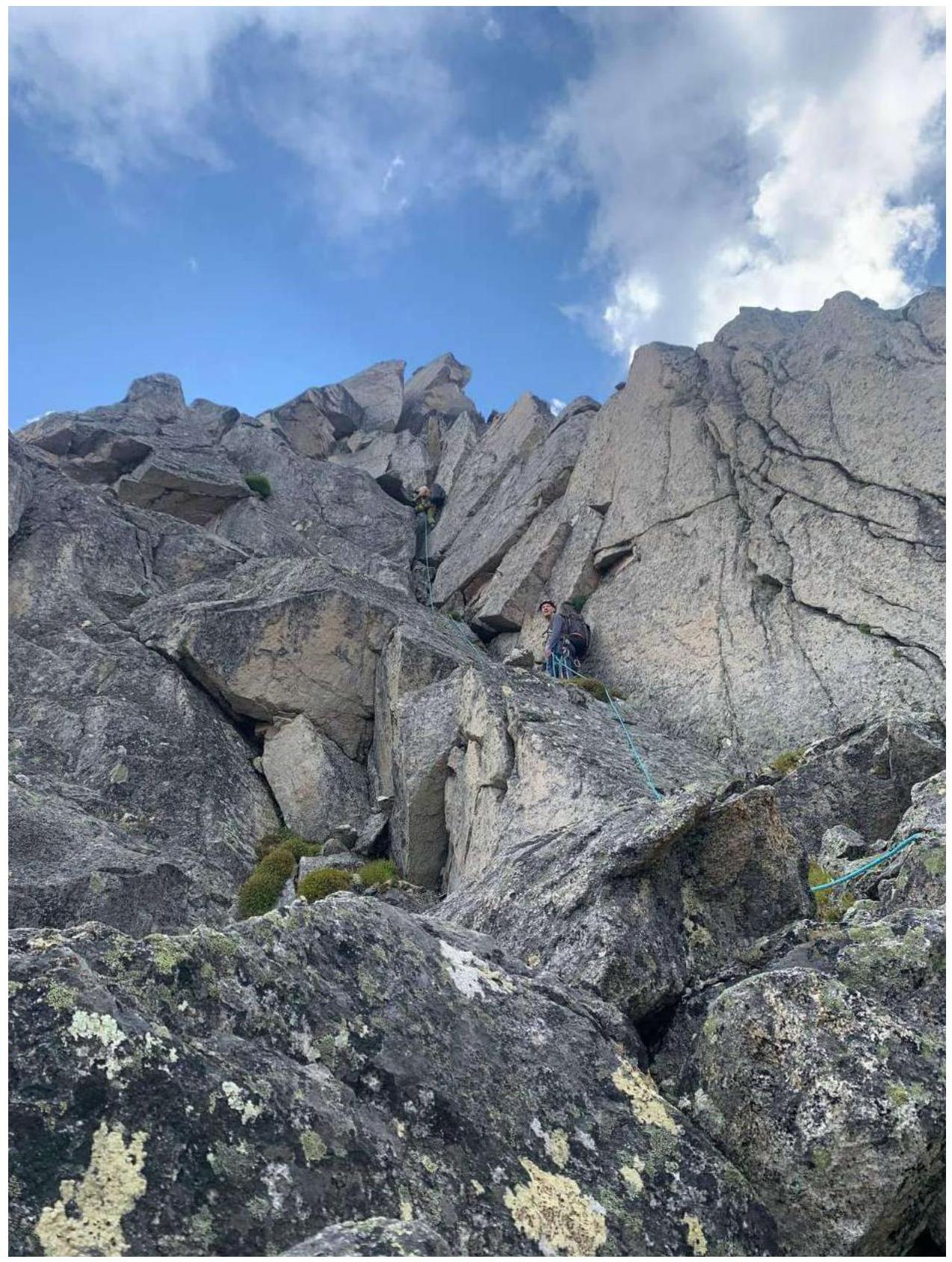
Photo 12. Ridge before the summit
3.2. Photo of the team on the summit at the control cairn
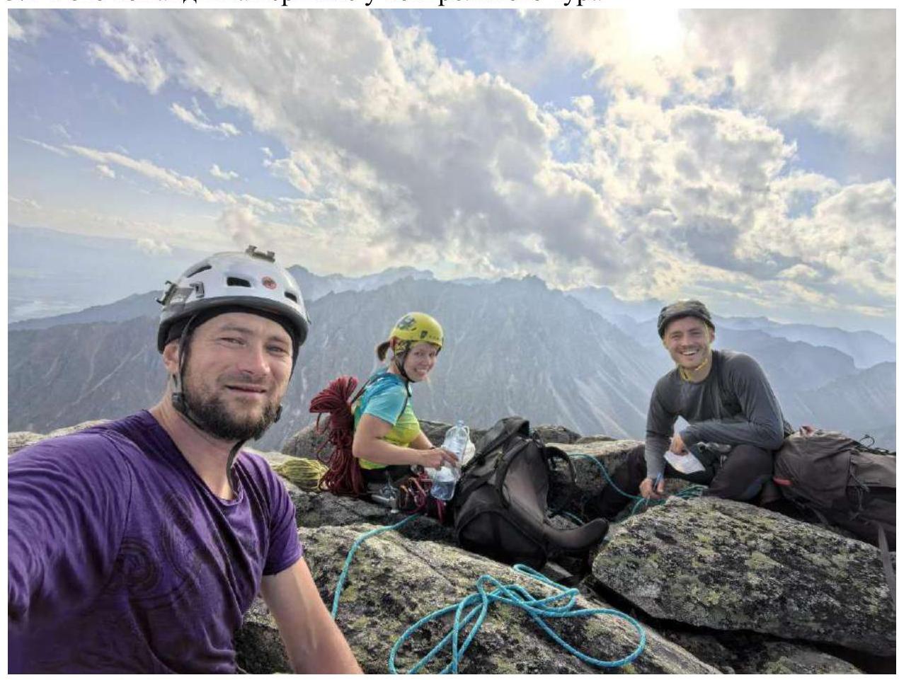
From left to right: Klepikov A., Panova A., Ivanovskiy A.
3.3. The route contains sections of challenging climbing with loose rocks, the main hazardous section R6–R8 was passed with a variation to the left, which is less prone to rockfall. Cellular connection is available on the route starting from R3, including internet.