Report
ON THE FIRST ASCENT TO THE SUMMIT OPTIMIST VIA THE EASTERN RIDGE ROUTE, CATEGORY 4A, BY THE GORY BAIKALA TEAM, OCTOBER 19, 2018
Irkutsk 2018
I. Ascent Report
| 1. General Information | ||
|---|---|---|
| 1. 1 | Full Name, Sport Rank of the Leader | Repina Ekaterina Viktorovna, 1st sports rank |
| 1. 2 | Full Names, Sport Ranks of the Participants | Olenova Nadezhda Aleksandrovna, CMS, Panova Alena Mikhailovna, 1st sports rank |
| 1. 3 | Full Name of the Coach | Glazunov Evgeny Vladimirovich (MS) |
| 1. 4 | Organization | Irkutsk Regional Public Organization "Club of Active Leisure and Alpinism 'Gory Baikala'" |
| 2. Characteristics of the Ascent Object | ||
| 2. 1 | Region | Eastern Sayan, Tunkin Golets ridge |
| 2. 2 | Valley | Cherlytym-Gorkhon |
| 2. 3 | Section Number according to the 2013 Classification Table | 6.1.2 |
| 2. 4 | Name and Height of the Summit | Optimist, 2660 m |
| 2. 5 | Geographical Coordinates of the Summit (Latitude/Longitude), GPS Coordinates | 51°50′25.78″ N 101°36′35.72″ E |
| 3. Route Characteristics | ||
| 3. 1 | Route Name | Via the Eastern Ridge |
| 3. 2 | Proposed Category of Difficulty | 4A |
| 3. 3 | Degree of Route Exploration | First Ascent |
| 3. 4 | Relief Character of the Route | Rocky |
| 3. 5 | Height Difference of the Route (Altimeter or GPS data) | 300 m |
| 3. 6 | Route Length (in meters) | 590 m |
| 3. 7 | Technical Elements of the Route (Total length of sections with different difficulty categories, indicating relief type: ice-snow, rocky) | Summit Optimist. Via the Eastern Ridge. Assumed category 4A. | Section | Pitons | Stoppers | Bolts | ITO | Length, m | Steepness, ° | Difficulty | | :-------: | :----: | :-------: | :----------: | :-: | :---------------: | :-----------: | :-------: | | R9–R10 | 0 | 0 | - | - | 50 | 20 | I | | R8–R9 | 0 | 3 | - | - | 90 | 30 | II–III | | R7–R8 | 0 | 0 | - | - | 60 | 40 | I–II | | R6–R7 | 0 | 1 | - | - | 60 | 60 | I–II | | R5–R6 | 2 | 7/6 | - | 6 | 50 | 70 | V | | R4–R5 | 4 | 8 | - | - | 35 | 70 | V | | R3–R4 | 5/2 | 5 | - | 2 | 60 | 75 | IV (VI, ITO A1, 5 m) | | R2–R3 | - | - | - | - | 70 | 0 | n/k | | R1–R2 | 3/2 | 8 | - | 2 | 55 | 75 | V (V, I) | | R0–R1 | 2 | 5 | - | - | 60 | 65 | III–IV | |
| 3. 8 | Descent from the Summit | Along the northern ridge 150 m, rappelling 20 m to a saddle, descent via a scree gully in the eastern direction into the Gorkhon river valley |
| 3. 9 | Additional Route Characteristics | Absence of water |
| 4. Characteristics of the Team's Actions | ||
| 4. 1 | Time of Movement (Team's Climbing Hours) | 9 hours |
| 4. 2 | Overnights | No |
| 4. 3 | Time Spent on Route Preparation | - |
| 4. 4 | Departure onto the Route | 8:00, October 19, 2018 |
| 4. 5 | Reaching the Summit | 17:00, October 19, 2018 |
| 4. 6 | Return to the Base Camp | 20:00, October 19, 2018 |
| 5. Meteorological Conditions | ||
| 5. 1 | Temperature, °C | - |
| 5. 2 | Wind Speed, m/s | - |
| 5. 3 | Precipitation | - |
| 5. 4 | Visibility, m | - |
| 6. Person Responsible for the Report | ||
| 6. 1 | Full Name, e-mail | Repina Ekaterina Viktorovna repina.ekaterina.viktorovna@yandex.ru |
II. Ascent Description
1. Characteristics of the Ascent Object
1.1. General Photo of the Optimist Summit
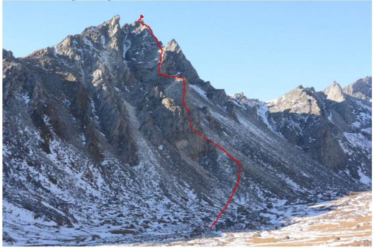
Photo 1. General view of the Optimist summit from the NE from the Gorkhon river valley on October 14, 2018.
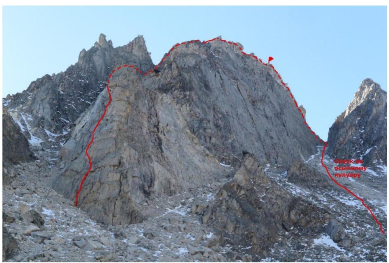
Photo 2. Optimist summit from the east, close-up.
1.2. Route Profile (photo taken from the Gorkhon river valley)
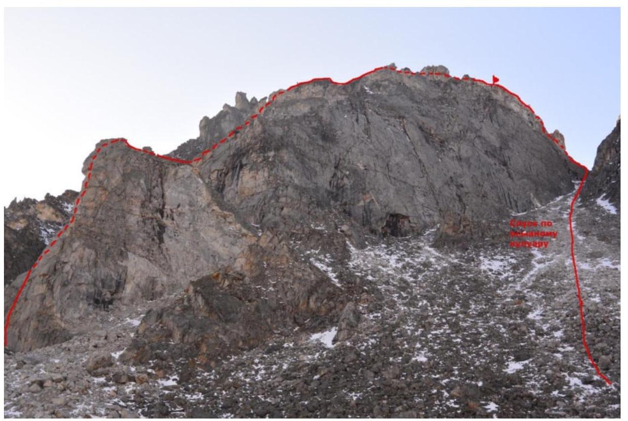
Photo 3. From the Gorkhon river valley, east.
1.4. Photopanorama of the upper Cherlytym-Gorkhon valley from the Shkolnaya summit
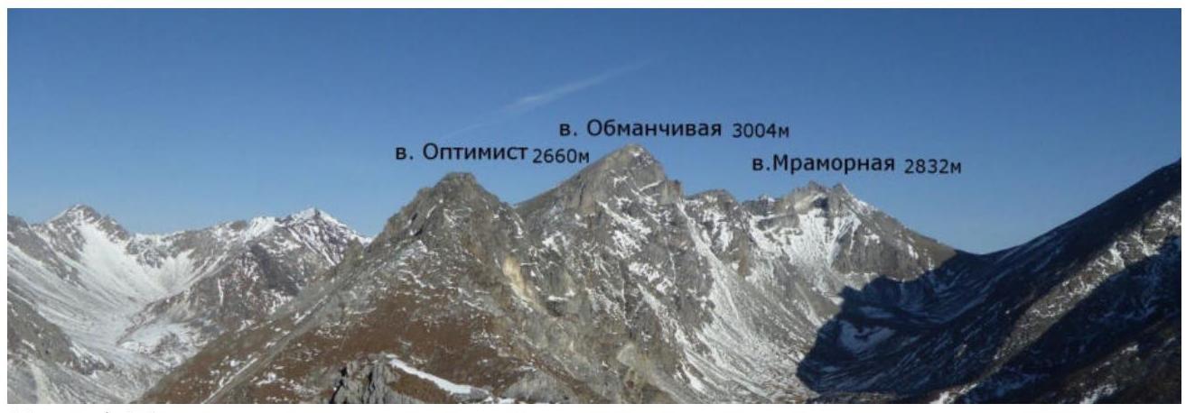
Photo 4. Panorama
1.5. Map of the Area.
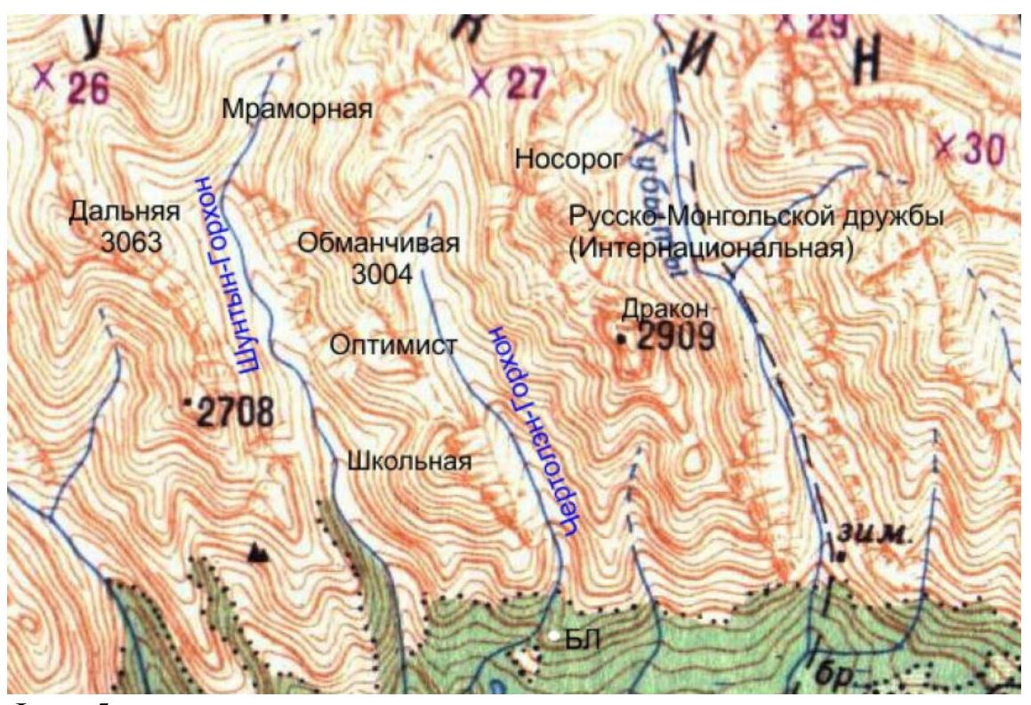
Photo 5. Map of the area.
The Optimist summit is located in the upper Cherlytym-Gorkhon valley, Tunkin ridge, Eastern Sayan, west of the Khubuta river valley, along which a trail leads to the Shumak mineral springs - a popular tourist route in our region. The nearest settlement is Nilova Pustyn and Khoito-Gol village, Tunkin district, Buryatia Republic (district center - Kyren settlement). From there, travel along the old road to the "Sukhoy Ruchey" tourist base, then a 4WD vehicle can be used to reach the Cherlytym-Gorkhon river, from where a good trail leads into the valley.
The valley is a dead end, regularly visited by local herb and wild food gatherers, and has a very straightforward approach. The trail allows for horseback riding to the base camp. The valley's alpinist potential allows for alpine events with ascents from category 1B to 5A.
The chosen route along the Eastern ridge is obvious and logical, visible immediately upon ascent into the valley, and will be of interest for future ascents via this route. The approach to the route from the base camp takes 2.5 hours. The route consists of ascending a bastion (2 ropes of moderate climbing), traversing a non-categorical area between the bastion and a counterfort (70 m), ascending the counterfort (3 ropes of moderate to difficult climbing), and traversing the ridge (250 m). Wide cracks suitable for a #4 cam are encountered (its presence is not necessary for the ascent). At the end of the second rope on the bastion, there are loose blocks, and many loose boulders. According to the team's assessment, the route corresponds to similar routes in the Eastern Sayan of category 4A.
2. Route Characteristics
2.1. Technical Photograph of the Route.
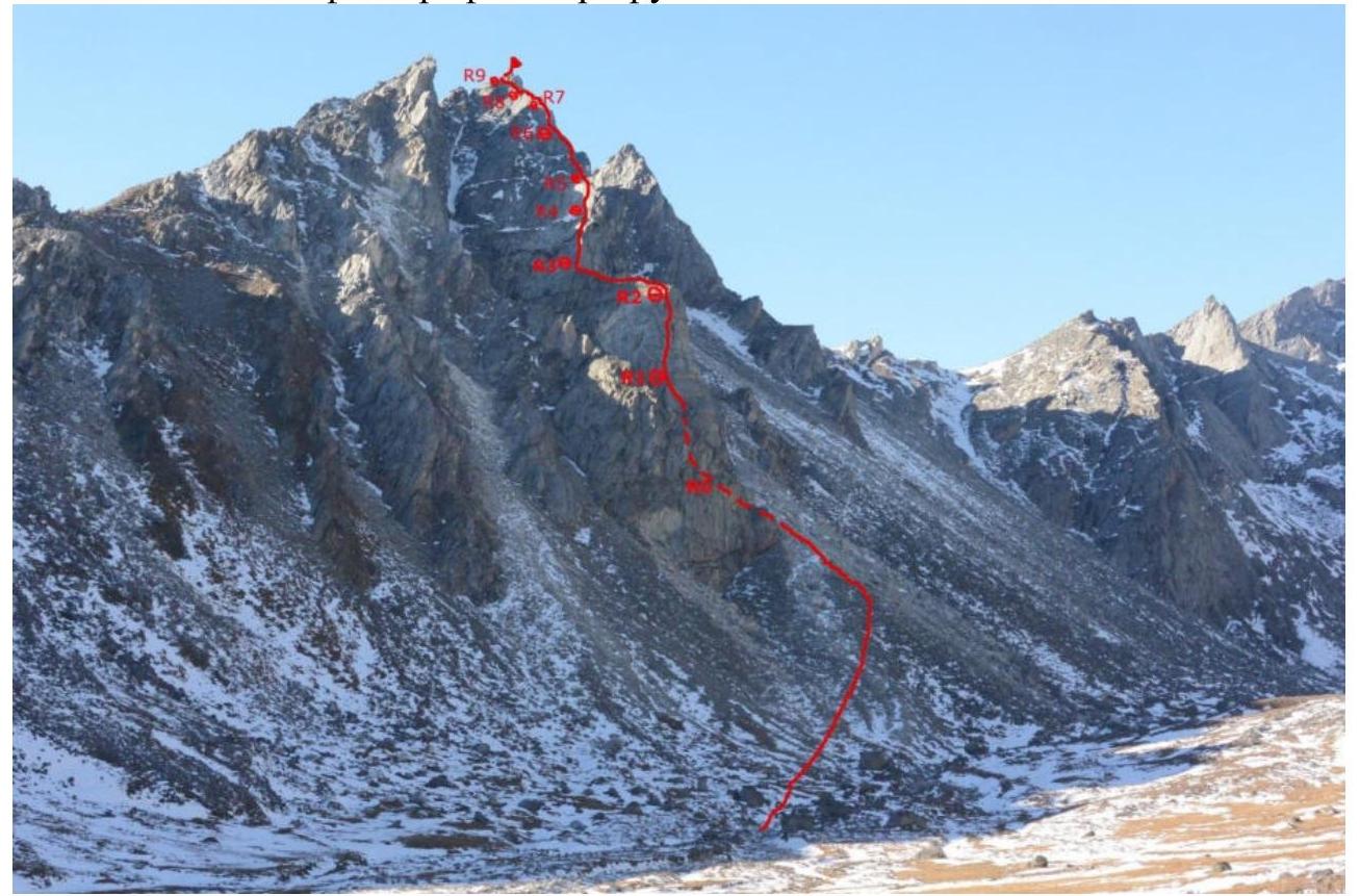
Photo 6. The start of the route is hidden behind the front ridge.
2.2. Section numbers on the technical photograph correspond to the section numbers on the UIAA symbol route diagram.
3. Characteristics of the Team's Actions
3.1. The approach to the start of the route from the base camp takes 2-2.5 hours. Follow the trail upstream along the river, which alternates between the left and right banks. From the river, ascend the scree slope towards the eastern ridge of Optimist summit. Reach the wall of the bastion (eastern exposure). There's a landmark - a wide (30-50 cm) crack-chimney, the start of the route is 15 m to the left (south) in a wide internal corner with easy (III) climbing.
| Section | Description | Photo Number |
|---|---|---|
| R0–R1 | Up the internal corner along the rocks of III category difficulty. Then left along the wall with good relief, while to the right remains a smooth steep wall with smoothed cracks. Further up the internal corner, right along simple rocks (many loose stones). The relief is unambiguous. Good ledge for a station, 20 meters below the eaves. Station on 2 friends and an anchor. 60 m 65° III–IV | Photos 8, 9 |
| R1–R2 | The eaves are passed on the left. From the station, an internal corner goes up-left with smooth walls. Further relief - the internal corner bends right-up. 25 m 70° IV. Then a wall is passed either by VI category climbing or ITO A1 along cracks on anchors. 8 m 80° VI, ITO A1. Internal corner to the top of the bastion. Many live blocks. Upon reaching the roof of the bastion, many individual loose stones. 20 m 75° IV. The entire rope goes predominantly along the SE exposure. Station on a rocky outcrop. | Photo 10 |
| R2–R3 | Along the roof of the bastion to the start of the counterfort. The section is traversed on foot. 70 m 0° n/k | Photo 11 |
| R3–R4 | At the start, the counterfort is bypassed on the left and begins with SE exposure. Along a characteristic 7-meter wide crack (for #4-5 cam). Further, a wall with relief. 20 m 75° IV. A wall with good cracks for anchors but difficult for free climbing; ITO was used. 5 m 80° ITO A1. Then slabs with good crack systems, passed, by free climbing. 35 m 65° III–IV. The route thread goes left of the counterfort (SE exposure). Station on a comfortable ledge on 3 friends. | Photos 12, 13 |
| R4–R5 | From the station, up-right, a wall 2 m. Then up-left along the internal corner with rich monolithic relief, climbing is not difficult. 20 m 65° III. Further, a traverse 8 m from the counterfort left along the southern wall to a crack system leading up and bypassing the eave on the left. Station on friends under the eave, within these crack systems. 15 m 70° V | Photo 14 |
| R5–R6 | Left of the eave, along a pronounced internal corner with a crack for large friends. 15 m 90° V, ITO A1. Then along the slabs of SE exposure, left of the counterfort, ascending left-up. Station on friends. 35 m 65° IV | Photos 15, 16 |
| R6–R7 | Along cracks up-left to a gentle pronounced internal corner. Then up along this corner. 60 m 60° I–II | Photo 17 |
| R7–R8 | Along the ridge simultaneously 60 m 40° I–II | |
| R8–R9 | Along the ridge, overcoming a rocky wall | Photo 18 |
| (6 m 80° IV), then the ridge takes the form of a knife edge. Further, another wall of III complexity (rocky pinnacles on the ridge are bypassed on the left). 90 m 30° II–III | ||
| R9–R10 | On foot along the ridge to the summit 50 m 20° I |
3.2. Photo of the team on the summit with the control token.
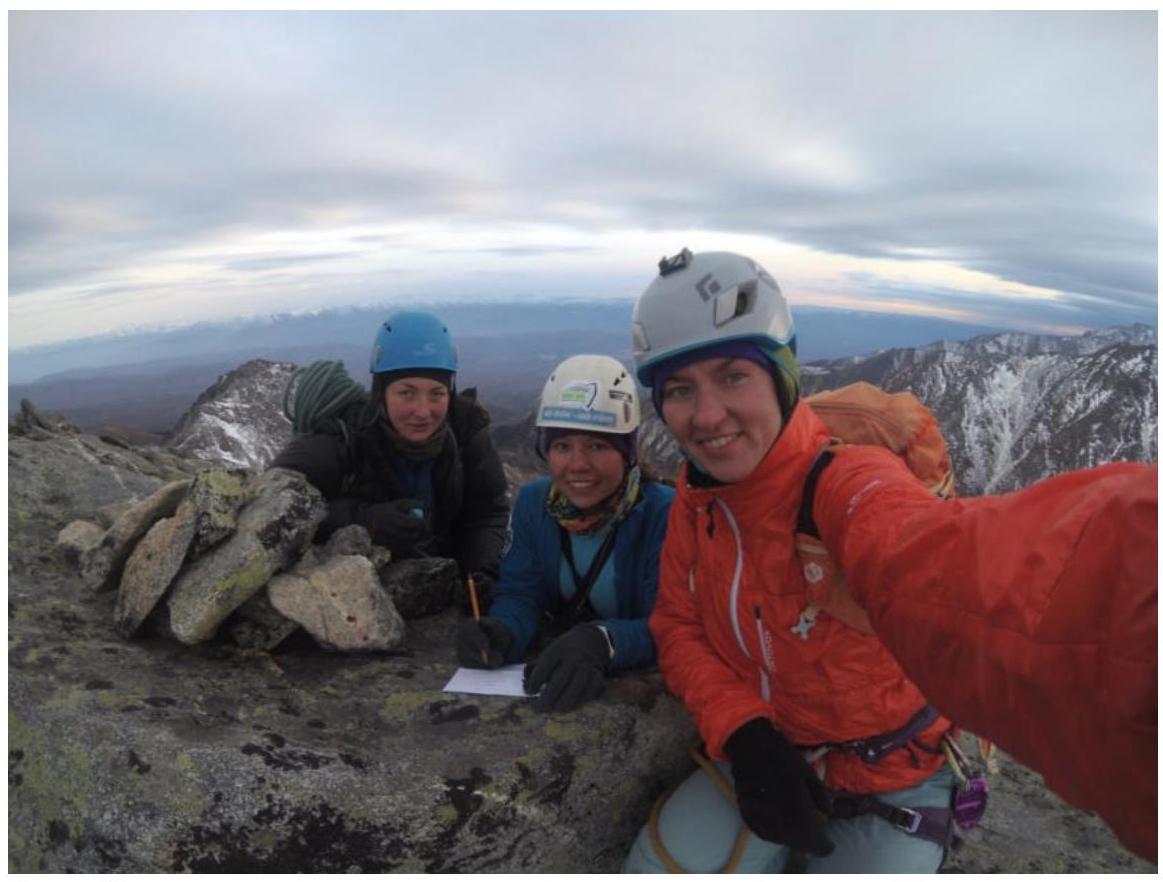
Photo 7.
3.3. Descent from the summit in a northern direction along the ridge, bypassing difficult sections on the left (west). Along the ridge 150 m. Rappelling 20 m to a saddle. From the saddle, descent via a scree gully in an eastern direction into the Gorkhon river valley. Caution! Live stones hang on the walls of the gully. In conditions of rain or heavy snowfall, it's possible to descend into a neighboring wide gully to the north (200 m), bypassing a pinnacle on the left (west). Return to the base camp downstream along the river.
It's worth noting the presence of loose blocks and individual loose stones on the route, especially in the upper part of the bastion.
The route along the Eastern ridge on Optimist summit, according to the participants' assessment, by analogy with other routes in the Eastern Sayan, corresponds to category 4A.
Photo Report by Sections
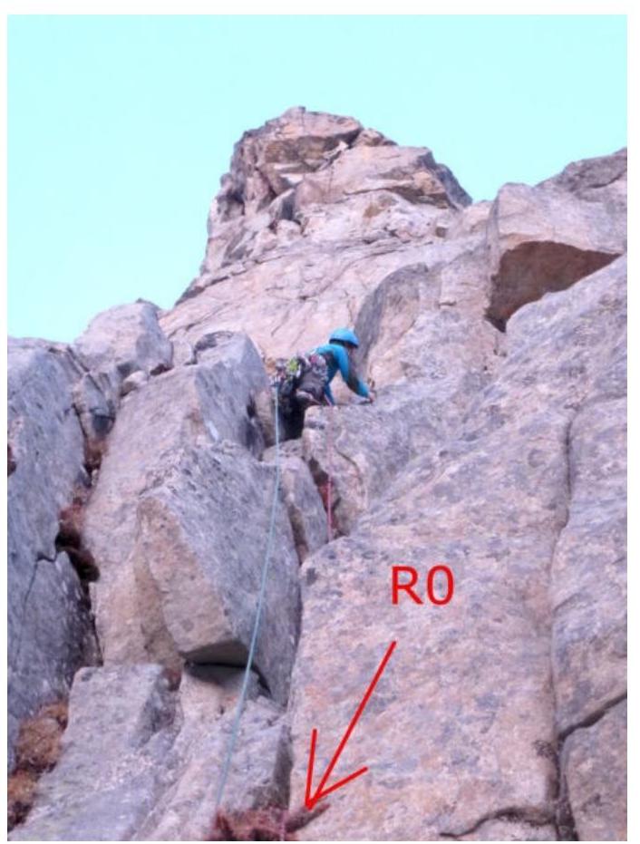
Photo 8. Start of the route
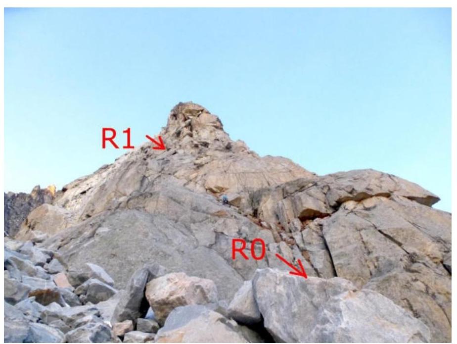
Photo 9. Section R0–R1
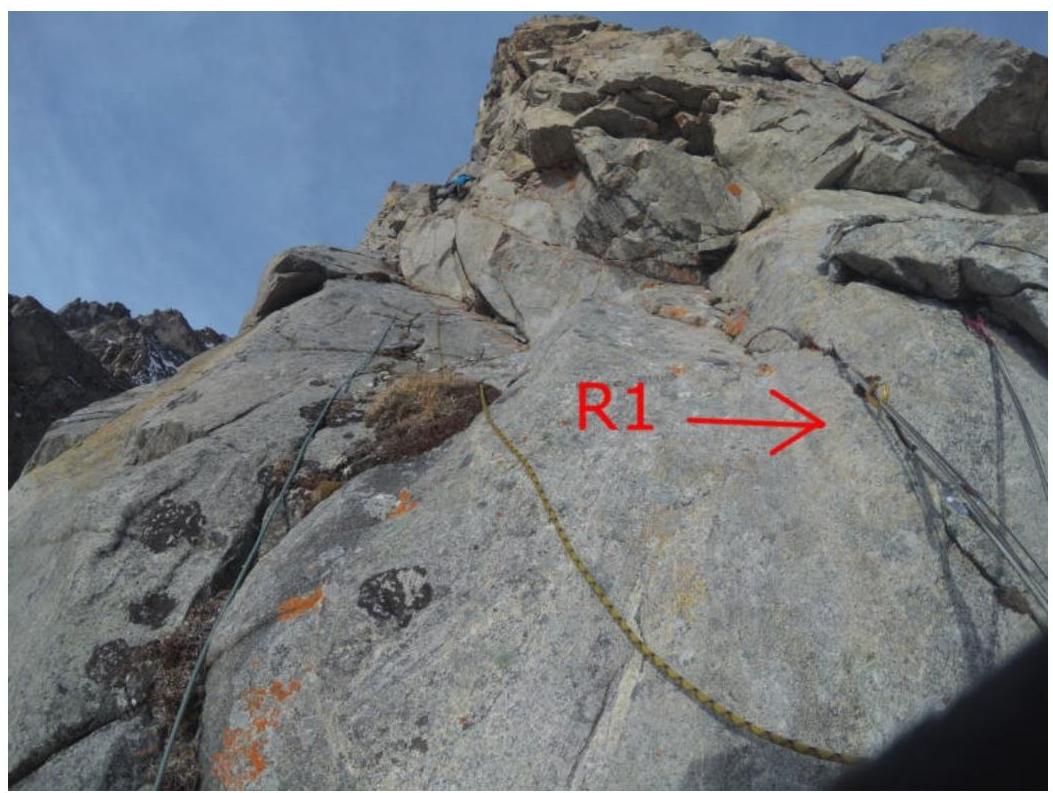
Photo 10. Section R1–R2
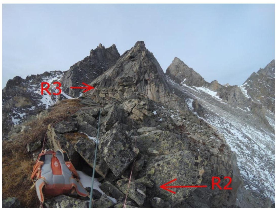
Photo 11. Section R2–R3
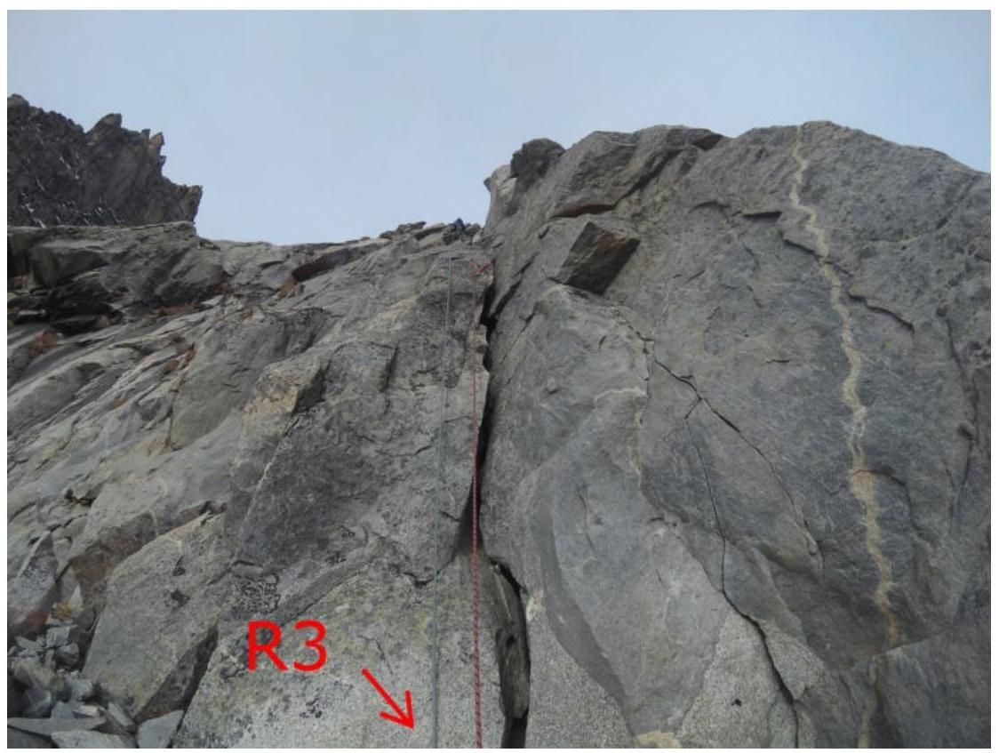
Photo 12. Start of R3–R4
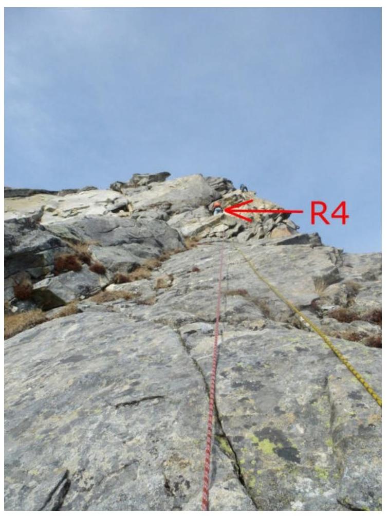
Photo 13. Section R3–R4
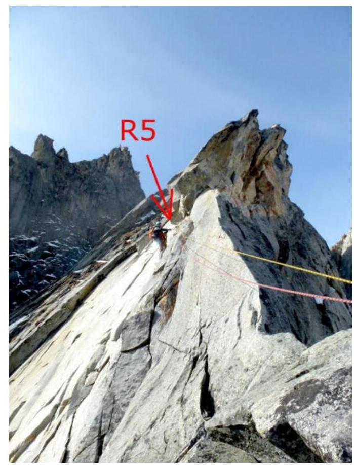
Photo 14. Section R4–R5
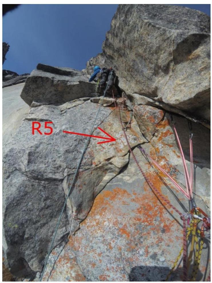
Photo 15. Start of R5–R6
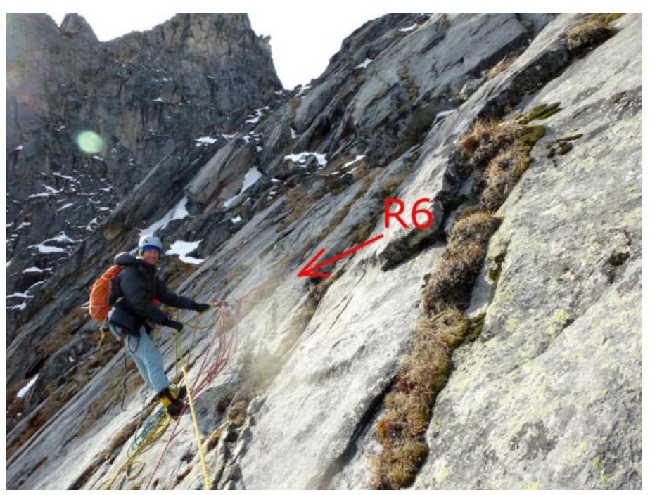
Photo 16. Section R5–R6

Photo 17. Section R6–R7
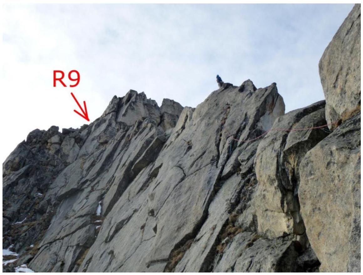
Photo 18. Section R8–R9