Irkutsk Regional Public Organization "Club of Active Leisure and Alpinism"
Gory Baykala
Report on the First Ascent
To v. Neftekhimikov 2746 m. Via the Western ridge. Approximately 1B category of difficulty.
Irkutsk, 2016. Climbing Passport
-
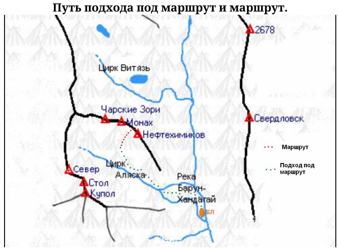
(Eastern) Sayan Mountains, Tunkin Goltsy, Barun-Khandagai river gorge. Section number according to the classification table (6.1.2).
-
Neftekhimikov 2746 m. (coordinates of the summit: 51° 54′ 59.55″ N, 102° 11′ 6.99″ E) via the Western ridge.
-
Category of difficulty: proposed 1B first ascent
-
Character of the route — rocky.
-
Elevation gain of the route: 458 m
Route length: 750 m. Average slope: total route 50°
- Hooks left on the route: total 0
Used on the route: nuts 0 (0)
- Team's moving hours: 5 h 40 min, overnight stays: no
- Leader: Glazunov Evgeny Vladimirovich (MS)
Participants:
- Yashin Mikhail Alekseevich (sign.)
- Rozhina Elvira Vyacheslavovna (sign.)
- Neverova Nina Mikhailovna (3rd sports category)
- Coach: Glazunov Evgeny Vladimirovich (MS)
Entry to the route: 6:00, September 5, 2016. To the summit — 11:40, September 5, 2016 g. Return to the base camp — 14:30, September 5, 2016.
- Irkutsk Regional Public Organization "Club of Active Leisure and Alpinism "Gory Baykala""
Overview of the climbing area, sports characteristics, and tactical actions of the team
General Information about the Area
Barun-Khandagai — a river and a gorge of the same name on the southern side of the Tunkin Goltsy ridge (Eastern Sayan). The ridge is composed of crystalline schists and granites. A dissected mid-mountain relief prevails. In the near-ridge part, an alpine-type relief is observed. The ridge peaks reach 3000–3300 m, the highest point being Peak Strelnikova (3284 m), the height difference between the ridges reaches 2000 m.
The Barun-Khandagai gorge is interesting for climbers and rock climbers. Rock climbing multipitches (6b+ 7a) have been prepared. Classified climbing routes from 1B to 6A inclusive have been laid out to the peaks of the gorge. There is an opportunity to make first ascents.
The peak Neftekhimikov is located to the east of the peak Monakh. Until now, one classified route of 4B category of difficulty has been laid out to it.
It is necessary to ascend via the couloir, which leads to the saddle between the peaks Monakh and Neftekhimikov.
General view of the peak
Neftekhimikov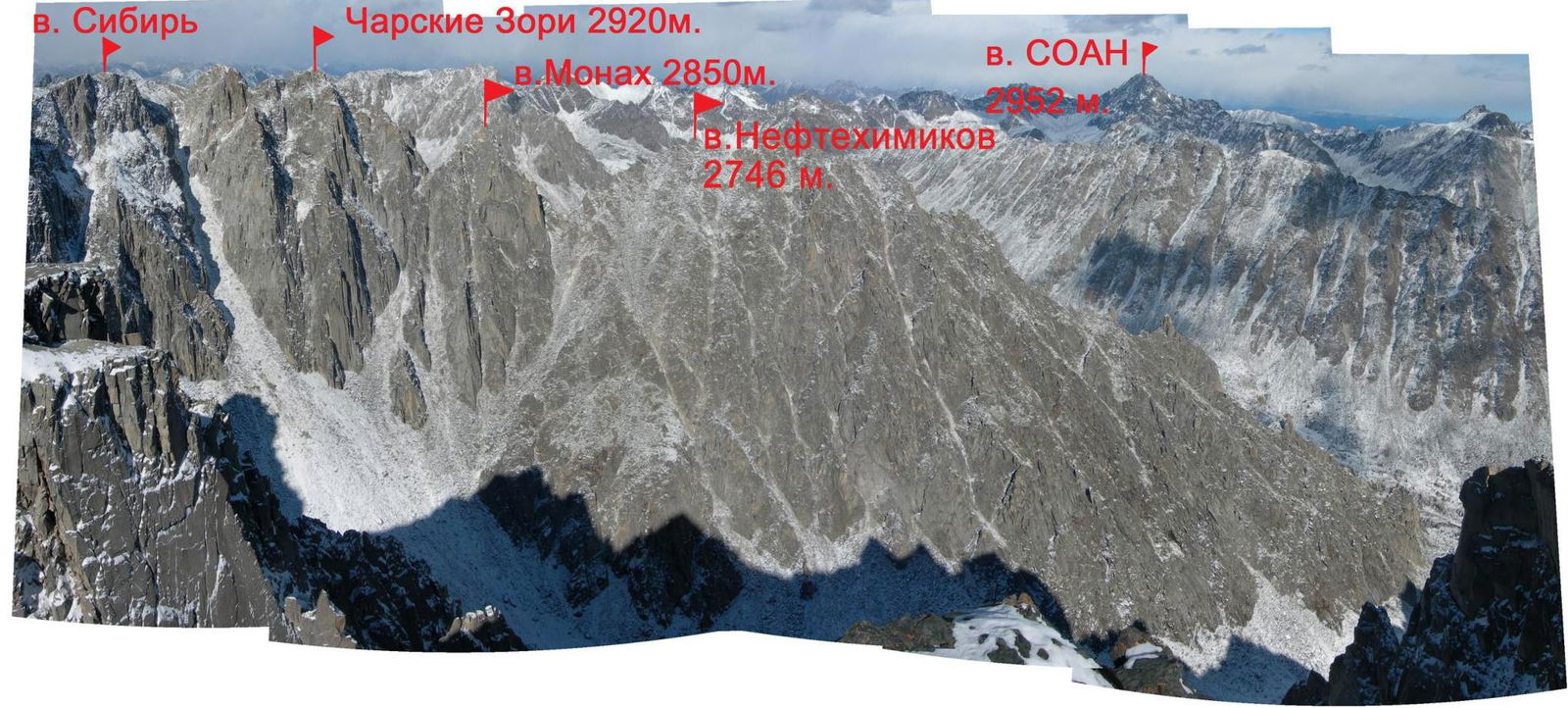
Route profile with the ascent
line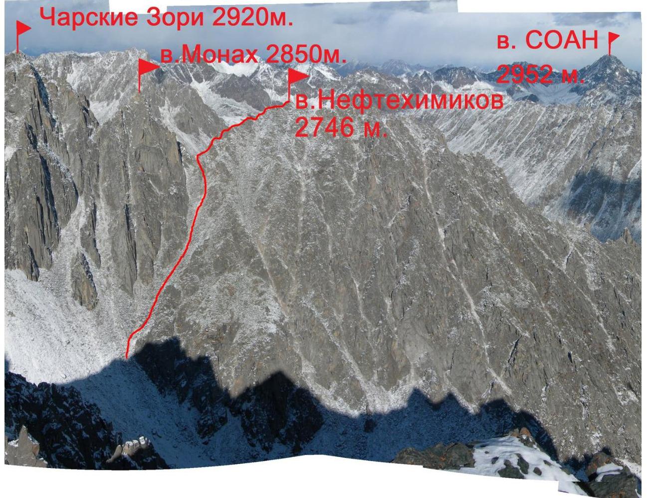
UIAA scheme of v. Neftekhimikov 2746 m
Description of the Route by Sections
Approach to the start of the route from the cirque of v. Kupol (Alaska). It is necessary to reach the couloir, which leads to the saddle between the peaks Monakh and Neftekhimikov.
0–1. Ascend the couloir, at the top turn slightly to the right to bypass the gendarme on the right. 400 m. 40° I
1–2. Bypass the gendarme on the right and follow the ridge towards v. Neftekhimikov. 170 m. 50° II
2–3. Follow the ridge to the sub-summit. 80 m. 55° II–III
3–4. From the sub-summit, proceed to the main summit. 100 m. 50° II
Descent via the ascent route. Photos from the
route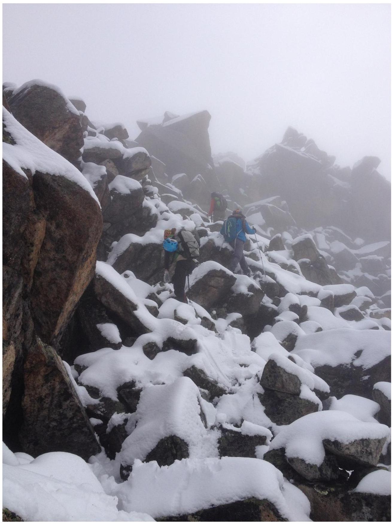
Ascent through the
couloir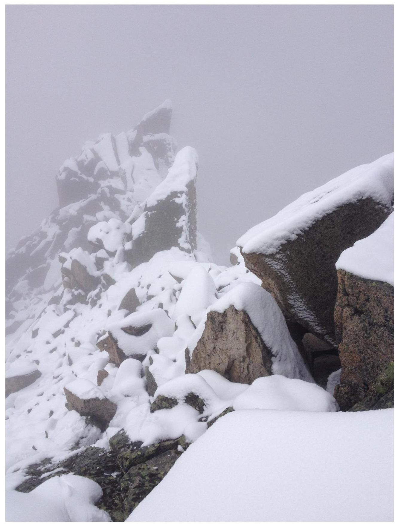
Ridge after the
gendarme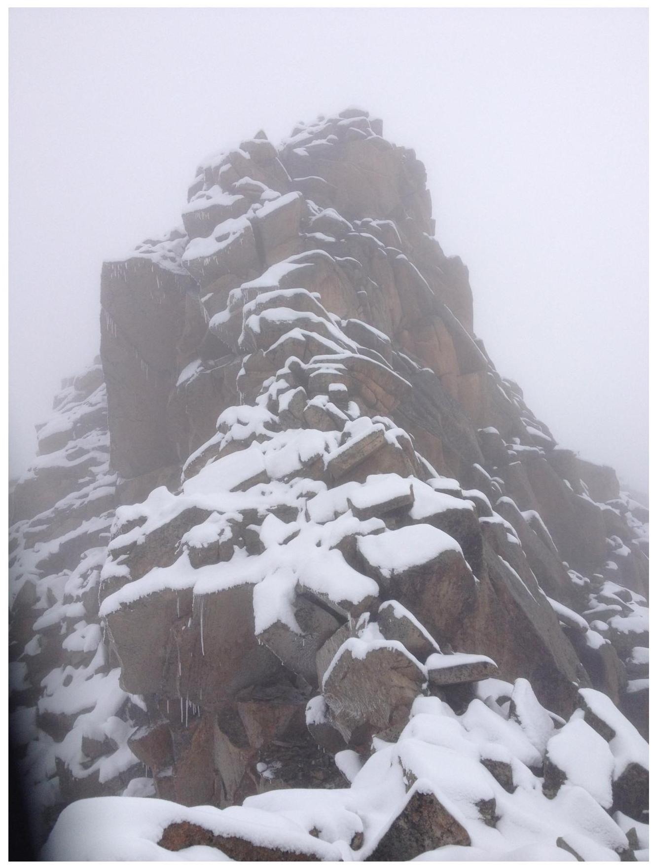
View from the sub-summit to the
summit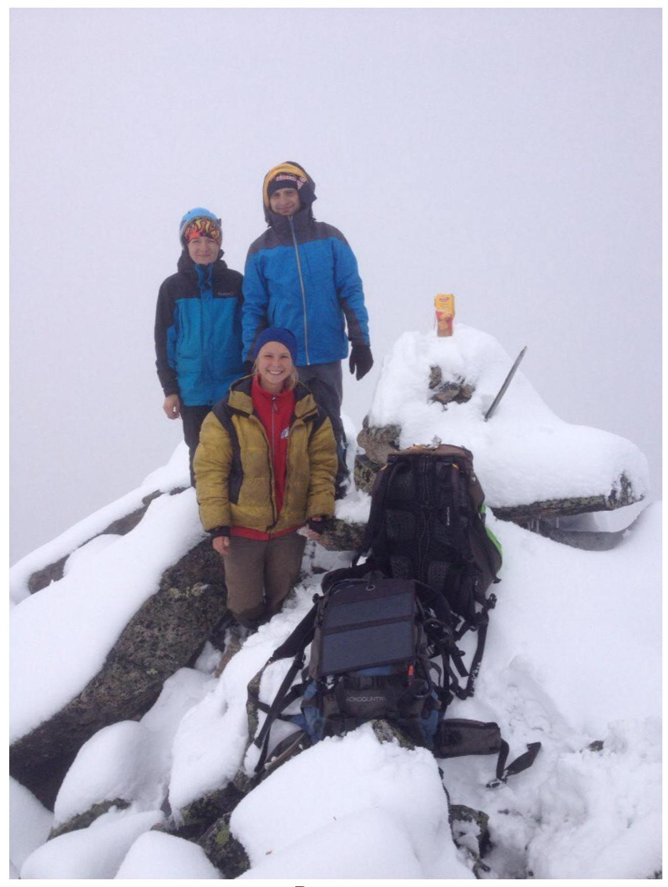
The summit