Ascent Report
Monakh Peak (2800 m)
Route via the South Counterfort, category 4A (proposed), first ascent. Eastern Sayan, Tunkinskiye Goltsy ridge, Barun-Khandagai valley, 6.1
Team Leader: Klepikov A.A. Participants:
- Il'inskiy V.A.
- Shcherban' A.N.
- Shakirov D.I.
Ascent Details
- Eastern Sayan, Tunkinskiye Goltsy ridge, Barun-Khandagai valley, 6.1.
- Monakh Peak (2800 m), South counterfort.
- Proposed category 4A — first ascent.
- Route type: rock climbing.
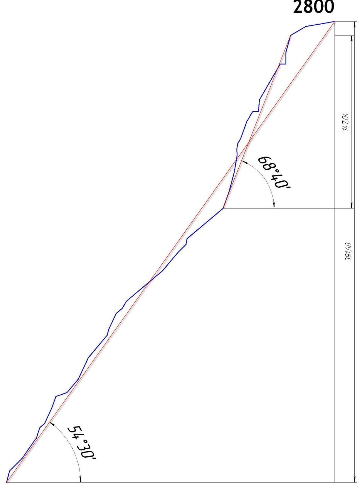
- Route elevation gain: 392 m
Route length: 512 m. Main section elevation gain: 147 m. Main section length: 167 m. Average steepness of the main section: 68°. Total route steepness: 54°. Section lengths:
- Category IV: 122 m
- Category V: 70 m
- Category VI: 37 m
- Pitons left on the route:
total: 0; including bolted pitons — 0. Total used on the route:
- bolted pitons — 0
- rock pitons (including anchors) — 4
- chocks — 17
- friends — 26
- skyhooks (including skyhook moves) — 0
Total number of belay points using artificial aids: 5
- Team's climbing hours (until the summit) — 8; days — 1
Number of bivouacs on the route — 0
- Team Leader: Klepikov Aleksandr Aleksandrovich (Master of Sports)
Participants:
- Il'inskiy Vasiliy Andreevich (1st sports category)
- Shcherban' Aleksey Nikolaevich (2nd sports category)
- Shakirov Daniil Igorevich (2nd sports category)
- Team Coach: Afanas'ev Andrey Evgen'evich (Master of Sports), (Coach), 1st category instructor
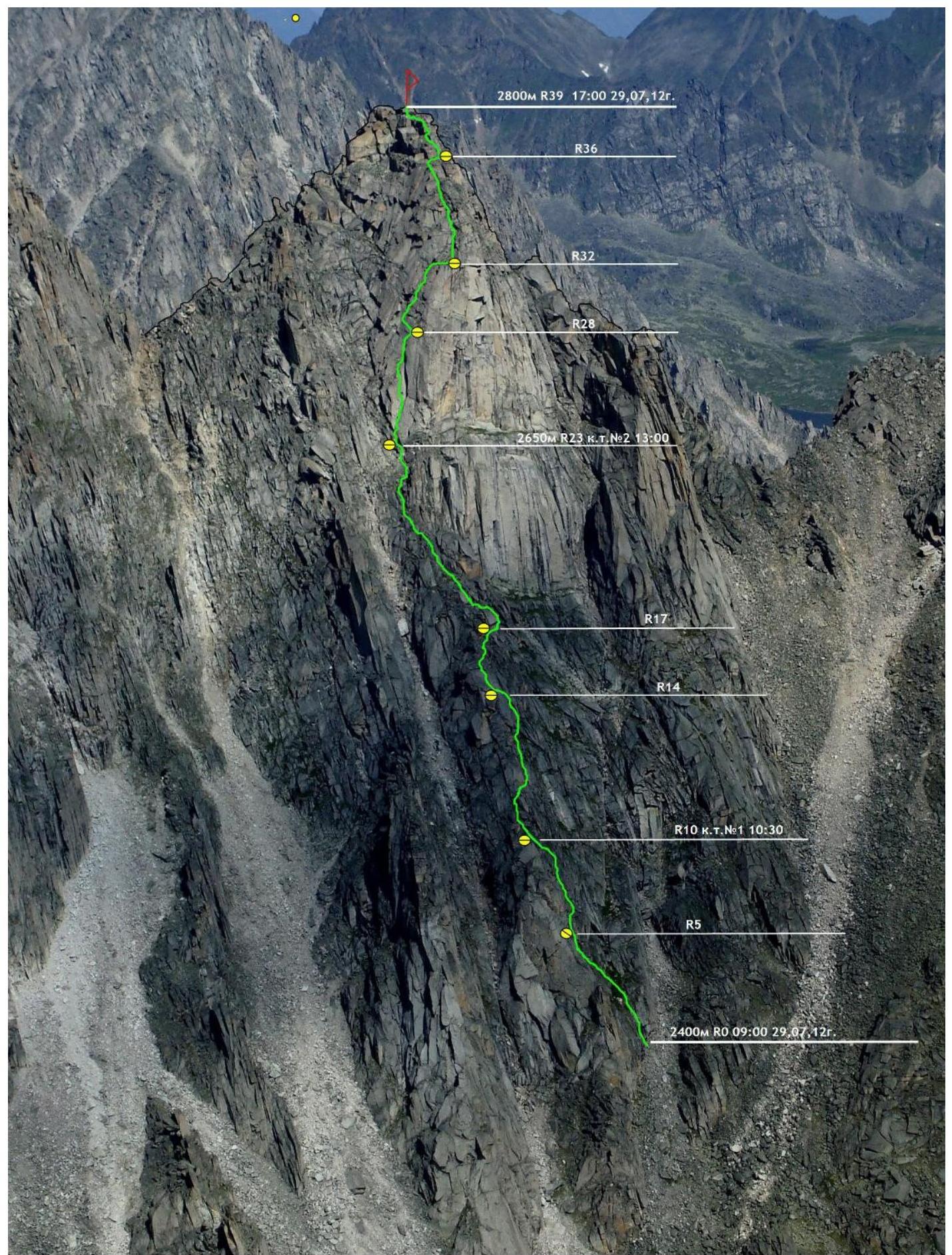
- Departure from Base Camp: 9:00, August 29, 2012
Reached the summit: 17:00, August 29, 2012. Returned to Base Camp: 22:00, August 29, 2012
Photo of the Southern wall of Monakh Peak.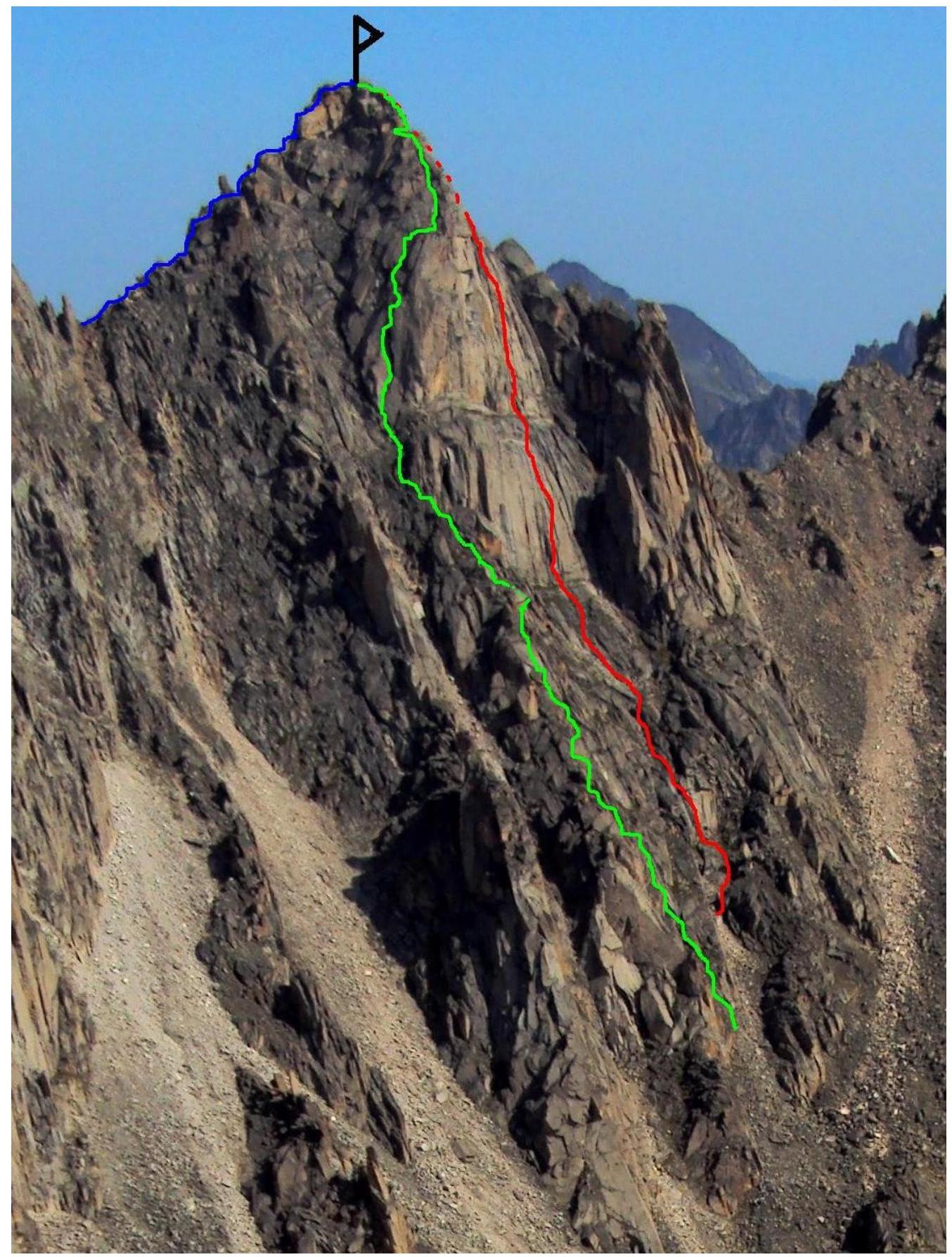
GREEN — route taken by the team
RED — Glazunov's route 2011, category 4Б
BLUE — Popov's route 2010, category 2Б
Photo of the route profile from the left (lower part). Photo taken during the first ascent of v. Sever via the NW shoulder's S wall on July 30, 2012. Height of 2350 m above sea level.
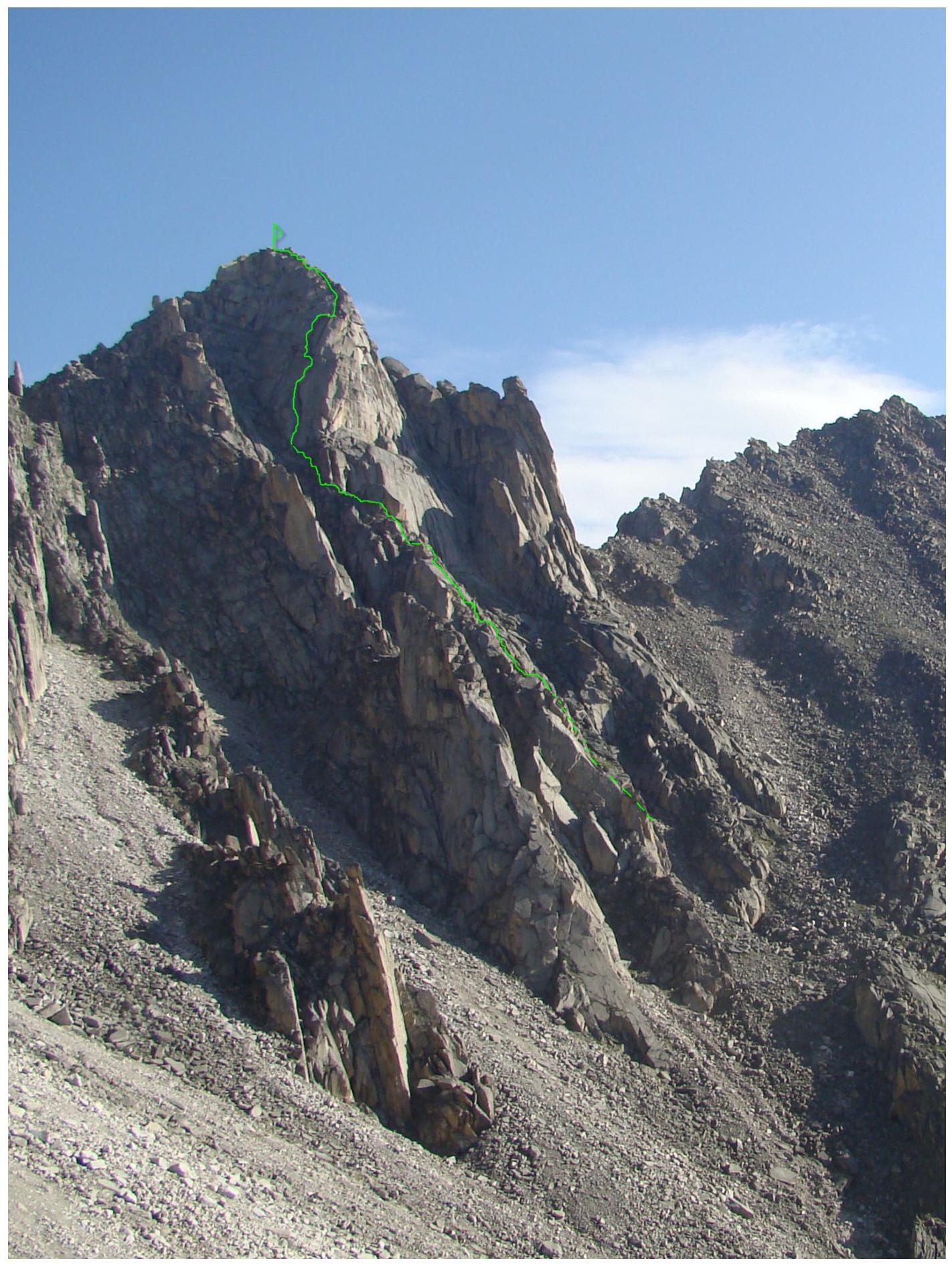
Photo of the route profile from the right (upper part).
Photo taken from the Alaska cirque, height of 2150 m above sea level. Date: July 30, 2012
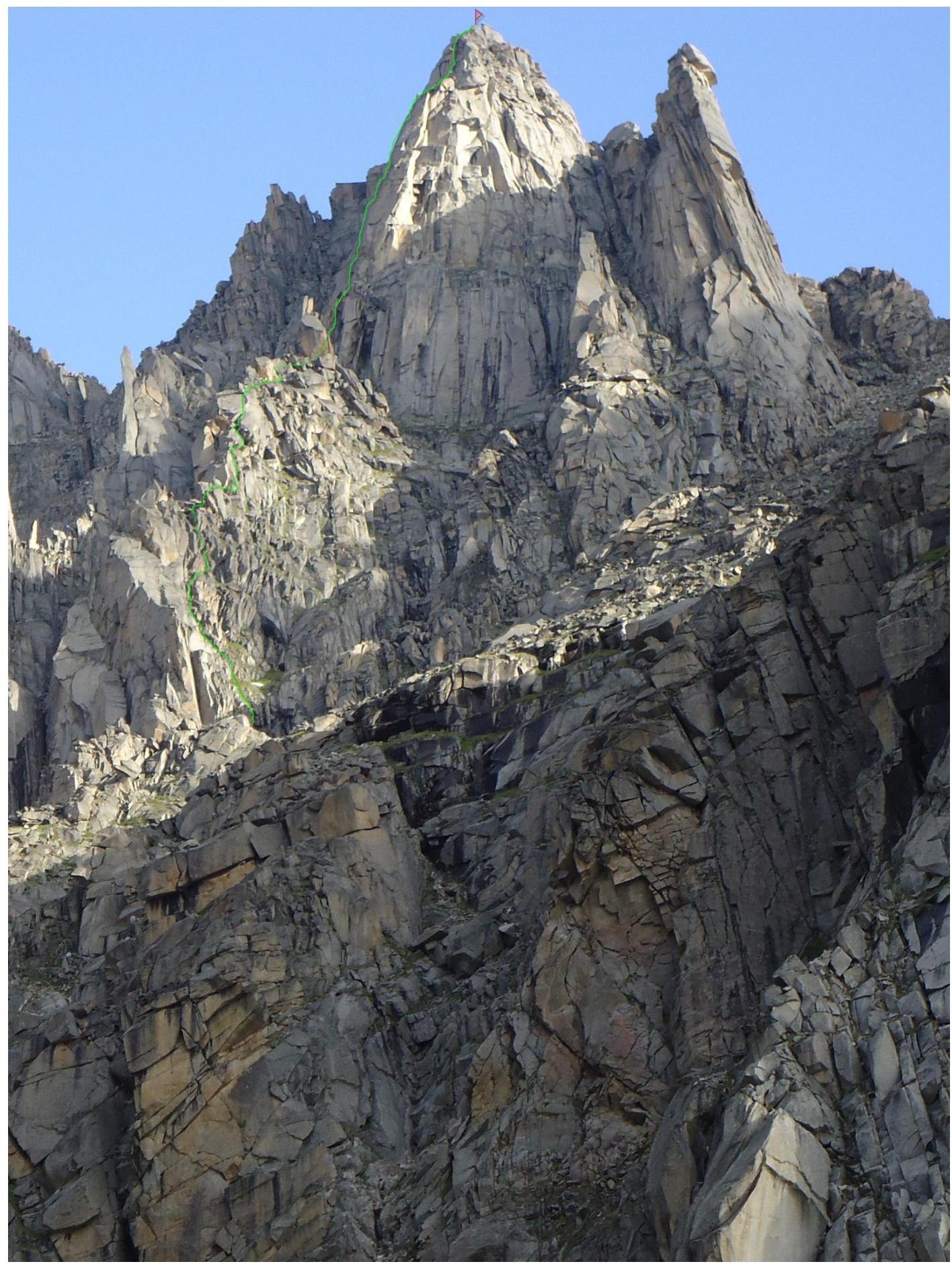
Drawn profile of the route
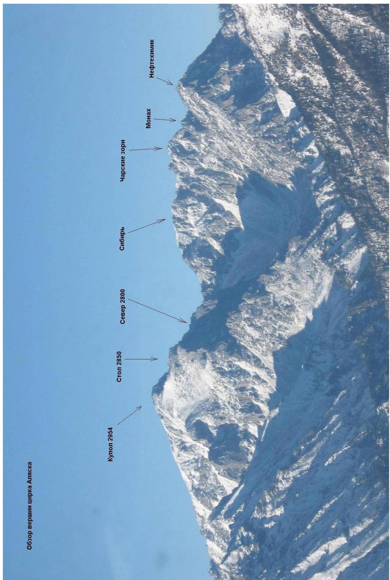
2410 Panorama of the Alaska cirque peaks
Barun-Khandagai valley is one of the most promising areas in the Eastern Sayan for sport climbing.
Monakh Peak is located in the same massif as Kupol Peak (2954 m), which dominates the area. It is situated in the Tunkinsky district of the Republic of Buryatia. The nearest large settlement is the village of Arshan. You can reach the foot of the mountain by car with high clearance.
The valley can be reached by car, so you can start the ascent from the "Barunovskaya clearing" (about 15 km). The route follows the valley, and there is a trail. The area is popular with tourists in the summer. The Alaska cirque is located to the left along the valley. The elevation gain on the approach is 1400 m, and the distance is approximately 15 km.
In the summer, it takes about 6-8 hours to reach the wall.
In winter, it may take 5-6 days due to the large amount of snow.
There are three routes to the summit of Monakh Peak from the south side:
- category 2Б
- category 4Б
- our proposed category 4A.
Ascent Timeline
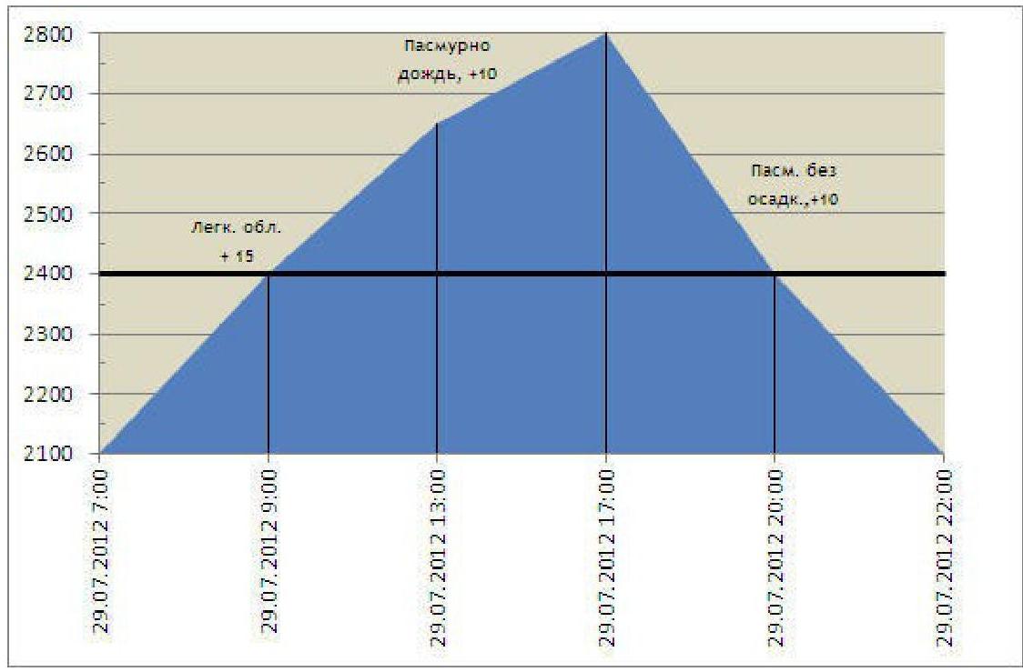
Team's movement timeline on the route:
- August 29, 2012, 07:00 — team departed from the Base Camp located in the Alaska cirque
- August 29, 2012, 09:00 — started working on the route
- August 29, 2012, 10:30 — Control Point (CP) №1, section R10
- August 29, 2012, 13:00 — CP №2, section R23
- August 29, 2012, 17:00 — Summit
- August 29, 2012, 22:00 — Returned to camp.
| Section | Chocks | Friends | Rock Pitons | Skyhooks | Scheme of the route in UIAA symbols M 1:2000 Sheet 1 | Length (m) | Steepness (°) | Climbing Grade | belay |
|---|---|---|---|---|---|---|---|---|---|
| R38–R39 | - | - | - | - | 25 | 0-20 | 2- | - | |
| R37–R38 | - | - | - | - | 15 | 30 | 2+ | - | |
| R36–R37 | 1 | 1 | - | - | 15 5(+10) | 75 0(90) | 4- -(5-) | - | |
| R34–(R36) | 1 | - | - | - | |||||
| R33–R34 | 1 | 1 | - | - | 35 | 60 | 4- | - | |
| R32–R33 | - | 1 | - | - | 60 | 4- | - | ||
| R31–R32 | - | - | - | - | 10 | 85 | 5- | - | |
| R30–R31 | - | - | 5 | 0 | - | - | |||
| R29–R30 | 1 | 1 | - | - | 10 | 60 | 3+ | ||
| R28–R29 | - | - | 15 | 70 | 5- | - | |||
| R26–(R28) | 2 | 2 | 3 | - | 5 | 60 | 4- | ||
| R25–R26 | - | 2 | - | - | 5(+5) | 95(80) | 6+(5-) | A2(–) | |
| R24–R25 | 1 | 2 | - | - | 15 | 80 | 6- | - | |
| R23–R24 | - | 2 | - | - | 17 | 75 | 6- | - | |
| R22–R23 | 1 | 1 | - | - | 15 | 70 | 5+ | - | |
| R21–R22 | - | - | 40 | 40 | 2+ | - | |||
| R20–R21 | 1 | - | 10 | 45 | |||||
| R19–R20 | - | - | - | - | 5 | 50 | 2- | - | |
| R18–R19 | - | - | 15 | 50 | 3- | ||||
| R17–R18 | 1 | 1 | - | - | 40 | 40 | 2+ | - | |
| R16–R17 | 1 | 2 | 1 | 7 | 60 | 4- | |||
| R15–R16 | - | - | - | - | 7 | 40 | 2+ | - | |
| R14–R15 | - | 2 | - | 15 | 65 | 5- | |||
| R13–R14 | - | - | |||||||
| :--: | :--: | :--: | :--: | :--: | :--: | ||||
| R12–R13 | - | - | - | - | |||||
| R11–R12 | 2 | 2 | |||||||
| R10–R11 | - | - | |||||||
| R9–R10 | - | - | |||||||
| R8–R9 | 1 | 1 | - | - | |||||
| R7–R8 | - | 1 | |||||||
| R5–R6 | - | 1 | - | - | |||||
| R4–R5 | 1 | 2 | |||||||
| R2–R3 | 1 | - | |||||||
| R1–R2 | - | - | - | - | |||||
| R0–R1 | 1 | 1 |
| 5 | 75 | 4- | |
|---|---|---|---|
| 25 | 50 | 3- | |
| 20 | 65 | 4+ | |
| 15 | 50 | 2+ | |
| 10 | 20 | 1+ | |
| 10 | 70 | 4+ | - |
| 15 | 65 | 3+ | |
| 5 | 70 | 4- | - |
| 5 | 75 | 4+ | - |
| 20 | 55 | 2+ | - |
| 15 | 45 | 2- | - |
| 10 | 75 | 4- | - |
Route scheme in UIAA symbols, 1:2000 scale, sheet 1
Terrain Description
R0–R1 10 m, 75°, 4 — Wet VUKAMIN. Exit left from the couloir. R1–R2 15 m, 45°, 2 — Steep grassy slope, movement follows the line of water flow. R2–R3 20 m, 55°, 2+ VU slightly left. R3–R4 1 m, 30°, ledge. R4–R5 5 m, 75°, 4+ Wall under an overhang. Belay station. R5–R6 5 m, 70°, 4 — Traverse right, under the overhang. R6–R7 5 m, 40°, 2 — Grassy ledge under VU. R7–R8 15 m, 65°, 3+ VU with grass. R8–R9 10 m, 70°, 4+ VU slightly right. R9–R10 10 m, 20°, 1+ Along the ridge on a ledge. Belay station. R10–R11 15 m, 50°, 2+ Along the ridge. R11–R12 20 m, 65°, 4+ Right of the ridge, through internal corners. R12–R13 25 m, 50°, 3 — Crumbly ridge. R13–R14 5 m, 75°, 4 — Squeeze between rocks — "skuroder". R14–R15 15 m, 65°, 5 — Wide crack on a slab. R15–R16 7 m, 40°, 2+ Along the ridge. R16–R17 7 m, 60°, 4 — Polished rocks under an overhanging stone to the right of the ridge. R17–R18 40 m, 40°, 2+ Right of the ridge, transition to the left side. R18–R19 15 m, 50°, 3 — VU. R19–R20 5 m, 50°, 2 — Descent. R20–R21 10 m, 45°, 2+ Diagonal ledge. R21–R22 5 m, 80°, 4 — Corner onto the ridge. R22–R23 40 m, 40°, 2+ Left of the "feathers" under the wall, CP №2. R23–R24 15 m, 70°, 5+ VU. R24–R25 17 m, 75°, 6 — System of cracks left. R25–R26 15 m, 80°, 6 — Under a steep VU. R26–R27 5 m, 95°, 6+, A2 On a steep VU. R27–R28 5 m, 80°, 5 — Exit onto a ledge. R28–R29 5 m, 60°, 4 — Left traverse. R29–R30 15 m, 70°, 5 — /+ Up through large-block terrain, slightly right. R30–R31 10 m, 60°, 3+ Exit onto a ledge. R31–R32 5 m, 0°, ledge. R32–R33 10 m, 85°, 5 — VU up from the ledge. R33–R34 35 m, 60°, 4 — Easy climbing through large-block rocks upwards. R34–R35 5 m, 0°, ledge. R35–R36 10 m, 90°, 5 — Horizontal traverse onto another ledge to the right. R36–R37 15 m, 75°, 4 — Wall onto the ridge, step through a crack. R37–R38 15 m, 30°, 2+ Diagonal ledge. R38–R39 25 m, 0–20°, 2 — Exit onto the summit.
Technical Photos of the Route
Photo taken from Stol Peak (2850 m) on August 3, 2012.
Characteristics of the route and team's actions on the wall. There are only two classified routes on the south side of Monakh Peak:
- category 2Б by Popov in 2010
- category 4Б by Glazunov in 2011
Our route follows the south counterfort of Monakh Peak and is a logical continuation of the terrain from the start to the summit.
The lower part of the route, up to the summit tower, constitutes approximately 65% of the total length and resembles a category 3A route. The summit tower is the key section of the route, with the steepness of the first and second ropes exceeding 70°. The climbing difficulty on the first rope is mainly 5+, 6– (UIAA) or 5C–6B (French), but reaches 6+ (UIAA) or 7C (French) on one section. This section is practically impassable without artificial aids. The route is characterized by minimal use of pitons, necessary only on the key section.
The descent from the summit is done towards the Neftehimik Peak, down to the eastern shoulder of Monakh Peak, then between the eastern shoulder and the summit tower to a passage through the southern ridge of the eastern shoulder, and finally through it into the couloir between Monakh and Neftehimik Peaks.
On the descent:
- at least four rappels,
- the rest can be done by climbing.
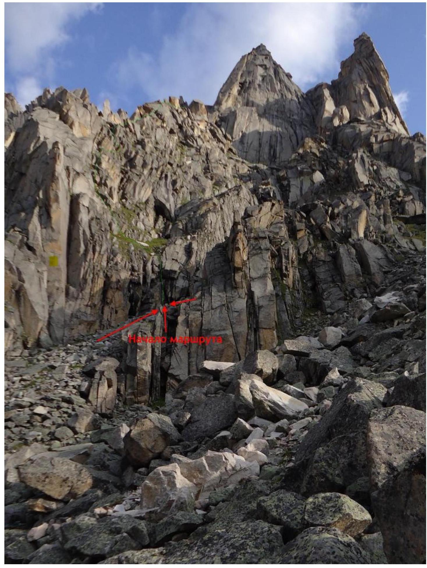
Start of the route.
40 m from the start of the couloir, orient by a large patch of grass.
First rope. Leader is at the belay station at point R5.
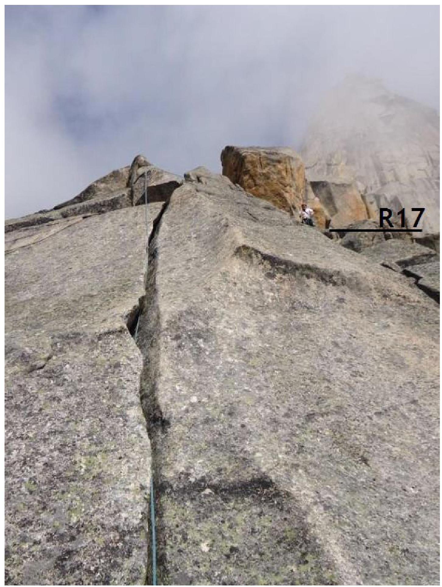
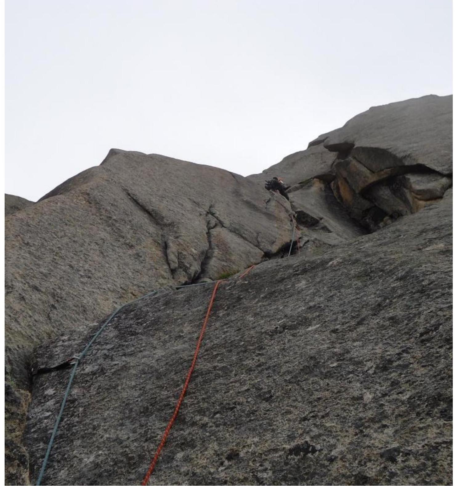
Section R14–R15. Passage through a steep slab with a crack.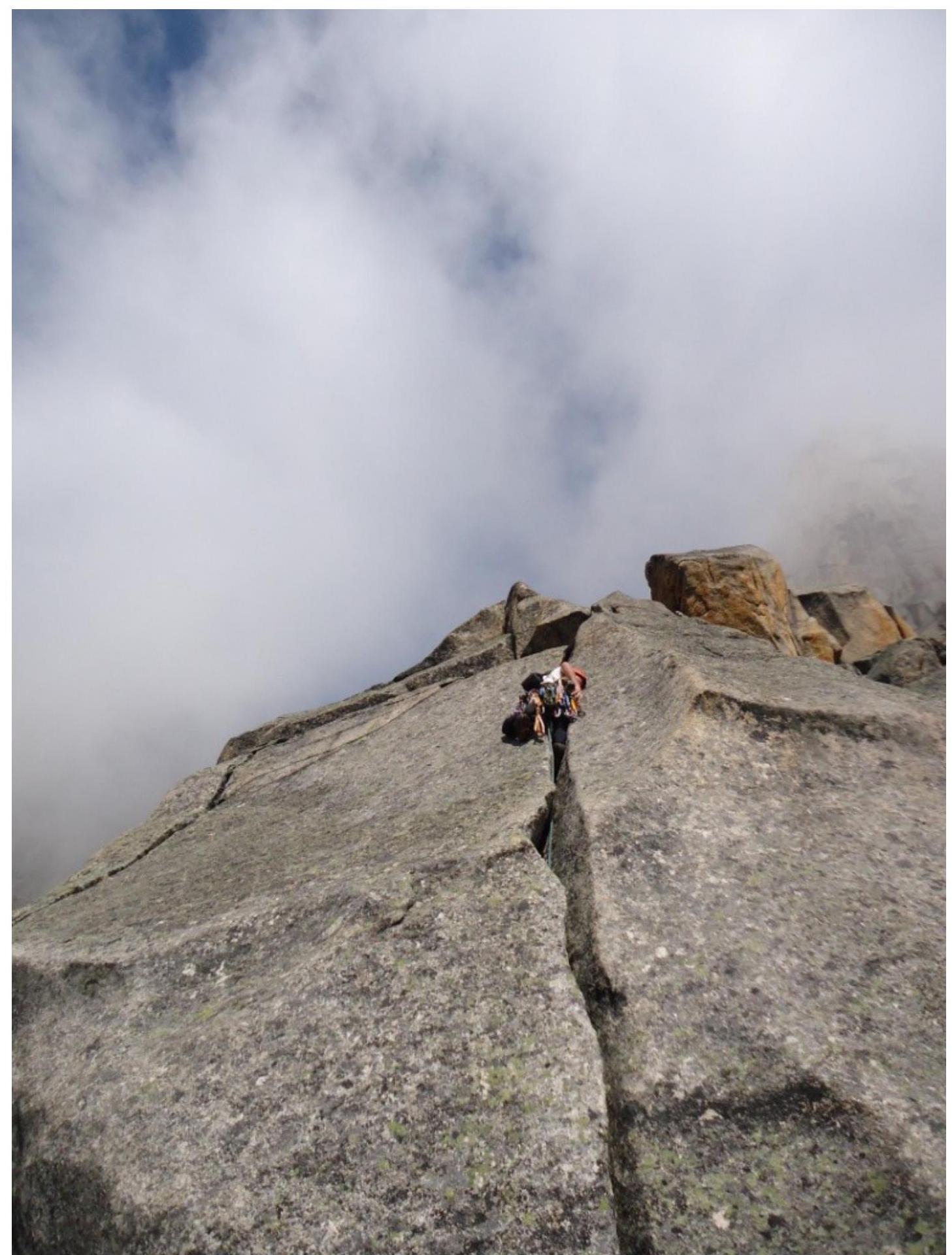
Key section of the route, summit tower. Section R23–R24, climbing 5+.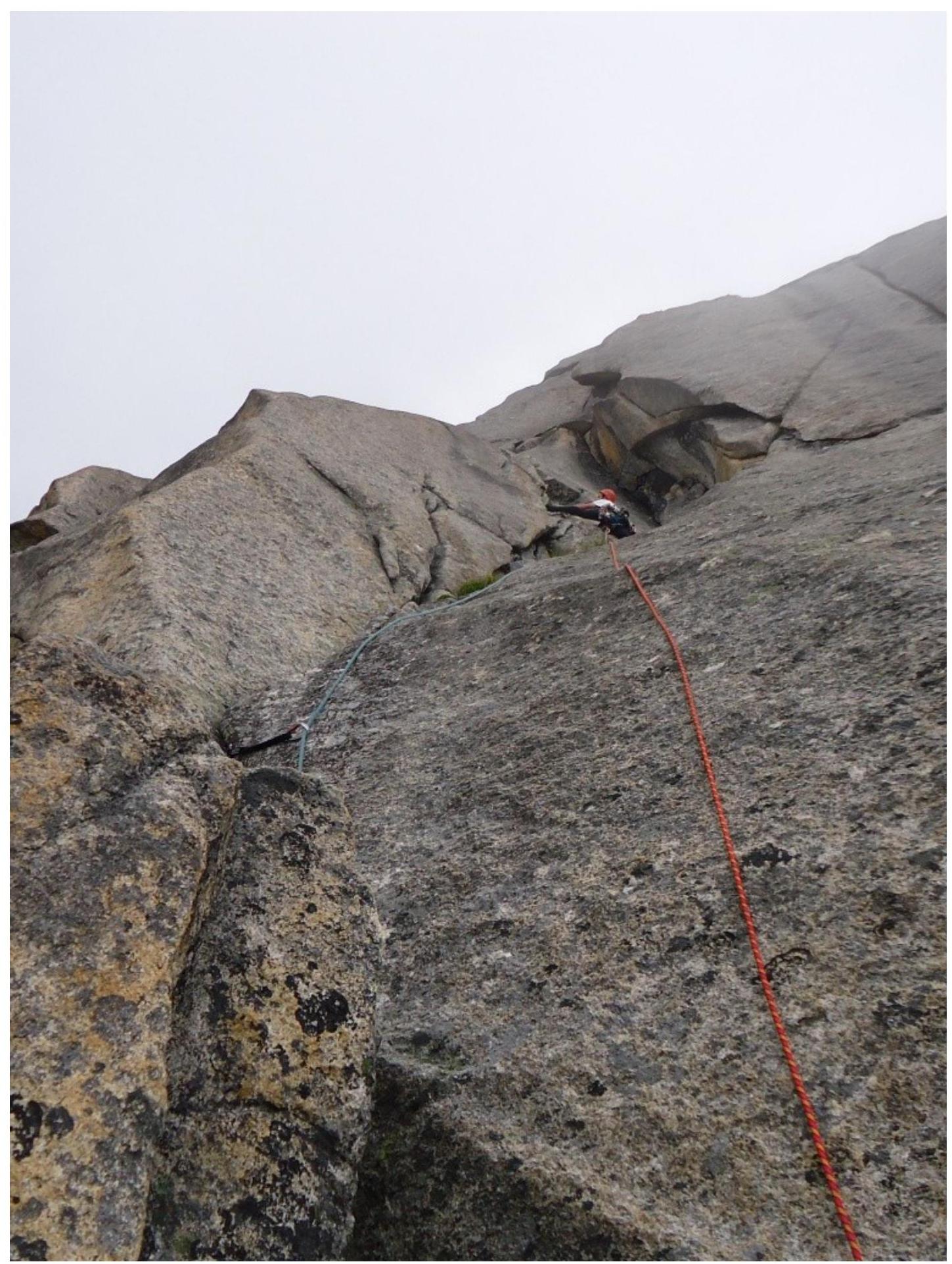
Key section of the route, summit tower. Section R24–R25, climbing category 6Б.
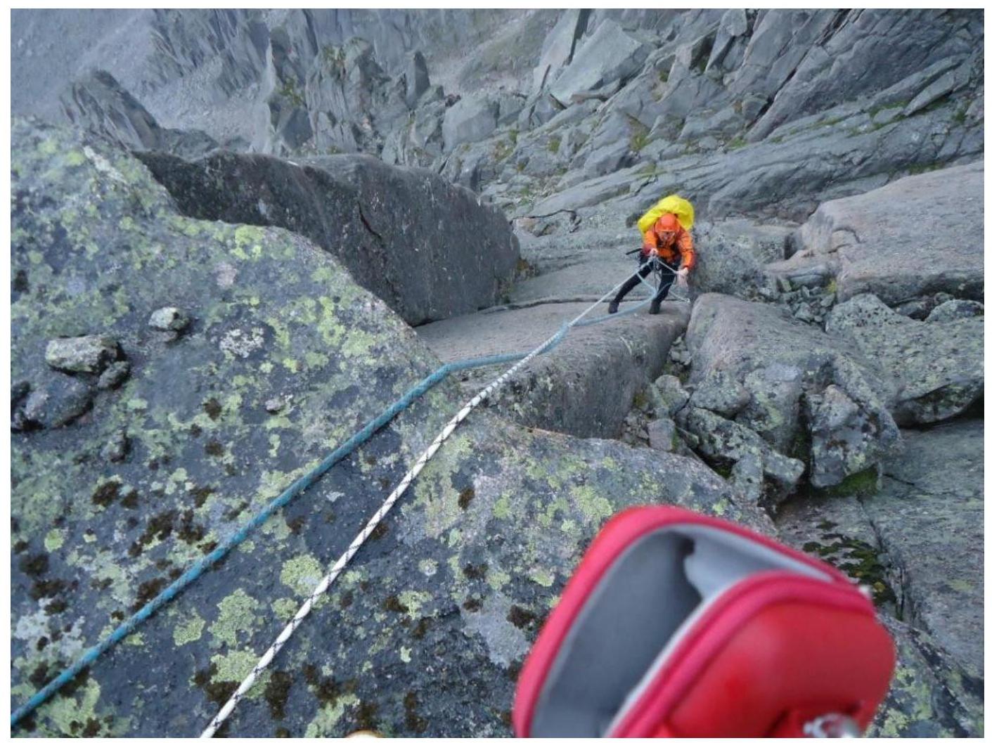
Key section of the route, summit tower, second rope.
Second climber following the rope. Rocks are wet.
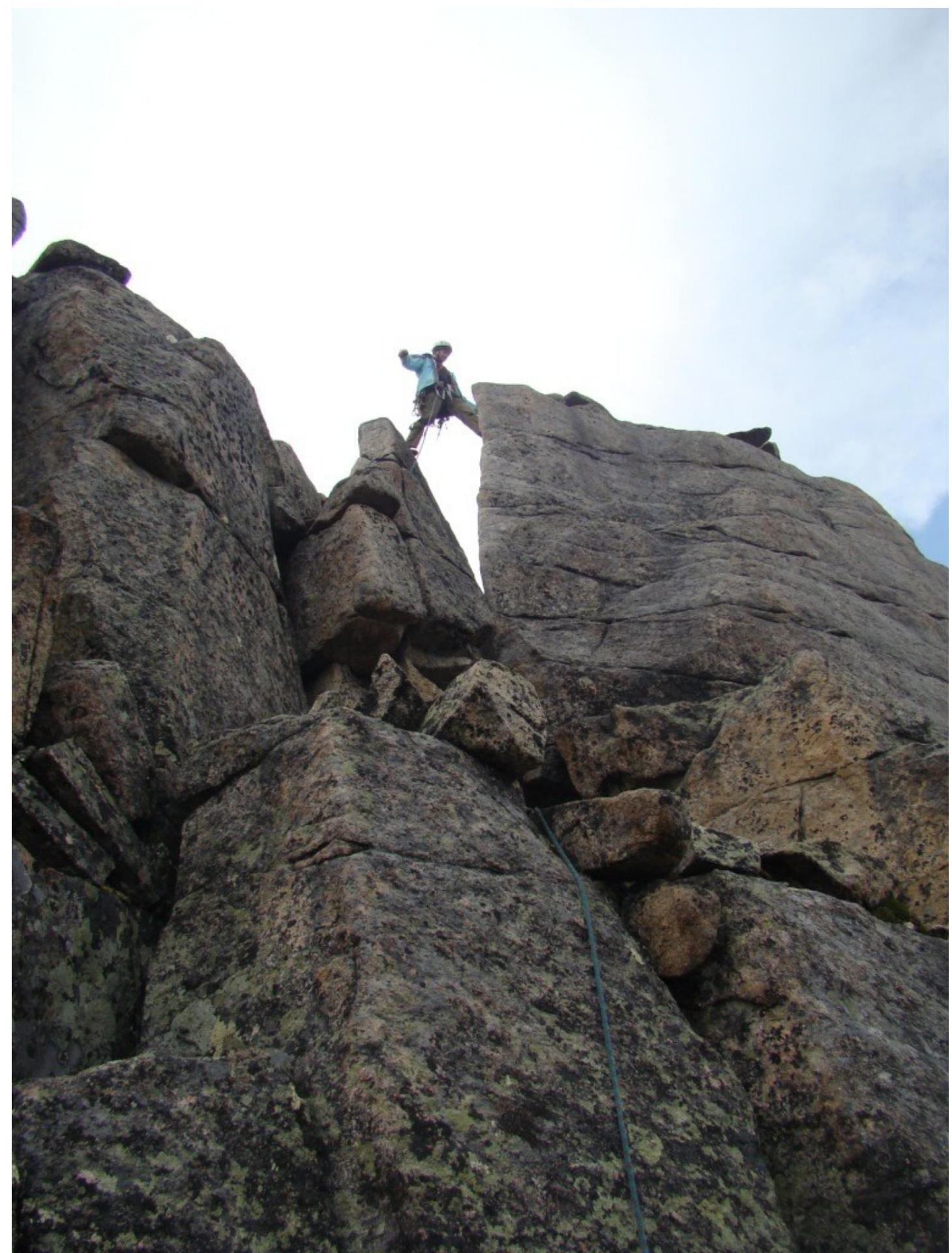
Summit tower, third rope. Climbing through large-block terrain. Rocks are wet.

Summit tower. Section R36–R37 — overcoming a gap. Rocks are wet.
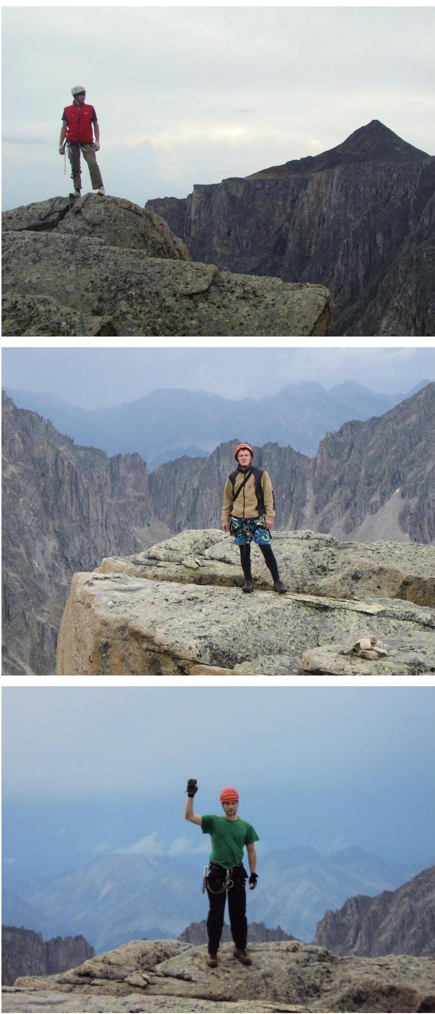
Team members on the summit: Klepikov A.A., Il'inskiy V.A., Shakirov D.I.