Russian Championship in Alpinism
High-Altitude Technical Class 2020
Report
on the ascent to Peak Kupol, 2954 m, via the V plecha wall, 6A category of complexity, Afanasiev's route, by the team from Krasnoyarsk, August 13, 2020.
I. Ascent Passport
| 1. General Information | ||
|---|---|---|
| 1.1 | Full Name, Sports Rank of the Leader | Prokofiev D.E. (MS) |
| 1.2 | Full Name, Sports Rank of Participants | Popova M.E. (MS) |
| 1.3 | Full Name of Coach | Zakharov N.N. (MSMK), Balezin V.V. (MSMK), Prokofiev D.E. (MS) |
| 1.4 | Organization | Krasnoyarsk Regional Alpinism Federation |
| 2. Characteristics of the Ascent Object | ||
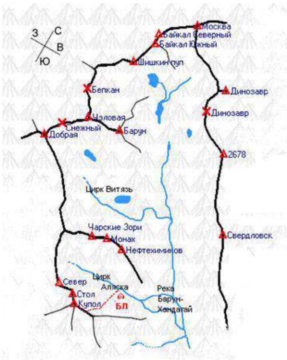
| 2.1 | Region | 6. SAYANS, 6.1.2. Tunkin Golsy |
| 2.2 | Valley | Barun-Khandagai valley |
| 2.3 | Classification Table Section Number (2013 edition) | 6.1.2 |
| 2.4 | Name and Height of the Summit | Peak Kupol, 2954 m |
| 2.5 | Geographical Coordinates of the Summit (latitude/longitude), GPS Coordinates | |
| 3. Route Characteristics | ||
| 3.1 | Route Name | From V plecha wall ("Klinok") |
| 3.2 | Proposed Category of Complexity | 6A |
| 3.3 | Degree of Route Exploration | |
| 3.4 | Terrain Characteristics | Rocky |
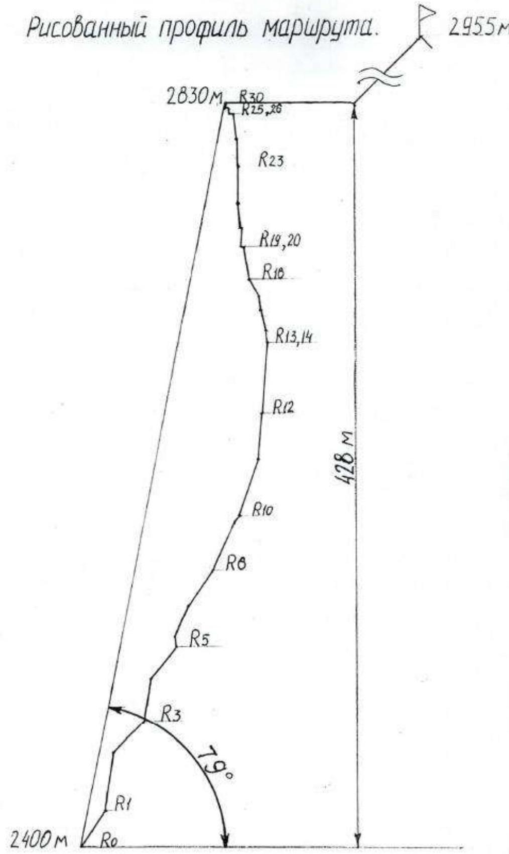
| 3.5 | Altitude Difference (data from altimeter or GPS) | 554 m |
| 3.6 | Route Length (in meters) | 730 m, wall part 461 m |
| 3.7 | Technical Elements of the Route (total length of sections of varying complexity with terrain characteristics (ice-snow, rocky)) | 1st cat. complexity ice/rock/combination — m. 2nd cat. complexity ice/rock/combination — m. 3rd cat. complexity ice/rock/combination — m. 4th cat. complexity rock — 745 m. 5th cat. complexity rock — 415 m. 6th cat. complexity rock — 595 m. Rock 6, A3 — 150 m. Rock 6, A4 — 15 m |
| 3.8 | Average Steepness of the Route, ° | 52° |
| 3.9 | Average Steepness of the Main Route Part, ° | 79° |
| 3.10 | Descent from the Summit | Via 1B category route to Barun valley |
| 3.11 | Additional Route Characteristics | |
| 4. Team Actions Characteristics | ||
| 4.1 | Time of Movement (team's walking hours, in hours and days) | 10 h 45 min, 1 day |
| 4.2 | Overnight Stays | - |
| 4.3 | Route Processing Time *(3) | 0 h, 0 days |
| 4.4 | Start of the Route | 6:50 August 13, 2020 |
| 4.5 | Summit Ascent | 17:35 August 13, 2020 |
| 4.6 | Return to Base Camp | 19:20 August 13, 2020 |
| 5. Weather Conditions *(4) | ||
| 5.1 | Temperature, °C | 14° |
| 2 | Wind Speed, m/s | 5 m/s |
| 5.3 | Precipitation | Slight rain in the upper part of the route |
| 5.4 | Visibility, m | full |
| 6. Responsible for the Report | ||
| 6.1 | Full Name, e-mail | Popova M.E. kalipso1966@mail.ru |
II. Ascent Description
1. Ascent Object Characteristics
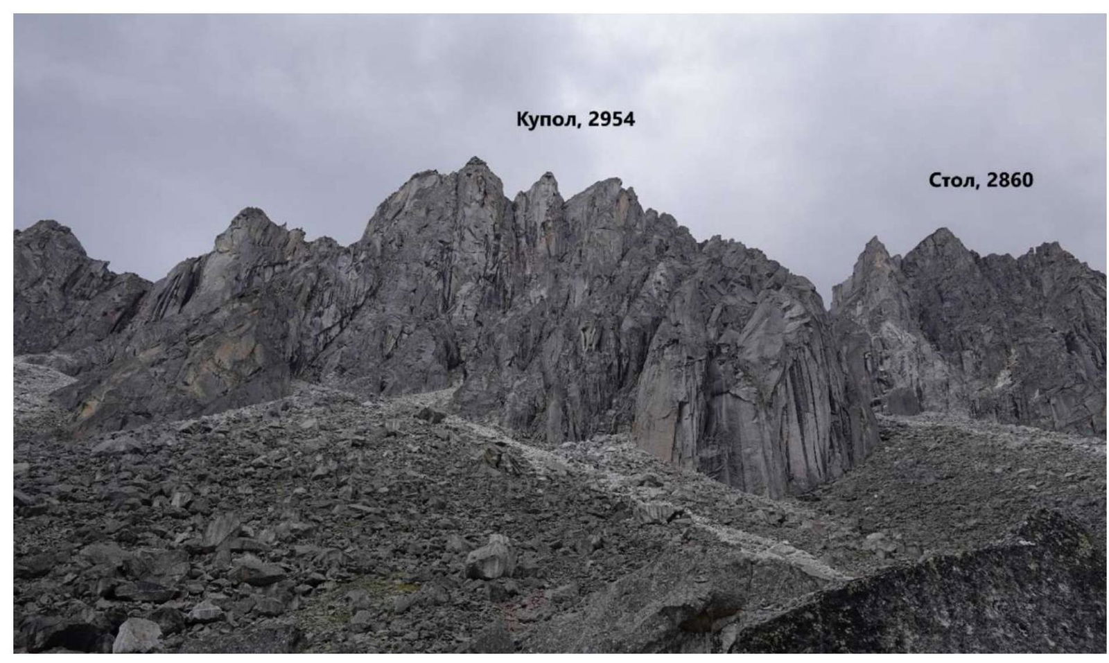
1.1. General Photo of the Summit
Peak Kupol, 2954 m, red line — team's route (From V plecha wall "Klinok", 6A).
1.2. Route Profile Photo
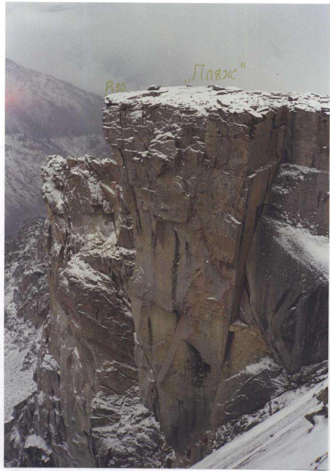
Photo: report of the first ascenders of this route (Afanasev — Khandzhapov, 2002).
1.3. Hand-Drawn Route Profile
1.4. Panoramic Photo of the Area
1.5. Area Map
2. Route Characteristics
2.1. Technical Photo of the Route
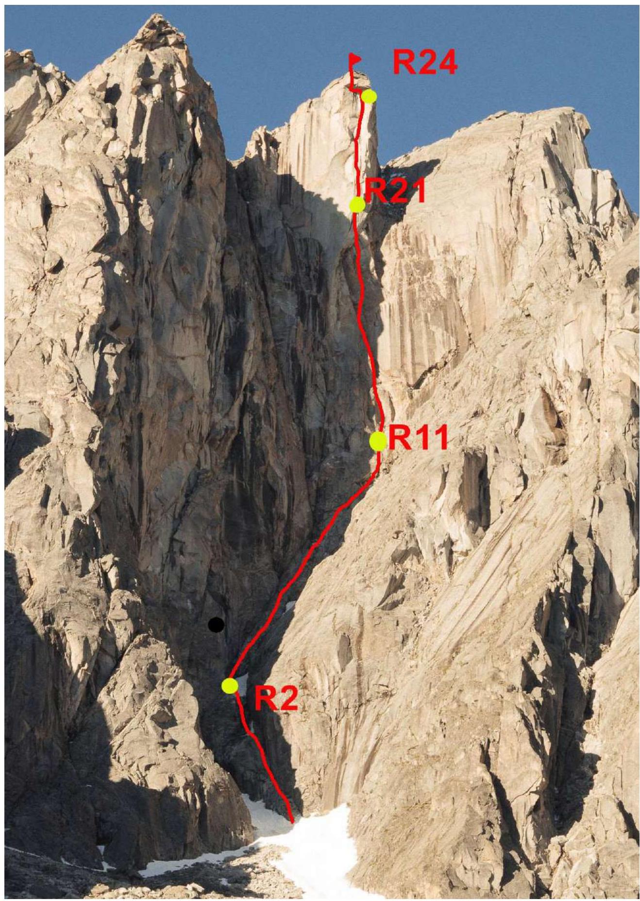
Photo: S. Glazunov (2016).
2.3. UIAA Symbol Route Diagram
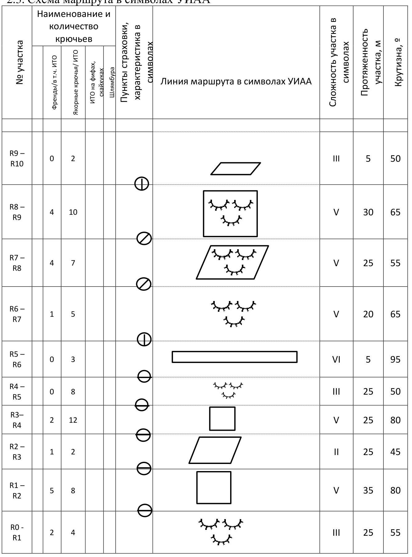
| Section # | Friends/ incl. ITO | Anchor Hooks/ITO | ITO on Fiffs, Skyhooks | Bolts | Belay Points, Description in Symbols | Route Line in UIAA Symbols | Section Complexity in Symbols | Section Length, m | Steepness, ° |
|---|---|---|---|---|---|---|---|---|---|
| R9–R10 | 0 | 2 | 3 | 5 | 50° | ||||
| R8–R9 | 4 | 10 | 5 | 30 | 65° | ||||
| R7–R8 | 4 | 7 | 5 | 25 | 55° | ||||
| R6–R7 | 1 | 5 | 5 | 20 | 65° | ||||
| R5–R6 | 0 | 3 | 6 | 5 | 95° | ||||
| R4–R5 | 0 | 8 | 3 | 25 | 50° | ||||
| R3–R4 | 2 | 12 | 5 | 25 | 80° | ||||
| R2–R3 | 1 | 2 | 2 | 25 | 45° | ||||
| R1–R2 | 5 | 8 | 5 | 35 | 80° | ||||
| R0–R1 | 2 | 4 | 3 | 25 | 55° | ||||
| R19–R20 | 1/1 | 1/1 | 6, A2 | 2 | 180° | ||||
| R18–R19 | 4/4 | 5/5 | 4 | 6, A3+ | 17 | 100° | |||
| R17–R18 | 1/1 | 2/2 | 2 | 6, A2 | 7 | 120° | |||
| R16–R17 | 2/2 | 2/2 | 2 | 1 | 6, A3+ | 8 | 95° | ||
| R15–R16 | 4/4 | 3/3 | 2 | 6, A3 | 12 | 100° | |||
| R14–R15 | 1/1 | 2/2 | 1 | 6, A3 | 4 | 91° | |||
| R13–R14 | 2/2 | 1/1 | 1 | 6, A2 | 6 | 90° | |||
| R12–R13 | 10 | 5 | 6 | 40 | 85° | ||||
| R11–R12 | 6/3 | 8/8 | 5 | 6, A2 | 25 | 85° | |||
| R10–R11 | 5/3 | 6/5 | 3 | 6, A2 | 35 | 70° | |||
| R28–R29 | 1 | 400 | 45° | ||||||
| R27–R28 | 6, A2 | 5 | 90° | ||||||
| R26–R27 | 6, A3+ | 3 | 180° | ||||||
| R25–R26 | 5/5 | 1/1 | 6, A3+ | 5 | 95° | ||||
| R24–R25 | 3/3 | 8/8 | 4 | 6, A3+ | 13 | 95° | |||
| R23–R24 | 6/6 | 4/4 | 3 | 6, A3+ | 15 | 89° | |||
| R22–R23 | 4/4 | 8/8 | 6 | 6, A3+ | 22 | 89° | |||
| R21–R22 | 4/4 | 4/4 | 4 | 6, A2+ | 12 | 95° | |||
| R20–R21 | 2/2 | 4/4 | 2 | 6, A3 | 10 | 87° |
Team Actions Characteristics
3.1. Brief Description of Route Passage
The 6A route from V plecha wall ("Klinok") to Peak Kupol is a calling card of the Barun-Khandagai area. It is characterized by a technically complex overhanging wall section. Out of 460 m of the wall part, 150 m are overhanging, and the remaining part is vertical at 70–85°.
In the Barun-Khandagai valley, large weather windows are rare, and our team wanted to climb the route as fast as possible with maximum free climbing. Therefore, we constantly monitored the weather for a month and arrived in the area only under a favorable forecast.
On August 12, 2020, the carry to the cirque of Peak Kupol from the village of Tagarhay took 11 hours (15 km with a 1300 m elevation gain). The weather "window" promised only one day of good weather, so we decided to start climbing the next day after the carry.
There are no places for overnight stays on the route (only platforms or hammocks), so we climbed in one day without processing or overnight stays on the route.
The second climber had a light backpack with water and snacks. The work on the route followed the "simultaneous climbing" scheme, meaning the second climber could follow closely on the fixed ropes without delaying the first climber. We met at a station only once on the route, during the leader change at section R11. The simultaneous climbing with running belay is one of the fastest and safest methods for complex wall routes. This tactic has been used by us multiple times, including in big mountains, allowing us to:
- fit into small weather windows;
- climb walls at the fastest pace;
- minimize the weight of gear and bivouac supplies.
This tactic allowed us to complete the route quickly in daylight. On the last two complex sections, a slight rain started, but since the route goes through a strong overhang, it did not affect the route's condition. At 17:50, when the team was on the summit, a downpour with a thunderstorm began. We descended within the daylight hours but in the rain.
We took to the route:
- two dynamic ropes, 60 m each;
- two sets of cams;
- 15 anchor hooks;
- 10 quickdraws, and anchoring loops.
The route took 10 h 45 min to complete without prior processing. According to our data, the fastest ascent of the route was made by the duo E. Glazunov and S. Glazunov in 2016, taking 11 hours. Thus, our ascent time can be considered comparable to the record.
On August 13, 2020, we exited the storm camp at 5:00, and began working on the route at 6:50.

Fig. 1. Approach to the route, M. Popova. Most of the route is visible, except sections R0–R7.
We started at 6:50, with M. Popova leading. The lower sections are characterized by highly deteriorated terrain; all snow in the lower part had melted, so we had to climb very carefully — the belay was sometimes extremely unreliable, with reliable points every 5–8 m, and smoothed slabs that rang with loose rocks. There were many live slabs and stones.
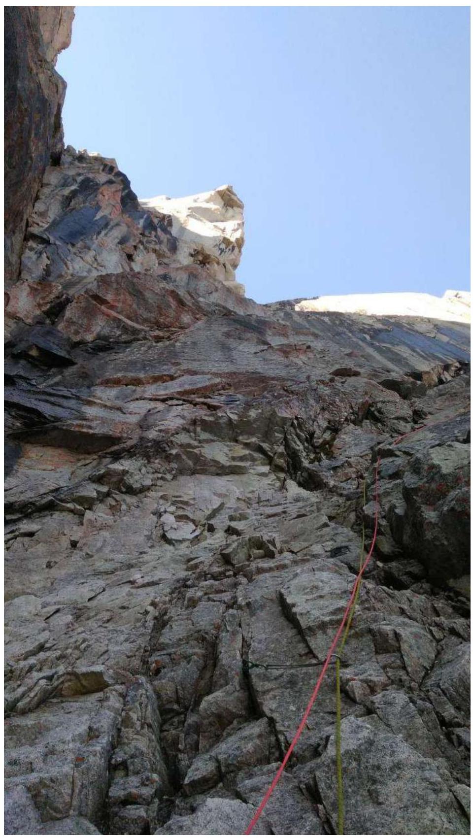
Fig. 2. Almost all blocks are loose or live, making it difficult to organize a belay. Water flows over the terrain, and in spring and early July, there is still snow here. Photo taken from the R7–R8 section's fixed ropes.
The lower part is more sloping, with a steepness of 45–65°. It requires:
- careful and extremely attentive climbing due to the highly deteriorated terrain;
- organization of belay stations away from the climbing line, as rocks are constantly falling.
At the start of the wall section, there is a small ledge (R11), from which a pronounced angle leads left and upwards, transitioning into the "cut" angle (R12–R13). Here, D. Prokofiev took the lead.
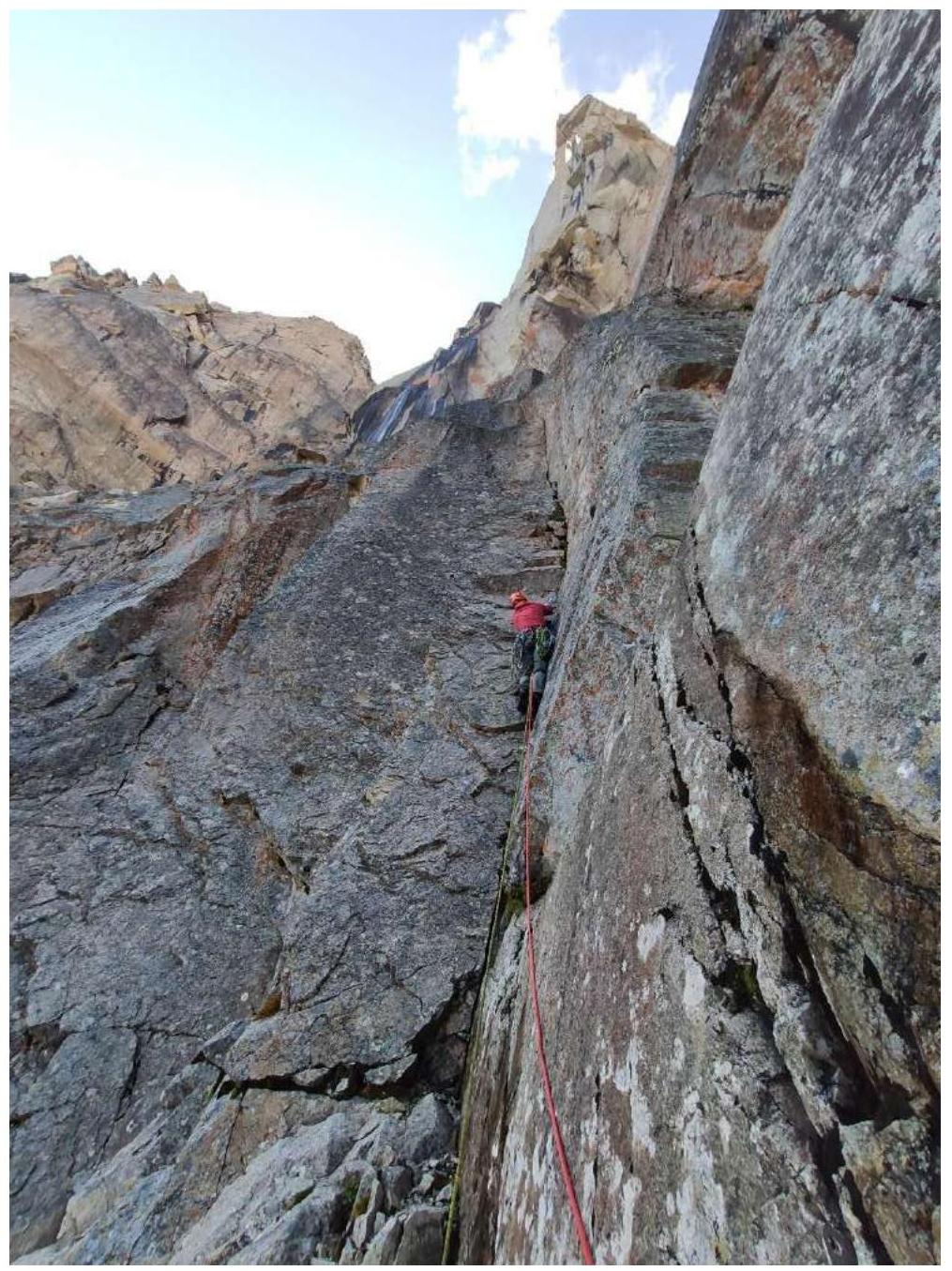
Fig. 3. R11–R12. Start of the wall section. A vertical internal angle (in the middle of three), becoming overhanging, with live blocks. The "cut" angle is climbed using free climbing, with several loose large blocks. Climbing is complex.
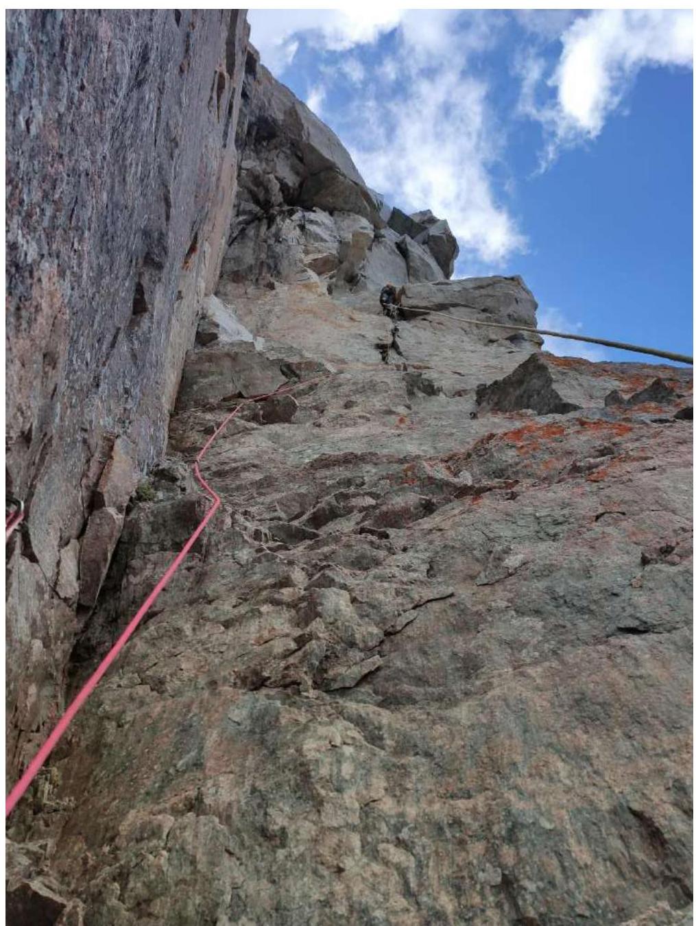
Fig. 4. Photo taken from station R13. Transition from the "cut" angle to the right via free climbing. The leader has already set up station R15. The second rope indicates the start of the overhang.
Further, from the angle, a transition to the right is made into a vertical and then overhanging crack. Many loose protrusions. Station R15 is hanging.
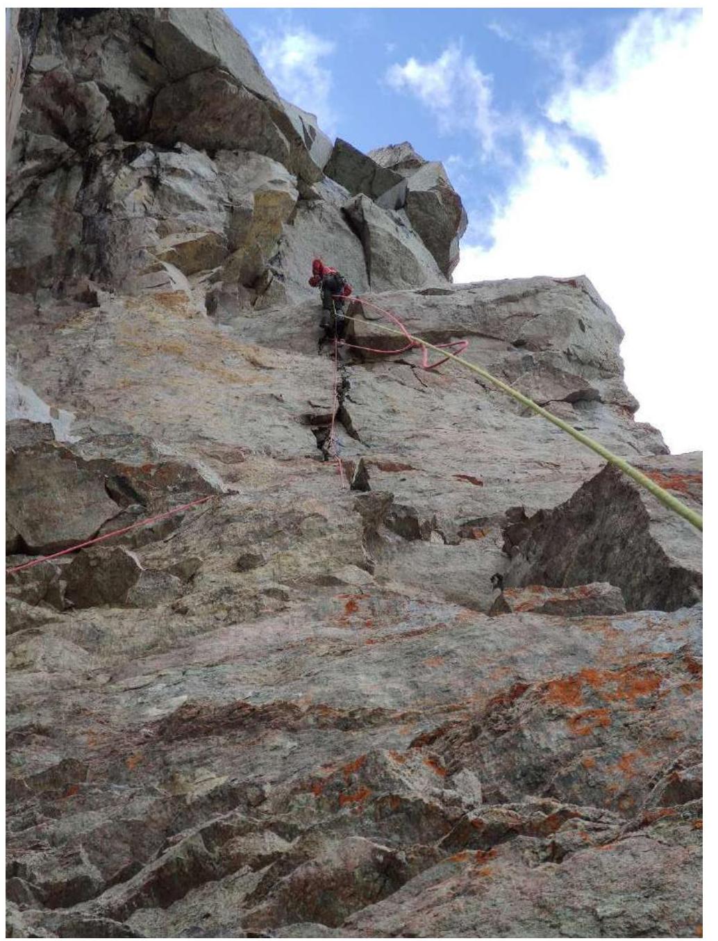
Fig. 5. Leader moves above R15, photo taken from the R15–R16 section's fixed ropes.
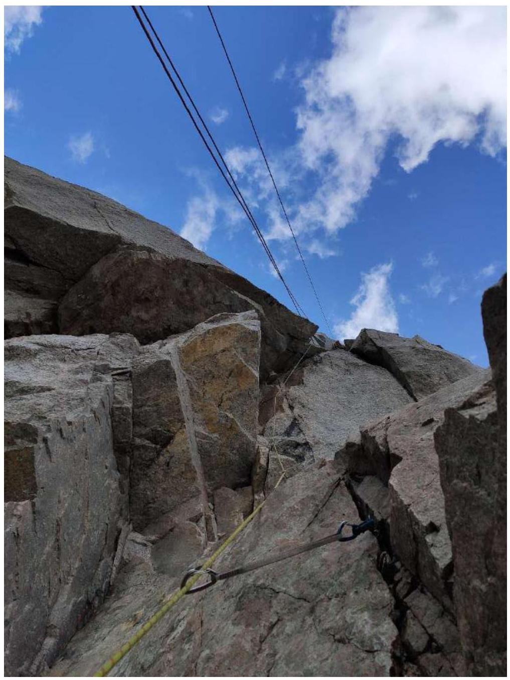
Fig. 6. R16. Photo taken from the station. The leader has passed through three consecutive overhangs and is now moving along a crack under the R19 overhang. The ropes show the overhang.
Next, movement is upwards and to the left through three overhanging "awnings," climbed using ITO. Exit to R20 — an overhanging crack leading under an overhang. The overhang is passed on the left part. Anchor hooks with bends work well.
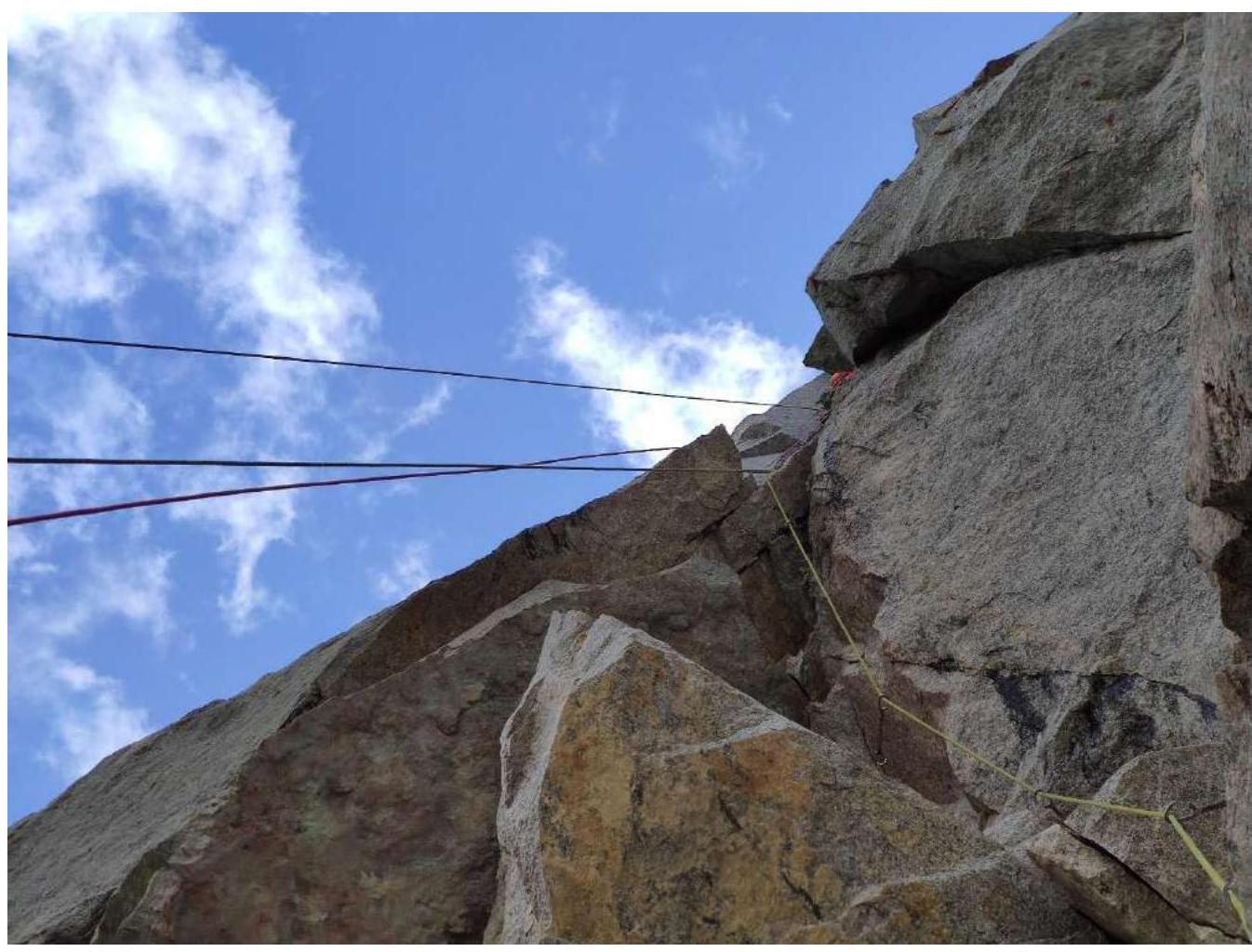
Fig. 7. Leader on section R20–R21. Photo taken from the hanging fixed ropes on R18. Then follows the passage of the overhang on the left part, a traverse on anchors and fiffies with bends along a hanging fragment (live). Further, along a vertical crack (85°) to the R23 ledge.
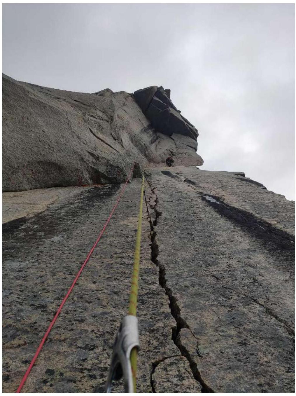
Fig. 8. Leader works on section R23–R24, already at the end of the section, having passed the "cobweb." Photo taken from the R22–R23 section's fixed ropes. The entire upper part of the route is visible.
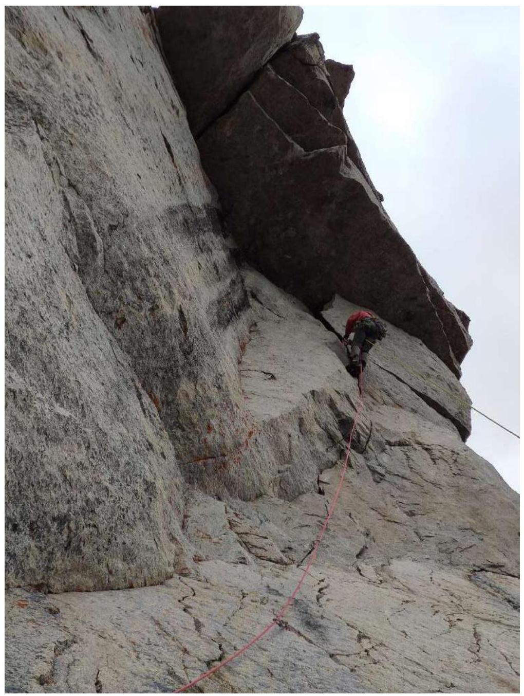
Fig. 9. D. Prokofiev works on section R23–R25. Approach under the overhang in the upper part of the route; a large cam (cam № 5 or large excentric) is helpful for transitioning under the overhang.
Further, a traverse under the overhang (fiffies work well).
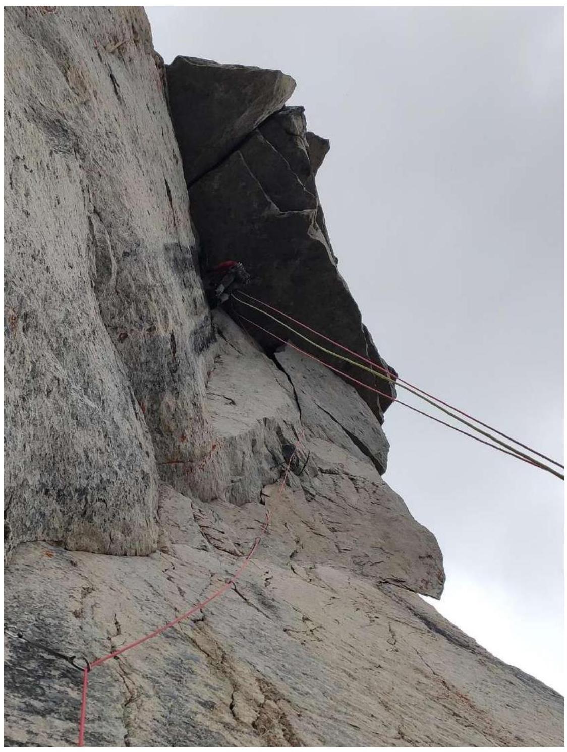
Fig. 10. Traverse under the R25–R26 overhang; the ropes show the overhang. After the traverse, passage of the overhang via a wide crack (large cams required).
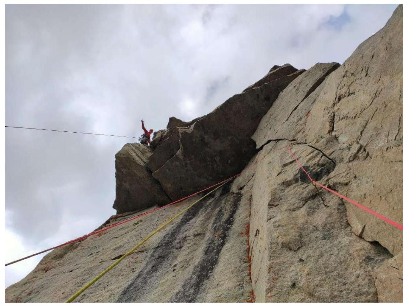
Fig. 11. Leader has passed the R26–R27 overhangs, photo taken from the fixed ropes.
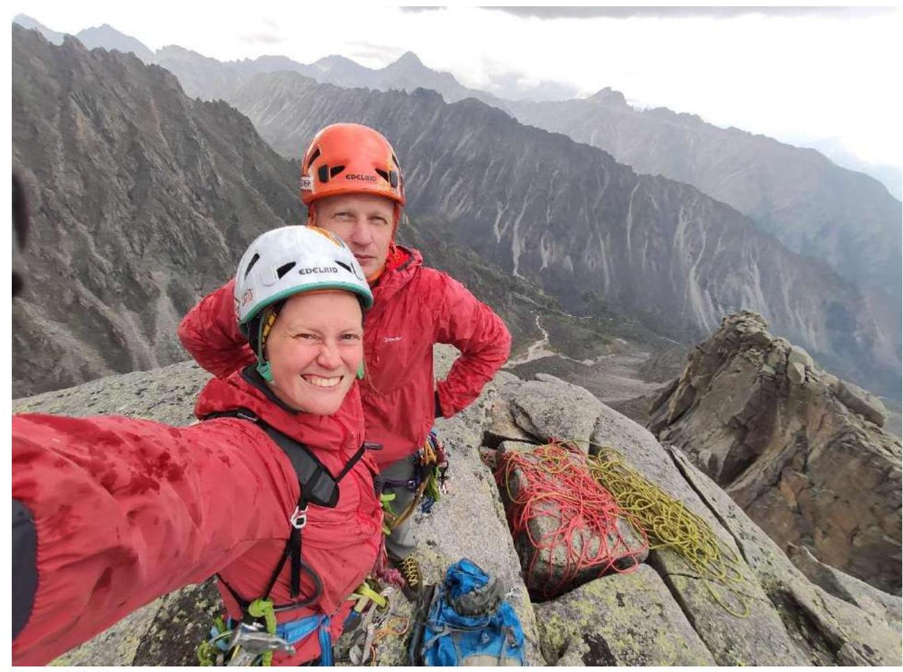
Fig. 12. Photo on the summit as rain begins.
| Section # | Description | Photo # |
|---|---|---|
| R0–R1 | "Ram's foreheads," sparse belay | |
| R1–R2 | Smoothed wall, difficult to find a place for a belay point. | |
| R2–R3 | Climbing a sloping slab upwards, many live slabs | |
| R3–R6 | Upwards through "ram's foreheads" walls, choosing the simplest terrain. Many live stones on ledges (melted snowpatch) | |
| R6–R7 | Wall, "ram's foreheads" | |
| R7–R9 | Moving right through a wall with flowing water, many live stones, careful climbing | 2 |
| R9–R11 | Climbing (possibly ITO) to approach the main wall part, choosing the most monolithic terrain, difficult to organize a reliable belay. Exit to a ledge. | |
| R11–R12 | Three internal angles with cracks, moving along the second. Then transition to the right. | 3 |
| R12–R14 | Sharp internal "cut" angle, climbed using free climbing, with many live blocks on the walls. | 4 |
| R14–R16 | Pendulum to the right (can be bypassed to the right via free climbing 6 m below) to a crack leading into overhangs. Movement up the crack to the start of the overhang. | 5 |
| R16–R17 | Crack in the internal angle smoothly transitions left into an overhang. | 6, 7 |
| R17–R18 | Overhanging crack, exit under an overhang. Passage through the overhang. | 7 |
| R18–R19 | Crack leads under an overhang. | 7 |
| R19–R20 | Upwards on the left part of the overhang. Desirable to have small stoppers or anchor hooks with bends. | |
| R20–R21 | Bypassing a ledge on the left using anchors and fiffies (all with bends), moving along the right part of a large fragment and then along a crack. Can move to the ledge on the left and along the left part of the fragment. | |
| R21–R22 | Upwards along a crack; the crack overhangs. | |
| R22–R23 | Further, the crack becomes vertical; exit to a ledge to the right of the overhanging angle-fragment. Bolt. | 8 |
| R23–R24 | Upwards along cracks, moving upwards and rightwards towards a large fragment. Medium and small cams, anchors. Transition into a wide crack with a fragment. | 8, 9 |
| R24–R25 | Wide crack leads under a large overhang to the right. | 9 |
| R25–R26 | Traverse under the overhang to the left. | 10 |
| R26–R27 | Overcoming the overhang (ceiling) via a wide crack. Several meters up and again through a small overhang via the same crack. | 11 |
| R27–R28 | Upwards along a crack, exit to the top | 11 |
| Walking to the summit about 400 m. |
3.1. Route Notes
Descent via 1B. It is advisable to know the descent path in advance — it's hard to find the right couloir, and navigating in the dark can be challenging.
Starting from R12, there are no places even for a sitting bivouac; the terrain overhangs. Also, below R14, it will be difficult to rappel down due to the significant overhang; this should be considered during tactical preparation for the route.
The route is recommended for those who are confident in their ITO technique; it is not recommended as a first "six." There are no easy sections throughout the wall part. The route is labor-intensive for both the first and second climbers (oblique overhanging fixed ropes on almost the entire wall part). We recommend that the second climber also have:
- pitons;
- ladders or étriers.
for quick passage of the traverse under the large overhang and the overhang itself (sections R25–R27).
Despite being first ascended in 2002, the route is considered a modern "six," requiring excellent technical preparation from both climbers in the team. The route is undoubtedly a gem of the area. We would recommend it to every alpinist to gain experience on long overhanging routes and to improve their technical level.
The route was climbed by a mixed team of two, without prior processing, in a record short time of 1 day, 10 h 45 min, in a modern climbing style with simultaneous belay. The route was divided between the participants roughly equally, with the change of lead occurring at section R11.