Ascent Passport
Appr. No. 13 dated April 13, 2007 6B cat. diff. In one hike 6.1.67
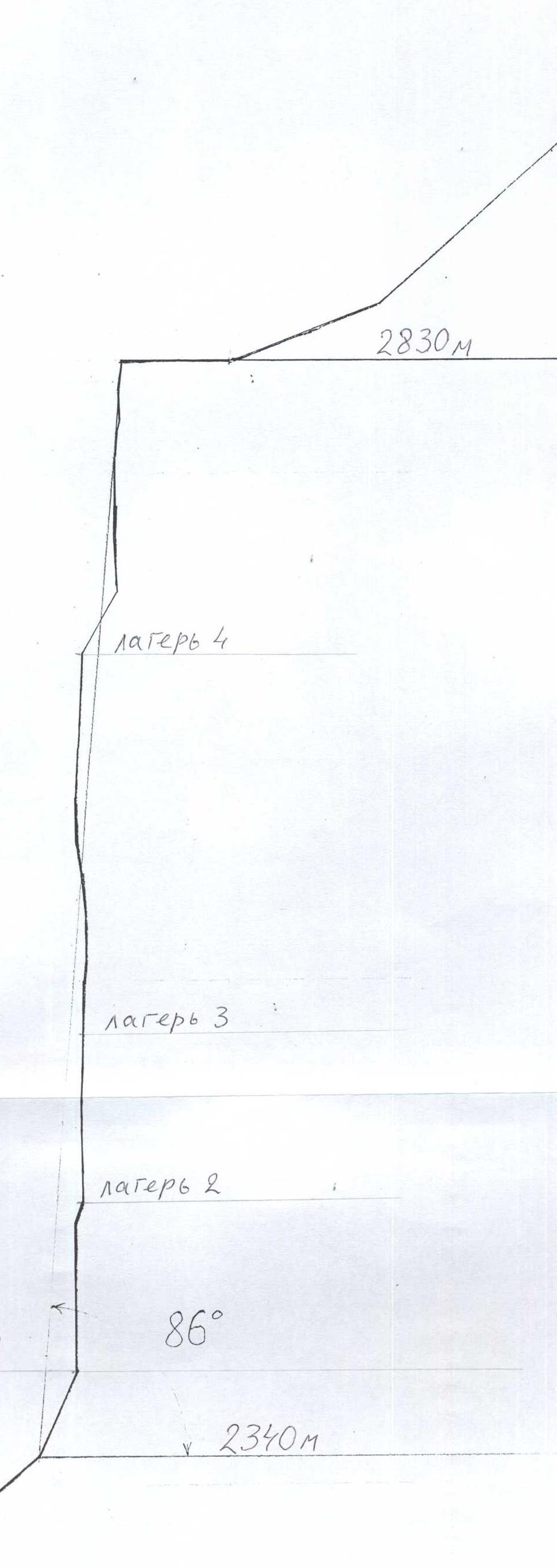
1. Region — Eastern Sayan Mountains, Tunkin Goltsy mountain range, Berun-Khandagai valley, 6.1. 2. Peak — Dome 2955 m, via plumb lines on the North face of the East shoulder. 3. Proposed 6B cat. diff., first ascent. Route type — rock. 4. Elevation difference: total route — 664 m, wall section — 474 m; length: total route — 1051 m, wall section — 511 m; section lengths: VI cat. diff. — 326 m, V cat. diff. — 80 m; average steepness of the wall route section — 86°. 5. Pitons left: total — 39, incl. drilled — 32; used: chocks — 86/51, rock pitons — 59/40, drilled pitons — 57/49, incl. removable — 25/17; celestial pitons — 97/97, incl. under Ø 6 mm drill — 90/90; total TTP used — 230. 6. Team's travel hours — 90, days — 16 (incl.: 1 — rest day, 8 — partial working day due to frosts). 7. Overnight stays — 15 on platforms. 8. Leader: Afanasyev A.E. (MS); Team members: Antonov E.V. (CMS); Moskovskikh S.V. (CMS); Muravyov O.Yu. (CMS). 9. Coach: Afanasyev A.E. 10. Route start — February 9, 2007, Summit — February 24, 2007 at 18:00, return to base camp — February 24, 2007 at 23:00. 11. Organization: Irkutsk Region Agency for Physical Culture and Sports.
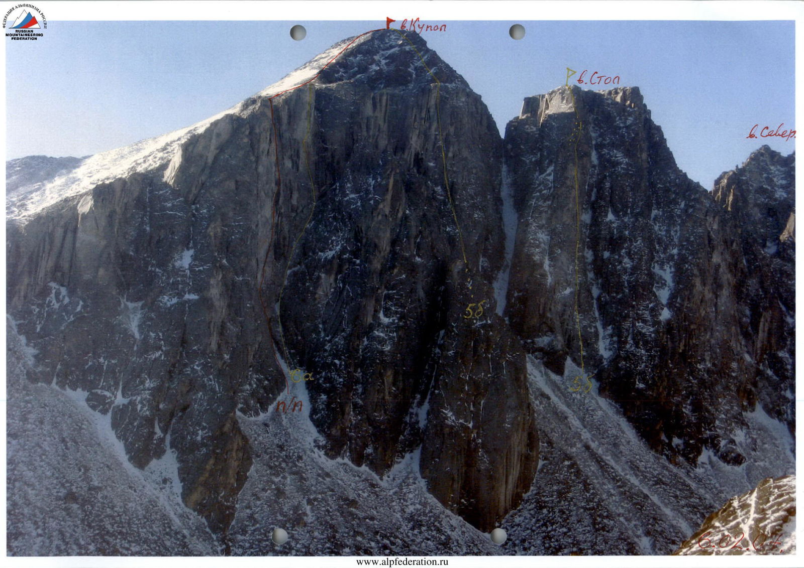
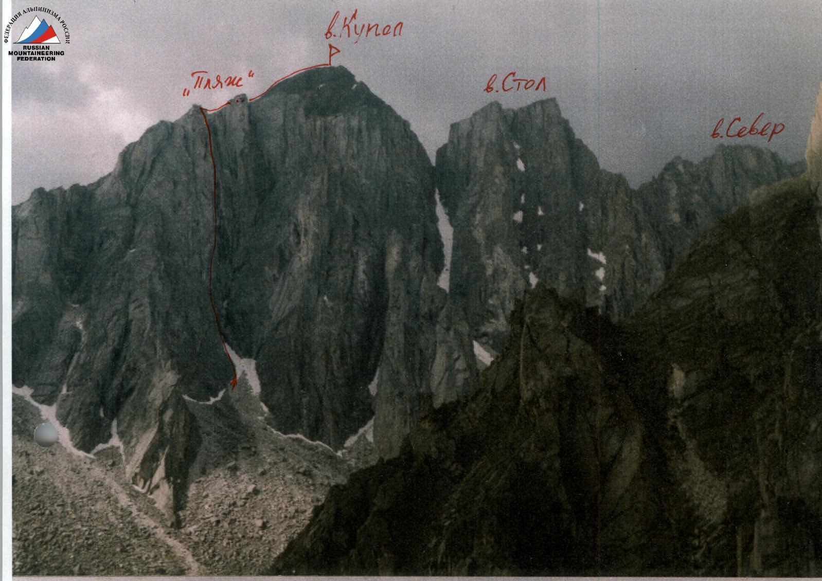
Photo of wall profile from the left.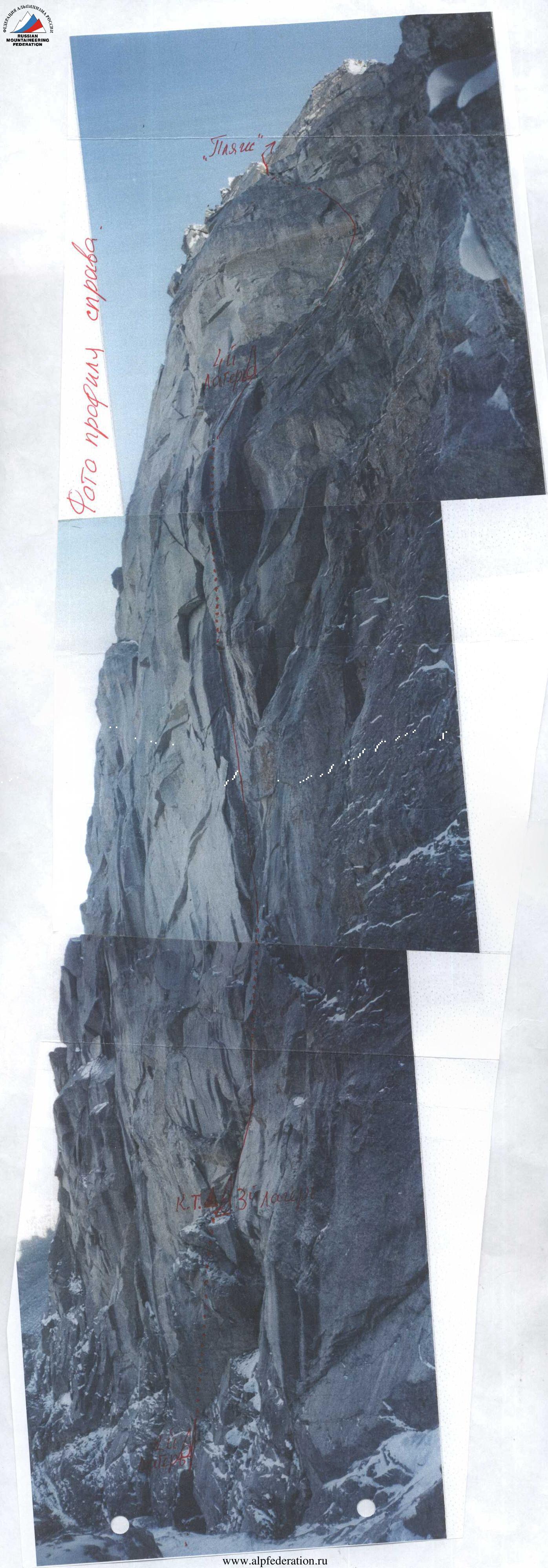 Photopanorama of the North face of the Stol-Kupol massif.
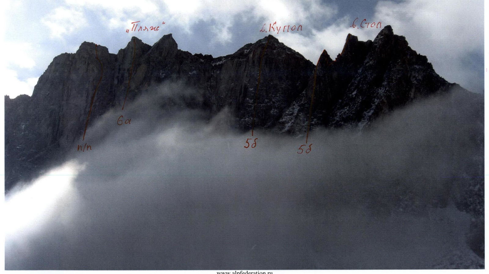
M 1:10000 Route profile drawing on Dome peak 2955 m via plumb lines on the North face M 1:2000

Ascent Schedule
| elevation | 9.02. | 10.02. | 11.02. | 12.02. | 13.02. | 14.02. | 15.02. | 16.02. | 17.02. | 18.02. | 19.02. | 20.02. | 21.02. | 22.02. | 23.02. | 24.02. |
|---|---|---|---|---|---|---|---|---|---|---|---|---|---|---|---|---|
| 2900 m | ||||||||||||||||
| 2800 m | –30 | –25 | ||||||||||||||
| 2700 m | wind | wind | –38 | –31 | –27 | |||||||||||
| 2600 m | snowfall | heavy | –33 | –40 | –43 | blizzard | ||||||||||
| 2500 m | –28 | –26 | –29 | –27 | –26 | –31 | –37 | |||||||||
| 2400 m | 6 h | 7 h | 8 h | 3 h | 4 h | 6 h | 7 h | 5 h | 8 h | 0 | 3 h | 5 h | 5 h | 5 h | 5 h | 13 h |
UIAA Scheme Dome peak 2955 m via plumb lines on the North face of the East shoulder
| pitons | UIAA Symbols | sections | complexity, length, steepness | |||
|---|---|---|---|---|---|---|
| rock | chocks | drilled | celestial | |||
| 59/40 | 86/51 | 57/49 | 97/97 | summit | ||
| R35 | I–, 20 m, 5° | |||||
| R34 | II+, 150 m, 35° | |||||
| R33 | I–, 70 m, 20° | |||||
| R32 | I–, 200 m | |||||
| 2 | 5 | R31 | V+, 15 m, 80° | |||
| 1 | 1 | 2 | R30 | VI+, A1e, 4 m, 92° | ||
| 1 | 3 | 1 | 5 | R29 | VI+, A1e, 13 m, 92° | |
| 2 | R28 | III+, 10 m, 45° | ||||
| 2 | R27 | III+, 15 m, 45° | ||||
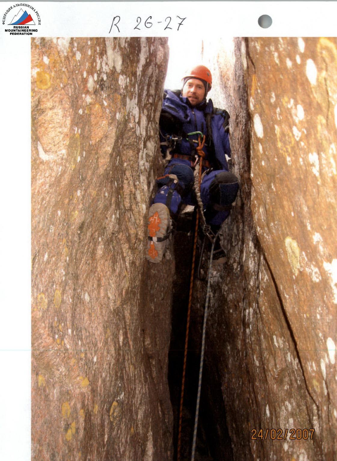
| 1 | R26 | V–, 7 m, 90° | ||||
| 1 | 5 | R25 | V–, 25 m, 45° | |||
| 1 | 1 | R24 | V+, 5 m, 90° | |||
| 1 | 4 | R23 | V+, A1, 7 m, 90° | |||
| 7 | 9 | R22 | VI–, A2, 25 m, 95° | |||
| 3 | 5 | R21 | IV+, 30 m, 60° | |||
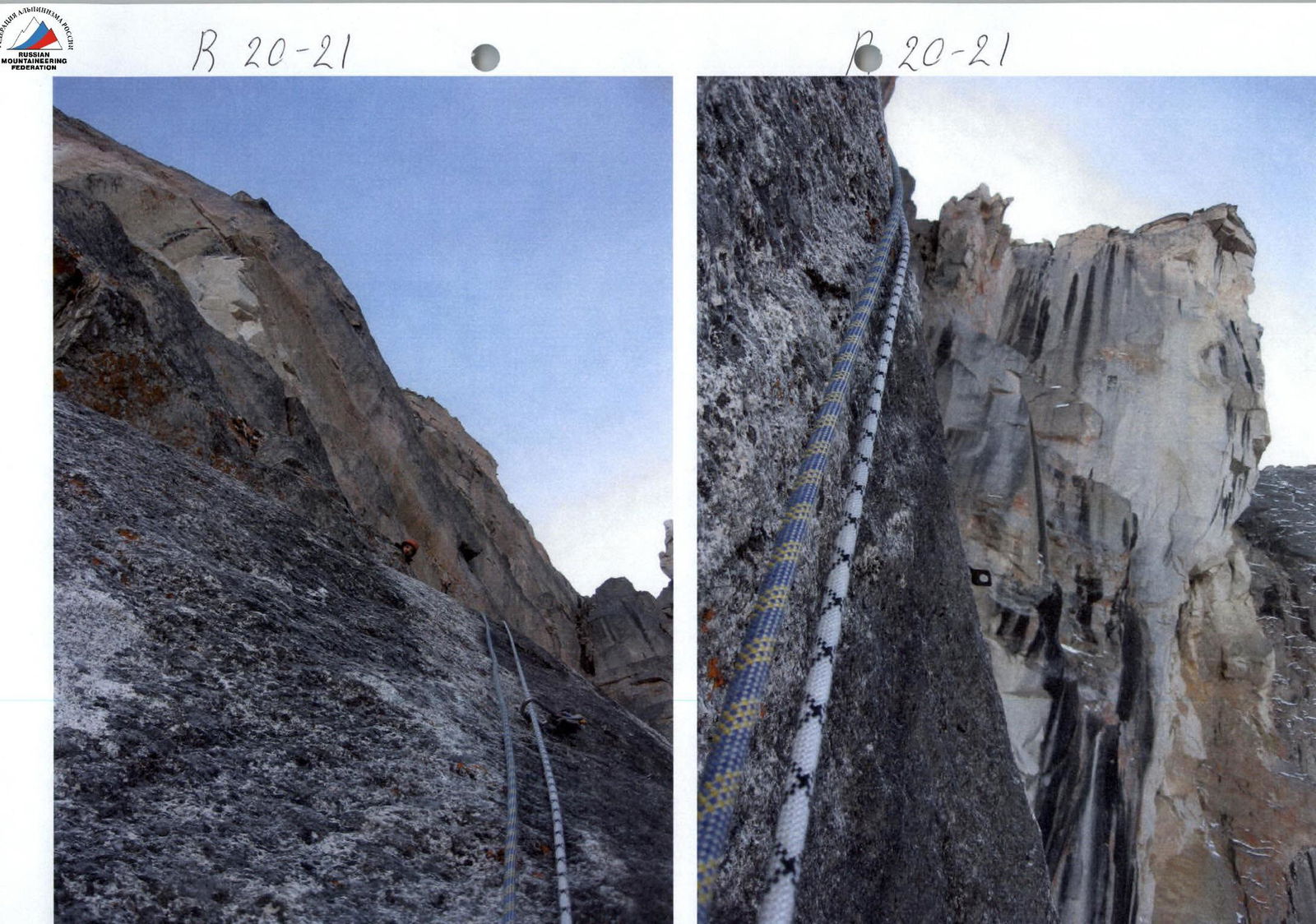
| 1 | 2 | 4 | 7 | R20 | VI+, A3e, 17 m, 90° | |
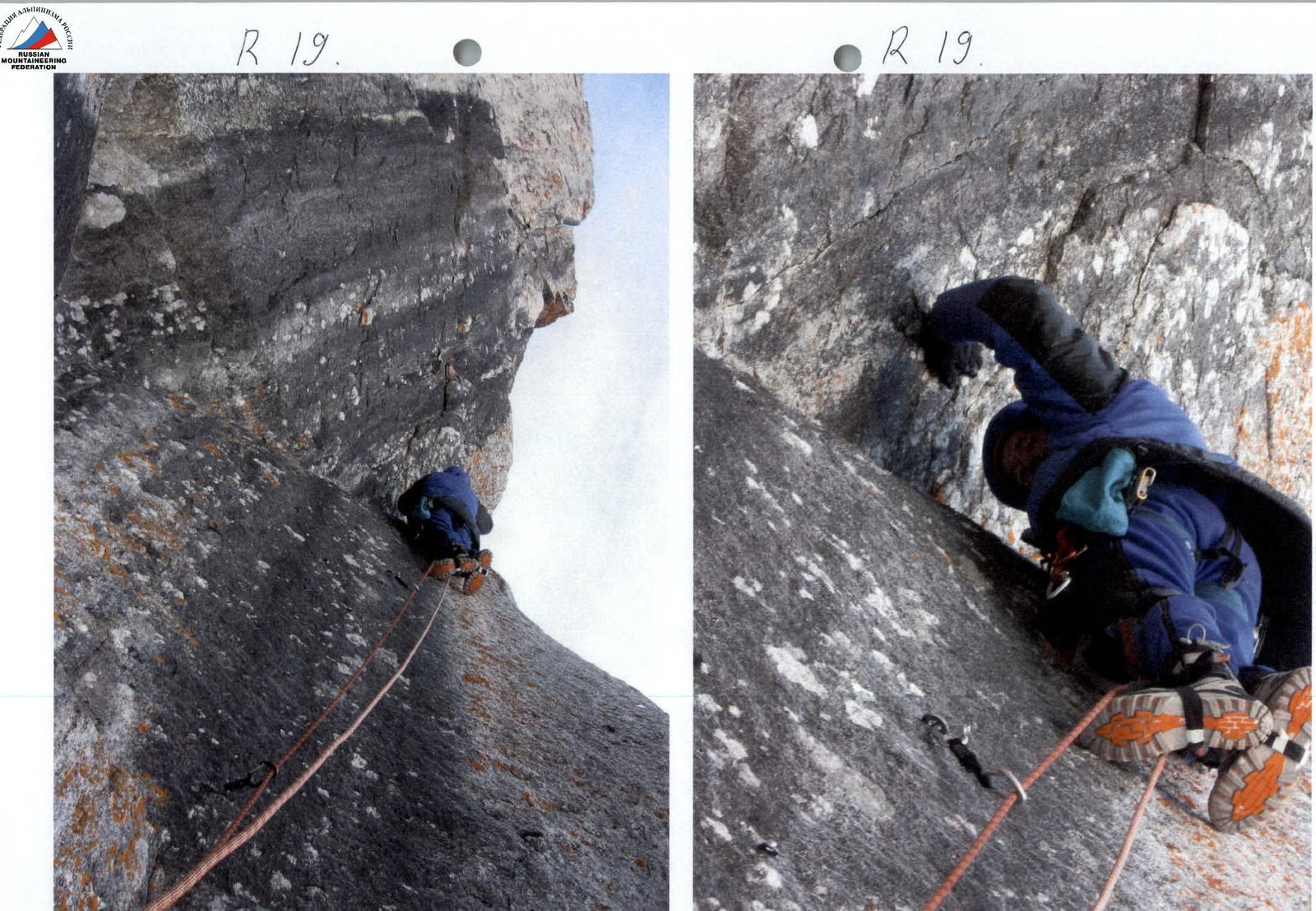
| 2 | R19 | V–, 2 m, 50° | ||||
| 1 | 3 | 9 | R18 | VI+, A3e, 17 m, 89° | ||
| 1 | 3 | R17 | VI+, A1e, 5 m, 92° | |||
| 1 | 5 | 11 | R16 | VI+, A3e, 25 m, 87° | ||
| 3 | 5 | R15 | VI+, A2e, 10 m, 95° | |||
| 2 | 2 | R14 | V+, 9 m, 85° | |||
| 2 | 4 | 4 | 5 | R13 | VI+, A3e, 15 m, 100° | |
| 2 | 7 | R12 | VI+, A3e, 10 m, 95° | |||
| 1 | 2 | 6 | R11 | VI+, A1e, 10 m, 95° | ||
| 4 | 5 | 3 | 7 | R10 | VI–, A2e, 20 m, 90° | |
| 2 | 3 | R9 | VI–, A1e, 6 m, 85° | |||
| 3 | 5 | 3 | 7 | R8 | VI+, A4e, 20 m, 90° | |
| 7 | 8 | 7 | 9 | R7 | VI–, A2e, 45 m, 90° | |
| 5 | 5 | 4 | 5 | R6 | VI+, A4e, 20 m, 92° | |
| 2 | 2 | 4 | R5 | VI–, A2e, 12 m, 89° | ||
| 1 | 2 | R4 | V–, 10 m, 70° | |||
| 7 | 12 | 5 | 3 | R3 | VI–, A3e, 55 m, 89° | |
| 1 | 2 | 2 | R2 | VI+, A1e, 7 m, 92° | ||
| 3 | 2 | R1 | IV–, 40 m, 65° | |||
| R0 | I+, 100 m, 40° |
Dome peak 2955 m via plumb lines on the North face of the East shoulder, 6B cat. diff. route.
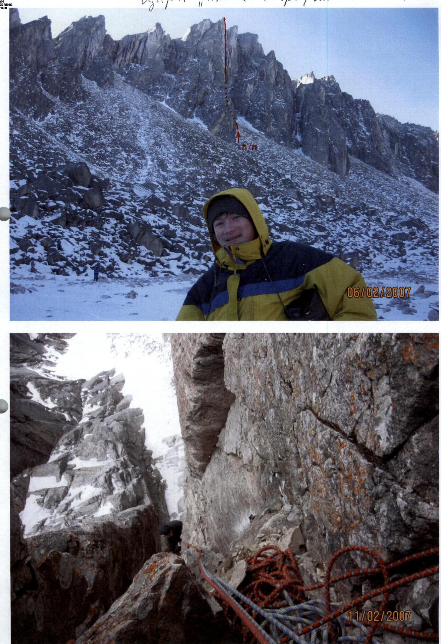
Approach to the route start via large scree takes 2 h.
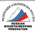
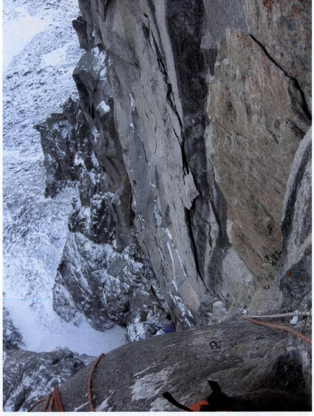
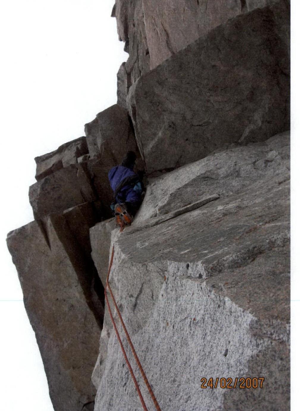
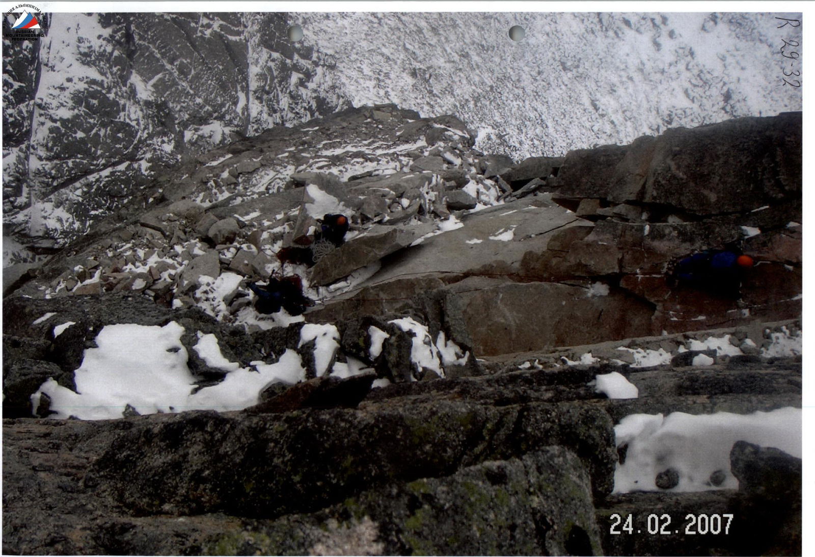
Sect. 0–1 I+, 100 m, 40°. Hard snow crust. Sect. 1–2 IV–, 40 m, 65°. The wall at the top of the snowy scree-filled couloir with overhanging walls on both sides. To the right is the start of the route to the "blade". Entry to a destroyed niche. 1–2 overnight stay on a platform. Sect. 2–3 VI+, A1e, 7 m, 92°. Exit from the niche to the left through overhangs. Sect. 3–4 VI–, A3e, 55 m, 89°. Destroyed crack with three one-sided cornices 0.5 m to the left. The right wall is overhanging. Sect. 4–5 V–, 10 m, 70°. Stepped fracture to the right. Exit to small ledges. Second overnight base. 3–6 overnight stays on a platform. Sect. 5–6 VI–, A2e, 12 m, 89°. Series of destroyed slabs to the left. Sect. 6–7 VI+, A4e, 20 m, 92°. Destroyed crack, through a "beak" into a chimney. Sect. 7–8 VI–, A2e, 45 m, 90°. Steep destroyed stepped chimney with a slope to the right ("minefield"). Exit to large blocks with a pile of live rocks. Third overnight base, 7–14 overnight stays on a platform. Control cairn. Sect. 8–9 VI+, A4e, 20 m, 90°. Oblique crack from left to right at an angle of 50° to the ledge (hanging inner corner above a cornice 0.7 m). Sect. 9–10 VI–, A1e, 6 m, 85°. Inner corner, left wall is overhanging. Approach to a vertical fracture. Sect. 10–11 VI–, A2e, 20 m, 90°. Destroyed crack. Sect. 11–12 VI+, A1e, 10 m, 95°. Overhanging destroyed crack is passed on the right along the wall on celestial pitons. Sect. 12–13 VI+, A3e, 10 m, 95°. Along the destroyed slit along the slab on celestial pitons. Sect. 13–14 VI+, A3e, 15 m, 100°. Up the overhang to the left, crossing the crack. Sect. 14–15 V+, 9 m, 85°. Up the destroyed crack. Above, the crack is overhanging and filled with live rocks. Sect. 15–16 VI+, A2e, 10 m, 95°. Transition slightly to the right of the slit through a cornice onto monolithic black "mirrors". Sect. 16–17 VI+, A3e, 25 m, 87°. First "mirror", up to the right. Drilled and celestial pitons. Sect. 17–18 VI+, 5 m, 92°. Overhanging step. Exit to a ledge. Sect. 18–19 VI+, A3e, 17 m, 89°. Second "mirror". Exit to an outer corner. Sect. 19–20 V–, 2 m, 50°. Smooth slab to the right. Transition through the outer edge. Sect. 20–21 VI+, A3e, 17 m, 90°. Gray slab on the right side. Exit to a ledge. Fourth platform base. 14–15 overnight stays. Sect. 21–22 IV+, 30 m, 60°. Relief rocks up to the right. Sect. 22–23 VI–, A2, 25 m, 95°. Inner corner with slits on the right wall. Sect. 23–24 V+, A1, 7 m, 90°. Two parallel cracks. Exit to a ledge. Above are destroyed overhangs: "negative scree". Sect. 24–25 V+, 5 m, 90°. Transition from the inner corner to the left onto a destroyed narrow ledge on a global flake. Sect. 25–26 V–, 25 m, 45°. Oblique narrow ledge with live rocks on a huge red flake to the left and above the overhanging walls. Rocks falling into the flake's fractures fly down to a great depth, making a booming sound. Sect. 26–27 V–, 7 m, 90°. Long narrow chimney. Sect. 27–28 III+, 15 m, 45°. Ledge to the left above the overhang. Sect. 28–29 III+, 10 m, 45°. Ledge to the right under the overhang. The overall steepness of the two sections is close to 85°. Sect. 29–30 VI+, A1e, 13 m, 92°. Slabs are smooth. Sect. 30–31 VI+, A1e, 4 m, 92°. One-sided cornice is passed to the right. Sect. 31–32 V+, 15 m, 80°. Inner corner along the left slab. Exit to the "beach". Sect. 32–33 I–, 200 m. Along the "beach". Sect. 33–34 I–, 70 m, 20°. Ridge. Sect. 34–35 II+, 150 m, 35°. Slope. Sect. 35–36 I–, 20 m, 5°. Ridge to the summit.
Summit Dome 2954 m. Descent to the east via a category 1 route.
"Alaska" Circus. Wall profile from the left.

Technical photo of the route on Dome peak via plumb lines on the N face of the E shoulder (view from below)

 R7
R7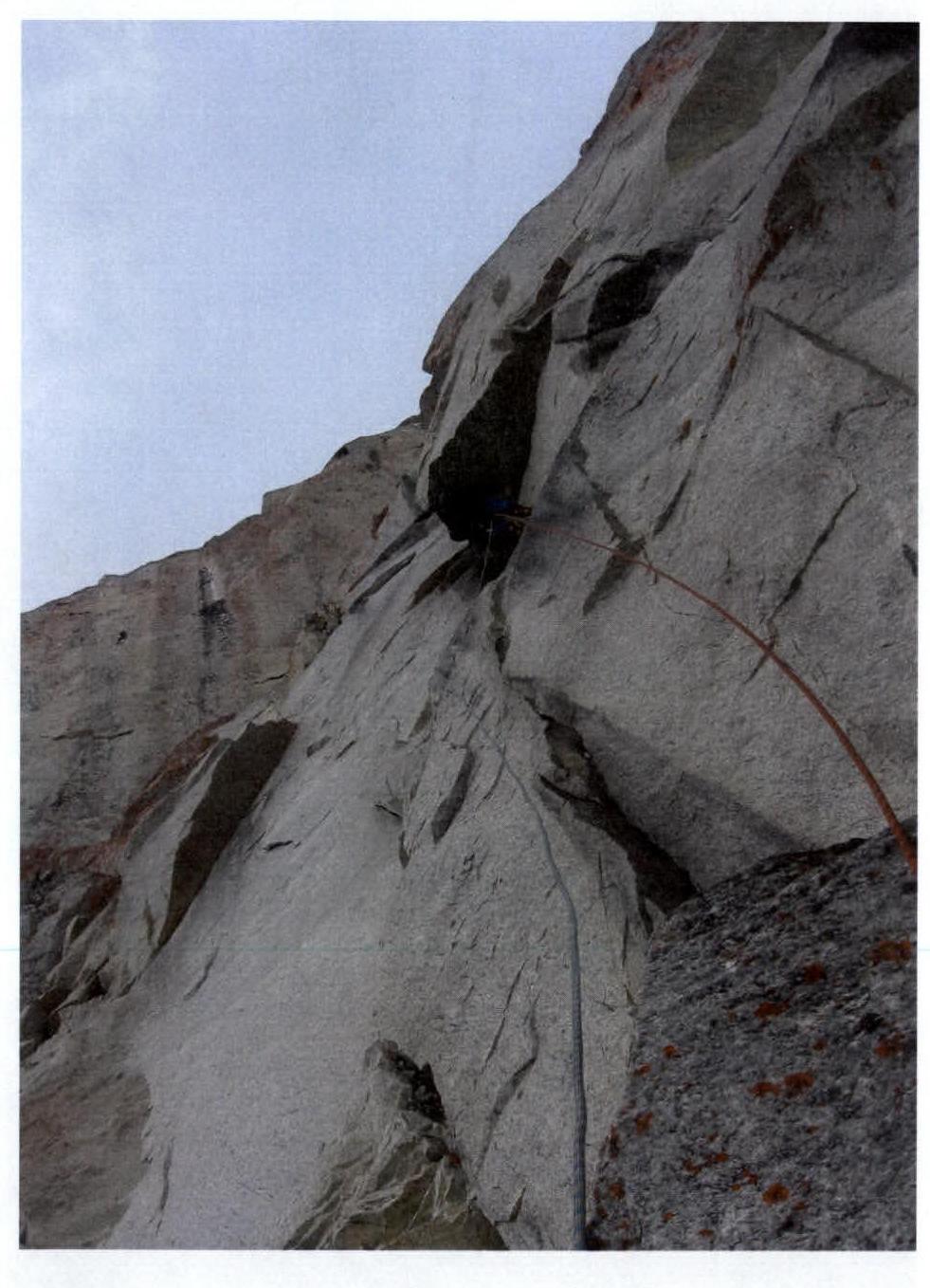
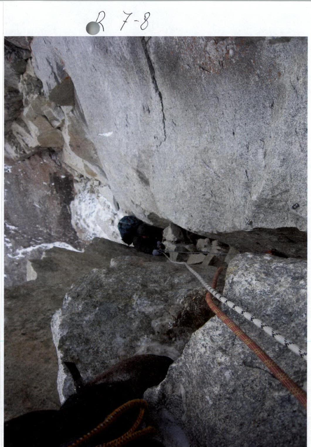
 R9
R9
Zilagan. View from R13.

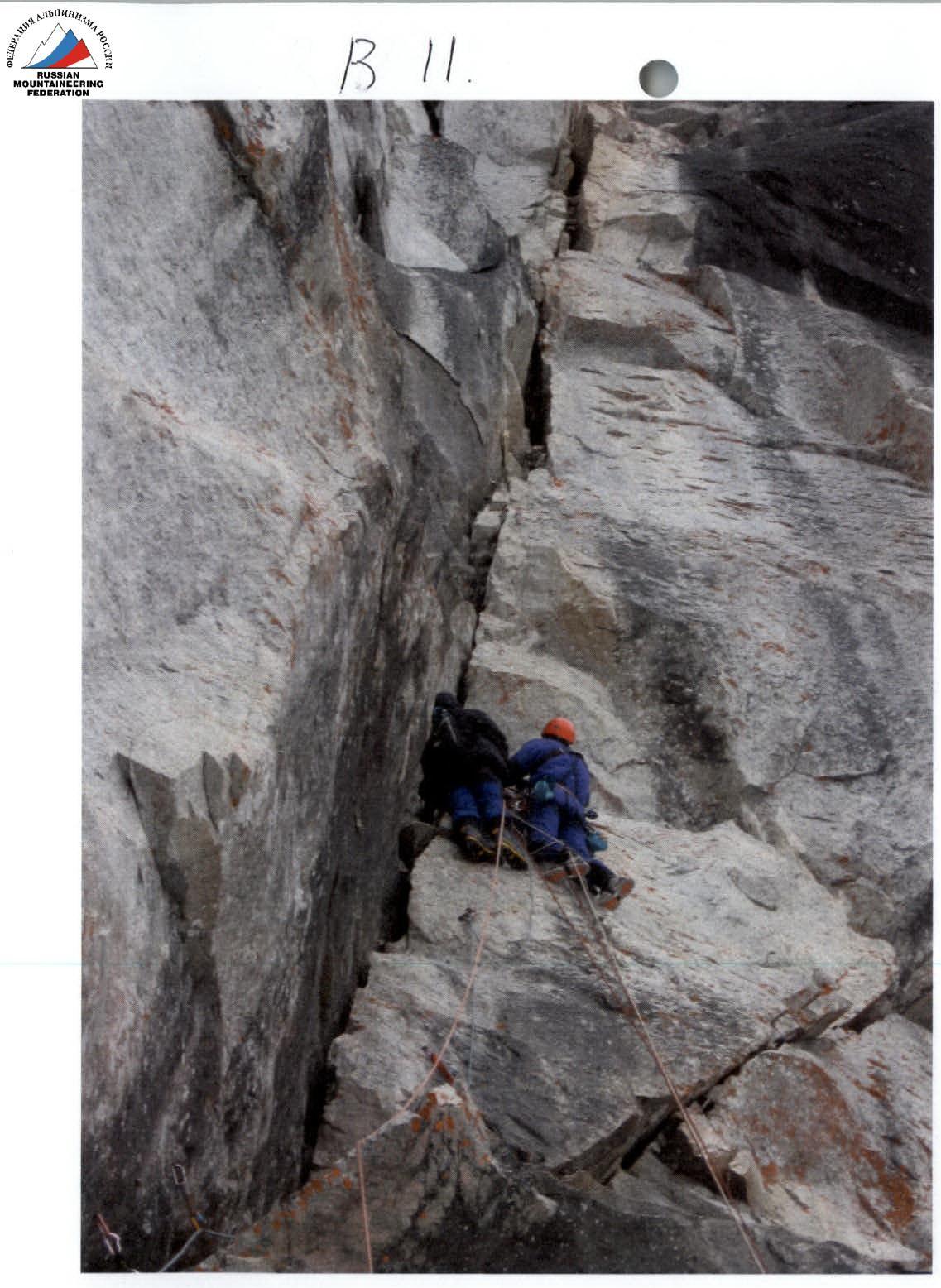
• R21
R30–31
 www.alp-federation.ru↗
Summit 2955 m.
www.alp-federation.ru↗
Summit 2955 m.