ASCENT REPORT
- Region: Eastern Sayan, Tunkin Goltsy, section 6.1.2
- Lyubvi peak, 2121 m. "Ice of Love" via the western couloir of the northern ridge.
- Proposed 3Az category of difficulty (first ascent)
- Route type: combined. elevation gain: 940 m; average slope of the entire route: 27°; average slope of the key sections: 45°; total route length: 2050 m; IV-V category sections: 25 m;
- Total pitons used on the route: 16 left on the route: 0; ice screws: 16; protection gear: 0;
- Total climbing hours (on the route): 8 hours, 0 days. Route start: 09:20, August 14, 2018 Summit reached: 17:20, August 14, 2018 Return to the base camp: 19:20, August 14, 2018 Total climbing hours from base camp to base camp: 12 hours.
- Team leader and coach: Voylichenko S.K., Candidate Master of Sports, category III instructor.
Team members:
- Zhdanov D. (category III)
- Rudman A. (category III)
- Serebrennikov E. (category III)
- Report responsible: Voylichenko S.K. kim@inbox.ru
- Organization: Irkutsk mountaineering section.
Irkutsk — 2018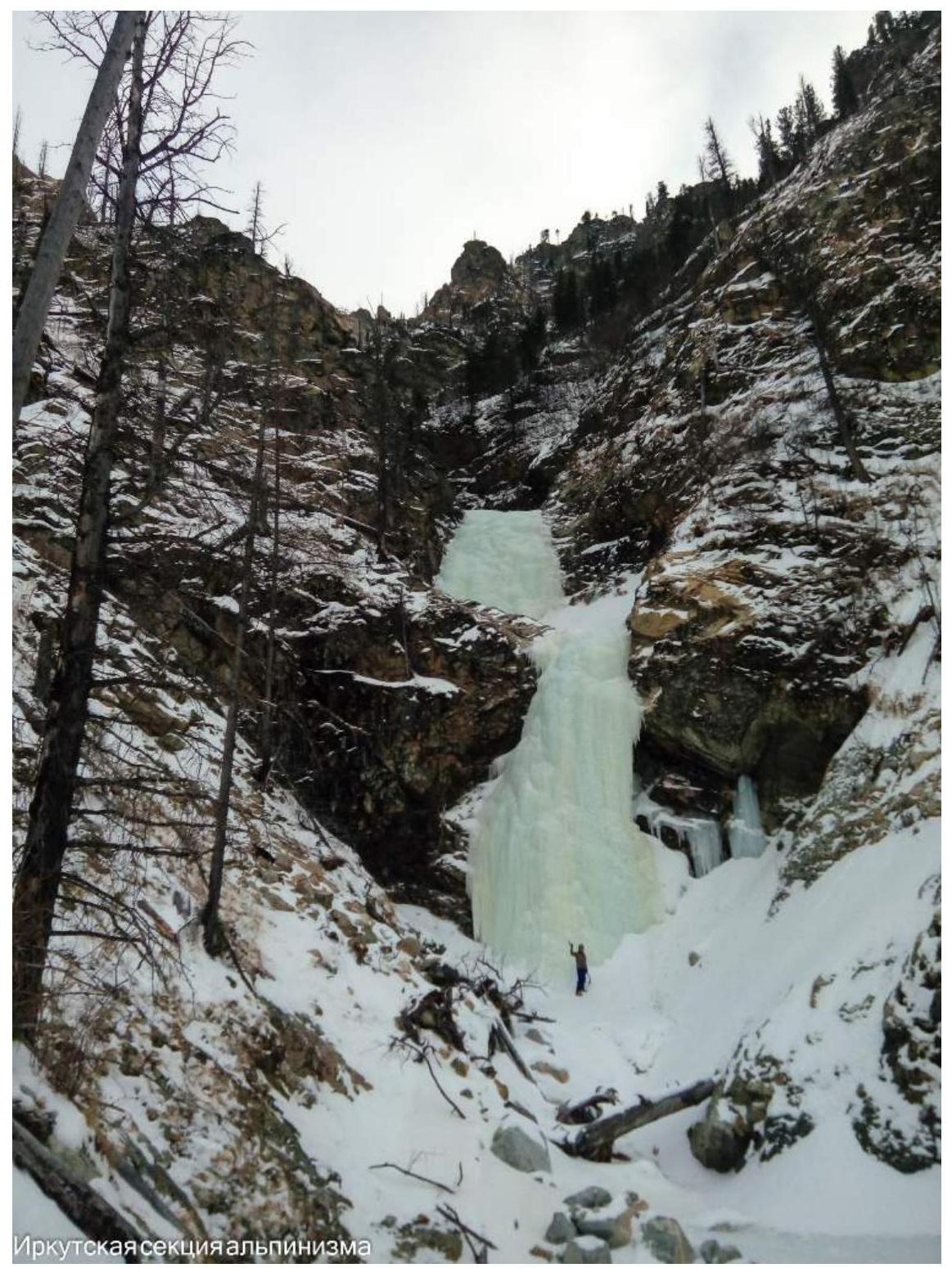
Fig. 1: "Ice of Love" route.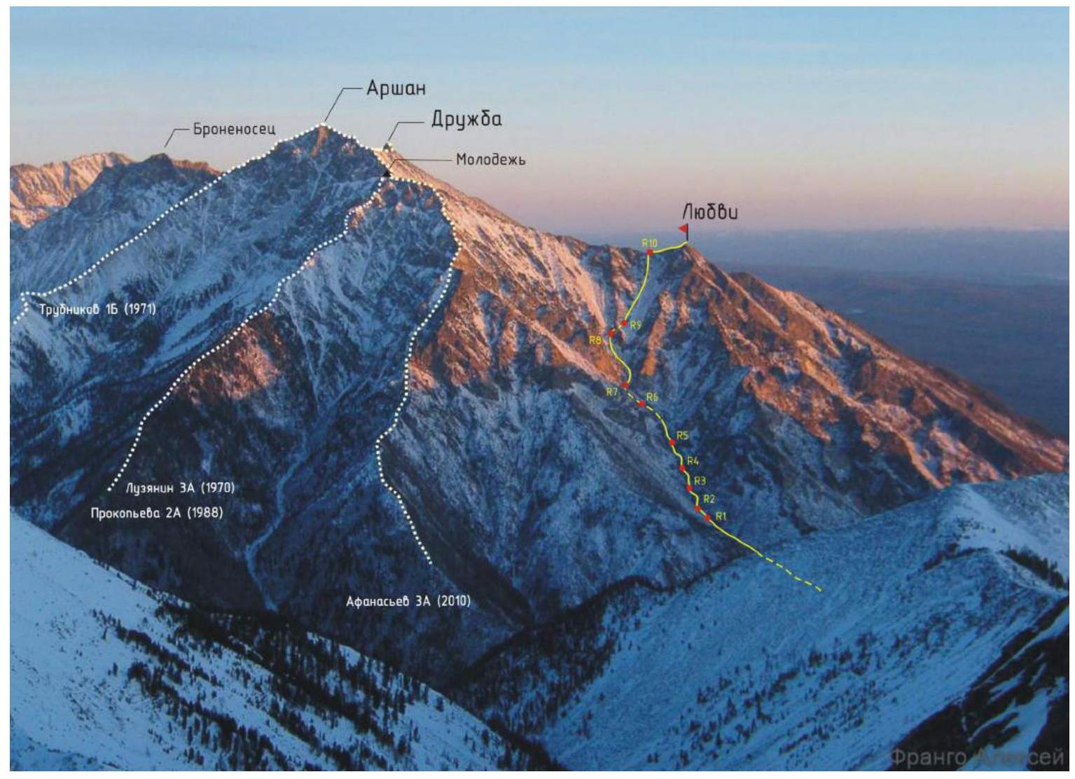
Fig. 2: Panorama of the ascent area. The climbed route is marked with a yellow line. Photo taken by Frango A. from the summit of Trekhglavaya peak in January 2017.
Fig. 3: Schematic map of the ascent area. Relative positions of routes and peaks in the Arshan peak area. Route categories are shown in color. The climbed route is marked as an orange line and labeled as "3Az Voylichenko-proposed route".
Brief Overview of the Region and Tactical Actions
Lyubvi peak, 2121 m (GPS), is located in the western spur of the Tunkin Goltsy ridge near the settlement of Arshan. Several peaks are notable in the ridge spur: Druzhba (2500 m according to classification), Arshan (2546 m according to classification), and Bronenosets (2430 m according to classification). The spur is bounded by the Kyngarga river gorge to the west and the Artemyevsky pass to the east.
The northern side of Lyubvi peak features heavily destroyed overhanging rocks, while the eastern slopes are adjacent to the slopes of the Druzhba cirque, composed of scree and large rock fragments. The western side is characterized by a series of heavily destroyed buttresses descending to the Kyngarga gorge, with lower sections covered in vegetation.
In June 2014, heavy rainfall near Arshan triggered powerful mudflows into the Tunkin valley and the Kyngarga gorge. The heavily dissected western slopes of Lyubvi and Molodezhi peaks provoked numerous mudflows, with one of the strongest flowing down the western couloir of the northern ridge. The removal of sedimentary material down to bedrock led to active ice formation on bare rocks during winter, creating "ice flows" or "ledotoki" as they are commonly known in the Eastern Sayan.
In May 2016, a group of tourists descended the couloir, exiting via the Kyngarga river to Arshan; the report can be found at nature.baikal.ru/text.shtml?id=608.
The ascent of Lyubvi peak, 2121 m, via the western couloir of the northern ridge, and its assessment were made by members of the Irkutsk mountaineering section based on experience with similar ice flow routes in the Eastern Sayan over recent years (Voylichenko 2Bz 2015 on Lyubvi peak and Voylichenko 3Az 2016 on a 2690 m peak), as well as experience on already classified ice routes in the Munku-Sardyk area (Afanasyev 2A, Perepechin 3A).
Tactical actions and recommendations. The team took rock, ice, and ITO equipment. Key sections involve waterfall ice. Rock sections, with proper route-finding on upper outcrops, do not require rock gear.
The favorable period for ascents is considered to be winter, from December to March inclusive. This route can be recommended for training groups as a first or second 3A category route, as well as for sports teams for training purposes. When moving on waterfall ice, remember that the ice forms in ledges, and a fall can result in landing on a ledge.

Fig. 4: Technical photograph of the route.
UIAA symbol scheme for the "Ice of Love" route on Lyubvi peak via the western couloir of the northern ridge
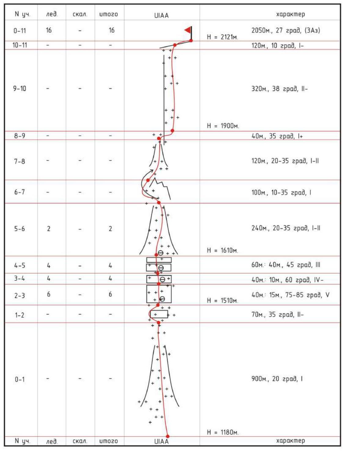
Fig. 5: UIAA symbol scheme for the route.
Route Description
On the day of the ascent, the weather was clear and windless, with a temperature of -20°C. The group departed from the base camp in Arshan at 07:20 on August 14, 2018.
Approach. From Arshan, move towards the "Kyngarga confluence" for about 2 hours until reaching a huge mudflow deposit that crossed the trail from the right.
General route description. Climb the mudflow cone to the start of the ice, approximately 1 hour. A cascade of complex ice walls on rock outcrops is climbed directly. Move through firn in a narrow snow-ice couloir, bypassing a large rock monolith on the left. Enter a zone of rock outcrops formed by a rock ridge dividing the slope between Molodezhi and Lyubvi peaks - cross the rock ridge via a small couloir at the base of the outcrops. Traverse a rocky-snowy slope to a saddle in the ridge, leaving the rock ridge on the left. From the saddle to Lyubvi peak.
Section-by-section description. To the start of the ascent, 2 hours from the base camp: elevation 1180 m, coordinates 51°56′31.62″ N, 102°25′20.00″ E; another 1 hour to the ice (R0-R2).
R0-R1. Climb the mudflow cone upwards (about 900 m, 20°, 1).
R1-R2. Bypass a 7 m ice wall on rock slabs to the left (70 m, 35°, 2).
A cascade of complex ice walls, belays: elevation 1510 m, about 3.5 hours, 140 m (R2-R5).
R2-R3. Ice outcrop is climbed via the left "screw" (40 m: 15 m, 75-85°, 5).
R3-R4. Ice wall climbed diagonally left (40 m: 10 m, 60°, 4).
R4-R5. Ice cascade of two steps (60 m: 40 m, 45°, 3).
Snow-ice couloir: elevation 1610 m, to the exit onto the slope through rocks, 2.5 hours, 500 m (R5-R9).
R5-R6. Simultaneous movement through firn in the ice-snow couloir (240 m, 20-35°, 1-2).
R6-R7. Traverse the couloir, bypassing the picturesque "Pegasus" rock on the left (100 m, 10-35°, 1-2).
R7-R8. Aim for the "Pyramid" rock and approach the right angle of the outcrops, resembling "sheep's foreheads" (120 m, 20-30°, 1-2).
R8-R9. Unnoticeable couloir at the base of outcrops, upwards to the right (40 m, 35°, 1+).
NW-facing slope: elevation about 1900 m, to the summit 440 m, 1 hour (R9-R11).
R9-R10. Rocky-snowy slope to the saddle in the ridge (320 m, 38°, 2).
R10-R11. Along the ridge to the summit (120 m, 10°, 1).
Summit 2121 m, on the route 8 hours, 51°56′43.88″ N, 102°26′24.75″ E.
Descent. Down the southern ridge trail to Arshan, about 2 hours.
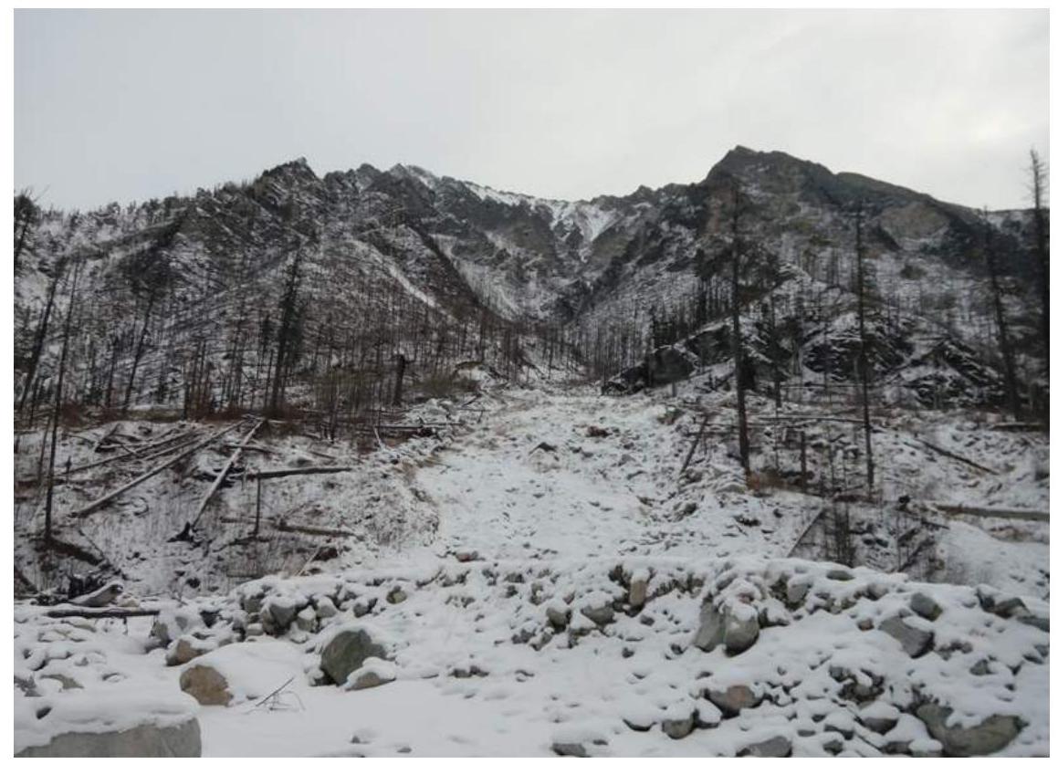
Fig. 6: Start of R0-R1. Mudflow cone from under Molodezhi and Lyubvi peaks.
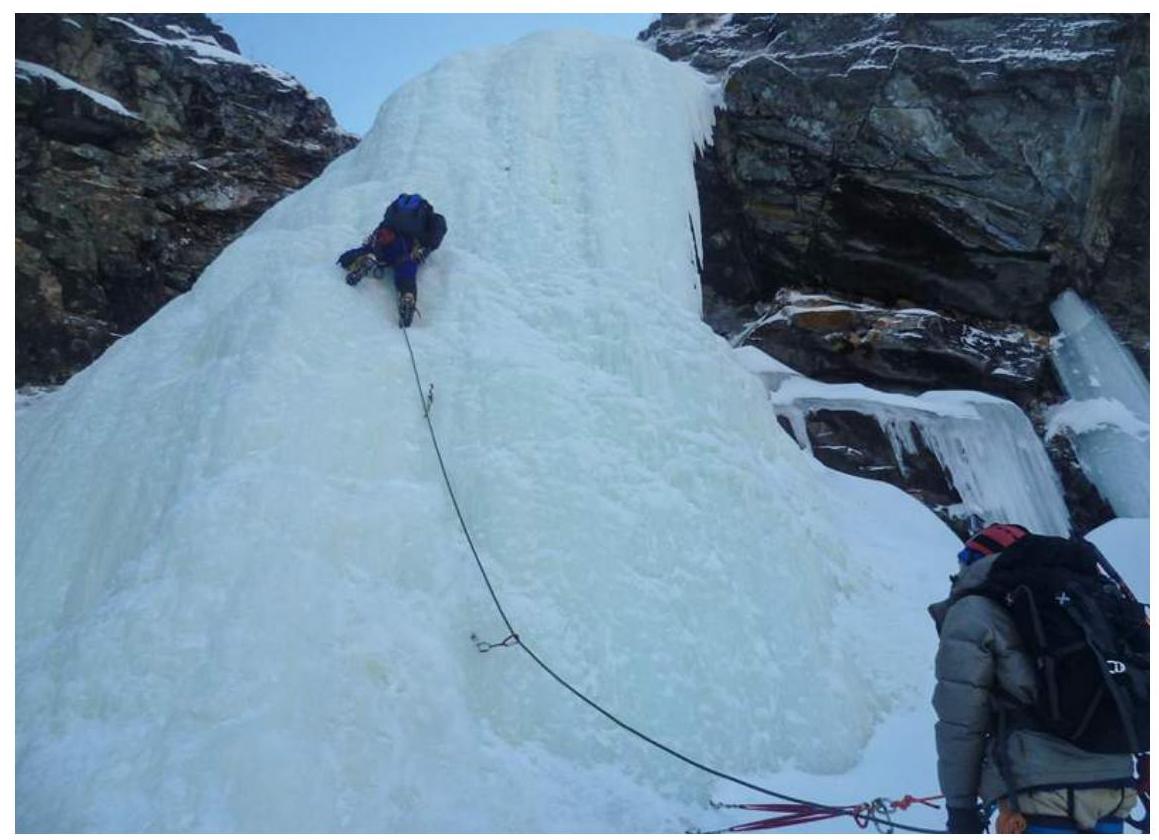
Fig. 7: On R2-R3. Ice outcrop climbed via left "screw" 40 m (15 m, 75-85°, 5).
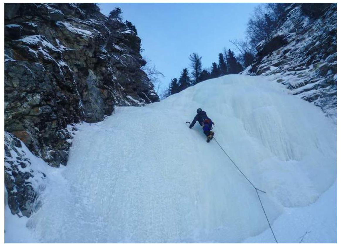
Fig. 8: On R3-R4. Ice wall climbed diagonally left 40 m (10 m, 60°, 4).
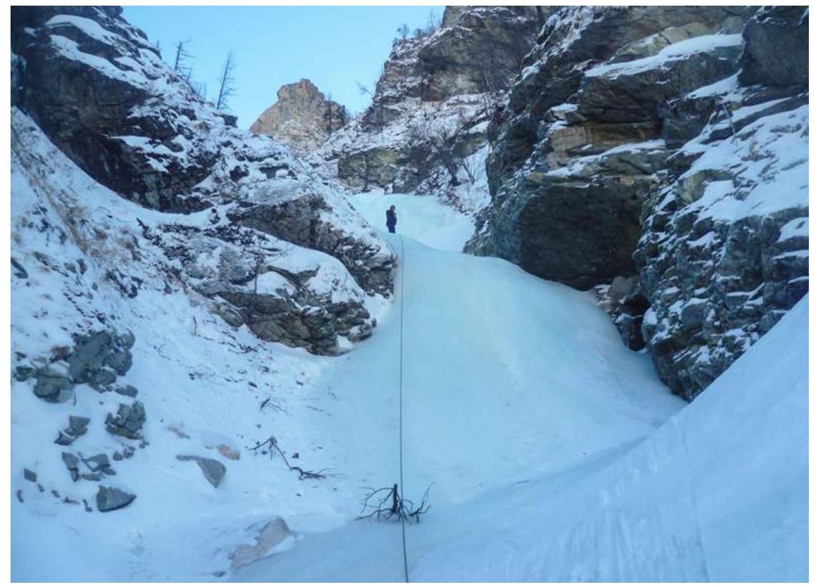
Fig. 9: On R4-R5. Photo from belay on ice cascade of two steps 60 m (40 m, 45°, 3).
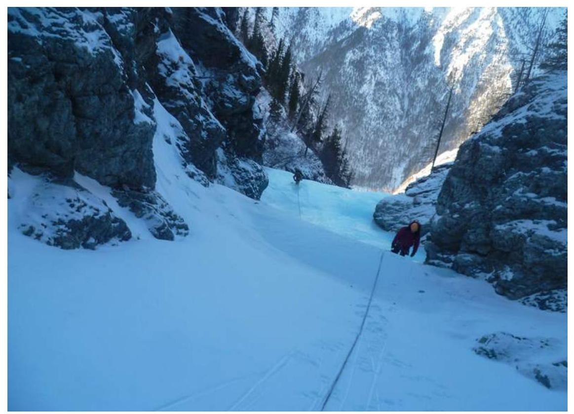
Fig. 10: Start of R5-R6, viewed from above. Transition from ice to ice-snow couloir.

Fig. 11: On R5-R6. Through firn in the ice-snow couloir towards "Pegasus" rock.
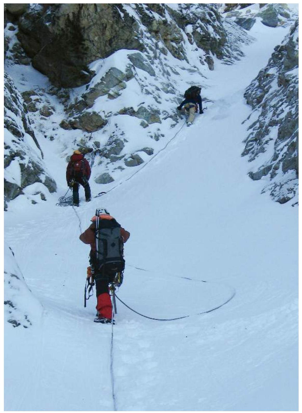
Fig. 12: On R5-R6. In the couloir (240 m, 20-35°, 1-2), overcoming short steps of ice.
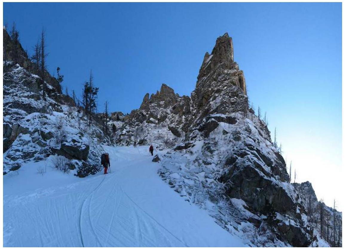
Fig. 13: On R6-R7. Left hook to bypass "Pegasus".
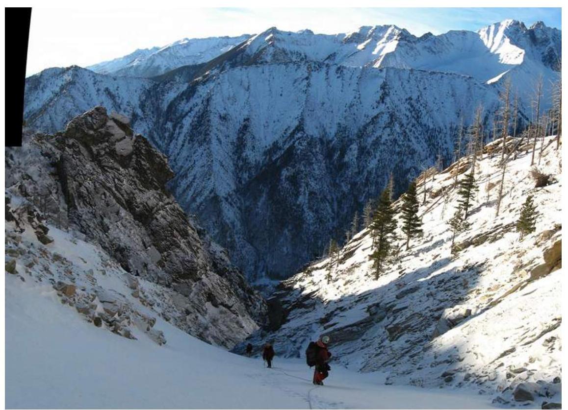
Fig. 14: On R7-R8, viewed from above. Upper part of ice-snow couloir.
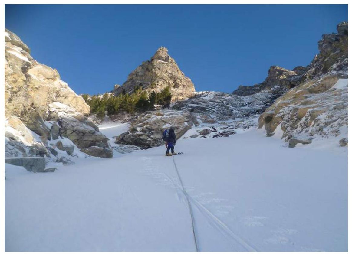
Fig. 15: On R7-R8. Upper part of ice-snow couloir against "Pyramid" rock. For scale, see photo 16 at the "base of outcrops".
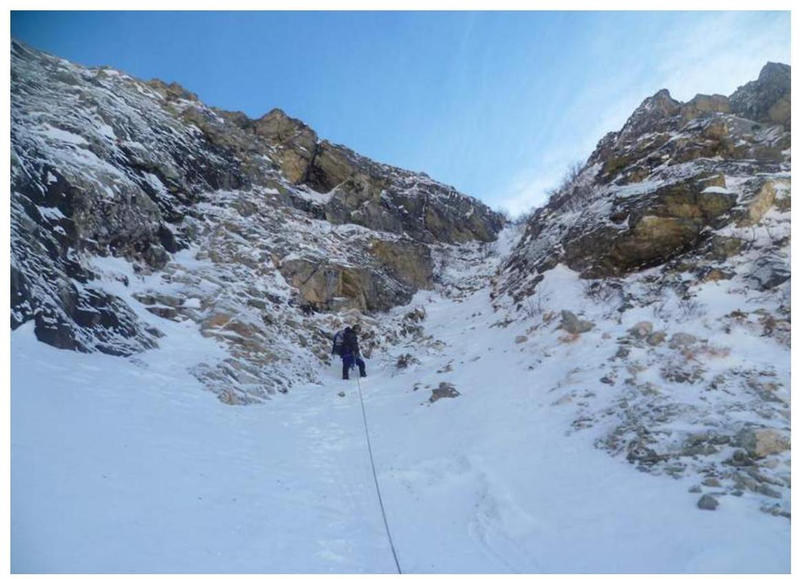
Fig. 16: On R8-R9. Unnoticeable couloir at the base of outcrops to the right upwards (40 m, 35°, 1+).
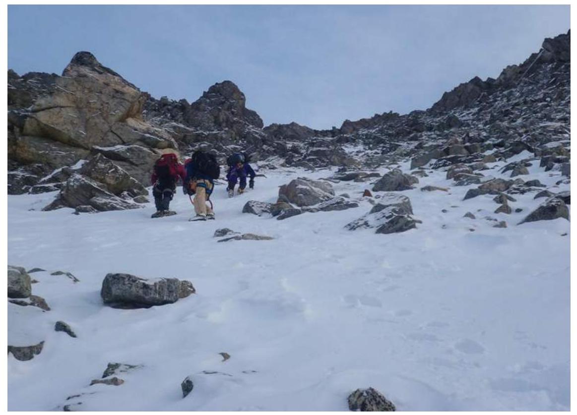
Fig. 17: On R9-R10. Rocky-snowy slope to the saddle in the ridge (320 m, 38°, 2).
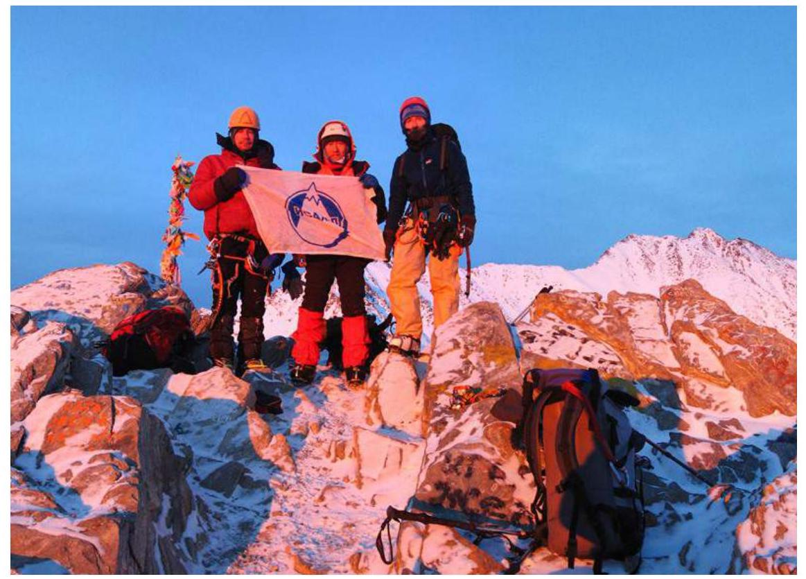
Fig. 18: Photo at the summit of Lyubvi peak: Rudman A., Voylichenko S., Serebrennikov E.