ASCENT DOCUMENT
-
Region: Eastern Sayan, Tunkinskie Goltsy, section 6.1.2
-
Peak Druzhba 2500 m via Western ridge through Lyubov
-
Category 2A (variant of Prokopieva 2A)
-
Route type: rock.
Height difference: 1600 m; average steepness: 20°; total route length: 4780 m;
-
Total pitons used: 4 left behind: 0; placed protection: 4 (R4–R5);
-
Time to summit: 7.5 hours.
Route started: 05:00, April 1, 2017 Reached summit: 12:30, April 1, 2017 Returned to base camp: 16:00, April 1, 2017
-
Leader and coach: Voylichenko S.K., Candidate for Master of Sports, instructor category III Participants: Berngard M., (III); Golovin K., (youth); Metlyaev A., (youth); Rudman A., (youth); Serebrennikov E., (youth)
-
Report author: Voylichenko S.K. kim@inbox.ru
-
Organization: Irkutsk mountaineering section.
Irkutsk – 2017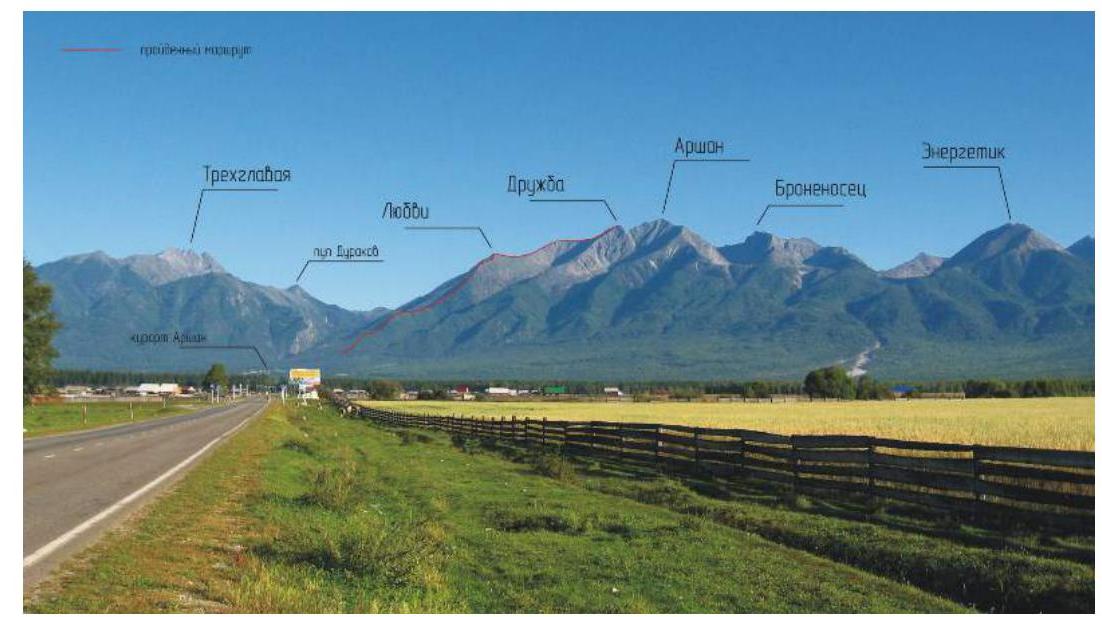
Fig. 1: Panorama of peaks in the ascent area. Base camp is located in the resort village Arshan. The route is marked in red (photo taken in summer 2016).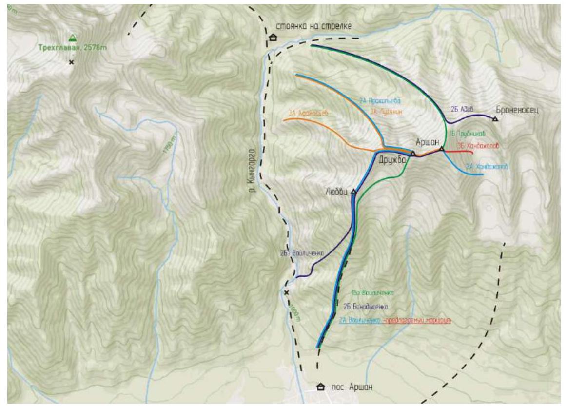
Fig. 2: Schematic map of the ascent area. Relative positions of routes and peaks around peak Arshan. Route difficulty categories are color-coded. The route taken is shown as a blue line labeled "2A Voylichenko – proposed route".
Brief Overview of the Ascent Area
There are three classified routes to peak Druzhba (2500 m):
- 2A Prokopiev (1988) via W ridge,
- 3A Afanasiev (2010) via v. Molodezh along W edge,
- 1B Voylichenko (2016) via S edge.
The proposed route to Druzhba via W ridge through peak Lyubvi is a variant of 2A Prokopiev (1988) and is convenient when the base camp is in Arshan village rather than at the "strelka" of Kyngargi.
The difficulty of this route to Druzhba is similar to 2A (Taran) on Krylya Sovetov (Munku-Sardyk region) and slightly easier than 2A (Khandazhapon) on Arshan due to its lower average steepness. The route features diverse terrain:
- frozen grassy slopes
- talus and scree
- snow-covered rocks
- prolonged movement in teams.
The route is recommended for training groups as a first winter 2A ascent, being relatively safe for improving skills on mixed terrain.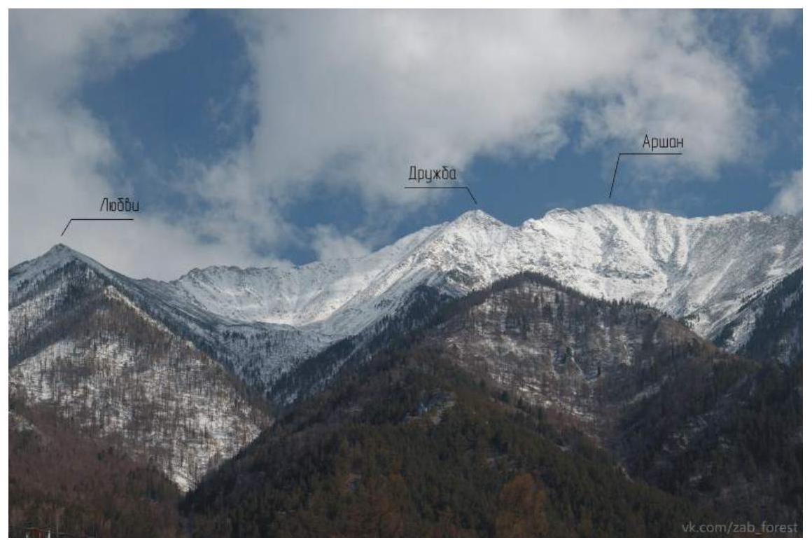
Fig. 3: View of the Lyubov-Druzhba-Arshan peak massif from Arshan village. Photo courtesy of Balabanov A. (zab_forest).
General Route Description
Start coordinates: 51°55′15″ E102°25′54″, summit coordinates: 51°57′03″ E102°27′24″.
Approach. The ascent begins from the village along a trail to peak Lyubov. It takes 15 minutes to reach the trailhead from the bus station.
Route description. Follow the trail (a sky running competition "Vertical Kilometer") to peak Lyubov. Then proceed along the ridge towards peak Druzhba via peak Molodezh. The section from Molodezh to Druzhba follows 2A Prokopieva (1988). Stay on the southern side of the ridge as the northern side has overhanging sections. Descend via the ascent route or 1B Voylichenko (2016) along the S edge.
General notes and recommendations. In winter, the well-trodden trail to peak Lyubov becomes:
- low-snow
- icy
- grassy-earthy slope
Crampons are recommended. Reaching the tree line may take up to 3 hours.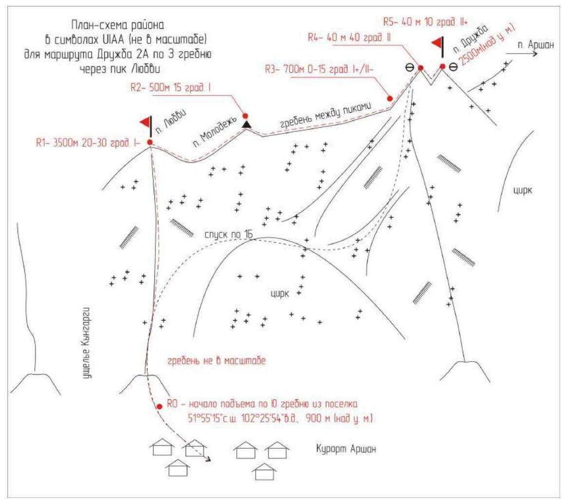
Fig. 4: Route schematic in UIAA symbols. Not to scale, for illustrative purposes.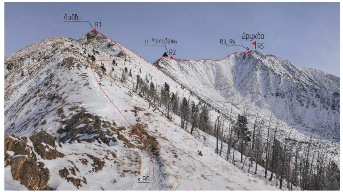
Detailed Route Description
R0–R1 3500 m. 20–30° I–. Along S ridge to peak Lyubov. R1–R2 500 m. 15° I. Across talus on S ridge to peak Molodezh.
- Movement in teams
- Self-arrest protection
R2–R3 700 m. 0–15° I+/II–. Along W ridge, sometimes on the ridge.
- Caution! Overhanging rocks!
R3–R4 40 m. 40° II. Pre-summit ascent to peak Druzhba. R4–R5 40 m. 10° II+. Crossing a gap. Summit of Druzhba. Protection via placed elements, alternating movement.
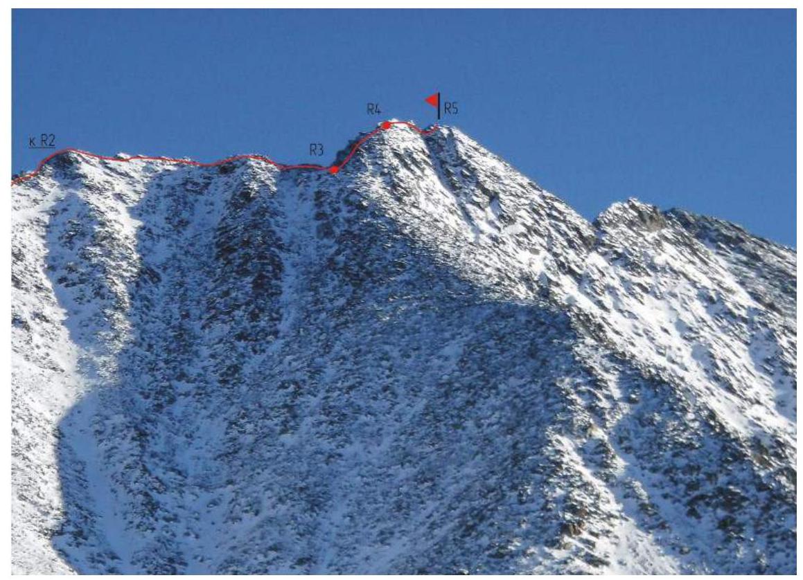
Fig. 5: Technical photograph of the route from the tree line.
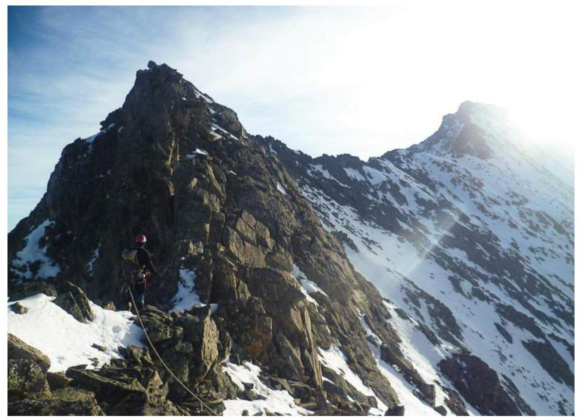
Fig. 6: Technical photograph of sections R3–R5.
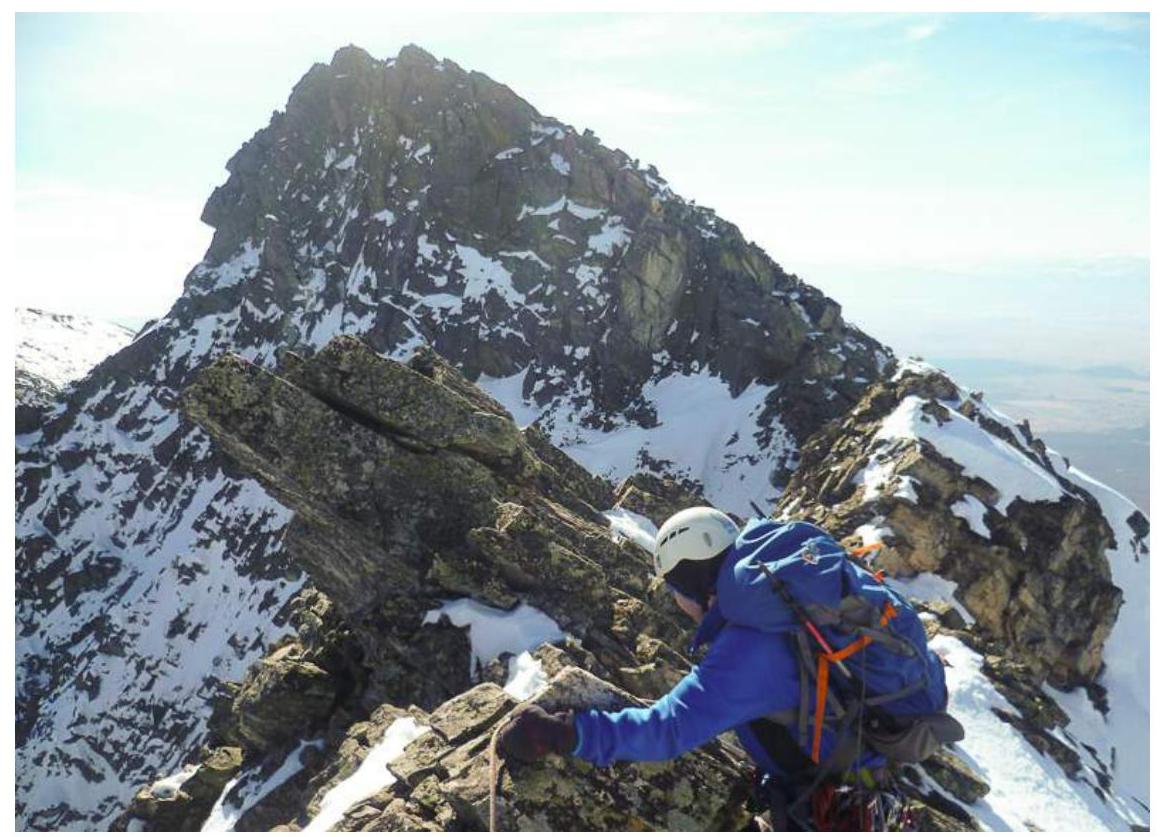
Fig. 7: Section R1–R2. Across talus on S ridge to peak Molodezh. Movement in teams, self-arrest protection.
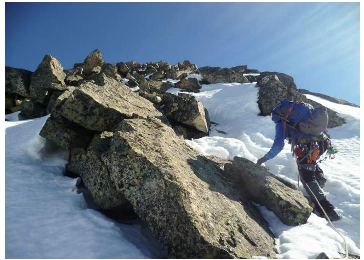
Fig. 8: Section R2–R3. Along W ridge. Sometimes on the ridge. Caution! Overhanging rocks!
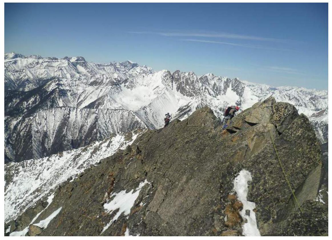
Fig. 9: Section R3–R4. Pre-summit ascent.

Fig. 10: Section R4–R5. Crossing a gap. Summit of Druzhba. Protection via placed elements, alternating movement.

Fig. 11: Participants at the summit of Druzhba (Berngard M., Metlyaev A., Rudman A., Golovin K., Serebrennikov E.).