Report on the ascent of Pik Bronenosets (2430 m) via the Western ridge, route category 2B (first ascent by V. Adov, 1976) Eastern Sayan, Tunkinskie Goltsy ridge, Dождевое gorge, 6.1.2
2023
I compiled this report because I was unable to find a description of the route ascended by V.G. Adov in 1976.
The route has many advantages, such as diverse terrain, which will allow novice climbers to practice their skills in несложном лазанье, setting points, and moving in связках, and there is also a rappel.
In addition, the route is conveniently located near the village of Arshan, which eliminates the need for tedious and multi-day approaches. On average, it takes no more than 4 hours to reach the base camp from the village (approximately 8 km and 1000 m ascent).
Another advantage is the logic and beauty of the route: it runs between two beautiful peaks of the Eastern Sayan, and the climber will have a magnificent view of the panorama from the Western ridge.
Ascent Passport
- Eastern Sayan, Tunkinskie Goltsy ridge, Dождевое gorge, 6.1.2
- Pik Bronenosets (2430 m), 3rd category
- 2B — passage of V. Adov's route
- Route type: rock (ridge)
- Route height difference: 80 m
- Route length: 900 m
- Pitons left on the route: total: 0; including шлямбурные: 0;
- Total used on the route: — шлямбурные крючья — 0 — rock pitons (including anchors) — 2 — закладные elements — 6 (including friends — 6) — sky-hooks (including passage on фифах) — 0 Total ИТО points: 0
- Team coach: Korshunov Maxim Viktorovich (1st sports category), instructor 3rd category.
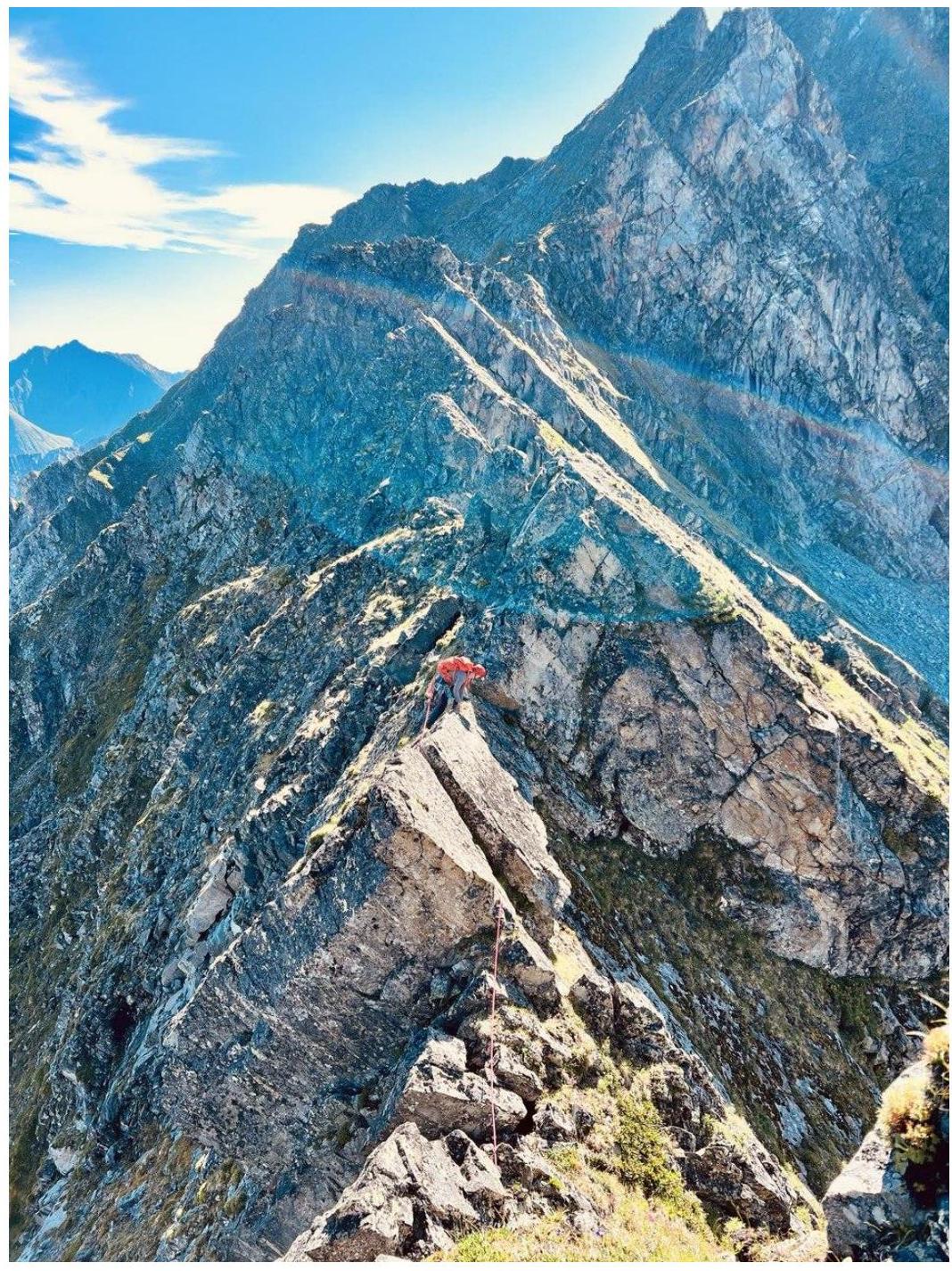
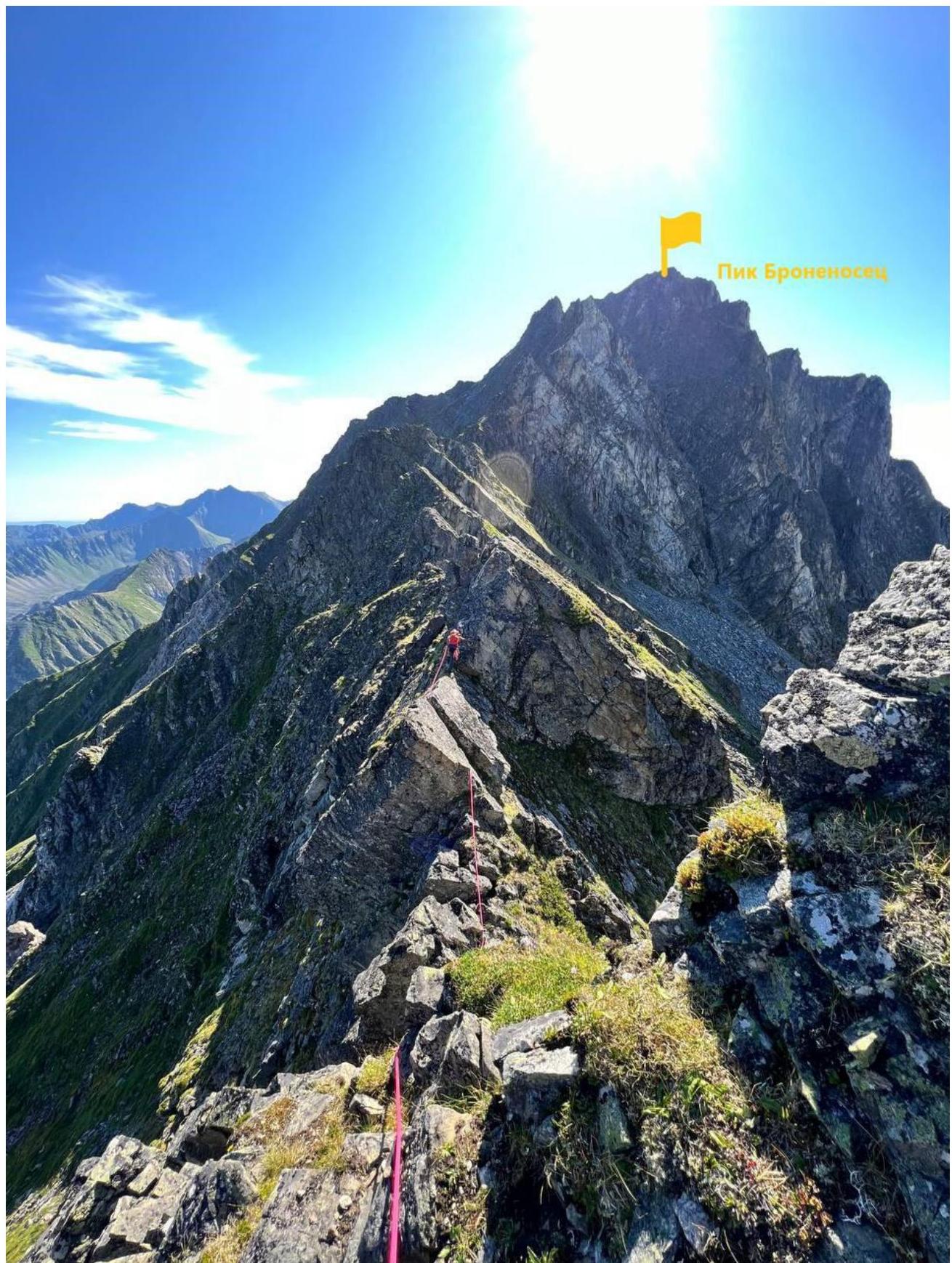
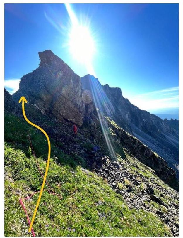
General photo of the Western ridge of Pik Bronenosets (view from the Dождевое cirque on the approach to the route)
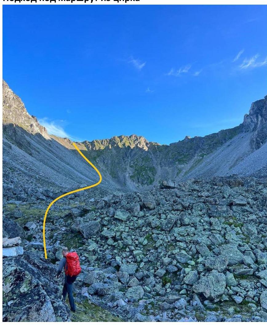
Approach to the route from the cirque
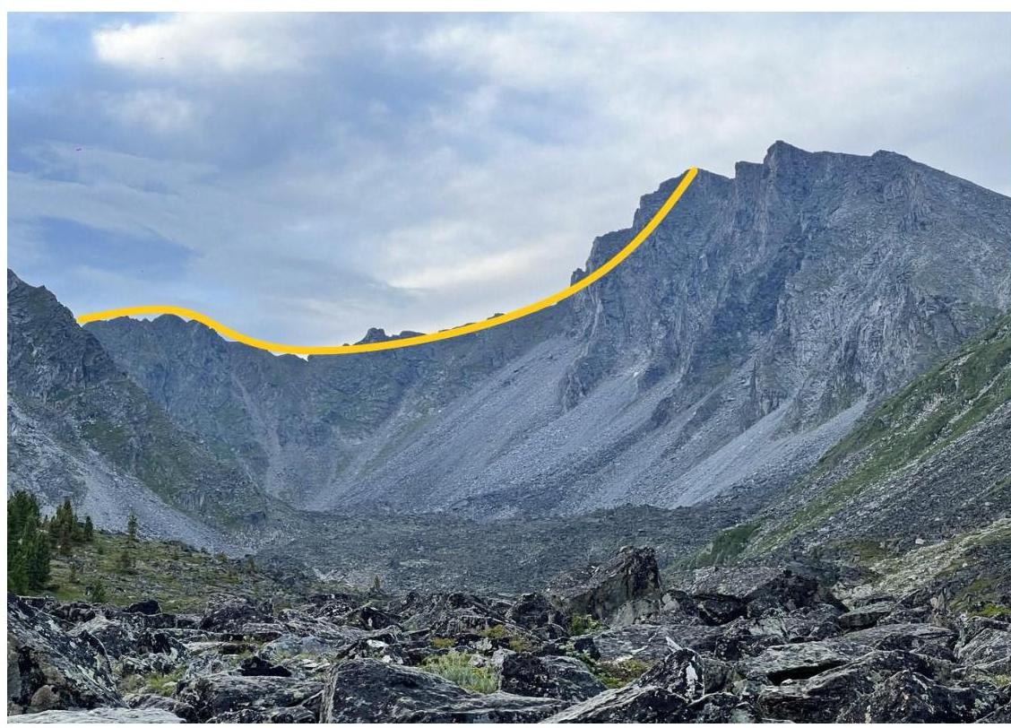
Longitudinal profile of the Western ridge, view of Pik Bronenosets
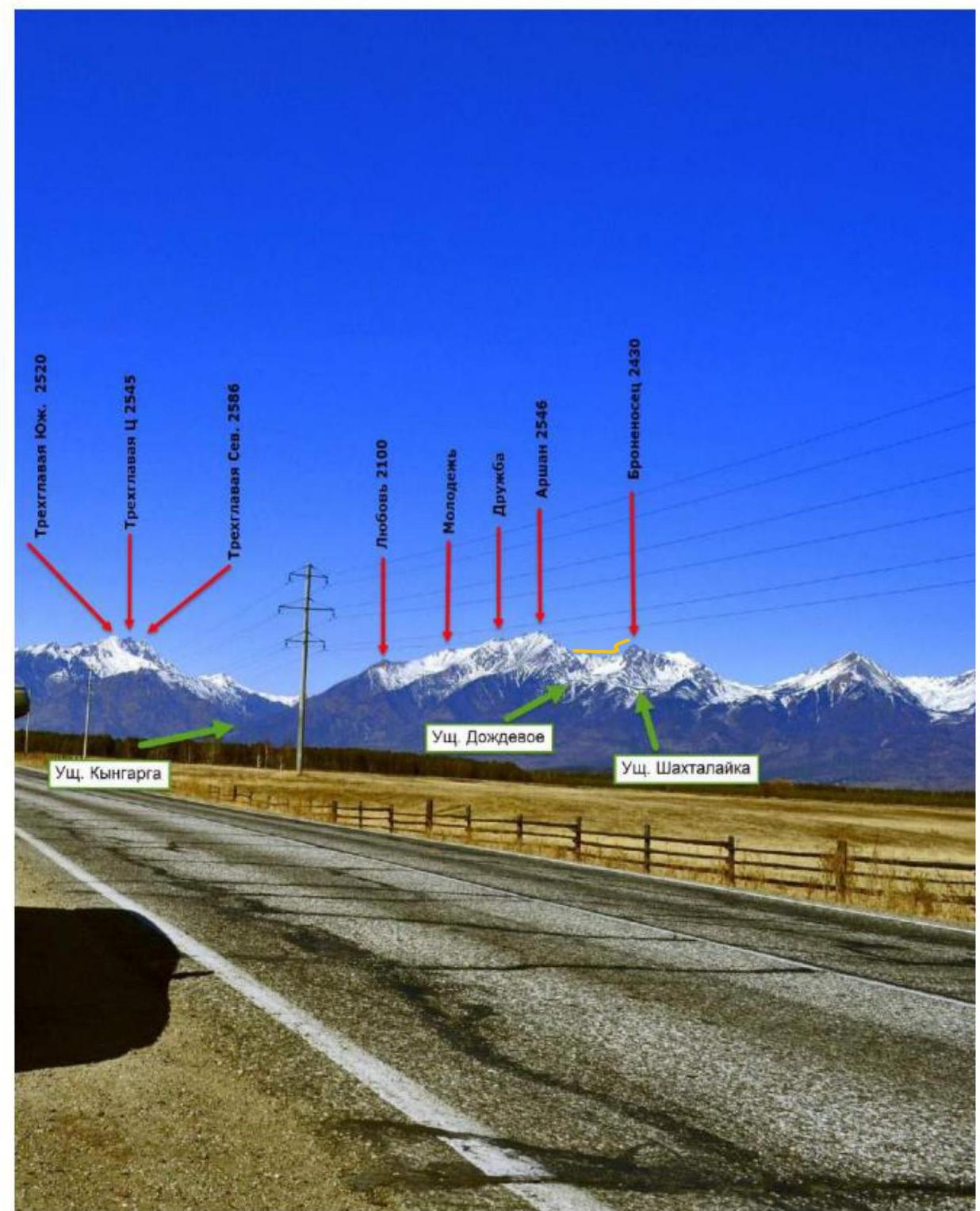
Panorama of the peaks of the Tunkinskie Goltsy ridge near the village of Arshan. (Photo taken from the Tunkinskaya valley, at a distance of 15 km)
Map-scheme of Dождевое gorge
Dождевое gorge is located in the Tunkinskie Goltsy ridge near the village of Arshan and is oriented towards the Tunkinskaya valley. Morphologically, the gorge is essentially a long cirque, or hanging valley, situated between the mountains Bronenosets and Arshan and ending in a steep, weakly incised stream towards the Tunkinskaya valley. The surface of the gorge above the forest zone is weakly inclined, and when intersected, it appears as a trough. The bottom of the gorge and part of its slopes are composed of moraine deposits (bottom, surface, and lateral) with coarse-grained material, with an average fraction of 0.5 to 5 m in diameter, of intrusive rocks, mainly granite, and less often sedimentary metamorphic rocks. The bottom of the gorge has been weakly altered by post-glacial erosion. It is the most accessible gorge for mountaineering ascents in the Eastern Sayan. The time required to reach the base camp from the village of Arshan is between three to five hours. Even in winter, the approach is not complicated, as the height of the snow cover is very low due to the slope exposure, and it becomes significant only half an hour before reaching the base camp. The gorge is bounded by only two mountains and their ridges: to the west is the mountain Arshan, and to the east is the mountain Bronenosets. Currently, there are routes of various categories in the gorge: 1B — 1, 2A — 2, 2B — 1, 3A — 1, 3B — 2, 4A — 2, 4B — 2, 5A — 1.
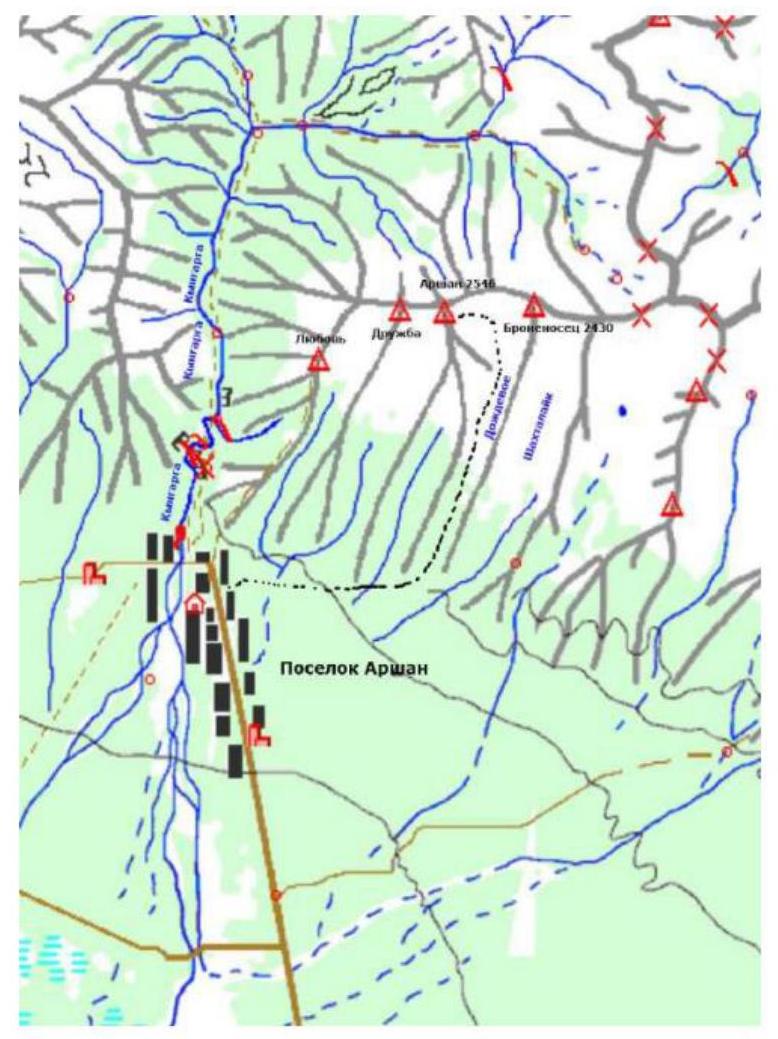
In the cirque, on the moraine, there is a small lake, where it is convenient to set up a base camp in the summer; in dry periods, there may be no water, in which case it is advisable to look for a spring under the moraine wall to the right of the bushes. In winter, it is more advantageous to set up a base camp at the edge of the forest to access firewood.
Scheme of the main part of the route, made in UIAA symbols
| Section | Зак. Эл. | Friends | Rock pitons | ИТО | Route scheme in UIAA symbols | Length in m | Steepness in degrees | Climbing difficulty |
|---|---|---|---|---|---|---|---|---|
| R9–R10 | 0 | 0 | 0 | 0 |  | 70 | 50 | 2 |
| R8–R9 | 0 | 2 | 1 | 0 |  | 2 | 85 | 5 |
| 20 | ||||||||
| 2 | 90 | |||||||
| R7–R8 | 0 | 0 | 0 | 0 |  | 30 | 65 | 4+ |
| 50 | 30 | |||||||
| 50 | 30 | |||||||
| R6–R7 | 0 | 0 | 0 | 0 | 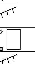 | 50 | 60 | 3 |
| 10 | 50 | |||||||
| 15 | 20 | |||||||
| R5–R6 | 0 | 2 | 1 | 0 | 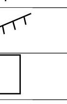 | 10 | 20 | 4+ |
| 2 | 90 | |||||||
| 10 | 20 | |||||||
| R4–R5 | 0 | 1 | 0 | 0 |  | 70 | 50 | 3 |
| R3–R4 | 0 | 0 | 0 | 0 |  | 50 | 90 | rappel |
| R2–R3 | 0 | 1 | 0 | 0 |  | 70 | 20 | 4 |
| 90 | ||||||||
| R1–R2 | 0 | 0 | 0 | 0 |  | 70 | 20 | 3+ |
| 85 | ||||||||
| R0–R1 | 0 | 0 | 0 | 0 |  | 70 | 20 | 2+ |
| 80 | ||||||||
| 20 |
Team movement schedule on the route: August 23, 2023.
At 06:45, climbers left the base camp located in Dождевое gorge at an altitude of 1800 m above sea level.
At 08:05, they approached the start of the route. At 08:20, the leader began the ascent. At 11:00, the key section was passed. At 11:30, they reached the summit. At 13:30, they returned to the base camp in Dождевое gorge.
Relief description
R0–R1. The route begins on the left side (when viewed from Dождевое gorge) of the Western ridge (closer to peak Arshan), which connects the peaks Arshan and Bronenosets. The start of the route is on a platform in front of a small rock wall located on the ridge (Fig. 1).

The first obstacle is bypassed on the right; insurance can be taken on the relief. In winter, insurance points will likely be required, as the southern slope of the ridge consists of large, slippery slabs for most of its upper length.
Fig. 1
After overcoming the first obstacle, the ridge becomes relatively safe again. This situation is characteristic of the entire route, where a rock wall or a pillar alternates with walkable sections.
R1–R2. Continuing on the route, there is another rock wall approximately 6–7 m high, which is climbed almost directly, with a slight shift to the right, as shown in the photo (Fig. 2).
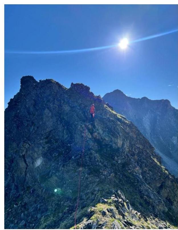
Fig. 2
The wall has rich relief for insurance, with good cracks for anchor pitons, which will be necessary when climbing this section in winter. In summer, it is sufficient to use relief for insurance.
After passing the wall:
- the ridge becomes walkable again, with insurance on the relief;
- the ridge then rises sharply to a height of 10–12 m (Fig. 3).
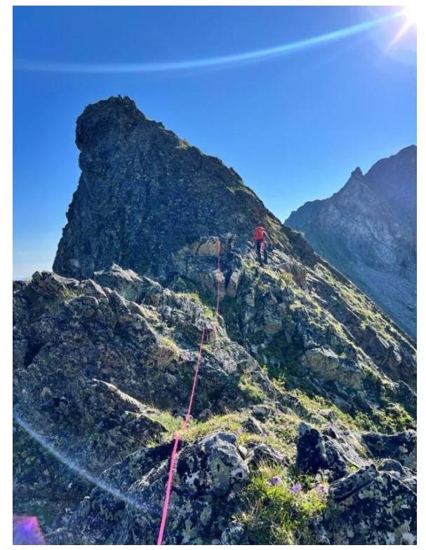 Fig. 3
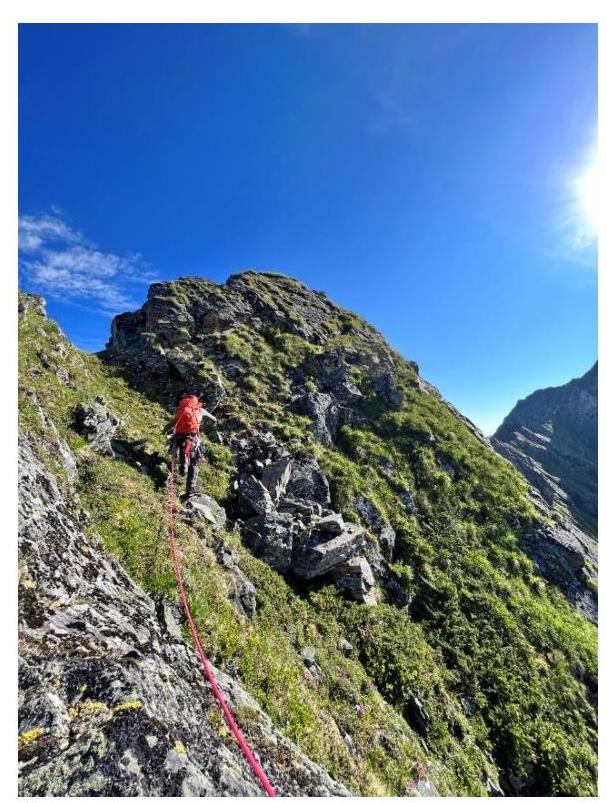 Fig. 4
R2–R3. We ascend a vertical wall at the base of the rise, approximately 2 m high. Climbing is easy, but insurance points are recommended in winter. Then, we bypass the ridge rise on the right, without ascending to its upper part. The route goes along grassy ledges, bypassing slabs, and through a small internal angle, we return to the upper part of the relief, bypassing obstacles on the right or directly (Fig. 4).
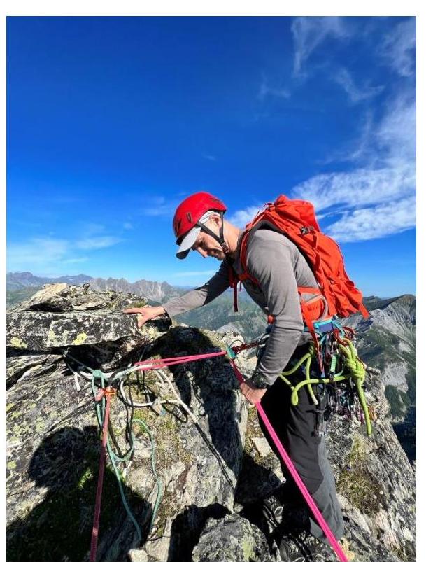 Fig. 5
R3–R4. The next section features a vertical wall approximately 6–8 m high, which requires a rappel descent (Fig. 5). Below, there will be a safe platform, followed by a traverse along a narrow ridge with vertical drops on the southern side along slabs (insurance on the relief).
R4–R5. The first pillar encountered on the route:
- in summer, it can be bypassed on either side;
- in winter, it is recommended to bypass on the left (Fig. 6).
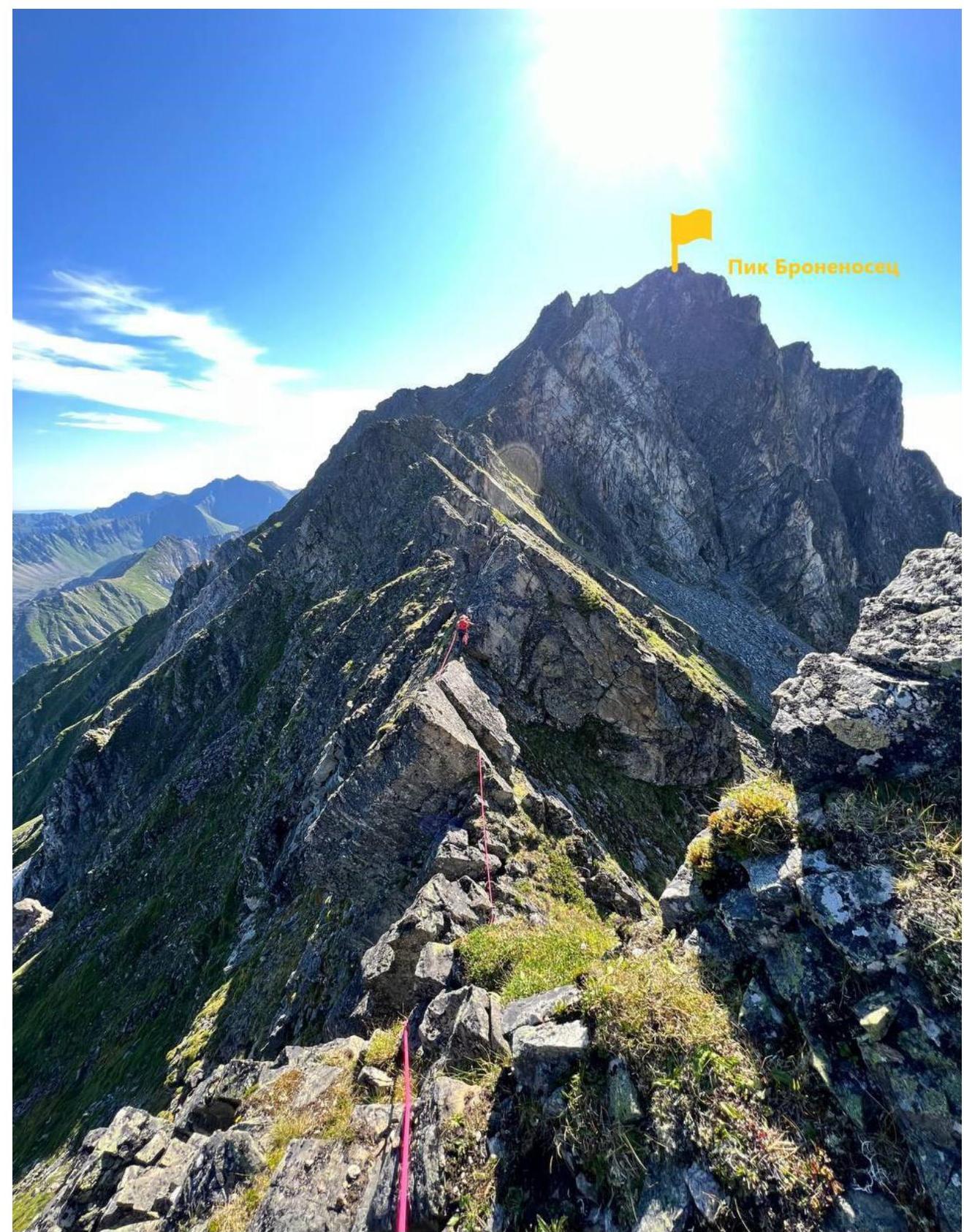 Fig. 7
R5–R6. The route then continues to the top of the ridge and follows steep but short rock outcrops — "knives". In summer, climbing is pleasant, with insurance on camalots and relief. This is one of the key sections of the route, which may require additional insurance on anchor pitons in winter (Fig. 7).
R6–R7. The ridge then becomes less steep until the next obstacle, which is a pile of stones, bypassed on the left as indicated in Fig. 8.
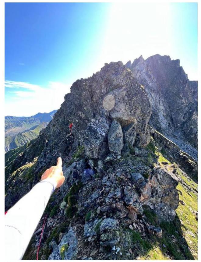
Fig. 8
After bypassing the obstacle along grassy ledges, we ascend to the upper part of the ridge via the easiest route. Upon reaching the ridge, we move forward (with gentle slabs to the south). Upon reaching rock piles in the center of the ridge, we bypass them on the left along a convenient ledge (Fig. 9).
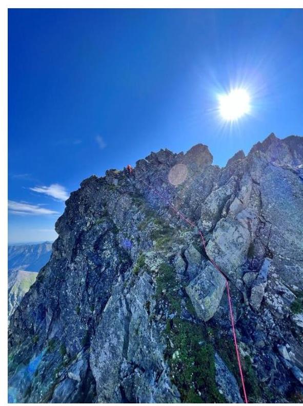
Fig. 9
All insurance on this section can be taken on the relief. The next section is key; the previously horizontal ridge begins to rise sharply towards the summit, and the climber will encounter two large pillars (Fig. 10).
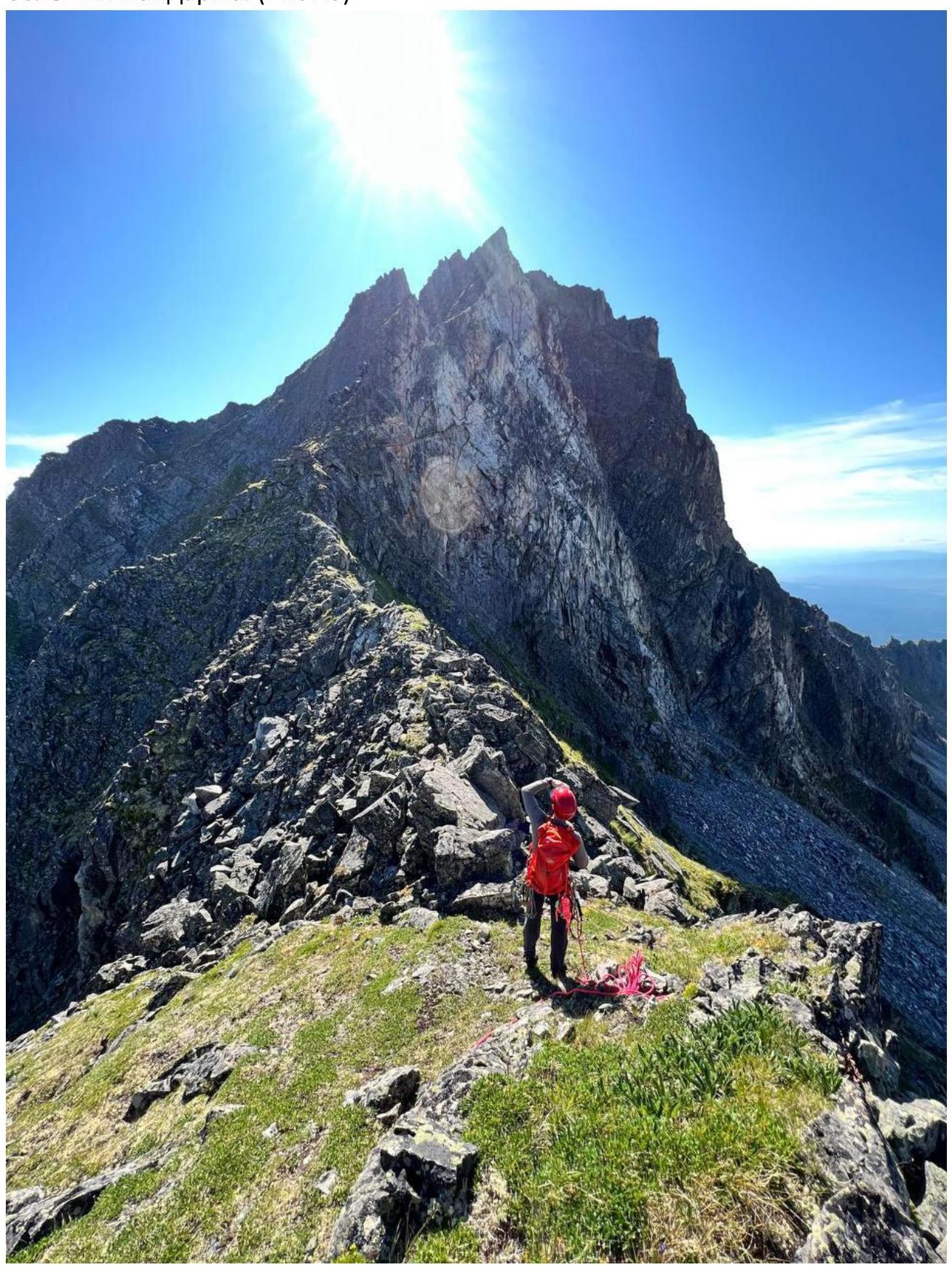 Fig. 10
R7–R8. The first pillar is bypassed on the left with a gradual gain in height. Short rock walls and piles of stones are encountered on this section, with relatively easy climbing (4+).
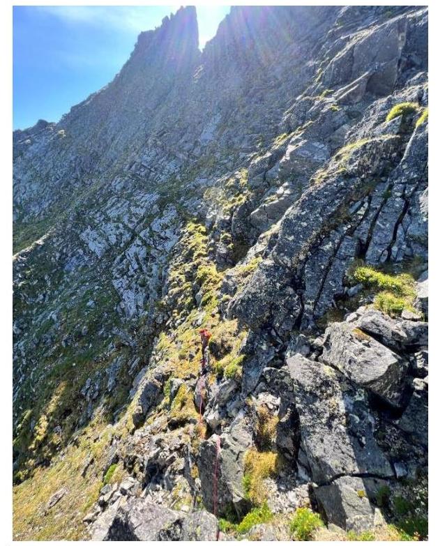 Fig. 11
The general direction of movement towards the saddle between the pillars is the most logical and easiest route. In summer, the entire slope is slippery with moss and grass; the relief is rich in possible insurance points; and there are many "live" stones.
R8–R9. After reaching the ridge and the saddle between the pillars, we head upwards and to the left, ascend to the pillar, and bypass it on the left along a narrow but convenient ledge (Fig. 12).
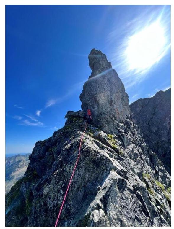 Fig. 12
Further movement follows a system of ledges and internal angles, with insurance on the relief. Upon reaching the ridge again, the view opens up to the summit and a logical, easy ascent to it (Fig. 13).
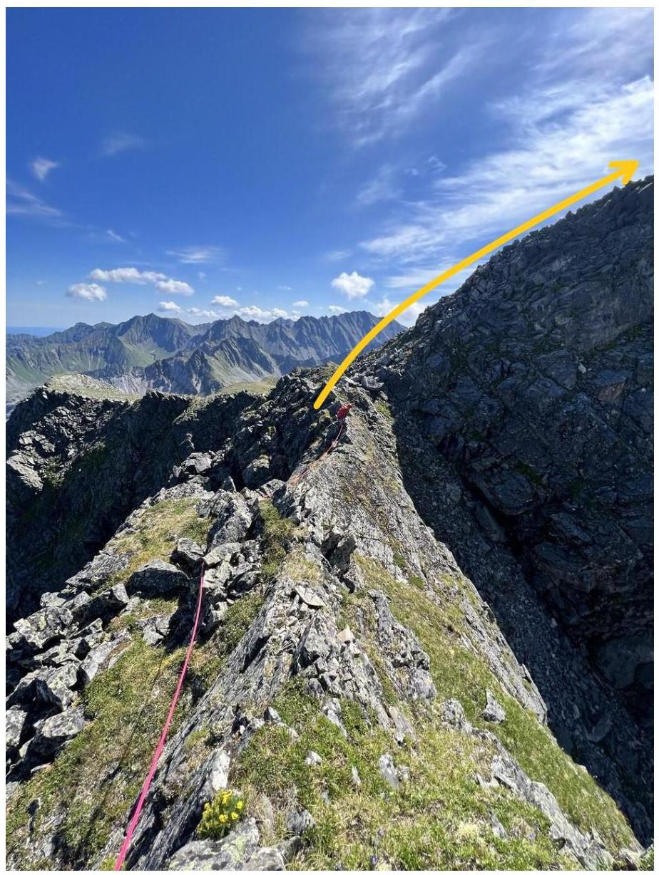 Fig. 13
Route characteristics
The route is entirely ridge-related, and the logic of the ascent can be summarized as follows: all obstacles on the way to section R5–R6 are bypassed on the right or directly, and after section R5–R6, obstacles are bypassed on the left.
The route is well-structured and logical, with no risk of getting lost.
- In summer, it is possible to bypass the last two pillars along grassy ledges without reaching the saddle between them, but this makes the route less interesting and spectacular.
- In winter, bypassing may be dangerous and could potentially trigger an avalanche.
85% of the route follows external relief forms and is well tied to them.
- With high snow cover, there may be risks of avalanche on the final ascent before the start of the route from the SW wall of the ridge.
- The rocks are quite heavily destroyed, with "live" stones present; however, the route line is such that stones falling from the climber always go to the side of the partner.
The route has two distinct key sections that require average free climbing skills.
The descent from the summit is carried out along a non-category route on the S ridge, category 1B, towards the Tunkinskaya valley, into the Dождевое cirque, or to the SE through the Vtorya Shikhtolayka gorge.
The route description was compiled by Ivanovski A.V. on August 2, 2023.