X KIV /8
Irkutsk Regional Alpine Federation
Traverse of the peaks Druzhba — Arshan (Eastern Sayan)
Brief geographical description of the region
The peaks Druzhba and Arshan are located in the Tunkin Goltsy ridge, in the Eastern Sayan, in a lateral spur. The western slopes of the spur drop steeply into the gorge of the Kyngarga river.
Tunkin Goltsy is the highest ridge in the Eastern Sayan, stretching latitudinally for 200 km. The highest point of the ridge reaches 3266 m above sea level in the upper reaches of the Ganga-Khairym river gorge.
Overall, the ridge has sharp alpine forms with deep gorges and wide glacial cirques.
For over 100 km from the Arshan resort in the east to the Shumak pass in the west, the ridge has many peaks of great interest to mountaineers.
The forest boundary:
- on the southern slopes — 1800 m;
- on the northern slopes — 1600–1700 m.
The snow cover almost completely disappears by the end of summer. There is no glaciation.
Peak Arshan has a height of 2546 m above sea level, and peak Druzhba is around 2360 m. The nearest settlement is the Arshan resort, 225 km from Irkutsk. From the resort to the base camp at the confluence of the Right and Left Kyngarga rivers — 4 hours walk up the gorge.
Route description
Section R0–R1
From the campsite at the confluence of the Right and Left Kyngarga rivers (at benchmark No. 1262 m) — 500 m downstream along the gorge. Before reaching the confluence of the right stream, which originates from the foot of the spur, we begin the ascent up a steep, forested slope, eventually reaching the ridge (photo No. 2). We reach the forest boundary in 2–2.5 hours. Then, continuing along the ridge, we reach the base of the rocks (35–40 minutes).
Section R1–R2
Upon reaching the first rocky outcrop, we bypass it on the right, emerging onto a saddle (photo No. 3). After rounding the rocky massif, we begin ascending the rocks, with a slope of 35–40°, moving simultaneously (photo No. 4).
Upon reaching the next saddle, we rope up. From the saddle, we start a "direct ascent up a steep 10-meter rock wall of medium difficulty," with sufficient holds. After ascending 5–6 m, we traverse along an inclined ledge to the left and upwards, eventually reaching the ridge (photo No. 4).
The ridge is composed of monolithic rocks; individual walls are traversed with alternate belays (photo No. 5, 6). We pass a section of snow-covered slabs with a slope of 30°; to reach the foot of the gendarme, we traverse along the upper part of the slabs, as the slope drops steeply into a narrow couloir below.
We do not ascend to the very ridge — the rocks overhang and are unstable (photo No. 7). The ascent to the gendarme is straight up to the middle, then a traverse to the left, emerging onto the ridge. The rocks are местами of medium difficulty, with good holds, and belays from the start of the slabs to the top of the gendarme are mostly alternate (photo No. 8).
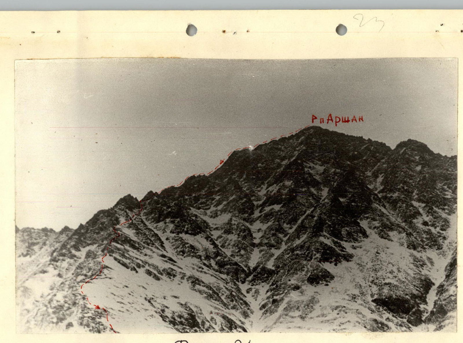
The top of the gendarme marks the end of the section and the beginning of the main ridge, offering a view of the zigzagging ridge that ends at the first western peak of Druzhba (photo No. 9). The section is completed in 2 hours.
Section R2–R3
Further movement is along the ridge (photo No. 9), mostly simultaneous, with some alternate belays (photo No. 10). Caution is required: deep snow to the right of the ridge crest forces movement along rocky outcrops near the precipices (photo No. 9).
The ascent to the tower of Druzhba peak is via steep rocky blocks. The summit of Druzhba is a narrow rocky ridge with steep drops on both sides (photo No. 10, 11). A cairn is built on a 2×2 m platform at the end of the ridge. The ridge before the platform with the cairn is broken by a gap about 6 m deep with steep walls (photo No. 14). When moving along the summit ridge to the platform with the cairn, it is recommended to use ropes.
From the summit, there is a view of the western ridge with a gendarme and the peak Arshan (photo No. 15, 12).
The section is completed in 1.5–2 hours.
Section R3–R4
The section begins with a descent into the gap between Druzhba and Arshan peaks (photo No. I, II). The ridge is narrow, with a slope of up to 50°; two ropes are used for protection, followed by alternate movement, belaying off protrusions. In the lower part, the rocks are crumbling, requiring caution; the steepness of the rocks remains the same.
To the snowy saddle — 5 ropes. From the saddle, we ascend to the right, up a snowy slope of 30°, without reaching the ridge, as it leads to sheer rocks (photo No. 15).
Approaching the rocks, we begin ascending snow-covered slabs with a slope of 40–50°, moving with alternate belays, careful protection via protrusions, and in some places, using ropes (photo No. 16 — start of the ascent to the ridge from the saddle). The ridge is wide, initially gradually narrowing, then dropping steeply on both sides: to the north — almost sheer deep gaps, to the south — slabs. Movement requires extreme caution. Two ropes along the rocks — a challenging section; a narrow ridge. Monolithic slab-like rocks with a slope of up to 60°, length up to 40 m, limited small holds, and steep drops on both sides.
Protection involves 2–3 pitons; ropes; ascent is "athletic" with a Prusik knot. Further along the ridge, the terrain becomes more even, with alternate belays, and some simultaneous movement.
We approach a large gendarme — the second critical point. The lower part is bypassed with a horizontal traverse to the right, with alternate belays, then ascending simultaneously to the steep summit rise of the gendarme (photo No. 17). The summit rise (photo No. 18), about 40 m high, with a slope of up to 65°, is overcome with careful piton protection (4 pitons). Vertical ropes; ascent is athletic, with a Prusik knot (photo No. 19).
Overcoming this section demands significant physical effort and precision (risk of rockfall), imposing certain requirements on the participants.
The summit ridge of the gendarme is very narrow; movement is cautious, with two ropes for protection.
After a short descent, we reach the final summit rise (photo No. 12), which is a jumble of rocky boulders (photo No. 21).
- Individual walls are bypassed on the right or overcome directly with alternate belays (photo No. 22, 23).
The section takes about 3 hours to complete.
Section R4–R5
Descent from peak Arshan along the northern ridge (photo No. 24). The ridge is heavily damaged; sections with boulder jumbles require cautious passage with alternate belays.
There are individual groups of rocks with difficult bypasses and descents using ropes.
Reaching the last gap, we descend into a couloir, then traverse along a snow-covered, stable talus slope and emerge onto the ridge. The descent to this point takes 1 hour. Then, 1.5–2 hours of movement remain to the base camp.
The entire route takes 12–13 hours. The group believes that the route in winter conditions corresponds to category 2B.
Group composition
- Luzyanin E. (4A, 4A, 4A, 4B, 4B, 5A) — leader.
- Kuznetsov Yu. (4A, 4A, 4B, 4B) — participant.
- Shirshov V. (4A, 4A, 4B, 5A) — participant.
- Petrushin Yu. (4A, 4A, 4B, 5A) — participant.
- Mikhailov A. — participant.
- Mikhailova R. — participant.
- Kolmakova G. — participant.
- Lyashenko M. (4A, 4A, 4B, 4B) — participant.
Recommendations
- Ascending in groups larger than 8 people is not recommended, as on the ridge, the rope teams stretch out, making it difficult to monitor participants.
- Ascending via vertical ropes demands significant physical effort and endurance; the group should be carefully selected.
- Departure for the route should not be later than 7:00.
- If necessary, a descent is possible to the north via a couloir from the saddle between Druzhba and Arshan peaks, followed by a traverse to the North ridge.
Recommended equipment (for a group of 4)
- Main rope 40 m — 2 pieces.
- Rock pitons — 10 pieces.
- Rock hammers — 2 pieces.
Table of main route characteristics
Route — traverse Druzhba–Arshan (estimated category 2B) Height difference — 1280 m Route steepness — 30–40°
| Section | Steepness | Length, m | Terrain characteristics | Difficulty category | Method of overcoming and belay | Weather conditions | Pitons used (rock/ice/bolt) |
|---|---|---|---|---|---|---|---|
| R0–R1 | 0.3 | 2500 | forested slope | — | — | Clear, calm | — / — / — |
| R1–R2 | 30–40° | 900 | rocks, snow-covered slabs | 1B, 2A | Climbing, alternate belay off protrusions | Overcast | — / — / — |
| R2–R3 | 30° | 1200 | ridge, snow-covered rocks, snow | 1B, 2A | Simultaneous and alternate movement, ropes, belay off protrusions | Overcast, light wind | — / — / — |
| R3–R4 | 40–60° | 1200 | ridge, rocks, snow-covered slabs | 2B | Climbing, ropes, alternate belay off protrusions, pitons | Wind, snow | 7 / — / — |
| R4–R5 | 30° | 6000 | damaged ridge, snow-covered talus | 1B | Descent with alternate belay | Wind, snow | — / — / — |
Map of the region
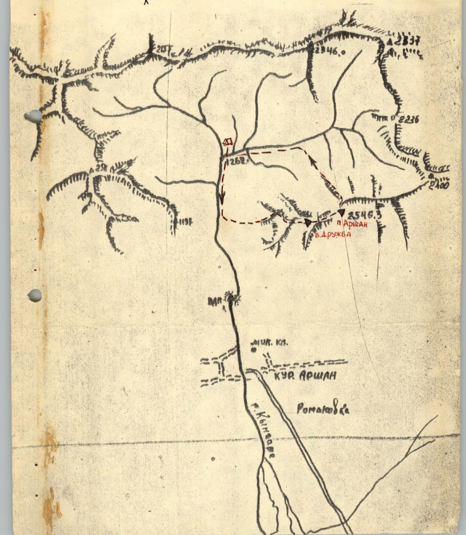
Photo № 2
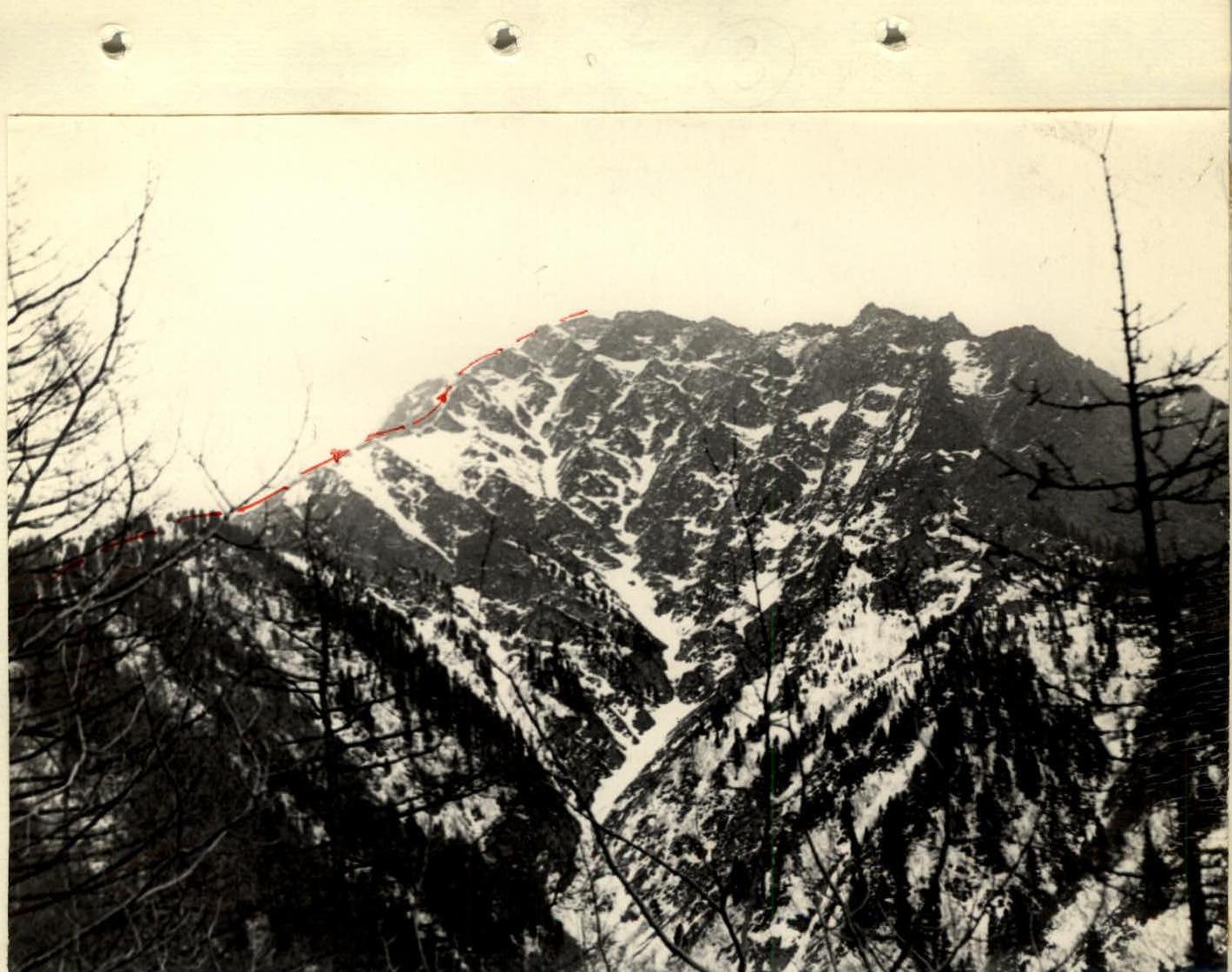
Photo № 3
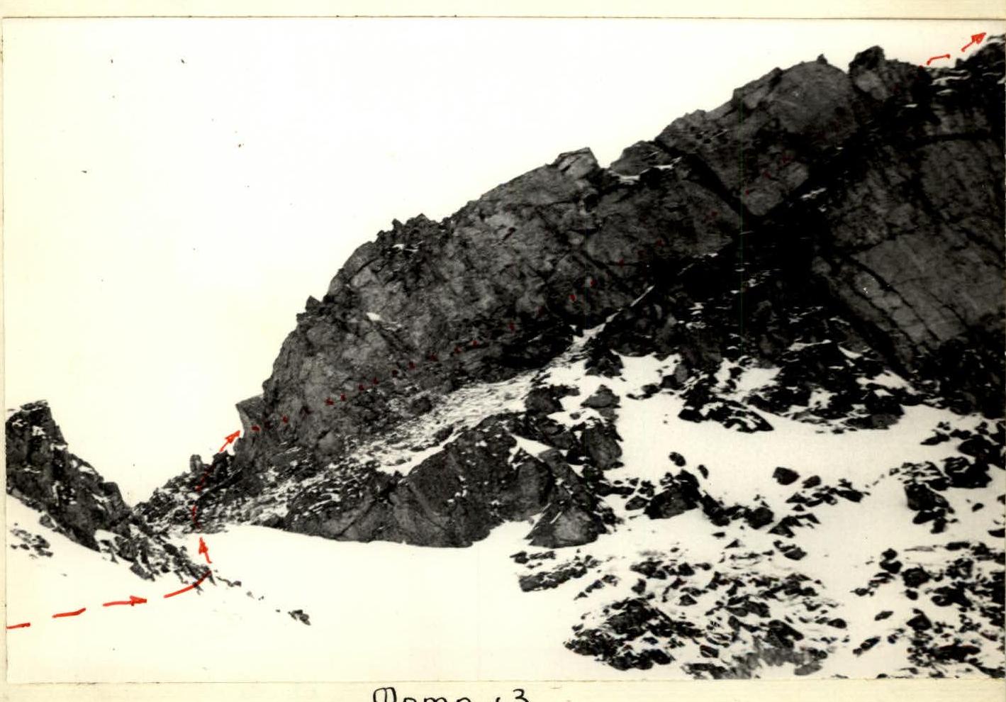
Photo № 4

Photo № 9
Photo № 10
Photo № 11
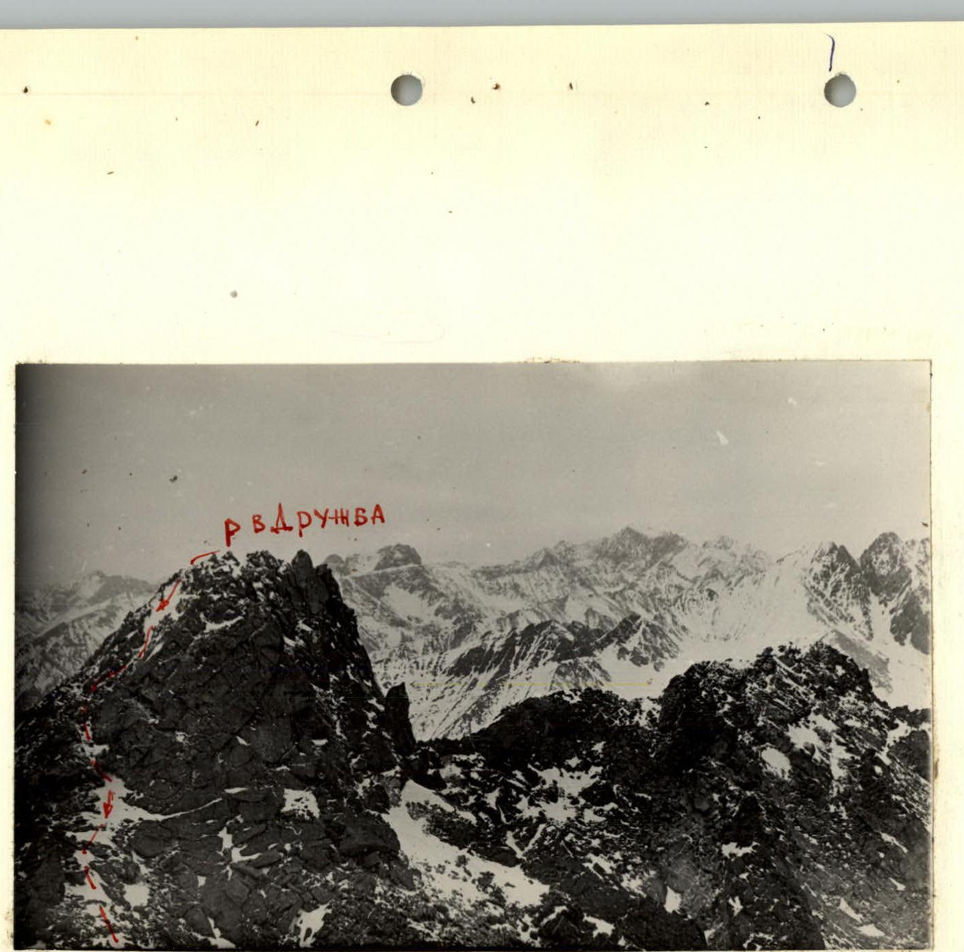
Photo № 12
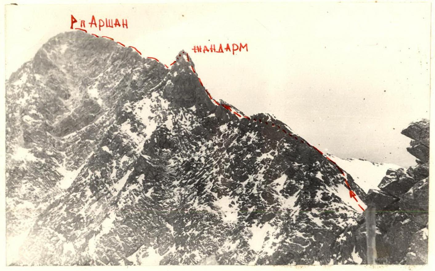
Photo № 13
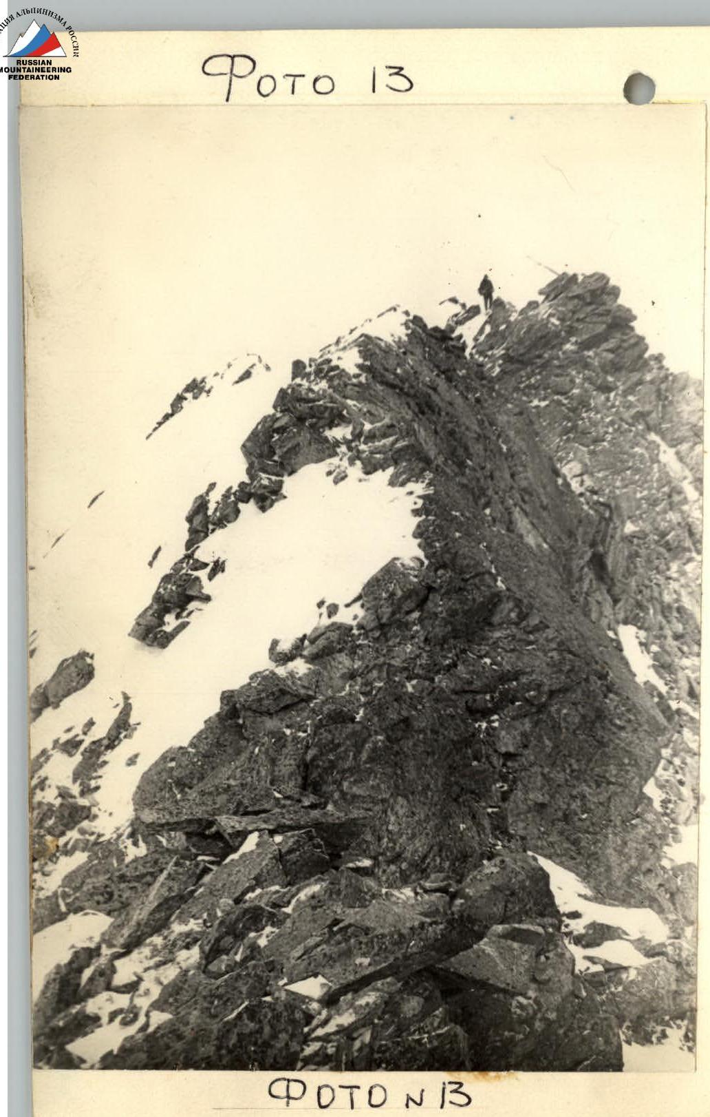
Photo № 14
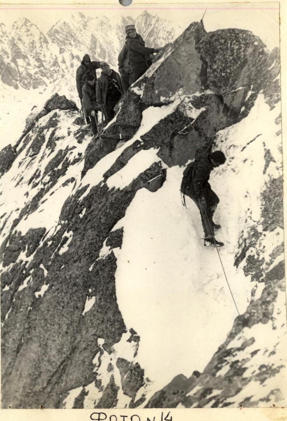
Photo № 15
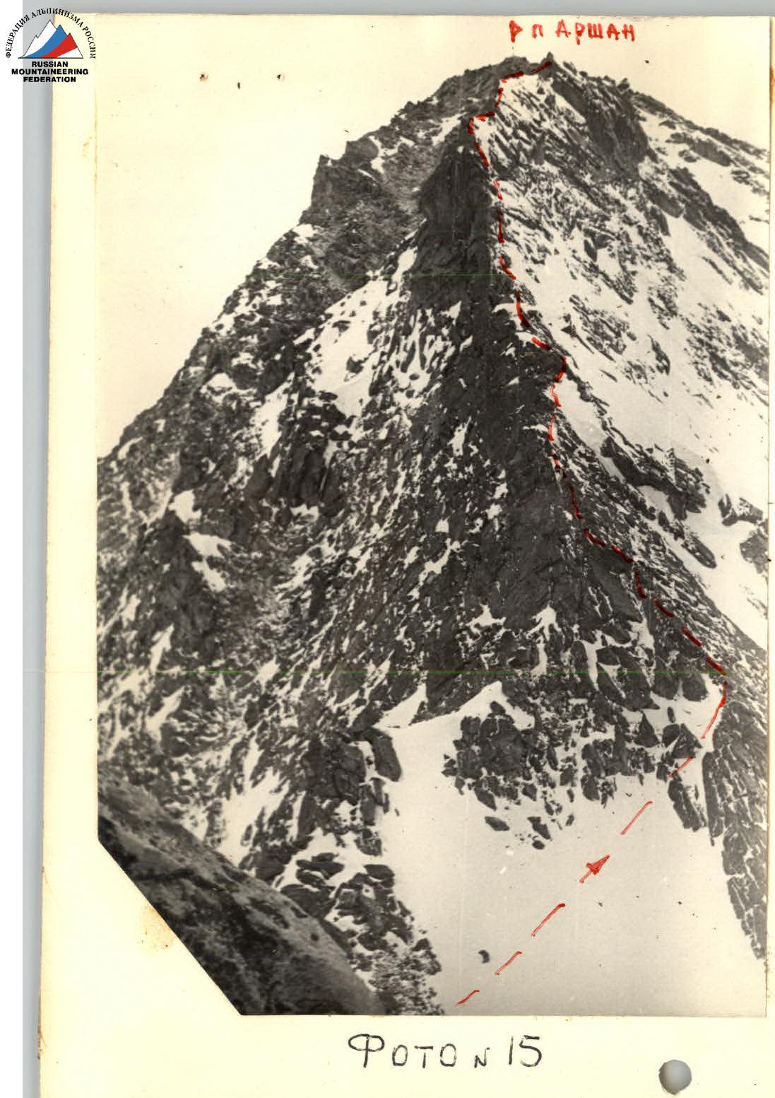
Photo № 16
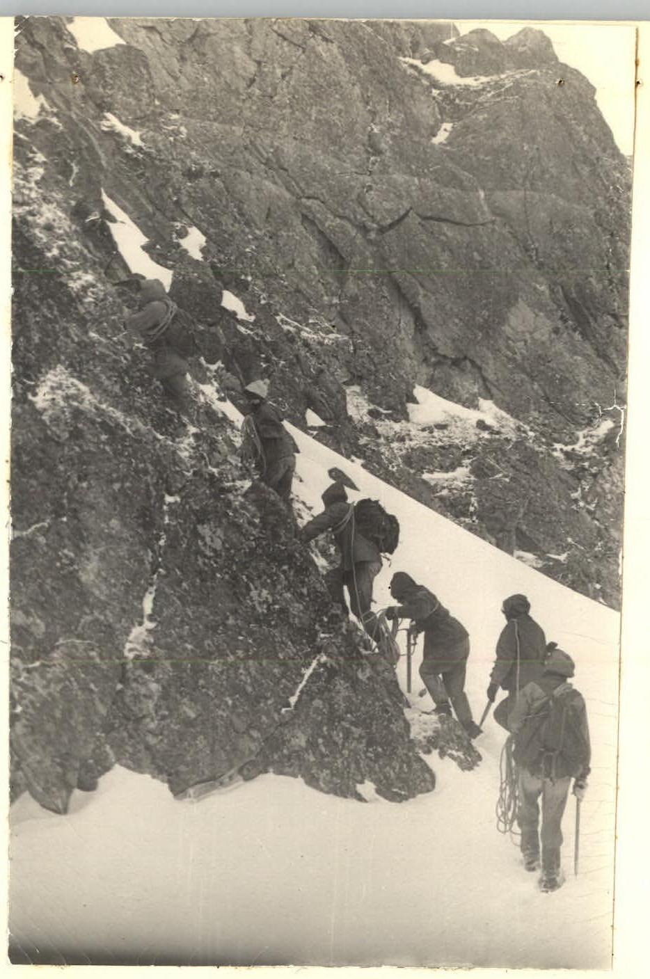
Photo № 24