
Ascent Passport
-
Region — Eastern Sayan.
-
Peak — Tykhen-Ardyn 3175 m NE ridge from Gorny pass.
-
Category — 2A cat. dif., first ascent.
-
Route type — combined.
-
Route description:
Total elevation gain — 1100 m, including ascent to Gorny pass. Average steepness of the main part — 40°.
-
Equipment used on the route: protection — 6 pieces.
-
Total climbing hours — 10 hours.
-
Overnights — none.
-
Team members:
Leader: Muravyev Vladimir Yuryevich CMS
- Verbitsky Alexander Vladimirovich 2nd sports category
- Korovin Denis Vladimirovich 3rd sports category
- Trunova Evgeniya Gennadyevna badge
- Rudko Pavel Vasilyevich badge
-
Team coach:
Suvorkina Lyudmila Davydovna CMS
-
Dates:
- Departure — April 2, 2005
- Summit — April 2, 2005
- Return — April 2, 2005
-
Ascent organized by — Krasnoyarsk Youth Centre of Travellers.
-
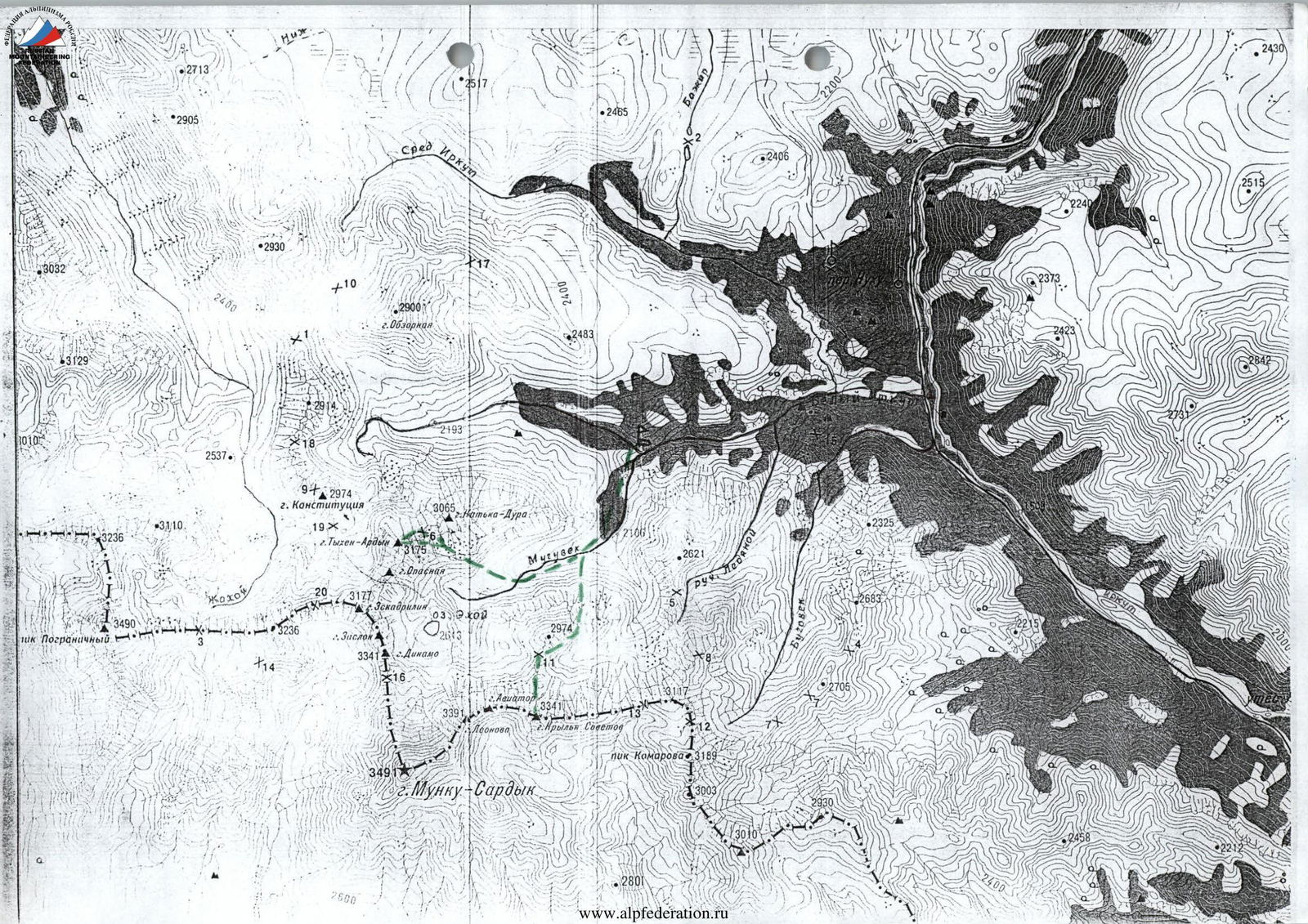
The highest point of Eastern Sayan is the Munku-Sardyk massif with the same named peak, reaching a height of 3491 m. Translated into Russian, it means "eternally white mountain". Its glaciers cover an area of 1.3 sq. km. Its specificity is the absence of a deep snow cover.
The history of ascending the main peak began on July 12, 1858. Naturalist Gustav Raade from the side of Lake Khubsugul, located on the territory of Mongolia, almost reached the summit. In 1897, S. P. Peretolchin and Lieutenant Colonel E. Henning-Mikhelisson ascended to the summit from the northwest.
Soviet ascents began in 1935 by tourists from Irkutsk. Besides Munku-Sardyk, there are many interesting peaks above 3 thousand meters in the region: p. Pограничный — 3425 m, p. Леонова 3391 m, p. Крылья Советов 3341 m, p. Динамо 3341 m, p. Тыхен-Ардын 3192 m, which are of great interest to mountaineers.
The region is characterized by a large number of ice obstacles — multi-meter stepped icefalls on the Muguvek and Beliy Irkut rivers. To overcome them, good ice equipment and corresponding training are necessary.
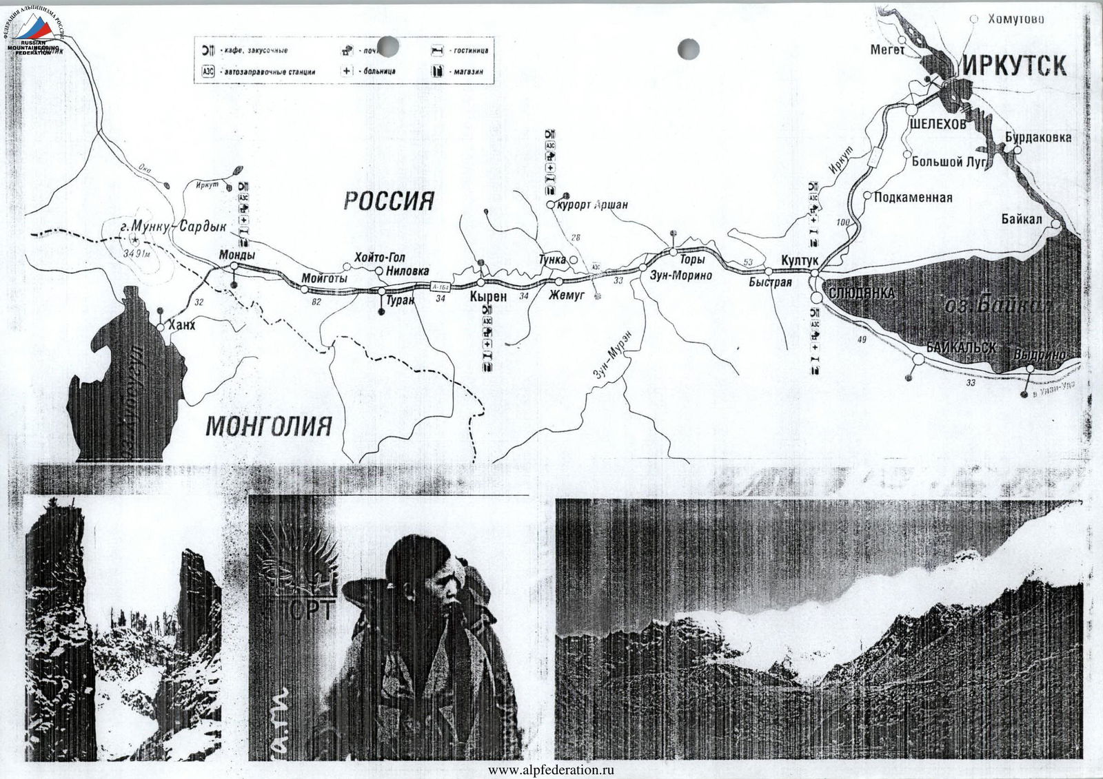
Approach to the region is convenient. From Irkutsk to Slyudyanka is 100 km by train. From Slyudyanka, 240 km to Mondy settlement, to the border post by bus. Then along the Beliy Irkut river to the confluence with the Muguvek river — there is the base camp.
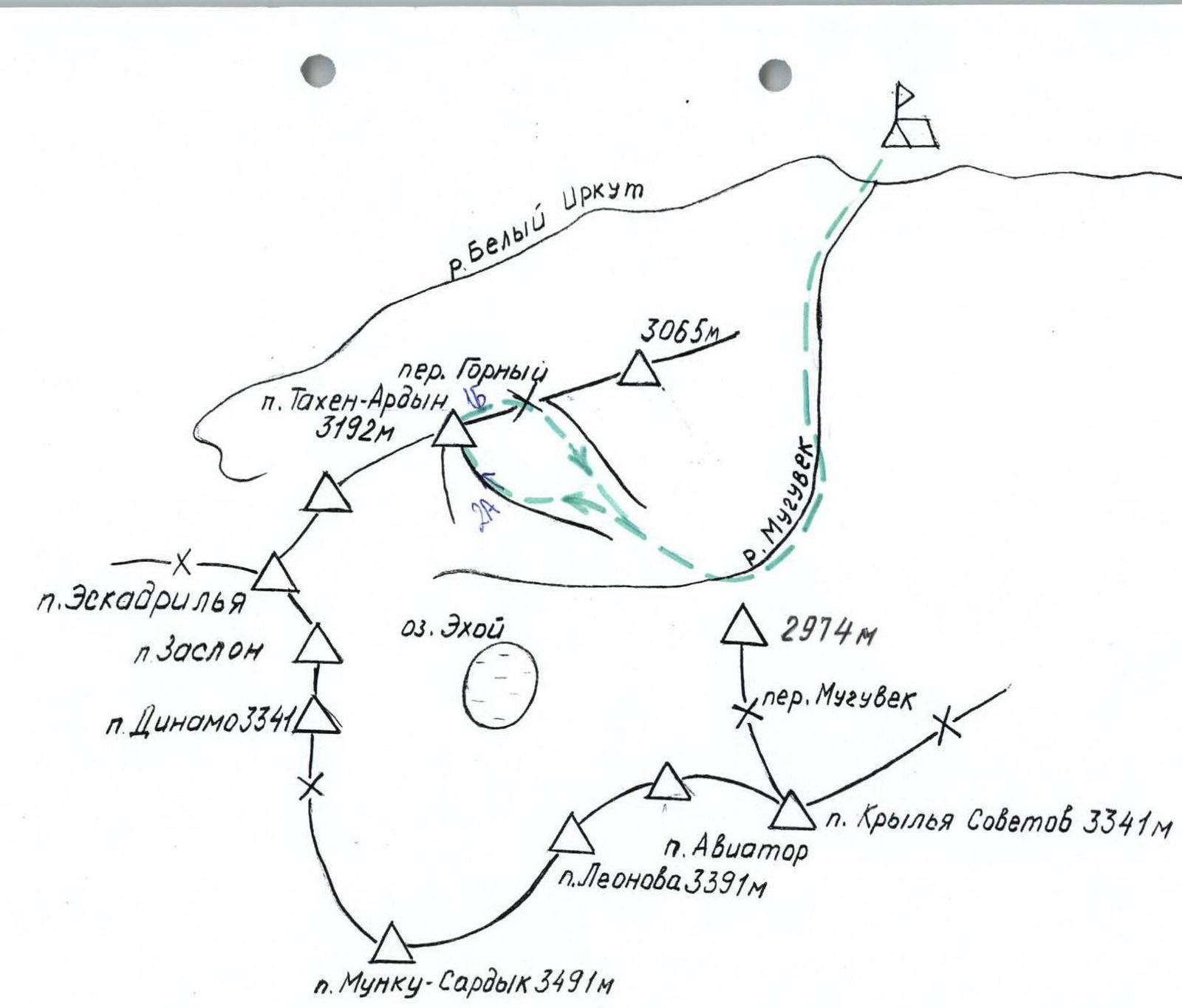
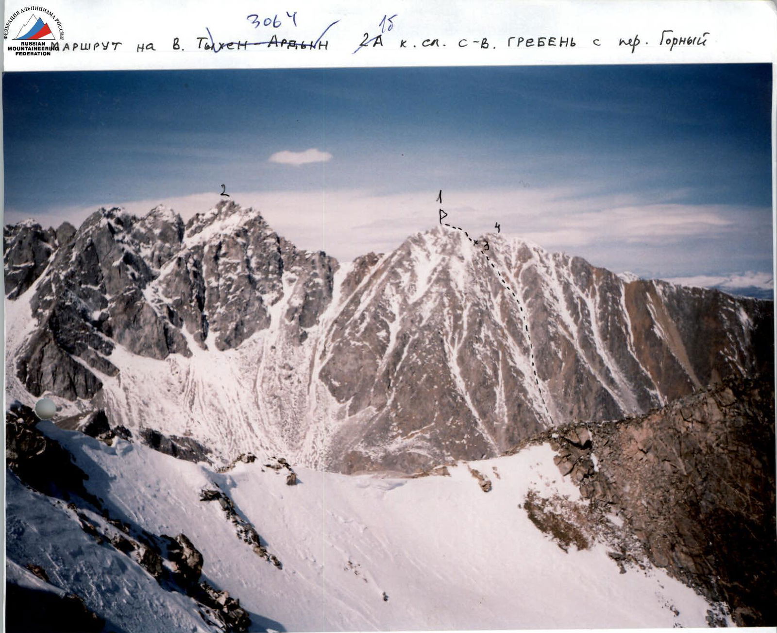
- P. Tykhen-Ardyn 3175 m
- P. Opasnaya
- Gorny pass
- P. Katka-Dura
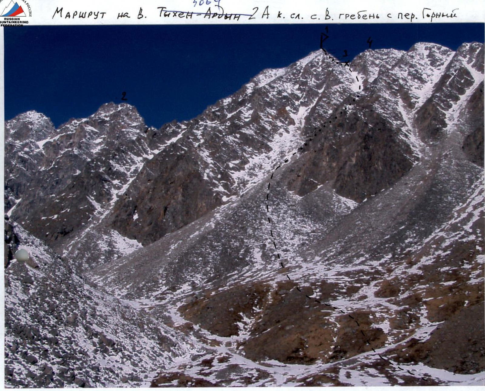
UIAA scheme of the 2A cat. dif. route to Tykhen-Ardyn peak.

Route description to Tykhen-Ardyn peak 2A cat. dif. by sections
Section R0–R1:
- Ascent to Gorny pass along a snow-rock slope with a steepness of 30°, length 800 m.
Section R1–R2:
- Snow-covered rock slabs, steepness 45°, length 60 m.
Section R2–R3:
- Pre-summit ridge, snow-covered rocks, steepness 20°, length 100 m.
Descent via the ascent route to the southern side of Gorny pass into the Muguvek river valley.
Alternative descent: from Gorny pass to the northern side into the Beliy Irkut river valley.
Comments
Sign in to leave a comment