
Russian Championship (Technical Climbing Category)
Climbing Report of the MAI Team
on peak Chiringyad 5864 m via the center of the Western wall, 6B category, August 5-8, 2008
Moscow, 2008
Team Captain: M. Volkov alpclu@yandex.ru ph. +7-985-233-83-64
Team Coach: V. Lavrinenko lavrinenco2004@mail.ru ph. +7-916-439-03-12
Report preparation: M. Pankov maxtreme@bk.ru ph. +7-910-492-76-05
Climbing Details
№ 4.12.61, peak Chiringyad 5864 m via the center of the Western wall (N. Petrov, 1989), 6B
-
Western Pamir, Yazgulyam range
-
peak Chiringyad 5864 m, via the center of the Western wall
-
Category: 6B; second ascent
-
Route type: combined
-
Elevation gain: 1864 m (by altimeter)
Route length: 2695 m. Section lengths:
- 5th category – 645 m
- 6th category – 550 m. Average steepness:
- main part of the route — 78°
- entire route — 70°
-
Pitons left on the route: 28 total; including 0 pitons drilled into the rock. Pitons used on the route:
- stationary drilled pitons — 3 (including 0 for artificial climbing holds)
- removable drilled pitons — 0 (including 0 for artificial climbing holds). Total artificial climbing holds used — 0
-
Total climbing hours: 45 hours, 4 days
-
Team Leader: Mikhail E. Volkov, Candidate for Master of Sports
Alexander V. Novikov, Candidate for Master of Sports Maxim A. Pankov, Candidate for Master of Sports Nikolai G. Sinyushin, Candidate for Master of Sports Andrey V. Satanin, 1st sports category
-
Coach: Vladimir V. Lavrinenko, Master of Sports, 2nd category judge
-
Departure for the route: 7:00 AM, August 5, 2008
Summit arrival: 5:00 PM, August 8, 2008 Return to Base Camp: 8:00 PM, August 9, 2008
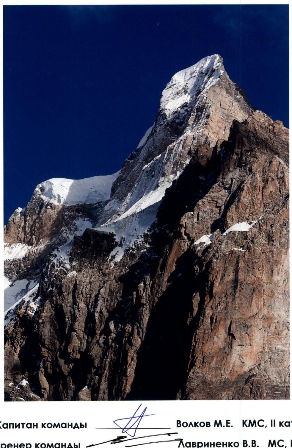
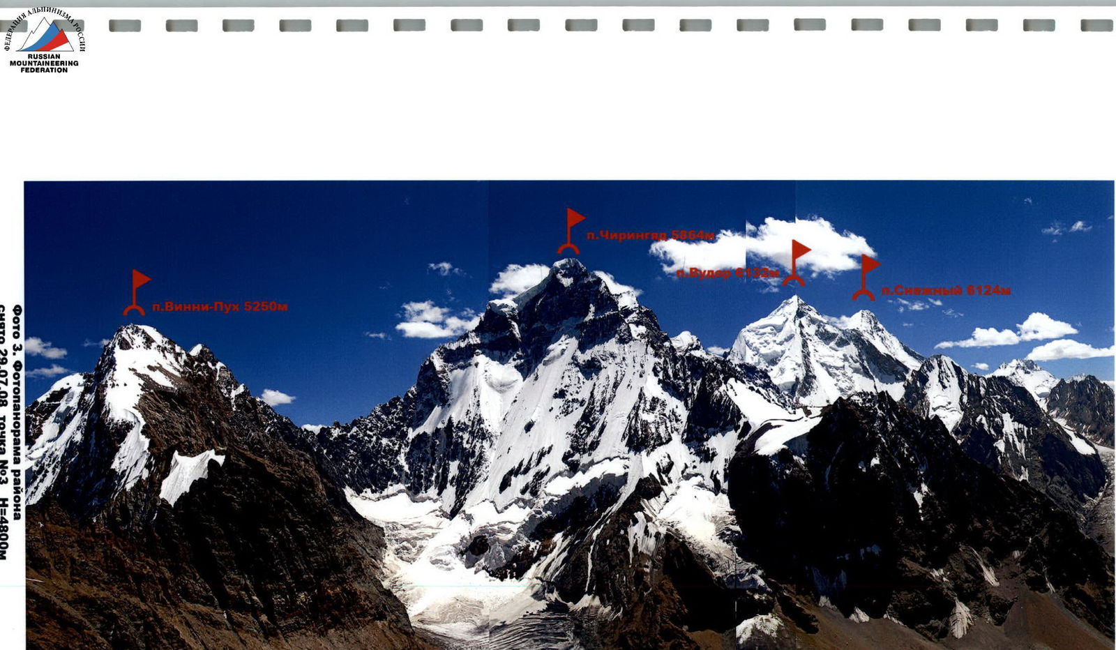
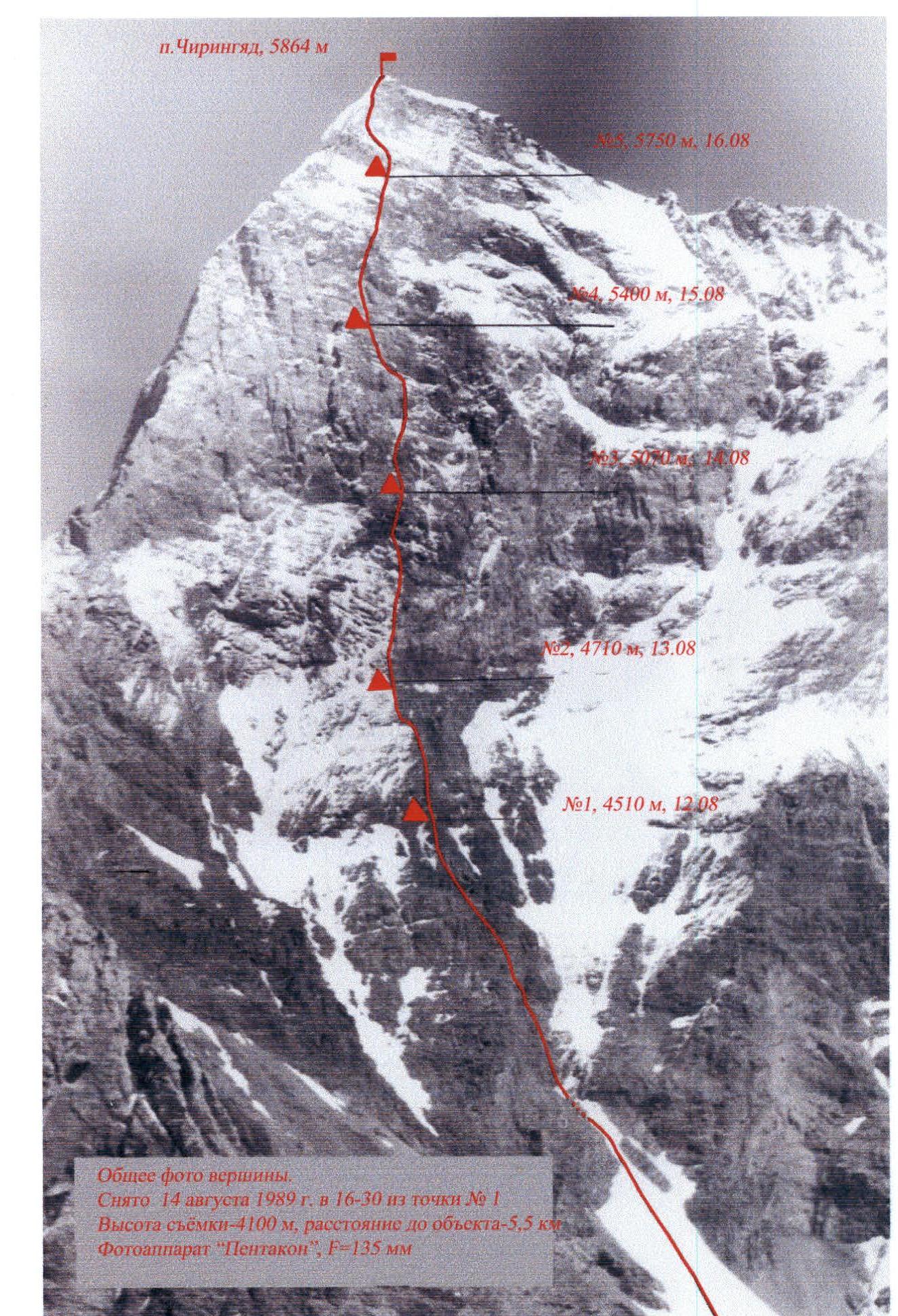
General view of the summit. Route via the center of the Western wall of peak Chiringyad 5864 m (N. Petrov, 1989). Photo 1, taken on August 8, 2008, from point #1, H=4100 m, S=5 km, peak Chiringyad 5864 m.
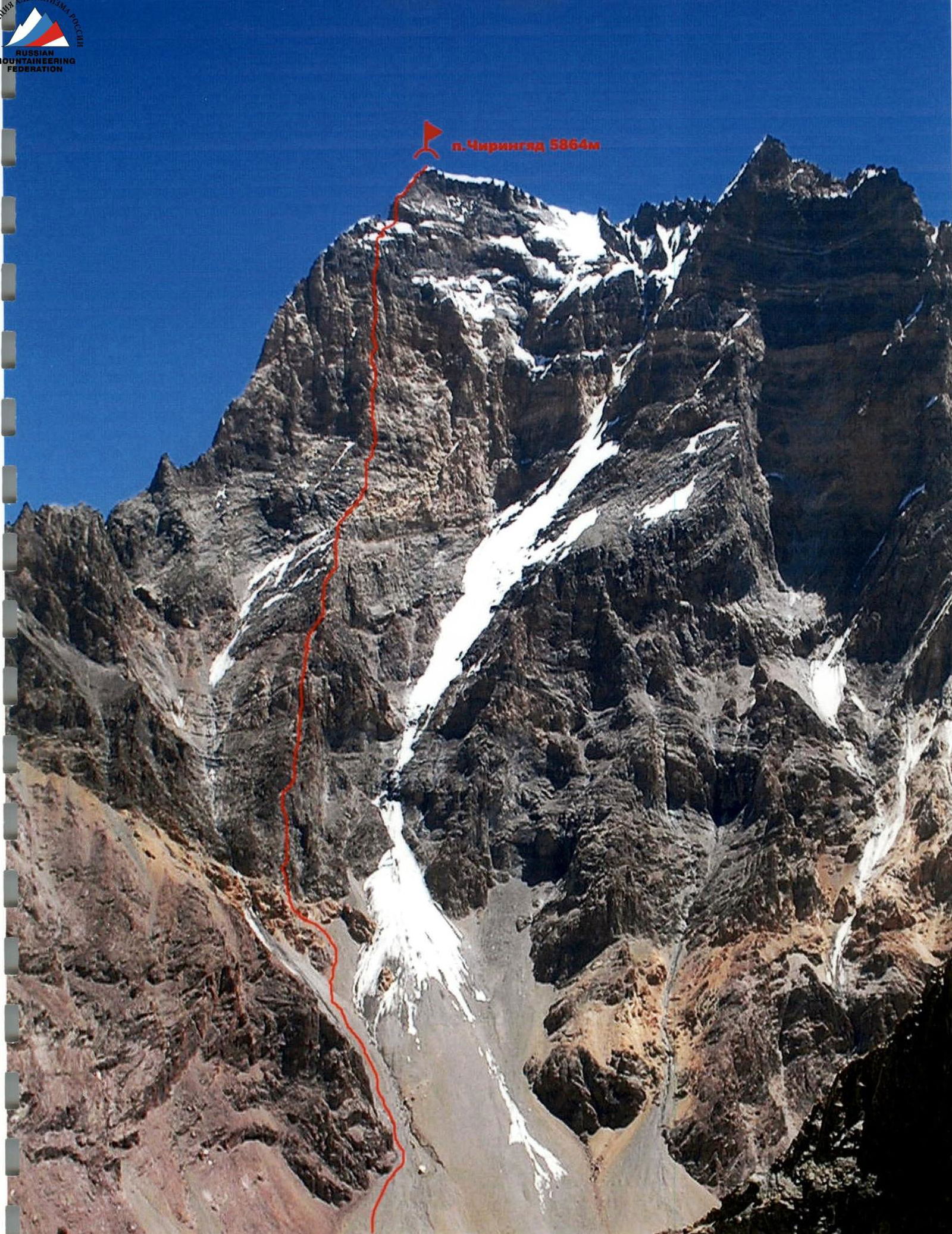
View of the wall from the left, taken on July 24, 2008, from point #2, H=3200 m, S=4.5 km. Route profile diagram, scale 1:6500
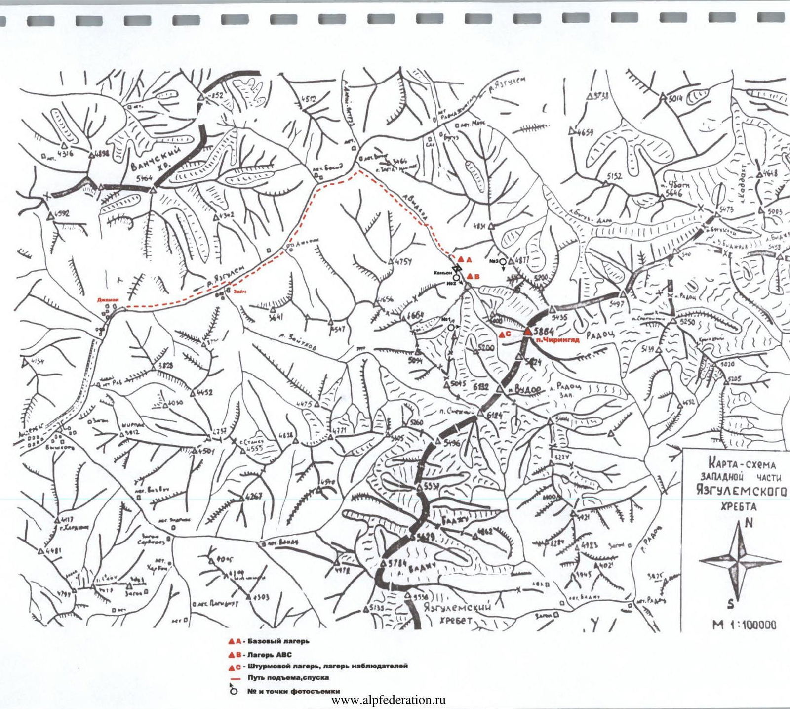
Legend for the map:
- A — Base Camp
- B — ABC Camp
- C — Assault Camp, Observation Camp
- Ascent and descent route
- Photo points with numbers
Brief Overview of the Climbing Area
Peak Chiringyad (5864 m) is located in the central part of the Yazgulyam range in Western Pamir, among peaks around 6000 m, many of which remain unconquered. So far, only two expeditions have visited this area:
- 1982 — USSR Championship — "Lokomotiv" sports society team made the first ascent (5B category at the time) to the summit from the north, followed by a traverse (7th place);
- 1989 — First ascent via the center of the Western wall (6B category). Team led by V. L. Bashkirov.
The area is characterized by its inaccessibility — long approaches and challenging terrain requiring mountaineering skills even at the approach stage. This likely explains its underdevelopment from an alpinistic perspective, despite the presence of many complex and logical routes of the highest category. The peaks have a jagged relief with sharp peaks and intricate ridges. The walls are steep, with vertical, eroded sections that are particularly challenging. Significant glaciation is characteristic, with heavily crevassed glaciers and icefalls. The area is unique:
- for its sporting opportunities;
- from an aesthetic viewpoint.
The only access route is as follows: from Dushanbe, 400 km by car on the Western Pamir Highway towards Khorog, to the confluence of the Yazgulyam and Pyanj rivers on the Afghan border (30 km short of Rushan village). Then, up the Yazgulyam valley about 30 km to the end of the motorable road (Jamak village). From there, on foot along the right (orographic) bank of the Yazgulyam river, approximately 5–7 km (1.5–2 hours) to the last inhabited village — Zaich. The trail then crosses to the left bank and becomes more challenging and sometimes difficult to traverse (especially for pack animals). Another 12–15 km along this trail to the left tributary of Yazgulyam — the Vydvyadj river (photo 4). Up the Vydvyadj valley, first on the left, then on the right (orographic) side of the valley to a canyon, about 5–7 km (2–3 hours). This is a good location for a base camp. There is no trail further. From the base camp, cross to the left (orographic) side of the valley and move towards the left edge of the canyon (photo 5, 120 m of rock, 3–4 category, pitons, chocks, belay). Then, along steep, grassy, and rocky slopes and eroded rocks (photo 6, 30 m, 3rd category, belay) under the spurs of Chiringyad peak. Here, cross the river to the right (orographic) side of the valley and, skirting the spurs of Chiringyad on the right along a moraine ridge, approach the icefall leading to the upper cirque of the Western wall. The icefall is impassable; the left bypass along steep, heavily eroded rocks is possible (100 m, 3–4 category, pitons, chocks, belay). Then, about another hour across moraine scree — exit to the upper cirque under the route. Here, directly under the route, in a moraine pocket, is a good site for an assault camp. From the base camp location before the canyon to the assault camp site under the wall — about 7–10 hours.
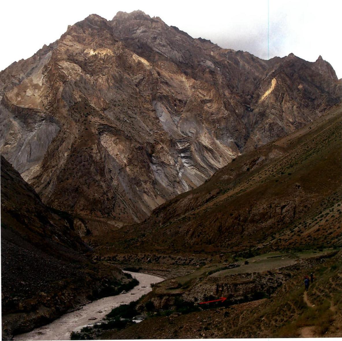
Photo 4. Confluence of the Vydvyadj and Yazgulyam rivers.
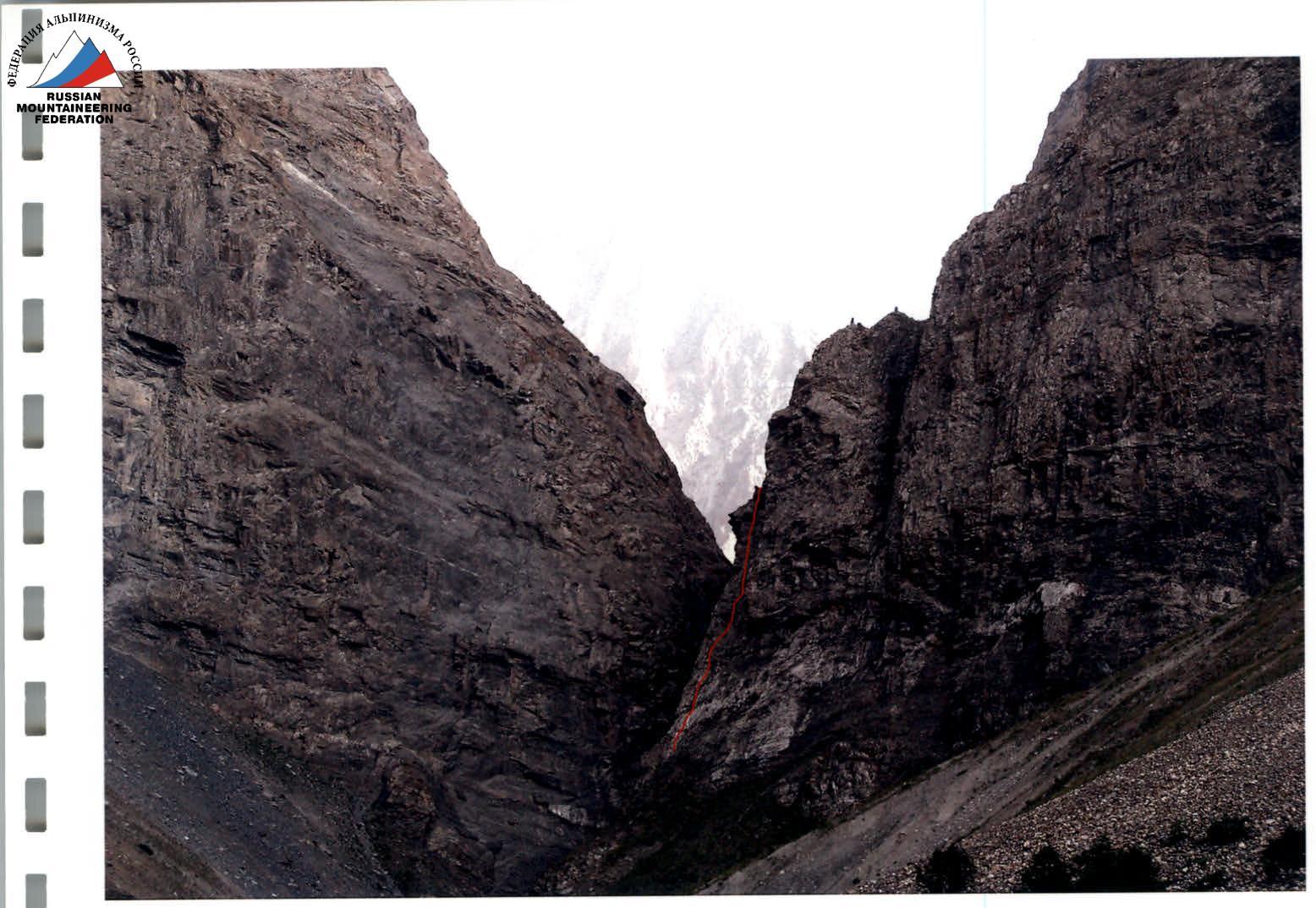
Photo 5. Possible route along the right wall of the canyon (120 m of rock, 3–4 category).
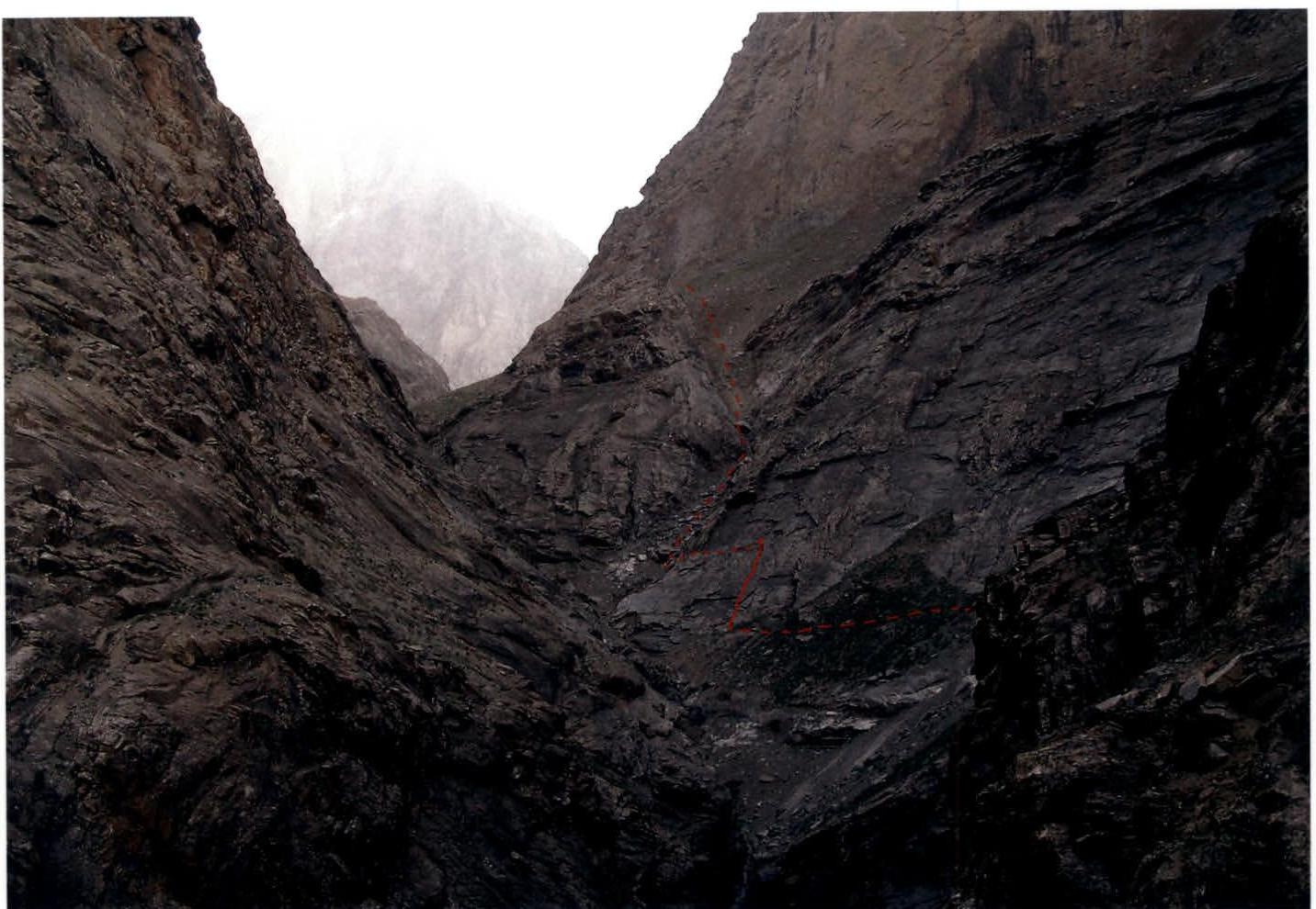
Photo 6. Passage under the spurs of Chiringyad peak after the canyon wall (30 m, 3rd category).
Total travel hours: 62 hours to the summit; 45 hours climbing.
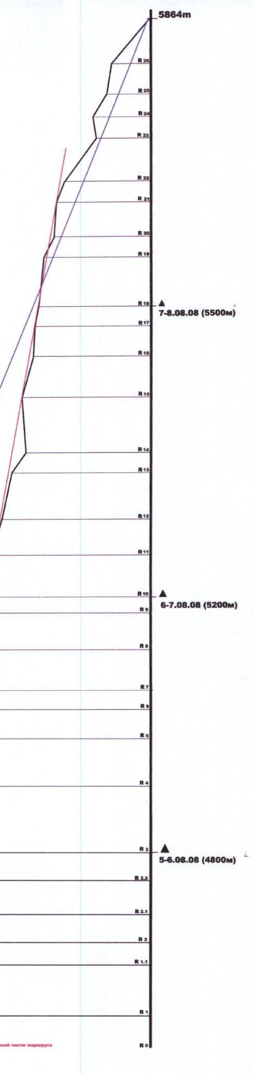
Route Diagram in UIAA Symbols


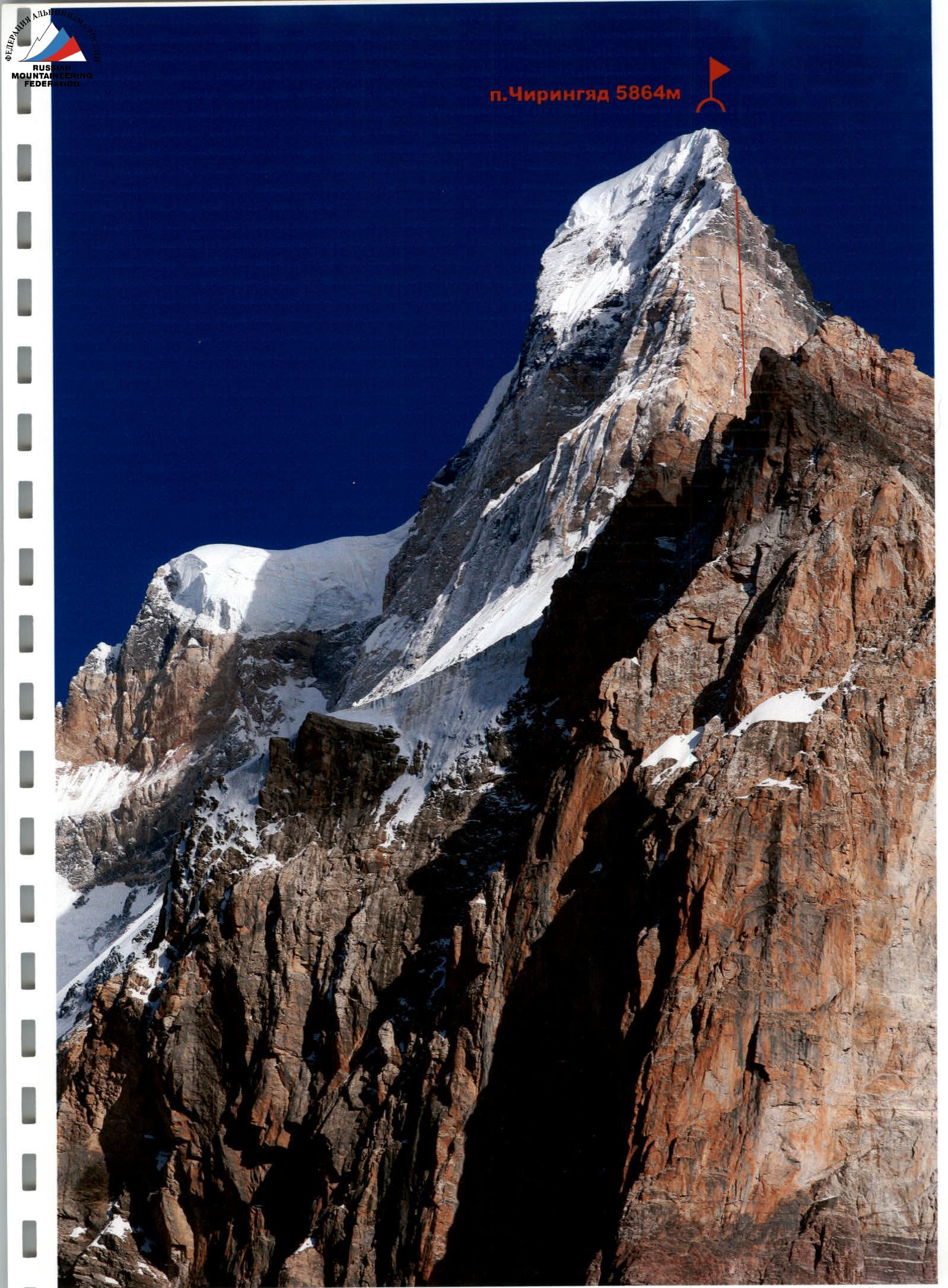
Technical photo of the route
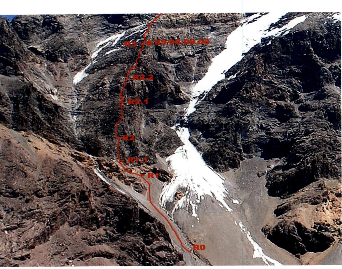
Technical photo (R0–R3) — lower part of the route
Route Description by Sections
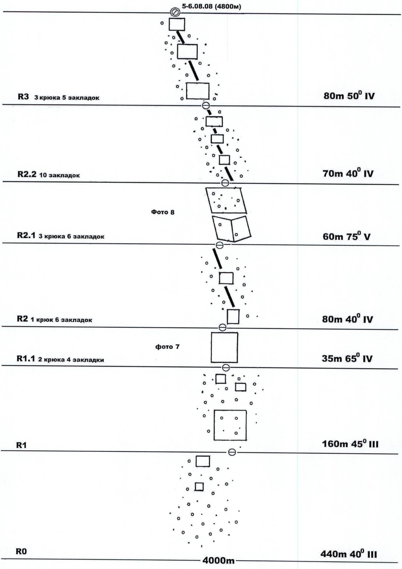
Section R0–R1: Steep scree slope.
Section R1–R1.1: Very eroded rocks. Approach to the wall, in the right part of the counterfort, leading to the start of the ridge. Belay through rock outcrops.
Section R1.1–R2: Climb up the characteristic internal corner (right to left) of eroded rocks onto the counterfort ridge. Many "live" stones, very fragile rock! Belay through pitons and chocks (stoppers, friends). Photo 7.
Section R2–R2.1: Eroded rocks of the wide counterfort with freely lying stones on ledges. Movement in "gallops." Belay through rock outcrops and chocks.
Section R2.1–R2.2: Eroded rock belt on the counterfort. Overcome through an internal corner and wall on the left part of the ridge. Belay through rock outcrops and chocks. Photo 8.
Section R2.2–R3: Counterfort with individual rock walls up to 5–10 m. Many "live" stones, movement in "gallops." There are ledges for a tent if expanded and cleared.
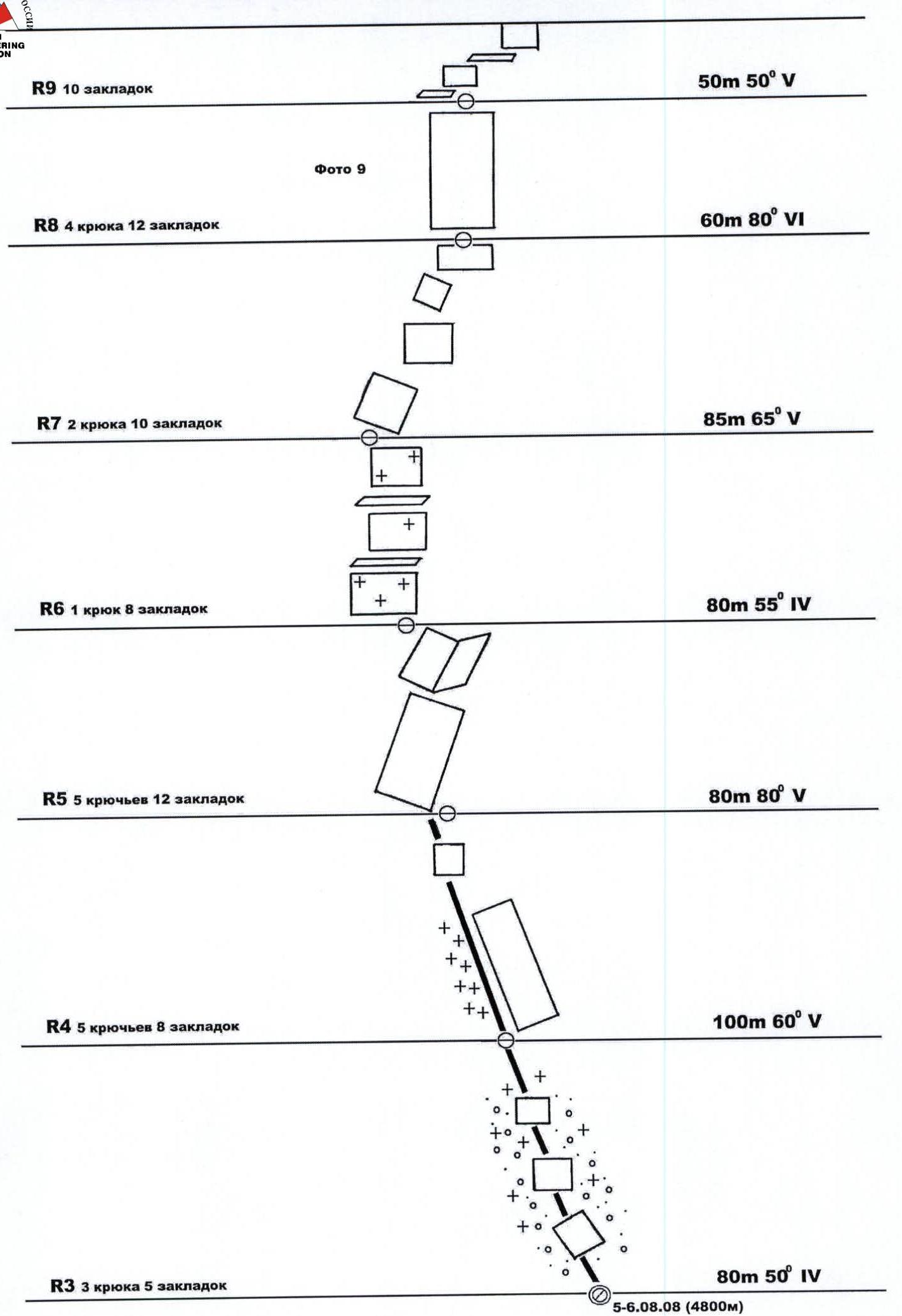
Section R3–R4: Movement along the counterfort. More monolithic rocks. местами кулуары с натечным льдом. Belay through pitons and chocks.
Section R4–R5: Climb up the wall in the right part of the counterfort. To the left — smooth wet slabs, frequent rockfall. Many unstable, protruding blocks. местами движение в кошках, участки снега и льда. Belay through pitons and chocks.
Section R5–R6: Series of polished slabs transitioning into a wide internal corner with ice accretion. Climbing in crampons. Belay through pitons and chocks.
Section R6–R7: Alternating ice and rock sections. Belay through pitons and chocks.
Section R7–R8: Steep eroded rocks of the counterfort with individual walls and unstable blocks. Movement in "gallops." Belay through pitons and chocks.
Section R8–R9: Start of the main wall (light-colored rocks). Climb left upwards along a characteristic steep internal corner of eroded rocks. Very fragile, schistose rock! Extremely cautious movement. Belay through pitons and chocks. Photo 9.
Section R9–R10: Climb right upwards along an eroded wall to a small ledge. Many "live" stones. Belay through pitons and chocks. Possible bivouac (height 5200 m).
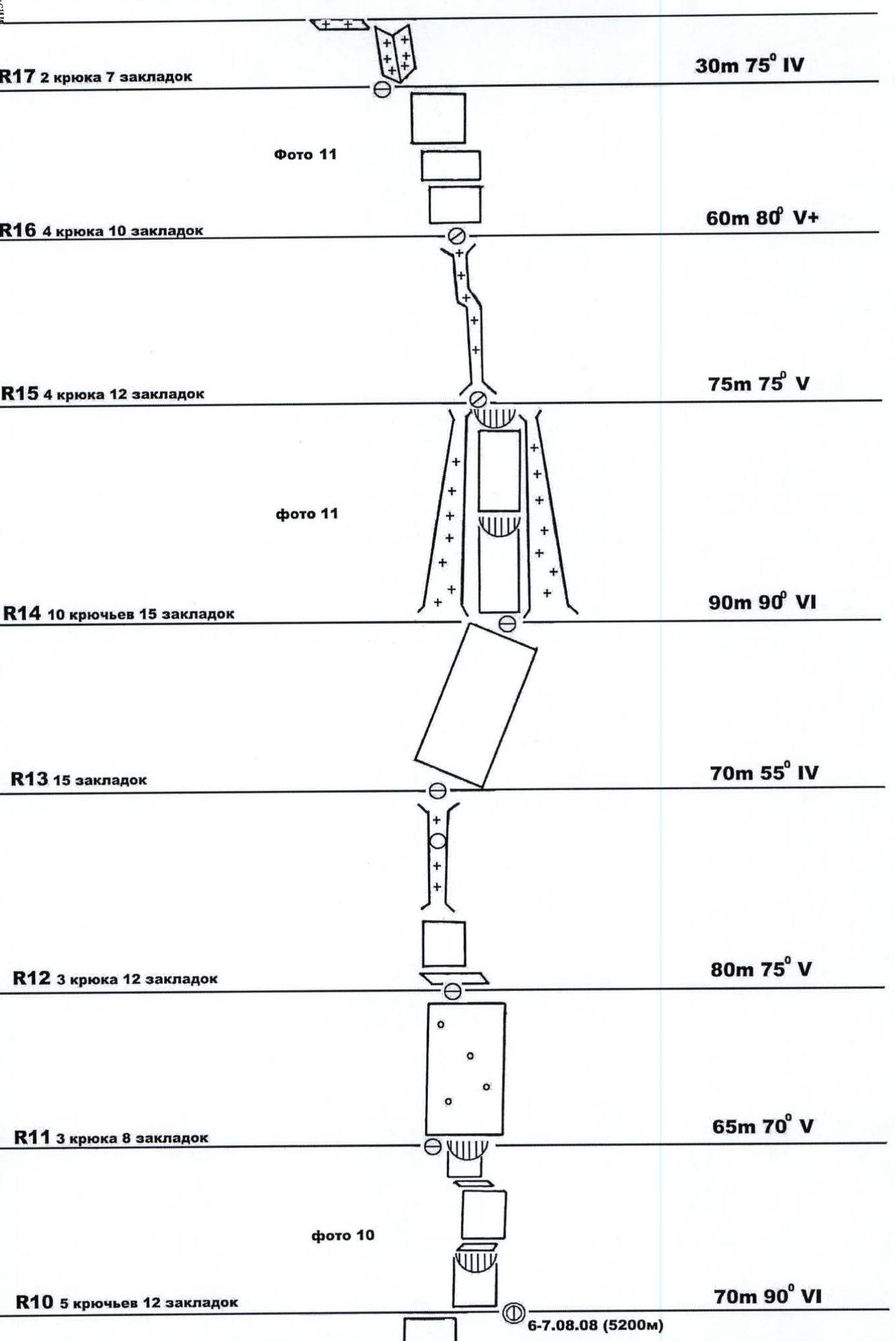
Section R10–R11: Alternating vertical walls up to 15–25 m and internal corners, местами нависания. Climbing is complex. Wall is monolithic, with cracks. Belay through pitons and chocks. Photo 10.
Section R11–R12: Climb 30 m upwards. Eroded vertical wall with large "live" blocks. Then traverse 20 m right upwards into a characteristic wide, overhanging internal corner, leading to a small ledge. Belay through pitons and chocks. Possible bivouac.
Section R12–R13: Climb right upwards along steep eroded rocks to an overhanging iced-up chimney with a plug. Climb in the right part of the chimney. Belay through pitons and chocks.
Section R13–R14: Right upwards. Alternating short and steep sections of eroded rocks. Belay through pitons and chocks.
Section R14–R15: Wall with overhanging sections between two vertical ice-rock couloirs (rockfall hazard!). Climbing is complex, with limited options due to grooves. Start of the climb is in the right couloir, then move left upwards. Belay through pitons and chocks. Photo 11.
Section R15–R16: Wide chimney — internal corner, with ice accretion.
Section R16–R17: Alternating smooth vertical walls and small ledges. Belay through pitons and chocks. Photo 11.
Section R17–R18: Climb left upwards along an ice-filled internal corner to a narrow snow saddle at the base of vertical smooth slabs. Slightly below — a small ledge. Possible bivouac (height 5500 m).
Section R18–R19: Very complex smooth wall (one of the key sections of the route), extremely cautious climbing, fragile holds — they flake off! Few cracks. Used:
- three drilled pitons (from the first ascent);
- anchor rock pitons;
- chocks. Photo 12.
Section R19–R20: Climb up a smooth steep slab under a wall with a crack. Belay through pitons and chocks. Photo 13.
Section R20–R21: Narrow crack in a monolithic wall. In the middle — an overhang. Complex climbing. Belay through pitons and chocks.
Section R21–R22: Climb onto the main ridge of the peak along extremely eroded rocks. Early in the morning, rocks are iced up! Belay through pitons and chocks. Photo 14.
Section R22–R23: Snow-ice slope of the main ridge. Climbing in crampons. Approach to the summit vertical rock wall. Belay through ice screws. Photo 15.
Section R23–R24: Overhanging belt of monolithic rocks (one of the key sections of the route). Complex relief, few holds and cracks. Extremely difficult climbing. Used:
- thin anchor rock pitons;
- chocks (stoppers, friends). Photo 16, 17.
Section R24–R25: Climb left upwards along steep, heavily eroded rocks. Belay through pitons and chocks.
Section R25–R26: Wall with very small, fragile holds. Cautious climbing. Belay through pitons and chocks.
Section R26–R27: Summit ridge. Photo 18. To the left of the route — large snow cornices. Climbing along smooth slabs, in the summit part — along snow and ice. Summit — a large snow field!
No note from the previous group was found on the summit or nearby! The summit is a large snow field (see photo from the summit). No control towers on the wall!
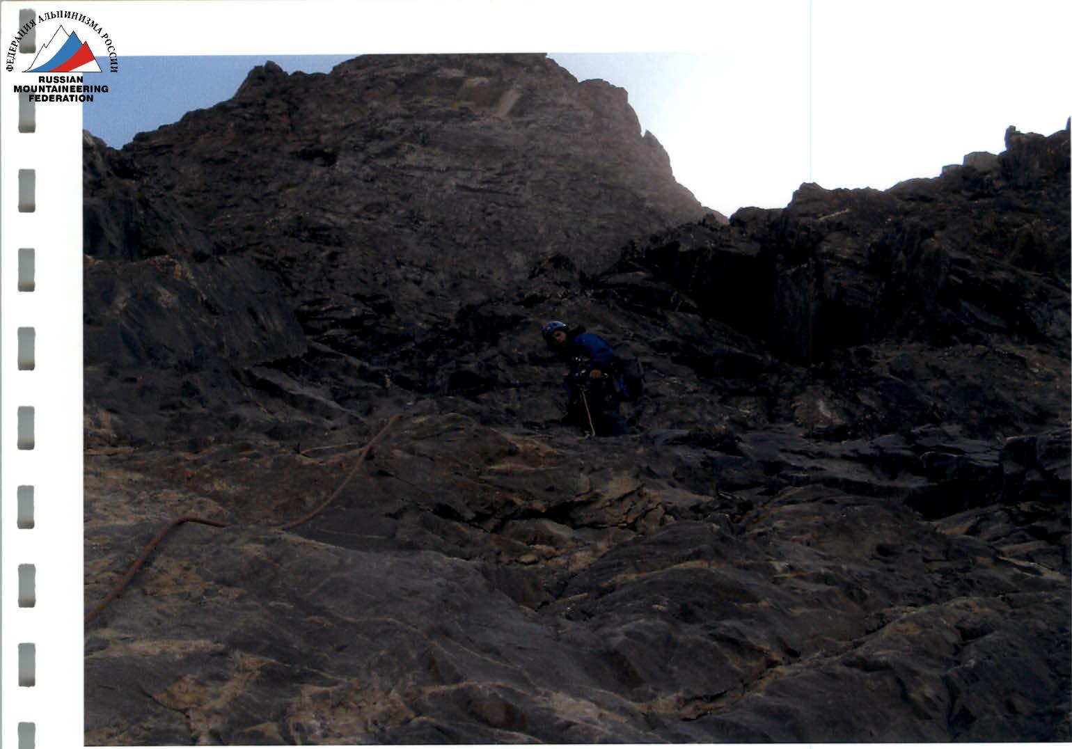
Photo 7. First climber on section R1.1–R2.
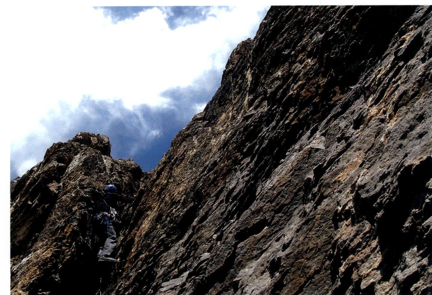
Photo 8. First climber on section R2.1–R2.2.
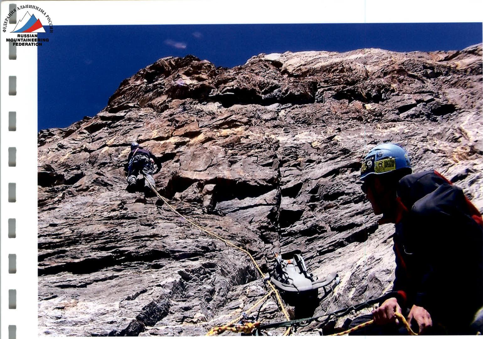
Photo 9. First climber on section R8–R9.
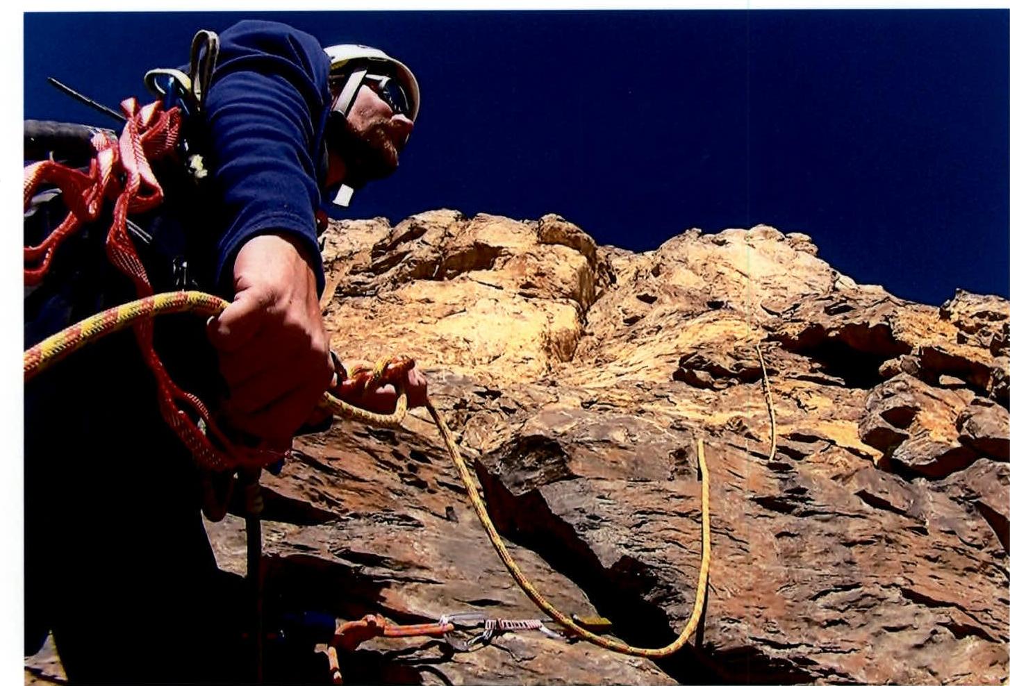
Photo 10. Section R10–R11.
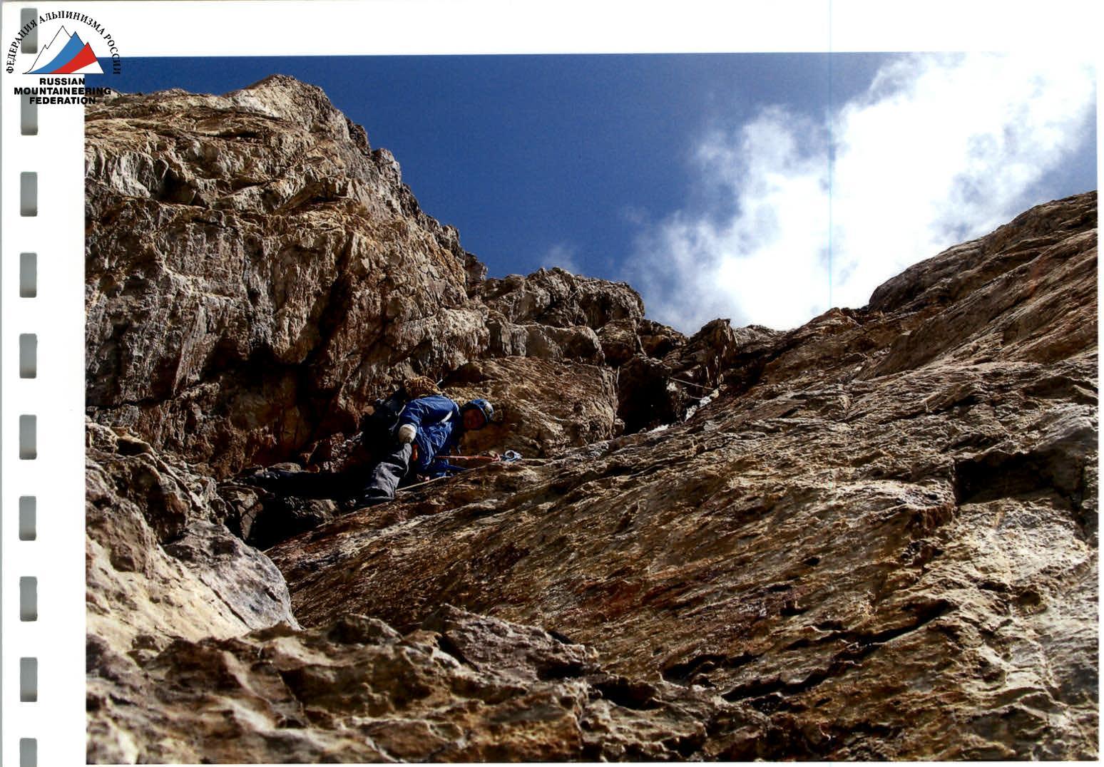
Photo 11. Section R14–R17.
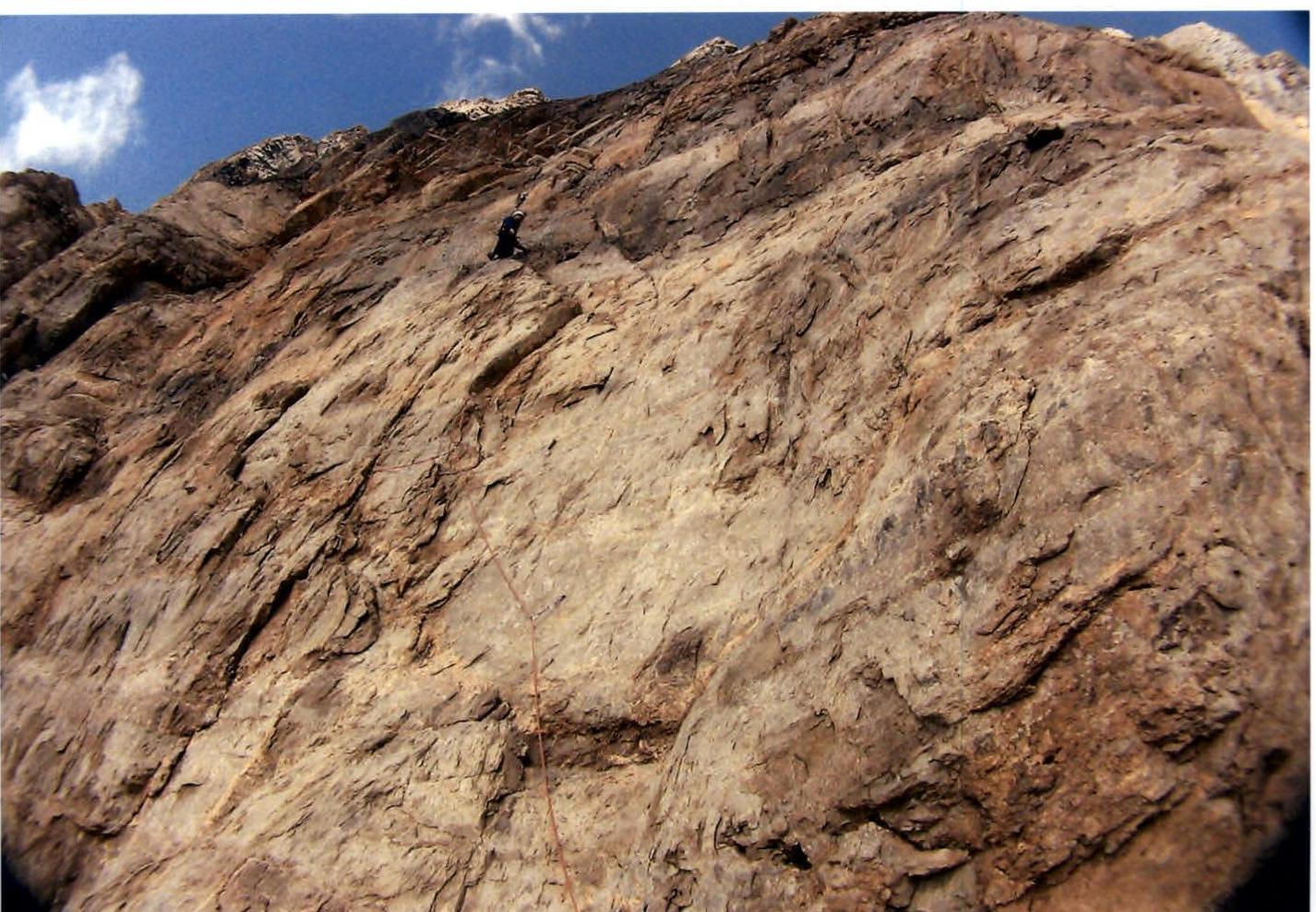
Photo 12. First climber on section R18–R19.
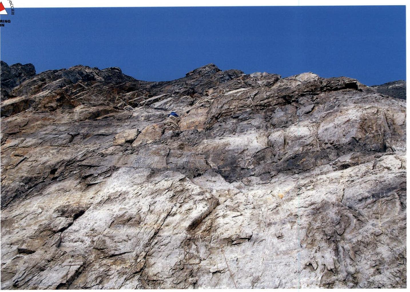
Photo 13. Climbing on section R19–R20.
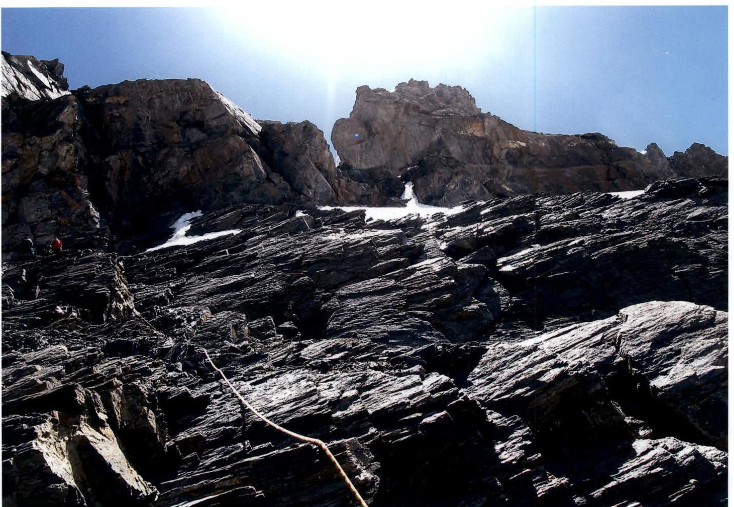
Photo 14. Section R21–R22.
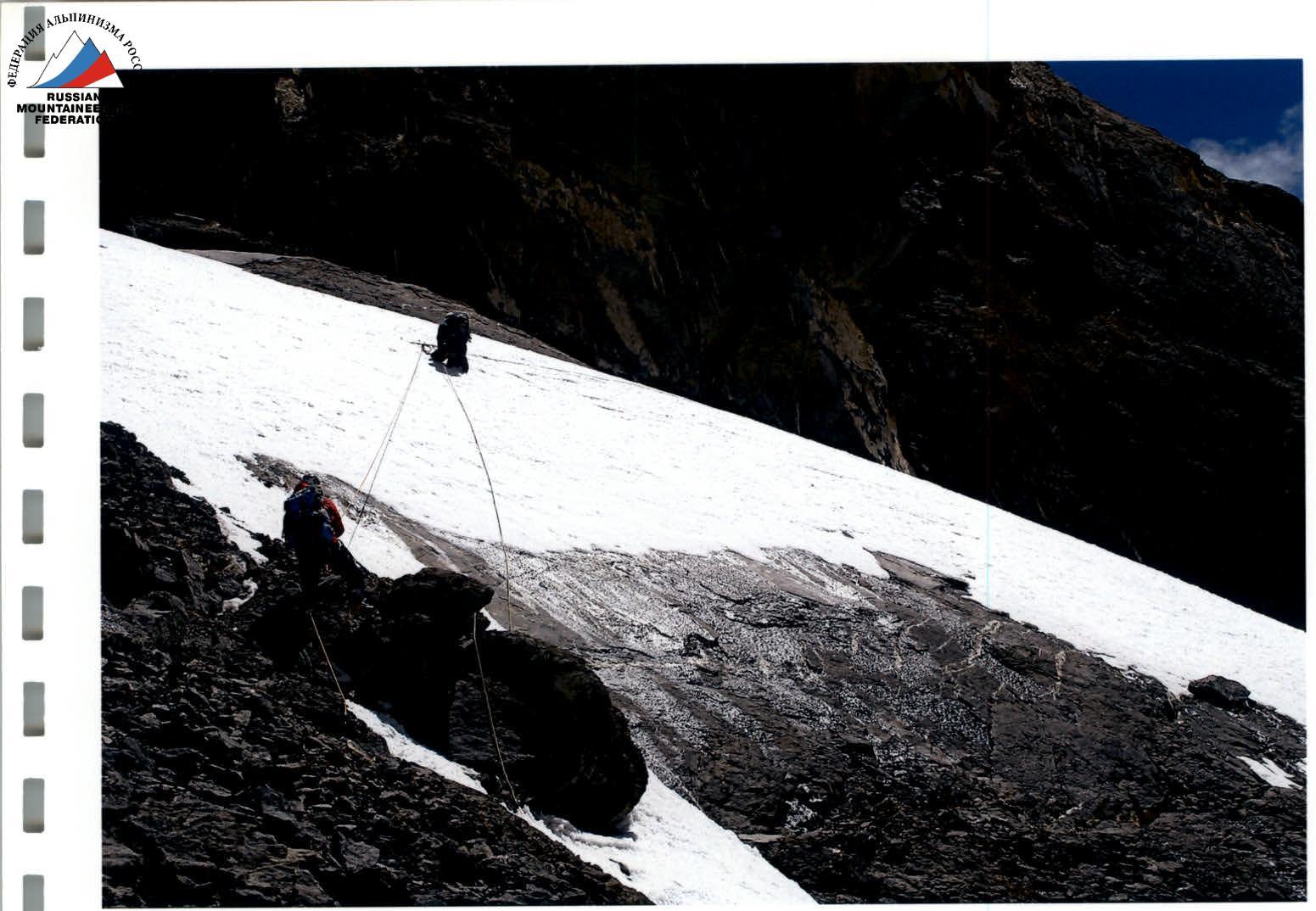
Photo 15. Section R22–R23.
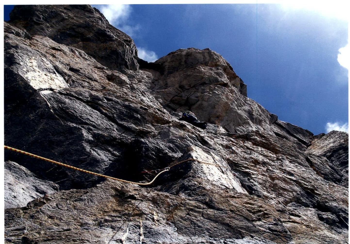
Photo 16. First climber on section R23–R24.
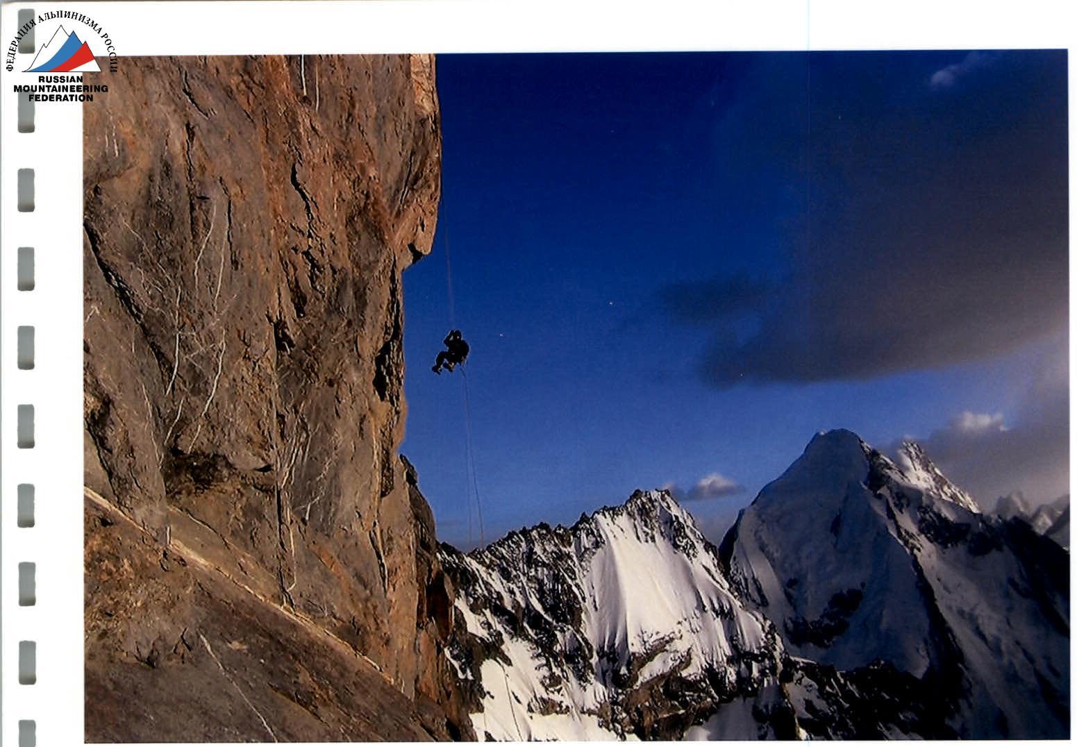
Photo 17. Section R23–R24.

Photo (M. Volkov) on the summit of Chiringyad 5864 m. In the background — peak Vudor 6132 m. Left to right: M. Pankov, A. Novikov, A. Satanin, N. Sinyushin.
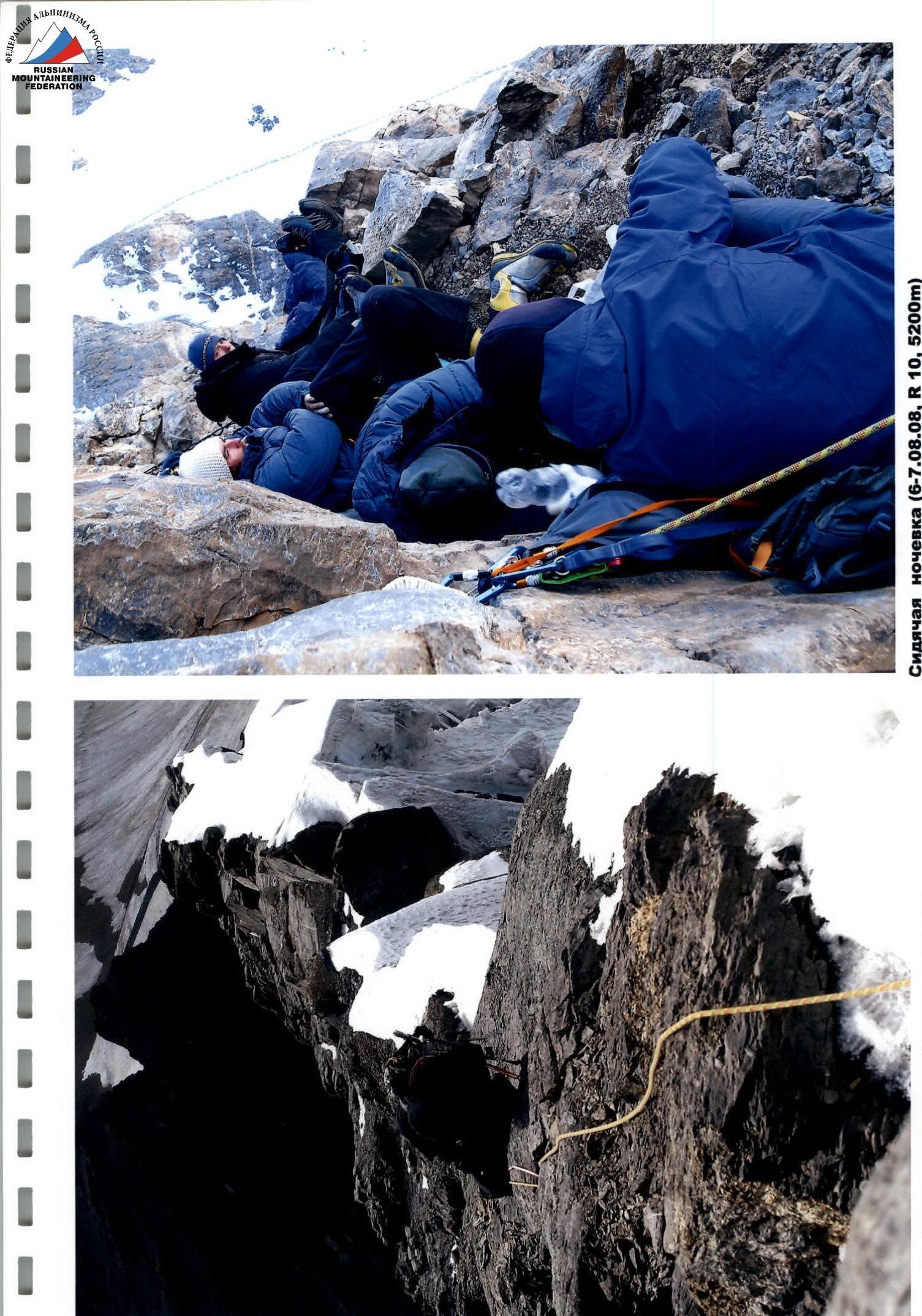
Bivouac (August 6-7, 2008, R10, 5200 m).
Comments
Sign in to leave a comment