
PASSPORT
I. Altitude-technical class 2. Pamir, Yazgulemsky Ridge 3. Peak 5864 (Chiringyad) via the West face 4. Proposed category: 6B, first ascent 5. Route characteristics: Elevation gain — 1864 m Distance — 2695 m Sections of 5–6 category difficulty — 110 m Average steepness of the main route section (4300–5864) — 67° Steepness of 5–6 category difficulty sections — 77° 6. Number of climbing hours: 66 and days: 6 7. Overnight stays: 3 sitting, 2 lying down 8. Team leader: Petrov Nikolai Evgenievich — CMS. Bashkirov Vladimir Leonidovich — MS. Obikhod Vladimir Nikolaevich — CMS. Yanochkin Vladimir Ivanovich — CMS. 9. Coach: Bashkirov Vladimir Leonidovich — MS 10. Departure to the route — August 12, 1989 Summit — August 17, 1989 Return — August 18, 1989 11. Organization: Committee for Physical Culture and Sports under the Moscow City Executive Committee
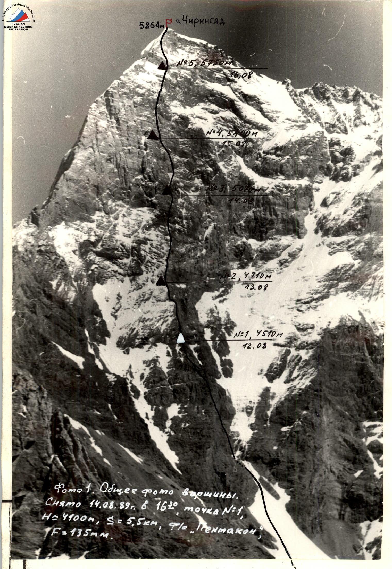 Photo 1. General photo of the summit. Taken on August 14, 1989, at 16:30, point #1, H = 4100 m, S = 5.5 km, camera “Pentacon”, F = 135 mm.
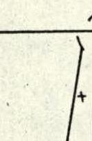
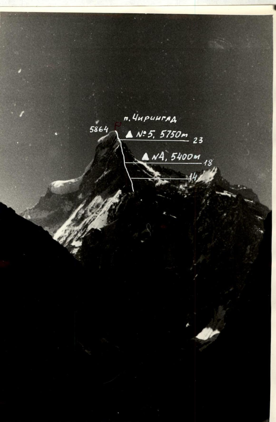 Photo 2. Left profile of the summit. Taken on August 14, 1989, at 10:30, point #2, H = 3200 m, S = 5 km, camera “Pentacon”, F = 135 mm.
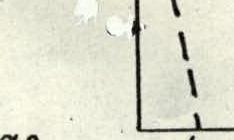
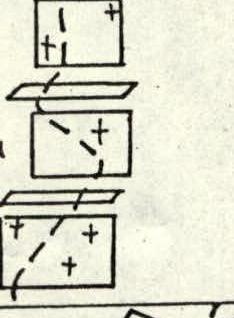
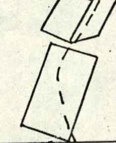
Route profile

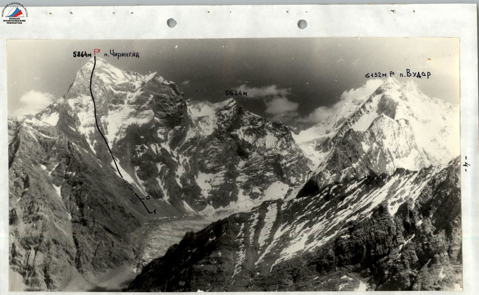
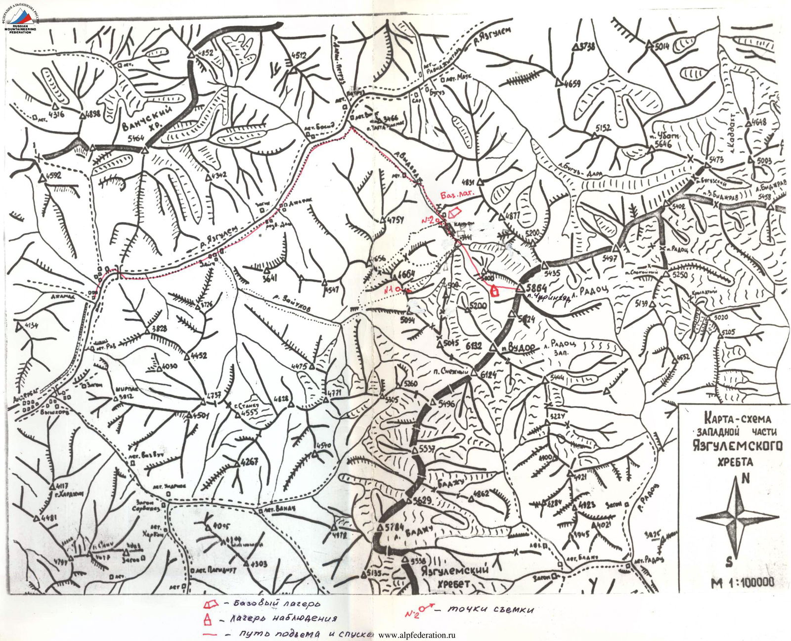 Photo 3. Panoramic photo of the area. Taken on August 14, 1989, at 17:00, point #1, H = 4100 m, S = 5.5 km, camera “Pancolor”, F = 50 mm. 0 — start of the route, 1 — observer camp.
 Map-scheme of the Western part of Yazgulemsky Ridge.
Brief overview of the climbing area
Peak Chiringyad (5864 m) is located in the central part of Yazgulemsky Ridge (Western Pamir), in a group of peaks about 6000 m high, many of which remain unconquered. The only expedition to visit this area before us was the “Lokomotiv” sports society expedition in 1982, which climbed Chiringyad from the north.
The area is characterized by its inaccessibility — long drives and approaches, ovrings, canyons, requiring mountaineering skills even on the approach. Apparently, this is the reason for its underdevelopment from an alpinist’s point of view, despite the presence of many complex and logical routes of the highest category of difficulty in the area. The relief of the peaks in the area is rugged, with sharp peaks and intricate ridges. The walls in the area are steep, with vertical, crumbling belts that are particularly difficult to pass. The area has significant glaciation, with torn glaciers and icefalls.
Overall, the area is unique in its aesthetic and sporting opportunities.
The only way to get to the area is by car from Dushanbe, 400 km along the West Pamir Highway to the confluence of the Yazgulem River and the Pyanj River on the Afghan border (30 km short of Rushan settlement). Then, up the Yazgulem valley, about 30 km to the end of the road (Jamak village). From there, on foot along the left (orographic) bank of the Yazgulem River, 7 km to the last settlement (Zaych village). Further, the trail becomes more complex and sometimes impassable (especially for donkeys). Along it, another 12 km to the left tributary of Yazgulem — the Andyrkhiv River. Along the Andyrkhiv valley, about 10 km to the canyon. Here, the base camp is set up.
From the base camp:
- through the canyon (160 m of 5th category rock climbing, pitons, belay);
- then along the left (orographic), steep, grassy-scree slopes under the spurs of Chiringyad peak;
- crossing the river (better early in the morning when the flow is not so strong);
- bypassing the spurs of Chiringyad to the right along the moraine;
- approaching the icefall leading to the upper cirque of the West face.
Passage through the icefall is impossible; a detour to the left along steep, heavily broken rocks (120 m of IV category rock climbing, pitons, belay). Then, another hour or so along the unstable scree of the moraine — exit to the route in the upper cirque. Here, directly under the route, is the assault camp. From the base camp, along the fixed ropes, about 7 hours.
Tactical actions of the team
The tactical plan, drawn up based on observations and reconnaissance, was carried out without deviation in terms of time and overnight stays.
On the route, the leading rope team worked in shifts — half a day each. The leading team worked on sections: Notation: B — Bashkirov, O — Obikhod, P — Petrov, Y — Yanochkin R0–R, R2–R4: P–Y R21–R24: P–B R2–R4: Y–P R14–R15: Y–P R24–R25: B–P R4–R5: O–B R15–R18: P–Y R25–R27: Y–O R5–R8: P–Y R18–R20: B–O R9–R11: B–O R20–R21: O–Y
In the morning, the leading rope team, having passed the processed ropes, continued working above. The second rope team removed the bivouac, belay ropes, and brought them up. This tactic ensured continuous work for the leading rope team.
The leading rope team worked on a double rope (photos 5, 17). When passing through destroyed sections, to protect the lower rope team from rockfall, movement was carried out “en échelon”.
When passing through sections with fragile rock, the lead climber's belay was organized mainly through chocks to avoid damaging the rock when hammering in pitons.
Seven ropes were taken, allowing for processing sufficiently long sections of the route.
The main difficulty on the route was the vertical walls with crumbling rocks, where it was very challenging to organize belay. Here, mainly used were:
- long universal pitons
- chocks like “stopper”.
Belay points were organized from 2–3 spaced, linked points (to belay in case a large piece of rock broke off).
To expand overnight stays, a hammock was used, into which ice and snow were poured, forming an additional area under the tent when frozen.
Around 17:00, the rope teams switched, and:
- one began to set up the bivouac and prepare food,
- the second continued processing.
A “pressure cooker” (with a “fur coat”) and an optimal selection of products allowed for preparing breakfast the night before.
Good preparation and acclimatization allowed the team to use almost all daylight hours for movement, except for early morning hours when severe cold prevented effective movement on complex rocks.
In the first two days of the ascent, movement was hampered by bad weather — lack of visibility and snow that covered all the micro-relief. Movement slowed down due to the need to clear holds. To pass through key sections of the route, the entire technical arsenal was used:
- “friends”
- “sky-hooks”
- pitons made of hard steel
- “micro-pitons” (small pitons and chocks for passage).
The lead climber worked in galoshes. Overall, the team had a physical and technical reserve in case of severe weather deterioration. There were no failures or injuries during the ascent.
The descent was carried out according to the tactical plan, along the ascent route. The remoteness and inaccessibility of the area required clear organization of observation, communication, and a rescue team. Three highly qualified climbers (CMS) were stationed directly below the route throughout the ascent and maintained radio contact with the climbers and the base camp, where a rescue team was constantly present under the leadership of MS USSR, Khokhlov D.V. The rescue team had twice-daily radio contact with the KSP of the Tajik region. To ensure the possibility of urgent consultation on the route, the observing pair listened in every hour during the entire working day of the climbers.
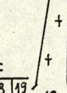
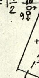
| Pitons | Ice screws | Rock pitons | Chocks | Section | Category | Meters | Steepness, degrees |
|---|---|---|---|---|---|---|---|
| - | - | 3 | 5 | 3 | IV | 80 | 40° |
| - | - | 3 | 4 | 2.2 | IV | 70 | 40° |
| - | - | 4 | 2 | 2.1 | IV | 60 | 72° |
| - | - | 3 | 4 | 2 | IV | 80 | 40° |
| - | 1 | 2 | - | 1.1 | IV | 35 | 65° |
| - | 4 | 6 | - | 1 | III | 160 | 45° |
| - 1 | 10 | 5 | 2 | 0 | III | 440 | 40° |
| - | - | 8 | - | 9 | V | 50 | 50° |
| - | 1¾ | 3 | - | 8 | VI А3 | 60 | 80° |
| - | 1 | 2 | 9 | 7 | V | 85 | 65° |
| - | 1 | 6 | - | 6 | V | 80 | 55° |
| - | - | 12 | 2 | 5 | V | 80 | 70° |
| - | - | 9 | 8 | 4 | V | 100 | 60° |
| - | - | 4 | 9 | IV | 110 | 50° | |
| - | 2 | 4 | - | 17 | IV | 30 | 75° |
| - | - | 4 | 7 | 16 | V+ | 60 | 80° |
| - | 2 | 12 | - | 15 | V | 75 | 75° |
| - | 14⁄2 | 5⁄1 | - | 14 | VI А4 | 90 | 90° |
| - | 3 | 4 | - | 13 | IV | 70 | 55° |
| - | 1 | 6 | 4 | 12 | V | 80 | 75° |
| - | - | 2 | 7 | 11 | V | 65 | 70° |
| - | - | 10 | 5⁄2 | 10 | VI А? | 70 | 90° |
| - | 3 | 6 | - | 26 | III | 100 | 50° |
| - | - | 5 | 2 | 25 | V | 50 | 75° |
| 1 | 1 | 7 | - | 24 | IV | 80 | 65° |
| 1 | 8⁄1 | 4 | - | 23 | VI А3 | 35 | 90° |
| - | 5 | 2 | - | 22 | III | 150 | 50° |
| - | 4 | 3 | - | 24 | IV | 50 | 65° |
| - | - | 10 | 7⁄2 | 20 | VI А4 | 75 | 85° |
| - | - | 7 | - | 19 | IV | 50 | 60° |
| - | 11⁄2 | 6 | - | 18 | VI А3 | 80 | 85° |
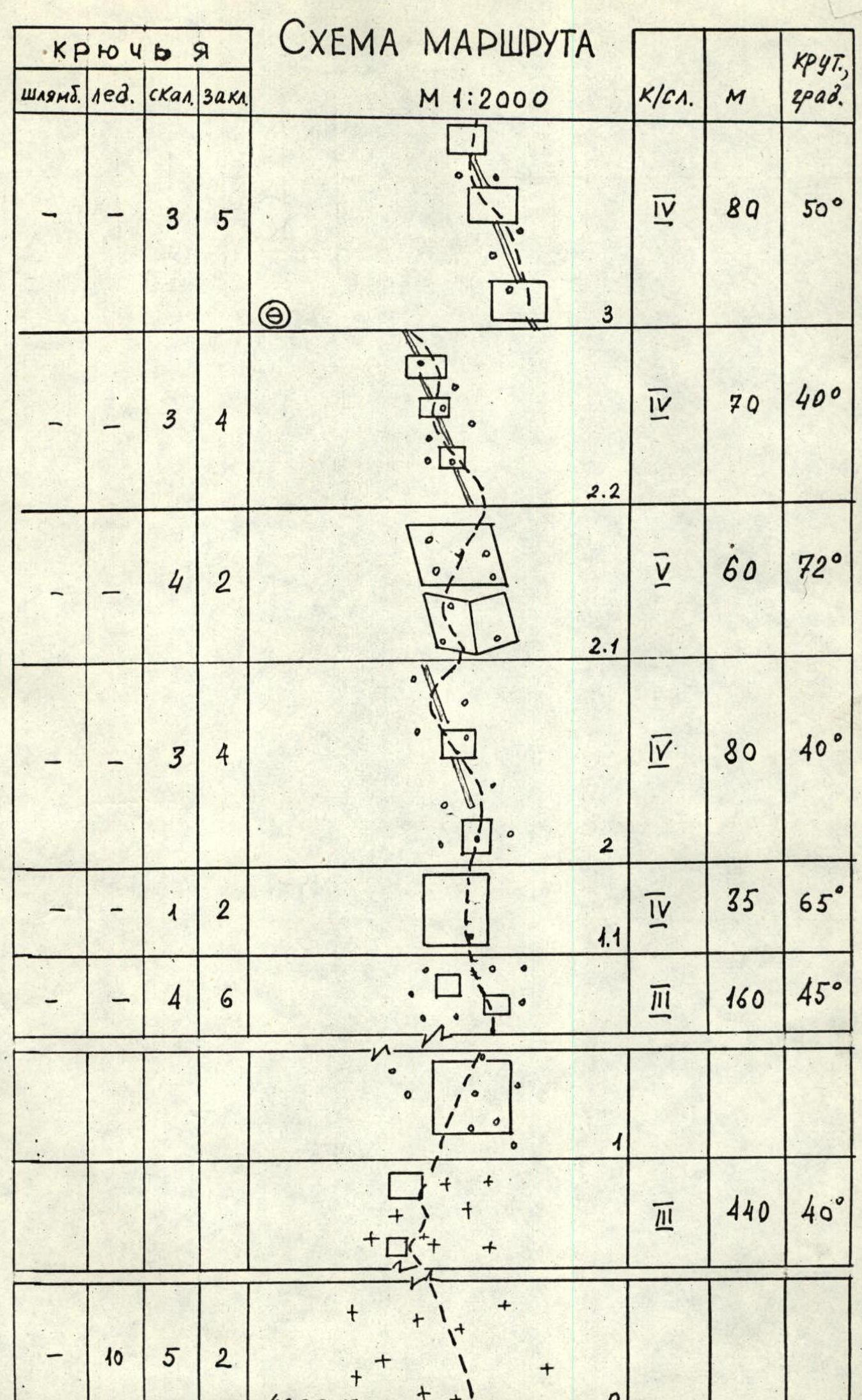 Photo 5. Sections 5–8. August 13, 1989, 16:30.


Route description by sections
Section 0–1. Ice-firn slope. Movement on crampons. Belay through ice screws and rock pitons in rock outcrops.
Section 1–1.1. Very broken rocks. Approach to the wall leading to the counterfort. Belay through pitons and rock ledges.
Section 1.1–2. Exit along the broken wall (“live” stones!) to the counterfort. Belay through “chocks” (stoppers, hexes).
Section 2–2.1. Broken rocks of the wide counterfort with freely lying stones on the shelves. Movement “en échelon”. Belay — long pitons, “chocks”.
Section 2.1–2.2. Broken rock belt on the counterfort. Overcome through a wide internal angle and wall. Belay — pitons, “chocks”.
Section 2.2–3. Counterfort with individual walls up to 5–8 m. Many “live” stones, movement “en échelon”. There are shelves for a tent (if you expand the platform using a hammock).
Section 3–4. Movement along the counterfort. More monolithic rocks. местами натечный лёд. Belay — pitons, “chocks”.
Section 4–5. Movement along the wall (with ice in the cracks) to the right of the counterfort. To the left — heavily iced smooth slabs. Icicles. Belay — “hard” steel pitons, “chocks”.
Section 5–6. A series of smoothed slabs turning into a wide internal angle. Limited number of cracks. Ice in the cracks. Belay — “hard” steel pitons.
Section 6–7. Alternation of ice and rock islands. Belay — ice screws, “hard” steel pitons.
Section 7–8. Steep broken walls. Unstable blocks. Movement extremely cautious. Belay — “chocks”, titanium boxes.
Section 8–9. Beginning of the main wall (light-colored rocks). Movement left and up. On the wall, fragile “reverse holds”. Break off under load. The middle section goes reliably only on artificial climbing aids (ICA).
Section 9–10. Movement right and up along a broken, partially iced wall. There are small ledges. Many “live” stones, caught in snow and ice. Belay — wedges, boxes, chocks.
Section 10–11. Alternation of walls up to 15–25 m, two overhangs. Climbing extremely difficult, in galoshes, but there are small ledges after the overhangs where you can stand. The wall is monolithic, with cracks. Reliable piton belay. “Friends” are used. On the overhangs, two “sky-hooks” were used.
Section 11–12. Broken wall with large “live” blocks. Initially, left and up 30 m, then “en échelon” to the right. Exit to a small ledge. Overnight stay possible.
Section 12–13. Along steep, partially iced rocks — exit to a chimney with a plug. Ice inside the chimney. Movement along the right side of the chimney. Belay — universal pitons, small “chocks”.
Section 13–14. Right and up. Alternation of short, steep ice sections with broken rocks. Belay — short ice screws, boxes.
Section 14–15. Wall with overhanging sections between two vertical grooves (rockfall hazard). Climbing extremely difficult, the grooves limit freedom of choice. When overcoming the first overhang, a sky-hook and small hard steel pitons, ladders were used. The lead climber — only in galoshes.
Section 15–16. Wide chimney — internal angle with vertical ice. Belay — short ice screws, thick wedges.
Section 16–17. Smooth vertical walls alternating with narrow ledges with built-up ice. Belay — long universal pitons.
Section 17–18. Exit left and up along an ice-filled internal angle to a snow ledge. Overnight stay possible if the ledge is expanded with a hammock. The first climber — in crampons.
Section 18–19. Very complex smoothed wall. Climbing extremely difficult, only in galoshes, holds fragile — flake off. For belay, pitons, thin flakes were used. Few cracks. For passage, a sky-hook was used.
Section 19–20. Exit along a smooth, gently sloping slab under a wall with a crack. Belay — universal titanium pitons.
Section 20–21. Narrow crack in a monolithic wall. In the middle — an overhang (two sky-hooks). Passage requires excellent technique of jamming, wedging. Climbing is extreme in physical and psychological terms. Belay — chocks, pitons, “friends”.
Section 21–22. Exit to an ice slope under the summit wall, along extremely broken rocks. Water flows from above in the second half of the day. In the morning, the rocks are icy. Belay — long pitons, chocks.
Section 22–23. Ice-firn slope. Movement on individual sections (3 × 15 m) on the front teeth of crampons. Approach to the summit wall. Belay — ice screws, pitons — in outcrops. A good overnight stay is possible under the wall if you have the strength to carve it out in the ice.
Section 23–24. Overhanging belt of monolithic rocks. Few cracks, and those at the top are filled with ice. Very few holds. Climbing in galoshes is extremely difficult. Had to use a sky-hook and ladder in the upper part of the wall, and for belay — a piton.
Section 24–25. Traverse left and up along steep, heavily iced rocks. Movement only in crampons. Few cracks. At the end of the traverse, there are no cracks. For belay, a piton was hammered in.
Section 25–26. Wall with very small, fragile holds. Climbing on friction in galoshes. Belay — pitons, chocks.
Section 26–27. Summit ridge. To the left, large snow cornices. To the right — rocks with a limited number of holds. Therefore, movement straight up on friction. Belay — pitons, ice screws (on the summit dome). Control cairn — on the last rocks at the ice-snow dome of the summit.
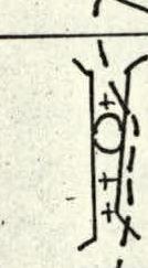
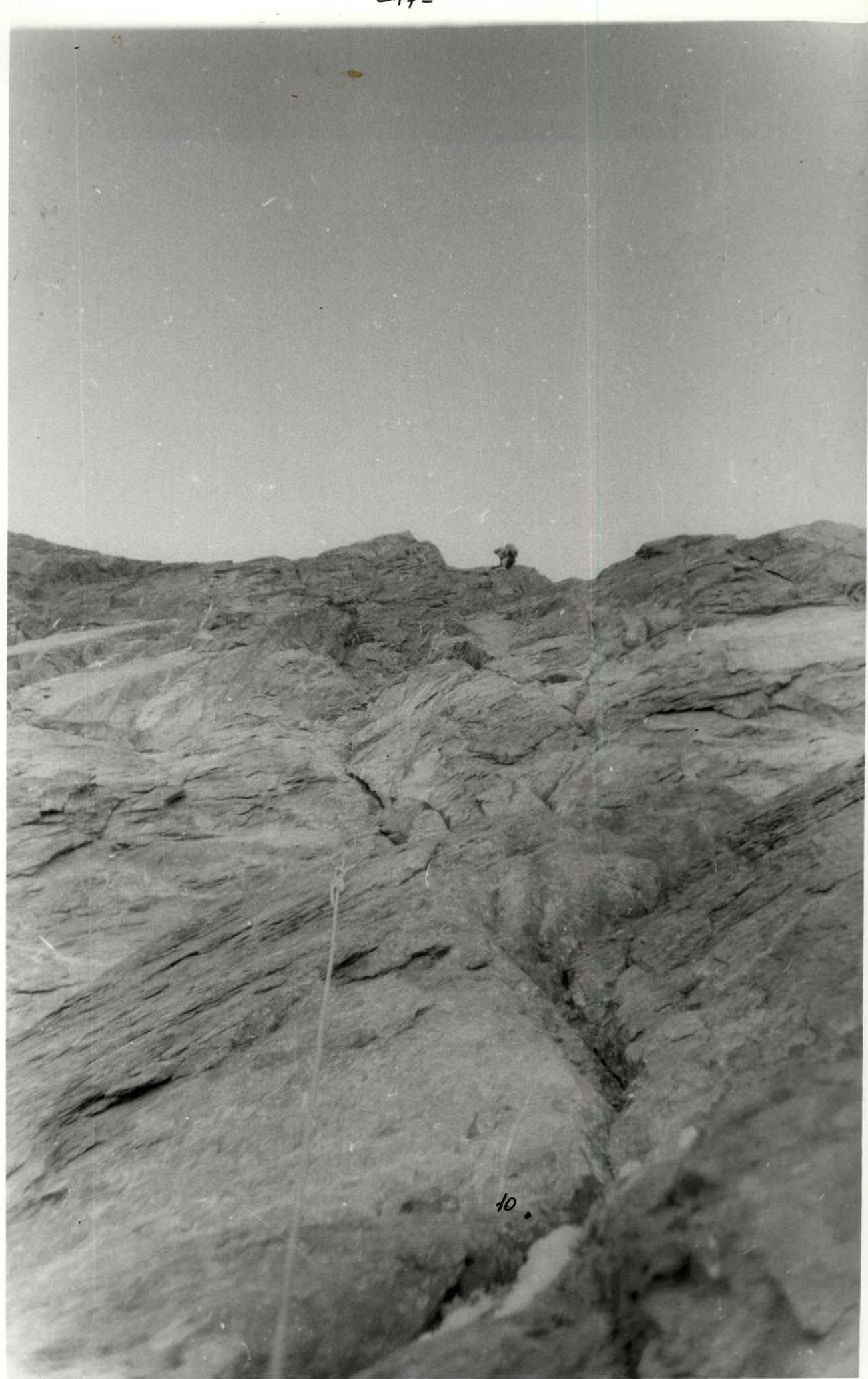 Photo 7. Section 10–11. August 14, 1989, 15:30.
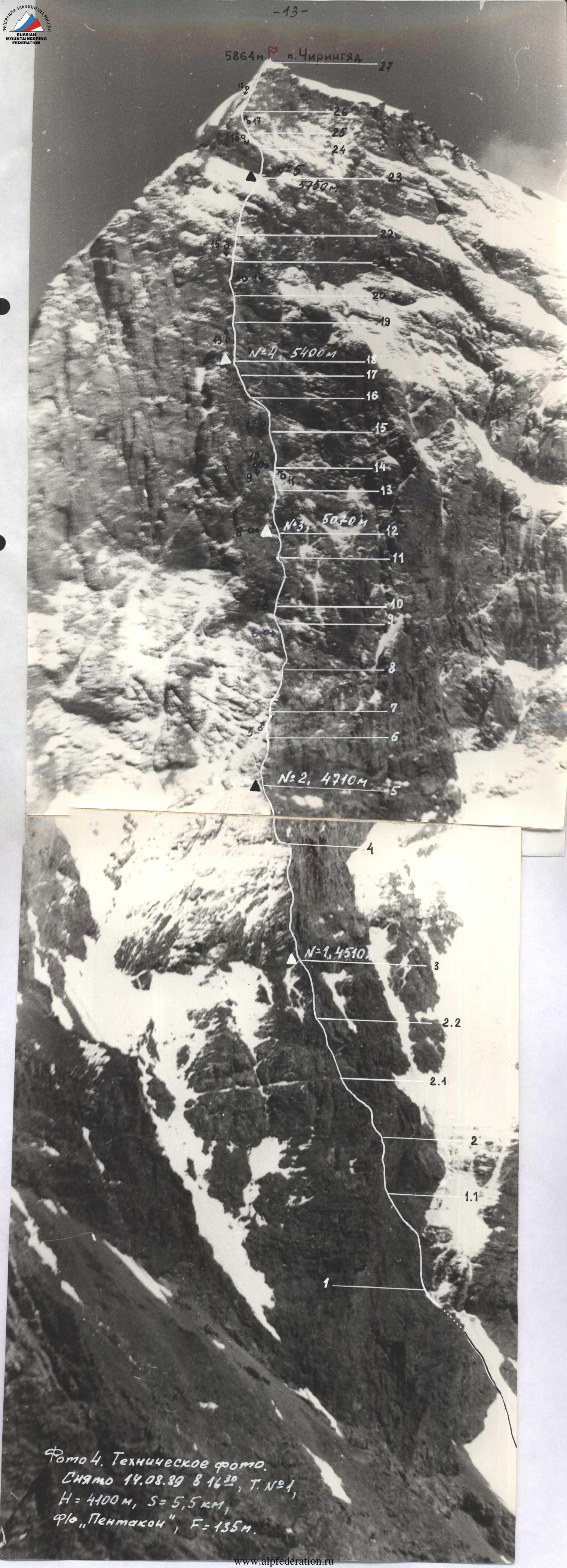 Photo 4. Technical photo. Taken on August 14, 1989, at 16:30, point #1, H = 4100 m, S = 5.5 km, camera “Pentacon”, F = 135 mm.
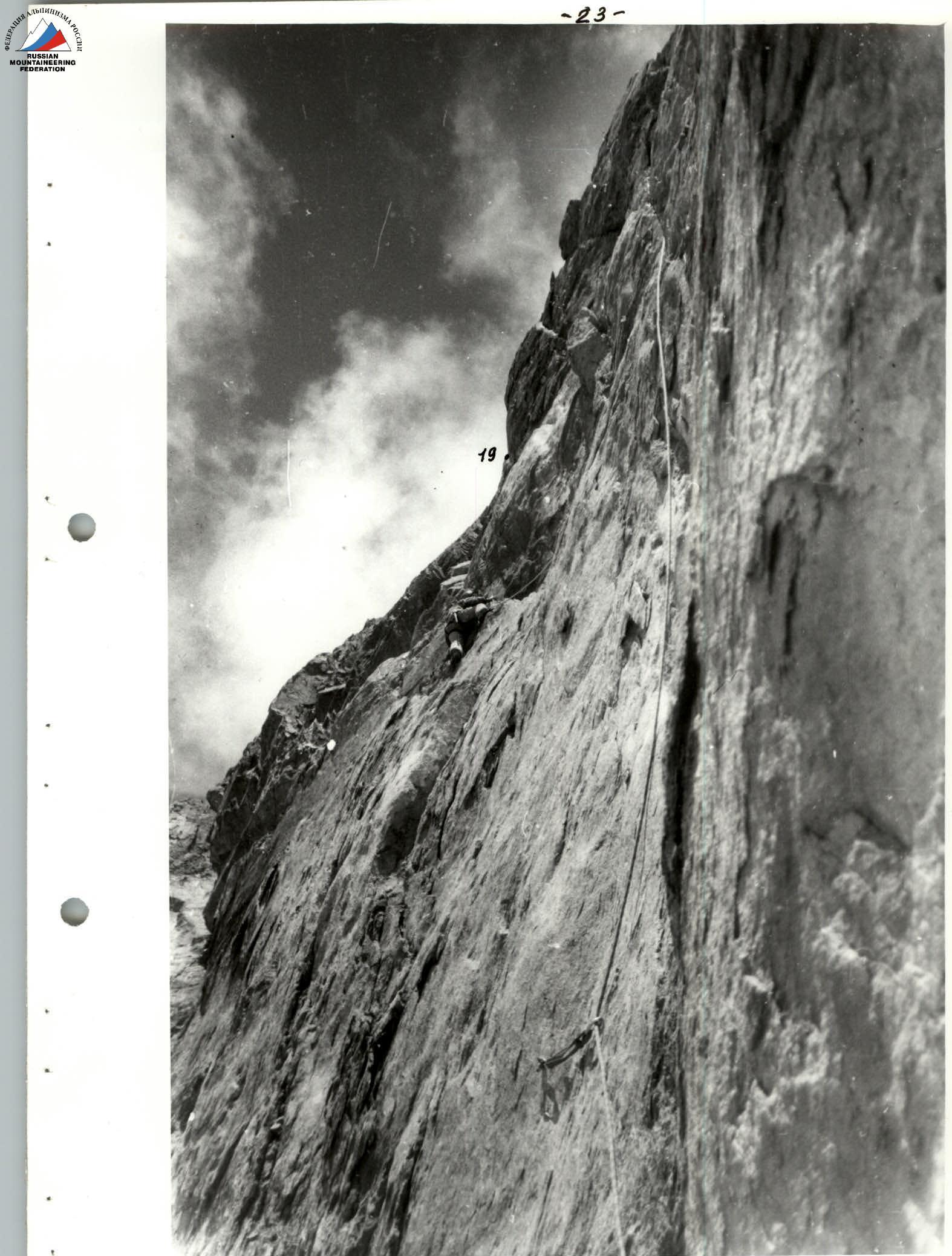 Photo 13. Section 18–19. During processing. August 15, 1989, 19:30.
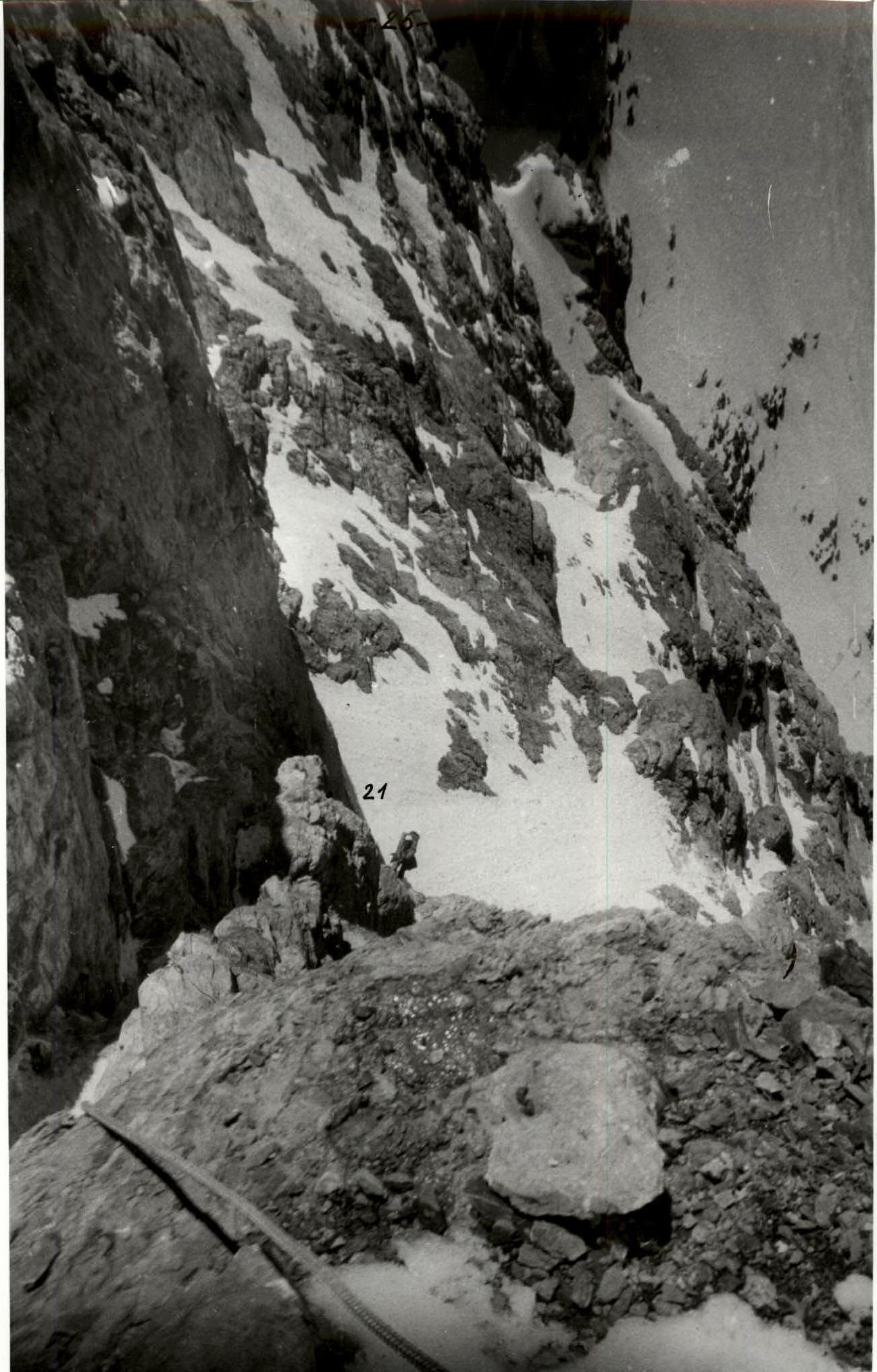 Photo 15. Section 21–22. August 16, 1989, 15:30.
Comments
Sign in to leave a comment