ASCENT REPORT
- Ascent category: Snow and Ice
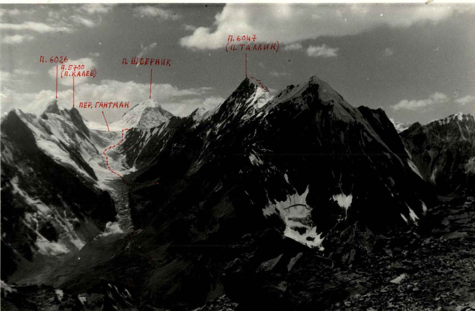
- Ascent area: Yazgulem Ridge
- Peak, its height, and ascent route: P. 6047 m, via the northwestern slope
- Proposed category: 3A, protocol 547, part 10, dated February 5, 1985
- Route characteristics: height difference — 600 m, average steepness — 30°, section lengths — R0–R1 300 m, R1–R2 40 m, R2–R3 200 m, R3–R4 80 m, R4–R5 1000 m, R5–R6 20 m, R6–R7 100 m
- Number of pitons: ice screws 30
- Climbing time: 14 hours
- Number of bivouacs: 2
- Names of the team leader and participants, their climbing qualifications:
- GOL'DI, I.V. — 2nd sports category
- HIJESALU, L.R. — 2nd sports category
- SALK, A.A. — 2nd sports category
- SUUK, N.A. — CMS (Candidate Master of Sports)
- TANNER, R.N. — 1st sports category
- PARK, V.V. — 2nd sports category
- TREIAR, YU.YU. — 2nd sports category
- Team coach: PRIYMETS Ilmar
Area Map. Peak 6047 m (Tallinn Peak). Central Pamir. Yazgulem Ridge.

M 1:100 000
| Date | Section | Average steepness (degrees) | Length (m) | Terrain type | Difficulty | Condition | Weather | Rock Pitons | Ice Pitons | Notes |
|---|---|---|---|---|---|---|---|---|---|---|
| August 18, 1984 | R0–R1 | 15° | 300 m | snow | 1 | good | – | |||
| R1–R2 | 45° | 40 m | ice | 3 | –"– | 4 | ||||
| R2–R3 | 15° | 200 m | snow | 2 | –"– | – | ||||
| R3–R4 | 35° | 80 m | ice | 3 | –"– | 9 | ||||
| August 19, 1984 | R4–R5 | 10° | 1000 m | snow | 1 | –"– | – | |||
| R5–R6 | 50° | 20 m | ice | 4 | –"– | 5 | ||||
| R6–R7 | 45° | 100 m | ice | 3 | –"– | 12 |
UIAA SCHEME
P. 6047 (TALLINN PEAK)
| Section | Terrain Type | Category | Steepness | Length |
|---|---|---|---|---|
| R6–R7 | ++++++ ++++++ | 3 | 45° | 100 m |
| R5–R6 | ++++++ ++++++ | 4 | 50° | 20 m |
| R4–R5 | ++++++ ++++++ | 1 | 10° | 1000 m |
| R3–R4 | ++++++ ++++++ | 3 | 35° | 80 m |
| R2–R3 | ++++++ ++++++ | 2 | 15° | 200 m |
| R1–R2 | ++++++ ++++++ | 3 | 45° | 40 m |
| R0–R1 | ++++++ ++++++ | 1 | 15° | 300 m |
 www.alpfederation.ru↗
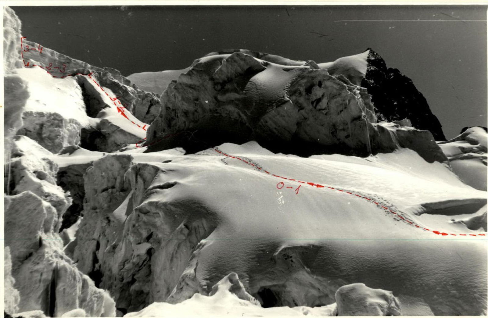 www.alpfederation.ru↗
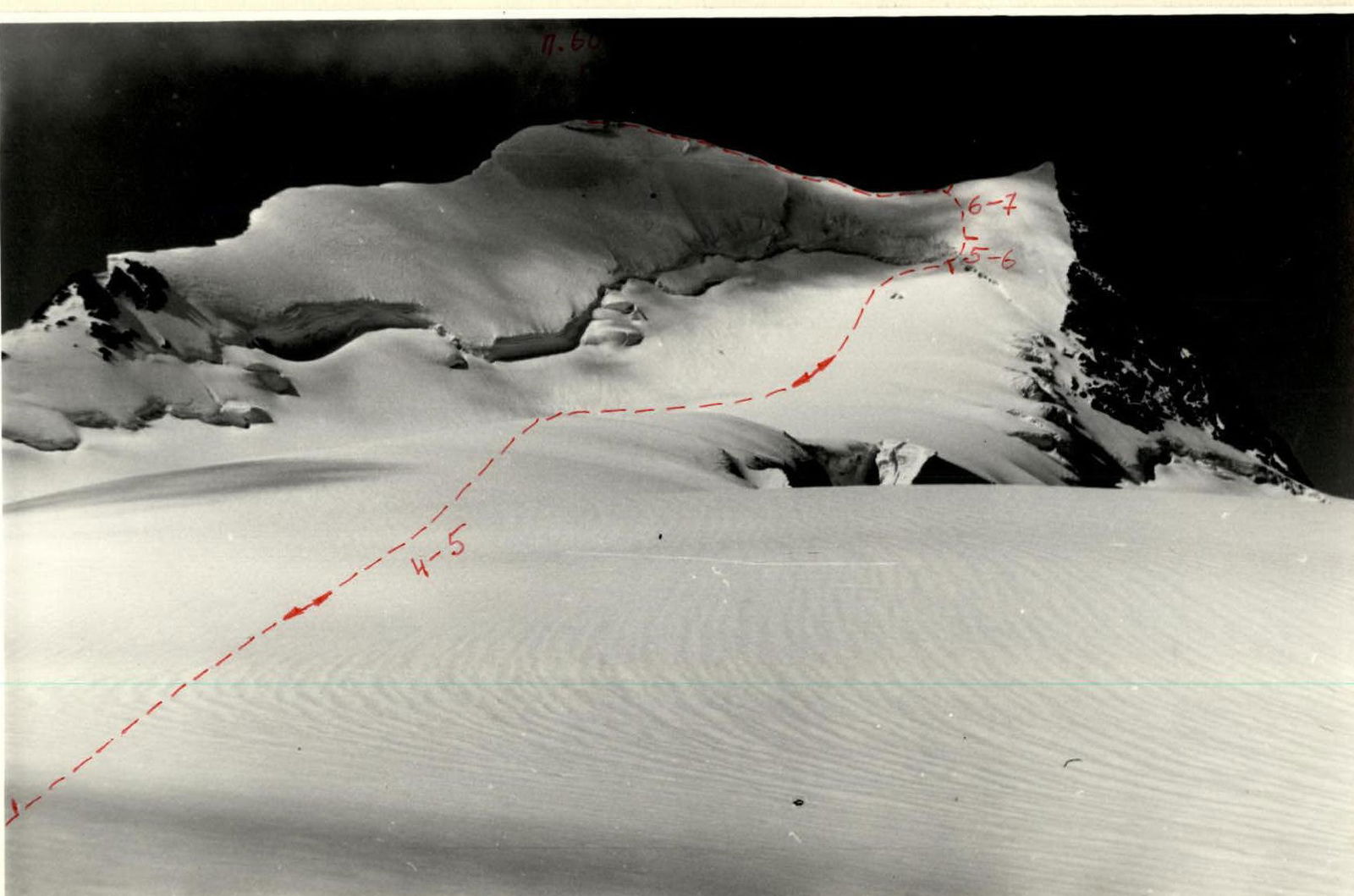 www.alpfederation.ru↗