Ascent Passport
- Class: HIGH-ALTITUDE
- Ridge: SHAKHDARINSKY
- Peak: Peak ENGELS (6510) via the CENTER OF THE EAST FACE
- Difficulty category: 6
- Height difference: 1340 m, distance 1885 m
- Sections of V difficulty category – 340 m
- Sections of VI difficulty category – 360 m
- Pitons driven:
rock bolt chocks ice screws 114 8 160 39 39 8 15 0 
- Climbing hours: 40, days: 4
- Overnights: 3
- Team captain: Pechyonkin M.V. CMS, team members: Pashkov P.M. CMS, Ivanov V.B. CMS, Kuzmin V.D. CMS, Papin V.G. CMS, Kulakov A.A. CMS
- Coach: Kurgin S.N. MS
- Departure to the route: 18.07.1988, at the summit: 21.07.1988, return: 22.07.1988
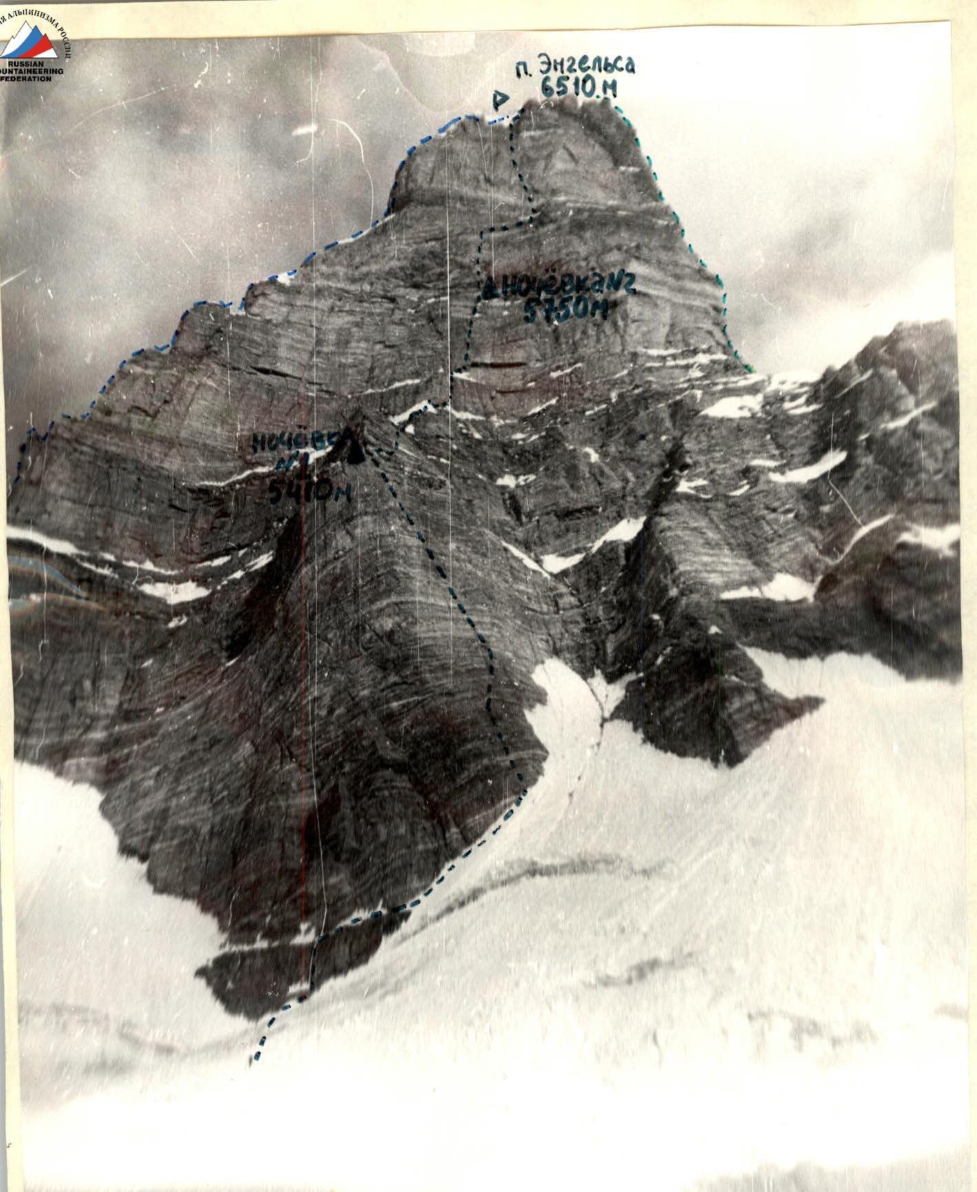
General photo of route No.10. H = 5100 m, L = 500 m, 12 hours. Lens "T-43" 1:4 (40 mm). Legend: — Route taken by the group — Nekrasov's route — Kustovsky's route
Tactical Team Actions
The team's tactical actions during the ascent largely corresponded to the planned tactical plan. The applied movement tactics were tested on previous ascents (Lithuania) and aimed to ensure the first climber's movement without delays.
All equipment and personal belongings were distributed among five backpacks. The first climber moved without a backpack, having all necessary gear on their harness. Throughout the route, they climbed on a double rope with a shock-absorbing knot. The second climber's task was to straighten the fixed ropes, removing quickdraws from carabiners and chocks. The last climber removed pitons and dismantled belay stations. Movement on fixed ropes was done with top-rope protection. The technique of moving on steep fixed ropes was well-practiced during training, and everyone confidently climbed the most challenging sections on two jumar ascenders with a backpack on their back or attached to their harness between their legs (photo 9).
The tactical plan included changing the lead climber. Teams rotated according to the tactical plan throughout the day.
Safety Measures
During the route, great attention was paid to safety. Safety was ensured through the following measures:
- Consultations and careful observation of the wall for 10 days to develop a rockfall schedule.
- Crossing the snow-ice slope early in the morning.
- Increasing the team's movement speed through the route by correctly chosen tactical actions (teamwork) and a large amount of rock sections climbed using free climbing with chocks and friends.
- Using paired pitons when organizing belay stations.
- The first climber moving on a double rope with a shock-absorbing knot and subsequent climbers moving on fixed ropes with top-rope protection.
- Choosing safe locations for overnight stops: the movement plan was calculated so that the team reached the next overnight location between 18:00 and 19:00, allowing them to set up camp and prepare food before nightfall; all overnight stops were lying down under the protection of rock overhangs, eliminating the risk of rockfall (photo 6).
- Having an observation team and reliable communication means.
- For clear orientation on the route, the team had a working photo and could consult with observers via radio at any moment, as they constantly monitored the route through a 60x telescope.
- Having a backup team.
- Possibility of long-distance communication through a border outpost.
- Prior agreement with the Kazan team about the possibility of using a KAMAZ truck.
Execution of the Tactical Plan
The team's movement on the route followed the tactical plan. The number of working days, the location of overnight stops, and the rotation of lead climbers and teams during the ascent exactly matched the tactical plan.
Environmental Protection
During the ascent, the team adhered to environmental protection rules for mountaineering ascents in the USSR. Specifically, tin cans and plastic bags were carried down.
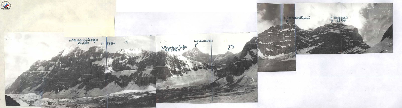
Panorama of the ascent area. OZ — shooting point H = 4050 m, L = 2–5 km, 14 hours. Lens "T-43" 1:4 (40 mm).
TOTAL: Rock – 114/39, climbing hours – 40. Bolt – 8/8, Chocks – 160/15, Ice screws – 39/0. (6510)
| Section | Rock | Bolt | Chocks | Ice screws | Length, m | Steepness | Difficulty category | Additional information |
|---|---|---|---|---|---|---|---|---|
| R1 | 2 | 0 | 9 | 0 | 50 | 75° | IV | |
| R2 | 2 | 0 | 6 | 0 | 60 | 45° | III | |
| R3 | 3 | 0 | 3 | 0 | 20 | 70° | V | |
| R4 | 2 | 0 | 4 | 0 | 25 | 65° | V | |
| R5 | 4 | 0 | 7 | 0 | 40 | 70° | VI | |
| R6 | 3 | 0 | 4 | 0 | 25 | 70° | V | |
| R7 | 2 | 0 | 3 | 0 | 20 | 85° | V | |
| R8 | 1 | 0 | 1 | 0 | 20 | 65° | V | Δ 1st control point |
| R9 | 0 | 0 | 0 | 0 | 40 | 90° | A3 | |
| R10 | 0 | 0 | 0 | 0 | 5 | 90° | A4 | |
| R11 | 0 | 0 | 0 | 0 | 10 | 65° | D | Climbing hours 11 |
| R12 | 0 | 0 | 0 | 0 | 15 | 70° | N | |
| R13 | 4 | 0 | 7 | 0 | 40 | 65° | V | |
| R14 | 4 | 0 | 9 | 0 | 50 | 65° | V | Preparation from the evening |
| R15 | 0 | 0 | 0 | 0 | 50 | 30° | III | |
| R16 | 0 | 0 | 0 | 0 | 20 | 70° | IV | |
| R17 | 3 | 0 | 2 | 4 | 60 | 25° | IV | |
| R18 | 4 | 0 | 8 | 0 | 35 | 80° | VI | |
| R19 | 6 | 0 | 10 | 0 | 60 | 85° | VI | |
| R20 | 3 | 0 | 5 | 0 | 20 | 60° | V | Δ 2nd control point, climbing hours 11 |
| R21 | 12 | 6 | 8 | 6 | 40 | 95° | A4 | Preparation from the evening |
| R22 | 18 | 2 | 8 | 3 | 50 | 90° | A4 | |
| R23 | 2 | 0 | 4 | 0 | 15 | 90° | A2 | Δ 3rd control point |
| R24 | 3 | 0 | 10 | 0 | 40 | 70° | V | |
| R25 | 4 | 0 | 9 | 0 | 40 | 70° | V | |
| R26 | 5 | 2 | 8 | 1 | 30 | 75° | A2 | |
| R27 | 2 | 0 | 8 | 0 | 20 | 85° | VI | |
| R28 | 3 | 0 | 6 | 0 | 25 | 75° | VI | |
| R29 | 2 | 0 | 3 | 15 | 340 | 55° | V | Climbing hours 11 |
| R30 | 8 | 0 | 8 | 10 | 620 | 20° | IV | Climbing hours 7 |
Route Description by Sections
| Section | Description of the section |
|---|---|
| R0–R1 | Cross the bergschrund on its left side. Early in the morning, the snow bridge holds well. |
| R1–R2 | Ascend the icy inner corner to a wide ledge. Traverse right. Ascend the snow-firn slope (60 m): crampons are worn, under the snow is ice. The first climber goes in crampons, insurance through ice screws, ascent to a small rock ledge. |
| R2–R3 | From the ledge straight up through the inner corner in crampons (photo 1). |
| R3–R4 | Rock slab with few holds. Move left and up to an inclined ledge. Visible hook marks. |
| R4–R5 | Rock wall with few holds (reverse orientation). To the left, 20 m away, a nylon loop is visible (do not go there). Ascend straight up to a good ledge under the corretto (photo 2). |
| R5–R6 | From the ledge, left and up through an inclined rock slab. |
| R6–R7 | Further up the wall with a crack. Good crack for medium-sized chocks. Exit to a wide ledge where the 1st control point is located (photo 3). |
| R7–R8 | Through the inner corner with increasing steepness to the beginning of the chimney. After 20 m from the ledge, it is advisable to make a belay station (photo 4). |
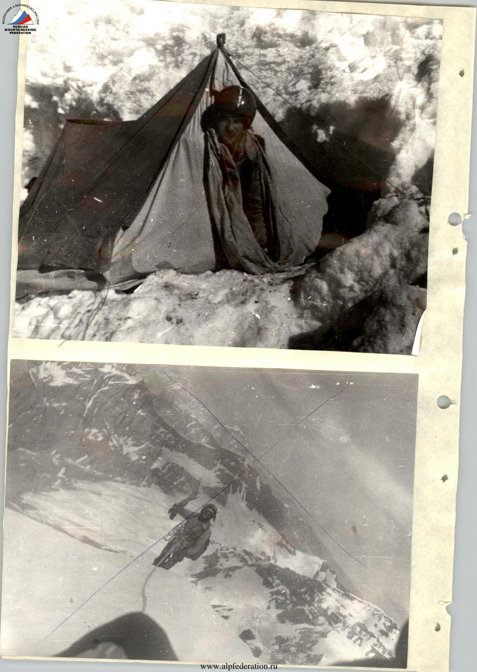
| R8–R9 | Chimney, destroyed and icy rocks. Climbing in opposition under the overhang (photo 5). The overhang is bypassed on the left. Exit to a good ledge. Traverse left along the ledge. Chop about 1 m³ of ice for a campsite. Overwintering camp (photo 6). |
| R9–R10 | Simple inner corner with exit to a wide ledge under the overhang. Traverse right 40 m. |
| R10–R11 | Inner corner ending in a small ledge (icy rocks). |
| R11–R12 | Along an inclined rock slab to a small ledge (photo 7). |
| R12–R13 | Along an inclined rock slab to a ledge under a snowy ridge. |
| R13–R14 | Along a snowy ridge to a rock wall. |
| R14–R15 | Simple rock wall. |
| R15–R16 | Second snowy ridge to a wall with a small ledge. |
| R16–R17 | From the ledge slightly right and up. Very difficult climbing (ladders). Exit to a wide ledge under a cornice where the 2nd control point is located. Overnight stay. |
| R17–R18 | From the ledge to the chip (blocky structure) — under the red overhanging rocks. |
| R18–R19 | Overhanging rocks, climbing on artificial holds to a good ledge (convenient place for belaying, photos 8, 9). |
| R19–R20 | Overhanging rocks gradually turning into "ram's foreheads." Smoothed wet rocks with few holds. Exit to a wide ledge under the overhang (3rd control point). |
| R20–R21 | After traversing the ledge right for 40 m (crossing a large inner corner where water flows), ascend a steep rock wall to a small ledge, then up a small overhang and traverse 10 m left to the base of the inner corner. |
| R21–R22 | Ascend the wide inner corner on its right wall to small ledges (belay station). |
| R22–R23 | Further up-left 10 m and transition to the next inner corner, ascending its left side to a chip where a stream flows to a ledge (belay station). |
| R23–R24 | Ascend the inner corner (wet rocks). |
| R24–R25 | Ascend a steep rock wall (wet rocks) to an inner corner. |
| R25–R26 | Ascend a wet inner corner to a ledge under a snowy ridge. |
| R26–R27 | Pass a small snowy cornice; exit to a snow-ice ridge (ice under the snow). Move in crampons. Insurance through ice screws. The ridge gradually becomes less steep. Overnight stay. |
| R27–R28 | Steep snow-ice ridge. Attention, cornices! Ice under the snow. Bypass the "giants" on the left, following the route, to a large "giant" "House" with a snowy cap. Descend from the saddle to the right side of the ridge (40 m), traverse along the slope (120 m), ascend to the summit along a snowy slope (80 m). Descend along simple, gentle snow-ice slopes towards Peak Marx (photo 10). |
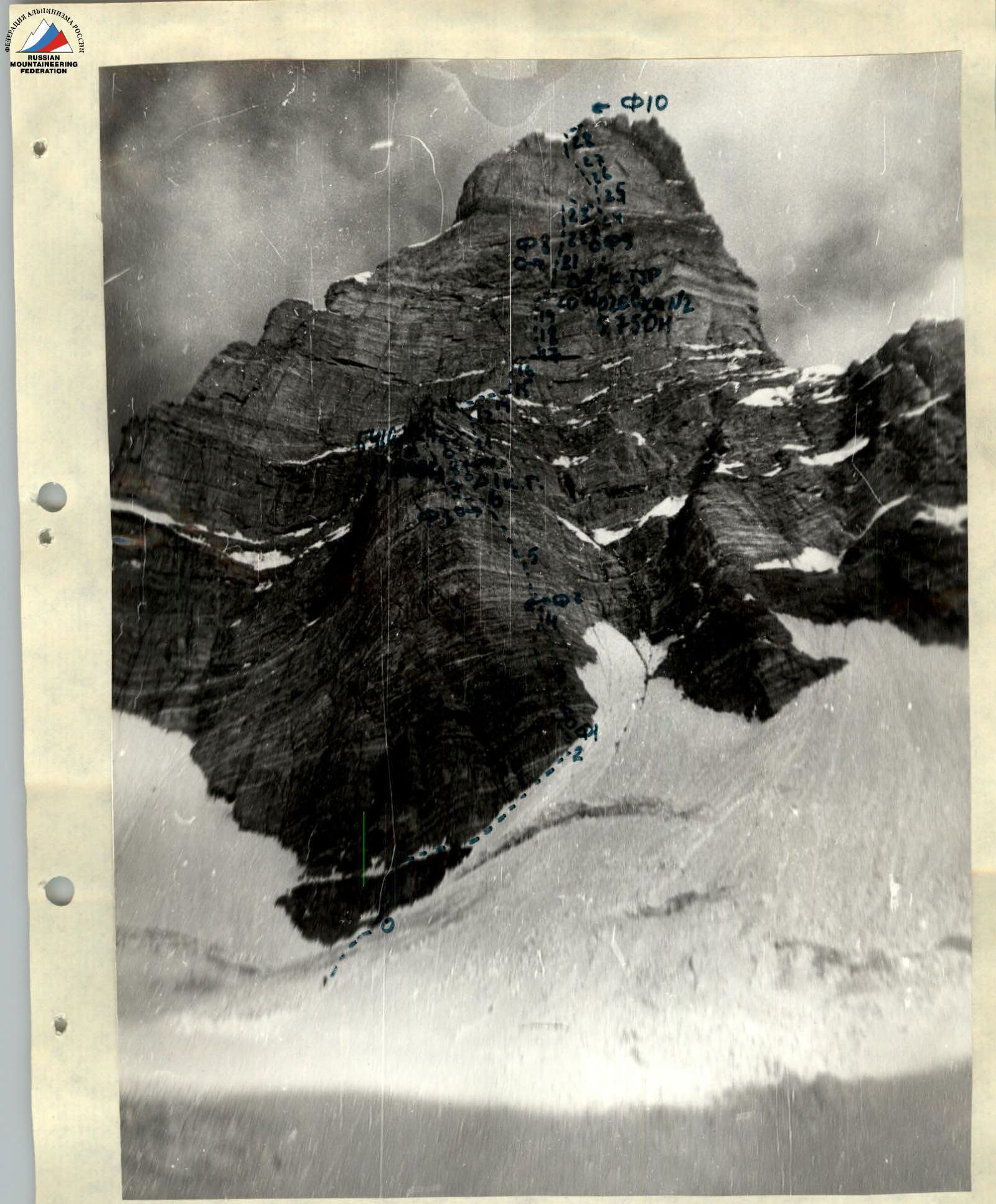 Technical photo of route No.10. Shooting point H = 5100 m, L = 500 m, 12 hours. Lens "T-43" 1:4 (40 mm).
Legend:
—– Route of the group
Δ – Control points
▲ – Overnight stays
ФБ – Location and direction of photos
Technical photo of route No.10. Shooting point H = 5100 m, L = 500 m, 12 hours. Lens "T-43" 1:4 (40 mm).
Legend:
—– Route of the group
Δ – Control points
▲ – Overnight stays
ФБ – Location and direction of photos
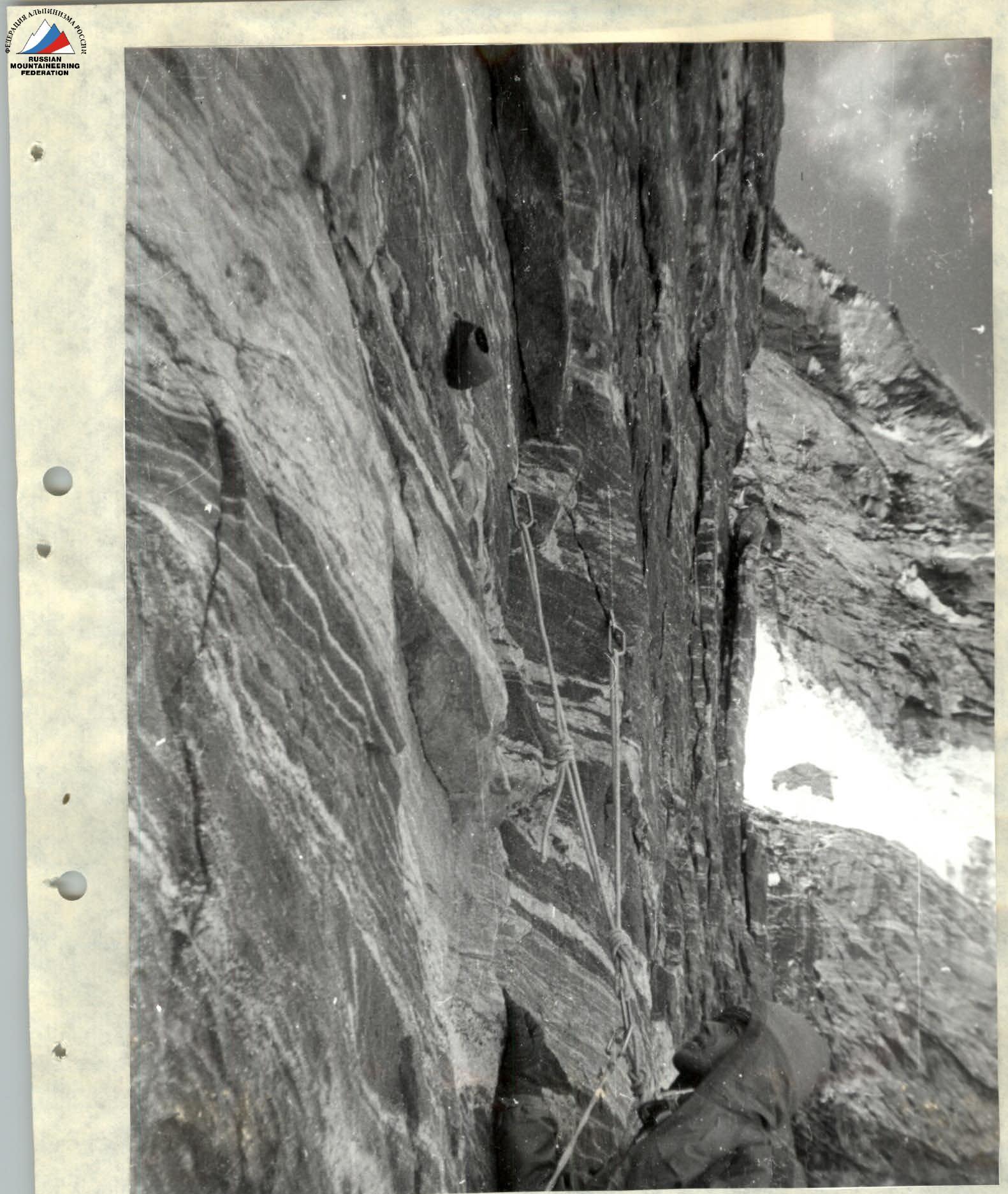 Photo 3. Station on section R6–R7. 1st control point. Note in a can.
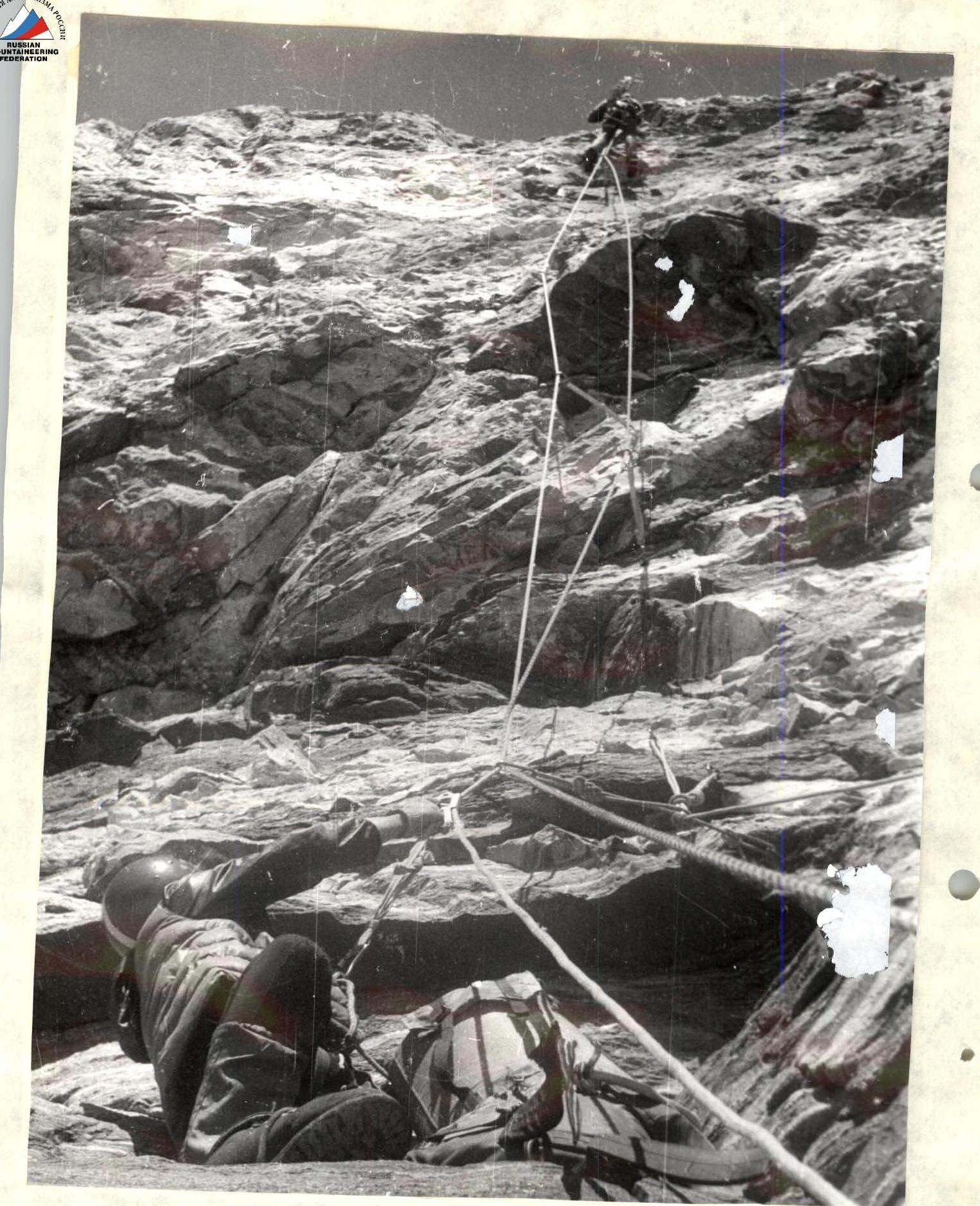
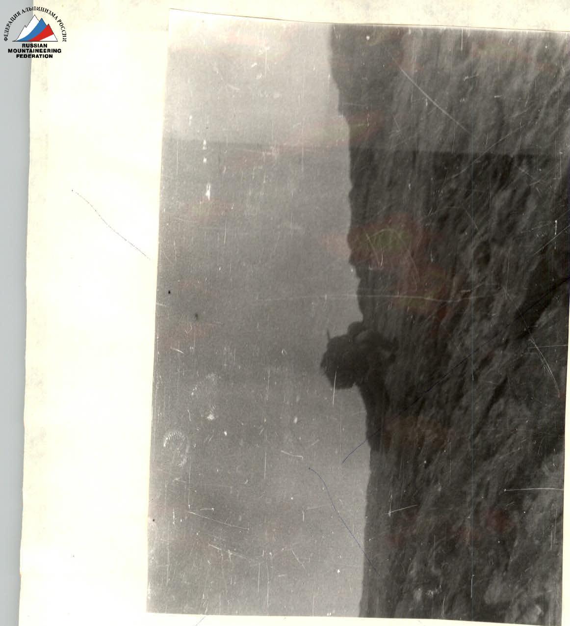 Photo 4. Inner corner before the chimney with an overhang on section R7–R8. Ascending on fixed ropes. Two ropes are visible: fixed ropes and top-rope protection.
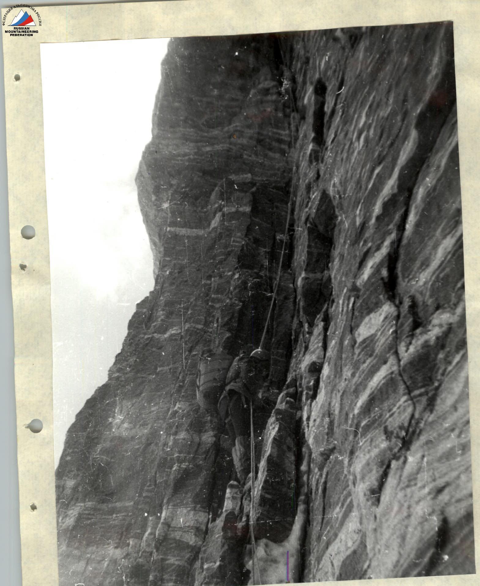
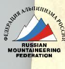
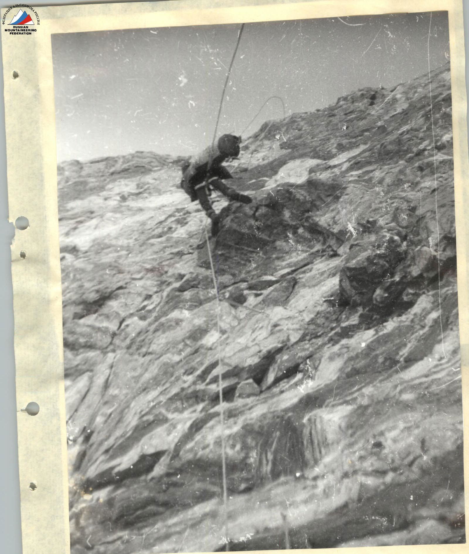
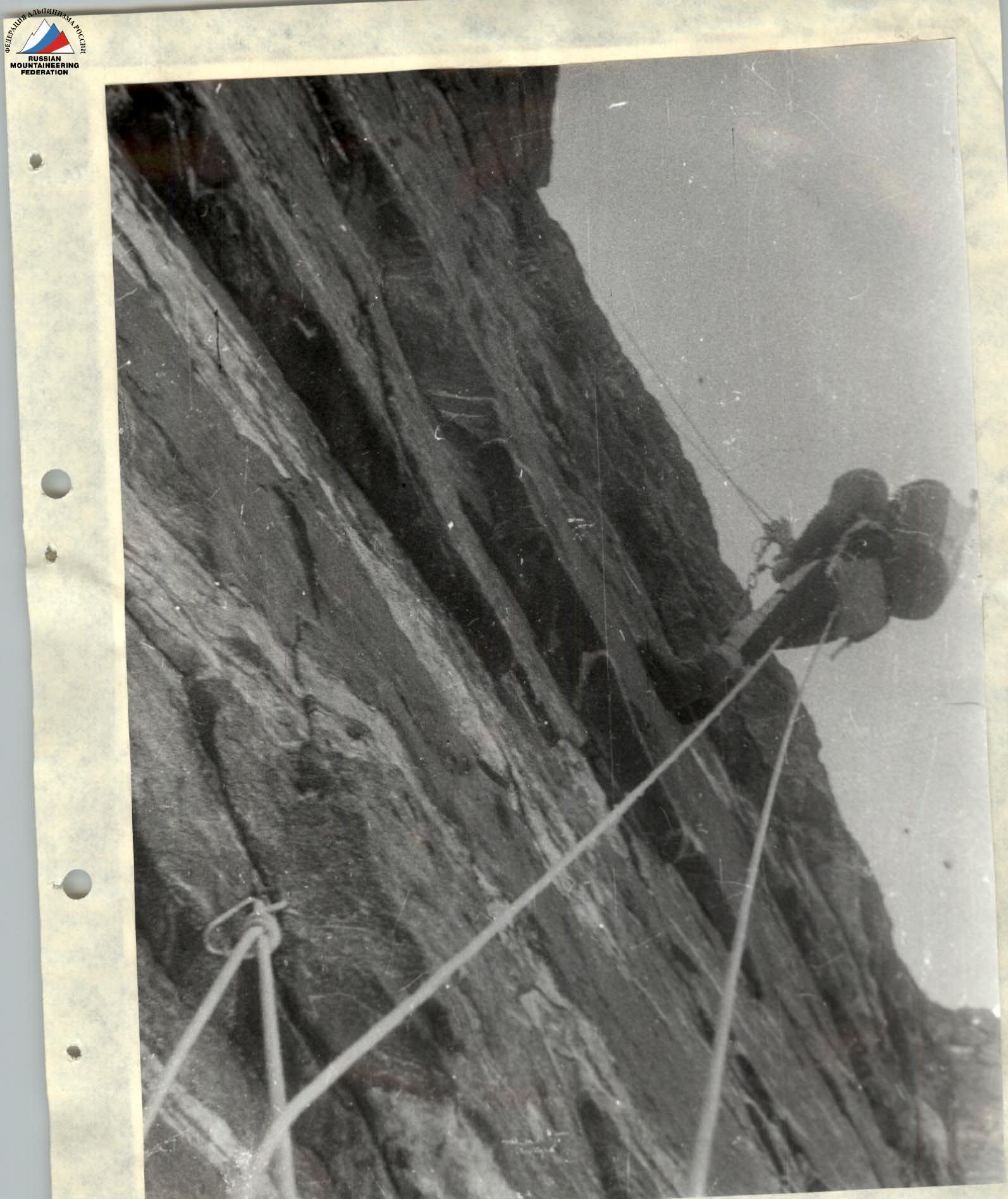 Photo 9. Ascending on fixed ropes on an overhang on section R20–R21. Photo from below. Backpack attached to the harness between the legs. The steepness of the section can be judged by the sagging of the second rope, which is pulled up by the climber. Height 5800 m.