Ascent Passport
- Ascent category: High-altitude technical.
- Ascent area: South-West Pamir.
- Peak, its height, and ascent route: Togu (6141 m) via the North-Eastern ridge.
- Proposed category difficulty: 4A
- Route characteristics: height difference about 1640 m; average steepness 32°; section lengths: R1 — 1700 m R2 — 1090 m R3 — 2240 m R4 — 340 m
- Pitons used: for belaying — rock 20, ice 12; for creating ITO — bolted.
- Total climbing hours: 25 h 30 min
- Number of bivouacs and their characteristics: July 29, 1978. In an ice mulde. Clear. Good. July 31, 1978. In an ice mulde. Clear. Cold. Good.
- Surname, name, patronymic of the leader and participants, their sports qualification:
- Korenkov Yu.N. CMS — leader
- Izmailov V.N. CMS
- Pashkov P.M. 1st sports category
- Zyryanov V.N. 1st sports category
- Udalov S.P. 2nd sports category.
- Team coach: Kurgin Sergey Nikolaevich MS — instructor.
- Date of departure to the route and return: Departure: July 30, 1978. Return: August 1, 1978.
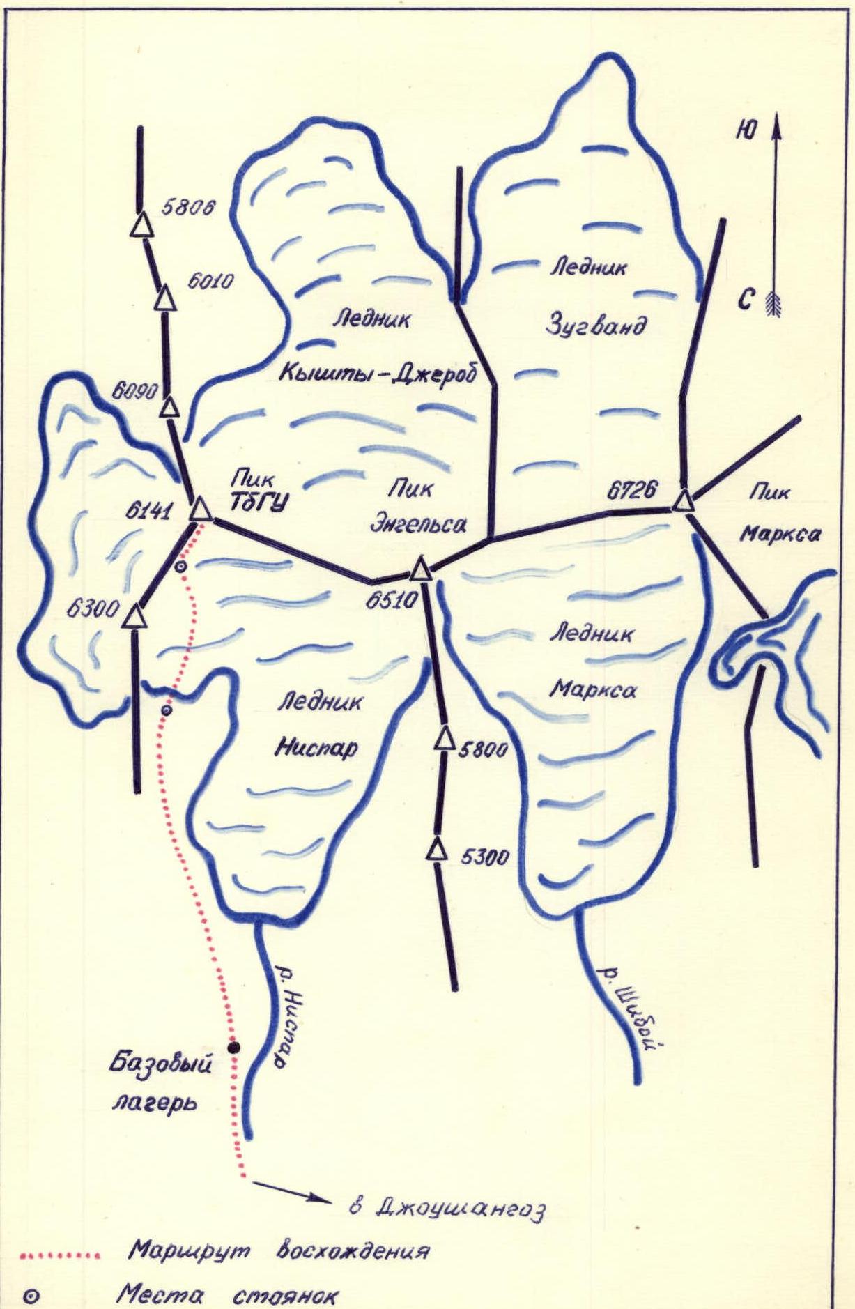
Ascent Area Map
Brief Description of the Approach to the Route
July 29, 1978. The group left the base camp, located on the right bank of the Nispar river, at 14:00. Through grassy slopes turning into scree to the foot of the right (orographic) part of the Nispar glacier in the Togu area. A bivouac was set up in a clearing by a lake, the eastern shore of which is framed by inclined slabs. The height is approximately 4500 m. From the base camp to the clearing by the lake — 5–6 hours.
| Date | Designation | Average steepness in ° | Length in m | Terrain characteristics | Section category | Condition | Weather | Rock pitons | Ice pitons | Bolted pitons |
|---|---|---|---|---|---|---|---|---|---|---|
| July 30, 1978 | R0–R1 | 10 | 1200 | scree slope | 1 | |||||
| R1–R2 | 20 | 1000 | glacier | 2 | ||||||
| R2–R3 | 35 | 800 | glacier | 3 | closed crevasses | Clear | via ice axe | |||
| R3–R4 | 15 | 30 | glacier | 1 | ||||||
| July 31, 1978 | R4–R5 | 35 | 400 | snow-ice ascent | 4 | closed crevasses | Cold | via ice axe | ||
| R5–R6 | 65 | 40 | rock ascent, internal angle | 4 | destroyed | 4 | ||||
| R6–R7 | 20 | 200 | scree ridge | 1 | very destroyed | |||||
| R7–R8 | 10 | 120 | rock ridge | 3 | jumble of black slabs | simultaneously | ||||
| R8–R9 | 10 | 90 | scree ledges | 2 | Clear | |||||
| R9–R10 | 50 | 60 | couloir | 3 | icy rocks | ledges | ||||
| R10–R11 | 45 | 80 | ice ascent | 4 | 3 | |||||
| R11–R12 | 40 | 120 | snow-ice ridge with rock islands | 4 | 4 | |||||
| R12–R13 | 80 | 40 | yellow gendarme | 4 | monolith | 7 | ||||
| R13–R14 | 15 | 80 | rock ridge | 3 | destroyed | ledges | ||||
| R14–R15 | 50 | 20 | ice ascent | 4 | 3 | |||||
| R15–R16 | 10 | 100 | snow ridge | 3 | firn | |||||
| R16–R17 | 60 | 40 | rock wall | 4 | icy rocks | 5 | ||||
| R17–R18 | 15 | 150 | snow ridge | 3 | firn | |||||
| R18–R19 | 45 | 30 | rock ascent | 3 | icy rocks | 4 | ||||
| R19–R20 | 15 | 600 | snow ridge | 3 | firn |
- Departure time — 7:40
- At the summit — 17:25
- Bivouac stop time — 21:00
- Climbing hours — 12 hours
Bivouac conditions: ice mulde. Good.
Brief Explanations for the Table
July 30, 1978. The group started the route at 7:00. The beginning is not difficult: scree slopes, then the Nispar glacier moraines. The glacier is gentle at the initial stage of the route. Then its steepness increases. Crevasses appear. Around 5000 m, the altitude begins to be felt. It's very hot. The air is heavy and stuffy. Because of this, the group's movement slows down. We overcome a steep snow-ice "face". Further, the glacier becomes gentler and leads us to an ice mulde, above which the North-Eastern ridge begins. Here we decide to set up a bivouac. A team of two goes to process the route. Sections (R0–R4) are passed and sections (R4–R6) are processed here. Height — 5300 m.
July 31, 1978. We depart at 7:40. The steps prepared yesterday by the "processors" team have frozen and hold very well. The snow-ice ascent is therefore overcome very quickly. To the left of the route — cornices! Section (R4–R5).
Further along the pre-arranged fixed ropes we overcome:
- the first gendarme of the ridge (R5–R6);
- we move simultaneously along the ridge;
- further, the ridge is a jumble of black slabs;
- movement is with careful alternate belaying (R6–R8);
- the 2nd gendarme of the ridge is bypassed on the right along the ledges (R8–R9);
- further — along an icy couloir (R9–R10), which leads to the base of the ice ascent (R10–R11);
- the ascent is overcome with front-point crampons and careful piton belaying.
Continuing to move up between the rock islands of the snow-ice ridge, we come to the base of the "Yellow" gendarme (R12–R13). This is the second key point of the route. After 40 m of difficult climbing — ascent to a section of destroyed ridge rocks (R13–R14).
Further:
- a steep ice "knife" (R14–R15), which is overcome with careful piton belaying;
- bypassing the cornices of the snow ridge, ascent to a rock island, covered in ice (R15–R17); belaying — via rock pitons;
- further, rock and snow sections of the ridge alternate;
- to the left, snow cornices constantly overhang — it is necessary to take this into account and move to the right of their break-off lines.
The ridge section leading to the summit represents three snow ascents with subsequent flattening (R17–R20).
The summit is a huge ice cornice. The cairn is located on the right on a rock island, a little below the highest point.
Descent — via the ascent route. From the summit through the mulde — 4.5–5 hours.
August 1, 1978. 7:00. We descend via the right part of the glacier. From the bivouac site to the camps under the route — 2.5–3 hours.
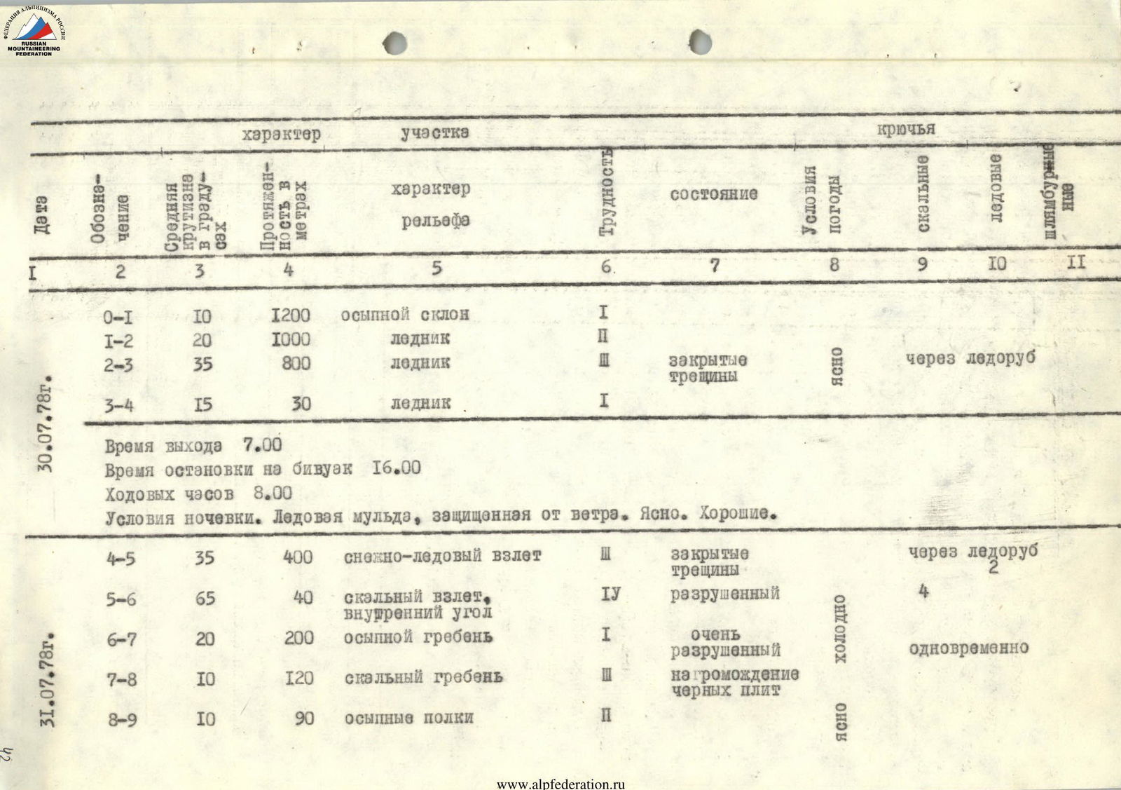
 Rock belt.
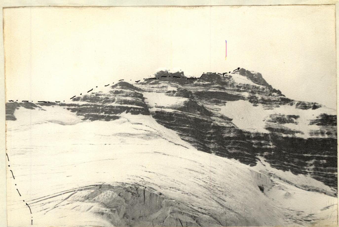
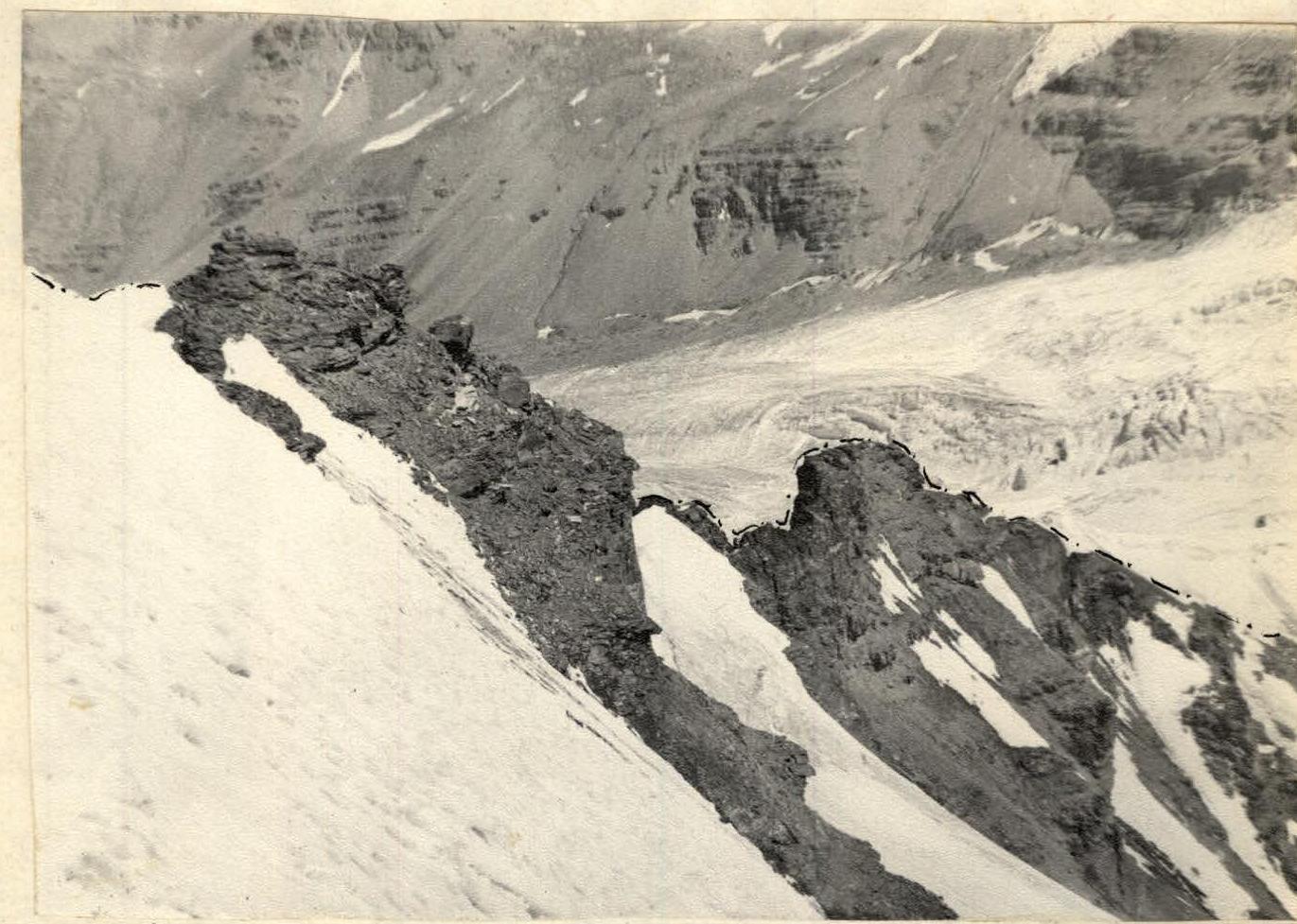
 1st gendarme. Sections R4–R6.
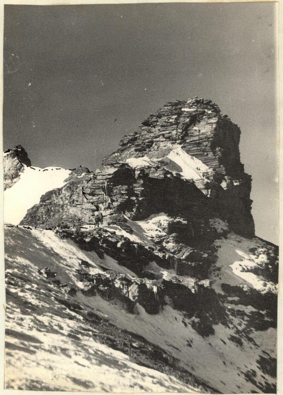
 Ridge section.