
Umarov's Report
On the ascent to the summit "Peak 5600" (approximately 2B category of difficulty) by a group of climbers from the MAI sports club
The summit "Peak 5600" is located in the Central Pamir region, in one of the northern ridges of the Peter the First ridge.
Diagram of the summit location. From a sporting perspective, this summit is of interest as an object for training and acclimatization ascents.
Characteristic features of this route, as well as many routes in this area, are:
- Unstable rock formations;
- Unpredictable weather conditions;
- High altitude.
The initial section of the route: the upper part of the Suloev meadow (absolute height 3900 m) - the boundary of the snow cover; it passes to the north on the left side of the couloir along a medium scree with an average steepness of approximately 30–40°. Further along the snowy slope, it becomes gentler at a height of 5100 m. At this height, near a large reddish rock (about 10 m in diameter), an overnight stay was organized for acclimatization purposes. The entire section of the route from the Suloev meadow to the reddish rock took 5 hours. The path then lies along a snowy ridge with a gentle slope to the northwest to the pre-summit rise. The time taken for this section was 1 hour. The pre-summit rise is a snowy slope with small rocky outcrops with a steepness of approximately 40–45°. Here, protection is possible using an ice axe. The time taken for this section and the descent to the reddish rock was 2 hours. The further descent follows the ascent route.
We request that the classification commission evaluate this route as a 2B category of difficulty.

ROUTE DIAGRAM to the summit "Peak 5600"
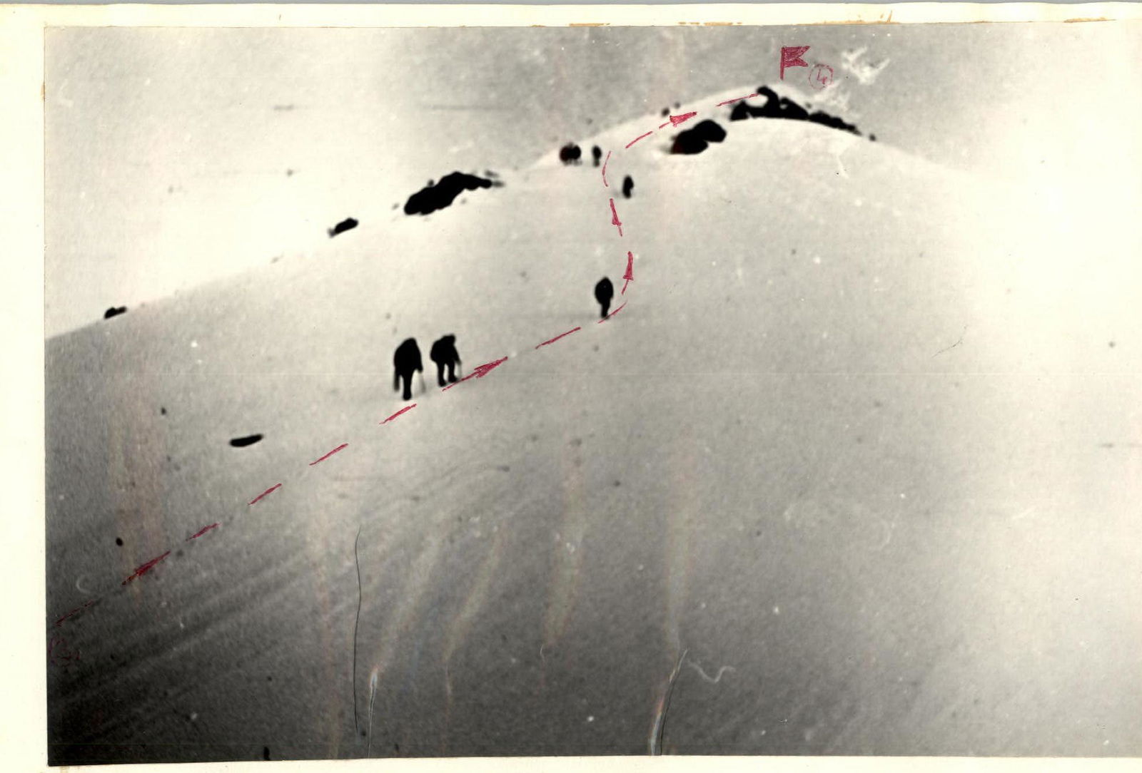
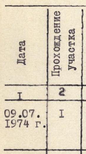
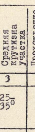
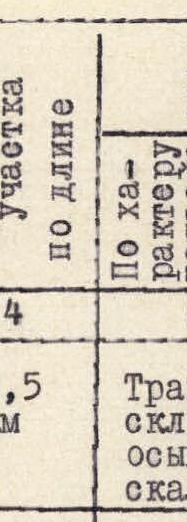
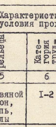
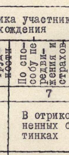
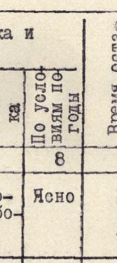
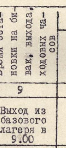


TABLE OF MAIN CHARACTERISTICS OF THE ASCENT ROUTE
Ascent route to "Peak 5600 m"
| Date | Passage of section | Average steepness of section | Passage length | Terrain characteristics | Category of difficulty | Method of movement and protection | Weather conditions | Time of bivouac stop, departure, and travel hours | Pitons driven: rock | Pitons driven: ice | Pitons driven: bolted | Overnight conditions |
|---|---|---|---|---|---|---|---|---|---|---|---|---|
| July 9, 1974 | R1 | 25–35° | 2.5 km | Grass slope, scree, rocks | 1–2 | In crampons | Clear | Departure from base camp at 9:00 | – | – | – | Overnight in base camp |
| July 9, 1974 | R2 | 20–25° | 1.5 km | Snow | 2 | In crampons, protection via ice axe | Clear | Arrival on snow at 12:00, reached bivouac site at 13:40 | – | – | – | Overnight on snow in a hollow near a reddish rock. Cloudy. |
| July 17, 1974 | R3 | 10–15° | 1 km | Snow | 1 | In crampons, roped, ice axe | Clear | Departure for the summit at 6:45 | – | – | – | |
| July 10, 1974 | R4 | 30–35° | 0.8 km | Snow | 2 | Roped, three paces, protection via ice axe | Clear | Departure for the pre-summit rise at 7:15. At the summit at 8:40 | – | – | – | |
| July 10, 1974 | R5 | Descent | Following the ascent route | – | – | – | Overnight in base camp |
Comments
Sign in to leave a comment