
Peak Agamal 5553 m (first ascent) Muzkol Pamir, Tajikistan
Creator: Judyta Tadeusz Dzięgielewski, e-mail: jtdziegielewski@gmail.com, photos: Judyta Tadeusz Dzięgielewski (JTD), Jerzy Kędra (JK)
Basic Information
Location: Tajikistan, Muzkol Pamir, peak 5553 m (according to Soviet military maps), north face, 38° 32′ 12.0″ N 73° 28′ 28.5″ E Climbing dates: 4–5 September 2019 Expedition dates: 10 August – 24 September 2019 (car trip through Central Asia1) Climbers: Jerzy Kędra, Judyta Tadeusz Dzięgielewski (Poland) Difficulties: 3A/3B (Russian grade), D (alpine grade), WI 2/3 (hard ice2, 40–60 degrees, a few short passages up to 70–80 degrees on the ridge), about 20 rope lengths (height about 1100 m, elevation gain about 650 m), including 3–4 lengths of simultaneous climbing. Descent: via the same route with belaying and rappelling from Abalakov stations.
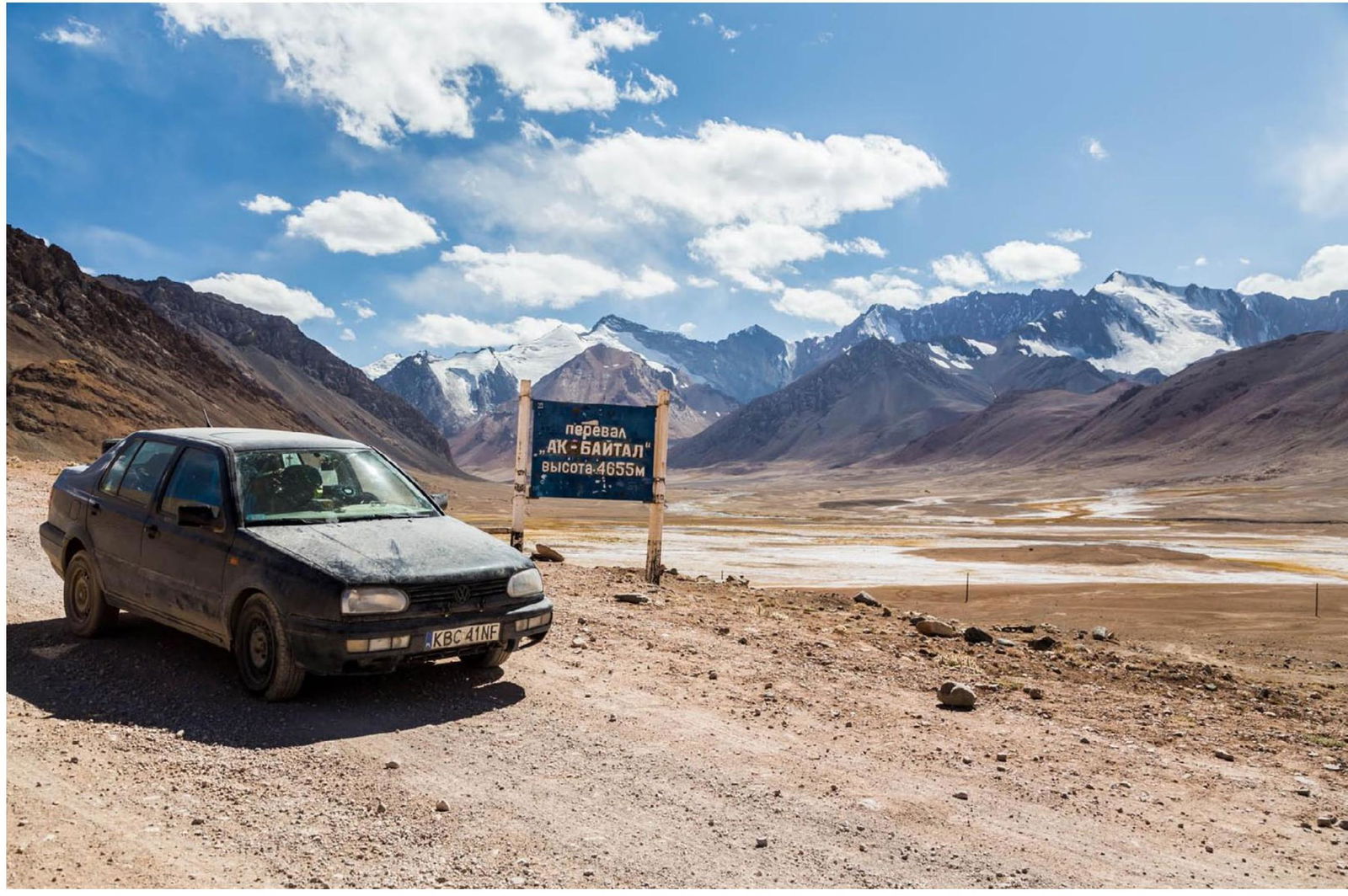
The peak caught my attention two years ago when I photographed it near the Ak-Baital pass on the Pamir Highway. Like most peaks in this area, it is not very high and lies in a region rarely visited by climbers—the Muzkol Pamir. Moreover, it is located in a remote area, not in the main regions of interest to climbers, in the southeastern part of the North Muzkol range, west of the Ak-Baital valley. I reviewed all available literature, including Russian-language sources, for any information on possible ascents or attempts. I also searched the internet. I corresponded with Vladimir Biryukov, a well-known researcher, geographer, and cartographer living in Kyrgyzstan, one of the main authors of the Soviet military maps of the Pamir and Tian Shan. It turned out that the mountain was (with 99% probability—"you never know") still "virgin," previously unclimbed3. I shared this with an old friend, and we began our journey through Central Asia. After three weeks of wandering, we ended up in the Ak-Baital river valley.
Route
31 August. We left our car near the Kyrgyz shepherd Akylbek's hut at the lower part of the Ak-Baital valley and went up an unnamed stream in a side valley leading to the peak, seeking a good spot to establish a base camp and gain some acclimatization and reconnaissance of the wall. Eventually, we decided not to climb straight through the center of the wall as initially planned. There were many crevasses and seracs, so we chose a couloir in the orographic right part of the wall—steeper but safer. We reached the glacier, descended to Akylbek's hut, and set up a tent.
1 September. Rest day.
2 September. We went back to the glacier and set up a "base camp" (we didn't have a tent, just mattresses and sleeping bags).
3 September. Rest and acclimatization day. We walked on the glacier to the foot of the wall.
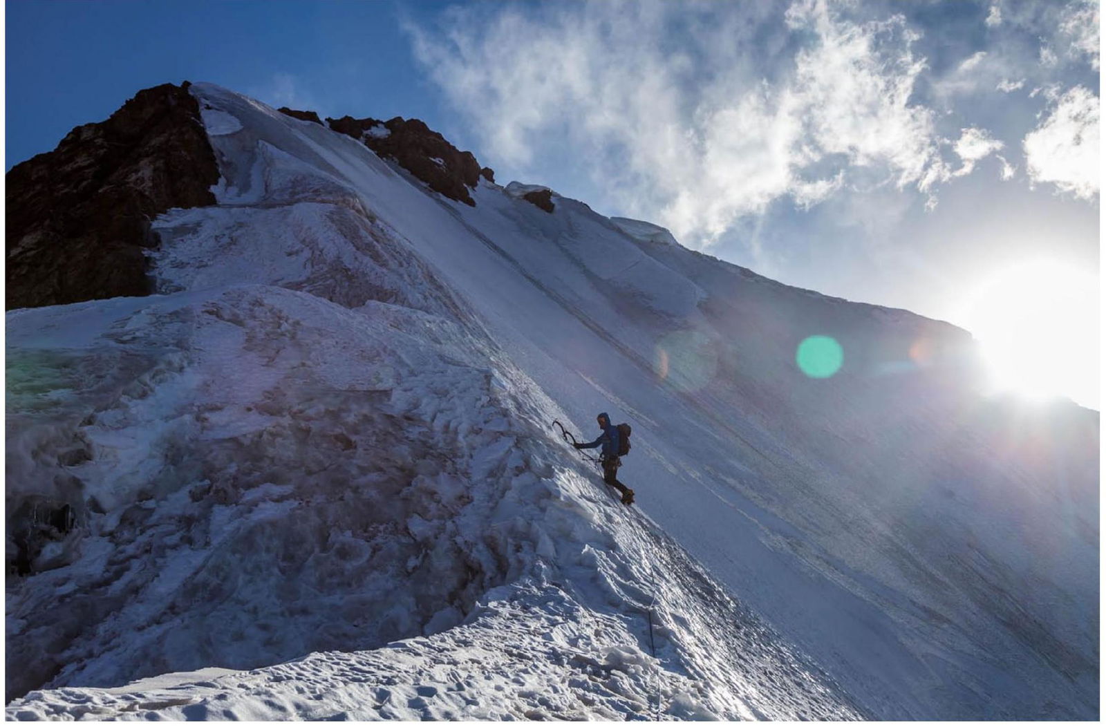
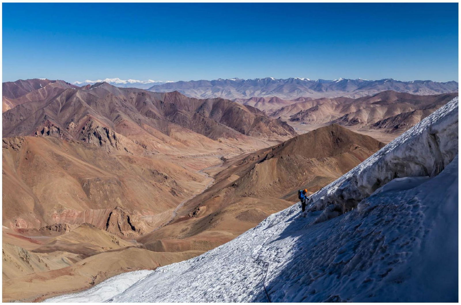
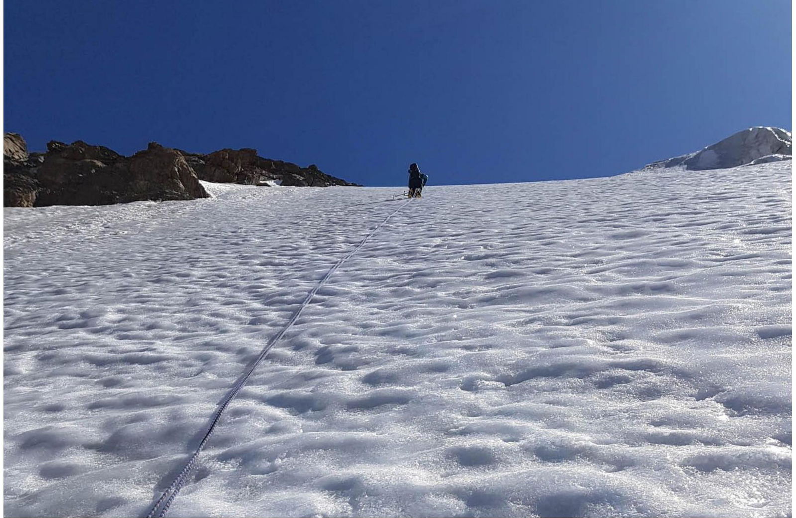
4 September. We woke up at 4:00. Around 8:00, we started climbing the ice couloir: – initially very steep (up to 60°), – then more gentle (about 40°), – then we traversed a long diagonal crevasse (simultaneous, not difficult), – and then to the eastern ridge.
Around 18:00, we reached the ridge, which turned out to be not as easy as expected: – mostly 40–50°, – short sections up to 60–80°.
After climbing the final meters in a steep (70–80°) but short ice couloir, we reached the summit at 20:20.
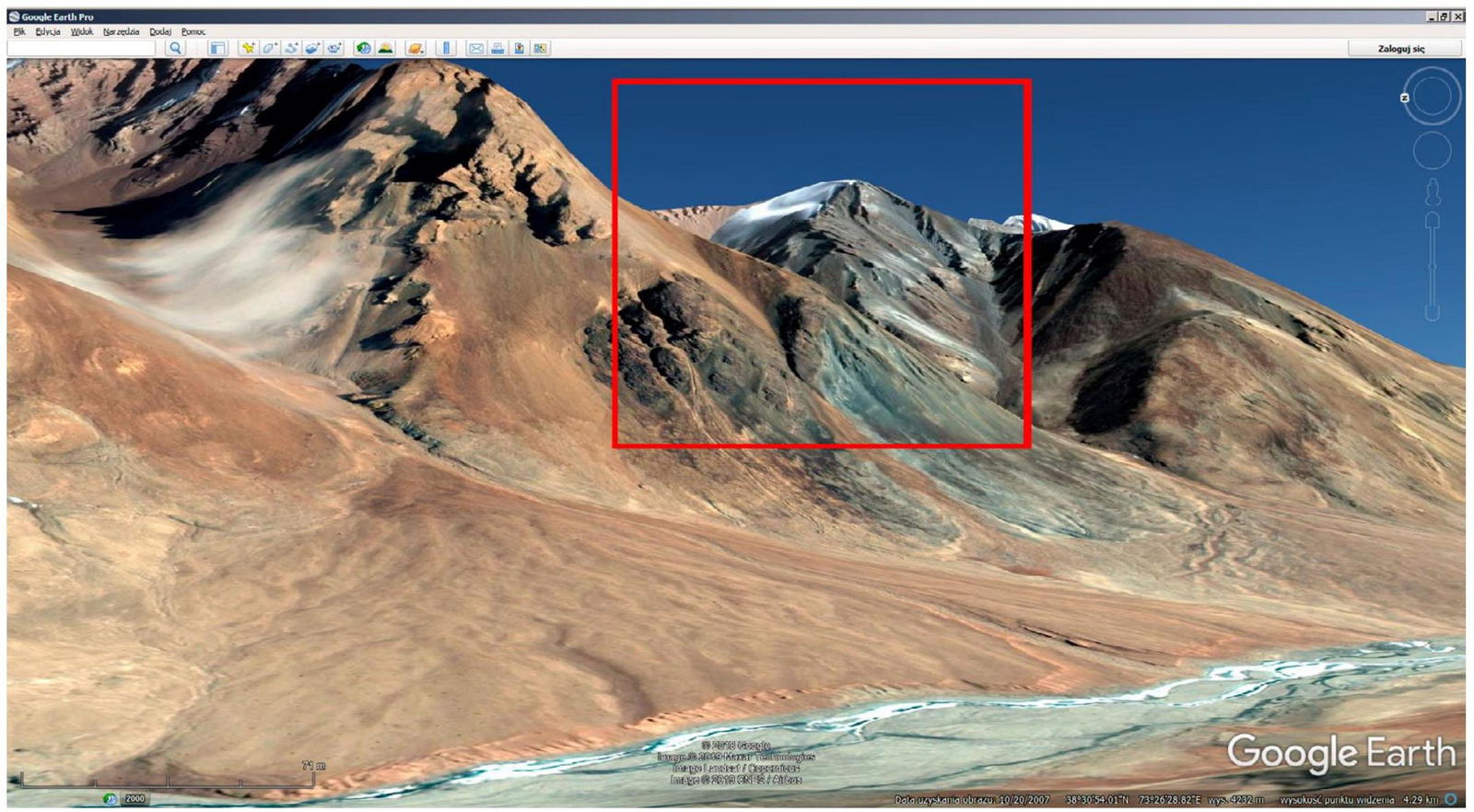
On the summit, we found no human footprints. Characteristics of the summit: – rocky, – broad, – double (a few meters apart), – snow-free, – the southern side is also rocky and crumbly, – also completely snow-free.
Strong wind and low temperature (it was already dark) forced us to descend, and we bivouacked 50 m below the summit in a crevice on the eastern ridge. The night was really cold and windy. We camped without a tent, sleeping bags, or even mattresses, which we had left at the base camp; we used only NRC foil.
5 September. In the morning, we began our descent, reaching the base camp around 17:00. Since we had only one 60 m rope (our mistake: we didn't bring another—looking at the photo I took from a distance two years earlier, we misjudged the climb as very easy and expected to use the rope mainly for glacier travel), we rappelled from Abalakov stations only on some of the steepest slopes.
6 September. We descended to our car at Akylbek's hut.
Naming
We would like to name the mountain Peak Agamal in honor of the abbreviated names of our beloved wives and also because it sounds like a local name.
Photos
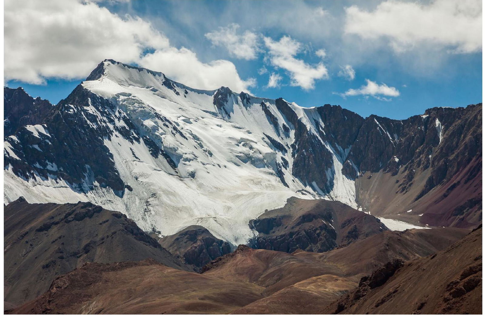
Peak Agamal 5553 m (north side), seen from the Pamir Highway about 3 km northwest of the Ak-Baital pass. This photograph, taken in 2017, inspired the idea of the ascent (JTD, 2017).
From the glacier, Peak Agamal (JTD, 2019).
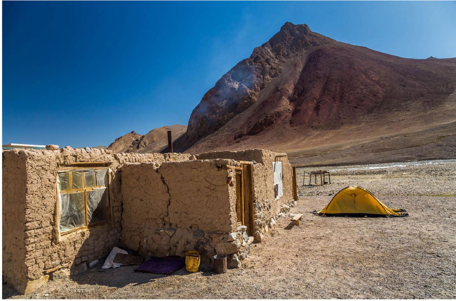
Our tent at Akylbek's hut (JTD, 2019).
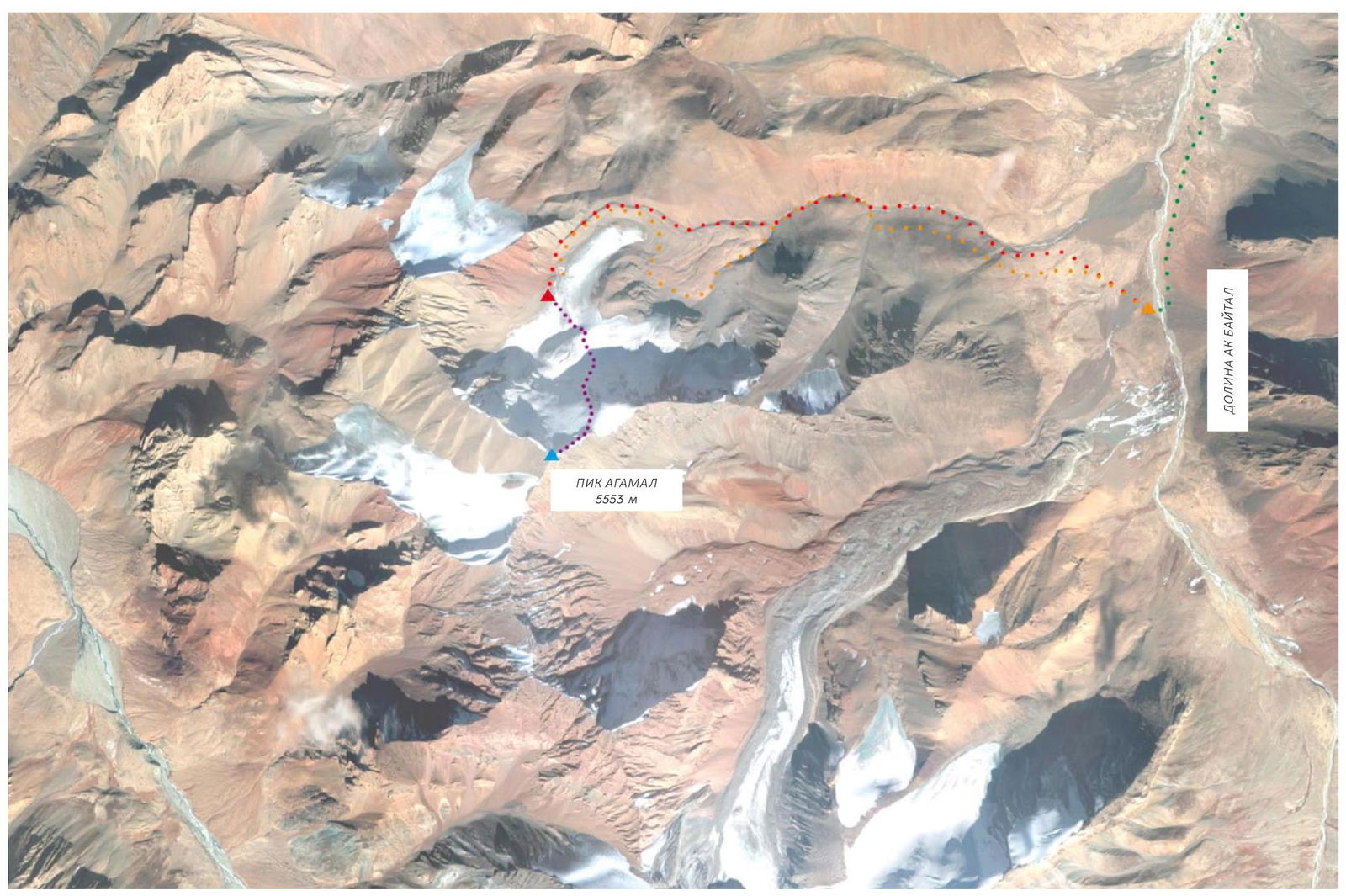
Route by car through the Ak-Baital river valley (green) to Akylbek's hut, approach to base camp (yellow/red), ascent (purple), summit (blue) (screenshot from Google Earth Pro).
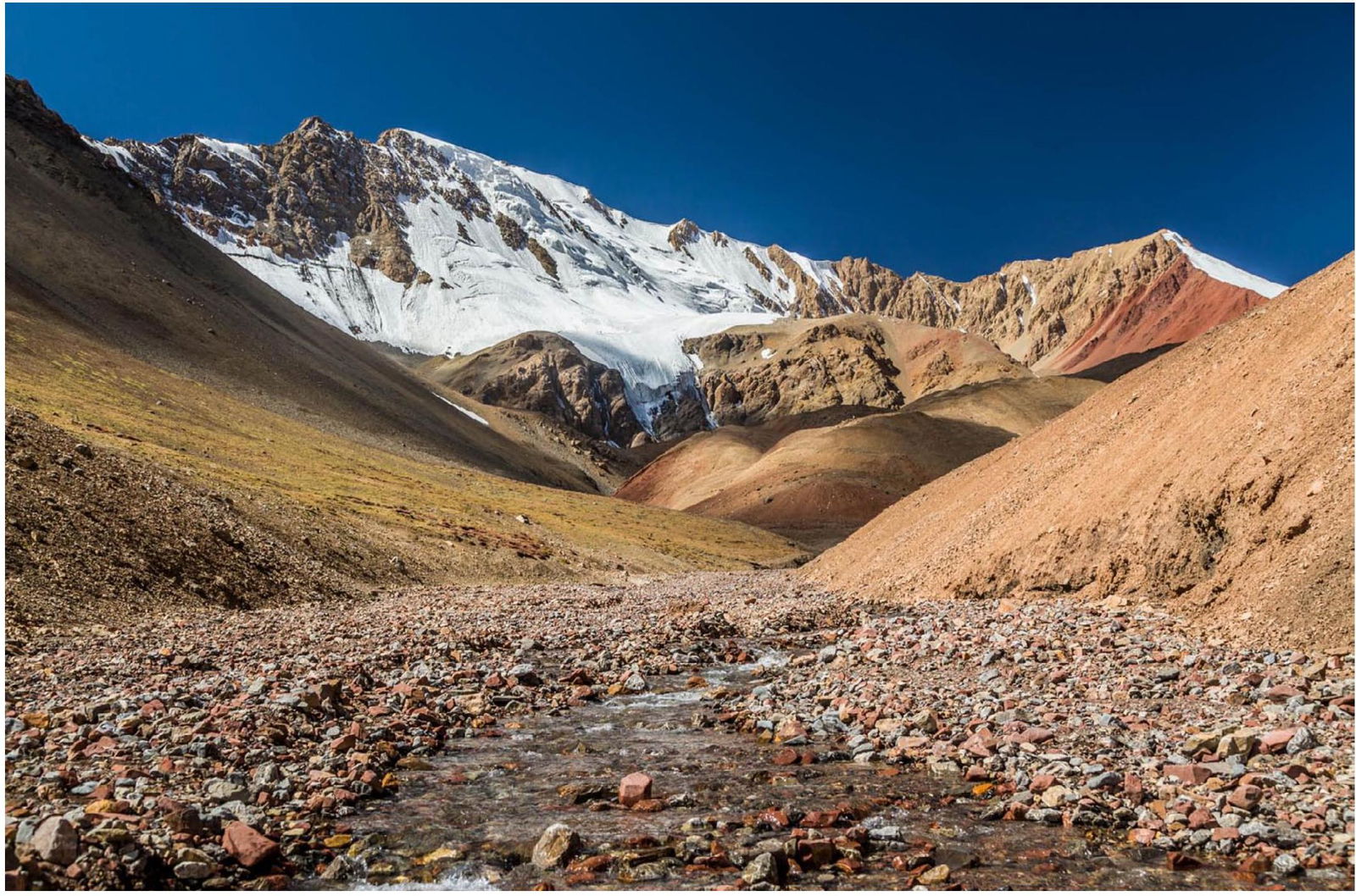
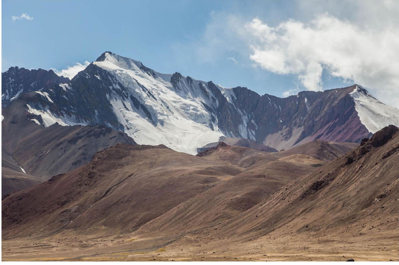
Peak Agamal 5553 m (left), as seen from the side stream valley (JTD, 2019).
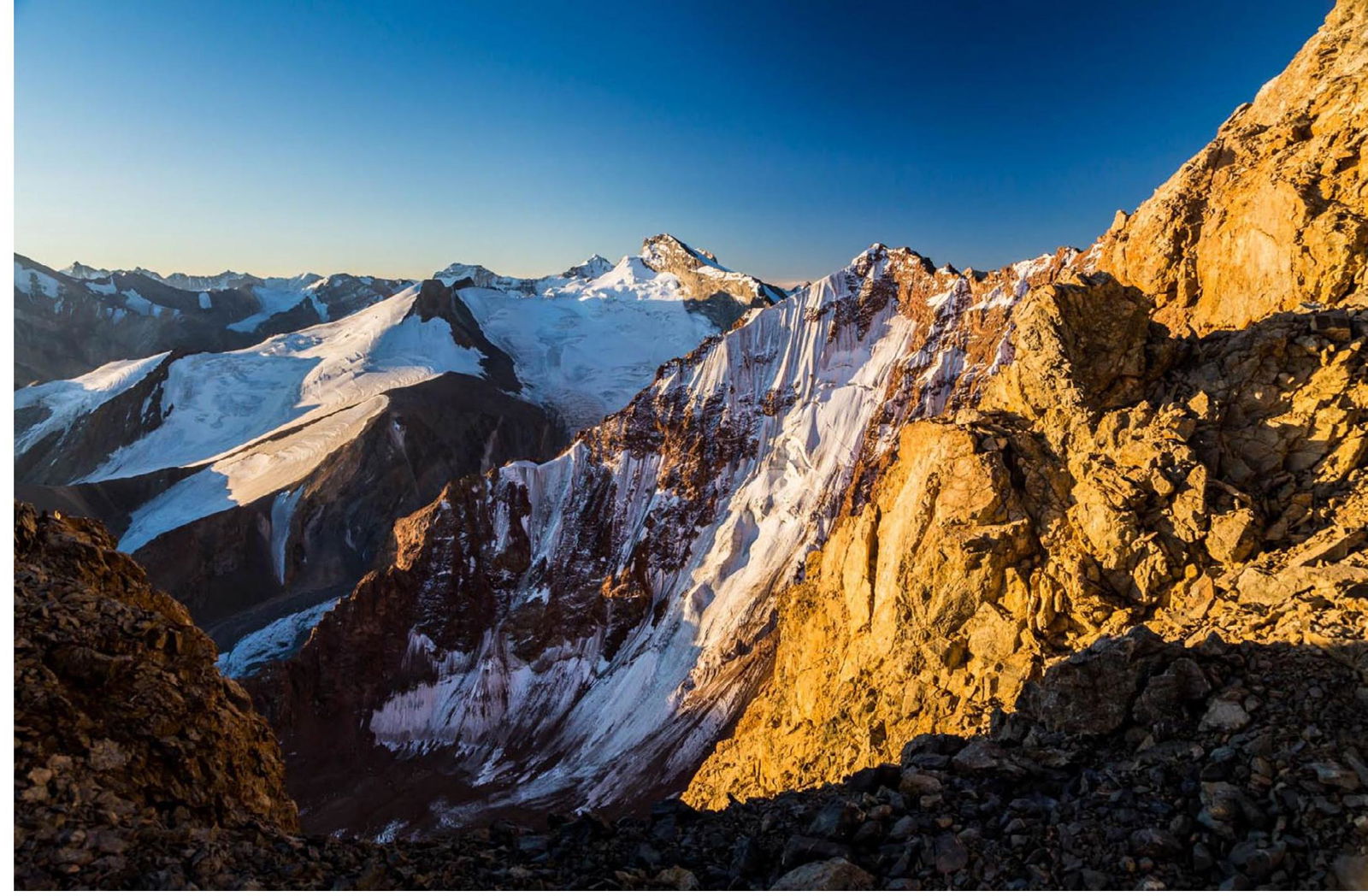
J. Kędra on the lateral moraine, panoramic view of the north face of Peak Agamal in the background (JTD, 2019).
J. Kędra in the morning of 3 September at the "base camp" on the lateral moraine (JTD, 2019).
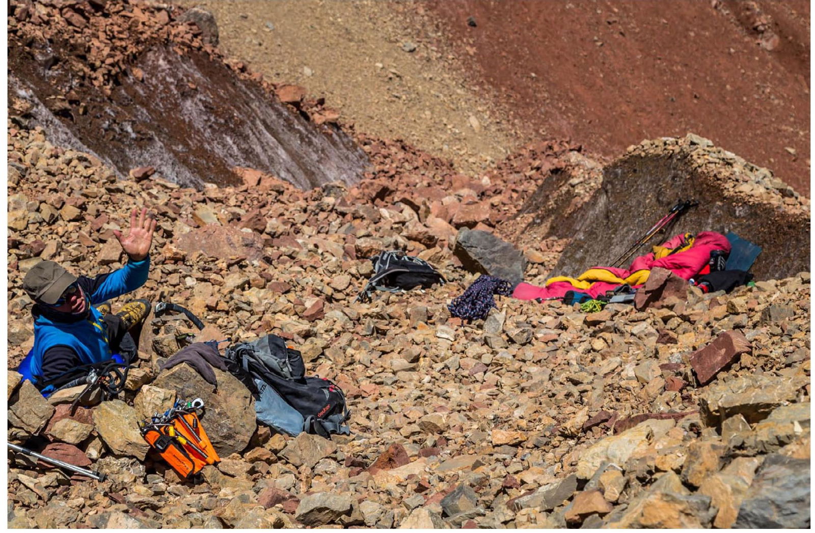
J. Kędra at the "base camp" (JTD, 2019).
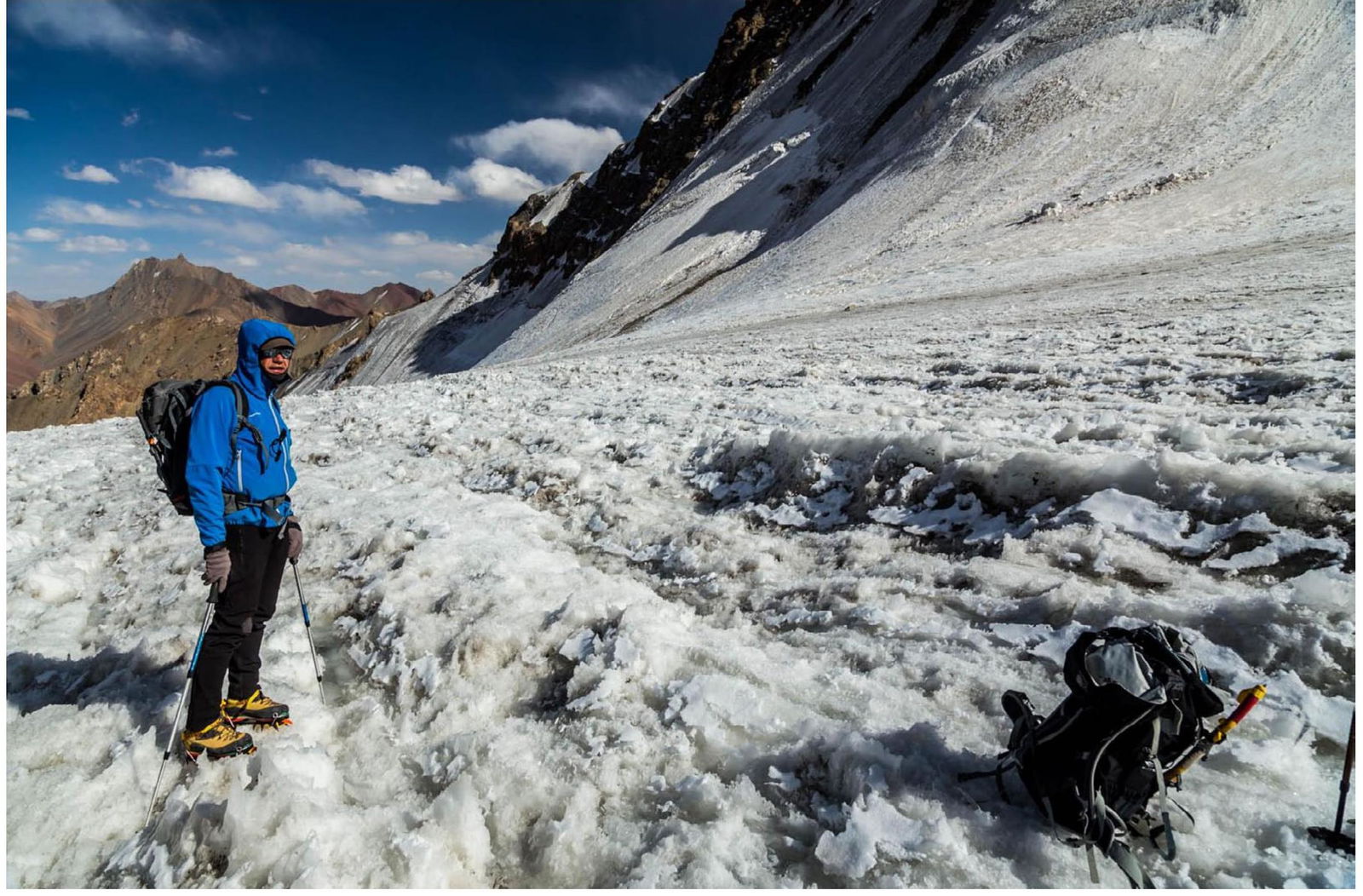
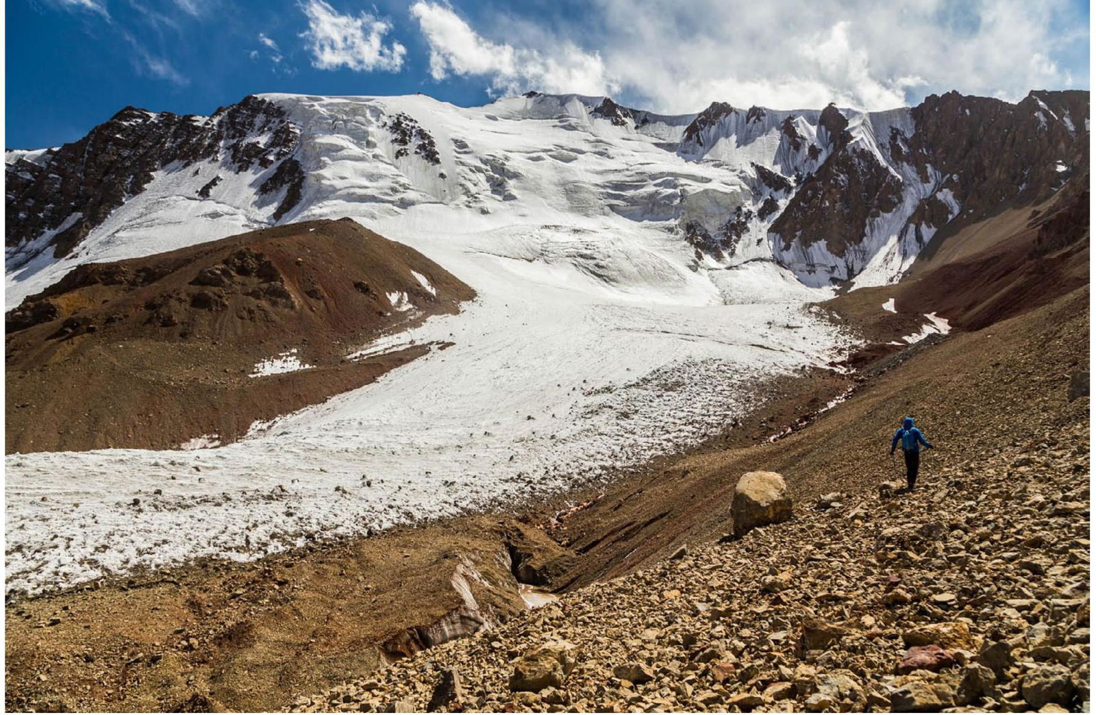
J. Kędra on the glacier (JTD, 2019).
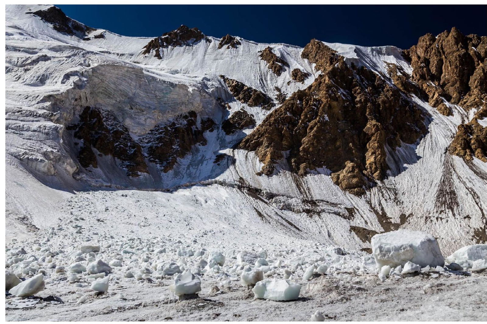
Serac fallen on the glacier, the leftmost (orographic) part of the wall (JTD, 2019).
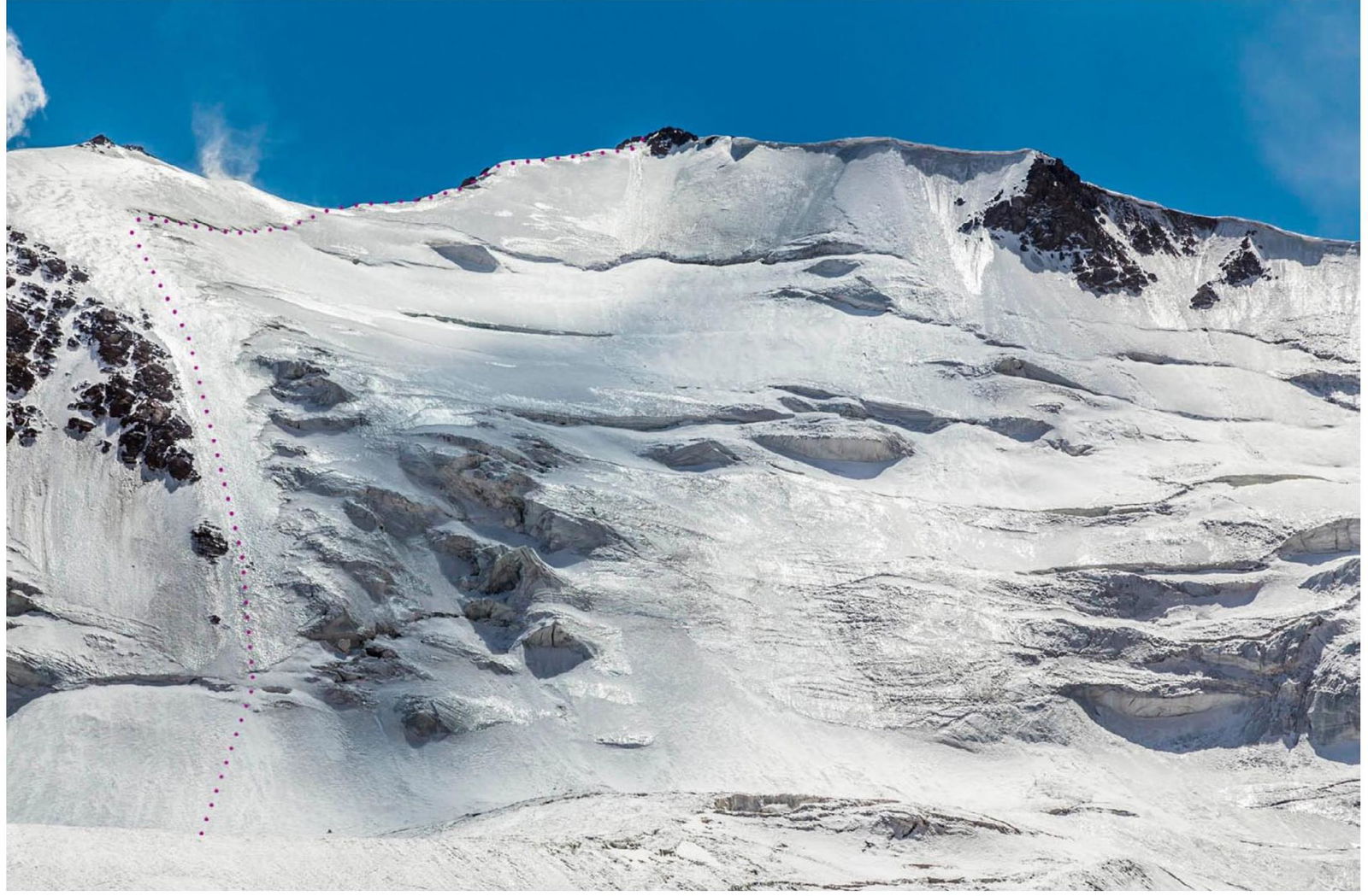
North face of Peak Agamal 5553 m with the ascent route marked (JTD, 2019).

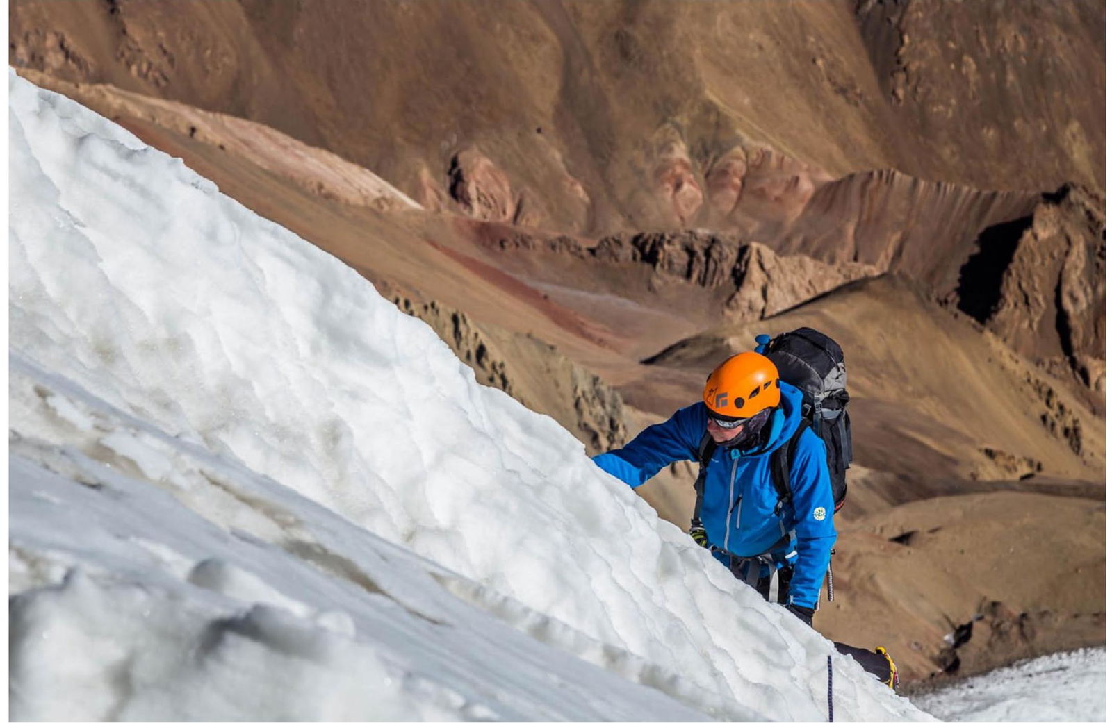
J. Kędra entering the ice couloir (JTD, 2019).

J. T. Dzięgielewski in the ice couloir, glacier in the background (JK, 2019).
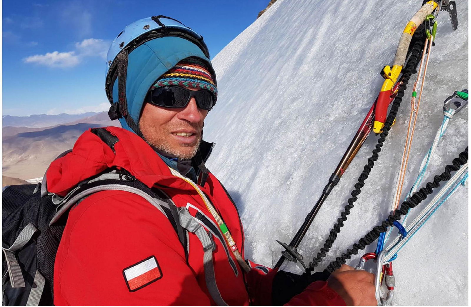
J. T. Dzięgielewski in the ice couloir (JK, 2019).
J. Kędra on the eastern ridge (JTD, 2019).

J. Kędra on the summit at around 20:20 (JTD, 2019).
Panoramic view from the summit to the southwest, the Muzkol (Zartosh) valley visible on the right (JTD, 2019).
Panoramic view from the summit to the south (JTD, 2019).
Peakfinder
Support • About • Peakfinder App
38°32′12″N 73°28′28″E
Facebook | Twitter
List
- English
- Deutsch
- Français
- Italiano
- Hindi
Facebook | Twitter
Panoramic view from the top to the southwest (screenshot from PeakFinder.com).

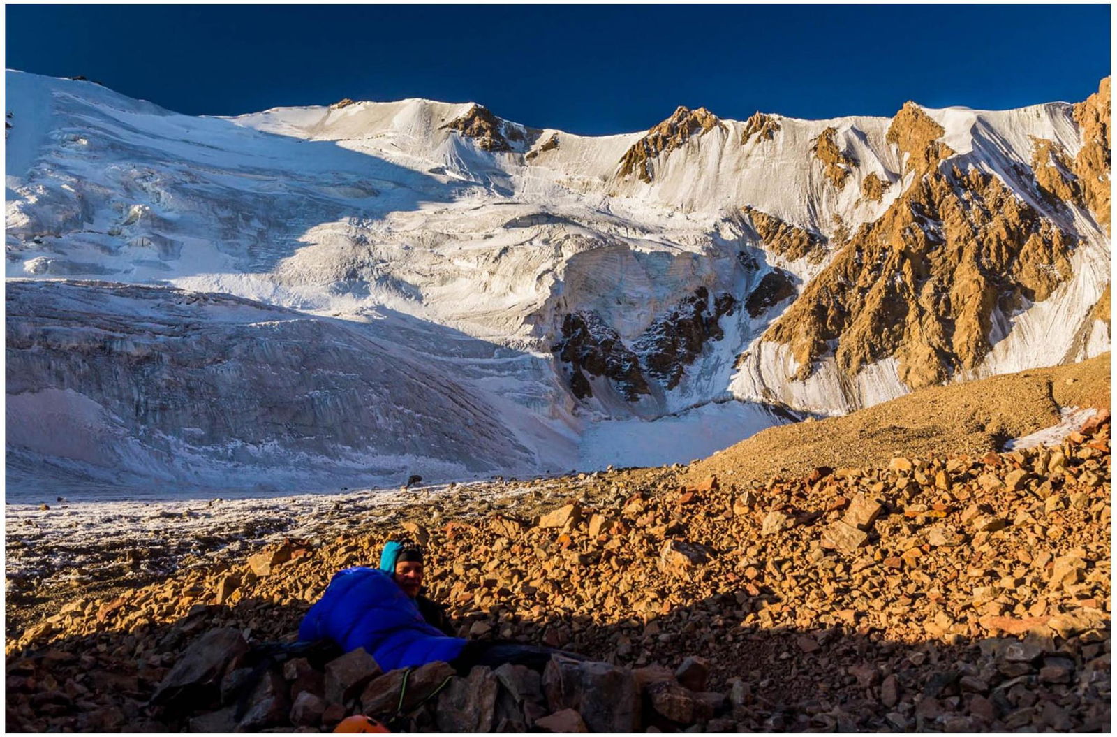
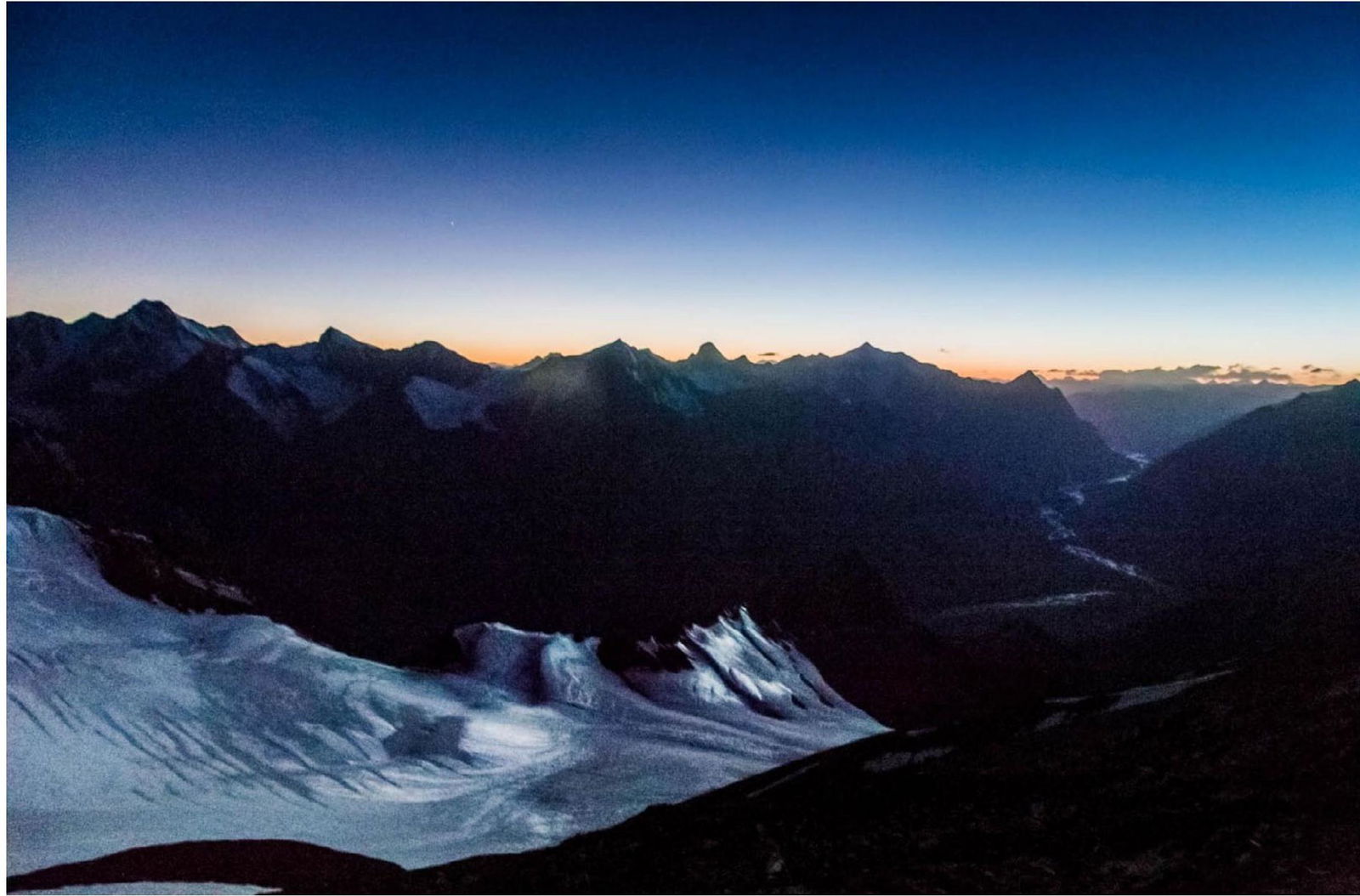
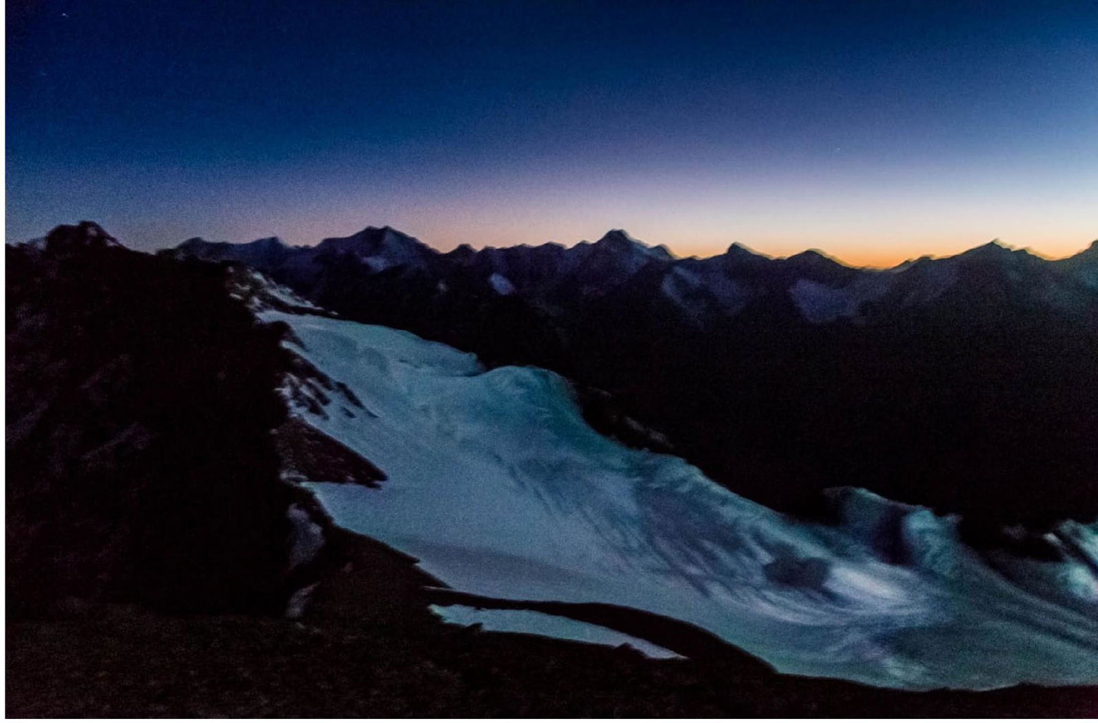
Morning after a cold night in a crevice about 50 m below the summit. The summit is visible as the second rock from the left with an ice couloir leading to it (JTD, 2019).
Peak North Muzkolsky on the right and Peak Gippsky on the left, viewed from the bivouac below the summit (JTD, 2019).
View to the southeast from the bivouac below the summit, neighboring peaks of the Ak-Baital range in the far left, first explored by V. S. Yatsenko's expedition in 1940 (JTD, 2019).
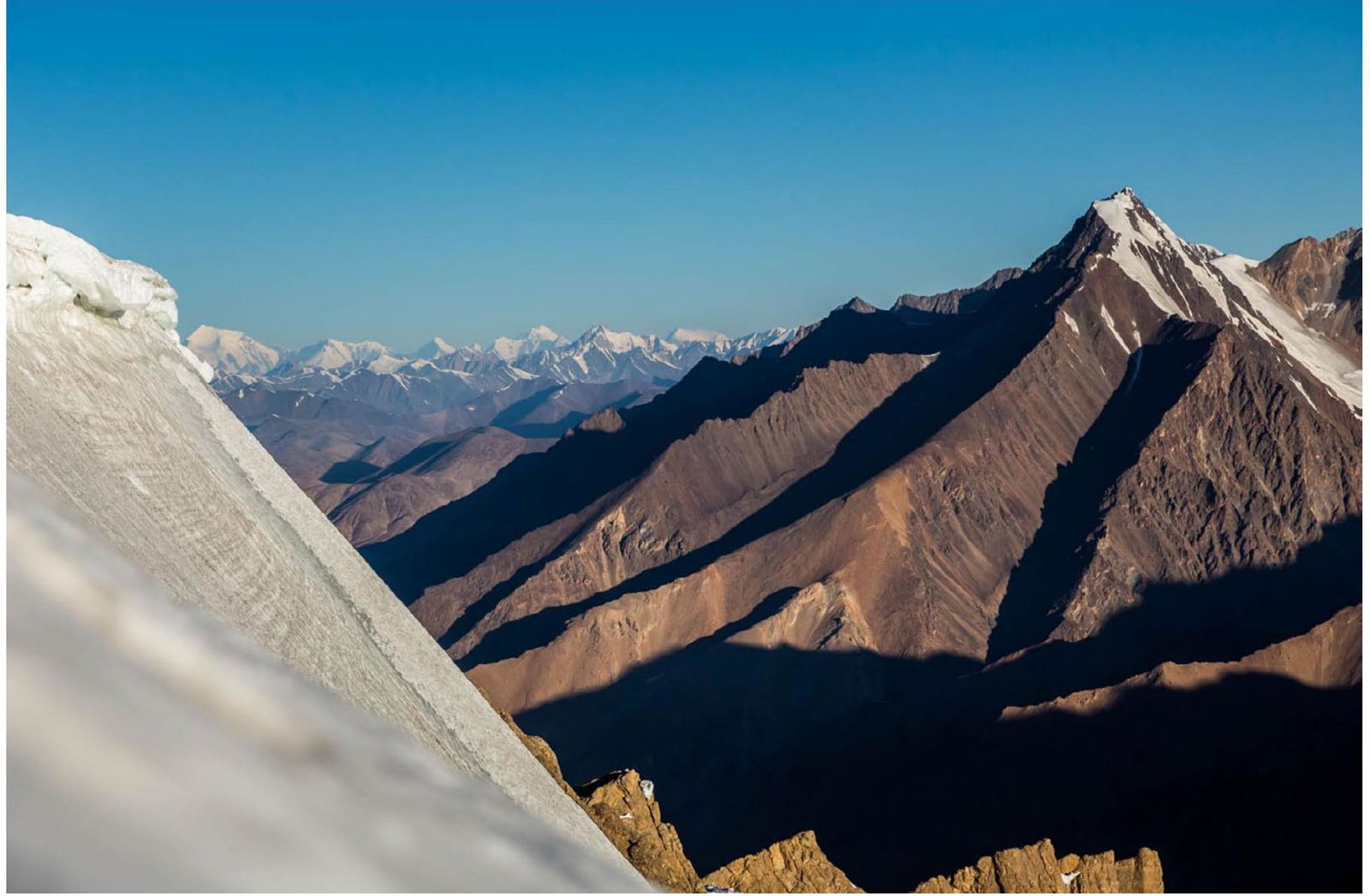
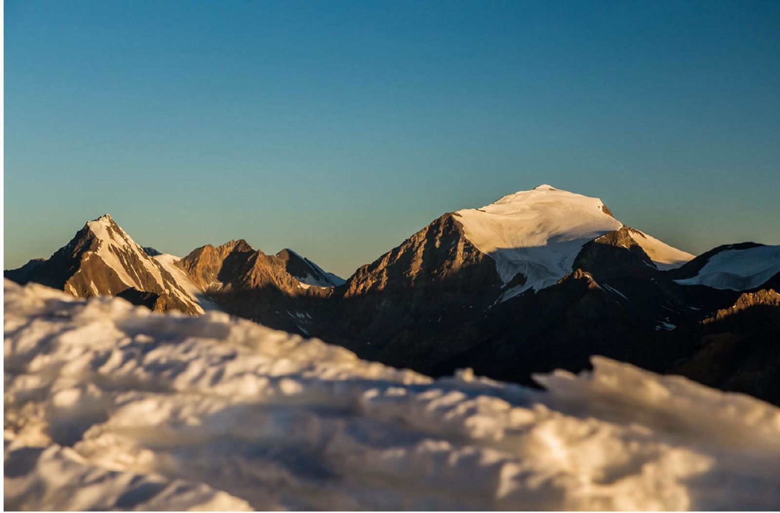
Distant view (about 135 km) to the northwest from the bivouac, on the horizon: – Ismoil Somoni (formerly Peak Communism)—on the far left; – Peak Korzhenevskaya—in the center; – Peak Gippsky—on the right. (JTD, 2019).
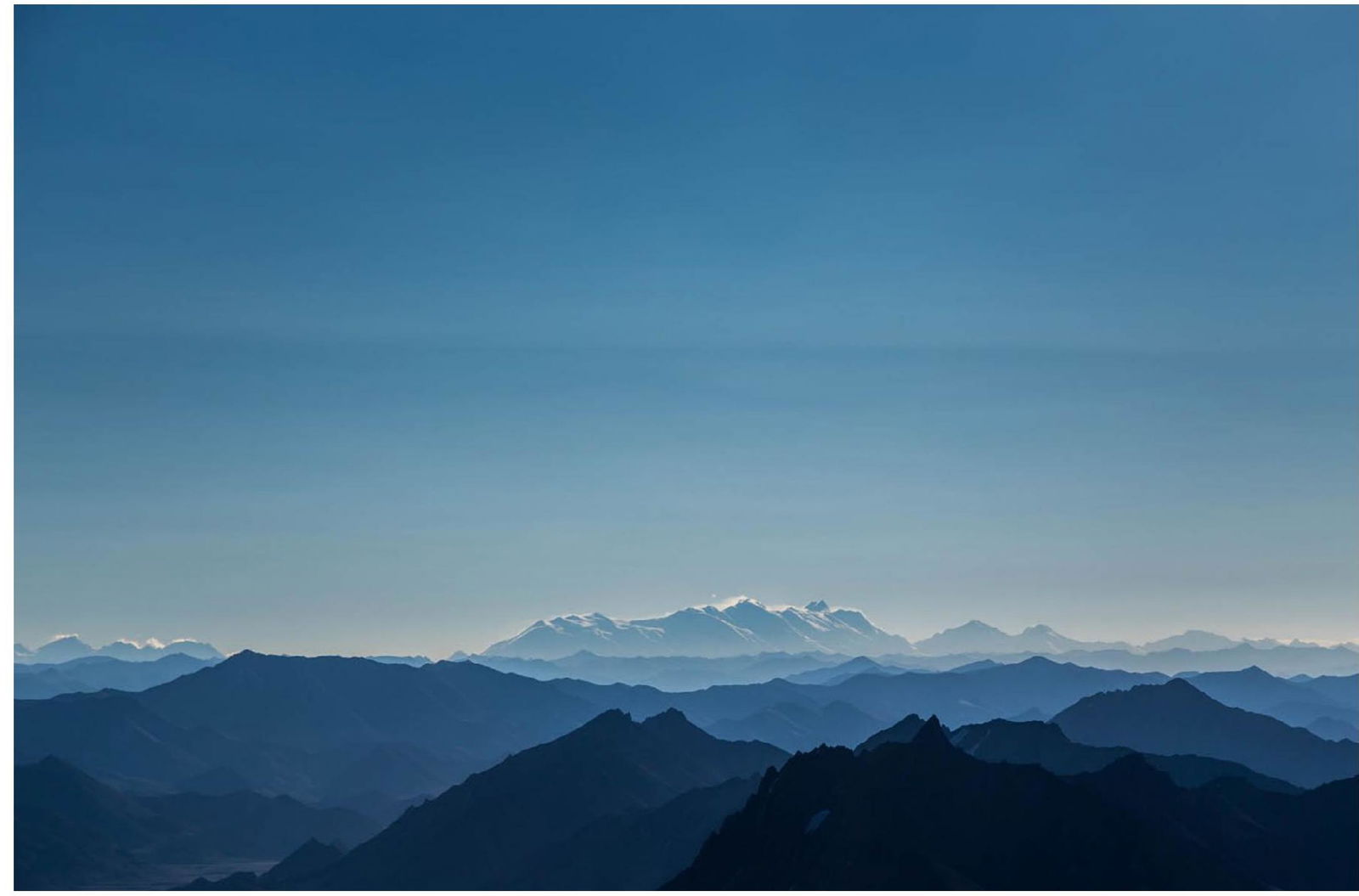
Distant view (about 157 km) to the east from the bivouac—Kongur Shan (East Pamir, Uighur, China) (JTD, 2019).

Distant view (about 142 km) to the east from the bivouac—Muztagh Ata (East Pamir, Uighur, China) (JTD, 2019).
J. Kędra descending (JTD, 2019).

J. T. Dzięgielewski on a traverse along a crevasse during descent, summit visible in the background (JK, 2019).
J. Kędra on a traverse along a crevasse during descent, peaks Kurumdy and Zaria Vostoka visible on the horizon to the left (JTD, 2019).
J. T. Dzięgielewski descending from an Abalakov station in the ice couloir (JK, 2019).
View of the Ak-Baital valley from the Pamir Highway, Peak Agamal visible on the right (JTD, 2019).
Appendix 1. Peak Agamal and Peak Baffy

Terraces and ridge partially obscuring the view of Peak Baffy, marked on a photo from the British report http://aac-publications.s3.amazonaws.com/aaj-13201213356-1437180039.pdf↗.
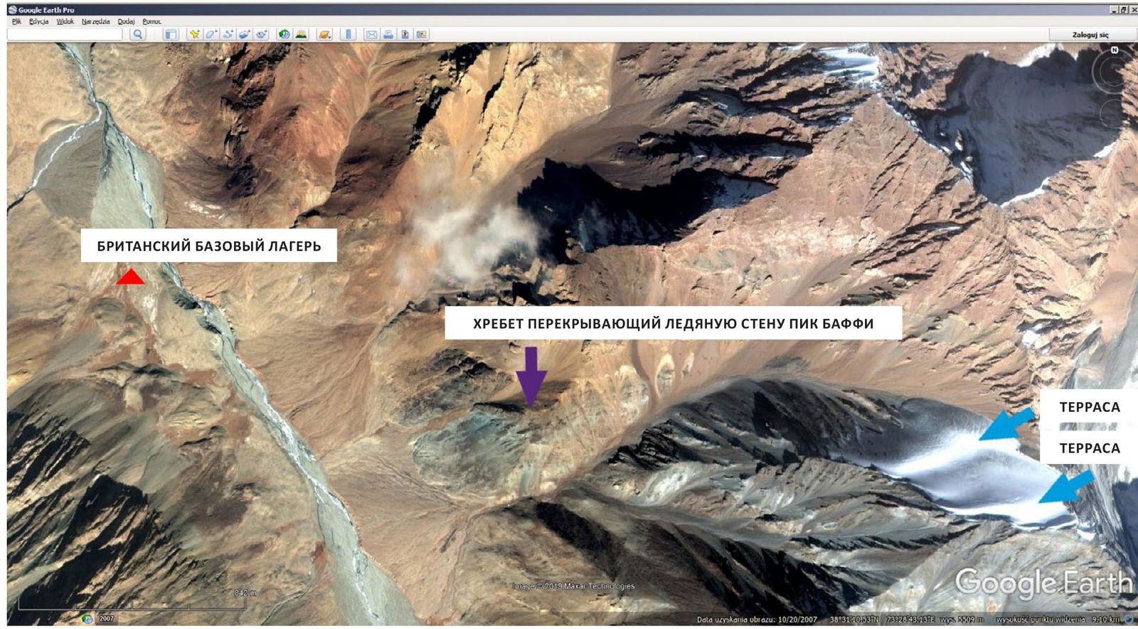
Terraces and ridge partially obscuring the view of Peak Baffy, on GEP screenshot.
Peak Baffy as seen from the British base camp 38°31′0.30″N 73°26′12.8″E, according to Appendix 3 in the British report (GEP screenshot).

Peak Agamal as seen from the Zartosh (Muzkol) river valley (38°32′46.0″N 73°24′28.7″E) about 3.8 km downstream from the British base camp. This is the closest spot from the British base camp where Peak Agamal can be seen from the Zartosh valley (GEP screenshot).
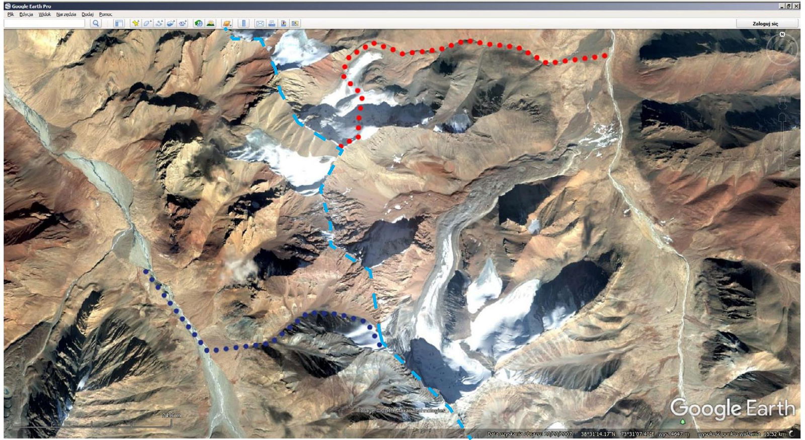
Most likely approach: – from the British base camp in the Zartosh (Muzkol) valley to Peak Baffy (dark blue); – from the Polish camp in the Ak-Baital valley to Peak Agamal (red); – main North Muzkol ridge (light blue), marked on GEP screenshot.
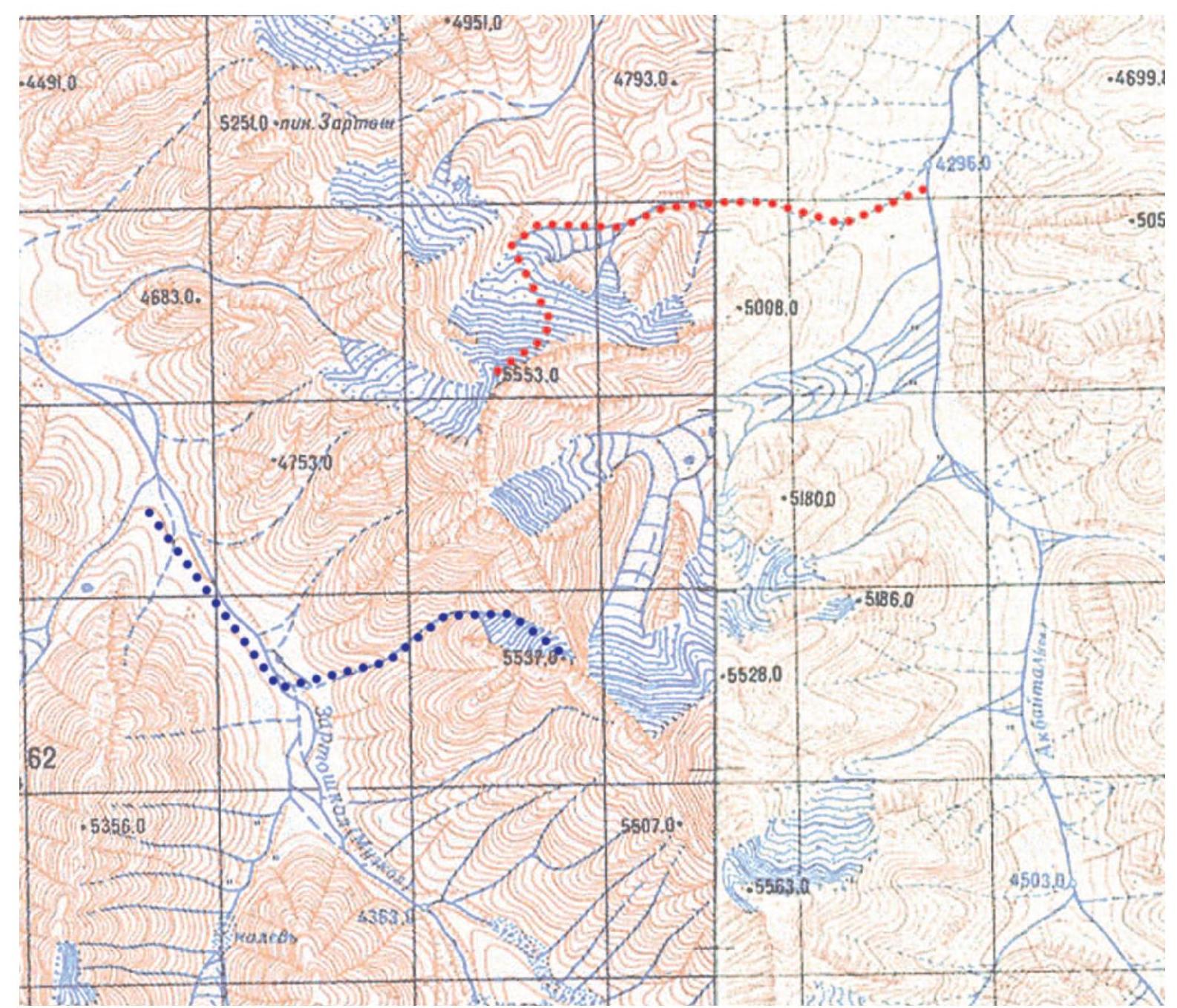
Most likely approach: – from the British base camp in the Zartosh (Muzkol) valley to Peak Baffy (dark blue); – from the Polish camp in the Ak-Baital valley to Peak Agamal (red), marked on Soviet military maps.
Footnotes
-
Since we were driving our own car, the time for the ascent was limited—the Tajik customs give only 15 days of temporary import for the entire route through Tajikistan; we entered Tajikistan on 24 August 19__ from the west. ↩
-
Possibly, if we had climbed a few weeks earlier, it would have been mainly firn rather than hard ice. ↩
-
AAJ publication http://aac-publications.s3.amazonaws.com/aaj-13201213356-1437180039.pdf↗ linked from http://publications.americanalpineclub.org/articles/13201213356↗ describes (very briefly) the ascent by the Huws (Vincent) team to the 5553 m summit (Peak Baffy) in the Muzkol Pamir in 2014. However, after a detailed comparison of available materials, I noticed that the British team likely made a mistake in locating the two peaks—the peak marked on Soviet military maps (from which the group likely took the height) at 5553 m (38° 32′ 12.0″ N 73° 28′ 28.5″ E https://goo.gl/maps/7kWcde45NREqLHFW9↗) with a peak about 3 km to the south (38° 30′ 38.2″N 73° 28′ 55.2″ E https://goo.gl/maps/hZohEg4KDxgZJRVd7↗), marked on Soviet military maps at 5537 m and about 5480 m according to Google Earth Pro (GEP). I compared: – the photograph from the publication (view of the upper part of the ice wall of Peak Baffy from the British base in the Zartosh-Muzkol valley) with our photographs (completely different view of the north face of Peak 5553; there is no snow on the southern wall) and GEP screenshots (both satellite and base)—there are two terraces on the ice wall visible on both British and GEP photographs, and the left, rocky part of the ridge on the photograph also matches the GEP view; – on the photographs taken both by the British and on GEP screenshots from the British base camp, the ice wall of Peak Baffy is partially obscured by a ridge descending southwest from the next peak located less than 2 km to the north (approximately 5650 m according to GEP). I also considered the terrain—the layout of the Zartosh (Muzkol) and Ak-Baital river valleys and their side branches—in the context of the approach to the ice walls of both peaks from both the Zartosh and Ak-Baital valleys (the transition between the valleys is complicated and leads through a high ridge; the Zartosh valley, lying south of the main ridge, is not visible from the north face of the proper Peak 5553 (and is only visible from above), and Peak Baffy drops on the Ak-Baital valley side (to the east) with a huge rocky wall over half a kilometer high, at the foot of which lies a large glacier about 4 km long. In summary: – Peak Baffy is the peak marked at 5537 m on Soviet military maps and is located 3 km south of Peak 5553 m; – access to both ice walls is from two different main valleys separated by the main North Muzkol ridge. See Appendix 1, "Peak Agamal and Peak Baffy," for illustrations. ↩