ASCENT REPORT
I. Technical Class.
2. South-West Pamir, Ishkashimsky ridge.
3. Peak Kiik-Bal-Khana, height 5100 m, combined route, via South ridge.
4. Proposed complexity category — 3B. pr. 560, p. 3 18/3–86
5. Height difference 500 m, average steepness 40°.
6. Rock pitons driven 10/0, chocks 4/0, no ice or bolt pitons.
7. Climbing hours — 8.
8. No overnight stays.
9. Leader: Ponomarev D.S., 1st sports category
Participants: Sukhova M.E., 1st sports category, Demidenko O.G., 1st sports category, Vodin P.I., 1st sports category.
10. Team coach: Razumov Yuri Mikhailovich, Master of Sports.
11. Departure to the route June 26, 1985, return June 26, 1985.
12. Leningrad Sports Committee.
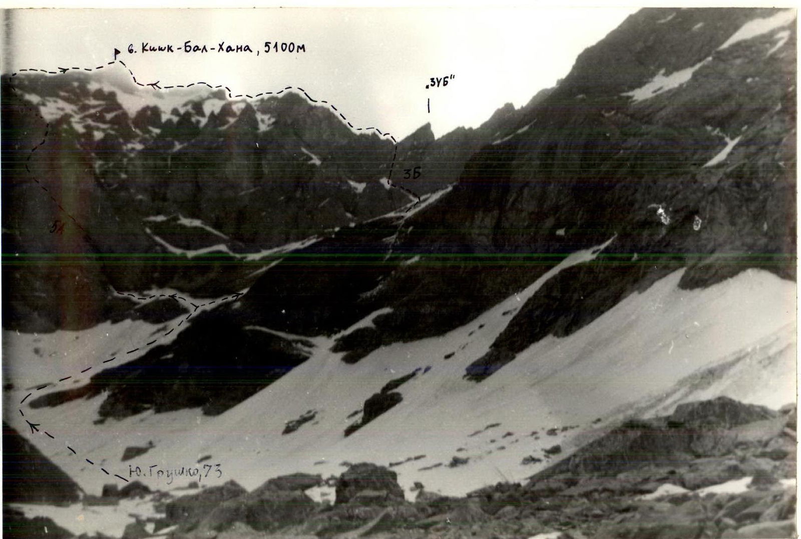
Kiik-Bal-Khana, view from the west. T-69 4/40 lens, distance 1 km. Routes:
- 5A — via West face
- 3B — via South ridge
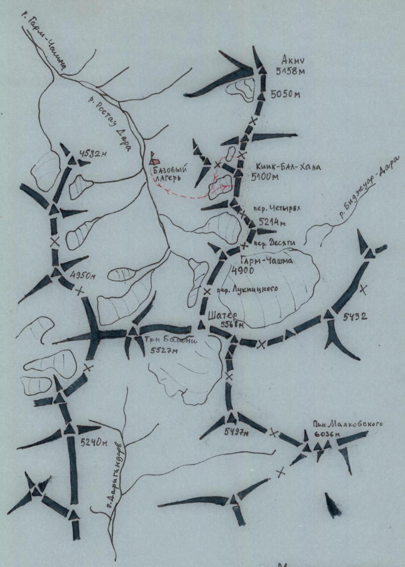
AREA MAP-SCHEME OF THE ASCENT
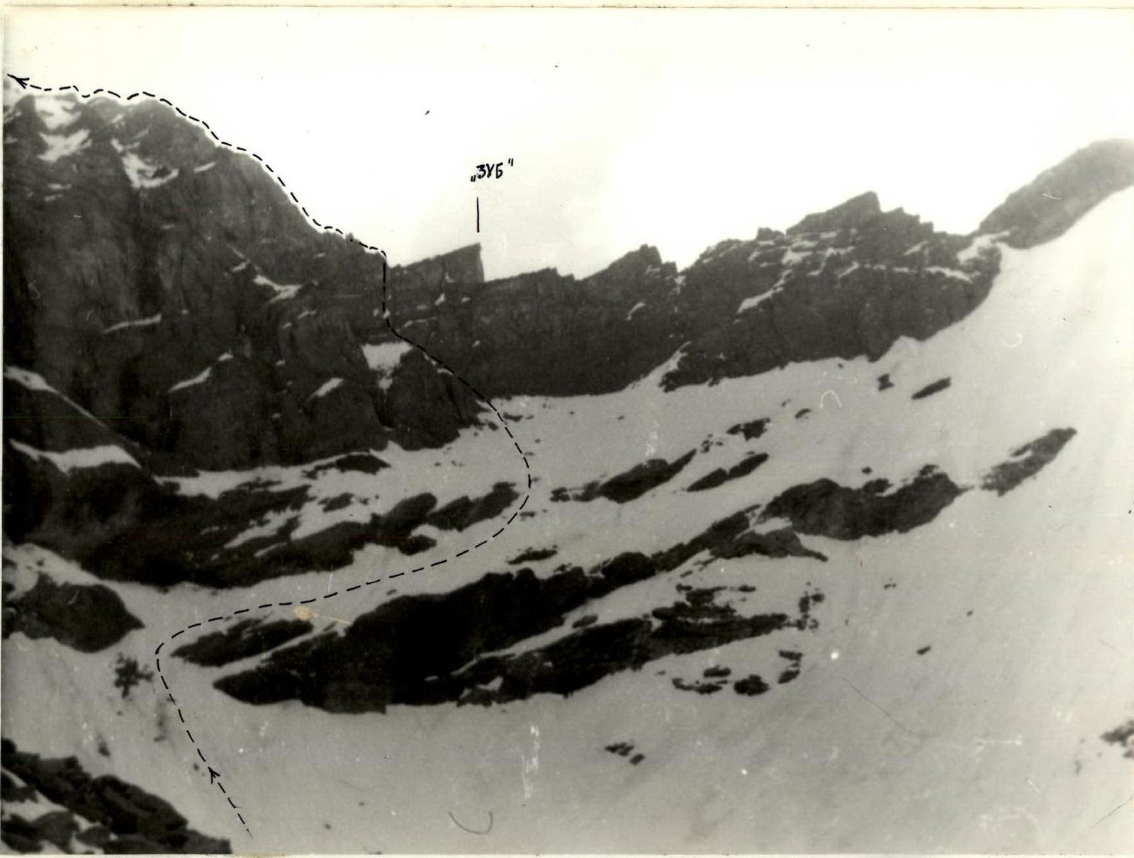
Approach to the South ridge of Kiik-Bal-Khana. T-69 4/40 lens, distance 200 m.
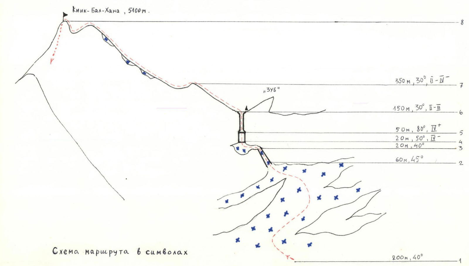
Route diagram in symbols
EXPLANATIONS TO THE DIAGRAM
Sect. 1–2. Movement on snow, bypassing rocks. Simultaneous insurance.
Sect. 2–3. Bypassing a rocky "island" from above. Simultaneous insurance.
Sect. 3–4. Approach on snow to the base of an internal angle-chimney leading to the ridge. Insurance through ledges. On the ridge, a characteristic landmark is a monolithic gendarme "tooth". The chimney leads to a depression to the left of the "tooth".
Sect. 4–5. A small slab section before the chimney. Piton insurance.
Sect. 5–6. Chimney. Piton insurance. Upon reaching the ridge, a control cairn.
Sect. 6–7. Ridge to the first weakly pronounced gendarme. Movement on the right (in the direction of travel) side of the ridge, on rocks. Insurance through ledges.
Sect. 7–8. Alternation of short snowy ridges (sometimes with cornices) and rocky sections, on which small walls are found. Insurance through ledges.
Note. On section 1–4, ice is possible in the second half of summer. Crampons and ice axes are necessary.
BRIEF DESCRIPTION OF THE APPROACH TO THE ROUTE
The cirque, where the peak Kiik-Bal-Khana is located, is the first on the right (orographically) side of the gorge after the grandiose cirque closing the Garg-Чашма gorge. From the base camp:
- 200 m upstream along the gorge,
- after a snow-scree couloir, you can immediately begin the ascent on grassy slopes, turning into scree.
The entrance to the cirque is clearly visible. The peak and the south ridge (with a characteristic gendarme "tooth") are clearly visible from the beginning of the cirque.
Time to:
- entrance to the cirque — 1.5 hours
- start of the route — 2.5 hours