
Peak Beleuli 6065 m. Via the north face and east ridge — second ascent
(Route by MAI (MAI) tourist club, led by A. Lebedev, cat. 4B)
Peak Beleuli (6065) was one of the last unclimbed "six-thousander" peaks in the Pamir region until 2001. It is the highest point in the Zulumart-Saukdara mountain node. Located in the Saukdara ridge. It has two peaks:
- The eastern peak is about 5950 m, with a rock wall dropping to the east;
- The higher western peak is 6065 m.
Between the peaks lies a plateau, from which a steep ice fall descends to the north. (From A. Lebedev's report.)
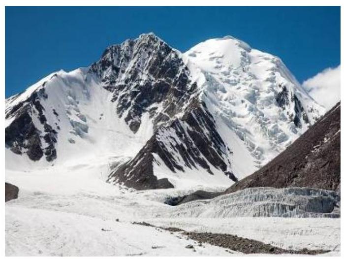
View of Peak Beleuli and the ascent route from the North Zulumart glacier.
Contents
- Route Passport — 4
- Description of the Climbing Area — 5 2.1. Approach to the Summit from Base Camp — 5 2.2. Map of the Area — 6 2.3. Scheme of Ridges — 7 2.4. Route Profile — 8
- Ascent Schedule — 9
- Stage-by-Stage Route Description — 10
- Conclusions and Recommendations — 12
- Photo Materials — 13
1. Route Passport
1. Mountain Region, Country
Saukdara ridge, Zulumart node, Pamir, Tajikistan, GBAO.
2. Mountain Name, Height, Route Name
Beleuli 6065 m. Route via the north face and east ridge.
3. Cat. sl. — 4B (RUS)
4. Route Type — Ice-Snow
5. Route Elevation Gain: 895 m (by GPS)
6. Route Length: 1650 m
7. Average Slope: Main part of the route — 34°
8. Pitons Left on the Route: Total — 1 (ice screw); Bolted — 0
9. Pitons Used on the Route: Ice — 17.
Stationary Bolted — 0, including ITO — 0.
10. Team's Climbing Time: 11 h 20 min, 1 day
11. Leader: Oleg Silin
Team Members:
- Konstantin Dikovskiy
- Eduard Skukis
12. Time
Start of the route: 7:20 — August 11, 2009. Summit: 13:15 — August 13, 2009. Departure from base camp — 8:00 — August 7, 2009. Return to base camp — 12:30 — August 14, 2009.
9. Weather Conditions — Excellent
2. Description of the Climbing Area
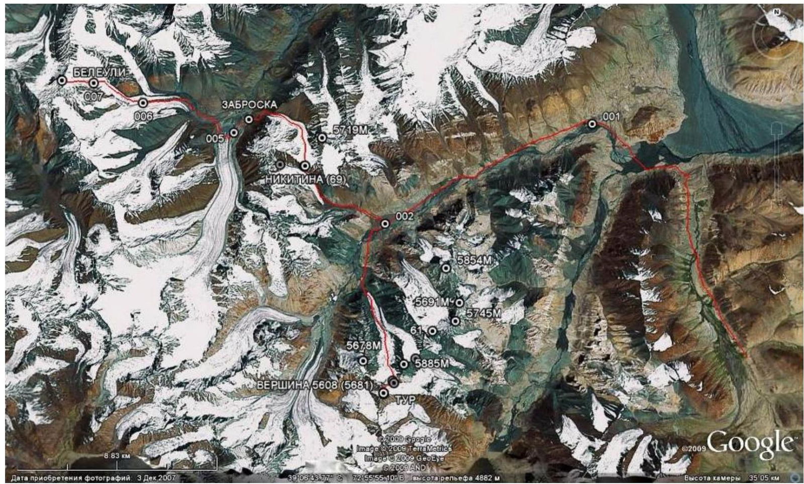
Peak Beleuli (6065) is located in the Saukdara ridge (western spur of the Zulumart ridge) to the west of the North Zulumart glacier tongue. It is the highest point in a vast mountainous area from the Fedchenko glacier in the west to Lake Karakul in the east and from the Sauksa valley in the north to the Tanymas valley in the south. The lack of attempts to climb this peak is explained by its significant remoteness from roads and difficulties in approaching the peak. The simplest approach to its foot leads from the Baygashka river valley through the Nikitina pass (5287 m; 2A) into the North Zulumart valley.
The Baygashka valley can be accessed from Osh by high-clearance vehicle, turning west from the Eastern Pamir Highway before the Markansu valley, but this year, according to locals, this route is impassable due to high water in the Akjilga river. Since we entered the area through Tajikistan, locals advised us on an alternative route:
- In the Karakul settlement on the lake of the same name, we arranged for a vehicle.
- Circumnavigating the lake from the south, we drove almost to the intended starting point via the Karachima valley.
It should be noted that this road is very poor and can only be traversed by an off-road vehicle, although there are many yurts along the Karachima valley and local Kyrgyz people occasionally travel to and from Karakul.
The Zulumart ridge area is characterized by a complete absence of people — both tourists and locals. Therefore, a team climbing in this area must rely solely on their own resources.
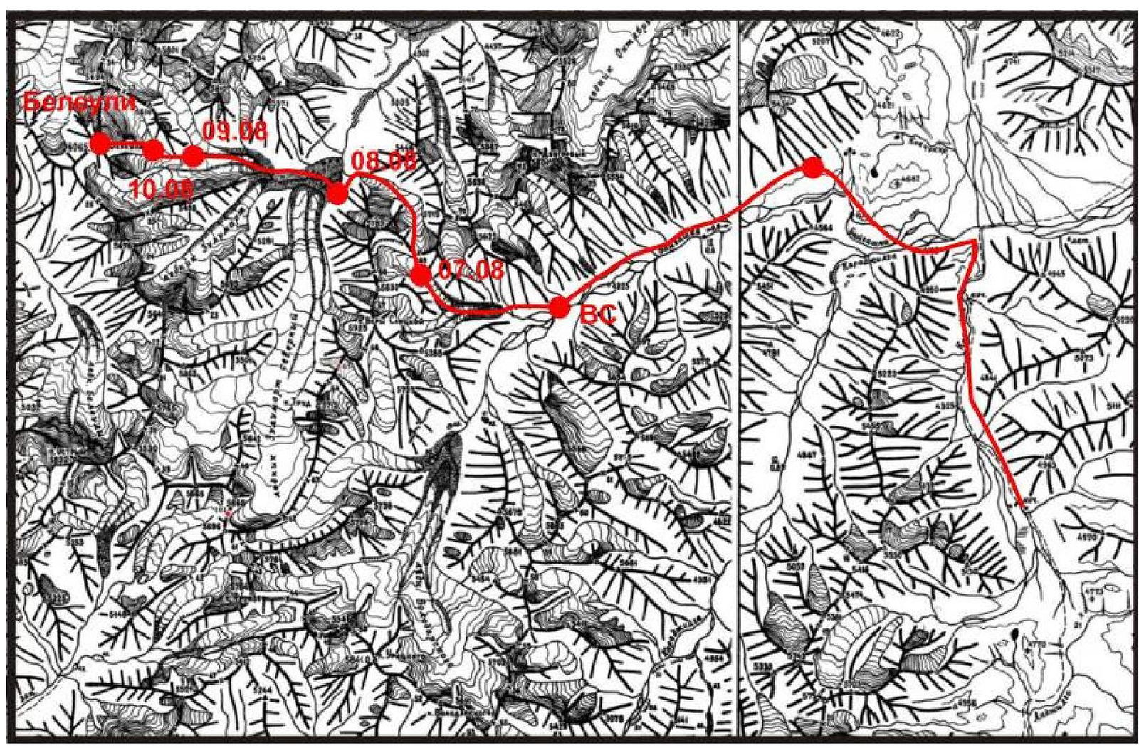
2.1. Approach to the Summit from Base Camp
For the ascent to Peak Beleuli, we used our camp in the upper reaches of the Baygashka river (Latitude: 39.1200760659, Longitude: 72.9221450351) at its confluence with a stream flowing from a nameless glacier, where the Nikitina pass is located. There is a lack of named features in the area (rivers, passes, peaks), making it somewhat challenging to describe the path. Along this stream, on its left (orographic) bank, we ascend an osypnoy slope and then, via the left couloir, reach the left-bank moraine ridge, which leads directly to the start of the ascent to the pass. From the camp — 5 h 20 min. The next morning:
- We ascend the pass slope (firn slope 35°, up to 45° at the top);
- Reach a broad snow saddle;
- Retrieve the note from the MAI tourist club (Latitude: 39.1415550280 Longitude: 72.8820422385);
- Descend to the Zulumart valley via a gentle glacier in one hour.
Descent features:
- The glacier tongue is quite steep.
- To transition to the moraine, one must move to the right in the lower part.
- We then descend to the Zulumart river via the moraines.
Crossing:
- Quite hazardous.
- We move upstream.
- The Zulumart glacier tongue flows directly into a large lake formed by its terminal moraine.
- The Zulumart river flows rapidly from the lake via a narrow channel.
- Crossing at this point is also problematic.
- We decide to circumvent the lake via the glacier tongue the next day.
In the morning:
- We relatively easily (1 h) circumnavigate the lake via the Zulumart glacier tongue;
- Begin ascending towards the North Zulumart glacier via osypi;
- Ford the North Zulumart river;
- Reach the glacier in 2 hours;
- Ascend to the median moraine ridge in about an hour, where there are good camping spots.
On the morning of August 10:
- We ascend to the base of the route in 1.5 hours.
See the ascent description for further details.
The return journey follows the same route.
2.2. Map of the Area
2.3. Scheme of Ridges
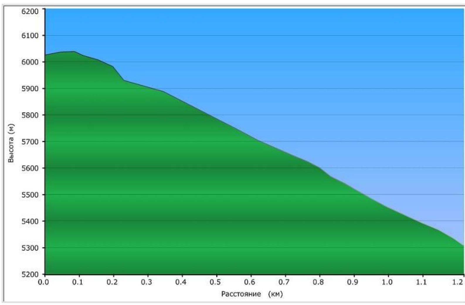
2.4. Route Profile
3. Ascent Schedule
| Date | Section of the Path | Height | Climbing Time |
|---|---|---|---|
| August 7, 2009 | Baygashka river camp — under Nikitina pass | 4300–5050 m | 5 h 20 min |
| August 8, 2009 | Nikitina pass — Zulumart river valley | 5050–5287–4200 m | 6 h 15 min |
| August 9, 2009 | Zulumart river valley — North Zulumart glacier | 4200–4850 m | 4 h 30 min |
| August 10, 2009 | North Zulumart glacier — assault camp under Beleuli | 4850–5240 m | 3 h 20 min |
| August 11, 2009 | Ascent to Peak Beleuli | 5240–6065–5240 m | 11 h 20 min |
| August 12, 2009 | Assault camp under Beleuli — Zulumart river valley | 5240–4200 m | 4 h 10 min |
| August 13, 2009 | Zulumart river valley — Nikitina pass — under Nikitina pass | 4200–5287–5050 m | 9 h 45 min |
| August 14, 2009 | Under Nikitina pass — Baygashka river camp | 5050–4300 m | 3 h 15 min |
4. Stage-by-Stage Route Description
 On August 10, from the median moraine of the North Zulumart glacier, we approach the base of the ice slope in rope teams in about 2 hours, first across open and then completely closed glacier. The base of the peak is at 5150 m.
Over 8 years since the first ascent, the route has changed. An extensive zone of ice fractures conditionally divides the ice fall on the north face into left and right halves. The MAI team passed to the right (in the direction of travel) in 2001, but now there has been a significant ice collapse there, making it impassable. Therefore, we decide to pass to the left of the fractures.
In 1 hour 20 minutes, we ascend (Stage I) to the first serac before entering the ice fall in rope teams. We set up camp under the shelter of this serac. Height 5240 m. After lunch, we establish 2 ropes of 50 m of rappel lines along the ice slope with a slope of 30–35°.
August 11. Departure at 7:00. We traverse our 2 ropes, gradually moving to the right in the direction of travel, almost pressing against the fracture zone. There, the ice is exposed, making it easier to organize rappel anchors on ice screws. A massive serac in the shape of a "shovel" hanging directly above the ascent route causes some concern.
After 250 m (ice, slope from 45° to 50°) (Stage II), we reach a snow field (Stage III), above which hangs an ice wall (Stage IV) blocking the exit to the plateau. The wall begins with a steep face (60–65°, 40 m), then the slope becomes gentler and transitions into a snow slope (20–25°). We climb simultaneously. After 80 m, the snow slope steepens, and the loose snow becomes nearly waist-deep. We move simultaneously since organizing protection is not feasible. Apparently, the mass of loose snow has covered a section of ice fractures, and we manage to overcome it almost "swimming."
The slope then becomes gentler again, and, bypassing the "shovel" to the right, we reach the snow field. Along it, in 1 hour 10 minutes, we approach a large bergschrund (4–5 m wide) crossing the entire slope. We traverse the bergschrund via a rickety bridge and then establish 2 ropes of rappel lines on ice at 40°, after which the slope becomes gentler again, and we move simultaneously (Stage V).
The ascent to the east ridge of the peak in its lowest part is complicated by fractures. We have to circumvent the fractures to the right (in the direction of travel), (ice, 35–45°, snow at the end of the section) (Stage VI). We traverse the straightforward ridge (Stage VII) simultaneously.
We reach the summit at 13:15. The MAI team in 2001 established a cairn at the exit of rocks located 50 m southwest of the highest point. We did not find it. We spend about an hour on the summit.
The descent follows the ascent route, mostly simultaneously. On steep sections:
- We establish rappel lines;
- The last participant descends via rappelling.
On the ice wall (Stage IV), we leave one ice screw during the descent. Back at the tent by 18:30.
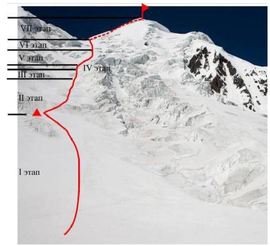
| № | Stage Name | Start Height | End Height | Photo | Length (m) | Slope (°) |
|---|---|---|---|---|---|---|
| VII | Snow-Ice Ridge | 5960 | 6065 | 2 | 300 | 45°, местами 30° |
| VI | Bergschrund + Ice Slope | 5900 | 5960 | 2 | 100 | 65°, at the top 55° |
| V | Snow Slope | 5770 | 5900 | 7 | 300 | 20–25° |
| IV | Ice Wall | 5670 | 5710 | 2,5,6 | 40 | 50°, at the bottom 65° |
| III | Snow Slope | 5600 | 5670 | 3,5 | 100 | 20–30° |
| II | Snow-Ice Slope | 5240 | 5600 | 3,4 | 250 | 45° |
| I | Snow-Ice Slope | 5160 | 5240 | 3,4 | 530 | From 30° to 35° |
5. Conclusions and Recommendations
The peak is very beautiful, especially for those who enjoy climbing in remote and uninhabited areas. The route corresponds to the claimed category. From the summit, one can see:
- Peak Lenin;
- Peak Korzhenevskoi;
- Peak Somoni (Communism).
There are concurrent possibilities for new routes on the peak, with the most promising being the route via the north saddle along the ridge. There are numerous unclimbed peaks in the surrounding area with heights around 5700–5800 m.
The route via Nikitina pass is indeed the simplest from the middle reaches of the Baygashka river to the upper reaches of Zulumart and Saukdara.
The circumvention via the Zulumart glacier tongue seemed more logical and significantly faster and safer to us than fording the Zulumart river, although it is understood that conditions change from year to year, and, possibly, due to the movement of the Zulumart glacier, the circumvention may not be the most favorable option. However, this is determined by the situation on the ground. In 2001, the MAI team made a ford, and, in their opinion, it was quite hazardous.
We recommend this climb to enthusiasts of mountain travel.
6. Photo Materials
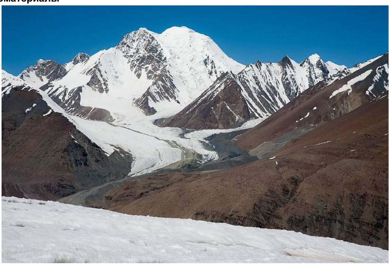 Photo 1. View of Peak Beleuli from under the Nikitina pass.
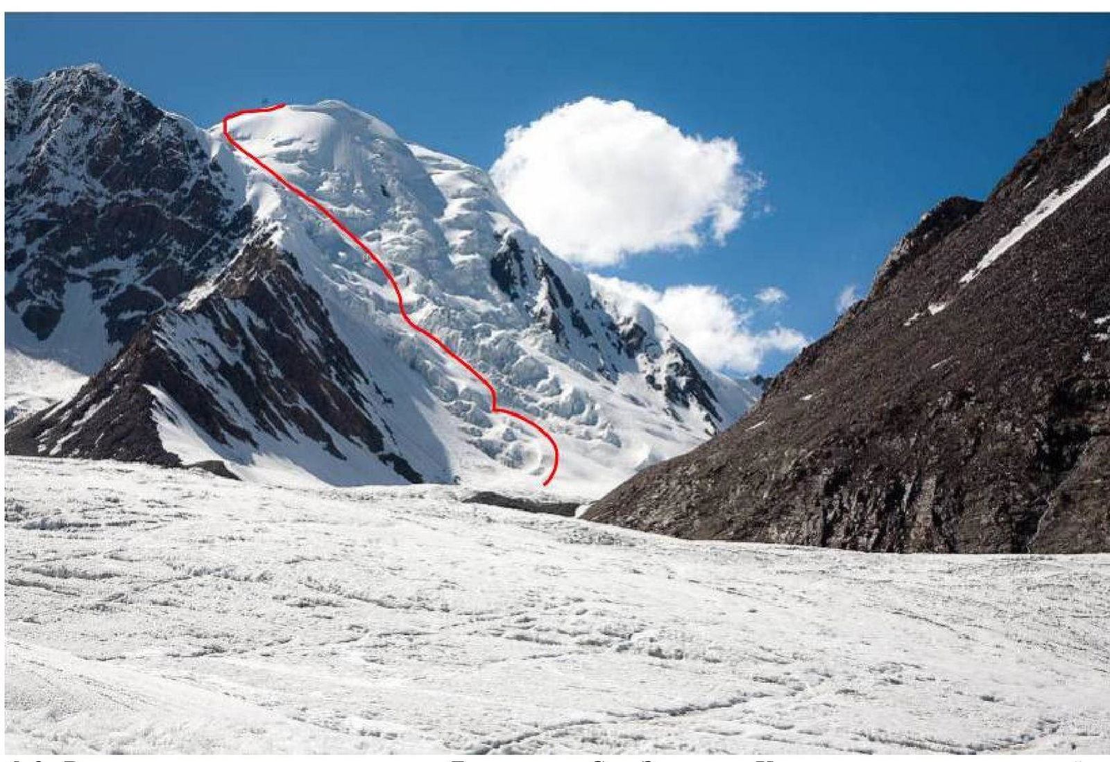 Photo 2. View of the ice fall on the north face of Peak Beleuli from the North Zulumart glacier. The ascent route is visible.
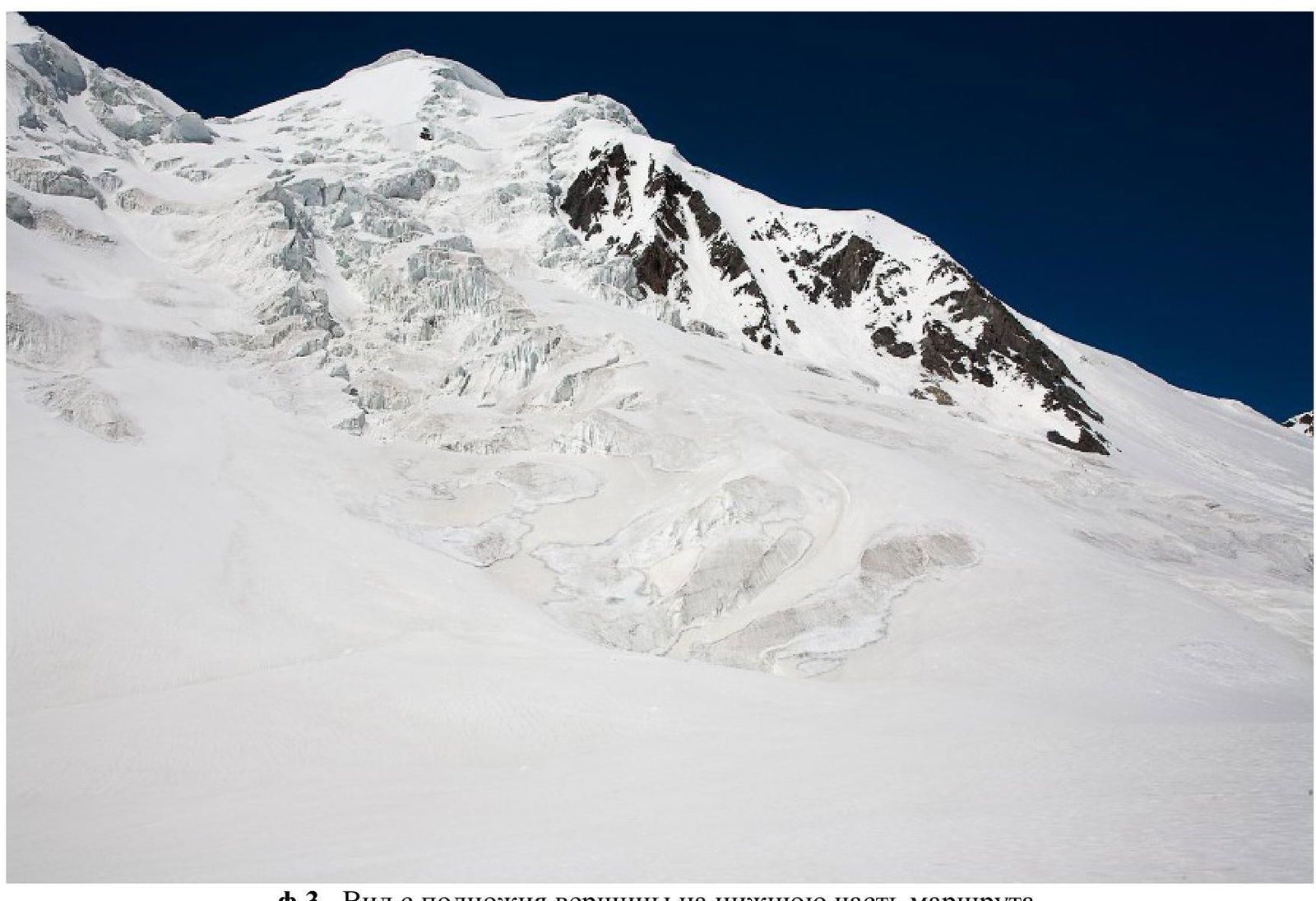 Photo 3. View from the base of the peak to the lower part of the route.
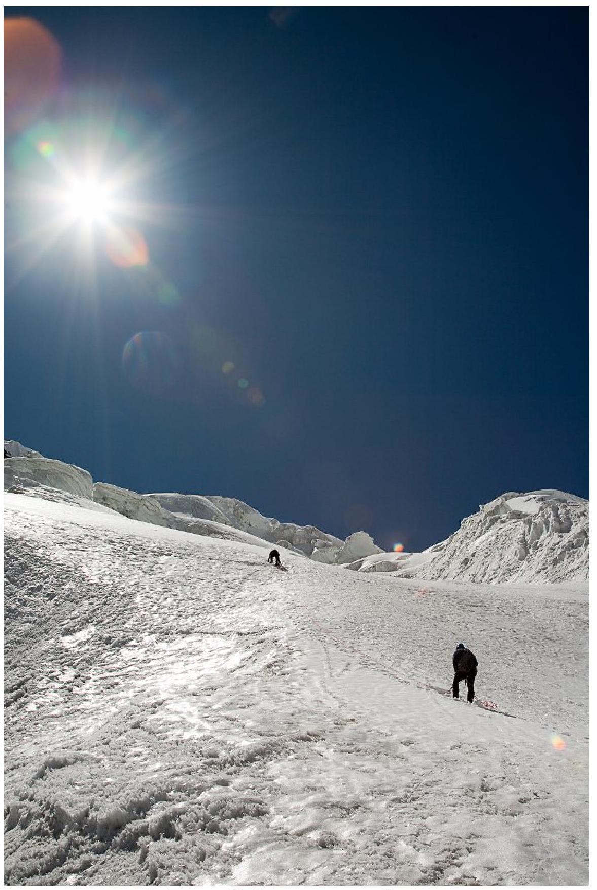 Photo 4. Stage II. Snow-Ice Slope.
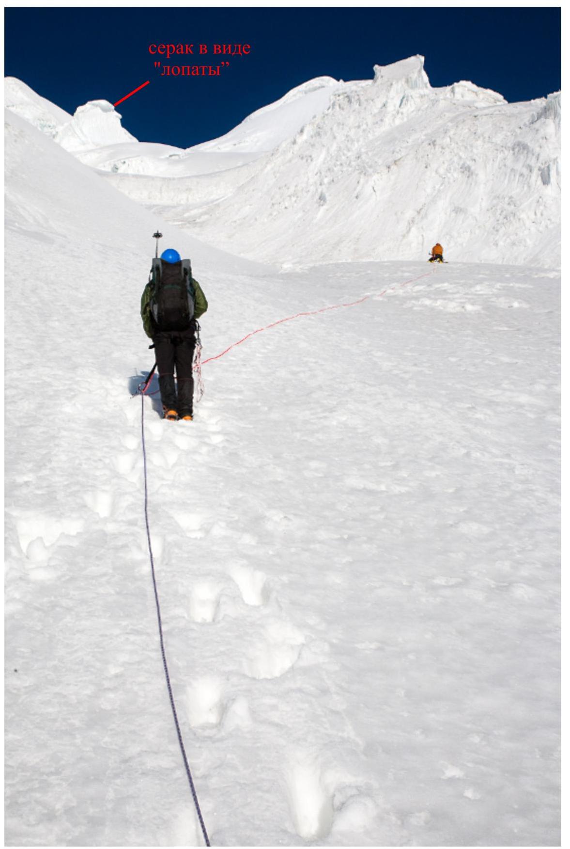 Photo 5. Stage III. Before the Ice Wall.
 Photo 6. Stage IV. Beginning of the Ice Wall.
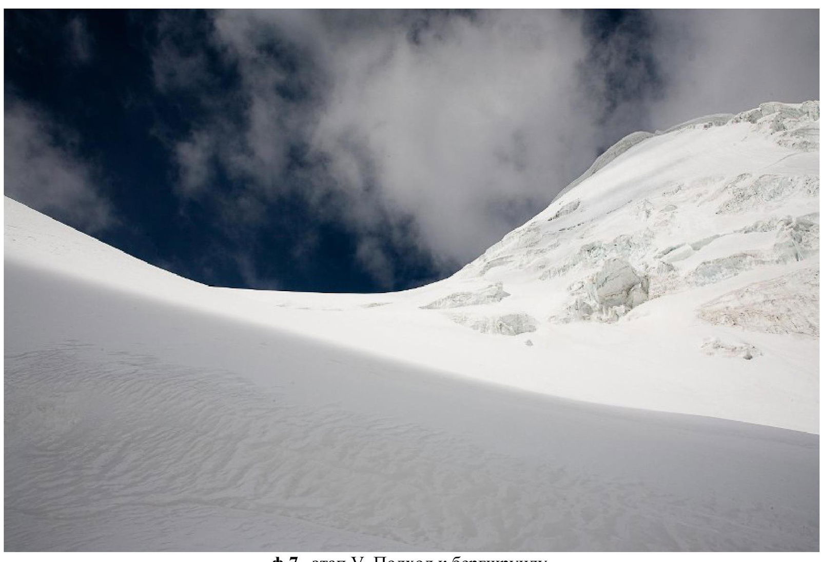 Photo 7. Stage V. Approach to the Bergschrund.
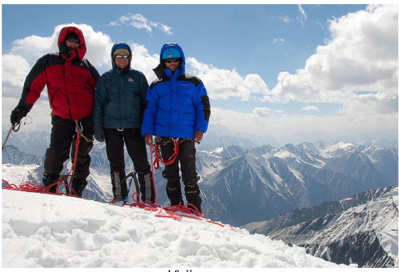 Photo 8. On the Summit.
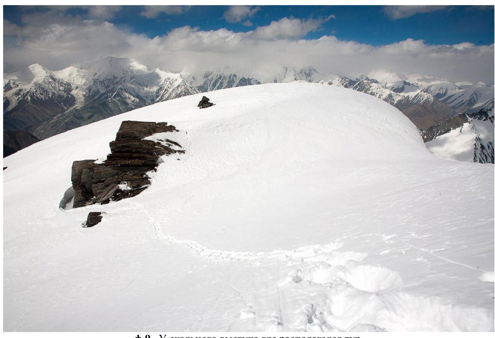 Photo 9. At the Rock Outcrop where the Cairn was Located.
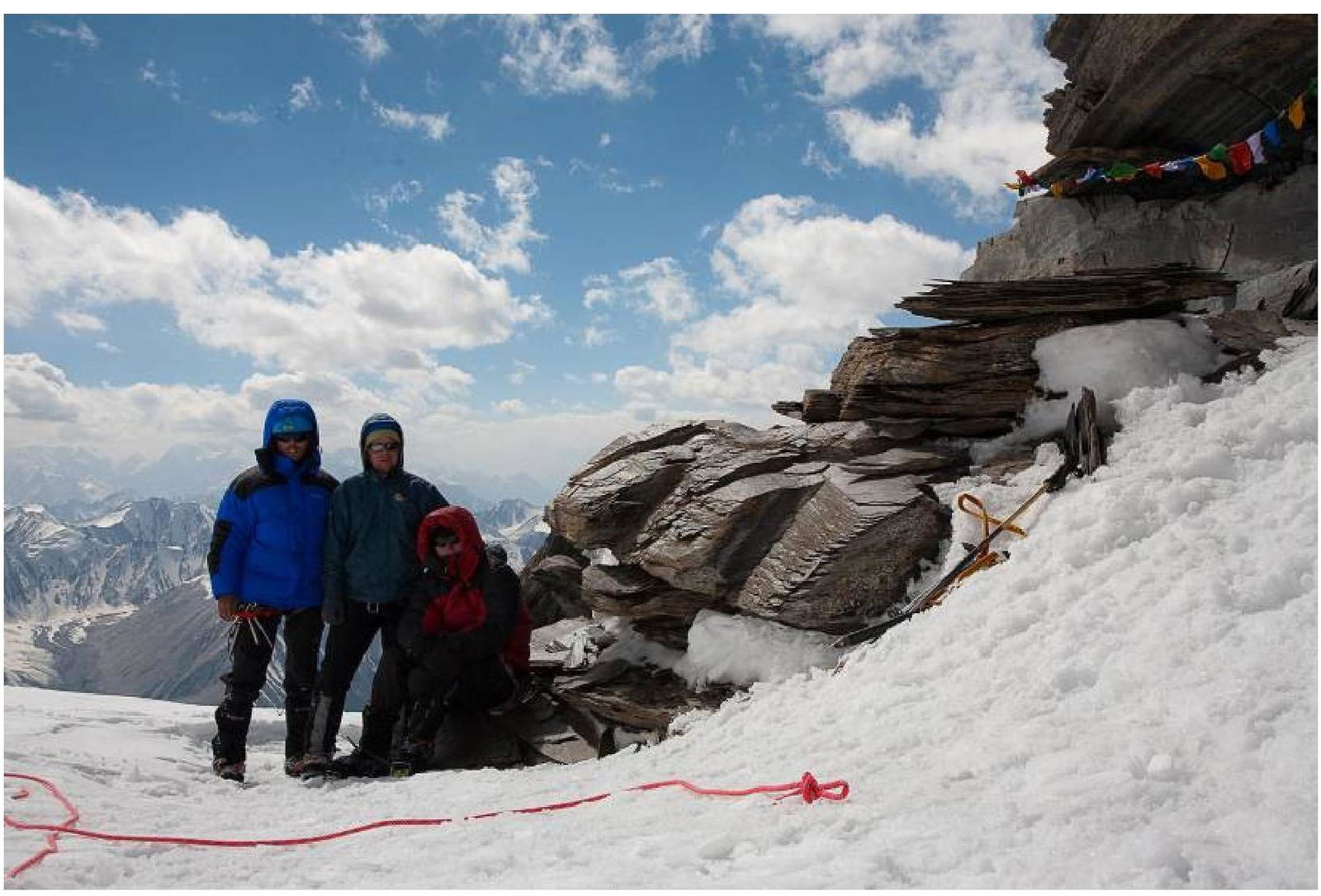 Photo 10. At the Cairn.
Comments
Sign in to leave a comment