
Report
On the first ascent of the route to the summit UNIVERSITET ITMO via the North-Eastern ridge — 3A category of complexity (presumably). By the team of climbers: Inozemtsev, Sokhatsky, Kurzin. For the period June 20, 2019.
| №№ | 1. General Information | |
|---|---|---|
| 1.1 | Full name, sports rank of the team leader | Kurzin Bogdan, 2nd sports rank |
| 1.2 | Full name, sports rank of the participants | Sokhatsky Alexander 2nd sports rank, Inozemtsev Eduard 1st sports rank |
| 1.3 | Full name of the coach | Suviga Vladimir Ivanovich |
| 1.4 | Organization | Asia Outdoor |
| 2. Characteristics of the Ascent Object | ||
| 2.1 | Region | Pamir. Trans-Alai range |
| 2.2 | Valley | Achik-Tash |
| 2.3 | Number according to the 2013 classification table | 4.4 |
| 2.4 | Name and height of the summit | Universitet ITMO 4729 m |
| 2.5 | Geographical coordinates of the summit (latitude/longitude), GPS coordinates (1) | 39.476123,72.964037 |
| 3. Characteristics of the Route | ||
| 3.1 | Name of the route | Via the north-eastern ridge |
| 3.2 | Proposed category of complexity | 3A |
| 3.3 | Degree of route development | First ascent |
| 3.4 | Nature of the route terrain | Ice and snow |
| 3.5 | Elevation gain of the route (according to altimeter or GPS data) | 489 m |
| 3.6 | Length of the route (in meters) | 875 m |
| 3.7 | Technical elements of the route (total length of sections of varying complexity with indication of terrain type (ice and snow, rock)) | 1st category. Snow, ice – 205 m 2nd category combination – 175 m. 3rd category. Snow, ice – 495 m. |
| 3.8 | Descent from the summit | Via the ascent route |
| 3.9 | Additional characteristics of the route | Lack of water (springs are on the approaches) |
| 4. Characteristics of the Team's Actions | ||
| 4.1 | Time of movement (team's walking hours, in hours and days) | 4 hours |
| 4.2 | Overnight stays | From the Base Camp MAL Pamir |
| 4.3 | Departure for the route | 8:00 June 20, 2019 |
| 4.4 | Reaching the summit | 12:00 June 20, 2019 |
| 4.5 | Return to the base camp | 16:00 June 20, 2019 |
| 5. Responsible for the Report | ||
| 5.1 | Full name, e-mail | Kurzin Bogdan. fal_con@inbox.ru |
II. Description of the Ascent
1. Characteristics of the Ascent Object
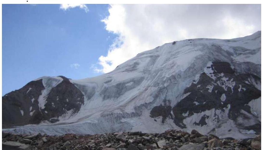
1.1. Photo from the moraine, not reaching the start of the route.
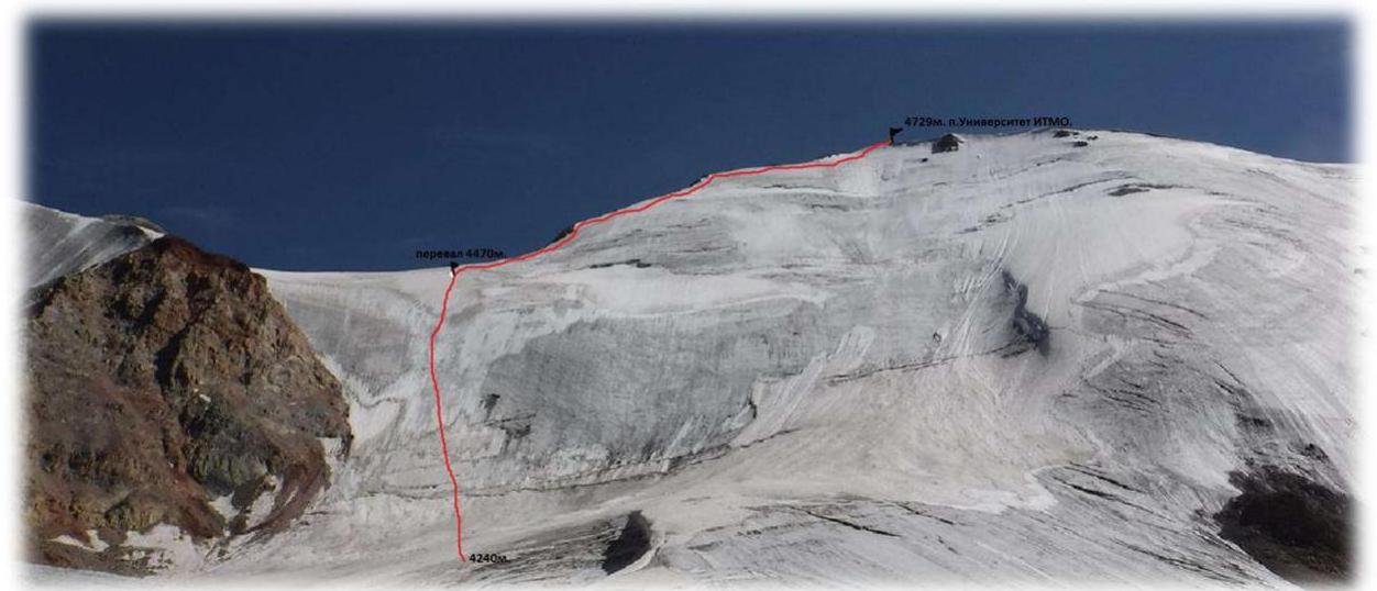
1.2. Profile of the route
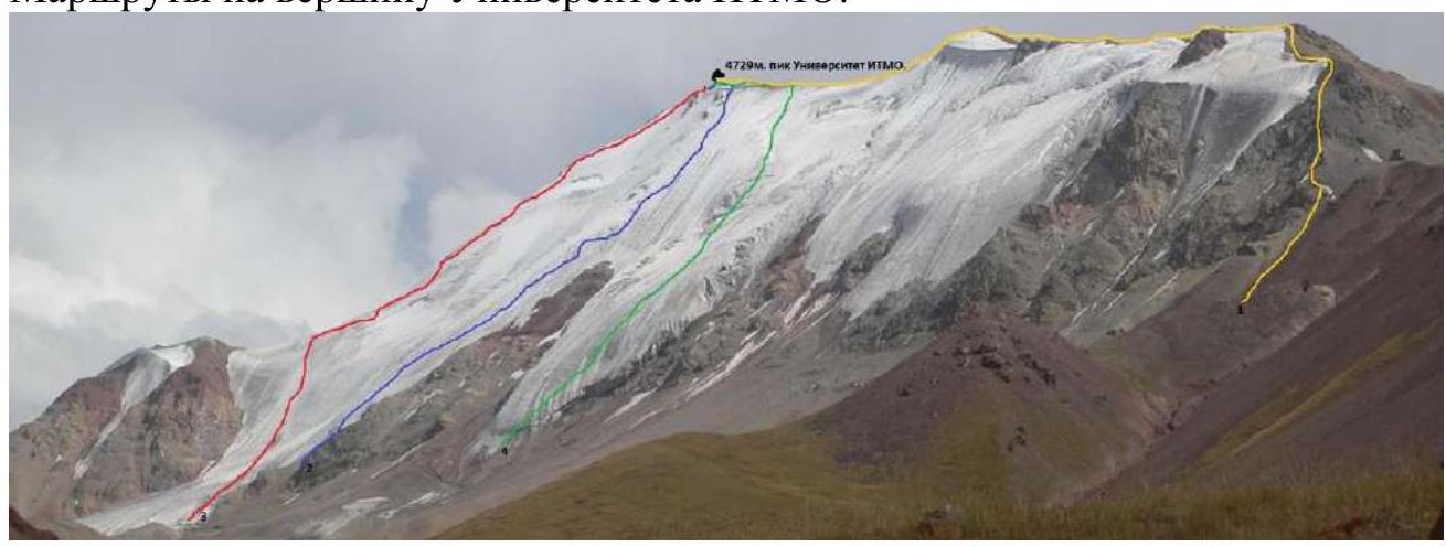
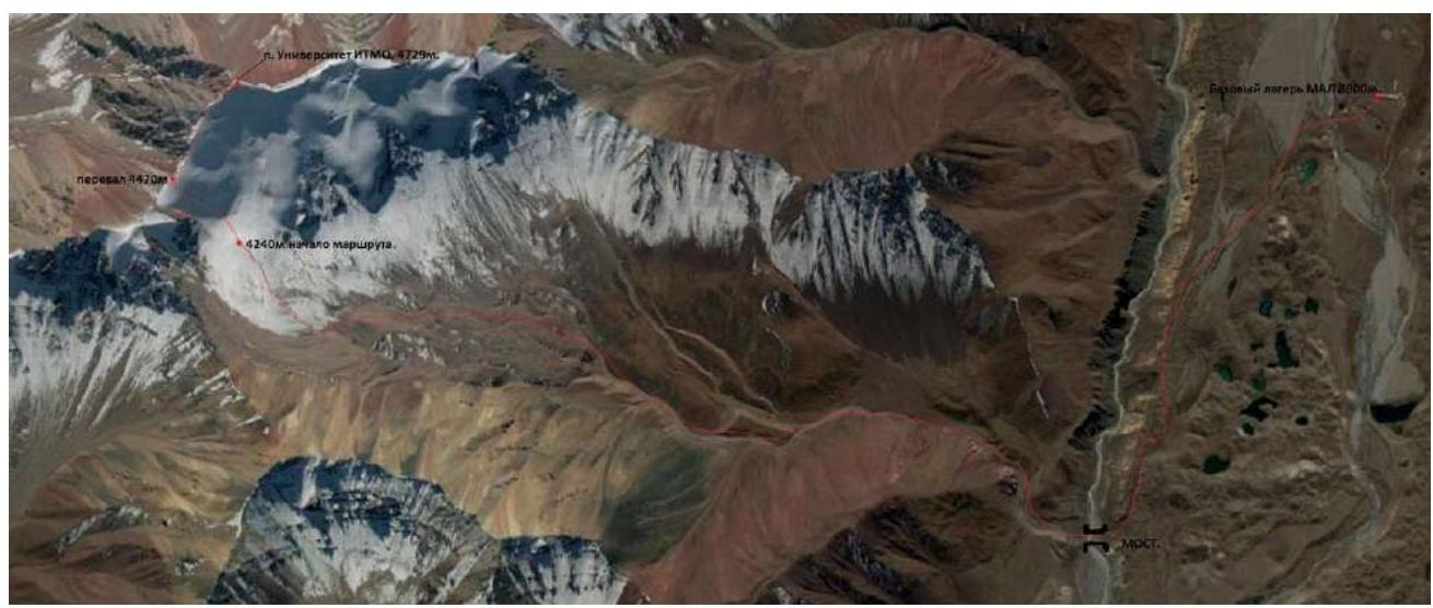
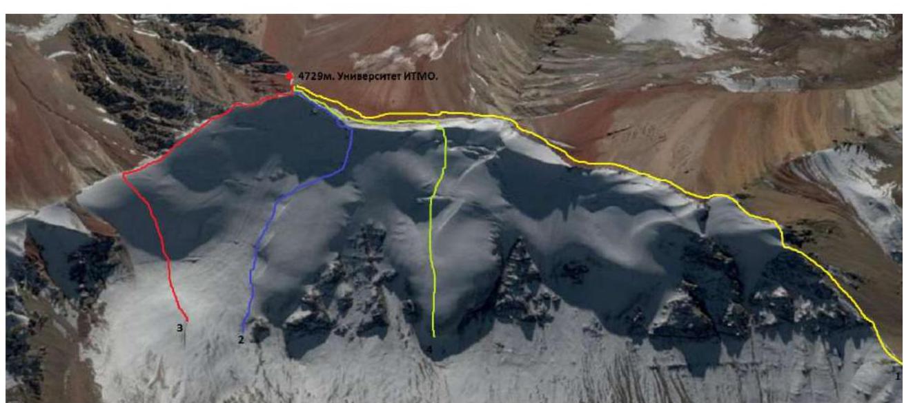
1.3. Routes to the summit of Universitet ITMO.
Photopanorama of the area
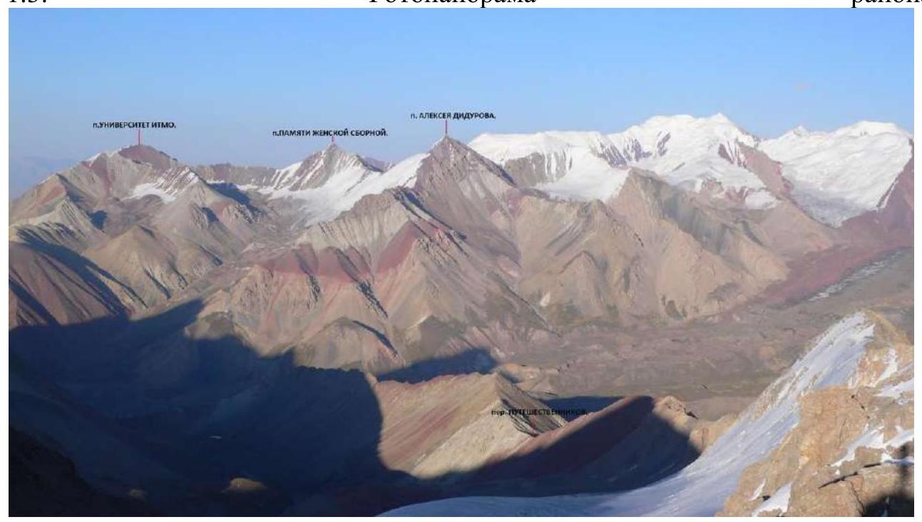
Taken from Sary-Mogol
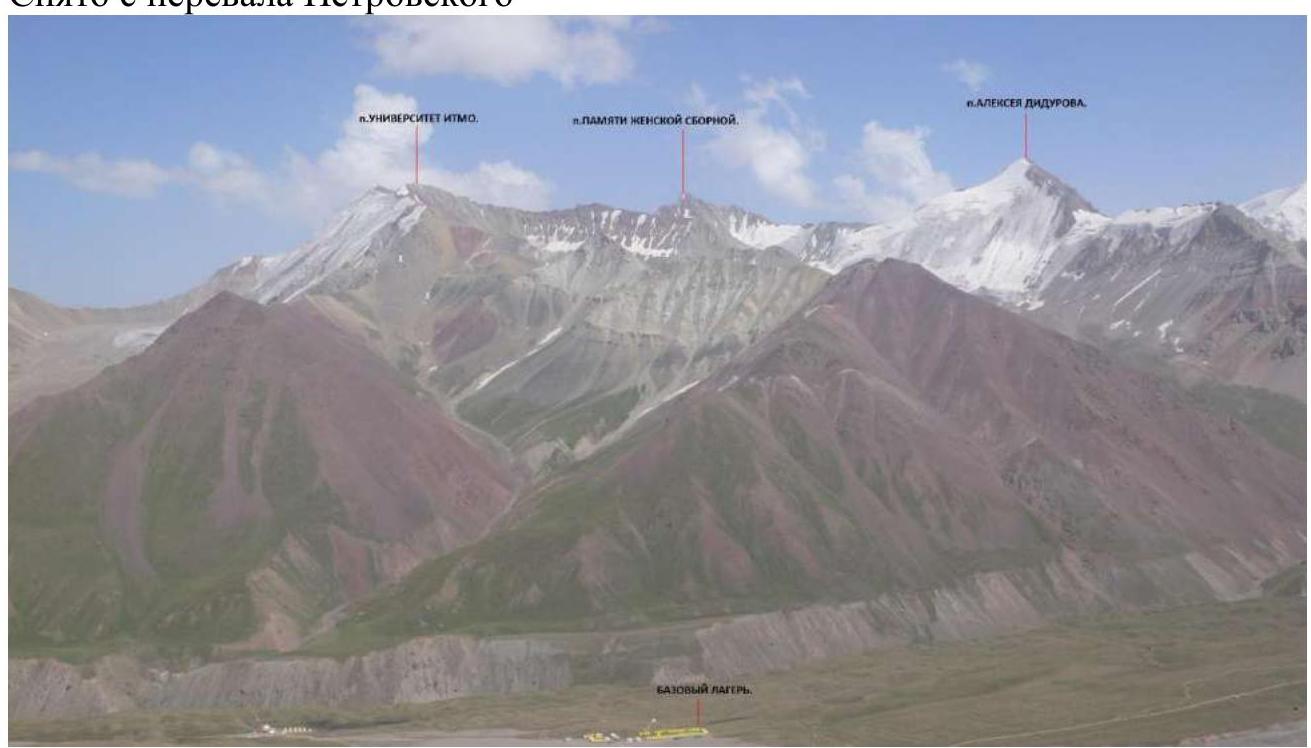
Taken from Petrovsky Pass
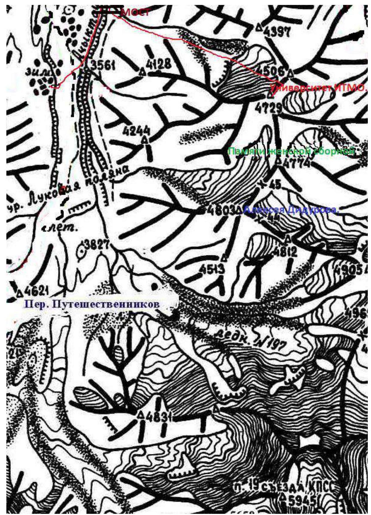
1.4. Map of the area
Route approach thread. Google Maps.
For scouting the route to peak Universitet ITMO on June 19, 2019, at 4:00 AM, our group – Bogdan Kurzin, Alexander Sokhatsky, and Eduard Inozemtsev – set out. We approached the mountain; the snow conditions were not critical, and it was possible to proceed with the route. The snow did not hold, but we didn't sink too deep, 10–20 cm. We returned by breakfast.
For the day, we prepared ice and snow equipment, provisions, and obtained permission from the authorities.
On June 20, 2019, we departed at 2:00 AM. The trail leads without issues to the bridge over the Achik-Tash River. Further, the main trail turns left and upwards, but we needed to go right and up, along a small stream flowing towards us. We reached the snowline in 2 hours but lost some time "tracing"; it's necessary to stick to the left bank of the valley as much as possible. At the beginning of summer, there's a lot of snow, but by the end of August, this problem disappears, and the approach can be made from the right or through the center of the valley.
Only at 8:00 were we under the route at an altitude of 4240 m, and, equipping ourselves, we moved upwards. At 8:00, we conducted a radio communication session with the Base Camp.
The weather was cloudy, with low clouds, but it wasn't raining or snowing – that was a relief. The route was being climbed for the first time, and in snowfall or with no visibility, it would be problematic.
We moved in a rope team. The slope on the first section was not steep, about 20°. We passed 180 m to the bergschrund, which was poorly visible under the snow. On the bergschrund, for insurance, we screwed in a couple of ice screws, at an altitude of 4290 m.
Further, the steepness increases to 45°, 300 m we go in 3 pitches, the snow holds well, местами up to the knee.
Then – an exit to a pass (4470 m), 25 m on firm, wind-blown snow, the angle decreases to 20–30°. We had passed more than 1/3 of the route; we were on the pass by 9:30. We sat down to rest, have a snack, and restore our water and salt balance, so to speak.
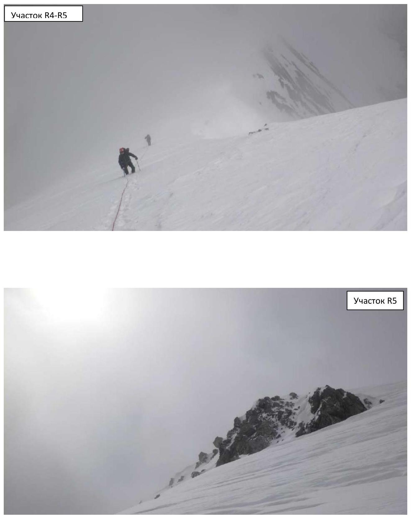
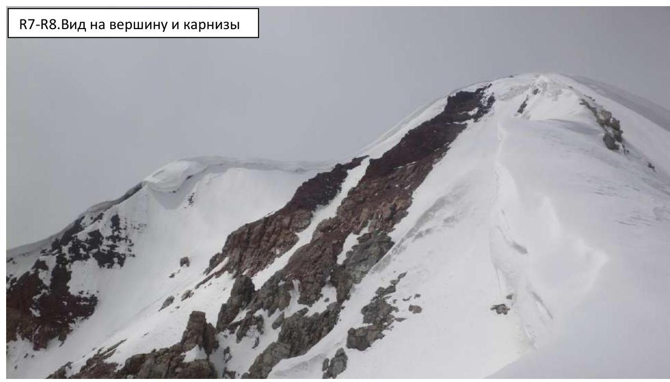
Further, the route represents a snowy ridge with cornices up to 2 m, oriented to the southeast, i.e., they face left of the ascent path. We moved slightly to the right of the cornice break-off line, which is not visible under the snow but exists. Occasionally, there were rock outcrops. The average steepness was 40°, but there were sections of 30° and 50°. The section from the pass to the summit is 550 m.
Already in the upper part, clouds caught up with the ridge, obstructing the view of the further path, but this was a short-term phenomenon.
At exactly 12:00, we were on the summit. We successfully conducted a communication session with the Base. We had a snack, drank water, rested, and took a circular panorama photo, including ourselves. We removed a note from previous climbers and left our own.
The weather improved; the blue sky appeared, and the sun began to peek through.
We descended via the ascent route:
- To the horizontal section under the pass, we descended in 1 hour.
- In another 3 hours, we reached the Base Camp, i.e., we were "home" by 16:00.
Ice on the route was encountered in several sections; mostly, it was deep, reliable snow. At the end of August, we would have had to screw in ice screws in many places.
I still assess the route as 3A category of complexity. The elevation gain is 500 m, the route length is 1055 m.
The route can be divided into 3 parts:
- From the start to the bergschrund.
- From the bergschrund to the pass.
- From the pass to the summit – the most challenging.
I consider the route to be safe. The only risk is breaking off a cornice and falling with it, but if one carefully follows the break-off line and the rope team leader, this can all be calculated. Nothing falls from above, neither at the beginning of summer nor at the end of the season.
2. Characteristics of the Route
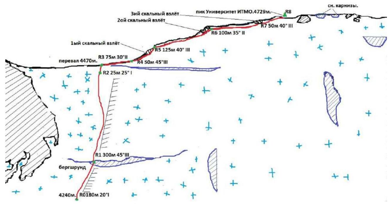
2.1. Technical photograph
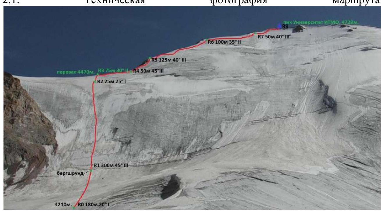
Technical characteristics of the route sections
| Section № | Terrain characteristics | Category of complexity | Length, m | Type and number of anchors |
|---|---|---|---|---|
| R0–R1 | Snow and ice ascent | 1 | 180 m | 1 snow anchor, 2 ice screws |
| R1–R2 | Bergschrund. Snow and ice wall | 3 | 300 m | - |
| R2–R3 | Exit to snow and ice pass | 1 | 25 m | - |
| R3–R4 | Snow ridge. Cornices. | 2 | 75 m | |
| R4–R5 | Broken rocks | 3 | 50 m | |
| R5–R6 | Snow and ice ridge | 3 | 125 m | |
| R6–R7 | Broken rocks and snow and ice ridge | 2 | 100 m | |
| R7–R8 | Pre-summit ridge and broken rocks | 3 | 50 m |
Plan scheme
3.1 Our team worked cohesively and carefully (photo report):
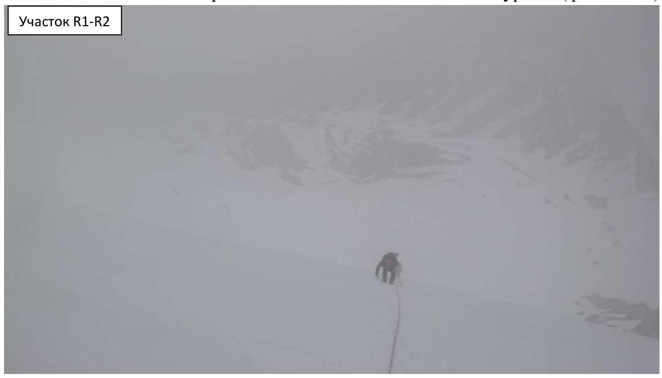
Section R1–R2
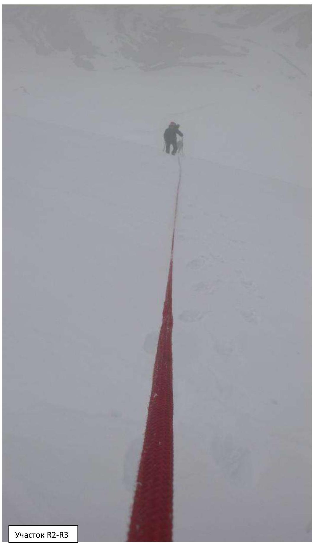
Section R2–R3
Section R4–R5
Section R6–R7
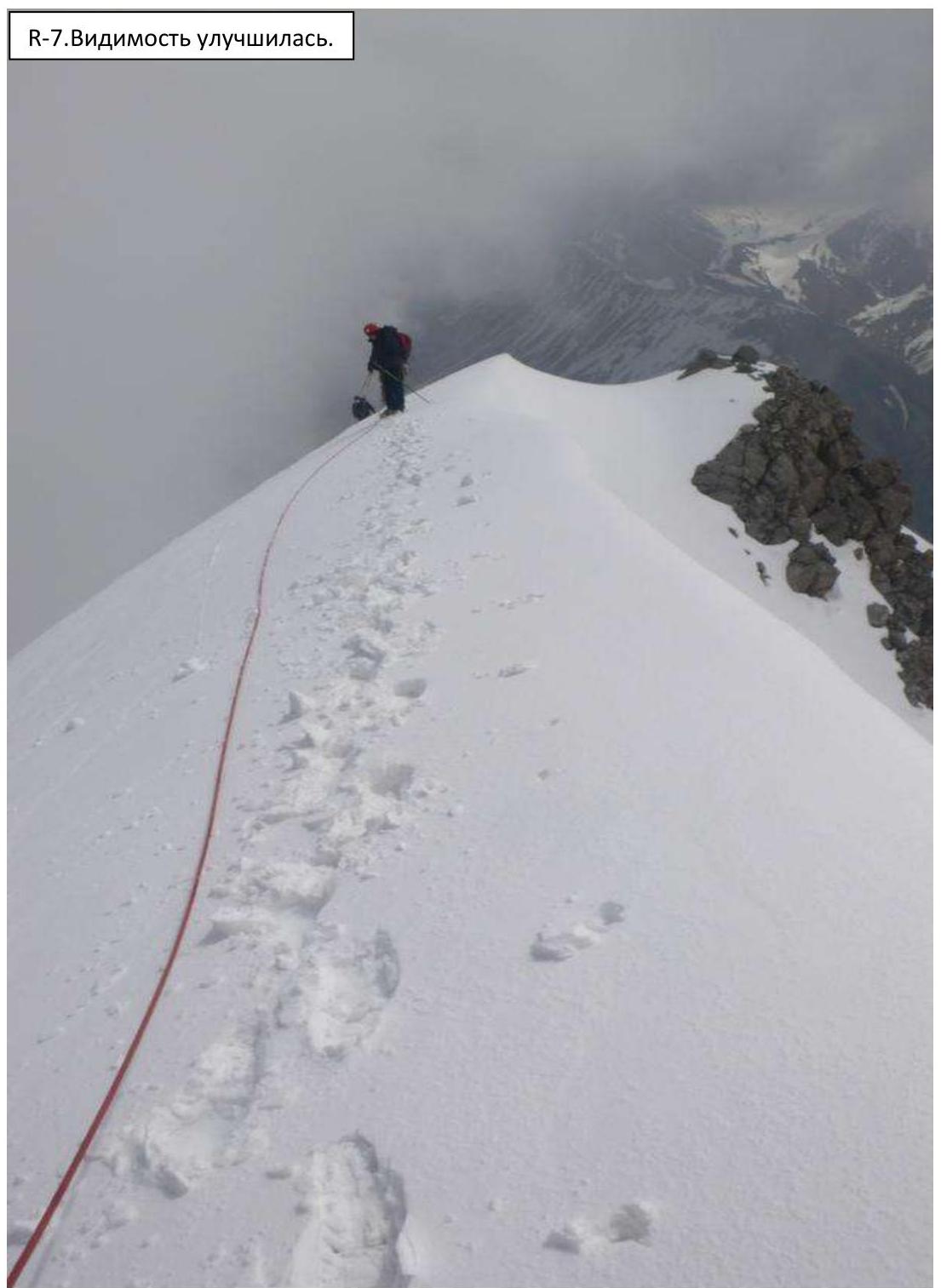
R–7. Visibility improved.
Characteristics of the Team's Actions
| Section № | Description | Photo № |
|---|---|---|
| R0–R1 | We moved in a rope team. The slope on the 1st section was not steep – 20°. We passed 180 m to the bergschrund, which was poorly visible under the snow. | |
| R1–R2 | On the bergschrund, for insurance, we screwed in a couple of ice screws. The steepness increases to 45°. 300 m we go in 3 pitches. | |
| R2–R3 | We exit to the pass on firm snow. The angle decreases to 20–30°. | |
| R3–R4 | Further, the route represents a snow and ice ridge with cornices up to 2 m, oriented to the southeast. We moved slightly to the right of the cornice break-off line, although it's not particularly visible under the snow. | |
| R4–summit | Moving along the ridge, we encountered rock outcrops, through which we climbed. The average steepness was 30–40°, but there were sections of 50°. | |
| Descent | Via the ascent route. To the horizontal section under the pass, we descended in 1 hour. In another 3 hours, we reached the Base Camp. |
3.2. Photo of the team on the summit with the control landmark.
R8. Sokhatsky on reliable insurance
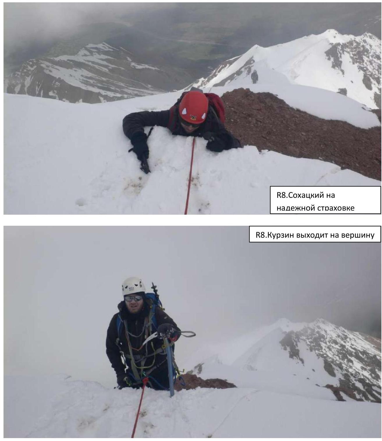
R8. Kurzin exits to the summit
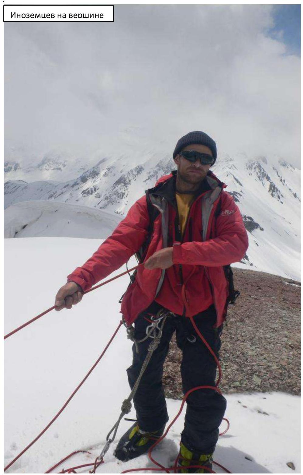
Inozemtsev on the summit
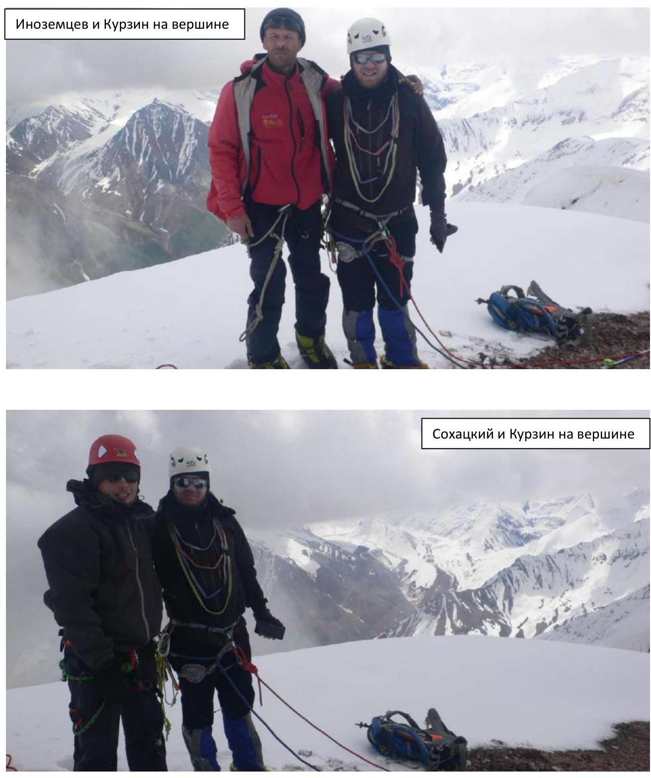
Inozemtsev and Kurzin on the summit
Sokhatsky and Kurzin on the summit
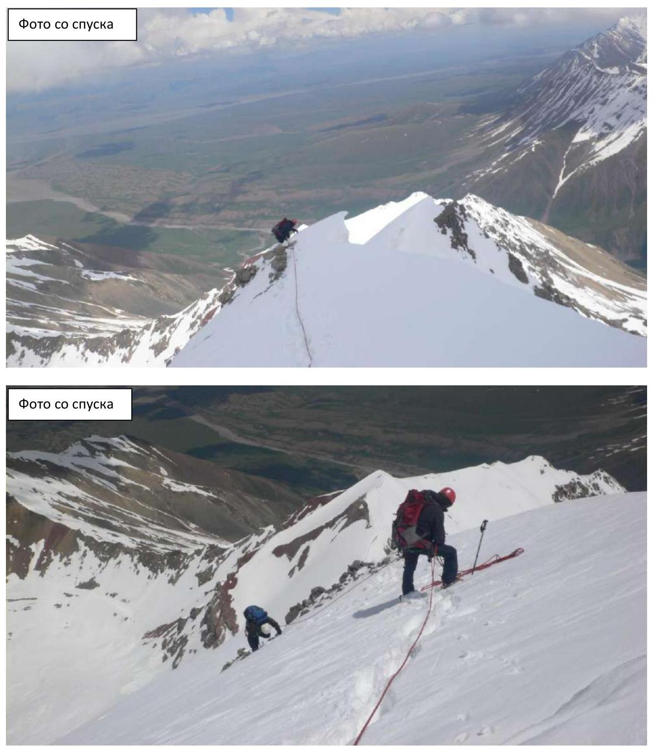
Photo from descent
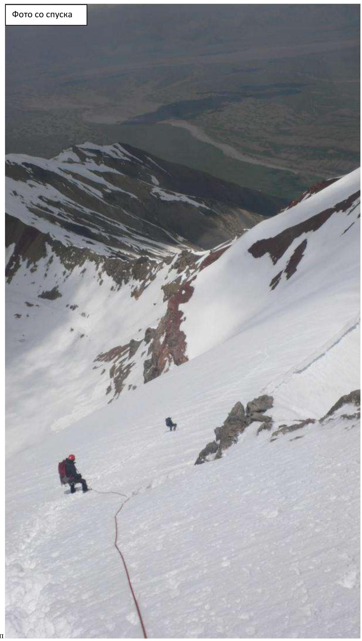
Photo from descent
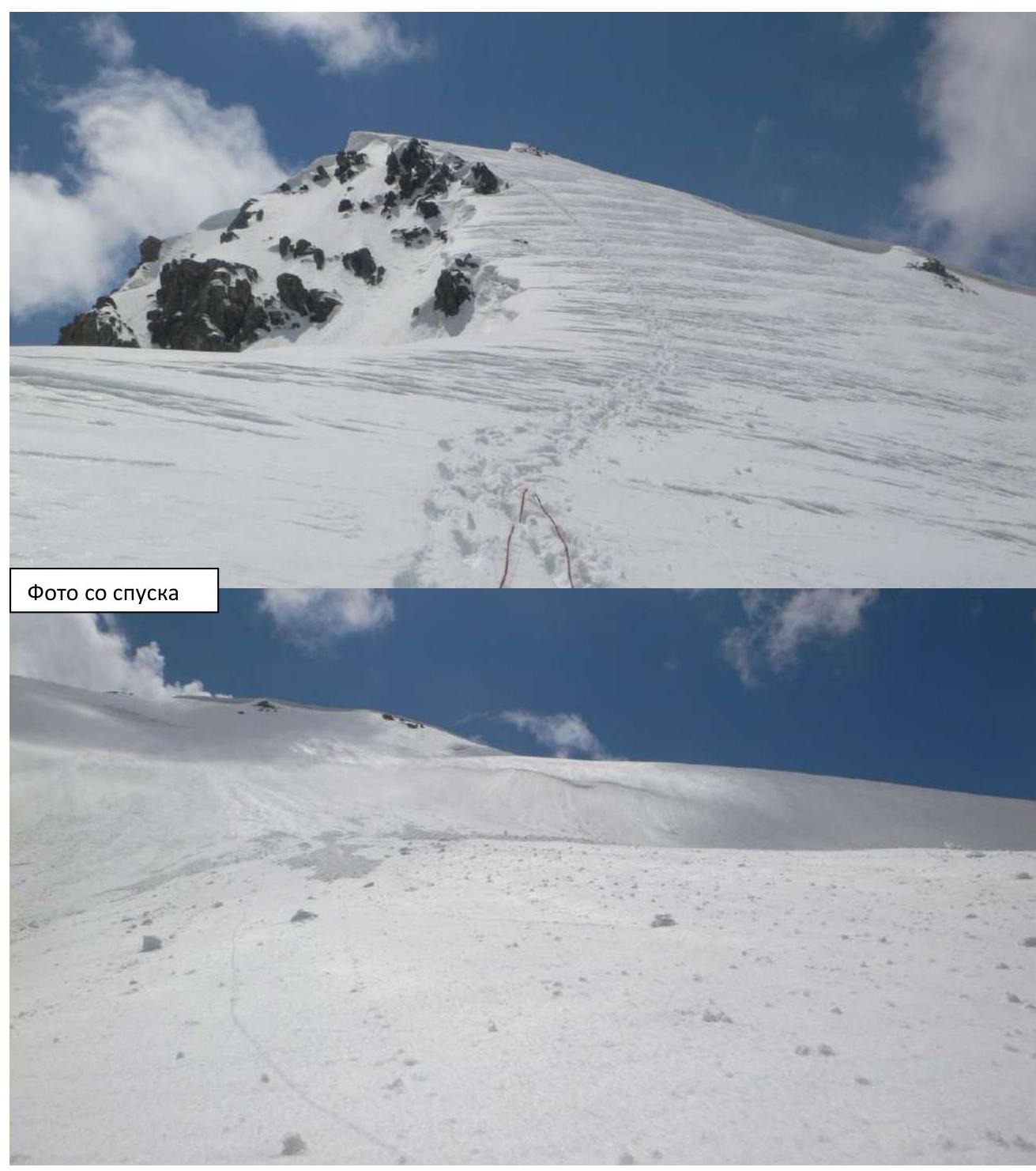
Photo from descent
Comments
Sign in to leave a comment