
On the first ascent to the summit of Pik Universiteta ITMO via the center of the Northern wall, category 4A, by the Ak-Sai Travel team — MPEI alpine club, from 26.08.2019 to 26.08.2019
I. Ascent Passport
| № п.п. | 1. General Information | |
|---|---|---|
| 1.1 | Full name, sports rank of the leader | Mikhail Khomenyuk, 1st sports rank |
| 1.2 | Full name, sports rank of participants | Bakytjan Nabieva, 2nd sports rank |
| 1.3 | Coach name | Vladimir Suiga, 3rd sports rank |
| 1.4 | Organization | Ak-Sai Travel |
| 2. Characteristics of the ascent object | ||
| 2.1 | Region | Pamir, Zaalaysky ridge |
| 2.2 | Valley | Achik-Tash |
| 2.3 | Section number according to the 2013 classification table | Section 4.4 according to the 2017 classification table |
| 2.4 | Name and height of the summit | Pik Universiteta ITMO, 4729 m |
| 2.5 | Geographical coordinates of the summit (latitude/longitude), GPS coordinates | |
| 3. Route characteristics | ||
| 3.1 | Route name | Pik Universiteta ITMO, via the center of the Northern wall |
| 3.2 | Proposed category of difficulty | 4A |
| 3.3 | Degree of route exploration | First ascent |
| 3.4 | Relief characteristics of the route | Snow-ice |
| :--: | :--: | :--: |
| 3.5 | Altitude difference of the route (altimeter or GPS data) | 800 m |
| 3.6 | Route length (in meters) | 1000 m |
| 3.7 | Technical elements of the route (total length of sections with different difficulty categories, indicating the relief type (snow-ice, rocky)) | I cat. diff. ice — 0 m. II cat. diff. ice — 380 m. III cat. diff. ice — 300 m. IV+ cat. diff. ice — 320 m. V cat. diff. ice — 0 m. VI cat. diff. ice — 0 m. Rocks VI, A3 — 0 m. Rocks VI, A4 — 0 m. |
| 3.8 | Average steepness of the route, (°) | 45 deg. |
| 3.9 | Average steepness of the main part of the route, (°) | 65 deg. |
| 3.10 | Descent from the summit | Via category 1B to the Achik-Tash valley |
| 3.11 | Additional route characteristics | Water presence: glacier |
| 4. Characteristics of the team's actions | ||
| 4.1 | Time in motion (team's walking hours, in hours and days) | 0 days, 7.5 hours |
| 4.2 | Overnights | - |
| :--: | :--: | :--: |
| 4.3 | Time spent on route processing | - |
| 4.4 | Start of the route | 8:05, 26.08.2019 |
| 4.5 | Reaching the summit | 15:34, 26.08.2019 |
| 4.6 | Return to the base camp | 20:00, 26.08.2019 |
| 5. Weather conditions | ||
| 5.1 | Temperature, °C | |
| 5.2 | Wind speed, m/s | |
| 5.3 | Precipitation | |
| 5.4 | Visibility, m | |
| 6. Person responsible for the report | ||
| 6.1 | Mikhail Khomenyuk | khomenyuk@ya.ru; phone: +201069479518 |
II. Ascent Description
| Section № | Name and number of pitons | Insurance points, characteristics in symbols | UIAA route line in symbols | Complexity of the section in x symbols | Section length, m | Steepness, " |
|---|---|---|---|---|---|---|
| R4–R5 | 0/0 | - |  | II | 30 | 20-30 |
| R3–R4 | 14/0 | ∅ | ++++++++++ ++++++++ | IV+ | 120 | 65-70 |
| R2–R3 | 20 / 0 | ∅ | ++++++++++ | IV+ | 200 | 50-60 |
| :--: | :--: | :--: | :--: | :--: | :--: | :--: |
| R1–R2 | 2 / 0 | ∅ | ++++++++++ | III | 300 | 30-40 |
| R0–R1 | 0 / 0 | - | ++++++++++ | II | 350 | 20-30 |
Route diagram in UIAA symbols as an outline on the mountain:
| Section № | Length | Steepness, deg. | Complexity | Ice screws/ITO |
|---|---|---|---|---|
| 1 | 350 м | 20-30 | II | 0 / 0 |
| 2 | 300 м | 30-40 | III | 2 / 0 |
| 3 | 200 м | 50-60 | IV+ | 20 / 0 |
| 4 | 120 м | 65-70 | IV+ | 14 / 0 |
| 5 | 120 м | 20-30 | II | 0 / 0 |
Photo 1: photo of the area with Pik Universiteta ITMO
summit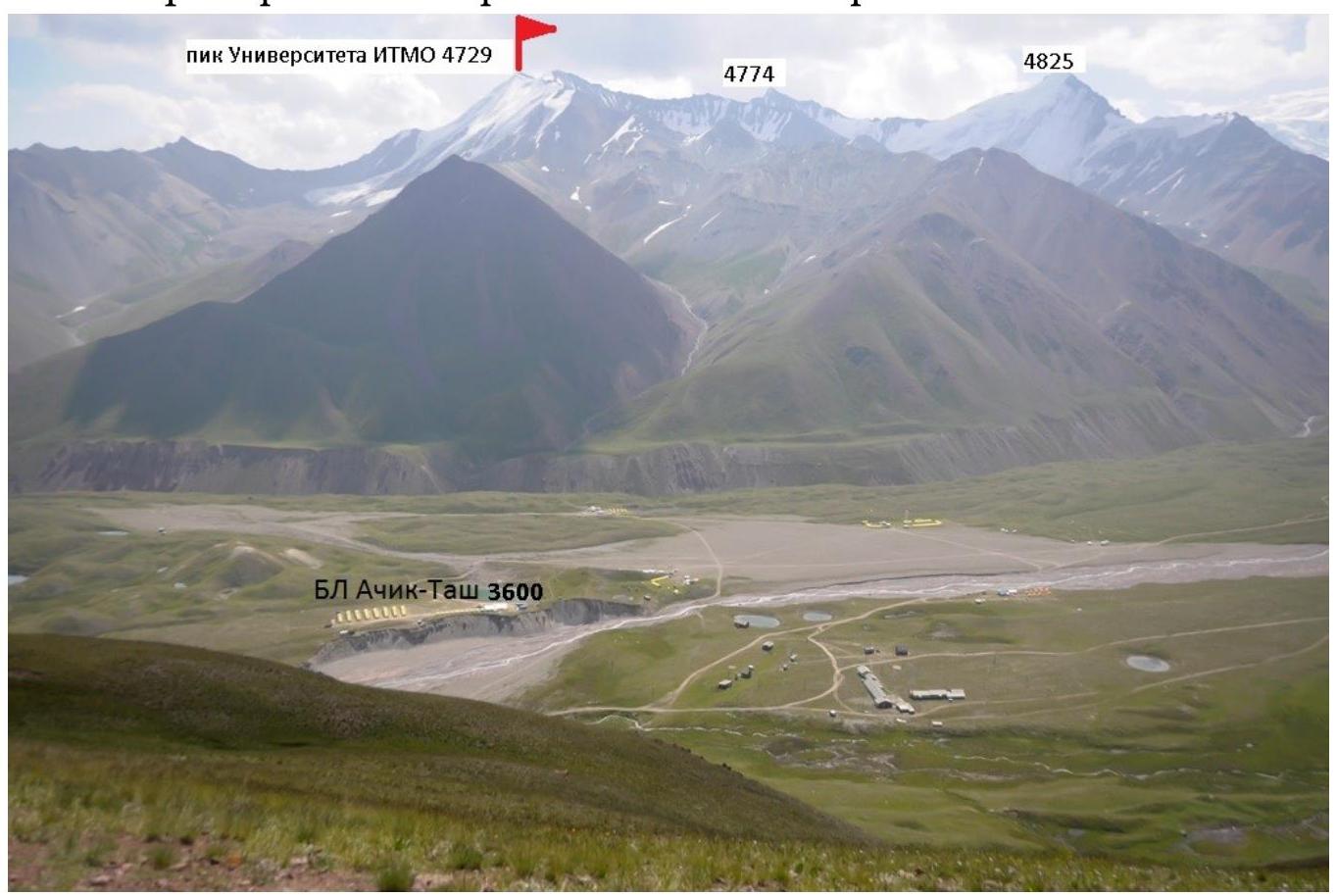
Map of the area indicating approaches and
descent: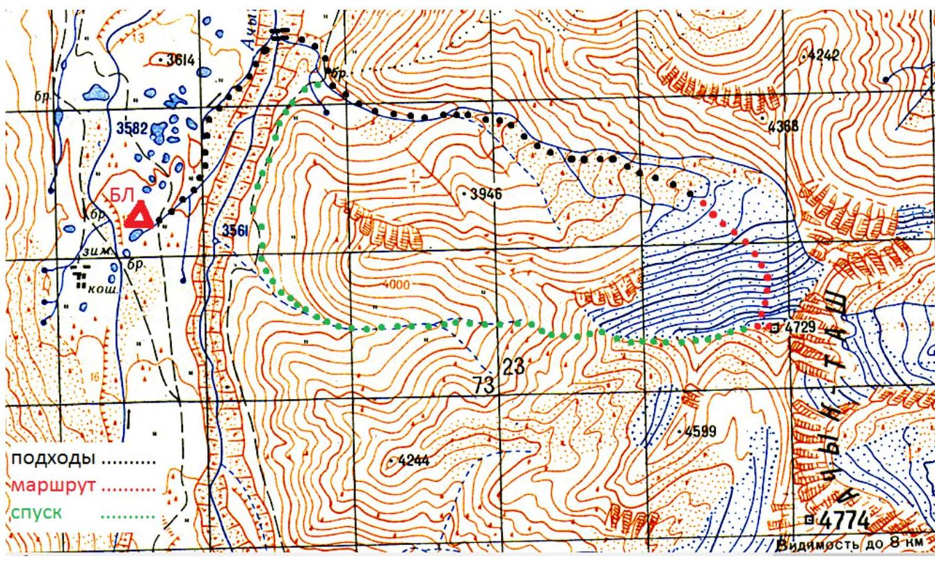
Approach: from the Achik-Tash base camp, follow the trail to the bridge over the Achik-Tash river. After crossing the bridge, ascend the valley along the stream that flows into the Achik-Tash river directly by the bridge. In the upper part of the valley, turn right onto the moraine and approach the glacier under the center of the Northern wall of Pik Universiteta ITMO.
The glacier was open, and the team crossed it without being roped up. If there is snow on the glacier, it is recommended to cross it in a rope team to avoid falling into a crevasse.
Time taken by the team to approach the route from the Achik-Tash BC — 2.5 hours.
Photo 2: photo of the northern wall of Pik Universiteta
ITMO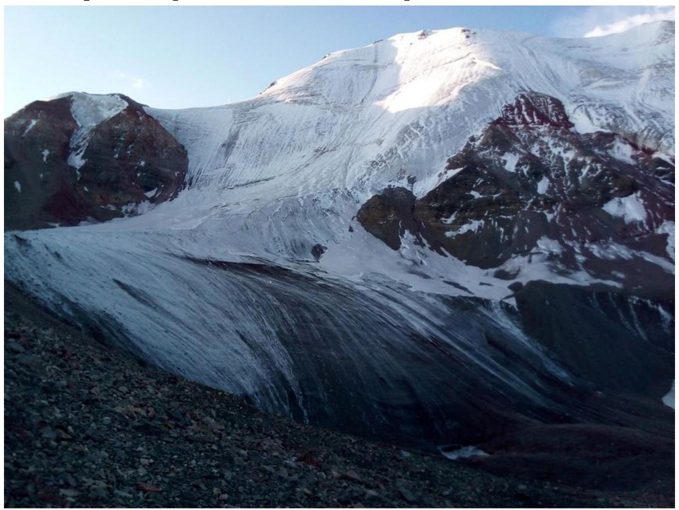
The route was climbed on a 50-meter rope doubled up for simplicity; in the text, the distance is measured in standard ropes (50 m). Photo 3: technical photo of the 4A route
(first ascent)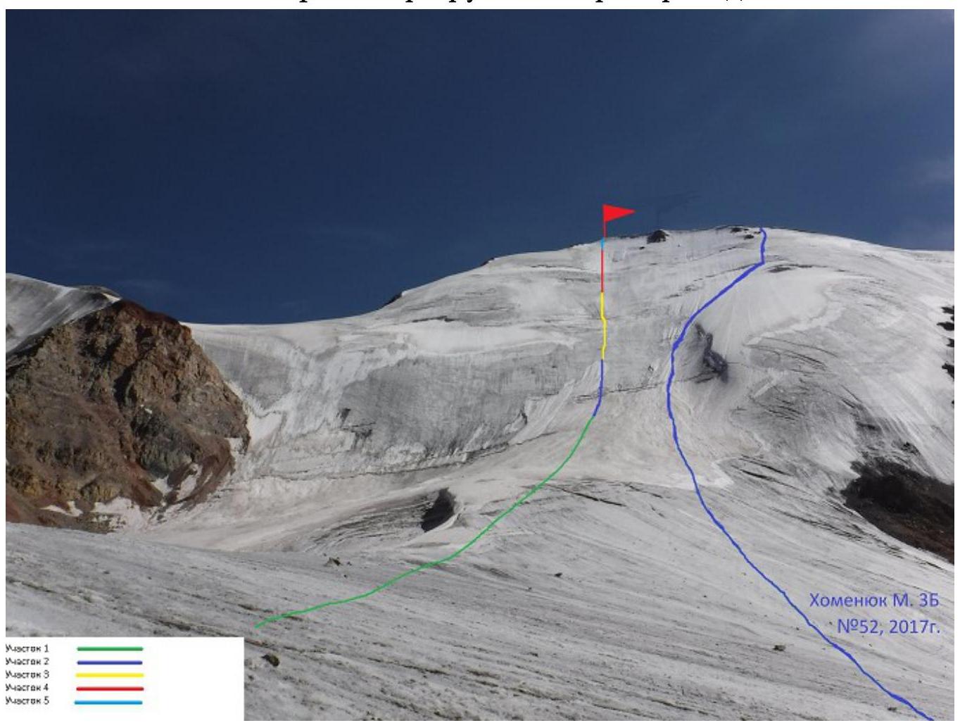
Section 1:
- Snow-ice slope, steepness 20–30°
- Steepness gradually increases
- Section length about 350 m
- Simultaneous movement in crampons, roped up
Section 2: snow-ice slope, steepness 30–40°. Steepness gradually increases. Section length about 300 m.
- Cross the bergschrund via a snow bridge.
- Then simultaneous movement in crampons, on ice axes with front points.
- Ascend directly up the center of the wall, so that the cornices on the summit ridge remain on the right side.
- For insurance, 2 ice screws were used.
- It is recommended to insure more frequently than the team did.
Photo 4: on section
2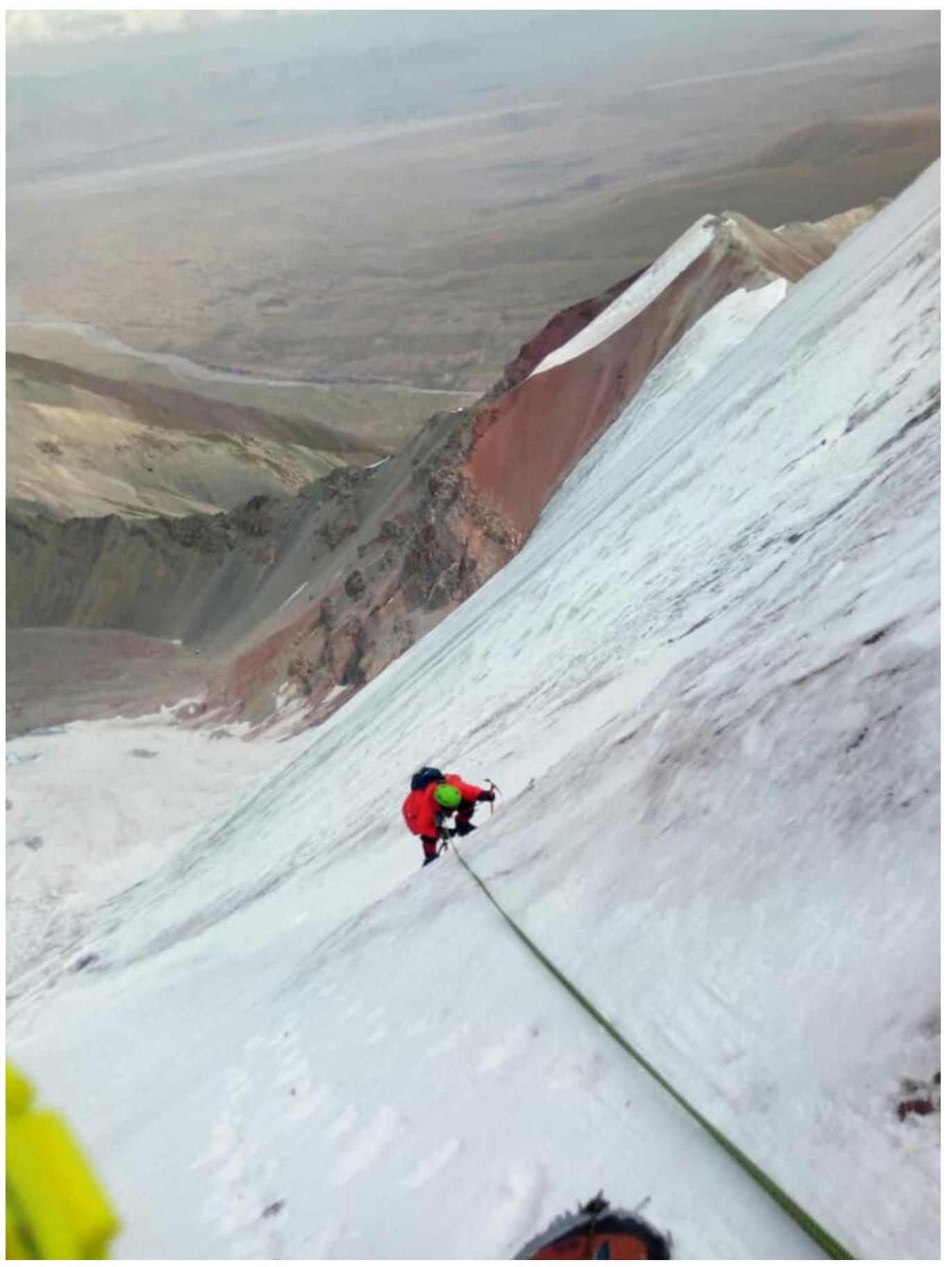
Section 3: Snow-ice slope, steepness 50–60°. IV+. Section length 200 m; 4 ropes of 50 m.
- The bergschrund is passed via a snow bridge.
- Then, alternating movement on front points of crampons and two ice axes.
- Insurance — 3 ice screws per rope, stations on two ice screws.
Photo 5: on section
3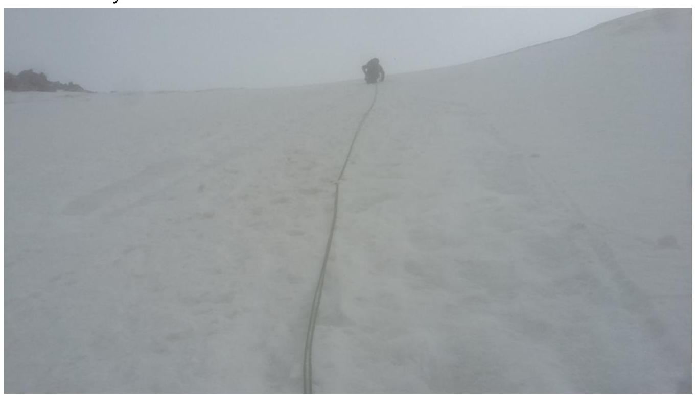
Photo 6: bergschrund on section
3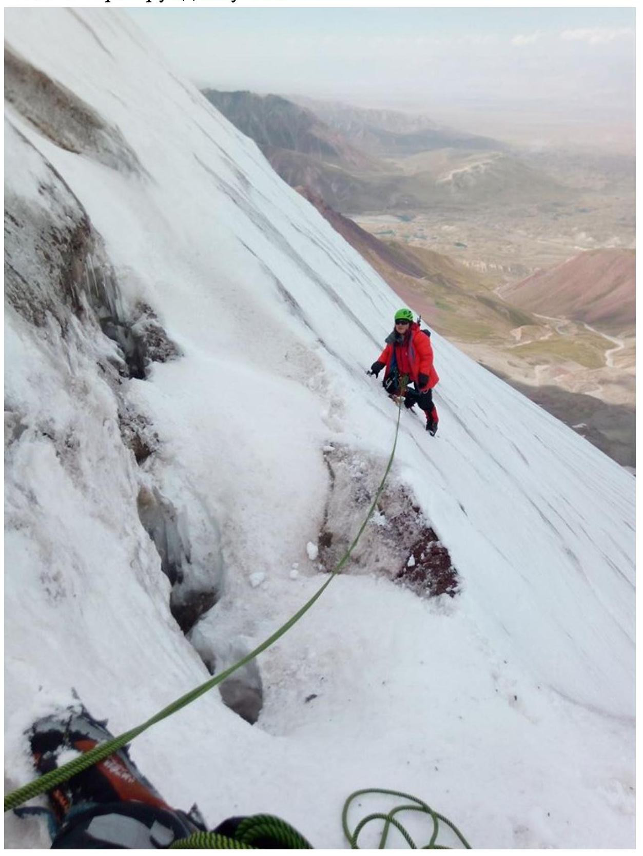
Section 4: Snow-ice slope, steepness 65–70°. IV+. Separate small sections (2–3 m) up to 80°. Section length 120 m; 2.5 ropes of 50 m.
Photo 7: upper part of section 4 (center). A snow cornice is visible, which remains to the right of the route line (in the foreground). The photo was taken at the beginning of the descent from the
summit.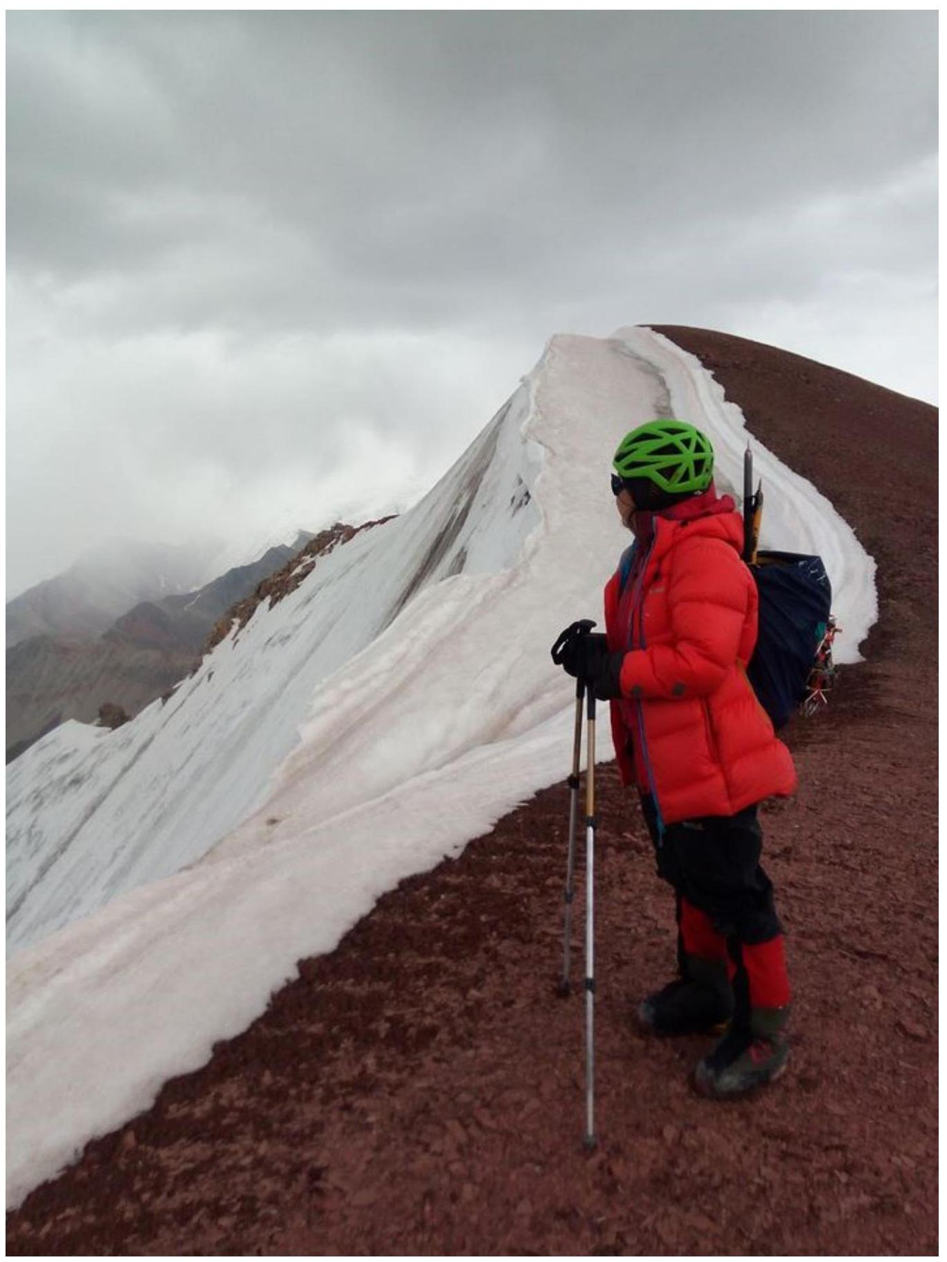
Then, alternating movement on front points of crampons and two ice axes. Insurance — 4 ice screws per rope, stations on two ice screws. The cornices on the summit ridge remain on the right side throughout the ascent.
Photo 8: view from a station on section
5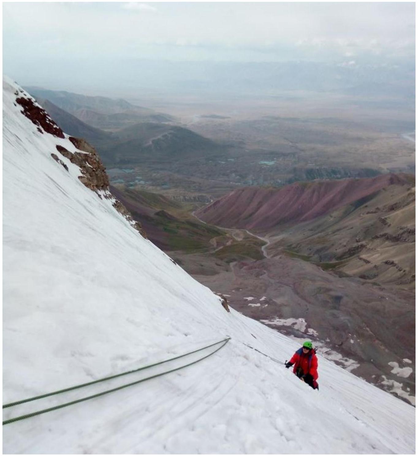
Section 5: snow-ice slope, steepness from 30° to 20°. Steepness gradually decreases. Section length about 30 m.
- The rope leads directly to the summit.
- The upper 4–5 m — scree slope (fine scree).
- The rope was passed alternately without insurance points.
- Insurance on the summit was "via the waist".
Photo 9: Bakytjan (MPEI alpine club) on the summit of Pik Universiteta
ITMO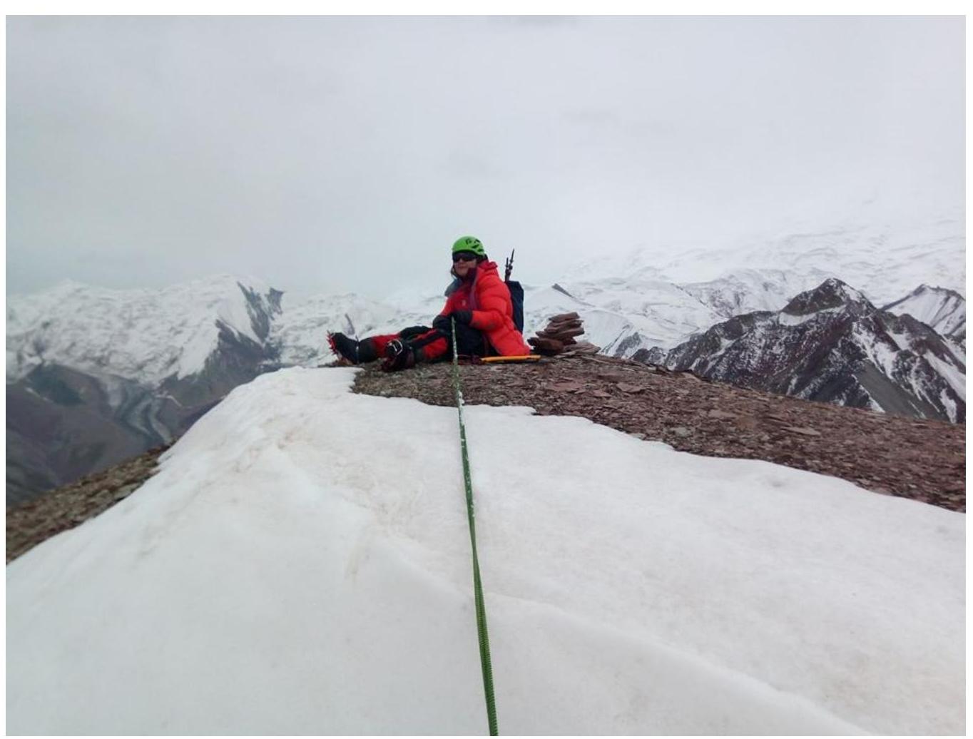
Photo 10: Mikhail (Ak-sai
travel)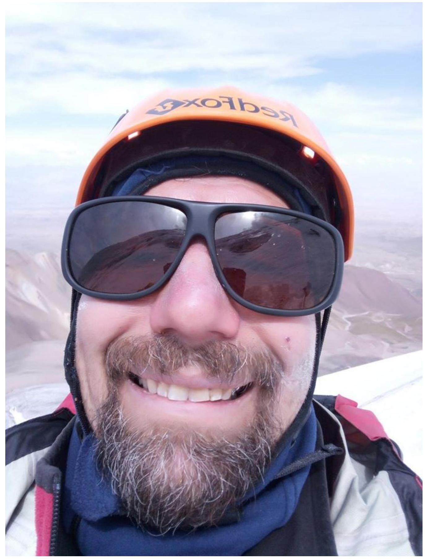
From the Achik-Tash base camp, Ak-Sai Travel completed the ascent to the summit and back in fifteen hours:
Departure from BC to the route: 5:00, August 26, 2019. Route started: 8:05, August 26, 2019. Reached the summit: 15:34, August 26, 2019. Returned to BC: 20:00, August 26, 2019.
Descent: via the western ridge, approximate difficulty 1B–2A, then down the scree slope into the valley and along the trail to the bridge. There is an option to quickly descend into the valley via the southern fine scree slope was possible, but it would be significantly farther to return to the bridge.
Overall impression: a pleasant, somewhat lengthy route. Reliable insurance.
- Not avalanche-prone as of late August — no snow.
- Practically not prone to rockfall — nothing fell during the ascent.
- The route was climbed under favorable weather conditions.
Comments
Sign in to leave a comment