
REPORT ON THE FIRST ASCENT OF THE PAMYATI ZHENSKOY SBORNOY PEAK VIA THE SOUTHWEST RIDGE ROUTE, CATEGORY 2B, BY THE ASIA OUTDOOR GUIDING TEAM ON AUGUST 9, 2019
2020 I. Ascent Passport
| № | 1. General Information | |
|---|---|---|
| 1.1 | Full name, sports rank of the leader | Inozemtsev Eduard Borisovich, 1st sports rank. |
| 1.2 | Full name, sports rank of the participants | Sokhatsky Alexander Ivanovich, 2nd sports rank. |
| 1.3 | Full name of the coach | Suviga Vladimir Ivanovich. |
| 1.4 | Organization | Asia Outdoor company |
| 5.1 | Full name, e-mail | Inozemtsev Eduard Borisovich, inozemtsev.edik@yandex.ru |
| 2. Characteristics of the Ascent Object | ||
| 2.1 | Region | Pamir, Trans-Alay Range. |
| 2.2 | Valley | Achik-Tash. |
| 2.3 | Section number according to the 2013 classification table | 4.4 |
| 2.4 | Name and height of the peak | Pamyati zhenskoy sbornoy, 4774 m. |
| 2.5 | GPS coordinates | 39.464304, 72.966667. |
| 3. Characteristics of the Route | ||
| 3.1 | Route name | Via the SW slope, through the SW ridge. |
| 3.2 | Proposed category of difficulty | Category 2B. |
| 3.3 | Degree of route exploration | First ascent. |
| 3.4 | Relief characteristics of the route | Combined. |
| 3.5 | Elevation gain of the route | 406 m. |
| 3.6 | Route length | 725 m. |
| 3.7 | Technical elements of the route | Category 1 combination – 100 m, Category 2 combination – 575 m, Category 3 snow/ice – 50 m. |
| 3.8 | Descent from the peak | Via the ascent route. |
| 3.9 | Additional route characteristics | Streams on the horizontal sections of the glacier, snow before the pass, and on the peak. |
| 4. Characteristics of the team's actions | ||
| 4.1 | Time in motion | 2 hours 50 minutes. |
| 4.2 | Overnight stays | One overnight stay under the mountain. |
| 4.3 | Start of the route | 6:30 AM, August 9, 2019. |
| 4.4 | Summit attempt | 9:20 AM, August 9, 2019. |
| 4.5 | Return to base camp | 4:10 PM, August 9, 2019. |
| 5. Responsible for the report |
II. Ascent Description
1. Characteristics of the Ascent Object
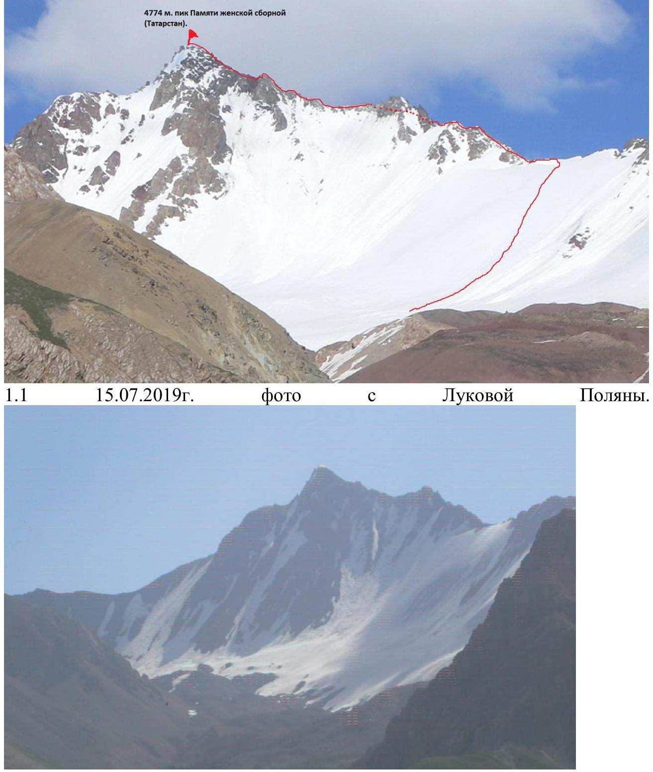
1.1 On July 15, 2019, a photo from Lukovaya Polyana.
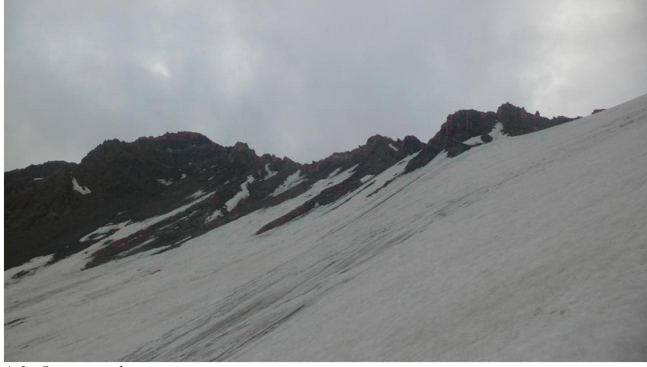
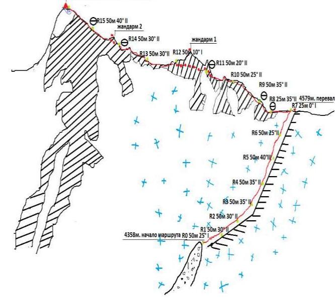
 1.2. Photo of the route profile.
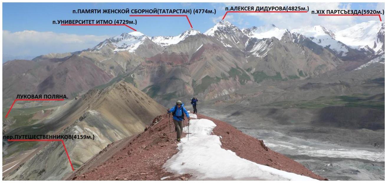
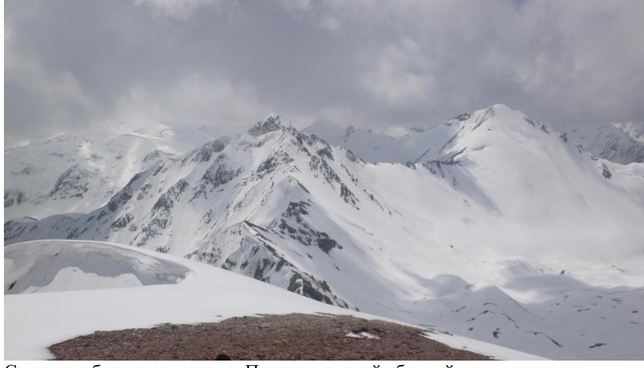
 1.3. Panorama of the area. Taken above the Puteshestvennikov Pass.
 Taken from Lukovaya Polyana.
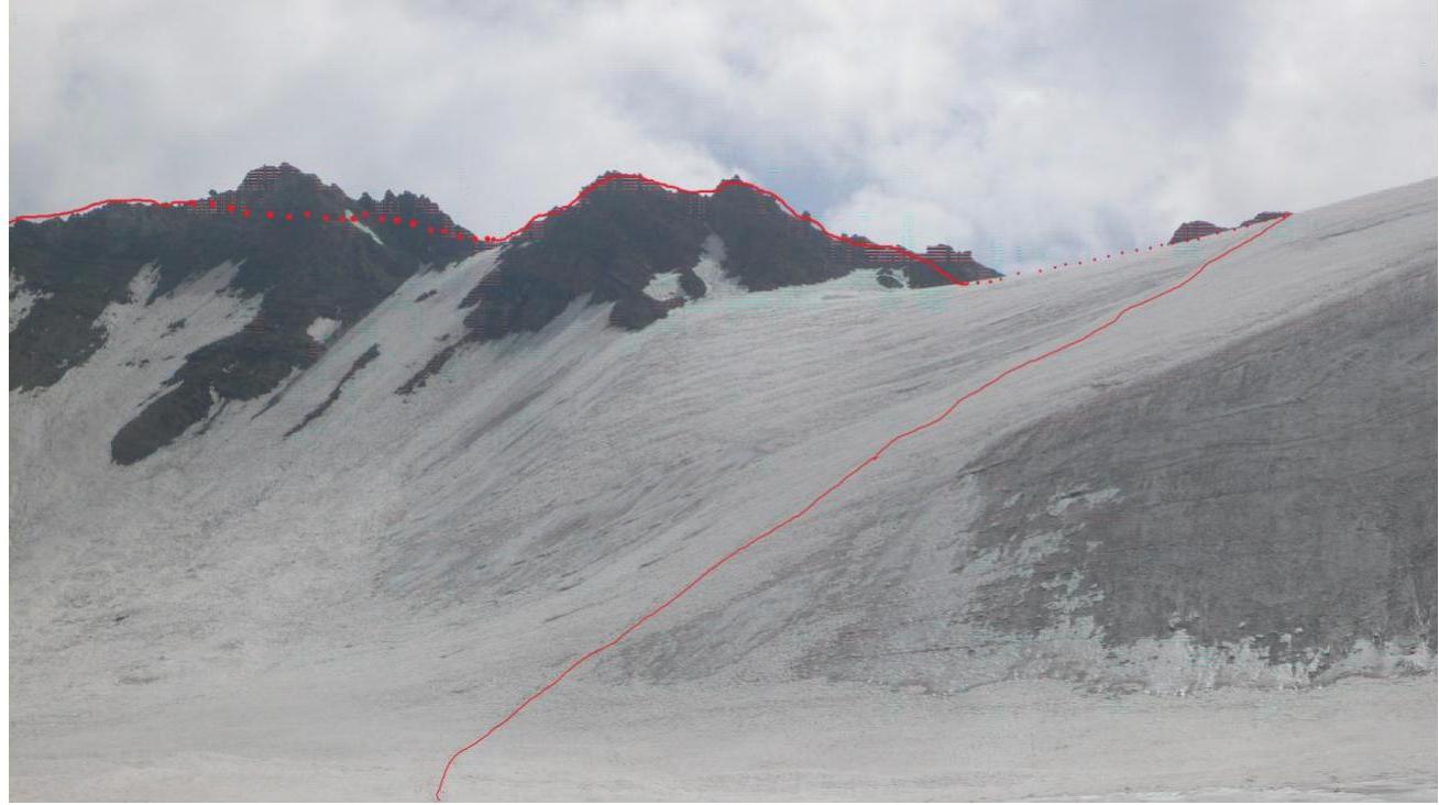
 Taken from the ridge, above the Puteshestvennikov Pass.
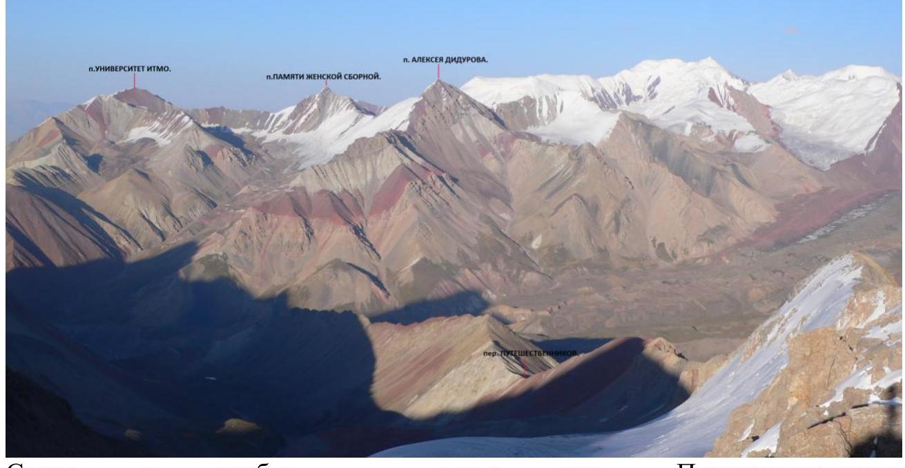
- Peak XIX PARTS'YEZDA
- Peak Aleksey Didorova
- Peak Pamyati zhenskoy sbornoy
- Peak Universitet ITMO
Taken from Sary-Mogol.

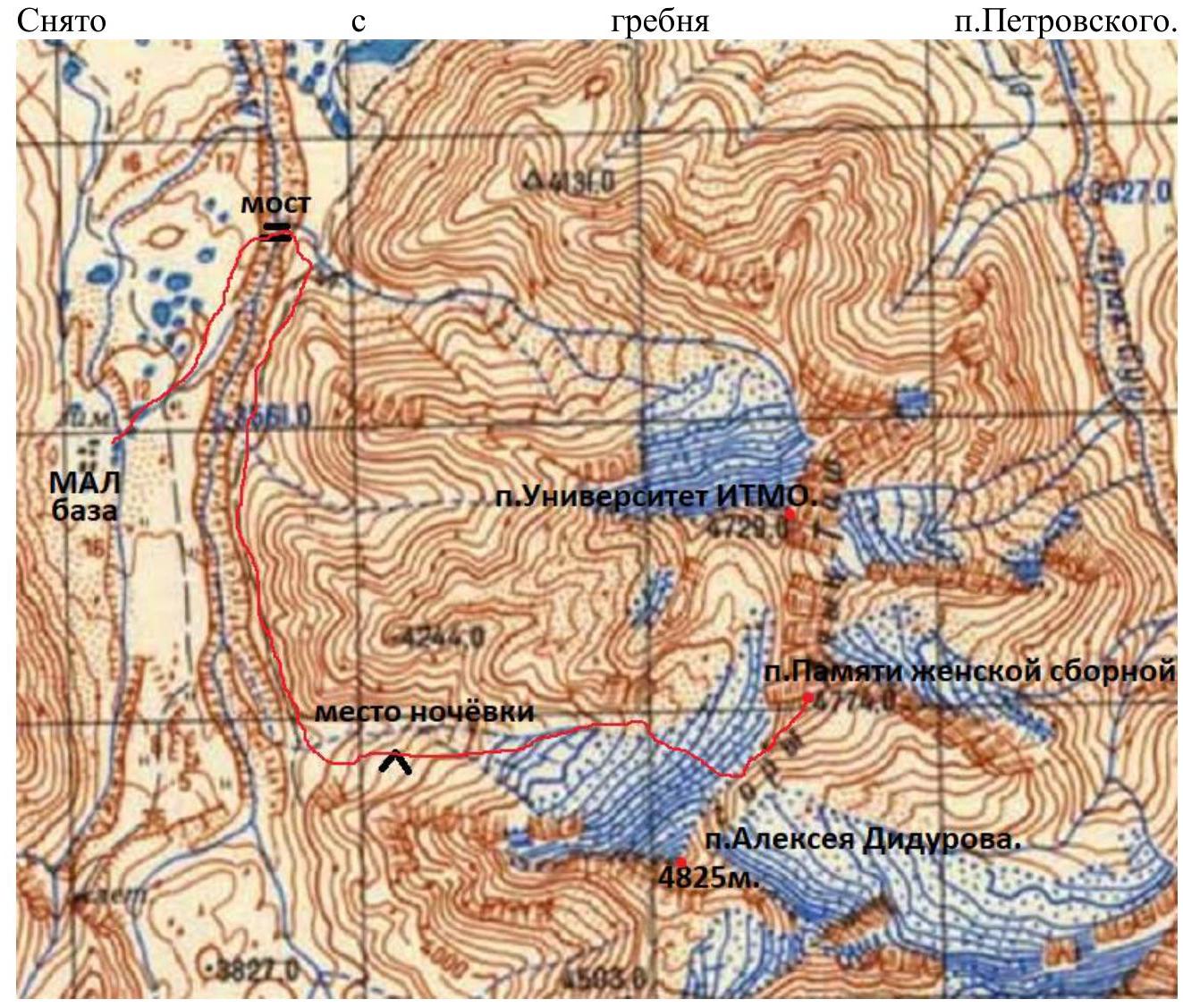

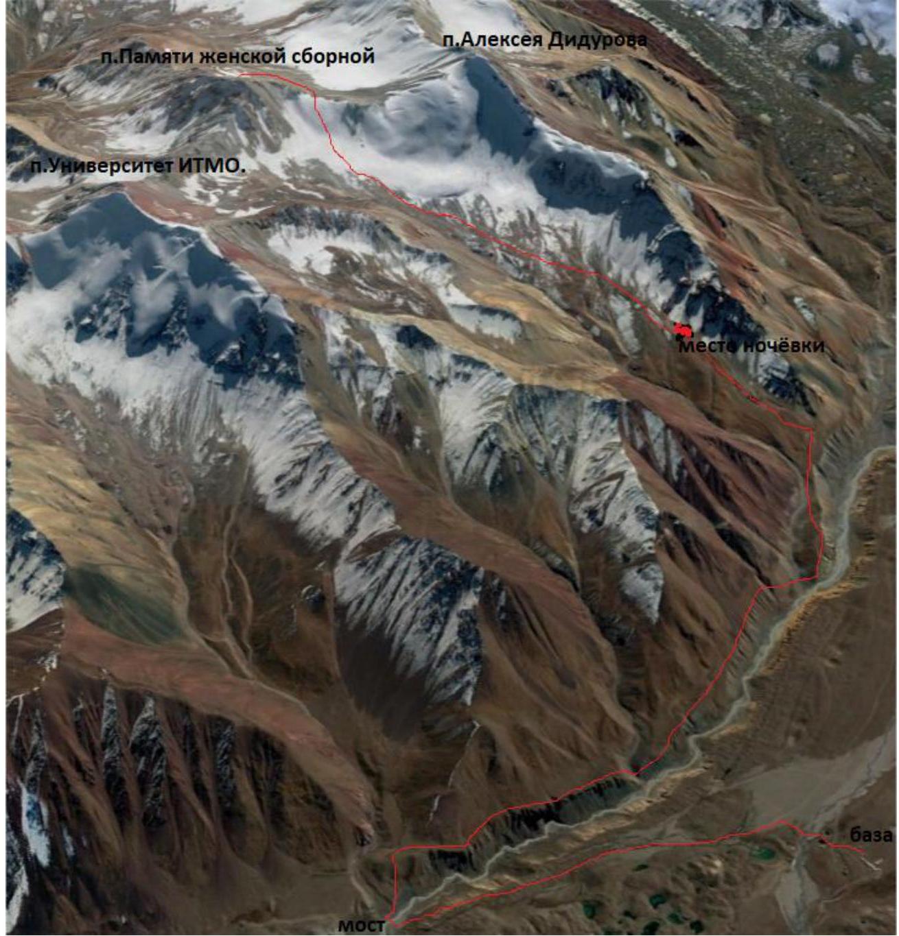
 1.4 The Pamyati zhenskoy sbornoy Peak is located near the border between Kyrgyzstan and Tajikistan, in the Osh Region, in the Achik-Tash valley, between the Universitet ITMO and Aleksey Didurov peaks, in the Trans-Alay Range. The highest point of the range is Peak Lenin (7134.3 m). The range stretches 150 km in the latitudinal direction and borders the extreme western spurs of the Kokshaaltau (Tian Shan) to the east and the confluence of the Muksu and Kyzylsu rivers to the west. The northern slope of the range faces the Alay Valley, and the southern slope faces the Pamir. For a significant distance, the average heights of the Trans-Alay Range exceed 6000 m. The nearest city to the Alay Valley is Osh, which can be reached by plane or by car from Bishkek. From there, only off-road vehicles can be used to reach the numerous tour firm bases. We were based at the MAL with the Asia Outdoor company. The distance from Osh to MAL is 120 km in a straight line and 280 km by road, taking 5-10 hours depending on the driver's experience and the cross-country ability of the vehicle. However, I have seen even a "Volga" car there. The road to the last settlement, Sary-Mogol, is a good asphalt highway, after which we turn left, cross the bridge, and continue on a dirt road. In early June, there may still be snow on the road, and the rivers can be challenging, especially in the evening or after rain. From there to the base is 37 km.
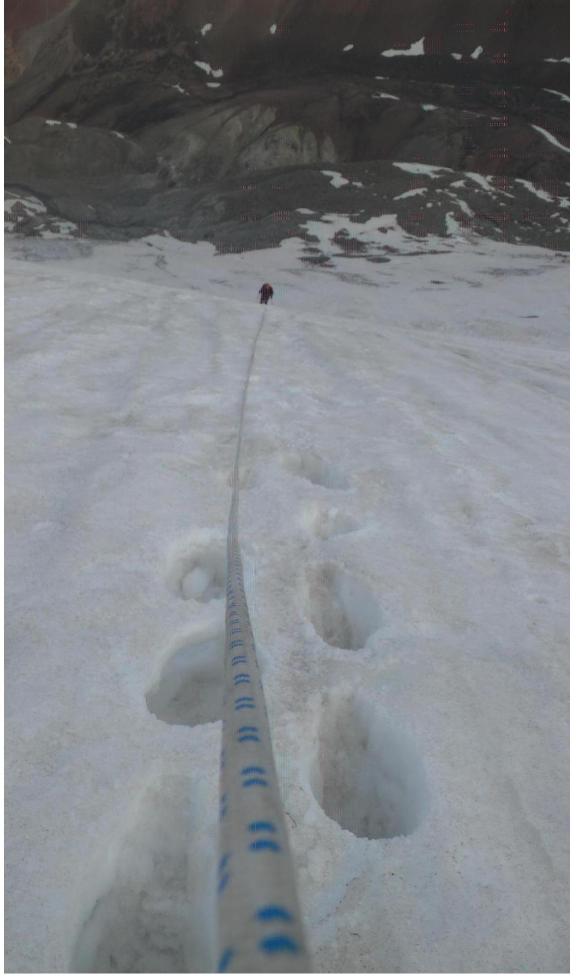
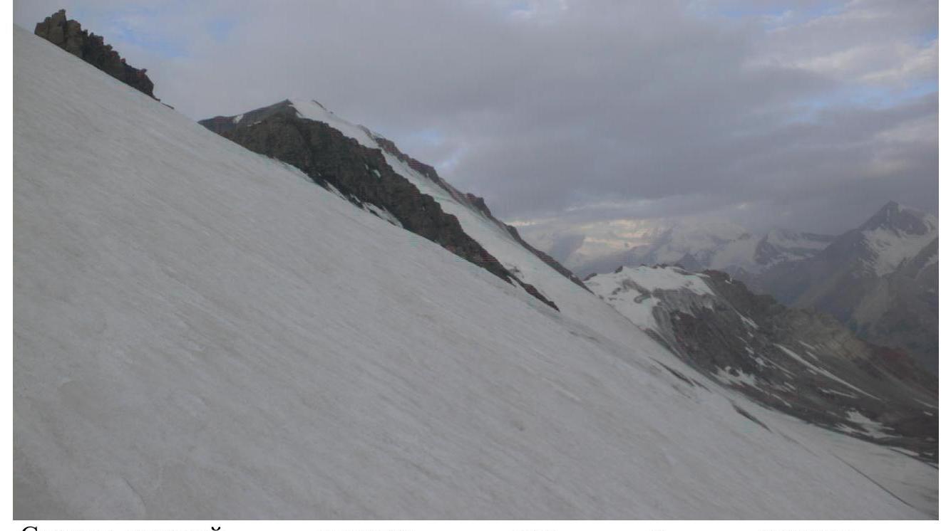
We assumed that we would not have enough daylight to complete the ascent, so we decided to stay overnight. We started at 4:40 PM. We crossed the Achik-Tash River via the new bridge, then followed the left side of the river upstream, crossing a small stream, and entered our valley. We gained altitude and set up camp near a stream where the grassy zone ended and the bare moraine began. The approach took 3 hours and 20 minutes. We could have walked without an overnight stay, but we had a secret plan to climb two routes. The weather was cloudy, and we wondered what the next day would bring. We woke up at 3:30 AM and started at 4:40 AM, walking along the border between the moraine and the glacier. At 6:15 AM, we stopped at the upper part of the moraine, put on our harnesses, and began the ascent in a rope team 15 minutes later. The first 50 m had a slope of 25°, which later increased to 35-40°. The layer of old snow on the ice was 10-40 cm, and we climbed simultaneously in three steps. At the top, when the snow became 10 cm deep, we screwed in a piton for safety. As we approached the pass, the slope decreased to 25°.
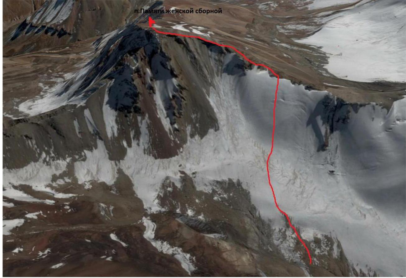
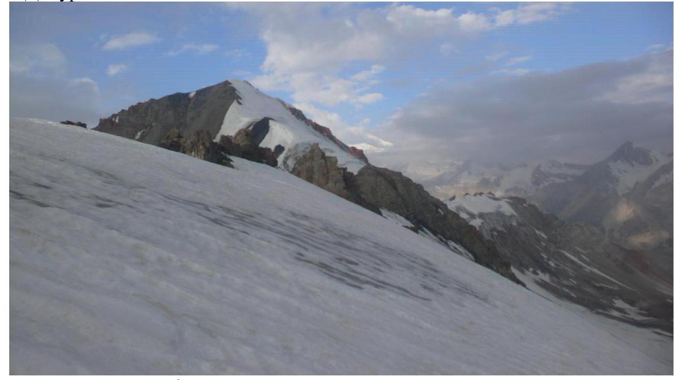
At 7:40 AM, we reached the pass (4579 m). We had a snack, replenished our water supply, contacted Base via radio, left behind some ice climbing gear, and took one piton and an ice axe, as we saw snow on the summit cap. The elevation gain from the pass to the summit was 200 m, and the distance was 400 m (8 rope lengths). We started upwards at 8:10 AM. We traversed a scree slope on the seventh rope length, which was practically horizontal, and then followed the rocky "feathers," staying on the right side. On the eleventh rope length, we bypassed a "gendarme" on the right, avoiding the rocks and staying on the boundary with the scree. We didn't need any additional protection, such as chocks, as we were able to use the natural features to safeguard our route. Above, there was a plateau where we could rest, having completed half of the distance from the pass to the summit. The ridge narrowed, and we had to climb over sharp "feathers," placing protection and being belayed by our partner. We had to be careful not to fall to either side. The climb became steeper, and we traversed a section of dry, colorful scree. Soon, we saw the snowy summit cap. The final rope length was over "gardens" – rocky outcrops that we navigated carefully, using them for protection. The snowy cap had no visible cornices and rose about 4 m above the rocky plateau. We reached the summit at 9:20 AM. To our surprise, we found a cairn and a note on the "unclimbed" summit. The note read: "August 13, 1983, 1:15 PM. A team of two climbers from the Leningrad Climbing Section: 1. Shaferov G. A., 2. Gravite L. I. completed the ascent to Peak Tatarstan via the Category 1B route on the S ridge. We were on the summit at 1:15 PM. The weather was excellent. We removed the note left by a team of climbers from the Armed Forces of the USSR, led by M. Kh. Agurin, who climbed the Category 3A route on the W rib on August 8, 1970. We started from Lukovaya Polyana. Descent via the N ridge. Greetings to the next climbers on this peak. All the best." We removed this note and wrote our own. While my partner was writing, I scouted out the descent route towards Peak Universitet ITMO, thinking about a possible traverse. In the chaos, we forgot to take a photo together on the summit and only remembered when we were descending to the horizontal glacier. We began our descent at 9:40 AM, following the ascent route, and reached the pass at 10:50 AM. We removed our gear and reached our camp at 12:40 PM. Just as we arrived, it started raining, so we ate our remaining food and headed down to base camp, arriving at 4:10 PM, feeling quite tired.
Back home, while researching the peaks in this area online, I found two maps that labeled our peak as "900th Anniversary of Minsk." The 900th anniversary of Minsk was in 1967, so it's possible that the Belorussians made a first ascent that year. However, in 1970, it was already known as Peak Tatarstan. Neither name appears in the classification. On August 7, 1974, a tragedy occurred on Peak Lenin, where the women's national team perished, with all 8 members lost. On August 9, 2019, 45 years later, to commemorate these tragic events, my partner, Sasha Sokhatsky, and I completed a first ascent or, more accurately, a first traverse of the route and propose to name it "Pamyati zhenskoy sbornoy" (In Memory of the Women's Team).
- The route can be divided into two parts: the first is a snow-ice slope with 7 rope lengths (350 m) at 25-40°, which could be more icy at the beginning of the season and potentially entirely icy by the end of August. The second part is a rocky ridge with 8 rope lengths (400 m) at 20-40°, which may have snowy sections at the beginning of the season. The climbing is not particularly difficult, mostly involving walking on scree, rocky "feathers," and a ridge crest, so there's little risk of falling rocks unless you accidentally dislodge something with your rope.
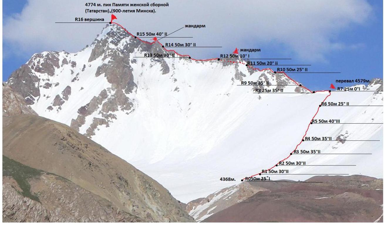
2.3. Technical Characteristics of the Route Sections
| Section # | Relief Characteristics | Category of Difficulty | Length, m | Type and Number of Pitons |
|---|---|---|---|---|
| R0–R1 | Snow | 1 | 50 m | - |
| R1–R2 | Snow | 2 | 50 m | - |
| R2–R3 | Snow | 2 | 50 m | - |
| R3–R4 | Snow | 2 | 50 m | - |
| R4–R5 | Snow | 2 | 50 m | - |
| R5–R6 | Ice-Snow | 3 | 50 m | Ice screw. |
| R6–R7 | Snow | 2 | 50 m | - |
| R7–R8 | Rock | 1 | 25 m | - |
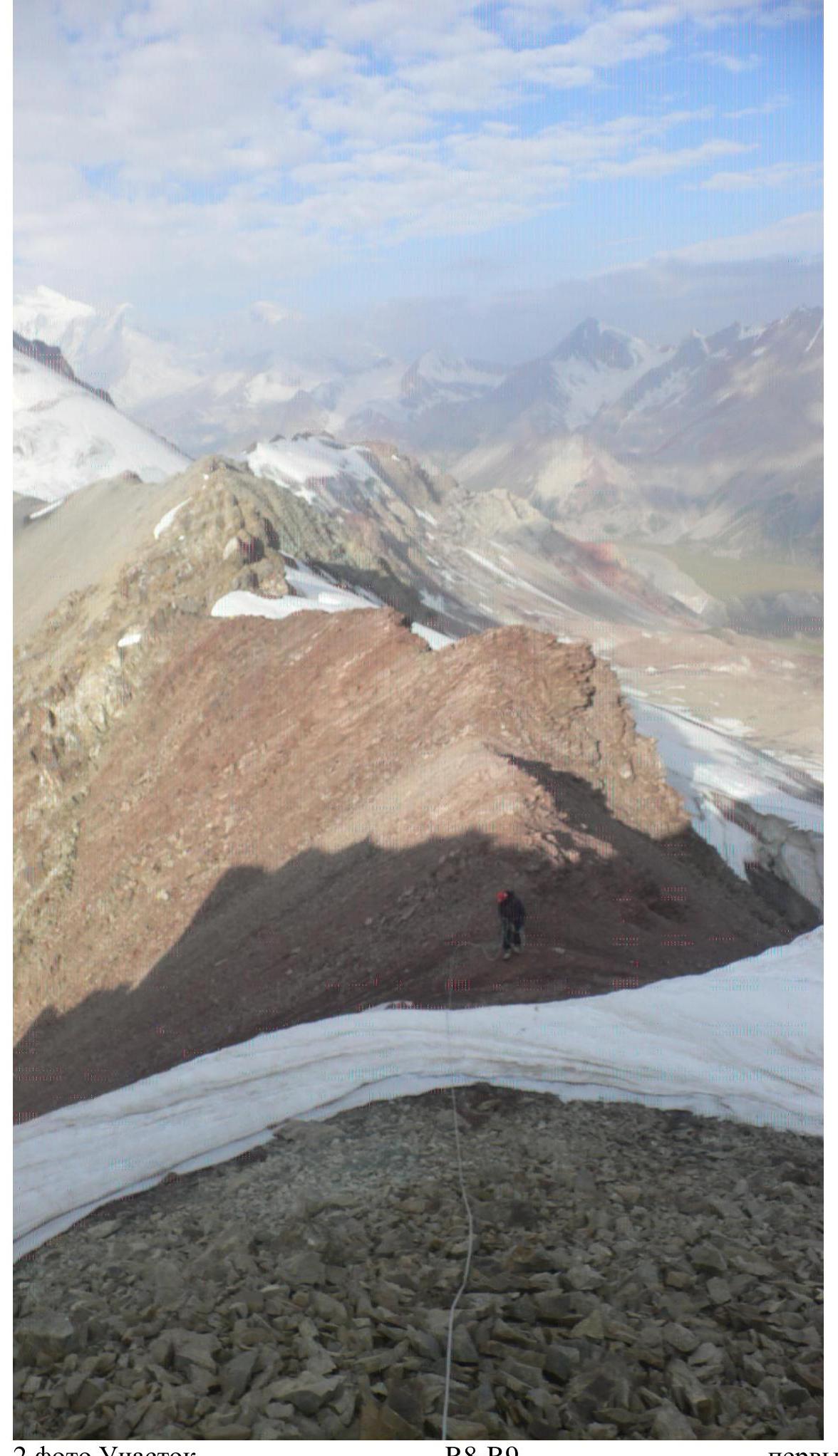
| R8–R9 | Rock | 2 | 25 m | - |
| R9–R10 | Rock | 2 | 50 m | - |
| R10–R11 | Rock | 2 | 50 m | - |
| R11–R12 | Rock | 2 | 50 m | - |
| R12–R13 | Rock | 1 | 50 m | - |
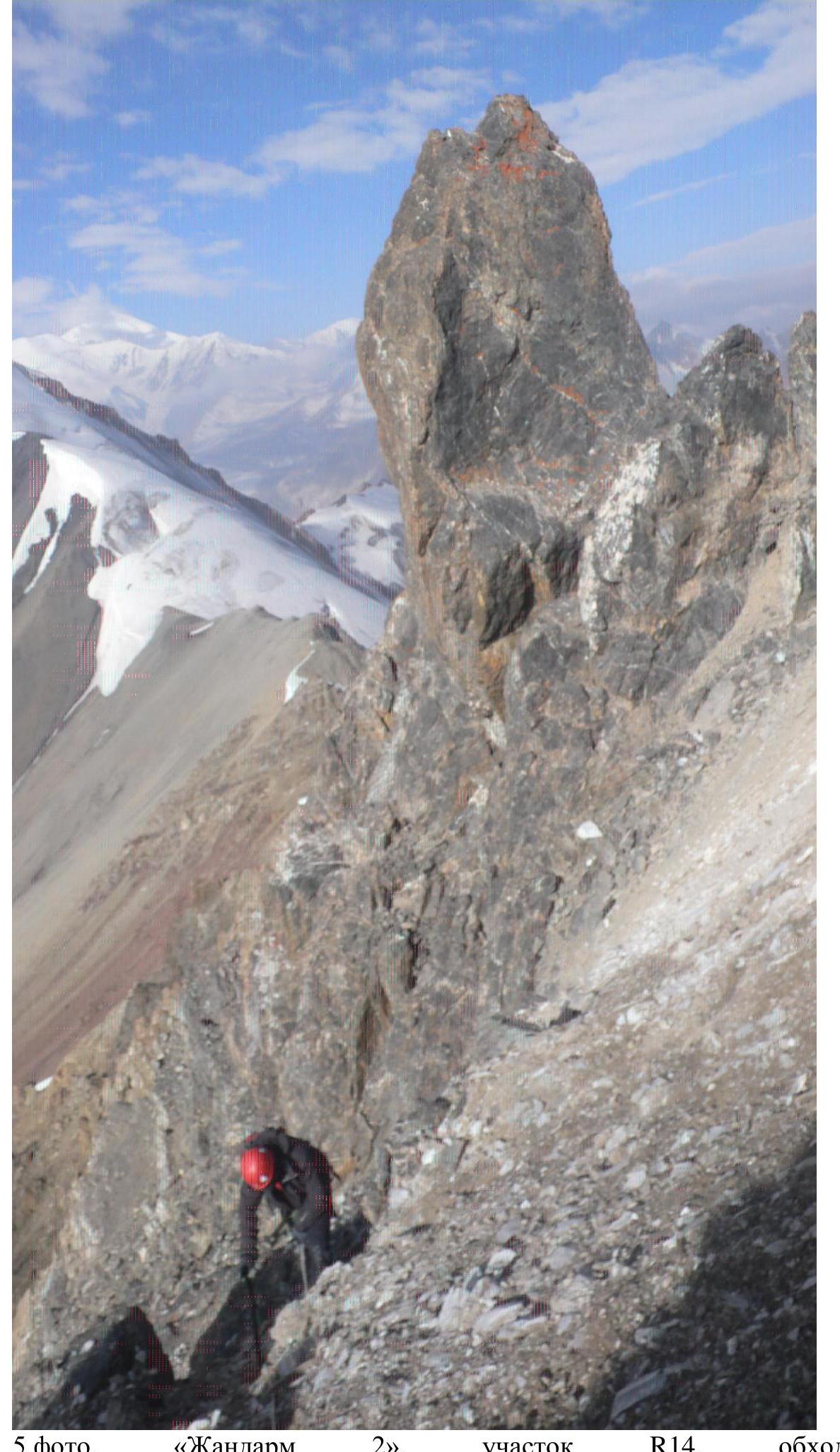
| R13–R14 | Rock | 2 | 50 m | - |
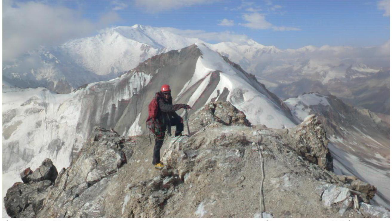
| R14–R15 | Rock | 2 | 50 m | - |
| R15–R16 | Combined | 2 | 50 m | - |
3. Our Climbing Duo Worked in Harmony and with Caution.
3.1. Photo taken after the descent, the route is on snow between ice fields.
-
Photo. Section R6–R7, exit to the pass via snow.
-
Photo. Section R8–R9, the first ascent.
-
Photo. Section R10, Sasha approaches the "feathers."

-
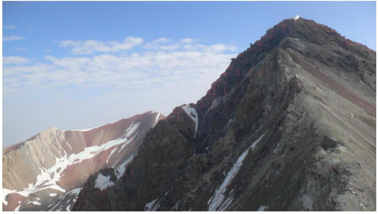
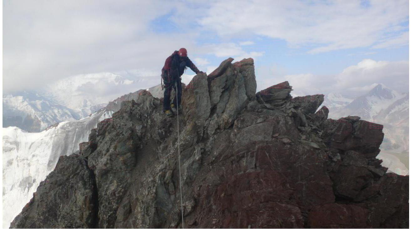
Photo. Before bypassing "gendarme 1," the snowy summit cap is visible on the left. Section R11–R12.
-
Photo. "Gendarme 2," section R14, bypass on the right.
-
Photo. Exit to the plateau above "gendarme 2," section R14–R15.
-
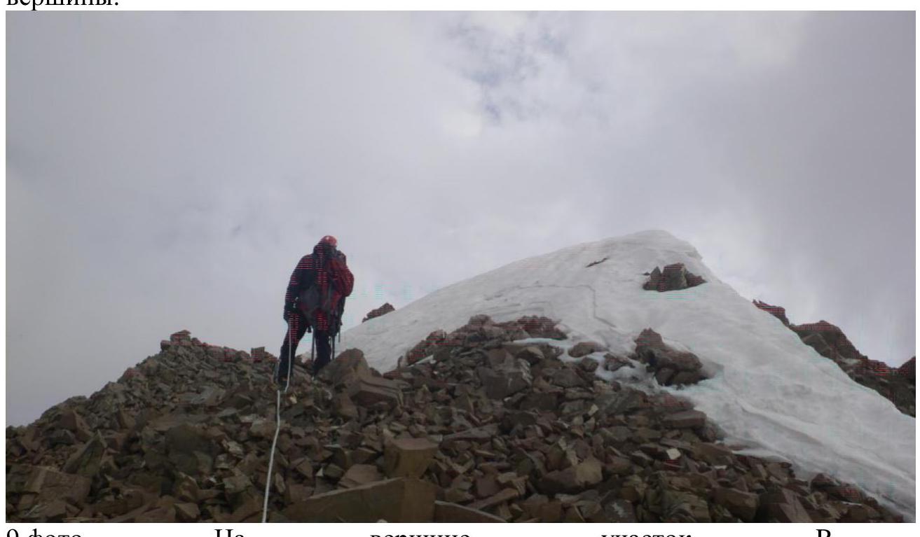
Photo. The final rope length to the summit, section R15. The snowy cornice is visible.
-
Photo. Section R15–R16, the final meters to the summit.
-
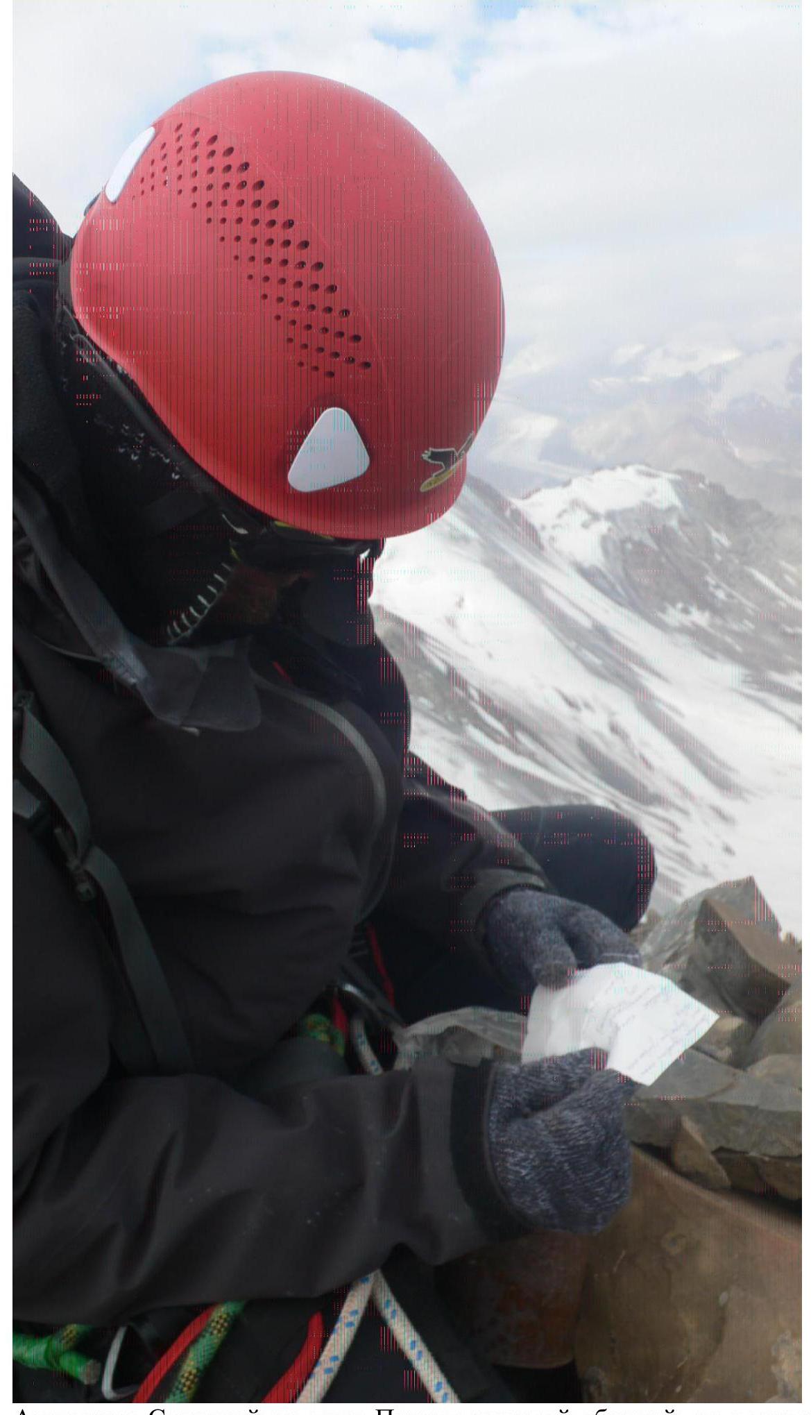
Photo. On the summit, section R16.

Alexander Sokhatsky on the Pamyati zhenskoy sbornoy Peak; we forgot to take a photo together on the summit. It turns out that the "unclimbed" peak, as we assumed, had a cairn and a note.
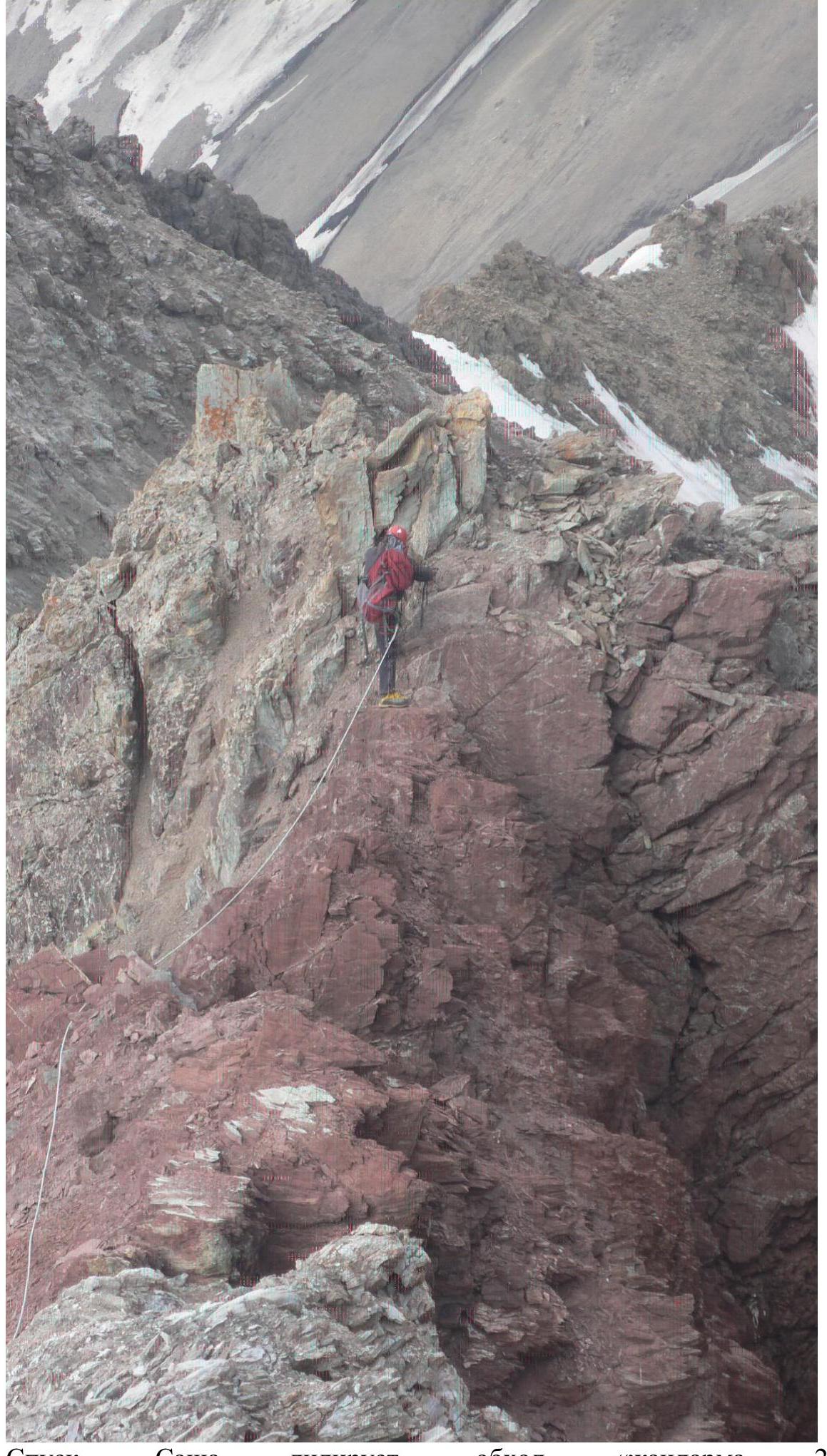
Descent, Sasha leads, bypassing "gendarme 2."
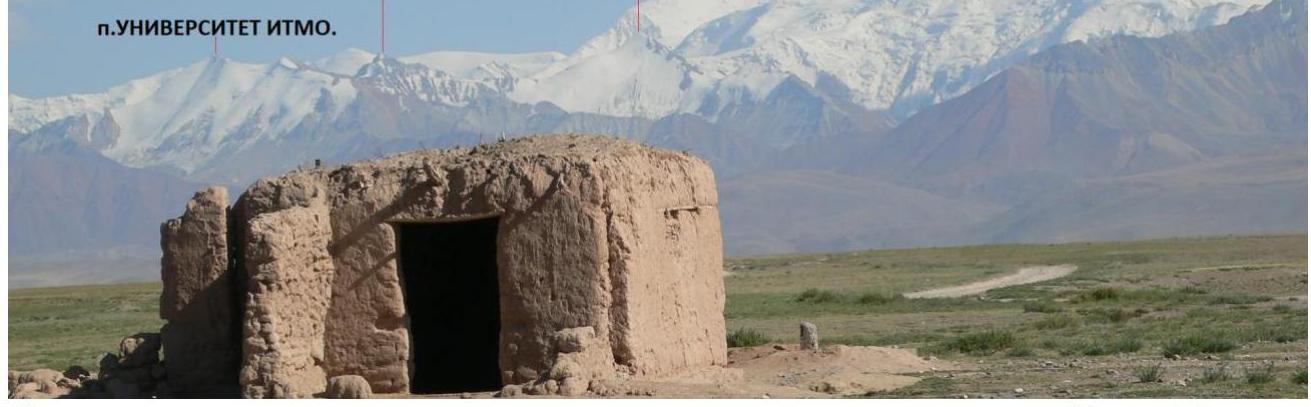
And just a photo: I, Inozemtsev Eduard, on Peak Universitet ITMO (2017). At first, we thought we were doing a first ascent, but then we found a note and started thinking it might be Peak Musa Jalil, but it turned out that a couple of months before us, some guys had climbed it and named it Universitet ITMO! And in the background is the Pamyati zhenskoy sbornoy Peak.

Peak Pamyati, photo from the edge of "Lukovaya Polyana."
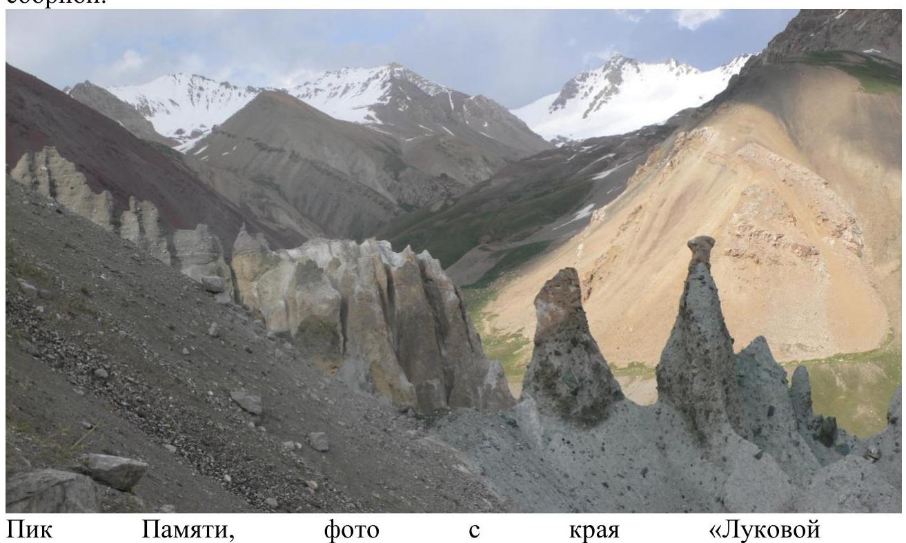

Our peak is on the left, and Peak Aleksey Didurov (4825 m) is on the right.
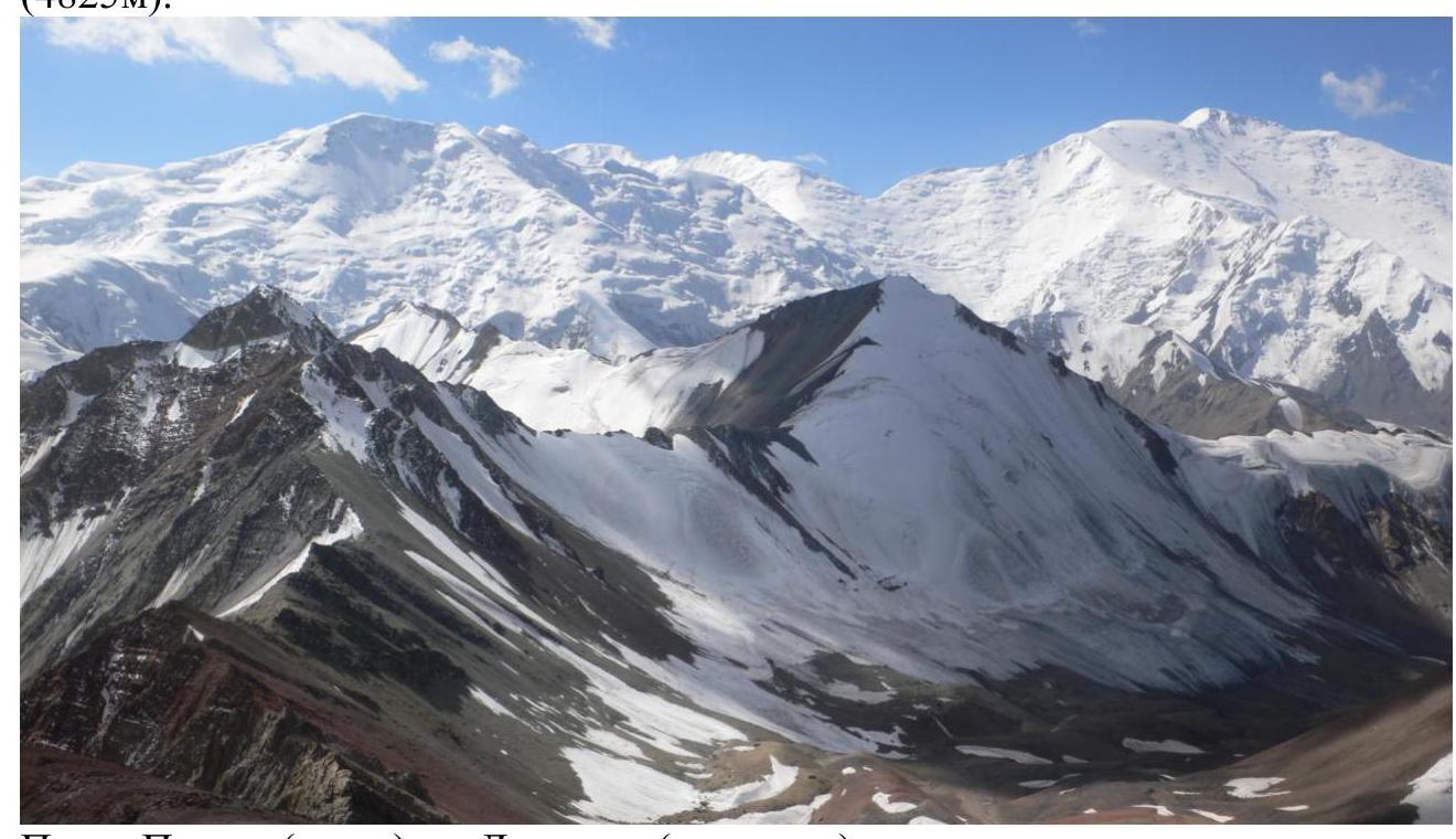
Peaks Pamyati (left) and Didurova (center), with Peak Lenin in the background. Photo from Universitet ITMO.
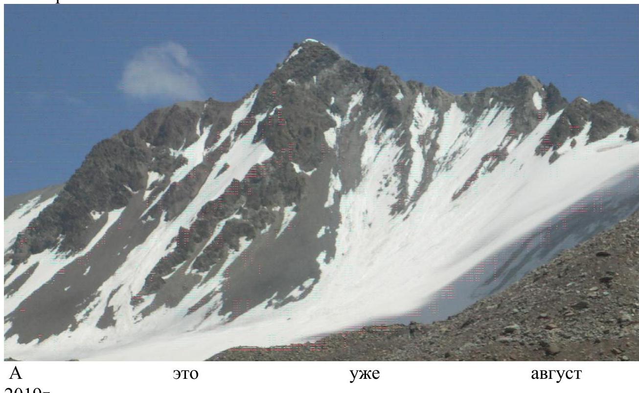
Snowy conditions on Peak Pamyati zhenskoy sbornoy at the beginning of the season (June 20, 2019), photo from Universitet ITMO.
Snow-ice section, view towards Peak Didurova.
Exit to the pass, photo towards Peak Didurova.
| Section # | Description | Photo # |
|---|---|---|
| R0–R1 | At 6:30 AM, we exited the moraine onto the glacier, with ice islands on both sides, and proceeded along the snow field. The first rope length (50 m) was relatively flat at 25°, Category 1 difficulty, with deep, wet snow; we climbed simultaneously. | |
| R1–R2 | Conditions remained the same, but the slope increased slightly. 50 m, 30°, Category 2 difficulty. | |
| R2–R3 | The same as before. It was anticipated that there might be a bergschrund, but it was likely buried under the snow. 50 m, 30°, Category 2 difficulty. | |
| R3–R4 | The slope became steeper. We climbed in three steps, using ice axes, but the snow was reliable. 50 m, 35°, Category 2 difficulty. | |
| R4–R5 | The slope remained the same. 50 m, 35°, Category 2 difficulty. | |
| R5–R6 | The snow layer decreased to 10 cm, revealing bare ice without firn, so we had to screw in a piton and climb carefully using our ice axe picks. The slope increased. 50 m, 40°, Category 3 difficulty. | |
| R6–R7 | Upon exiting onto the pass, the slope decreased, and the snow depth increased. 50 m, 25°, Category 2 difficulty. | №1 |
| R7–R8 | On the pass, we turned left onto a nearly horizontal section, traversing along the boundary between scree and snow. 25 m, 0°, Category 1 difficulty. | |
| R8–R9 | We crossed a partially melted snowpatch that spanned the pass from our valley to the adjacent one. The slope increased, with large scree. 25 m, 35°, Category 2 difficulty. | №2 |
| R9–R10 | The slope remained the same, and we encountered rocky outcrops that we could use for protection. 50 m, 35°, Category 2 difficulty. | |
| R10–R11 | We reached a plateau and then bypassed "gendarme 1" on the right, using the outcrops for protection. 50 m, 25°, Category 2 difficulty. | №3 |
| R11–R12 | We continued to bypass "gendarme 1," with a gentle slope upwards but a steep scree slope to the right, so we used the outcrops for protection. 50 m, 20°, Category 2 difficulty. | №4 |
| R12–R13 | A section with minimal elevation gain but a narrow ridge, so we proceeded with caution. 50 m, 10°, Category 1 difficulty. | |
| R13–R14 | The slope increased, and we encountered rocky "feathers." 50 m, 30°, Category 2 difficulty. | |
| R14–R15 | We bypassed "gendarme 2" on the right, using the outcrops for protection. 50 m, 30°, Category 2 difficulty. | №5, №6 |
| R15–R16 | The final section, with the snowy summit cap visible. The slope increased, but the difficulty was not high. We encountered dense scree alternating with rocky steps. On the summit, there was a snowy cornice but a slight overhang on the opposite side. 50 m, 40°, Category 2 difficulty. | №7–№8 |
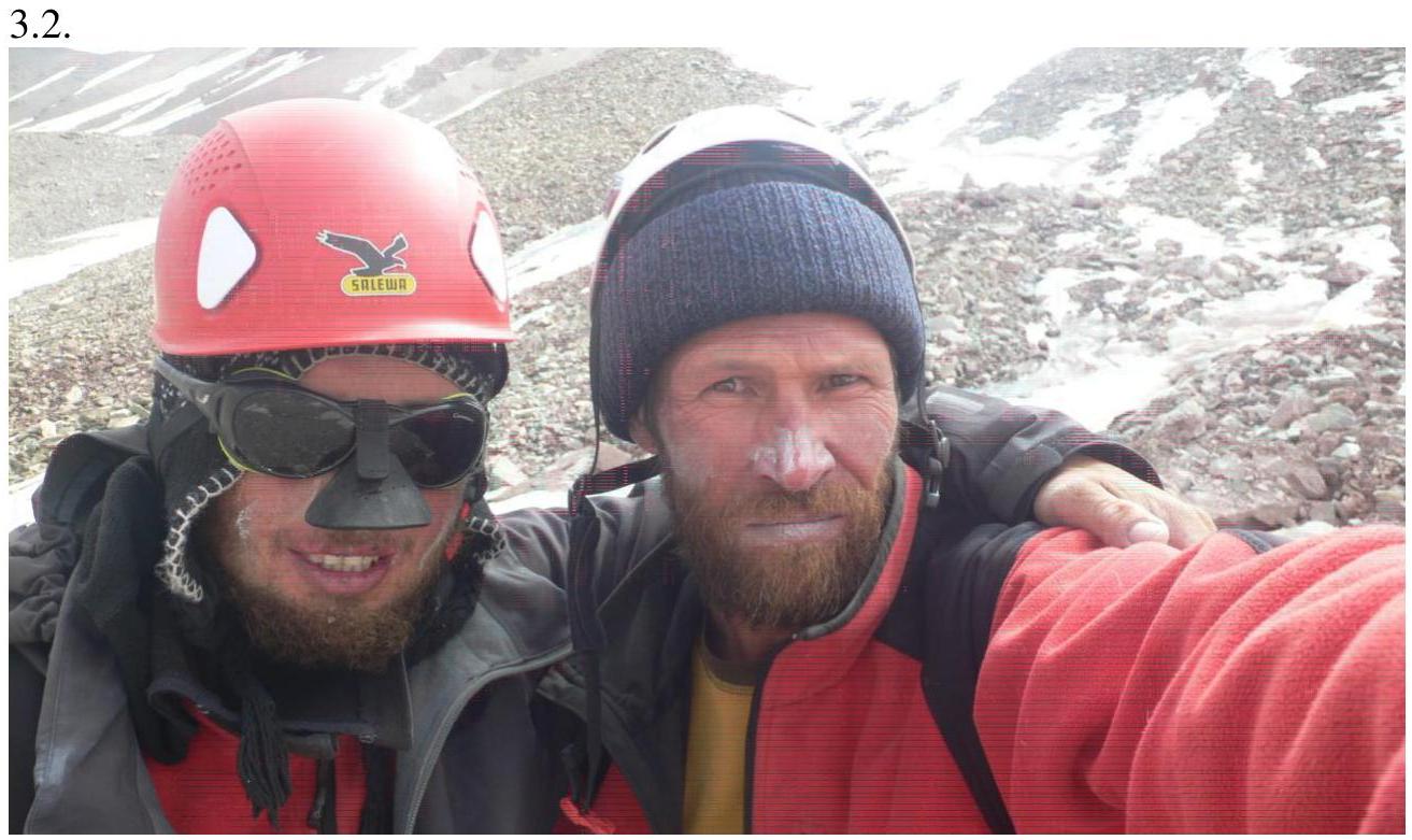
On the summit, we forgot to take a photo together and only did so after descending to the glacier. In the photo: Alexander Sokhatsky and Eduard Inozemtsev. As they say, tired but happy!
3.3. I believe the route is completely safe:
- On the snow-ice section, we started where there were no rocky outcrops on the pass, so that any falling rocks would miss us. We didn't observe any rockfall traces.
- On the rocky ridge, there were no steep sections where rocks could gain significant speed; if rocks did fall, they would go to the sides of the slope.
- We maintained radio communication throughout the route and could call for help if needed, as there was phone coverage.
- The route was short: from the base to the summit took 2 hours 50 minutes, and the approach took 3 hours 20 minutes. I believe a sports team could complete it without an overnight stay.
- Deeper snow on the pass could make the route more challenging and potentially prone to avalanches.
- We descended via the ascent route but believe it's possible to exit the ridge into a couloir via scree.
It's challenging to find a similar Category 2B route; it somewhat resembles Munhlik (Tuva) or Ak-Oyuk. I don't think our route is more complicated, but it does qualify as Category 2B. I apologize for the poor photo quality; the camera malfunctioned, producing red stripes, but there are no other photos available as my partner wasn't carrying a camera.
Comments
Sign in to leave a comment