
Report on the First Ascent of the Route to Peak Yukhina via the Eastern Ridge.
Report on the First Ascent of the Route to Peak Yukhina (5130 m) via the Eastern Ridge.
Ascent Passport
- Pamir. Trans-Alay Range.
Peak Yukhina 5130 m. Presumed 3B category of difficulty, first ascent. Nature of the route — rocky.
Height difference of the route — 400 m.
Route length — 1000 m.
- Length of sections: I — 350 m, II — 350 m, III — 300 m.
- Average steepness: main part of the route — degrees.
- Number of "hooks" left on the route: total — 0;
- Total used on the route: ice screws — 0, rock pitons — 0, chock stones — 25.
- Total artificial points of support (APS) used — 0 pcs.
- Team's travel time: 7 hours, 1 day (without overnight stays)
- Team:
Seliverstov Sergey (leader).
Filinov Viktor.
Klevtsova Anastasia.
- Senior coach: Popov Fyodor Efimovich
- Departure to the route: 8:00, August 17, 2015.
Reached the summit: 13:00, August 17, 2015.
Return to the base camp: 15:00, August 17, 2015.
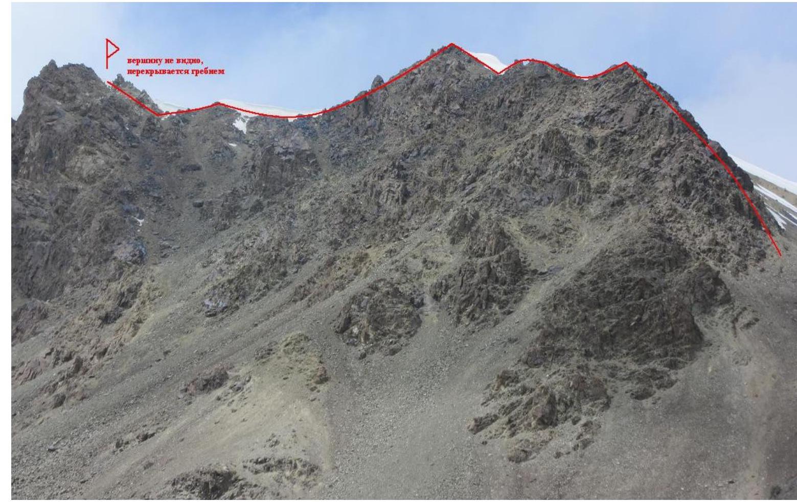
General view of the summit
Route
scheme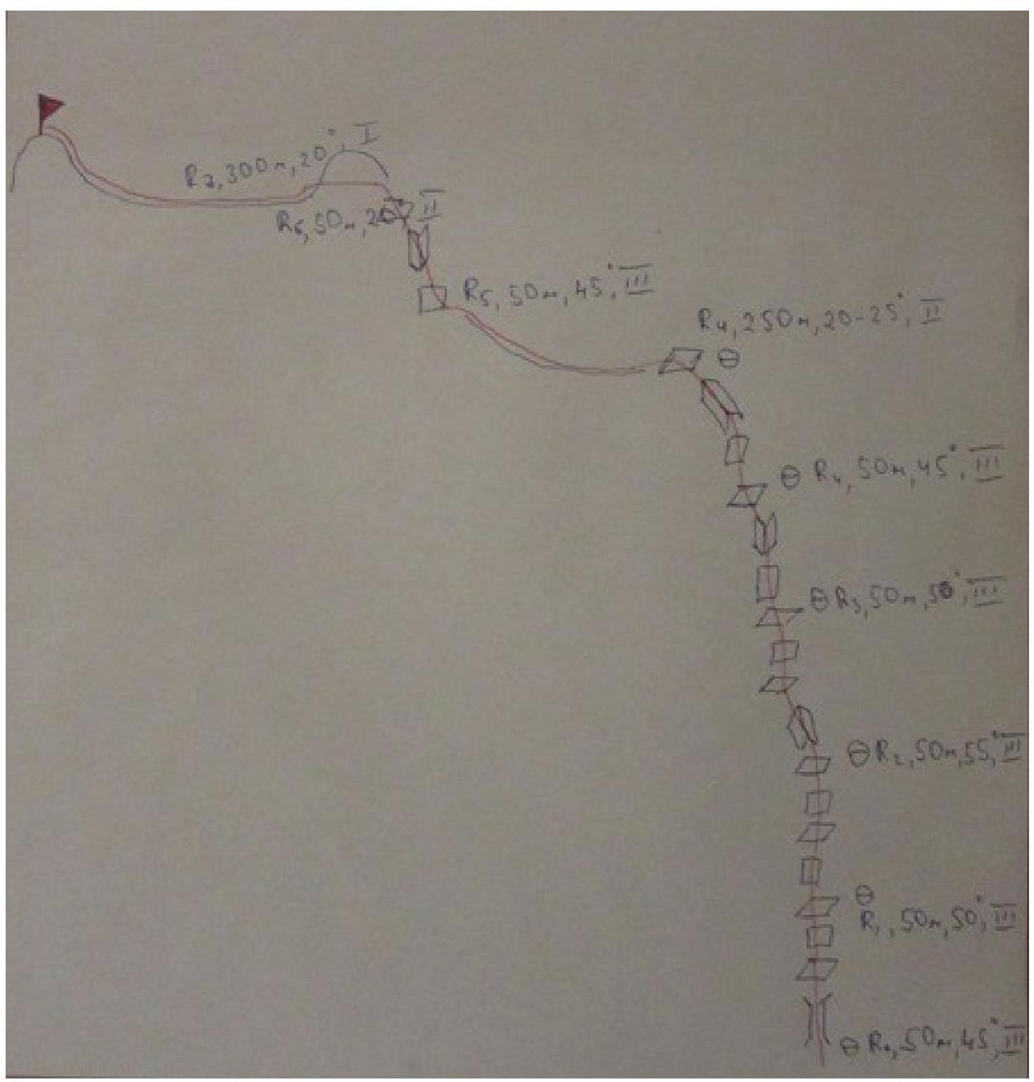
Route profile
| Difficulty | Category of terrain | Steepness | Opposition | |
|---|---|---|---|---|
| R8–summit | I | 20 | 300 | |
| R7–R8 | II | 20 | 50 | |
| R6–R7 | III | 45 | 50 | |
| R5–R6 | II | 20-25 | 250 | |
| R4–R5 | III | 45 | 50 | |
| R3–R4 | III | 50 | 50 | |
| R2–R3 | III | 55 | 50 | |
| R1–R2 | III | 50 | 50 | |
| R0–R1 | III | 45 | 50 |
Route Description
Departure from the 1st camp (4400 m) at 8:00. Approached the route at 9:30. Reached the summit at 13:00. Descent to the base camp at 15:00.
From the camp, we head north, towards the beginning of the ridge. We cross the plateau from which the ascent to Peak Obzornaya begins, descend into the riverbed and go upstream, towards the saddle. At the level of the beginning of the rocky ridge, we exit the riverbed, cross the talus slope, and approach the start of the route. It is visible from the camp, so orientation is straightforward.
- R0–R1 — Walls, slabs, ledges. Not complicated third-category climbing. Start on a small, crumbly couloir, so it's better to set up a station behind a rocky wall. 50 m, 45°, III.
- R1–R2 — From the station, we move to the right to avoid showering the belayer with debris. Then we go from right to left, towards the ridge. 50 m, 50°, III.
- R2–R3 — We follow the ridge. 50 m, 55°, III.
- R3–R4 — From the station, there's a shelf where a steep inner corner begins. About 10 meters of interesting climbing. Then we continue along the ridge. 50 m, 50°, III.
- R4–R5 — On this pitch, we reach a pedestrian rubble zone. 50 m, 45°, III.
- R5–R6 — We rope up and move simultaneously along the boundary between ice and talus. 250 m, 20–25°, II.
- R6–R7 — A gendarme. We climb not to the very top but to the left "shoulder." Then a small descent and again along the ridge. 50 m, 45°, III.
- R7–R8 — Another pitch through the rubble, and we reach a straightforward section. 50 m, 20°, II.
- R8–summit We follow the boundary between the talus and ice. We didn't wear crampons, so we had to descend a bit to bypass the ice outcrops. About 100 meters before the summit, we climbed an ice wall to the right onto the ridge and followed the snowy ridge. At 13:00, we reached the summit. We packed our gear into our backpacks, enjoyed the views, and descended.
Section
R0–R1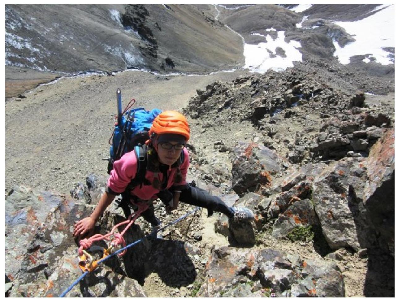
Section
R1–R2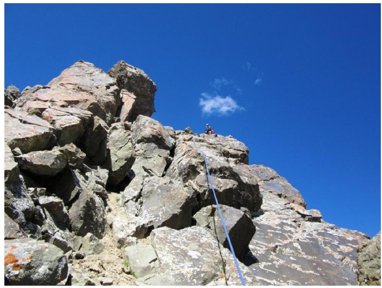
Section
R2–R3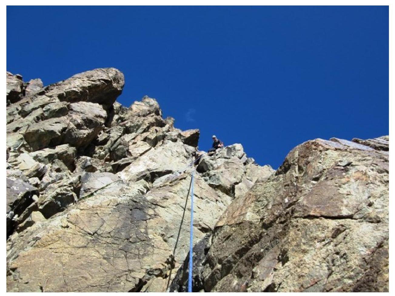
Section
R3–R4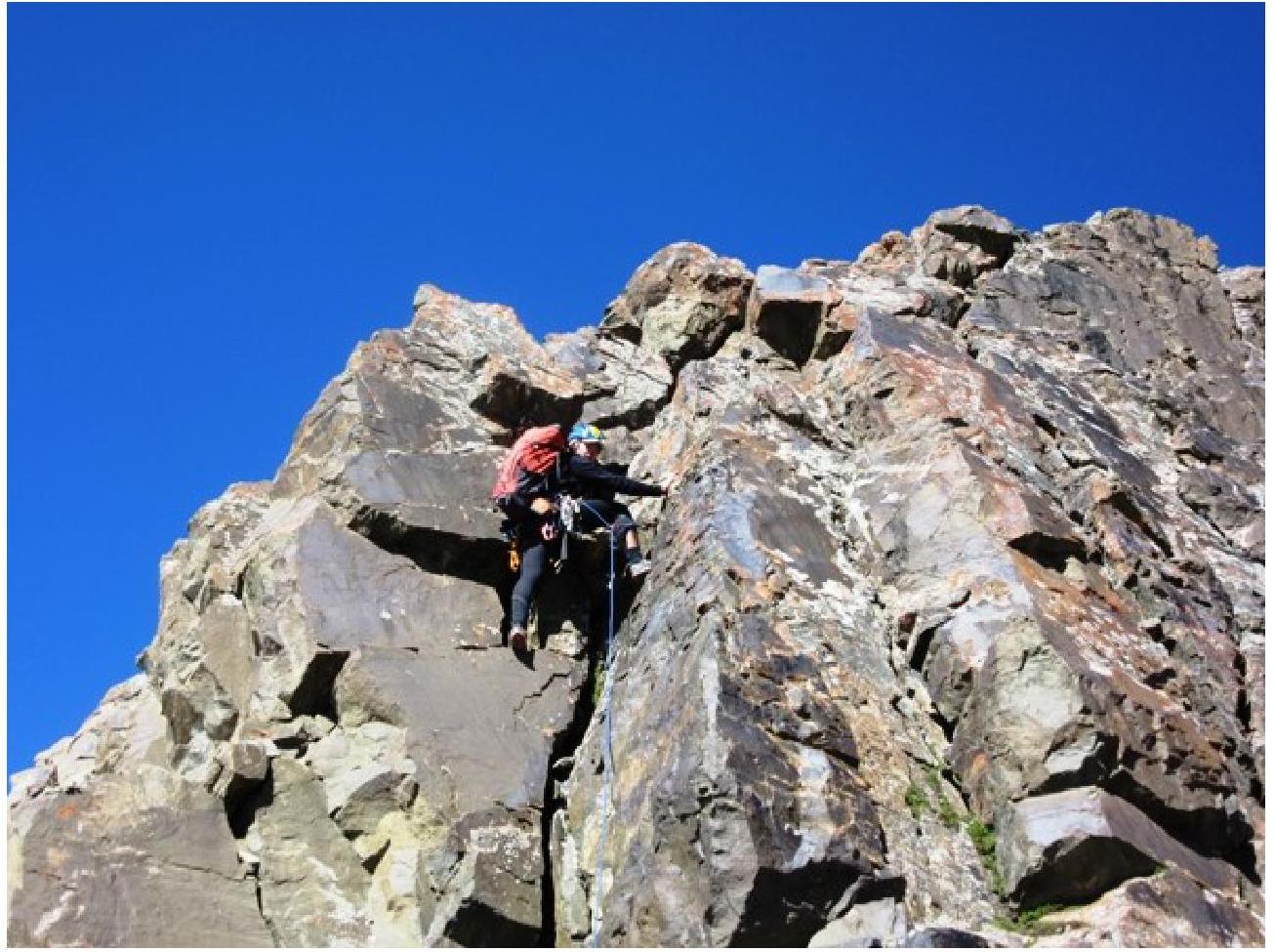
Section
R5–R6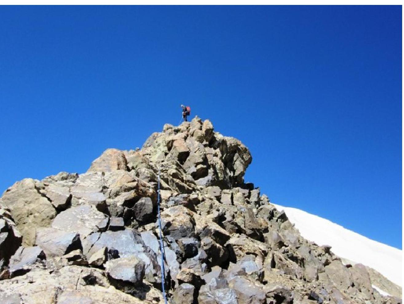
Section
R7–R8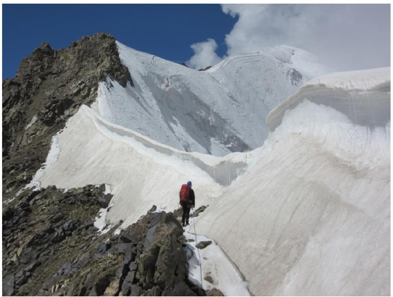
At the
summit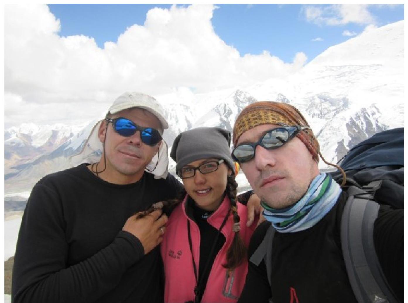
Comments
Sign in to leave a comment