Passport
- Snow and ice class.
- Pamir, West Zaalai.
- Proposed 4A category of complexity, first ascent.
- Height 5900 m.
- Height difference 1650 m.
- Travel time - 3 days ascent, 1 day descent.
- Bratkov Yu.N., 6GU, 4th with elements of 5th GR, leader, Belov A.A., 4th with elements of 5th GU, Kondratiev V.L., 5GU, Roshchin P.A., el. 5GU.
- August 1995.
- The ascent was made as part of a sports mountain trip.
General characteristics of the area
The weather is warm, consistently good. The rocks are prone to rockfall. Water often causes stomach upset. There is little drinking water.
In the main ridge, the northern slopes are steep, the southern ones are gentle. Glaciers are active, broken, and sometimes pulsating.
The development of the area was not publicized. In Moscow, the area was of interest to the Remote Sensing Laboratory of the Institute of Geography (K.P. Rototaev, L.V. Desinov, V.A. Rudakov). K.P. Rototaev climbed here alone in winter and summer, made a number of ascents. The author is aware of his ascent to peak Surkhangau from the north, 3B.
"Tourist trips of Moscow":
- Said-Galiev E.E., 1979 (report No.3730);
- Lyamin B., 3-4 category of complexity, 80s;
- Chkhetiani O.G., 5 category of complexity, 1994, with the transportation of the victim;
- Bratkov Yu.N., 5-6 category of complexity, 1995;
- as well as later trips by A. Lebedev, A. Novik, etc.
The area was also of interest to climbers from St. Petersburg and Kiev (from what is known). Dyakonov D.I. (St. Petersburg) - first ascent of peak Sat, 1984, ascent from the north, a corpse on the descent.
Approaches and access
Entry to the area from Osh: through the Saritash outpost to the village Daraut-Kurgan (one day's drive), then 30 km from Daraut-Kurgan to the village Shive.
From the village Shive 30 km (2 days) under the Kyzylkul pass (4273 m, 1A, snow) and one day descent to the lake in the pocket of the Kyzylsu glacier. The last 1-2 km here - a medium-difficulty crossing to the right bank of the river and ascent to a large moraine on the right bank.
From the lake along the Kyzylsu South glacier, half a day's ascent to the end of the NE ridge of peak Sat. Here is a safe overnight stay.
Peak Sat
From the overnight stay under the NE ridge, 2 hours along the broken glacier under the ice ribbon descending from the NE ridge. Along the ribbon, one day's ascent to the transverse crevasse. The ice has a convenient microrelief. Descent into the crevasse 3 m on a rope. Overnight stay in the crevasse.
Ascent from the crevasse on the left along the way, 5 m of ice 60-70°. Then half a day's ascent to the ridge. A total of 22 ropes were hung on the ice.
On the ridge, there is snow, in places loose and waist-deep. Ascent in ropes, crevasses. Half a day's ascent along the ridge, overnight stay under the first subpeak. The next half day - ascent to the 1st and 2nd subpeaks with a hollow 200 m between them. On the 2nd subpeak, things were left for an overnight stay and a lightweight ascent was made to the 3rd subpeak and the main peak. Between the 2nd and 3rd subpeaks, there is a hollow 200 m. Overnight stay on the 2nd subpeak.
The next day - descent along the ascent route to the end of the NE ridge. Total 3 days ascent, 1 day descent. A note from a group of mountain tourists from Leningrad, 4 people, led by D.I. Dyakonov, was taken from the summit. They made the first ascent from the north. Our ascent, therefore, is the 2nd, and the 1st accident-free (the first ascenders had a corpse on the descent).
The ascent was made as part of a sports mountain trip. 21 days, 160 km. The route of the trip: v. Shive - r. Shive - pass Kyzylkul - gl. M. Kyzylsu - pass Tash-Korou (3A, 4750 m, ice) - r. Kyzylkul - r. Saz-Jailoo - pass Shive (n/k, 3668 m) - r. Kechsu - pass Frontovikov (3B, 5288 m) - gl. Kyzylsu North - pass 1500 years to Kiev (2A*, 4800 m) - gl. M. Kyzylsu - gl. Kyzylsu South - peak Sat (3B tour., 5900 m) - r. Kyzylsu - pass Kyzyltash North (3A, 5000 m) - r. Kyzyltash - r. Tar-Asha - v. Daraut-Kurgan.

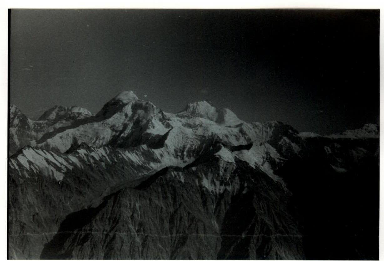
F.1. West Zaalai from the SW slope of pass Kyzyltash North (5000 m, 3A).
F.2. The node of peak Sat from pass 1500 years to Kiev (4900 m, 2A*).
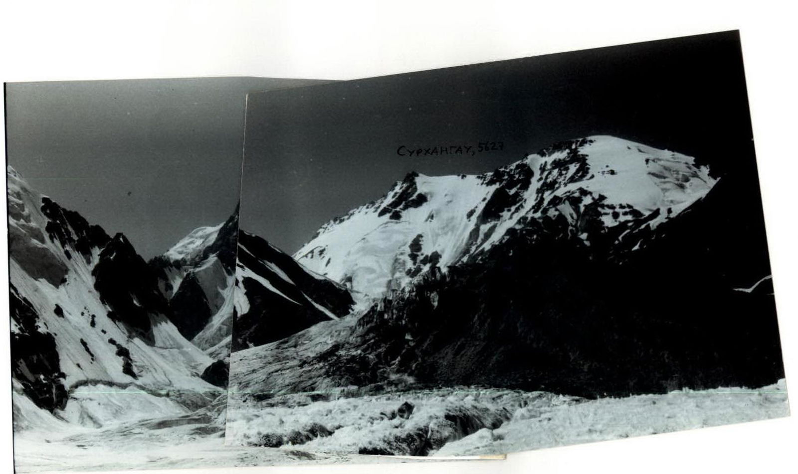
F.3. SE slopes of peaks Sat (left) and Surkhangau (right) from gl. South Kyzylsu.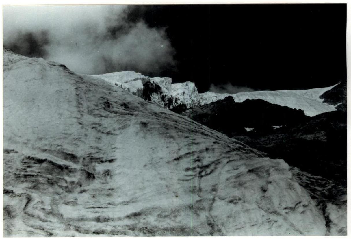
F.4. Ascent along the ice ribbon.
F.5. Ascent along the ice ribbon.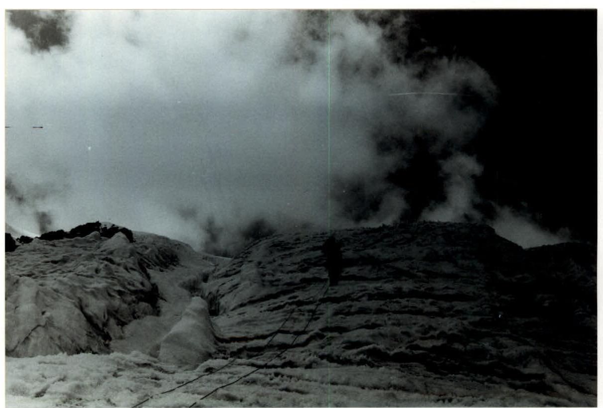
F.6. Ascent along the ice ribbon.
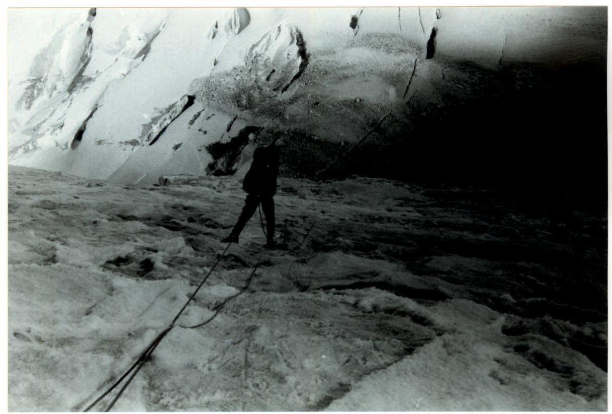
F.7. Transverse crevasse in the middle of the ice ribbon.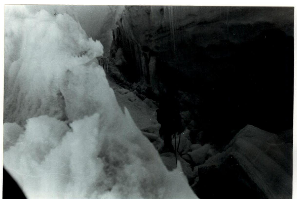
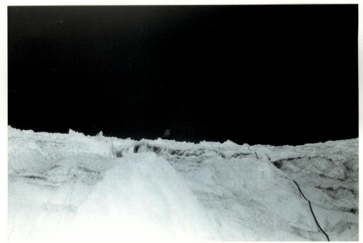
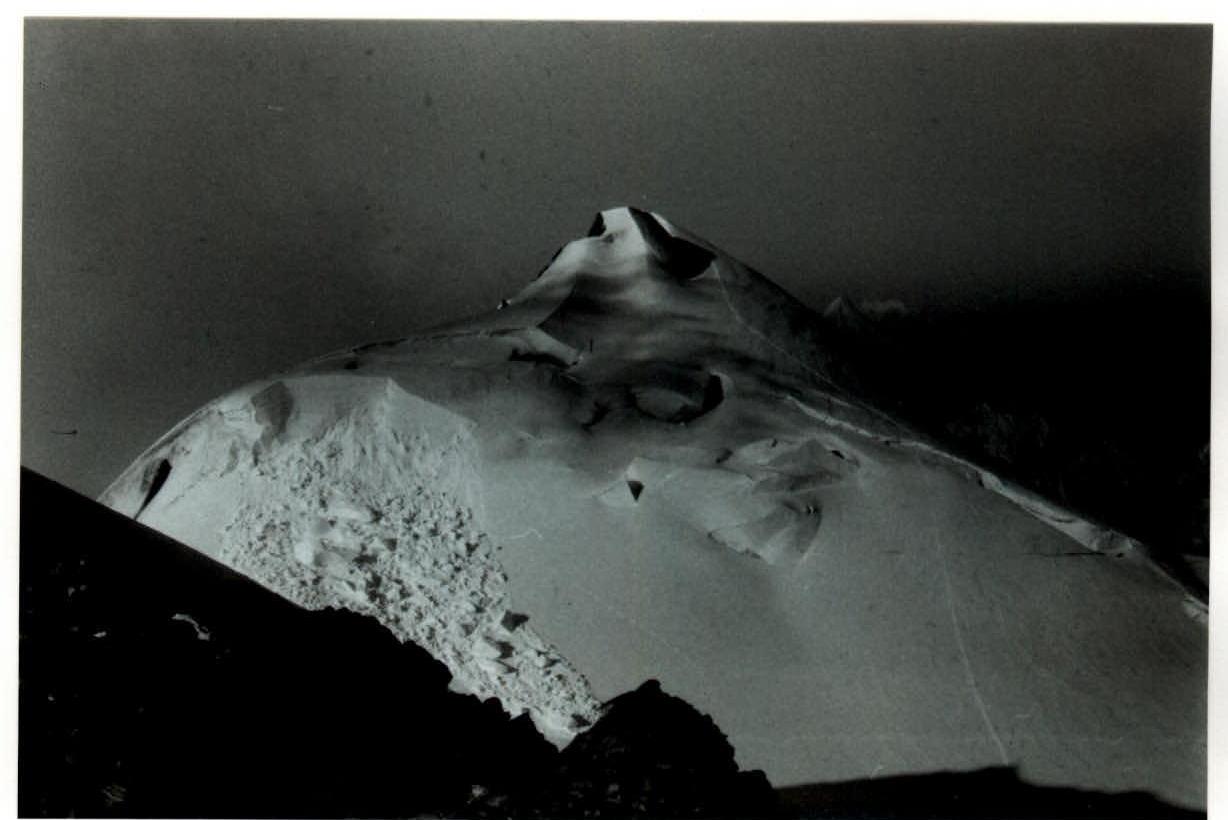
F.8. Upper part of the SE slope of the NE ridge of peak Sat.
F.9. Upper part of the SE slope of the NE ridge of peak Sat.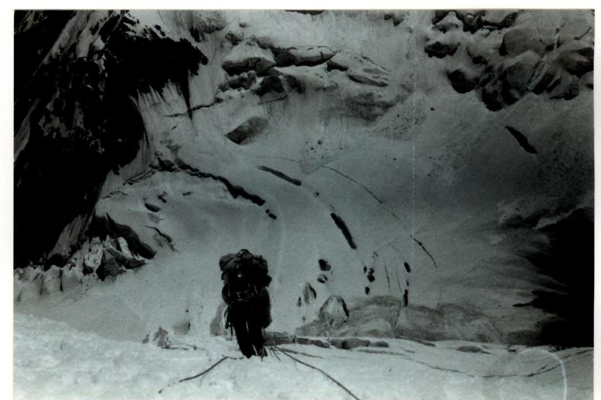
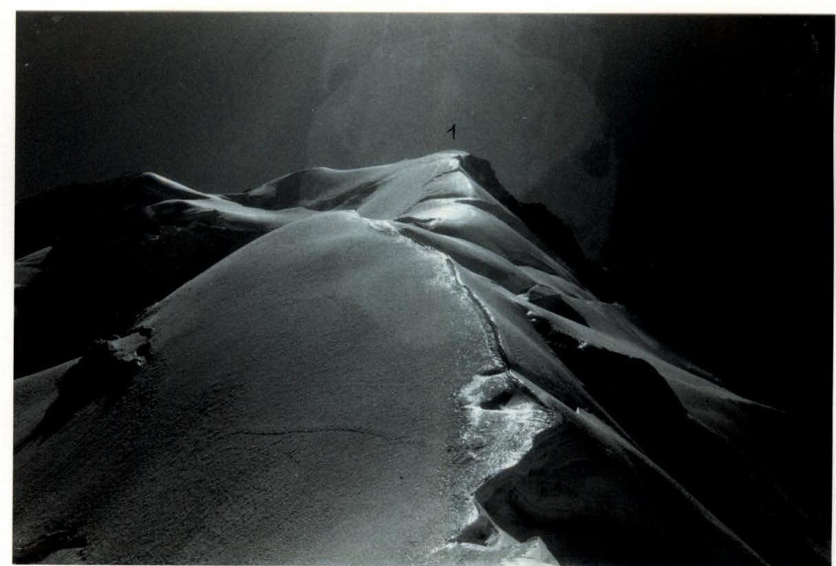
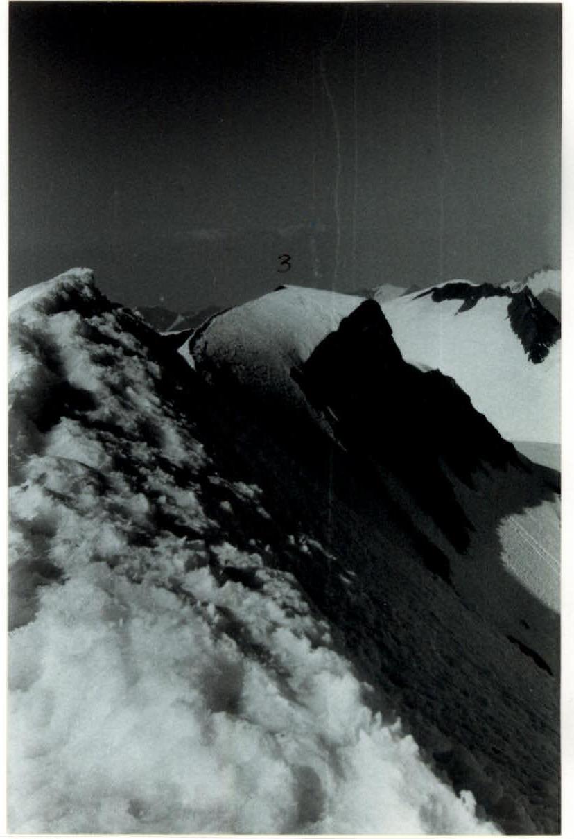
F.10. NE ridge of peak Sat, 1st peak.
F.11. NE ridge of peak Sat, 2nd peak. View from the 1st peak.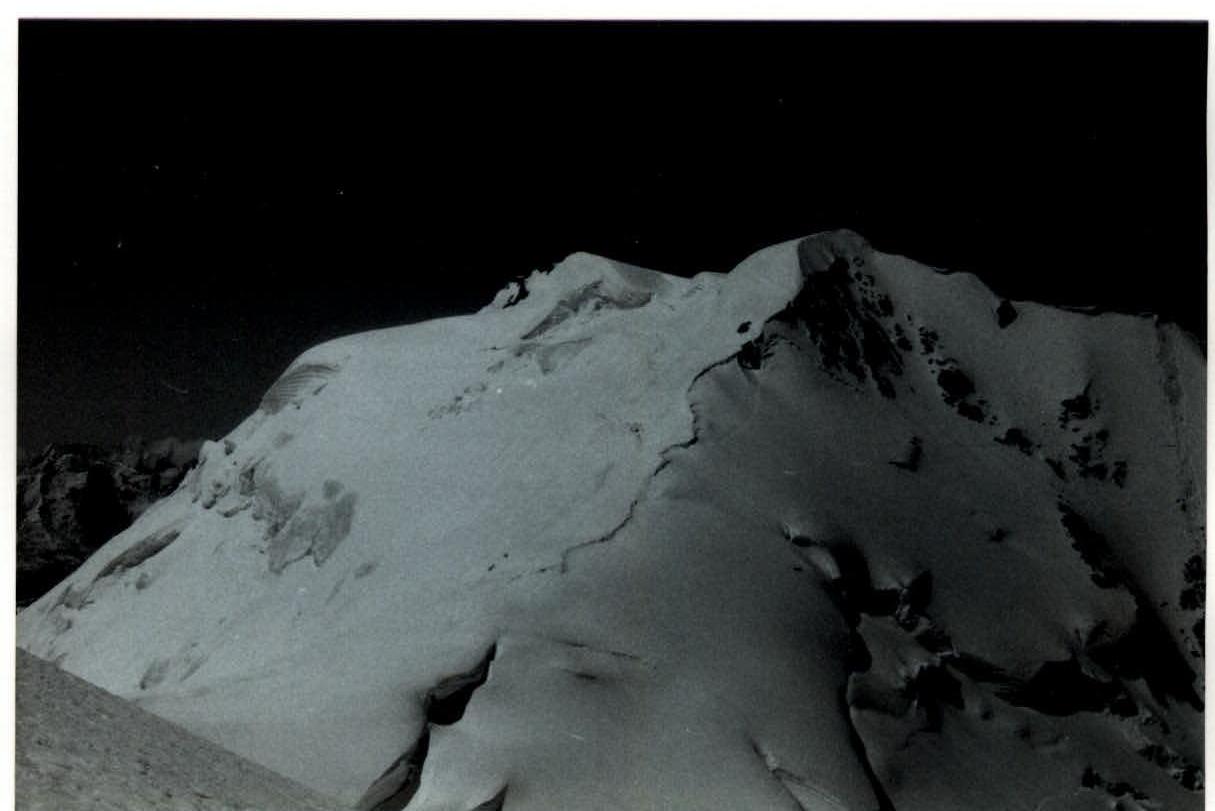
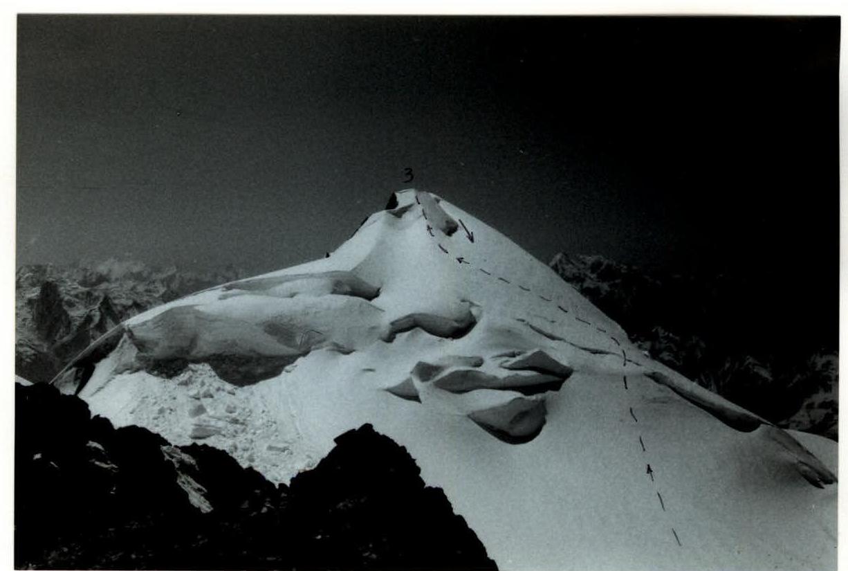
F.12. NE ridge of peak Sat, 3rd peak. View from the 2nd peak.
F.13. NE ridge of peak Sat. Main peak. View from the 3rd peak.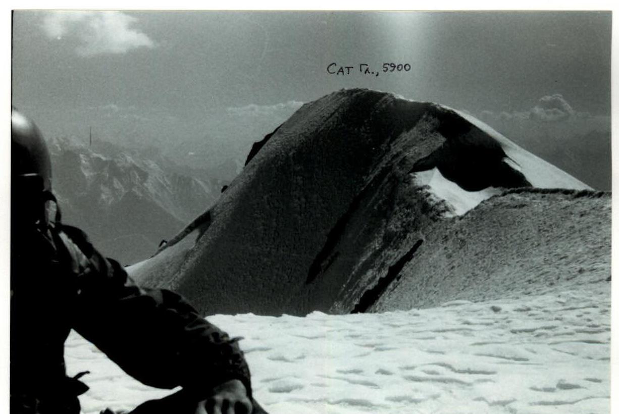
F.14. S slope of peak Sat, main and 3rd peaks. View from the main peak.
F.15. SW ridge of peak Sat. View from the main peak.
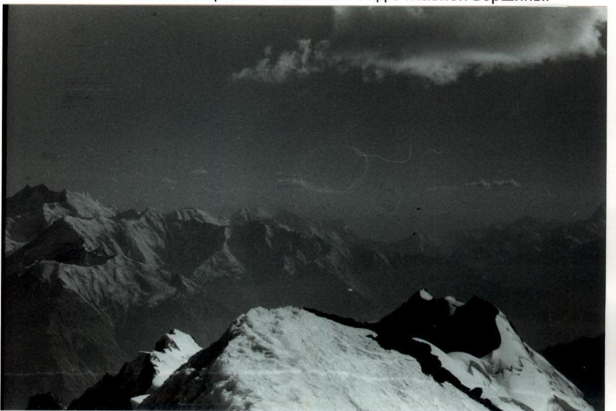
F.16. Peaks Korzhenevskaya (left) and Communism (right). View from peak Sat.
F.17. NE ridge of peak Sat. 3rd peak with traces of climbers. View from the 2nd peak.