Ascent Passport
- Region: Заалайский Ала-Тоо Valley: Кызылсу. Section number according to the 1999 classification table: 4.4
- Peak name: п. Курумды, route name: по северному гребню
- Proposed category: 5B cat. sl., first ascent.
- Route type: combined.
- Route elevation gain: 2600 m (by altimeter)
Route length: 7700 m.
Section length:
- V cat. sl. — — m.
- VI cat. sl. — — m. Average slope:
- main part of the route — 30 °
- entire route — 30 °
- Number of "hooks" left on the route:
total — —; including pitons — —
Number of pitons used on the route:
- Stationary pitons — — including ИТО — —
- Removable pitons — — including ИТО — — Total number of artificial support points (ИТО) used — —
- Team's walking hours: 40.4 h, 6 days
- Team leader: Губаев Александр Рафаэльевич, КМС
Team members:
- Михайлов Михаил Михайлович, МС
- Тураев Олег Юрьевич, МС
- Акимов Виталий Владимирович, КМС
- Coach: Попов Фёдор Ефимович, ЗТР Кирг.
- Departure for the route: 10:00, October 7, 2001 Summit reached: 12:43, October 12, 2001 Return to БЛ: 19:00, October 14, 2001
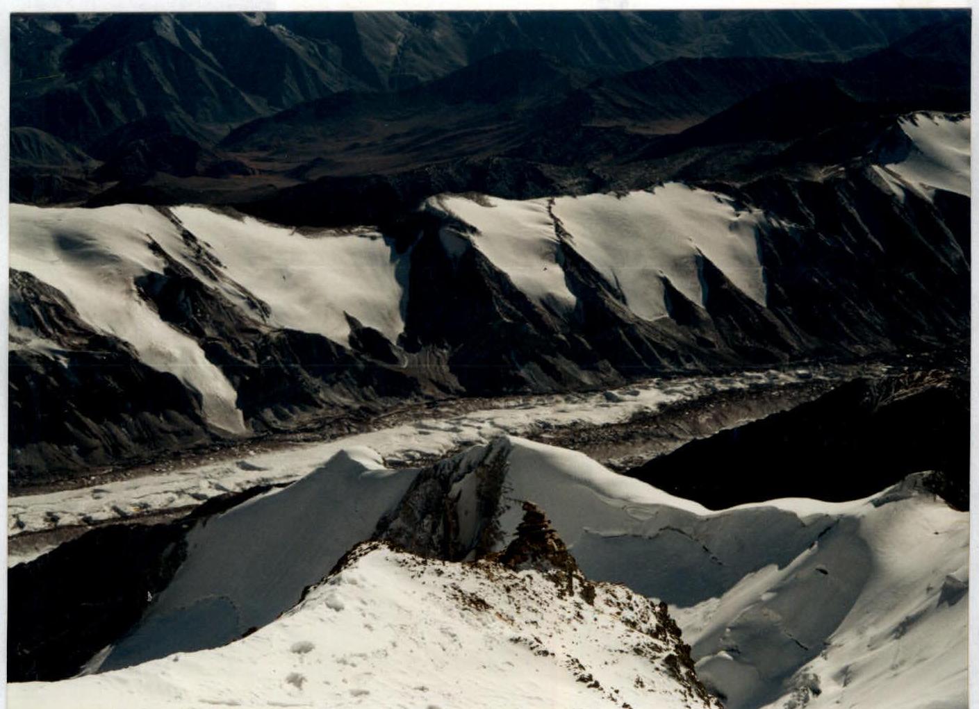
General Photo of the Summit
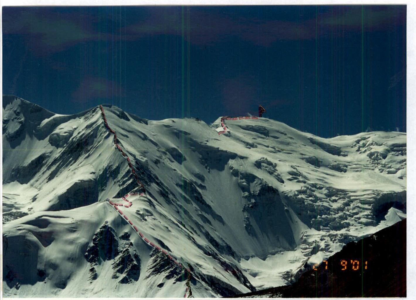
The photograph was taken on September 27, 2001. The location: lateral moraine on the approach to the forward base camp (АВС).
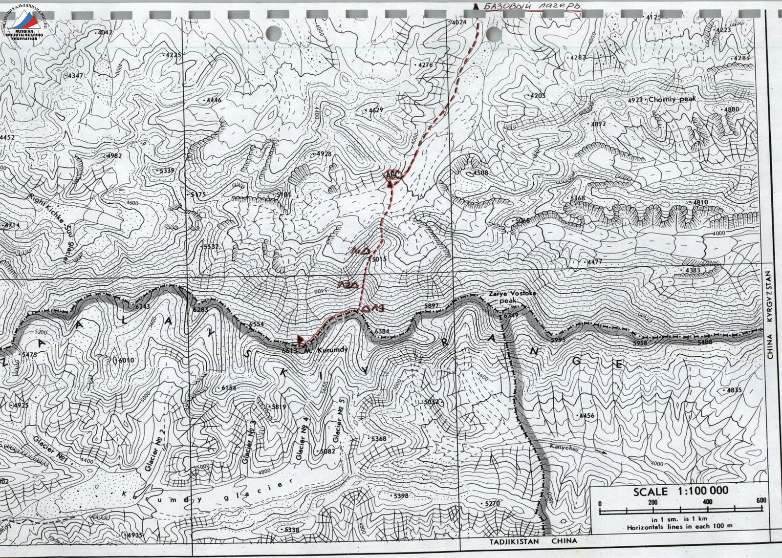
Overview of the Region
The Курумды massif is located in the Заалайский хребет where the state borders of three countries — Kyrgyzstan, Tajikistan, and China — intersect. The highest point in the area is пик Курумды (6613 m). Before our expedition, there were several attempts to climb this peak, but for various reasons, they were unsuccessful. The пик Курумды area is rarely visited by climbers, as the focus remains on пик Ленина, located approximately 60 km to the west. The approaches to пик Курумды and пик Ленина are not much different from each other:
- The expedition begins in Ош along the highway through the passes of the Кичиалайский хребет.
- Climbers reach the settlement of Сары-Таш. Here, the roads diverge.
- The distances from п. Сары-Таш to пик Курумды and to пик Ленина are approximately equal.
The base camp under пик Курумды can be reached by car along the road leading towards пер. Эркиш-Там, on the border with China. Then, the vehicle turns off and follows a well-worn track as far as possible up the Кара-Су river. Our expedition's base camp was located about a 3.5-hour walk from АВС, which we set up on a lateral moraine on the opposite side of the glacier from the start of the route.
The group, approaching the route, departed from the base camp, crossed a low ridge (1.5–2 km), descended into the Кызыл-Су river valley, and followed a good trail along the lateral moraine and moraine pockets to АВС. The АВС shows signs of previous expeditions.
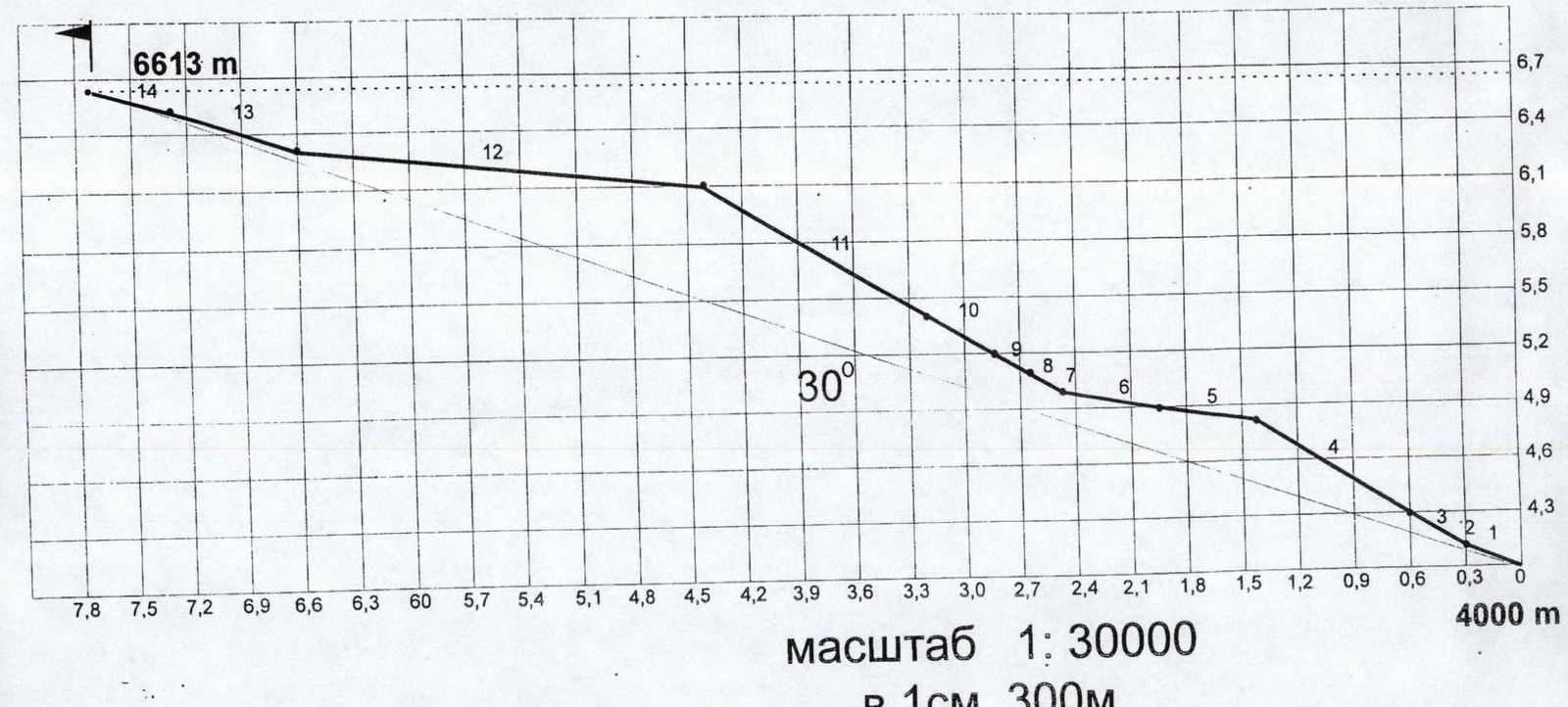
Hand-Drawn Route Profile
Ascent Graph
height
of the route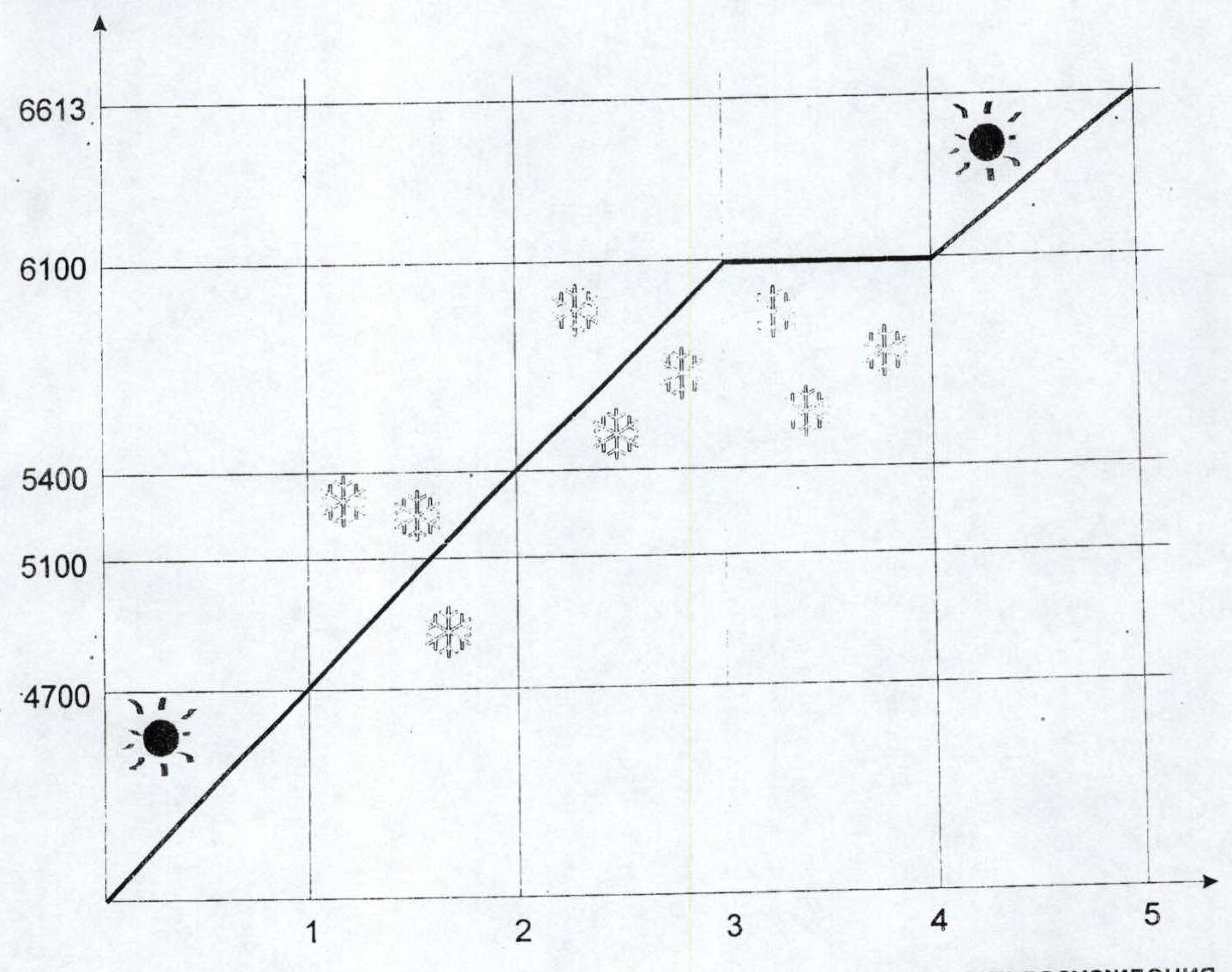
UIAA Route Diagram

Technical Photograph of the Route
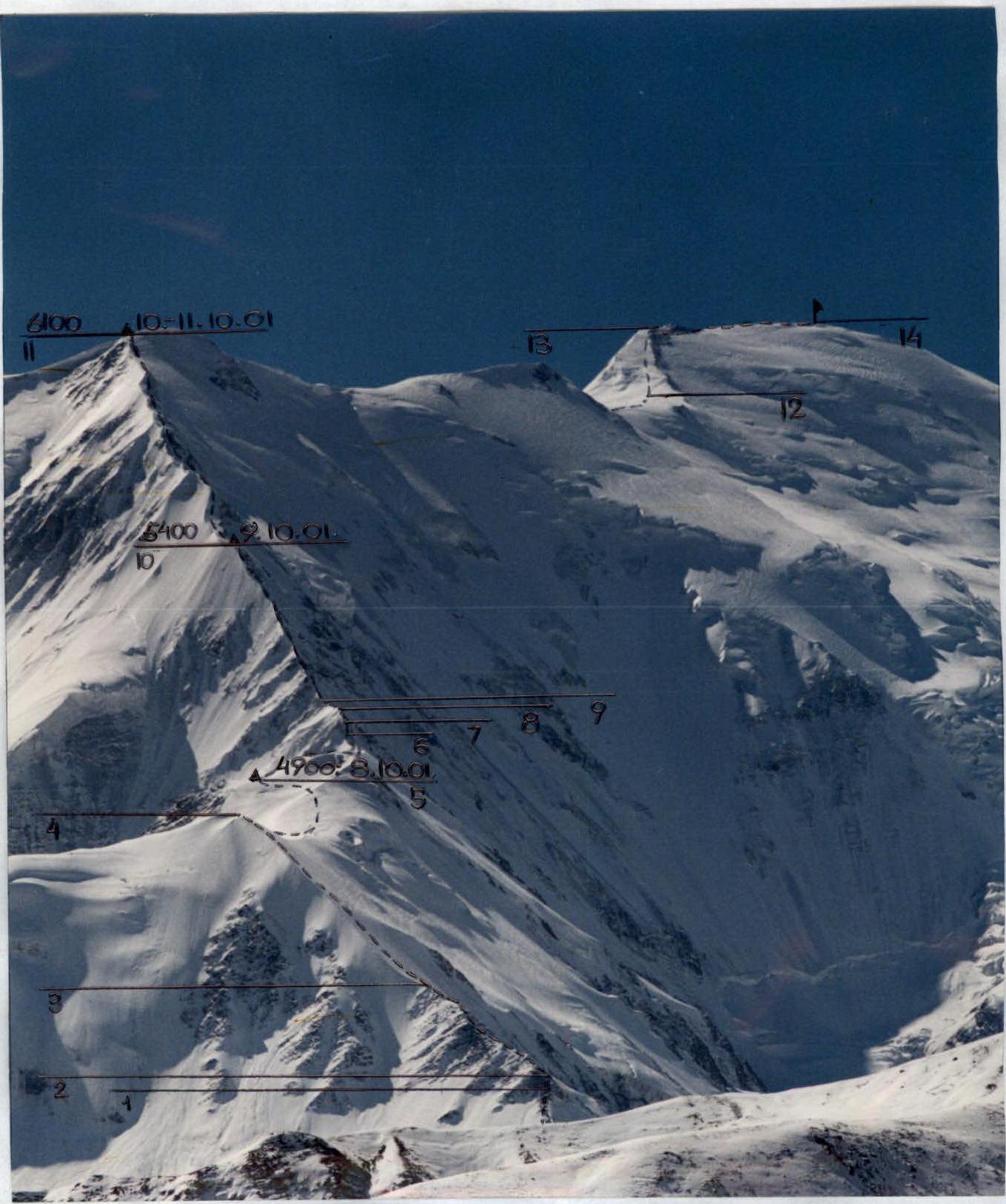
Photo Illustration of the Report
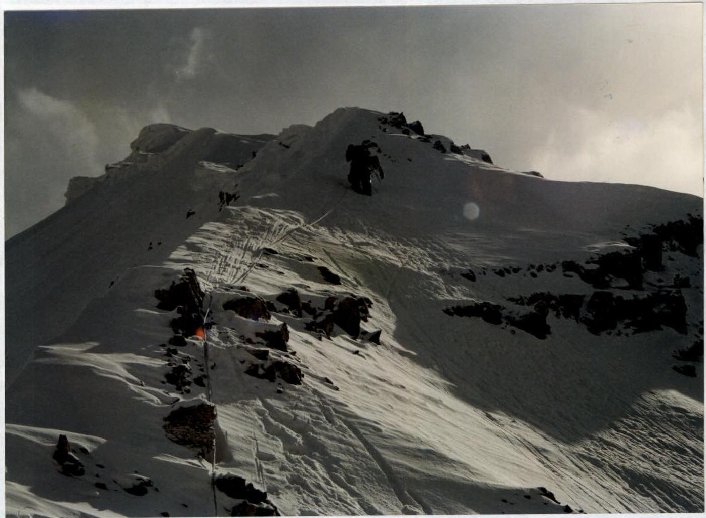
Photo 1

Section 6. Crossing the snow-ice ridge
Photo 2
Section 11.
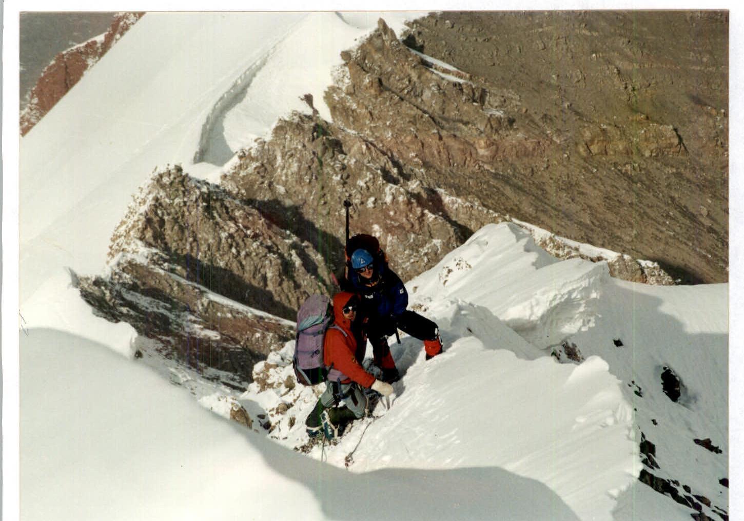
Photo 3
Section 11. On the combined ridge.
Photo 4
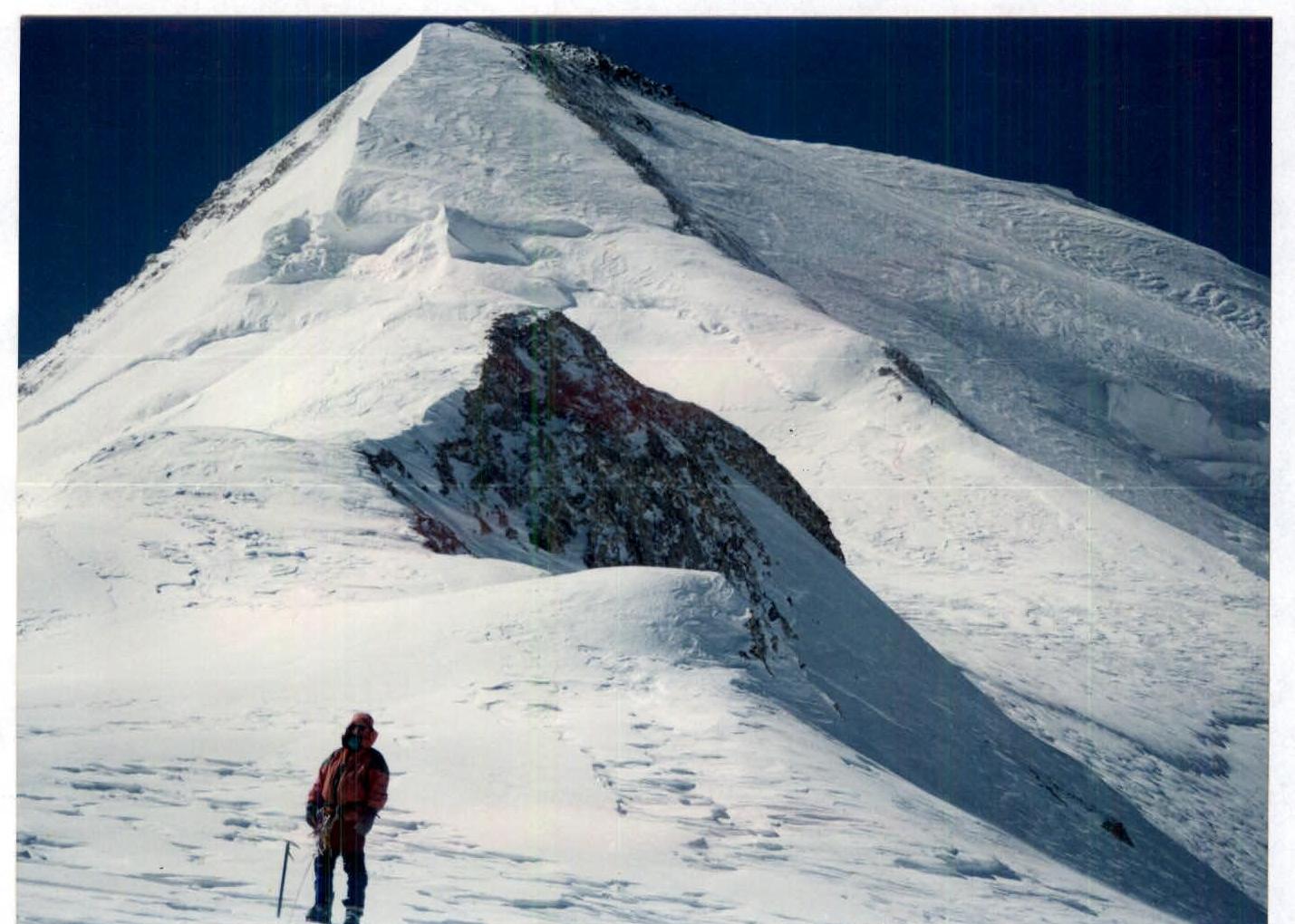
Sections 12–13.
Photo 5
Control tour, formed by the group on the summit below the snow drift.
Photo 6
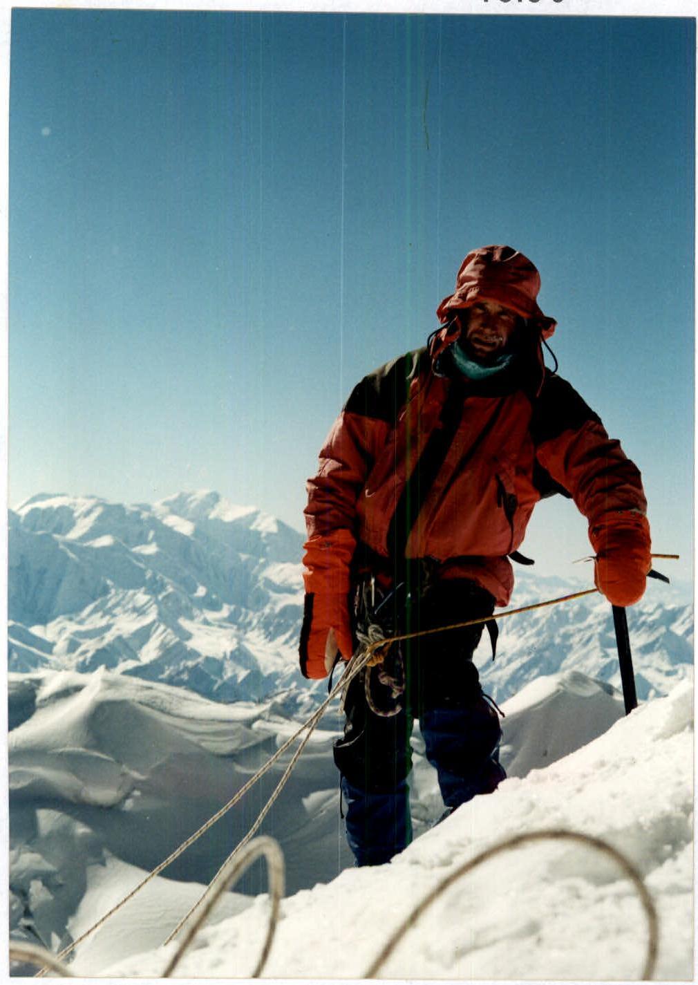
At the summit. пик Ленина is visible in the background.