ASCENT ROUTE DESCRIPTION TO PEAK KORZHENEVSKOGO VIA THE NORTHEAST RIDGE FROM NAZAROV GLACIER 5A cat. dif. (first ascent)
July 1961. Pamir
Brief geographical characteristics of the area
Peak Korzhenevskogo, 6005 m high, is located in the Trans-Alay Range. To the east of the summit is Peak Biletsky (6075 m), to the west - Peak VMF (5842 m).
The northern slopes of Peak Korzhenevskogo are the sources of the Nazarov Glacier, the northeastern ones - the sources of the At-Jaylau Glacier. The southern slopes of Peaks VMF, Korzhenevskogo, and Biletsky adjoin the Uy-Su Glacier.
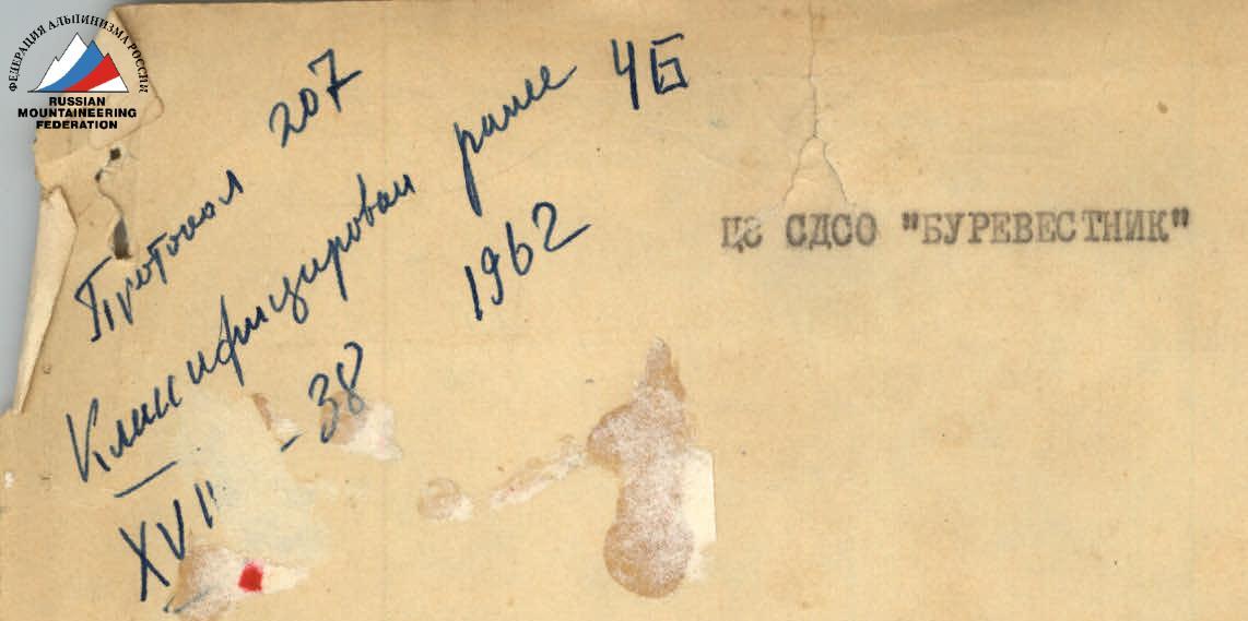
The first ascent to Peak Korzhenevskogo was made in 1951 by a group led by Nozdryukhin V. via Peak VMF. The route was rated as 4B cat. dif.
From Peak Korzhenevskogo, a long ridge extends to the northeast, covered with a powerful ice-snow cover on the northern side. Along this ridge, from July 26 to 29, 1961, participants of the high-altitude gathering of the CS SDSO "Burevestnik" made the first ascent to Peak Korzhenevskogo.
Route description
From the base camp, located 2 km from the tongue of the Korzhenevsky Glacier, the path passes along the right bank of the Dzhakay-Dartak River, then along the stone-covered glacier, sticking to its left (in the direction of travel) side.
After 2.5 hours of movement, the path leads to the confluence of the Nazarov and Korzhenevsky glaciers, from where it takes 1.5 hours to reach convenient overnight stays located on the terraces of the left lateral moraine of the Nazarov Glacier.
The next day, after making the necessary observations of the route, the group left the bivouac at 13:00, crossed the Nazarov Glacier towards the ice bridge, clearly visible on the northeastern ridge of Peak Korzhenevskogo. The steepness of the bridge allows climbing onto the ridge on crampons in a zigzag, bypassing crevices. The ascent to the bridge takes 1 hour. The height of the bridge is approximately 4300 m. The profile diagram shows the path of ascent to the summit.
Section R1 is relatively easy, the ridge has a steepness of 30-35°, the snow is deep. Movement occurs in teams, crevices are bypassed along the way.
Section R2, 40 m long, is quite technically challenging. The ice slope in its middle part has a steepness of 45-50°, it is necessary to move on the front teeth of crampons, piton protection is required (2 pitons). Movement on the rocks to the left is impossible due to high rockfall.
For some time, we move along the snowy ridge with cornices. On its wide, flat part, we stop for the night at 17:00. In sunny weather, there is water at this bivouac. Ascent at 6:00, departure at 7:00. Immediately after the overnight stay, we move along a long, mostly gentle ice ridge (R3), overcoming two 10-15 m walls on the front teeth of crampons. The ridge becomes steeper (R4). The steepness reaches 55° over a considerable distance (80-100 m), we move mainly on the front teeth of crampons with piton protection (3 ice pitons). Having overcome two ice walls 15-20 m long and 40-45° steep, at 9:30 we approach a steep snowy ascent (R5) (60-65°). The snow is very deep. The length of the section is 80 m. Protection through an ice axe.
At 10:30, we approach the ice ascent "Serp" (R6). Height 5200 m. The length of the ascent is 120 m, at the top, there is a rather powerful cornice. This section is one of the most difficult, passed mainly on the front teeth with piton protection (3 pitons).
At 11:45, the group climbs to the top of the серп (serp), after which it moves along a gentle section of the ridge (R7) 200 m long.
Further, the ridge becomes steeper (40-45°), the danger of the group reaching the cornice increases (R8). Due to this, we move for some time on rocks, then again on snow with alternate protection through an ice axe. In 2 hours 30 minutes, section (R8) is passed. Its length is 150-170 m.
Section (R9) has a steepness of 20-25°, the snow is deep and dry. Here, we traverse on crampons with piton protection, a small but quite steep ice section.
The ridge widens and turns into a wide snowy plateau adjacent to the steeply rising dome of Peak Korzhenevskogo. At 17:30, an overnight stay is organized on the plateau. The place is unprotected from the wind, so tents are set up deep in the snow, and windproof walls are built. 100 m higher, it is also possible to arrange a bivouac; there, on a heavily destroyed wide rock shoulder, there is water during the day. The height of the bivouac is 5500 m. The next day, ascent at 6:00, departure at 7:30. We climb either along a heavily destroyed rocky ridge or through very deep dry snow. We gain altitude quite quickly. At an altitude of 5900 m, we approach a powerful icefall, traverse under it a steep snowy slope with a steepness of 60-65° and reach the base of a steep inner corner formed by cracked ice blocks.
The ascent through it is complicated (R9), careful piton protection is required. The steepness of the section is 70-80°, the length is 30 m. After section (R9), there is a long ascent to the summit of the peak, which does not present technical difficulties. The group reached the summit at 14:00.
The descent from Peak Korzhenevskogo was made to the west along the rib through the summit of Peak VMF along the path of 4B cat. dif.
The group descended to the overnight stay on the moraine of the Nazarov Glacier at 18:00.
The group rated the route as 5A cat. dif. The route can be recommended only for those who have mastered snow and ice techniques perfectly.
The observation group can be located on the left lateral moraine of the Nazarov Glacier and practically continuously visually monitor the main group.
After snowfalls, the following areas should be considered avalanche-prone:
- the exit to the bridge on the northeastern rib of Peak Korzhenevskogo;
- traversing a snowy slope under icefalls before section (R10).
- the upper slopes of Peak VMF during descent.
After ascending Peak Korzhenevskogo, it is possible to descend along the ascent path. In this case, the last overnight stay before the summit should be arranged at the top of the "Serp" ascent. The group must have a sufficient number of loops and 10-12 ice pitons to descend along the ascent path.
Head of gathering (A. Chernobrovkin) Head of training part (I. Bogachev) Coaches: — (V. Ivanov) — (S. Grebenyuk)