Ascent Log
- Zaalaysky Ridge, Pravy Kichkesu glacier, TurkVO area, section 4.4/2008
- In-Yan Peak (our name), 4935 m, via NW wall.
- Proposed category: 2A, first ascent.
- Snow and ice route.
- Height difference: 400 m. Distance: 600 m. Average slope of the main part of the route: 45°.
- No equipment left behind.
- Climbing time: 3 hours.
- Leader: Koshelenko Yu. — Master of Sports. Partner: Bukinich A. — Candidate for Master of Sports.
- Coach: Koshelenko Yu.
- Approach to the route: August 14, 2010. Route started: 9:00. Reached the summit: 12:00. Returned: 14:30. Descent from the summit via the 3rd slope.
- Mixed team: Rostov-on-Don — Sochi.
- Responsible for the report: Koshelenko Yu.V., ykoshelenko@gmail.com
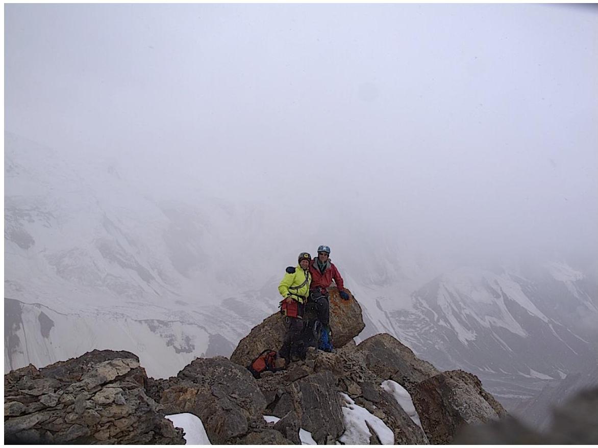
General photo of the summit
NW wall of In-Yan, with the team's route.
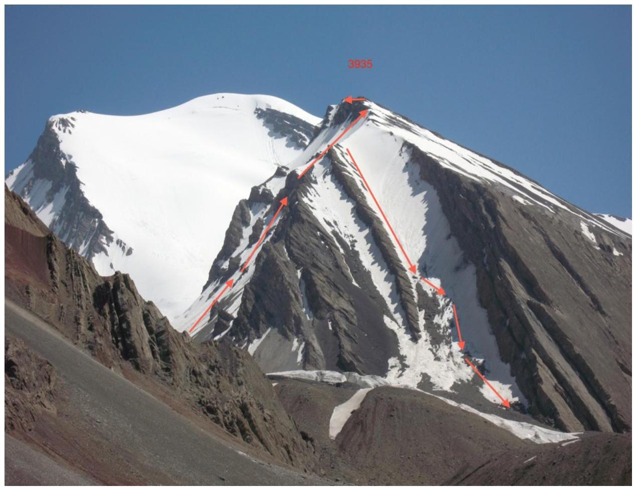
Profile view
Team's route and descent path.
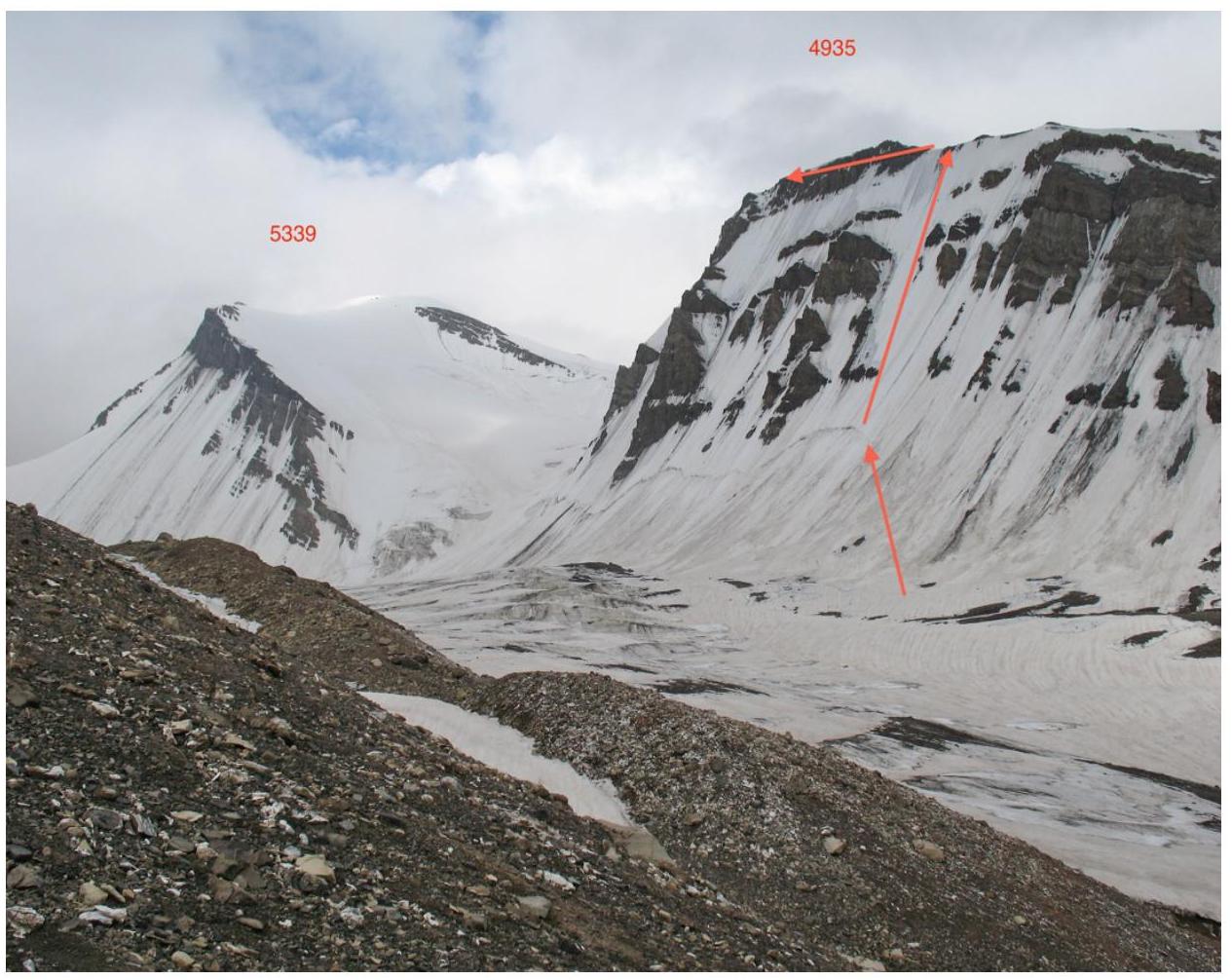
Panoramic photo of the area
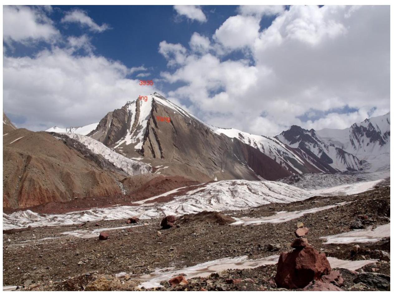
Pravy Kichkesu glacier and In-Yan Peak (named due to a natural phenomenon: NW wall is icy, S wall is rocky).
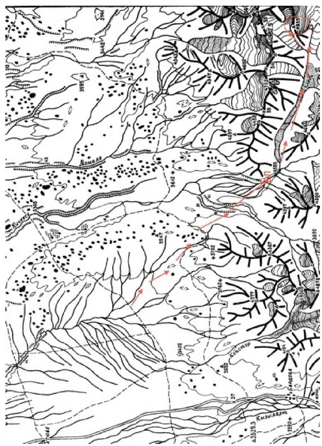
Map of the ascent area
The area is located near the Osh–Khorog road, 4/5 of the way can be traveled by car.
List of sections
| № | Distance | Steepness | Terrain | Category | Pitons |
|---|---|---|---|---|---|
| 1 | 100 | 30 | snow | 1 | 0 |
| 2 | 50 | 40 | névé | 2 | 0 |
| 3 | 50 | 45 | ice | 3 | 1 |
| 4 | 100 | 60 | ice | 4 | 6 |
| 5 | 100 | 45 | névé | 3 | 1 |
Then 200 m along the ridge, category 1, to the summit.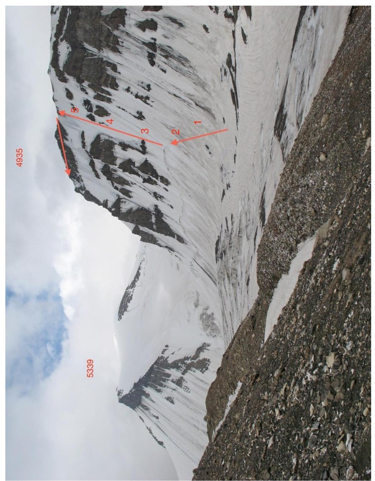
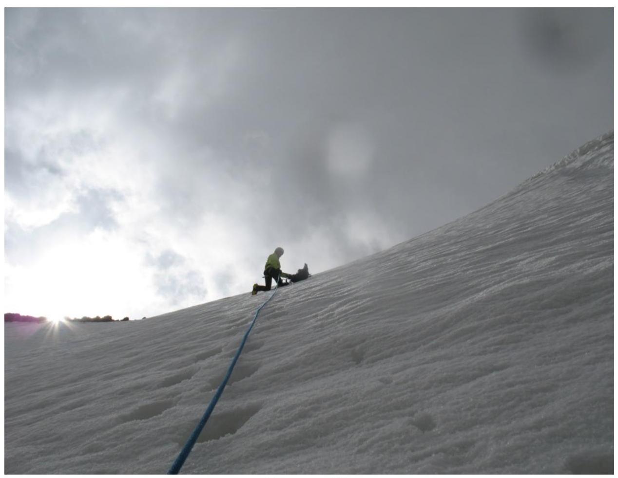
Technical photo of the route
Route description
The route is technically straightforward, but requires a correct assessment of the slope conditions. Belaying started from section 4 to the ridge. Three ropes on front points on ice. The rest — steps in névé and snow.
Descent via the 3rd slope's couloir without belay.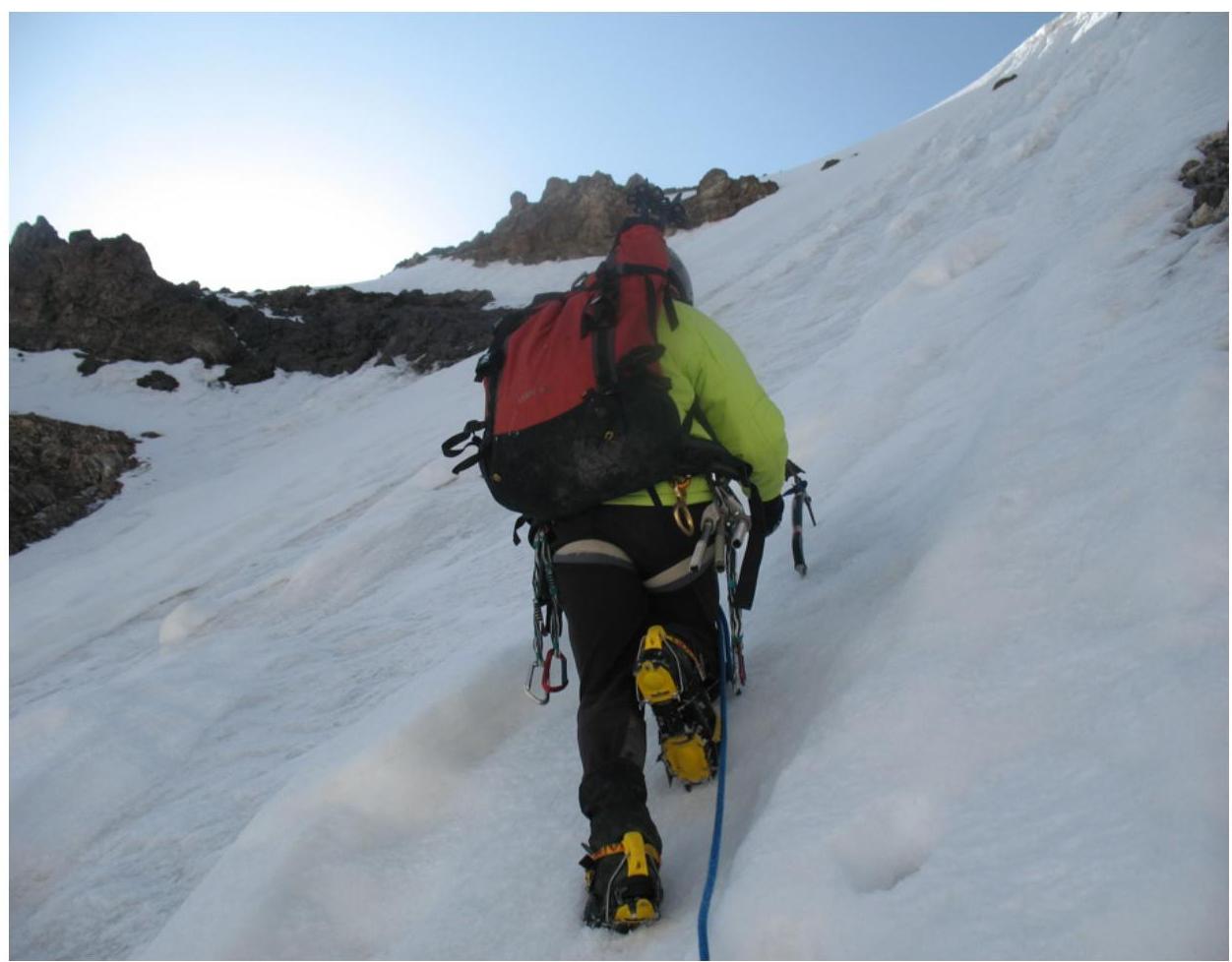
Start of the route
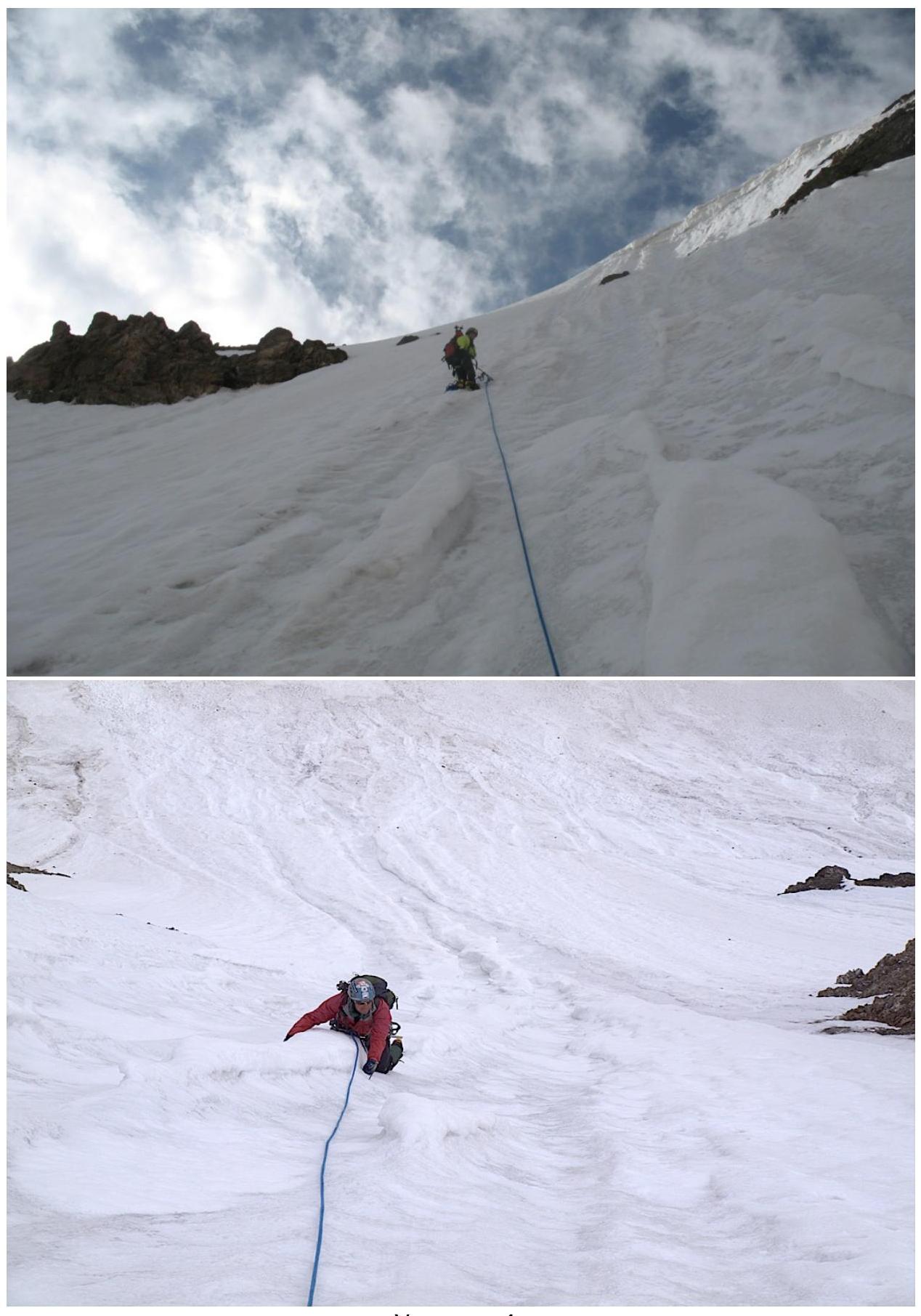
Section 4
Section 5