Route Description: Traversing the Petra I and Akademii Nauk Ridges on the Segment from Pik Parashyutistov to Pik Akhmad Donish
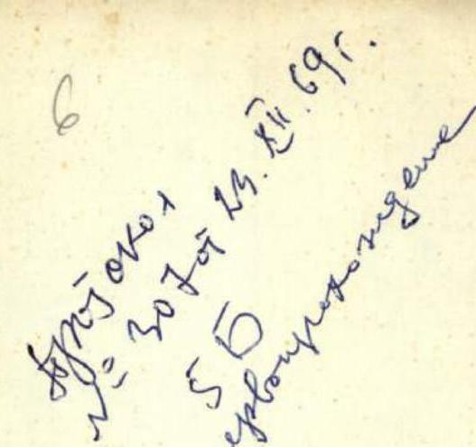
Group II of the "Burevestnik" Complex Expedition.

Pamir, August 1968.
Description
of traversing the Petra I and Akademii Nauk Ridges on the segment including Pik Parashyutistov – Pamiro Firnovo Plateau – Pik Kommunizma – Pik 6701 m – Pik Izvestiya – Pik K. Tsetkin – Pik A. Donisha.
I. Brief Geographical Characteristics of the Area
The Petra I and Akademii Nauk Ridges are located in the Northwestern Pamir. Their junction, Pik Kommunizma, is the highest peak in the USSR. The ridges, the first stretching in a latitudinal direction and the second in a meridional direction, are characterized by powerful glaciation and high peaks in their central parts adjacent to Pik Kommunizma. Studying the Petra I and Akademii Nauk Ridges, which play a significant role in shaping the climatic conditions of the Pamir and surrounding areas, as well as in the water balance of the Amu-Darya, is of great interest.
The first information about the area dates back to the last century (V.F. Oshanin, 1878). Major research was conducted later (N.L. Korzhenevsky, 1905; P.I. Besedin, 1923; Yu.V. Valter and Moskvin, 1933, 1936; E. Abalakov, 1948; A. Letavet, 1949; E.V. Timasheev, 1948–1949).
II. Review of the Alpinism Area
The beginning of alpinist exploration of the area dates back to 1933 when E. Abalakov, a participant in the Tajik Complex Expedition, crowned the efforts of a large team by ascending Pik Stalin in the east. Subsequently, several alpinist expeditions (to Pik E. Korzhenevskoi, Pik Stalin (Pik Kommunizma), Piki Moskva, Leningrad, Izvestiya, Voroshilov (A. Donisha)) thoroughly studied the area's features, conquered the most important peaks, and laid out the path to Pik Kommunizma from almost all sides except the north.
Alpinists from "Burevestnik," "Spartak," "Trud," "Lokomotiv," Uzbek alpinists, and the Georgian Alpine Club contributed to the conquest of the area's peaks. However, the northern part of the area remained the least explored due to its inaccessibility. Starting from 1966, "Burevestnik" alpinists arrived in the area for three consecutive years, targeting the Fortambek, Valter, and Moskvin Glaciers, and Traube. They pioneered three new routes to Pik E. Korzhenevskoi and laid a path to the Pamiro Firnovo Plateau.
In 1966, "Burevestnik" alpinists began preparing for the traverse of two seven-thousanders, Piki Kommunizma and E. Korzhenevskoi, located relatively close to each other (approximately 13 km apart in a straight line). However, due to the lack of high-altitude aviation, some aspects of the tactical plan developed in Moscow could not be implemented, and the traverse was postponed until 1968.
In August 1968, participants in the II Complex Pamir Expedition of the "Burevestnik" Sports Society successfully traversed the main section of the aforementioned route. This included ascending Pik Parashyutistov (the western extremity of the Pamiro Firnovo Plateau) along the Burevestnik Ridge from the Fortambek Glacier, crossing the Pamiro Firnovo Plateau (12 km long at an altitude close to 6000 m), ascending Pik Kommunizma (7495 m) from the plateau via the western shoulder of the peak, conquering Pik 6701 m, Pik Izvestiya (6840 m), Pik K. Tsetkin (6680 m), and Pik A. D. Donisha (6666 m), and descending from the latter along the western ridge to the Valter Glacier. The entire ascent took 15 days (from camp to camp, excluding preparation and route processing days).
The traverse was undertaken by a group consisting of:
| K.K. Kuzmin | Master of Sports | Moscow | — trainer |
| B.P. Soustin | Master of Sports | Tomsk | — participant |
| E.K. Zakharov | CMS | Moscow | — participant |
| N.D. Cherny | CMS | Moscow | — participant |
| G.I. Sergevnin | CMS | Moscow | — participant |
| V.M. Bozhukov | Master of Sports | Moscow | — leader |
The group was unable to complete the traverse by ascending Pik E. Korzhenevskoi due to the tragic death of expedition participant V.A. Suloev, who died on the western shoulder of Pik Kommunizma at an altitude of 7000 m.
III. Characteristics of the Traversed Route, Preparation, and Ascent Tactics
The primary feature of the traverse, determining its complexity and sporting significance, is the high altitude of the peaks and the length of the high-altitude ridges. It is also significant that a substantial part of the route had never been traversed before.
Peaks traversed during the traverse:
- Pik Parashyutistov 6000 m
- Pik Kommunizma 7495 m
- Pik 50 let VLKSM 6701 m
- Pik Izvestiya 6840 m
- Pik K. Tsetkin 6680 m
- Pik A. Donisha, western shoulder 6600 m
The route's length and altitude are characterized by the following figures (Table I):
Table I
| Altitude | Length | Notes |
|---|---|---|
| 7000 m – 7495 m | about 6.0 km | of which — 2.75 km — traversed for the first time |
| 6500 m – 7000 m | 9.5 km | of which — 8.5 km — traversed for the first time |
| 6000 m – 6500 m | 2.5 km | |
| 5000 m – 6000 m | 10.0 km | |
| 3500 m – 5000 m | 29 km | 28 km — along glaciers |
Total ascent (without considering microrelief) — 4575 m.
- The length refers to the horizontal projection of the route.
The route is characterized by significant snow cover, substantial glaciation, and weak rock strength of the ridges composed of metamorphic schist. Preparation and tracing were conducted in several directions:
- Studying the area and scouting sections using modern aviation means.
- Studying the area and scouting sections using modern aviation means.
- General physical training and acclimatization of participants were conducted according to standard methods, year-round.
- Preparation of lightweight equipment and inventory using:
- modern synthetic materials,
- light alloys,
- new models and designs.
The alpinists received significant assistance from the pilots of military unit 55523, modelers, designers, cutters, and workers at the 1st Experimental Factory of Sports Footwear (Director V.V. Pakhomov), the Sewing and Knitting Combine (Director N.G. Nefedov), and the Research Institute of Automatic Devices (Director F.E. Tkachev).
The developed samples reduced the weight of the equipment by 30–40% compared to standard equipment, while featuring better thermal properties, wind and moisture resistance, and elegant finish.
The main aspects of the traverse tactics, developed over three years of preparation and aimed at ensuring safety, were as follows:
- Organization of intermediate bases for food and fuel on the Pamiro Firnovo Plateau and at the Ayu-Dzhilga Pass by parachuting from an aircraft.
- Departure on the route in a large group, with the final composition of the traverse group determined upon ascending Pik Kommunizma based on objective data on the athletes' well-being at that moment.
- Considering the "marathon" length of the traverse, the plan was to maintain a very relaxed pace during the ascent to Pik Kommunizma, followed by enhanced nutrition, and then proceed with a tense pace along the route with prolonged rest at bivouacs.
- Preliminary acclimatization of participants through ascending a 7000 m peak via a technically simple route, followed by good rest before the main ascent.
- Admission to the final part of the traverse — Pik E. Korzhenevskoi — based on medical examination results after a rest day at the Ayu-Dzhilga Pass.
- Use of lightweight thermal equipment, tents, backpacks, and fuel economy by using autoclaves and quick-preparation high-calorie products.
- Use of "Signal" thermite matches for communication and signaling purposes.
- Interaction with other groups of the II Complex Expedition ascending Pik Kommunizma and Pik E. Korzhenevskoi.
- Presence in the group of a set of medications and tools, including syringes for intramuscular and intravenous injections.
IV. Conducting the Traverse
a) Preliminary Acclimatization
Ascent to 5000 m — July 17. Ascent to 6000 m — July 20. Ascent to Pik Lenin (7134 m) — July 24 – August 6. Rest in Fergana — August 4–14.
b) Organization of the Base Camp and Intermediate Bases
- Airdropping main cargo for the traverse to the Fortambek Glacier, Burevestnik Clearing, altitude 4060 m, using a Mi-4 helicopter from the Frunze Separate Air Group; pilot A. Panferov accompanied by V. Suloev. Conducted on August 3, 1968.
- Relocation of the advance group to the Fortambek Glacier and establishment of a base by the auxiliary group at the Ayu-Dzhilga Pass — August 8–9, 1968.
- Departure of a group of 8 people led by B. Soustin to the Pamiro Firnovo Plateau to receive cargo dropped from a Mi-4 helicopter by parachute — August 11, 1968.
- Airdropping cargo to the plateau — August 15, 1968.
C. Ascent
Day 1. August 15, 1968
17 people departed from the camp at Burevestnik Clearing: 10 people led by Yu. Sklatov and V. Maksimov set out after breakfast, and 7 people led by V. Bozhukov departed after receiving news of the successful airdrop of cargo by parachute from the Mi-4 helicopter. This was at 16:15.
After three transitions, they reached the 1966 campsite on the Burevestnik Ridge and set up camp at 19:55. Altitude according to V. Suloev's altimeter — 4650 m. They traversed the glacier and scree slopes of the lower part of the ridge.
Day 2. August 16, 1968
- Ascent at 6:30.
- Departure at 9:30.
- Set up camp at 15:20, having traversed a challenging ice-rock section of the ridge, including a rock tower with medium-difficulty climbing sections.
Movement was mostly alternate, with insurance through ledges and pitons. Camp altitude — 5200 m.
Day 3. August 17, 1968
Ascent at 7:00, departure at 8:25. Weather was fine — sunrise at 7:10 behind the Pik Kirov ridge. Quiet. Morale was high. They traversed:
- steep snow-ice slopes,
- a rocky ridge
and reached Pik Parashyutistov at 12:15 — altitude according to the altimeter 5800 m.
The ridge traversed over these three days was rated as Category 5 complexity by the previous year's assessment, and this assessment was confirmed by the qualification commission of the federation.
While traversing the Pamiro Firnovo Plateau, they conducted height measurements at characteristic points. Here are the results:
- 12:15 — Pik Parashyutistov, the westernmost part of the Pamiro Firnovo Plateau — 5800 m
- 13:00 — lowest point under Pik Leningrad — 5690 m
- 13:20 — elevation under Pik Leningrad — 5720 m
- 13:45 — near Pik Krokha — 5730 m
They stopped for lunch — to eat and rest. The path across the plateau, when covered with dense snow, is very simple.
Day 4. August 18, 1968
They rose at 7:00, conducted a recount of supplies, and redistributed expedition cargo. They carried cinematographic equipment — about 15 kg of additional weight.
After departing, they traversed a crevasse crossing the path at the beginning of the ascent up the western shoulder's slope. The snow was challenging, but they were aided by the tracks of Maksimov's group, which had departed an hour or two earlier. They reached the cache made by B. Soustin at an altitude of 6080 m. From here, they saw that D. Sklatov's group was descending. V. Shalaturkin was leading them, and V. Maksimov's group had sent down doctor A. Shindyaikin and A. Malikov to assist. As a result, Maksimov's group did not take much of their cache and could not assist with carrying loads.
They decided to:
- send the cinematographic equipment down;
- review supplies considering the replenishment from the 6080 m cache.
They decided to have lunch at the cache and departed at 15:35. They rested at 16:05 at an altitude of 6220 m. Further movement followed this schedule:
- 16:45 — altitude 6300 m
- 17:33 — 6410 m
- 18:25 — 6520 m
They set up camp at 19:00 at an altitude of 6630 m. They traversed a technically simple but relatively steep snow section with occasionally protruding heavily weathered rocks. Movement was simultaneous.
Day 5. August 19, 1968
The altimeter showed 6640 m in the morning, indicating a 10 m "ascent" overnight. They:
- brewed tea,
- had oatmeal,
- black caviar as a snack.
Departure at 11:30 — waiting for V. Maksimov to depart. Halt at 11:50 — 6710 m.
- 12:55 — 6790 m
- 13:40 — 6840 m
- 14:25 — 6910 m
They traversed a steep ice-snow ridge, occasionally rocks slightly covered with snow. Movement was mostly simultaneous, with some sections being alternate. Insurance was through ice axes. Crámpons were on their boots. On the shoulder of the peak, at its highest point, the altimeter showed 7020 m at 16:20.
They traversed snow undulations on the shoulder towards the peak and set up camp at 17:25 under the peak's wall.
Day 6. August 20, 1968
B. Soustin conducted a medical examination of the participants in the ascent, revealing that V. Suloev and V. Maksimov had red throats — a sign of illness. V. Suloev's temperature was 37.3°. It became clear that taking risks and proceeding with the traverse was not advisable for him.
V. Maksimov, despite significant voice loss and poor well-being the previous day, believed he could still ascend Pik Kommunizma. V. Suloev initially intended to join Maksimov's group on the ascent but decided to stay at the bivouac upon K.K. Kuzmin's advice, awaiting another group of alpinists.
Gena Kurochkin was also excluded from the traverse due to prolonged gastrointestinal issues and concerns about potential complications during the lengthy traverse.
V. Kochetov, a young and experienced high-altitude climber and Master of Sports from Frunze, was added to the traverse group in place of those who were excluded.
At 12:30, the alpinists began their ascent up the steep ice slope. Crámpons on their boots and dense snow ensured reliable insurance — the groups progressed fairly quickly despite the high altitude.
On the ridge, they encountered a hurricane-force wind from the east. It was cold, with occasional fog. The traverse participants left their backpacks at an altitude of around 7300 m.
The summit ridge featured rock and snow-ice sections, mostly traversed with alternate insurance. They reached the summit at 17:30. It was windy and cold, though sunny. They took photos, installed a cairn — the previous group's cairn seemed unimpressive, so they created a new one using a 1.2 m long slab.
Day 7. August 21, 1968
They descended cautiously and reached their backpacks by 19:30. They descended another 100 m along the ridge and set up camp. Altitude — 7250 m.
They departed the bivouac at 10:00 and descended to the 6500 m col under Pik 6701 m by 13:15. The path followed a rocky ridge descending steeply northward. On the eastern side, the ridge was crowned with snow cornices; they had to stick to the rocky part of the ridge. Movement was generally simultaneous. The snow was compacted by winds, and they only occasionally sank knee-deep. The steepest section — up to 45° — about 150 m long was traversed alternately with insurance through rocks. This section was located where the ridge sharply bent at an altitude of 7200 m.
Rest on the col. From here, the traverse entered its decisive phase — it would be very difficult to descend from the ridge further. They rechecked their strength. To proceed, they needed to be in excellent condition and have the firm belief that they had enough strength for another 7–10 days of traversing peaks at 6600–6800 m.
Vladimir Kochetov reported feeling unwell, not as usual after descending from a seven-thousander — his strength was waning, not growing. He suggested it would be better to descend. Yura Kolokolnikov offered to accompany him down. It was hard to part with the guys, especially Yura Kolokolnikov, a strong and determined athlete, kind and considerate.
The group of six continued upward, onto the rocky ridge leading to Pik 6701 m. Climbing was of medium complexity, rather straightforward. Movement was alternate, with insurance through ledges. After about 1 hour and 30 minutes, they reached the summit.
The Kolokolnikov-Kochetov team traversed to the eastern ridge and began their descent.
In the cairn on the summit, they found a note from D. Borodkin's group, which had ascended Pik 6701 m and traversed the eastern ridge. They added a wimpel from the Central Committee of the Komsomol to the cairn. The team of alpinists from the "Burevestnik" Complex Expedition named Pik 6701 m "Pik 50-letiya VLKSM" (50th Anniversary of the Komsomol Peak) in honor of the jubilee.
Day 8. August 22, 1968
A strong north wind, 10–12 m/s, was blowing snow, reducing visibility to 300–500 m. Temperature was between -20 to -25 °C. They departed the campsite along the ridge. To their right, towards the Biваchnogo Glacier, were enormous cornices; to their left, the slope towards the Moskvina Glacier was steep (25–40°), transitioning into rock cliffs. Snow was deep, sometimes waist-deep. Drifting snow obscured their tracks in half a minute. Movement was with alternate insurance. Leaders and teams frequently changed.
It took about 2–2.5 hours to reach the rocks from the campsite.
The rocky ridge was of medium difficulty, heavily iced and snow-covered; it dropped off steeply (80°) to the northwest towards steep snow slopes, and to the south with snow cornices from 1 to 10 m. Some cornices easily broke off when hit with an ice axe.
Movement along the rocky ridge was with piton insurance and insurance through ledges, mostly on the northern side, sometimes on the ridge itself. A sport climbing section was added to the first rock pinnacle on the ridge.
It took 4–5 hours to traverse the ridge, during which they hammered in 10 pitons. The average steepness of the ridge was 70–75°, with some sections reaching 80° over 10–20 m.
Before reaching the snow slope, they encountered a small (7–8 m) chimney, not very difficult but dangerous due to loose rocks and the presence of a cornice on the right.
Further traverse across the snow slope with a steepness of up to 30°, featuring snowboards and soft fresh snow, took 40–50 minutes. They camped near two large rocks in a depression.
Day 9. August 23, 1968
The wind persisted, and it was snowing. Visibility was 200–300 m. Very cold. They moved along the snow ridge with alternate insurance through ice axes. At times, the snow was very deep, reaching the waist. Sections of fresh snow alternated with variable snow and snowboards. The slope was 20–25°; they traversed the slope. After 4–5 hours, they stopped for the night before the rocky ridge of Pik Izvestiya, about 80–100 m from the summit, near a large rock on the ridge.
Day 10. August 24, 1968
A very strong north wind; no snow, but drifting. Very cold. They attempted to approach the cairn on Pik Izvestiya's summit but returned after 2 hours due to the risk of frostbite on their hands and feet while climbing the heavily snow-covered rocky ridge.
They built a cairn on the ridge near their tent.
Their path continued along the gentle northwest snow slope under the rocky tower of the summit. During the descent into a depression, a two-sided avalanche was triggered, but they escaped unharmed.
Upon examining the snow slopes, they found most to be avalanche-prone due to periodic snowfalls. They proceeded along the upper part of the snow fields adjacent to the rocks, crossing ice and rocky walls with piton insurance.
The descent from Pik Izvestiya to the ridge leading to Pik K. Tsetkin took about 4–5 hours. The ridge had the same character as the previous one but was significantly steeper and more avalanche-prone.
They camped in a depression near a large rock at an altitude similar to the previous night's — 6700 m.
Day 11. August 25, 1968
The wind remained strong, but it was not snowing, and there was cloud cover. They moved along the ridge, traversing downward with an average slope of 10–15°. The ridge stretched from Pik Izvestiya to the northeast; to their right were enormous cornices, and to their left, slopes transitioned into ice cliffs and eventually into large icefalls. The slopes of the ridge were avalanche-prone, with snowboards.
Insurance was through rocky outcrops using pitons and ledges; movement was very cautious.
The last 300 m before the lowest point of the ridge between Piki Izvestiya and K. Tsetkin were traversed with particular mental tension due to the purely snowy slope and absence of rocky outcrops.
The descent to the col was icy (45–50°) with piton insurance and a traverse to the right; this section was about two rope lengths. The descent to the col took about 3 hours.
The ascent to Pik K. Tsetkin followed a "curly" rocky ridge with snowy slopes to the left. Movement was along the rocks with insurance through pitons and ledges. The rocks were of medium difficulty.
The summit, 6680 m, was composed of huge stone towers. The summit tower was crowned with a large cornice to the right.
The ascent from the col to the summit took 3–3.5 hours. They camped on the summit due to poor visibility.
Day 12. August 26, 1968
They departed at 9:30. From the depression, they ascended to the summit, then descended along a very steep (up to 45°) slope for two rope lengths to the ridge leading to Pik A. Donisha. Movement was with alternate insurance.
The path followed a broad snow ridge, very straightforward and calm. The snow was deep, sinking 25–30 cm, occasionally knee-deep when crossing "boards".
About halfway from the summit to the col, a rocky outcrop narrowed the ridge and dropped steeply toward the col.
The initial section of this ridge was visible from Pik Kommunizma's descent: snow-ice cornices hung to the southeast with an overhang of up to 10–15 m. They moved 25–30 m from the cornice edge.
The ridge's steepness in the direction of movement was 25°, and towards the slope, 15–20°. The snow was dense, with occasional snow drifts poorly attached to the substrate.
Most of this section was traversed with alternate insurance through ice axes.
After 400–500 m along the ridge, they encountered rocky outcrops, making progress easier due to reliable insurance.
Another 250–300 m, and the ridge dropped steeply. A 35–40 m rock-ice drop was bypassed on the left using a rocky outcrop for upper insurance.
The ridge then continued as a monotonous snow ridge with cornice "teeth" on the right.
They reached a col at an altitude of 6250 m, where a helicopter dropped a wimpel with an order to stop the ascent: "On August 23, Valentin Suloev died on the shoulder of Pik Kommunizma."
Day 13. August 27, 1968
They departed at 10:00. A steep section of the ridge featured snow crust with a soft subsurface on ice. The length to the inflection was about 45 m. Insurance was through an ice axe; in the upper part, the snow was dense.
The ridge then descended and turned right. They moved along the very edge — the "jaw" of the snow ridge.
For four to five rope lengths, they moved with alternate insurance through two ice axes (in a team of three).
The ridge then featured rocky outcrops, allowing simultaneous movement. They ascended steeply, leaving the ridge crest slightly to the left, and reached a large rock — the base of Pik A. Donisha's rocky shoulder.
Further path:
- Upward 40–60 m from the rock,
- Then traversing two snow gullies towards the western ridge of Pik A. Donisha, 50 m below the junction of the western and southern ridges.
In the gullies, the snow was thin, and they hammered in ice axes for insurance. Three rope lengths of traverse were completed with significant mental tension.
Day 14. August 28, 1968
Departure at 12:00 — very strong frost and wind. From the campsite, they descended along a snow slope with a steepness of about 35°, gradually transitioning into a ridge.
Further descent followed a rocky ridge with an overall steepness of 40–50° and a height difference of about 300 m. Movement was alternate, with piton insurance (20 pitons were hammered). The ridge consisted of individual rocky walls interspersed with rocky and snowy ridges. They traversed this section in 6 hours.
The final descent section was a steep snow slope with a total height difference of about 500 m. In the upper part, the steepness was 40–45°, and at the bottom, 25–30°. The snow was dense and deep. Movement was alternate, with insurance through ice axes. At the bottom, they encountered a bergschrund with a 1.5–2 m difference in edges, followed by a gentle slope towards the glacier.
Day 15. August 29, 1968
In teams, they descended along the closed glacier to a lake at the junction of the Moskvina and Valter Glaciers.
Day 16. August 30, 1968
They traversed the Moskvina Glacier, passed the 1966 "Burevestnik" camp clearing, descended to the Fortambek Glacier, and followed it to the base camp at Suloev Clearing.
VI. Recommendations for Subsequent Climbers
- Preliminary airdropping of supplies and fuel to the Pamiro Firnovo Plateau and to the Moskvina Glacier is essential; airdropping to Pik 50 let VLKSM is desirable.
- A group of 10–12 people is considered most suitable for the route, as it ensures self-rescue capability in case of a participant's illness on the ridge.
- The final decision on proceeding with the traverse and the group's personnel should be made at the col under Pik 50 let VLKSM.
- The use of equipment with higher quality (thermal, weight characteristics) than that produced by VTsSPS enterprises (1968 model and earlier) is essential.
VII. Conclusion
The route is characterized by:
- significant altitude and duration (18 km of ridges at altitudes from 6000 m to 7495 m);
- large height difference (4575 m without considering microrelief);
- substantial complexity of rock, ice, and snow sections;
- high technical, physical, and tactical demands on climbers.
In the opinion of the group members, the route stands alongside the traverse of the Pobeda massif, differing in greater height difference and ridge dissection.
Group Leader: V.M. Bozhukov
Participants: K.K. Kuzmin E.K. Zakharov N.D. Cherny B.P. Soustin G.I. Sergevnin


| Date | Traversed Section | Height Difference/Length (m) | Relief Characteristics | Technical Difficulty | Method of Overcoming and Insurance | Weather Conditions | Departure Time | End Time | Working Hours | Pitons Hammered | Ice Axes Used | Camping Conditions | Daily Ration Weight (g) |
|---|---|---|---|---|---|---|---|---|---|---|---|---|---|
| 15.08 | 1+ | 650/4000 | ice, scree, simple rocks | simple | simultaneous | excellent | 16:15 | 19:55 | 3:40 | good | 1200 | ||
| 16.08 | 2 | 550/1000 | combined | medium and difficult | alternate, piton, ledges | excellent | 9:30 | 15:20 | 5:30 | 3 | 2 | excellent | 800 |
| 17.08 | 2a | 600/1000 | combined | difficult | pitons, ice axe | excellent | 8:25 | 12:15 | 3:50 | 3 | |||
| 17.08 | 3 | 200/7000 | snow | simple | simultaneous on extended rope | excellent | 12:15 | 20:30 | 8:15 | excellent | 800 | ||
| 18.08 | 4 | 630/2500 | snow | medium | simultaneous and alternate, ice axe | excellent | 7:30 | 19:15 | 11:45 | good | 600 | ||
| 19.08 | 5 | 390/1500 | snow, medium rocks | simultaneous and alternate | good | 11:30 | 17:25 | 6:05 | good | 600 | |||
| 20.08 | 6 | +495; –250/3700 | snow | medium | simultaneous and alternate, ice axe | good | 12:30 | 19:30 | 7:00 | good | 600 | ||
| 21.08 | 7++/ | –750; +200; –100/3000 | snow, rocks, medium ice | complex | alternate, ice axe, pitons | satisfactory | 10:00 | 21:00 | 11:00 | 3 | 5 | good | 400 |
| 22.08 | 8 | –50; +70/1200 | rocks, snow complex | ice axe, pitons | poor | 10:30 | 18:40 | 8:10 | 6 | 4 | good | 400 | |
| 23.08 | 9 | +1200/900 | loose snow simple | ice axe | poor | 11:00 | 15:30 | 4:30 | good | 400 | |||
| 24.08 | 10 | +50; –90/1500 | ice, rocks, medium snow | complex | pitons, ice axe | satisfactory | 10:30 | 20:30 | 9:30 | 7 | 5 | satisfactory | 400 |
| 25.08 | 11 | –200; +180; –20/800 | snow, rocks, medium ice | difficult | ice axe, ledges | satisfactory | 10:30 | 17:00 | 6:30 | 2 | 8 | satisfactory | 400 |
| 26.08 | 12 | +20; –380; +80/2000 | snow, rocks, difficult ice | ice axe, pitons | good | 9:30 | 19:30 | 10:00 | 5 | 7 | good | 400 | |
| 27.08 | 13 | +270; –300/1200 | rocks, ice, difficult snow | pitons, ice axe | poor | 10:00 | 20:00 | 10:00 | 12 | 5 | poor | 400 | |
| 28.08 | 14 | –1000/1700 | rocks, ice, difficult snow | pitons, ice axe | good | 12:00 | 21:00 | 9:00 | 17 | 3 | good |