
ASCENT DESCRIPTION FOR TOLBACHIK OSTRY VIA NORTH-WEST RIDGE, CATEGORY 3B
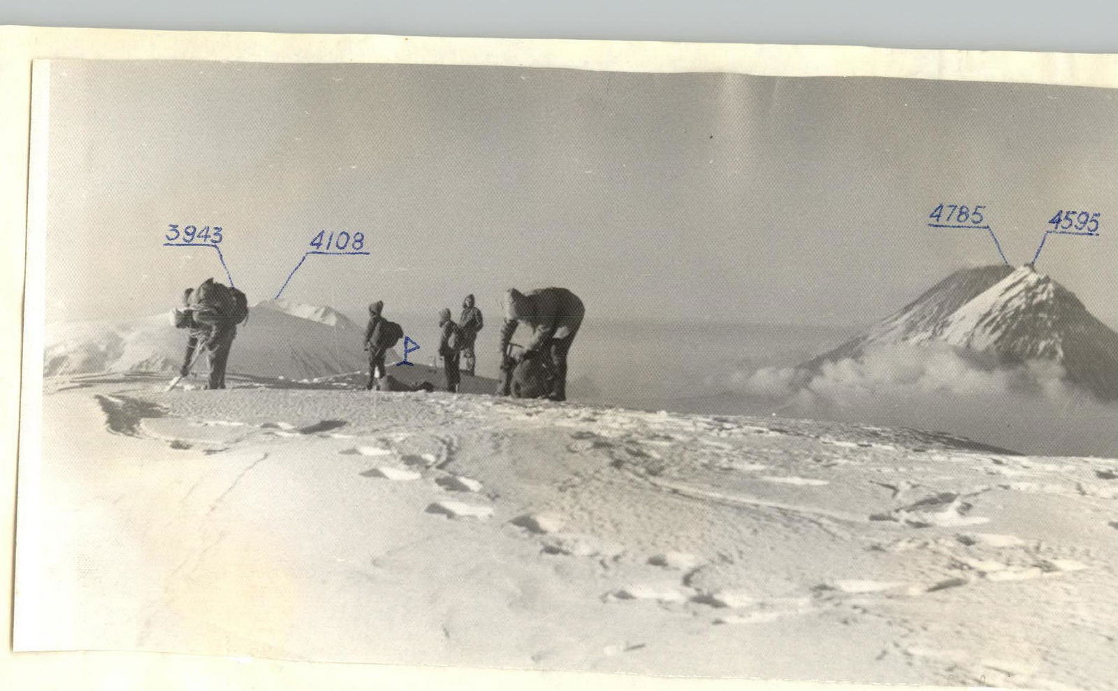
The volcanoes Tolbachik Ostry and Tolbachik Plosky have glaciated peaks with glaciers descending to 1000–1100 m above sea level. Routes to the summit of Tolbachik Ostry go via snow and ice slopes, and only from the south and south-east, rocky ridges lead to the summit, which fall short by 150–200 m. On all other sides, the ridges terminate at heights of 1600–2100 m. The summit of Tolbachik Ostry is not clearly defined, and only in summer months can the highest point of the snowy ridge, resembling a pyramid, be identified. The following glaciers are identified on the Ostry and Plosky Tolbachik massifs:
- Number: 11
- Total area: 26.1 km²
The approach to the western and north-eastern routes follows the same path and diverges at the depression of the north-west ridge. Those heading to the western ridge must descend into the valley.
Approach to the Climbing Site
From the shepherds' hut, built on a wide clearing at a height of 800 m, follow the riverbed to the Neizvestny stream, and then along the stream until the end of the bushes. After that, a stream flowing into it from the right will be encountered. Turn into this stream. About 600 meters later, it cuts into the right ridge along the ascent route and forms a narrow gorge, which should be followed. Continue along the gorge for 1.5–2 hours. It leads to a plateau. Cross the plateau in a southerly direction until it is divided by a stream flowing south. Follow the stream and it will lead to the left slope, transitioning into a destroyed rocky ridge running in a north-westerly direction.
Time required to approach the ridge: 4–5 hours from the shepherds' hut. Elevation at this point: 1500 m.
Route Description by Sections
The ascent from the start to the highest point is 2168 m. The count starts from the assumed starting point of the ascent.
1st section. Elevation gain 420 m, slope 15–25°. The ridge is rocky with many gendarmes that are impassable head-on due to severe degradation. Move in teams as the gendarmes are bypassed via scree slopes with a steepness of 40–45°. Maintain a 20–25 minute interval between teams. Time taken: 3 hours.
2nd section. Elevation gain 285 m. Slope 20°, with one section in the middle reaching 50°. Proceed in a team with simultaneous belay. A 15 m ascent involves piton belay. Time taken: 2 hours 30 minutes.
3rd section. Elevation gain 235 m. Slope 20°. At the end of the ridge, there's a rocky ascent ending on a good ledge suitable for setting up two tents. The ascent is done with alternate combined belay over 20 m. Time taken: 2 hours 20 minutes.
4th section. Elevation gain 210 m. Slope 25–35°. Proceed with simultaneous belay. Everyone wears crampons. Time taken: 1 hour 50 minutes.
5th section. Elevation gain 242 m. Slope 30–40°. Move in teams on an icy slope with a steepness of 45°, involving step cutting and alternate belay. Time taken: 2 hours 40 minutes.
6th section. Elevation gain 260 m. Slope 40–50°. One section reaches 55–60° and is traversed with piton belay and step cutting. The entire section is traversed in teams with alternate belay via ice axe. Time taken: 2 hours 45 minutes.
7th section. Elevation gain 315 m. Slope 40°, reaching 50° in places. Proceed with alternate belay and step cutting in particularly steep areas. Time taken: 3 hours 20 minutes.
8th section. Elevation gain 105 m. Slope 45°. One section reaches 60° over 35 m. This section is traversed with piton belay and involves cutting 110 steps. Time taken: 2 hours.
9th section. Elevation gain 110 m. Slope 40°. Belay is simultaneous, with some alternate belay via ice axe. Time taken: 1 hour 30 minutes. This section leads to the summit, where a suitable spot for overnight stay should be found:
- Set up a tent
- Dig a cave.
Descent from the Summit
Descent from the summit follows route category 2B from the north, as classified in 1971.
- The first 200 m with simultaneous belay.
- Followed by about 350 m with alternate belay via pitons.
Then, exit onto a rocky ridge and follow it until reaching the Bystry stream. Time taken: 6 hours.
Next:
- Cross the stream.
- Proceed for 2 hours along the right side.
The path leads to a steep descent, and before reaching a rocky massif, descend onto a clearing with a lake. The path goes through a marshy lowland that gently slopes down to the Bystry stream. Time taken: 1 hour.
Further:
- Cross the Bystry stream.
- Follow a well-trodden path on the left side.
- The path leads to the shepherds' hut. Time taken: 45 minutes.
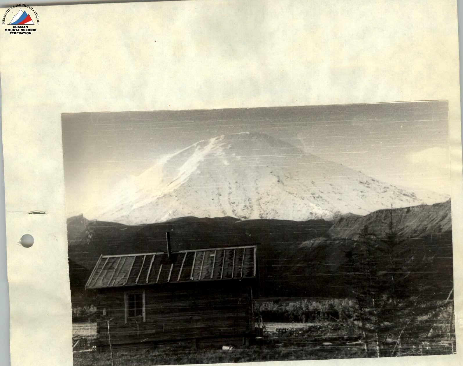
Tolbachik Ostry
GENERAL VIEW FROM THE BASE CAMP.
Day 1.
Transition from the shepherds' hut to the start of the route. 4 hours
- 1st section: 3 hours
- 2nd section: 2 hours 30 minutes
- 3rd section: 2 hours 20 minutes
Total: 11 hours 50 minutes
Day 2.
- 4th section: 1 hour 50 minutes
- 5th section: 2 hours 40 minutes
- 6th section: 2 hours 45 minutes
- 7th section: 3 hours 20 minutes
- 8th section: 2 hours
- 9th section: 1 hour 35 minutes
Total: 15 hours 10 minutes
Day 3.
- 1st section: 6 hours
- 2nd section: 2 hours
- 3rd section: 1 hour
- 4th section: 45 minutes
Total: 9 hours 45 minutes
Recommendations for Climbers
Everyone should wear crampons. Group size: 4–6 people. Overnight stay locations:
- At the start of the route;
- At the end of the rocky ridge.
The group must have all bivouac equipment.
Special equipment for a group of 6:
- Main rope — 3 pieces, 40 m each
- Ice pitons — 10 pieces
- Rock pitons — 4 pieces
- Ice hammers — 2 pieces
- Group carabiners — 6 pieces
Individual equipment:
- Avalanche shovels — 1–2 pieces
- Helmets — 6 pieces
- Crampons — 6 pairs
First ascent completed from August 1 to August 3, 1971. Description compiled on October 19, 1971.
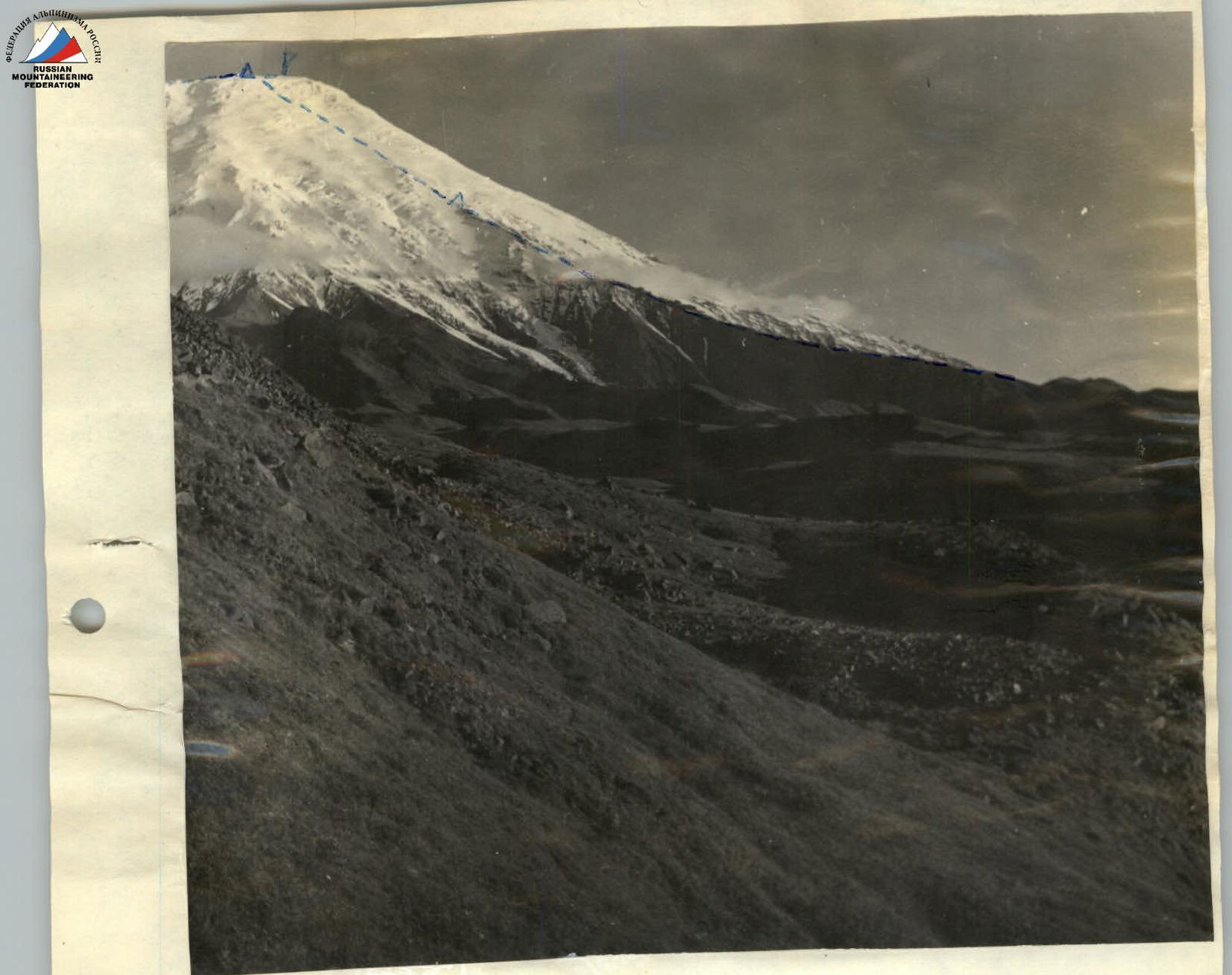
Tolbachik Ostry
--- PASSAGE OF THE NORTH-WEST ROUTE.
Δ — Overnight locations. P — Control cairn.
P — Summit Ostry Tolbachik — 3682 m
Comments
Sign in to leave a comment