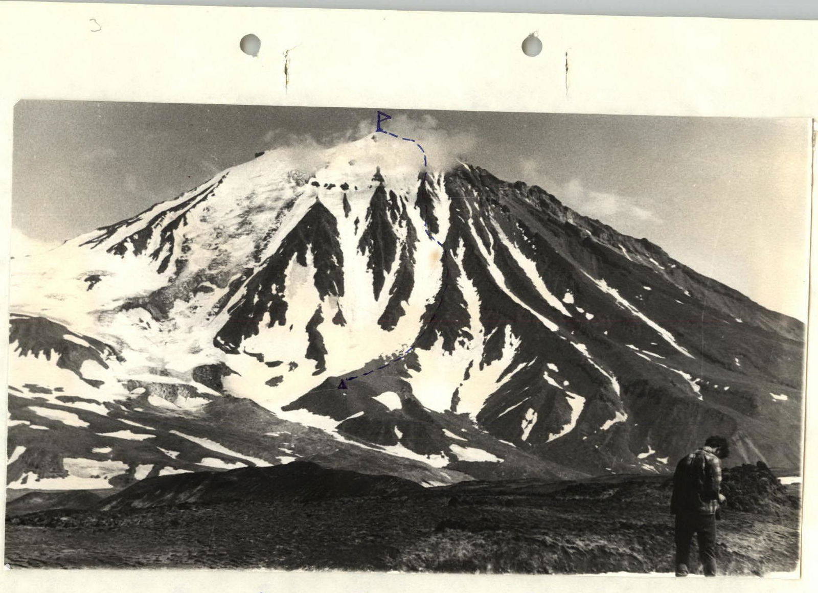
 Ovalnaya Zimina volcano, 3rd ridge
--- — Passage of the western route.
P — Control tour.
Δ — Base camp.
Ovalnaya Zimina volcano, 3rd ridge
--- — Passage of the western route.
P — Control tour.
Δ — Base camp.
Description
Ascent to the summit of Ovalnaya Zimina via western ridges, category 2B.
1. Location description of the volcano
Ovalnaya Zimina is located in the central part of the Klyuchevskaya group of volcanoes. This is an ancient extinct volcano with gentle, uniform slopes from the north and east. Its western and southern slopes are steep and heavily destroyed.
The summit of Ovalnaya Zimina is snow-ice. A 4-meter pole is installed at the highest point of the summit, clearly visible from all sides. It is impossible to blow it away by wind. A hermetically sealed metal box is nailed to this pole.
Approaches to Ovalnaya Zimina are the same as to Bolshaya Udina, but after descending, you should go not to the south, but to the east, or to the southeast to the shepherds' hut and set up a camp there. If you plan to ascend only one route, you need to go strictly to the east, keeping the descending glacier from the western slope in sight.
750–800 m south of that glacier on the slag plateau is a convenient place for a bivouac for ascending via western ridges. The time required to approach from the shepherds' hut at the confluence of the Neizvestny stream with the Studenaya river to this bivouac is approximately 6–7 hours.
2. Route description by sections
Relative height from the overnight stay to the highest point of the massif is 1681 m. The countdown is from the overnight stay location:
R1. Height difference — 200 m. Steepness 20–25°. The slopes are covered with small and medium scree, do not pose technical difficulties. Passage time — 35 min.
R2. Height difference — 310 m. Steepness 20–30°. Slopes of medium and large scree with cliffs on the sides. Movement in rope teams. Travel time — 1 h 30 min.
R3. Height difference — 150 m. Steepness 35–40°. Snow-ice section, местами — rocks from inclined slabs. In the middle of the section, there is a transition from one ridge to another along a snow-ice slope with a hook belay. Travel time — 1 h 25 min.
R4. Height difference — 171 m. Steepness 40°. At the beginning of the section — a rocky groove with a steepness of 50°. Passed with alternate belay through pitons 60 m. The rest is passed with simultaneous belay. Travel time — 1 h 45 min.
R5. Height difference — 200 m. Rocky ridge of destroyed basalts. Steepness 35–45°. Movement in rope teams with simultaneous belay. Travel time — 1 h.
R6. Height difference — 310 m. Steepness 30°. On the second half of the section, you should go to the snow-ice slope and move along it. The steepness increases, and the last 30 m are passed with a hook belay. Passage time of the section — 2 h 20 min.
R7. Height difference — 340 m. Steepness 45° for 40 m, then the slope flattens to 25°. The first 40 m are passed with alternate hook belay. The rest of the way is passed with simultaneous belay. The entire section is snow-ice. Passage time — 2 h.
3. Descent from the summit
The descent goes along a snow-ice groove. The first 200–220 m are passed with simultaneous belay. The next 800–850 m — with alternate belay through an ice axe or pitons. 3 hours are spent on this section. The rest of the way is passed in rope teams with simultaneous belay. Travel time — 1 h. Return to the base camp — along the approach path.
4. Calculation of route passage time
Day 1
Approach from the base camp to the start of the ascent — 6 h.
Day 2
R1 — 1 h 35 min. R2 — 1 h 30 min. R3 — 1 h 25 min. R4 — 1 h 45 min. R5 — 1 h. R6 — 2 h 20 min. R7 — 2 h.
Time spent on descent: R1 — 3 h. R2 — 1 h. Total on the 2nd day — 14 h 35 min.
Day 3
Return to the base camp — 7 h.
5. Recommendations for climbers
Everyone should have crampons. The group should consist of 4–6 people. Overnight stay locations can be chosen on all sections.
Special equipment for a group of 6 people:
- Main rope
- Rock pitons — 4 pcs.
- Ice pitons — 4 pcs.
- Crampons — 6 pairs.
- Climbing hammers — 2 pcs.
- Personal equipment
- Group carabiners — 4 pcs.
- Bivouac equipment
The first ascent was made on August 8, 1971. The description was compiled on November 5, 1971.
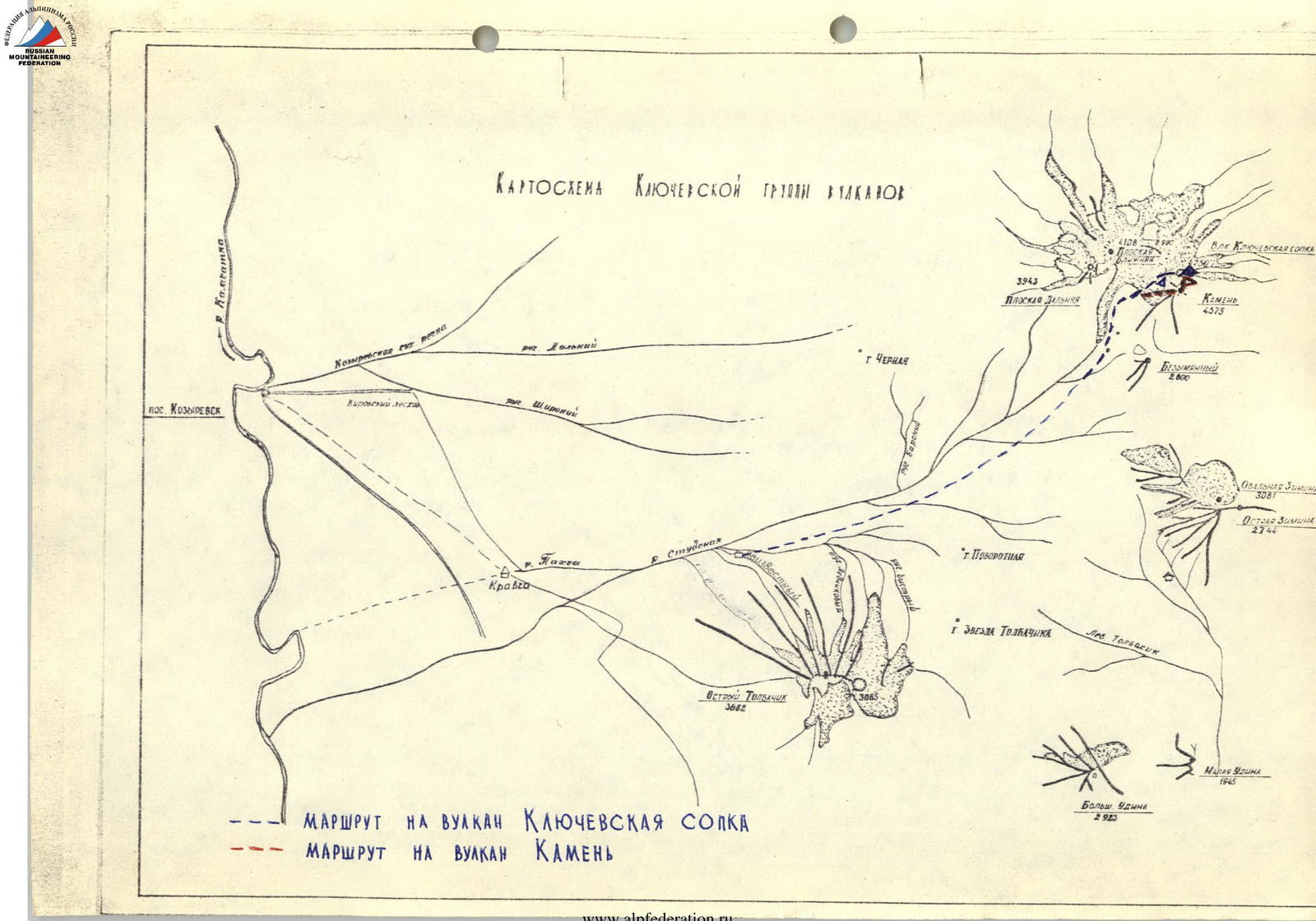 ROUTE TO KLJUCHEVSKAYA SOPKA VOLCANO
ROUTE TO KAMEN VOLCANO
ROUTE TO KLJUCHEVSKAYA SOPKA VOLCANO
ROUTE TO KAMEN VOLCANO