Kamchatka Federation of Mountaineering and Rock Climbing
REPORT
ON THE FIRST ASCENT TO THE SUMMIT OF 2nd BASTION VIA THE "WESTERN RIDGE" ROUTE, CATEGORY 2A, BY THE TEAM OF THE KAMCHATKA FEDERATION OF MOUNTAINEERING AND ROCK CLIMBING,
COMPLETED ON JULY 4, 2022
Climbing Details
| № | 1. General Information | |
|---|---|---|
| 1.1 | Full Name, Sport Rank of the Leader | Fedorov A.V., 2nd sport rank |
| 1.2 | Full Name, Sport Rank of the Participants | Milyukhin S.N., 2nd sport rank |
| Fadeev I.V., 2nd sport rank | ||
| 1.3 | Full Name of the Coach | Farberov F.A., CMS |
| 1.4 | Organization | Kamchatka Federation of Mountaineering and Rock Climbing |
| 2. Characteristics of the Climbing Object | ||
| 2.1 | Region | Ganal'skiye Vostryaki Ridge |
| 2.2 | Valley | - |
| 2.3 | Section Number according to the 2013 Classification Table | 3.2 |
| 2.4 | Name and Height of the Summit | 2nd Bastion, 1800 m |
| 2.5 | Geographical Coordinates of the Summit (latitude/longitude), GPS Coordinates | N 53.47391° E 157.78125° |
| 3. Characteristics of the Route | ||
| 3.1 | Route Name | Along the Western Ridge |
| 3.2 | Proposed Category of Difficulty | 2A |
| 3.3 | Degree of Route Exploration | First Ascent |
| 3.4 | Nature of the Route Terrain | Combined |
| 3.5 | Elevation Gain of the Route | 800 m |
| 3.6 | Route Length | 2675 m |
| 3.7 | Technical Elements of the Route | I category difficulty scree/snow — 1100 m |
| II category difficulty snow/rock/scree – 555 m | ||
| III category difficulty rock – 20 m | ||
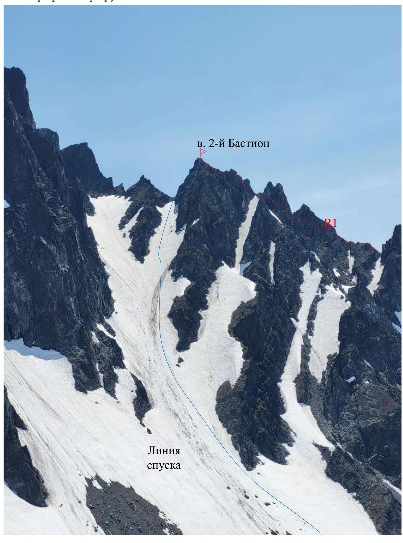
| 3.8 | Descent from the Summit | 1. Rappelling – 1×50 m. |
| 2. Along the couloir between 2nd Bastion and South Summit | ||
| 3.9 | Additional Characteristics of the Route | |
| 4. Characteristics of the Team's Actions | ||
| :-- | :-- | :-- |
| 4.1 | Time of Movement (team's walking hours, indicated in hours and days) | 5 hours 30 minutes |
| 4.2 | Overnights | - |
| 4.3 | Start of the Route | 4:00 |
| 4.4 | Reaching the Summit | 9:30 |
| 4.5 | Return to Base Camp | 14:00 |
| 5. Responsible for the Report | ||
| 5.1 | Full Name, e-mail | Fedorov A.V., sanfed90@mail.ru |
1. Characteristics of the Climbing Object
Map of the Climbing Area
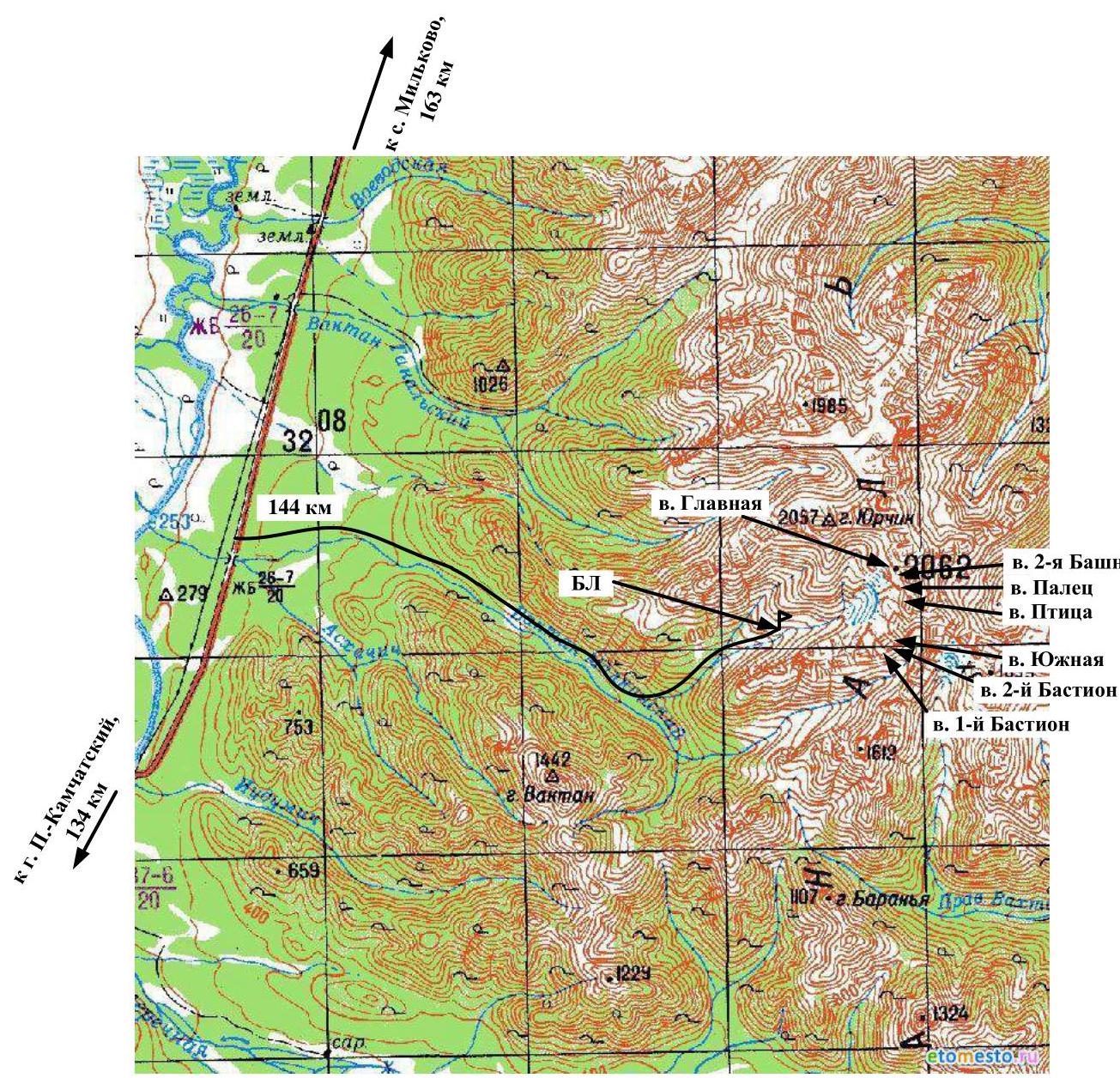
The Ganal'skiye Vostryaki Ridge is a compact area located in the southern part of the Kamchatka Peninsula within the Greater Eastern Ridge system. Its length from northwest to southeast is 20 km, and its width is about 10 km. The maximum height is Main Summit, 2062 m.
The area is characterized by alpine mountain structure, with wall elevations reaching 450 m. Despite the relatively low absolute height, the cold season lasts nine months.
- The first frosts occur in early September.
- Snow falls from the second half of September.
- Temperatures reach −45°C in December–February.
- Snow at the base camp level melts only by mid-June.
The most suitable period for climbing is from mid-June. The path to the mountain area:
- From Petropavlovsk-Kamchatsky, take any vehicle to the bridge over the Vaktan Malkinsky River, 144th km of the Milkovo highway.
- To the right of the bridge, a dirt forest road begins, approximately 9 km long. The first part is passable for almost any vehicle, the second half is accessible by high-clearance vehicles.
- At the end of the dirt road, a hiking trail starts on the left into the gorge along the first tributary of the Upper Malkinsky River. Move along the trail up the left side of the valley, then the trail leads to a terrace. Cross the bed of a small stream at the boundary of the forest and shrubs. Continue along the left slope of the tributary coming from Yurcnik Summit, cross the tributary after 300 m, and head towards the cirque. Move to a convenient meadow located on the bend of the stream, opposite a distinct pass on the right side of the cirque. The elevation gain along the trail is about 500 m, and the distance is about 4 km.
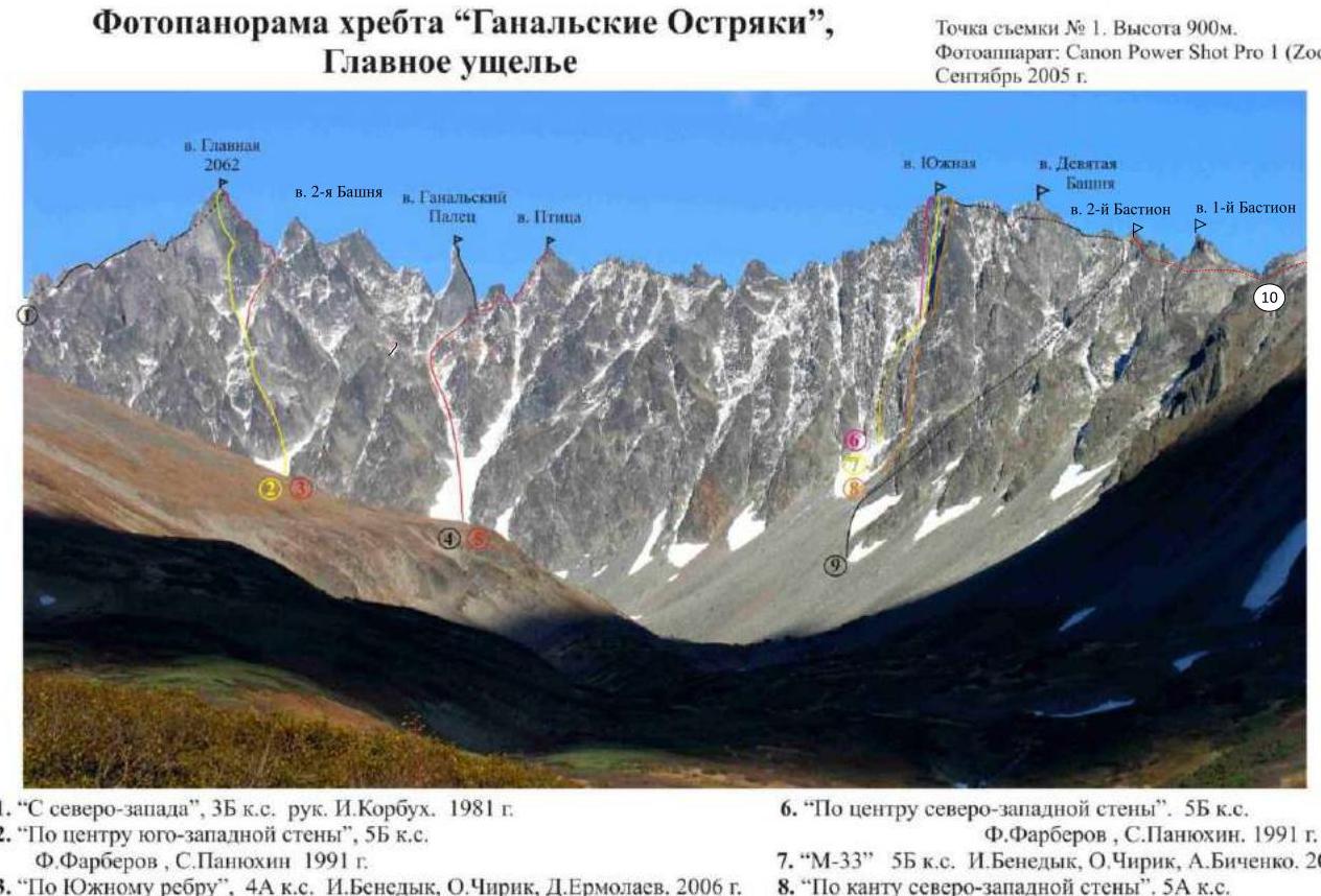 Photopanorama of the Ganal'skiye Ostrakki Ridge, Main Valley.
Shooting point № 1. Height 900 m. Camera: Canon PowerShot Pro 1 (Zoom). September 2005.
Photopanorama of the Ganal'skiye Ostrakki Ridge, Main Valley.
Shooting point № 1. Height 900 m. Camera: Canon PowerShot Pro 1 (Zoom). September 2005.
- "From the Northwest", category 3B, led by I. Korbuh. 1981.
- "Center of the Southwest Wall", category 5B, F. Farberov, S. Panyukhin 1991.
- "Along the South Ridge", category 4A, I. Benedyk, O. Chirik, D. Ermolaev. 2006.
- "Along the South Ridge", category 5A, F. Farberov, S. Panyukhin 1991.
- "Along the North Ridge", category 3B, I. Benedyk, O. Chirik, E. Lysenkov 2005.
- "Center of the Northwest Wall". category 5B, F. Farberov, S. Panyukhin. 1991.
- "M-33" category 5B, I. Benedyk, O. Chirik, A. Bichenko. 2001.
- "Along the edge of the Northwest Wall". category 5A, A. Bichenko, A. Alekseev, I. Bekrin. 1995.
- "Along the South Ridge". category 2B, A. Bichenko, A. Konshin, R. Sagitova. 1998.
- Team's route, "Along the Western Ridge", category 2A.
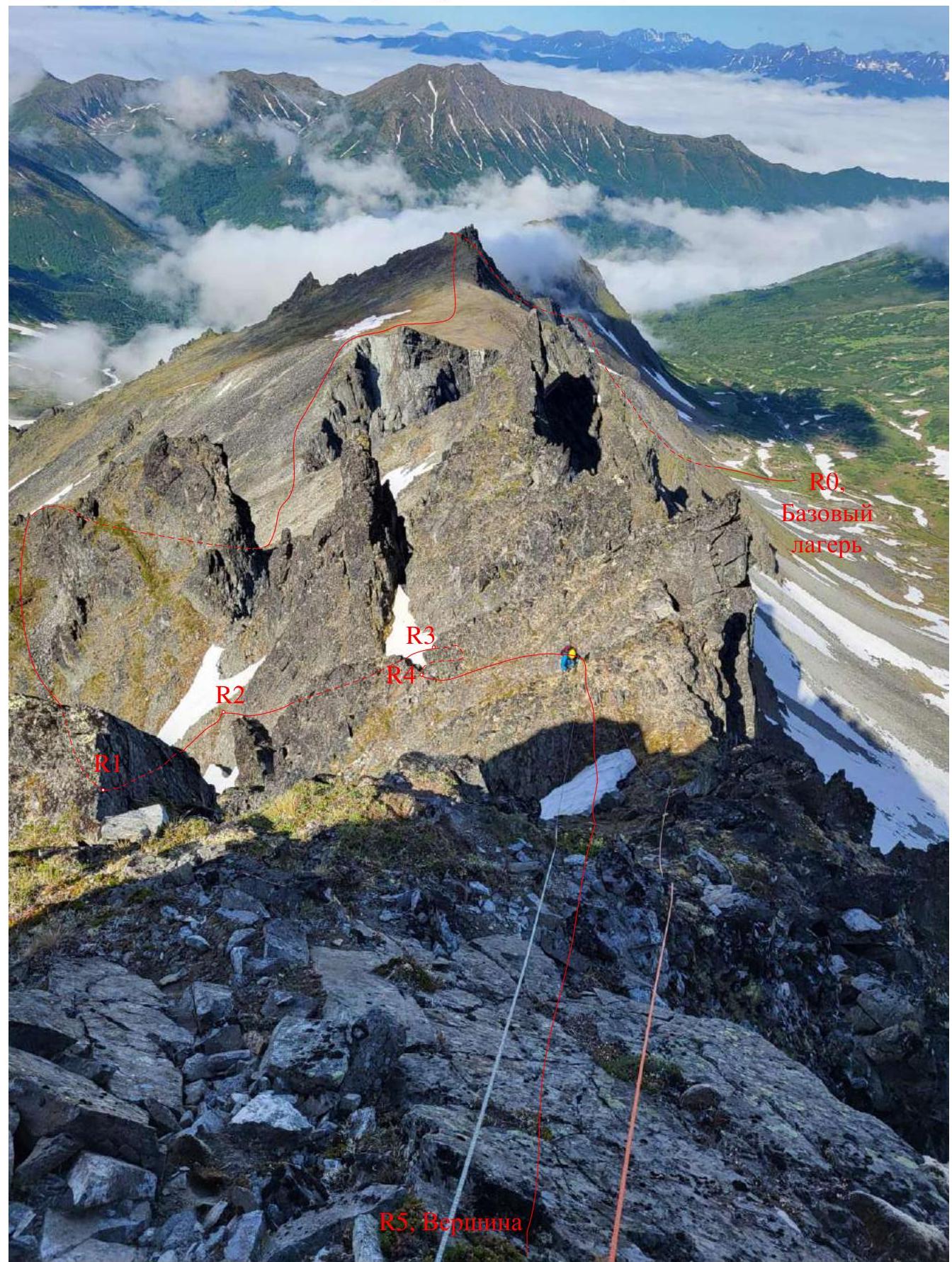
General photo of 2nd Bastion Summit with the route taken by the team
Date of shooting: June 30, 2022. Shooting point: N 53.48288° E 157.77457°. Height of the shooting point: 1400 m
2. Characteristics of the Route
Photo of the route profile
Technical photo of the route (section R0–R5)
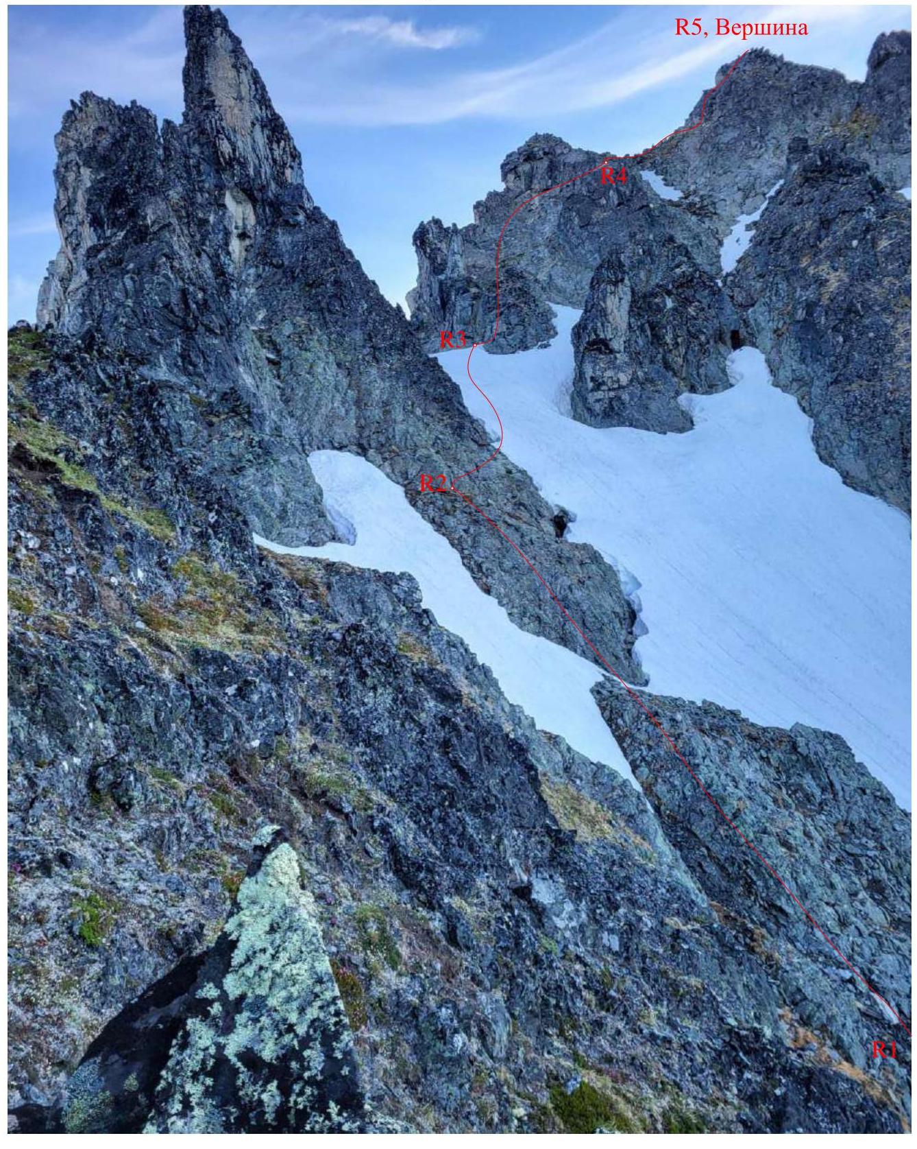
Technical photo of the route (section R1–R5)
2.3. Technical Characteristics of the Route Sections
| Section № | Terrain Characteristics | Category of Difficulty | Length, m | Type and Number of Anchors |
|---|---|---|---|---|
| R0–R1 | Grassy/scree slope | 1 | 300 | - |
| Grassy/scree slope/snow | 2 | 300 | ||
| Grassy/scree slope | 1 | 700 | ||
| Grassy/scree slope | n/c | 1000 | ||
| Grassy/scree slope/snow | 1 | 100 | ||
| R1–R2 | Rock | 2 | 40 | Through rock projections (blocks) |
| R2–R3 | Rock | 2 | 20 | Nuts, friends, 3 pcs. |
| Snow | 2 | 25 | ||
| R3–R4 | Rock | 3- | 10 | Nuts, friends, 4 pcs. |
| 2 | 30 | |||
| R4–R5 | Rock | 2 | 40 | Nuts, friends, anchors, 4 pcs. |
| (Summit) | Rock | 3- | 10 |
3. Characteristics of the Team's Actions
Brief description of the route passage.
Section R0–R1. The start of the route is directly from the base camp; ascend to the right side of the cirque towards an obvious pass along a snowy (later in the summer, grassy-scree) slope, 300 m, slope up to 25°, 1; 300 m, slope up to 40°, 2 (crampons and ice axe may be needed early in the season). Continue along the ridge on grassy terrain via an obvious trail, 700 m, slope up to 25°, 1; 1000 m, slope up to 10°, n/c. The trail bypasses 1st Bastion Summit on the right. Where the trail starts to sharply turn left and upwards, continue straight, crossing small snowfields to reach the saddle between 1st Bastion and 2nd Bastion (crampons and ice axe may be needed). Cross an inclined grassy terrace. Then, move around heavily damaged rocks on the right, traversing the slope with a slight loss of height to reach a rock ridge leading up to a rock formation (jendar) on the left of the Bastion massif, 100 m, slope up to 25°, 1. The technical part of the route begins here.
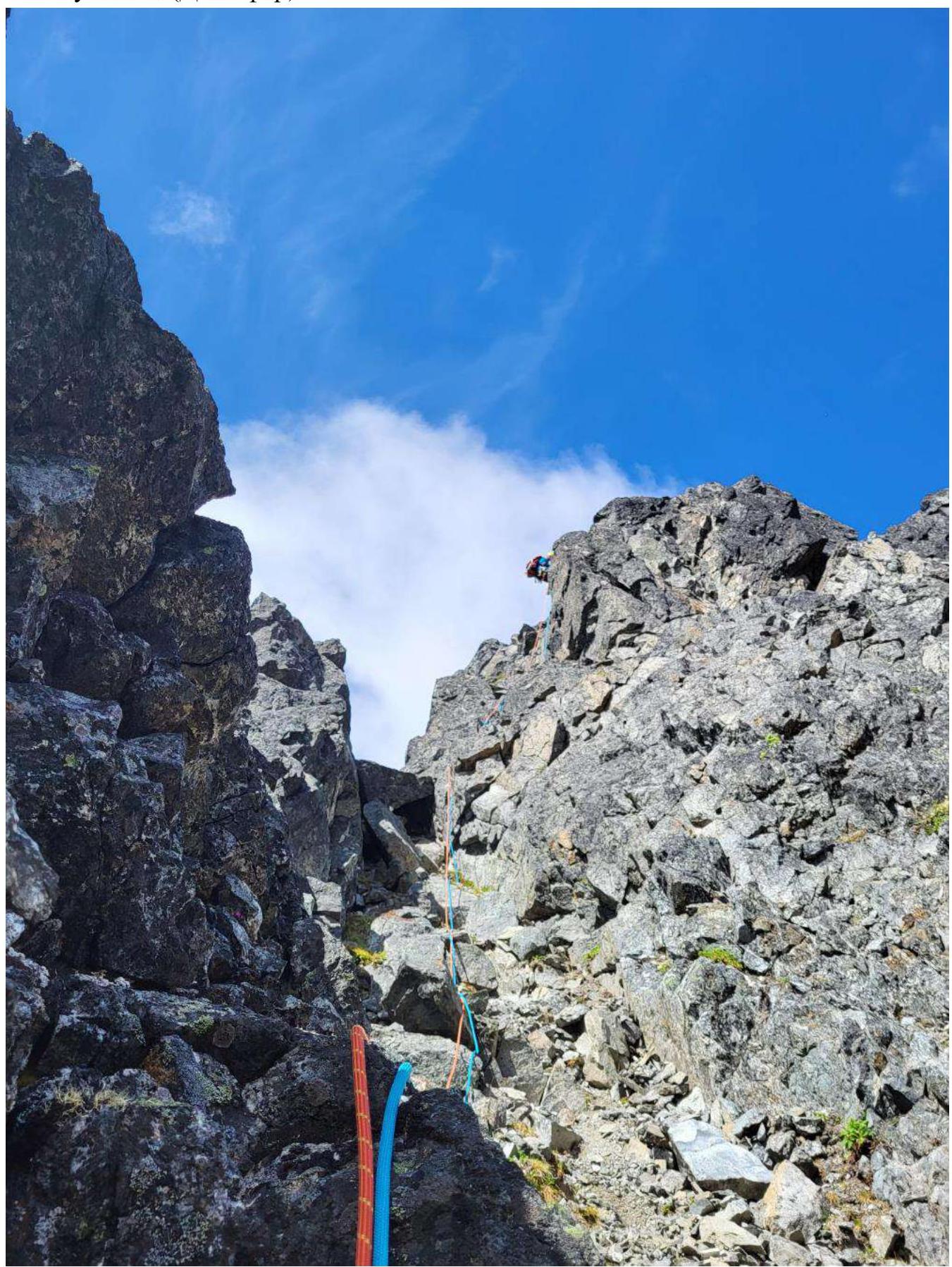
Section R1–R2. Belay station on a rock outcrop. Move with intermittent belay upwards along the rock ridge under the main mass of the jendar, 40 m, 2, slope up to 45°. Belay on rock projections. Station: anchor bolts, nuts.
Section R2–R3. Move with intermittent belay traversing right along the rock ridge with a slight gain in height, 20 m, 2, slope up to 50°. Then, move straight up on dense snow to the saddle under the rock on the right (start of the Bastion massif), 25 m, 2, slope up to 40°. Belay with friends, nuts. Station on own protection (friends, nuts).
Section R3–R4. Move with intermittent belay straight up along a weakly defined rock rib under the rock walls above, then right along the walls to a distinct pass, 10 m, 3-, slope 50°, 40 m, 2, slope 45°. Belay on rock projections, friends, nuts. Station on a rock outcrop.
Section R4–R5 (Summit). Move with intermittent belay from the shoulder upwards to the ridge, then along the ridge to the summit, 40 m, 2, slope up to 45°, 10 m, 3-, slope 50°. Belay on rock projections, friends, nuts. Station on a rock outcrop.
The summit is a small platform. Simultaneous presence of more than 5–6 people is challenging. Control cairn.
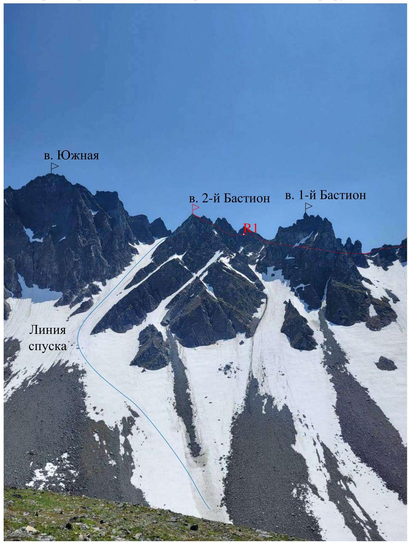
Descent. Move down with a 50 m rappel towards the South Summit, slightly deviating right (downhill) to a snowy saddle. Rappelling sling on a rock outcrop.
Then, descend 600 m along the couloir to the cirque:
- in the upper part, move in three pitches,
- dense snow, occasional ice,
- may require belay.
Then, left (downhill) along the snowfield to the base camp.
Conclusion. The climbers have experience on routes up to category 4A, including various mountain regions of Russia and the CIS. Comparing this route with others, including those in the Ganal'skiye Vostryaki area (Yurchik Summit, 2A "along the NE ridge", Cherepakha Summit, 2B "along the NW ridge", Kozel'skiy volcano, 2B "traverse from the NW summit, including Zub", Arik volcano, 1B "along the SW ridge", Vachkazhets volcano, 1B "along the NE ridge", etc.), the team concluded that this route corresponds to category 2A in terms of technical work and techniques.
This route, due to its ridge and traversing nature, is largely safe and can be recommended as a training route, which is crucial for the development of mountaineering in the Kamchatka region, as there is a clear deficit of categorized routes of 2–3 category difficulty necessary for UTS within NP-2, SP-1.
Photo of section R0–R1
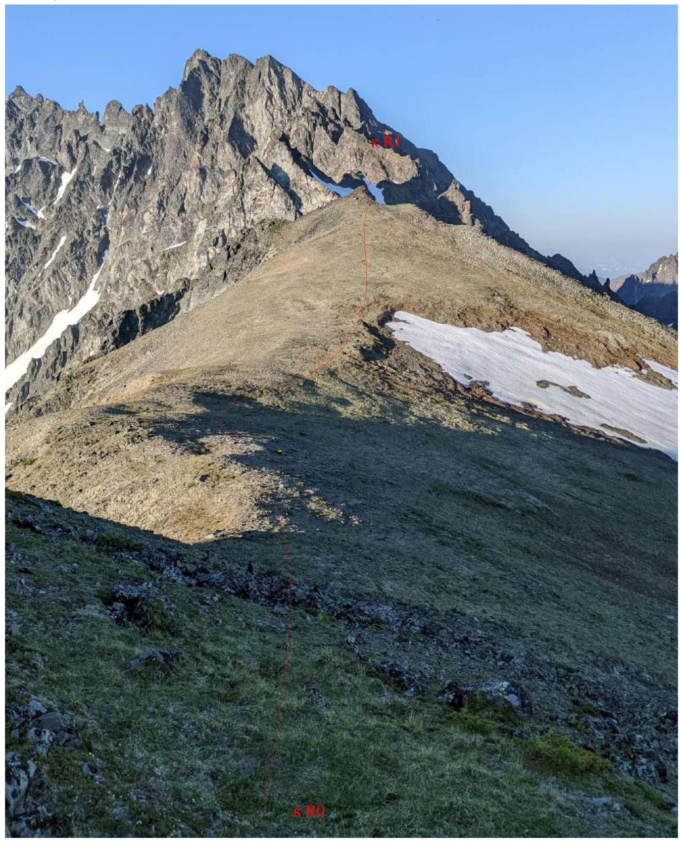
Photo of section R0–R1
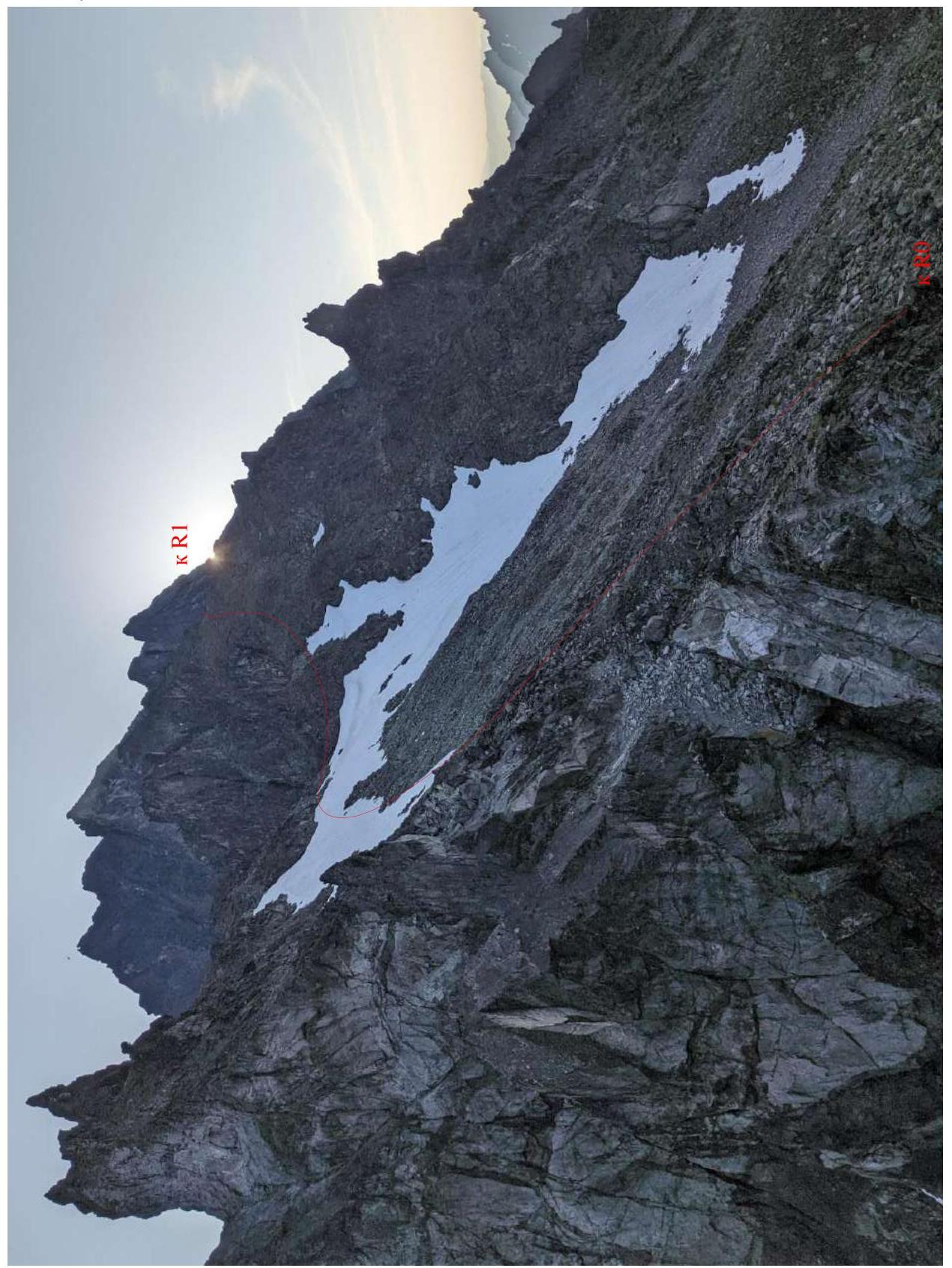
Photo of section R0–R1
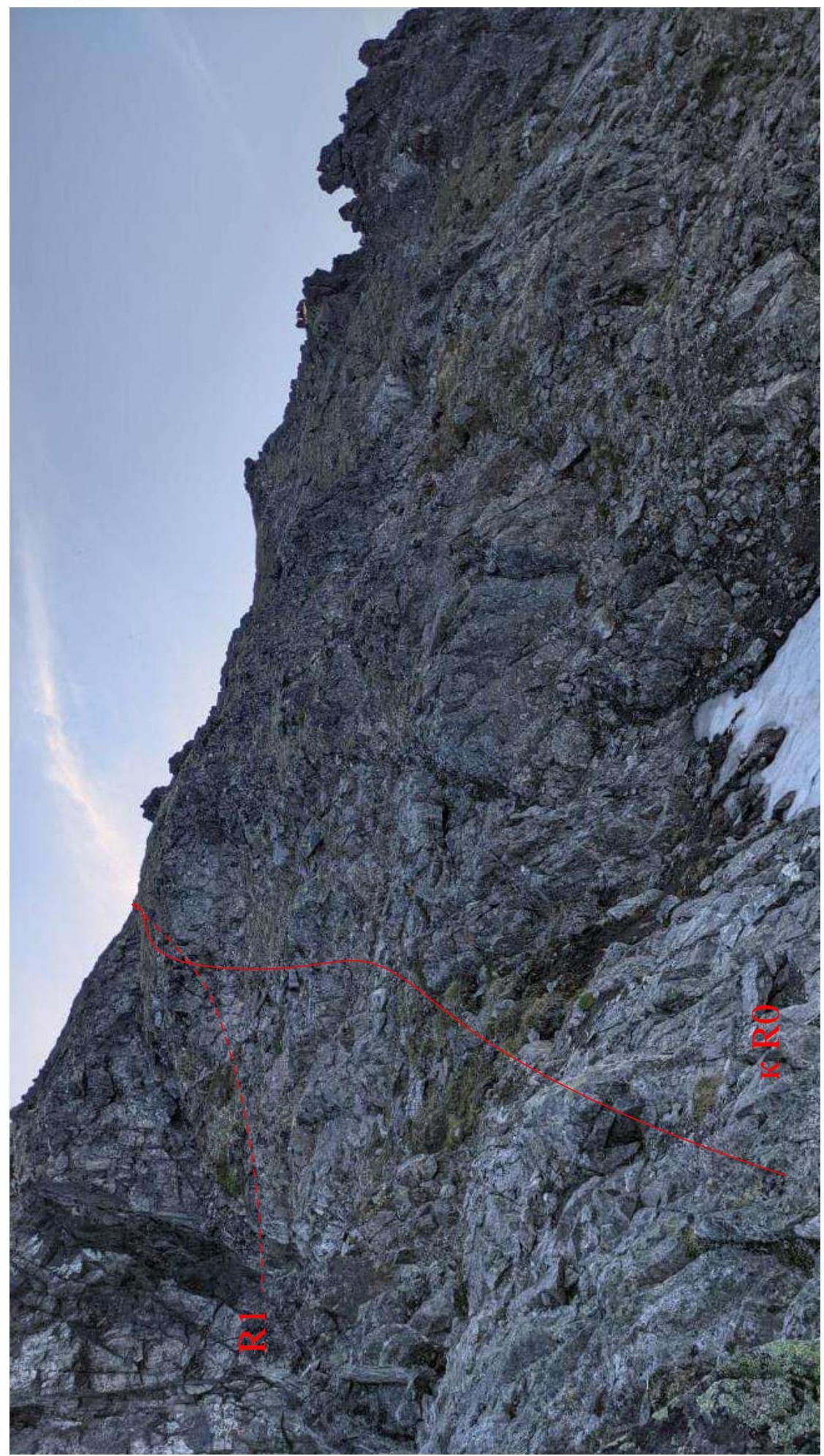
Photo of section R2–R3 , the team concluded that this route corresponds to category 2A in terms of technical difficulty and techniques.
This route, due to its ridge and traversing nature, is largely safe and can be recommended as a training route, which is crucial for the development of mountaineering in the Kamchatka region, as there is a clear deficit of categorized routes of 2–3 category difficulty necessary for UTS within NP-2, SP-1.
Photo of section R3–R4
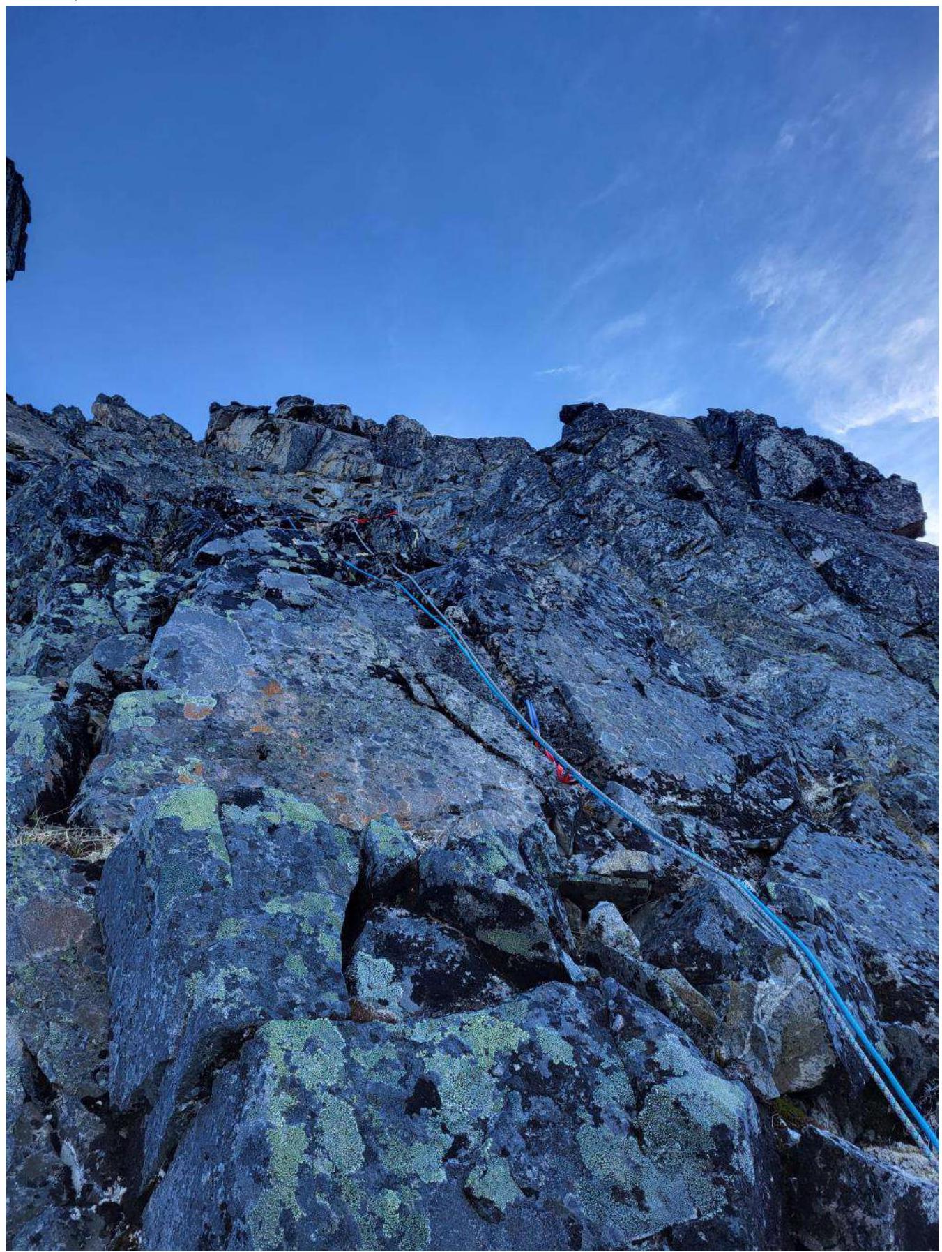
Photo of section R3–R4 (photo from the second ascent of the route on July 7, 2022)
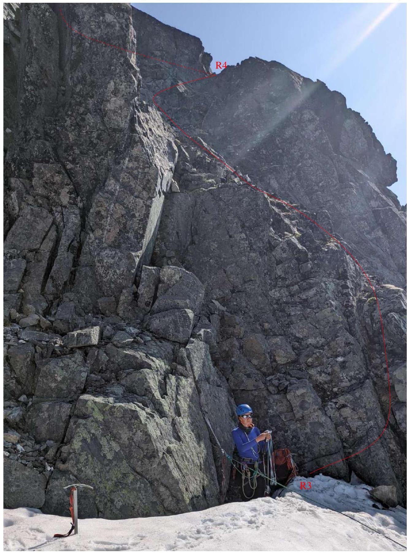
Photo of section R4–R5 (Summit)
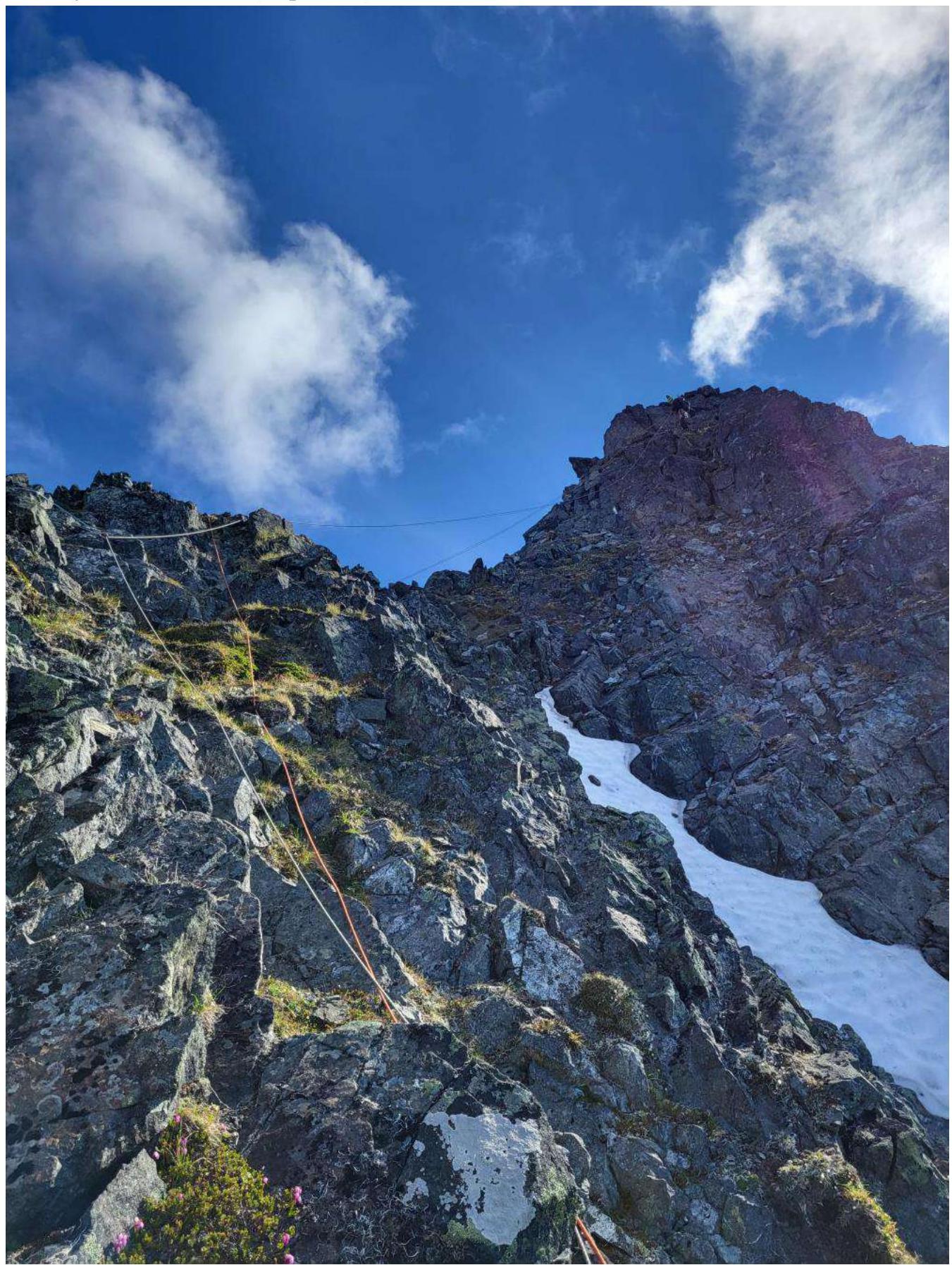
Photo at the summit (from left to right Fedorov A.V., Fadeev I.V., Milyukhin S.N.)
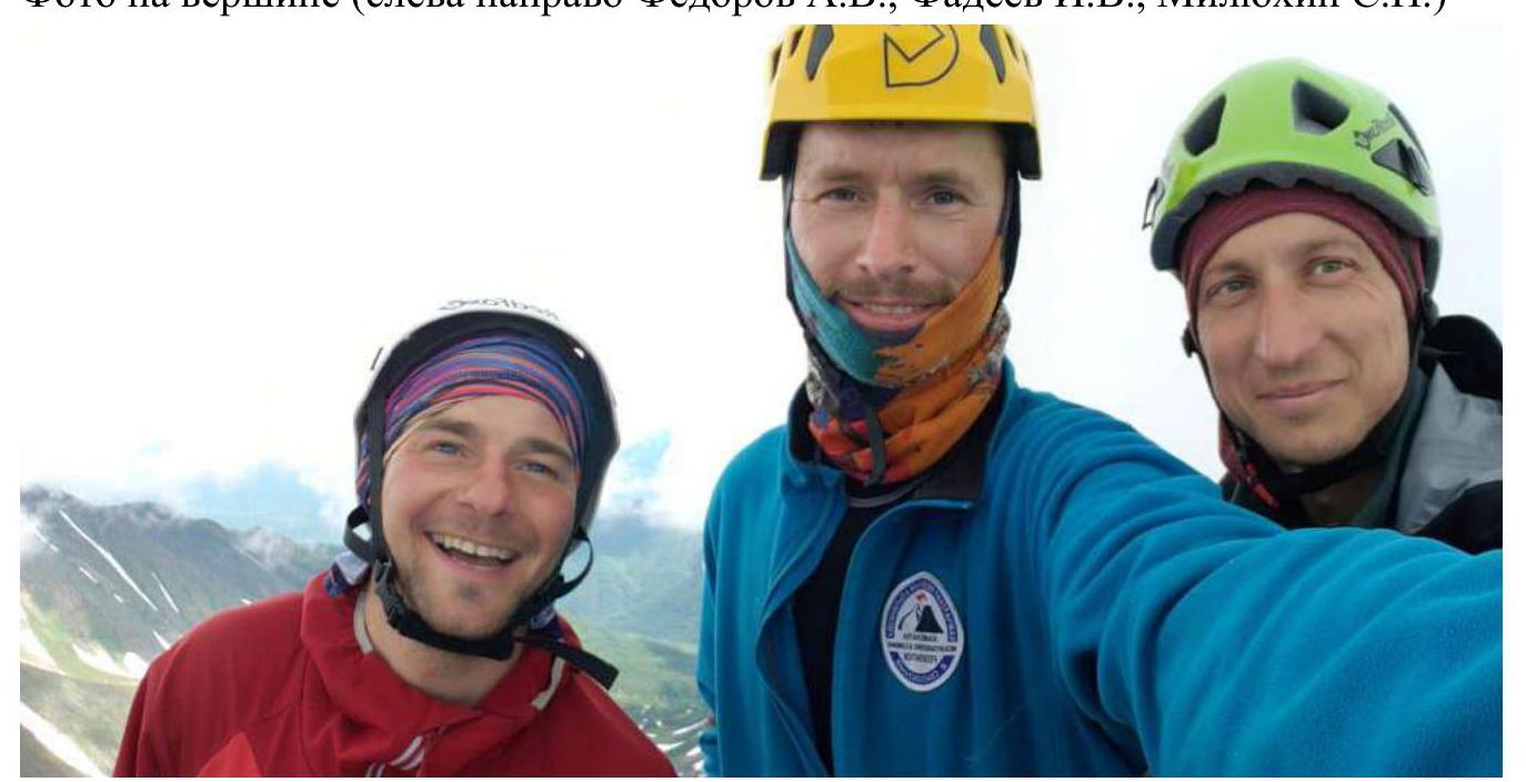
Photo of section (Rappelling)