Report
on the first ascent to the summit Gorelaya, 1237 m, Kamchatka Krai, Elizovsky District, Ganal Range via the South-Eastern edge route, category 1B (winter, combined) by the team of Tomsk Alpine Federation and Kamchatka Mountain School on February 27, 2022 2022
I. Ascent Passport
| No. | 1. General Information | |
|---|---|---|
| 1.1 | Full name, sports rank of the team leader | Temerev Ivan Mikhailovich, Master of Sports |
| 1.2 | Full name, sports rank of the participants | Gorokhov Kirill Gennadyevich, 3rd sports rank, Ermolina Alena Evgenyevna, no rank, Puchinin Nikolai Viktorovich, no rank, Romanyuk Evgeny Anatolyevich, no rank, Rudchenko Alena Igorevna, no rank, Salykova Irina Vladimirovna, no rank |
| 1.3 | Full name of the coach | Gorokhov Kirill Gennadyevich |
| 1.4 | Organization | Tomsk Alpine Federation and Kamchatka Mountain School |
| 2. Characteristics of the Ascent Object | ||
| 2.1 | Region | Kamchatka Krai, Elizovsky District |
| 2.2 | Ridge | Ganal |
| 2.3 | Section number according to the 2020 Classification Table | 3. Kamchatka |
| 2.4 | Name and height of the summit | Gorelaya, 1237 m above sea level |
| 2.5 | Geographical coordinates of the summit (latitude, longitude), GPS coordinates | 53°12′07″ N, 157°53′12″ E |
| 3. Characteristics of the Route | ||
| 3.1 | Name of the route | Via the South-Eastern edge |
| 3.2 | Proposed category of difficulty | 1B, winter, combined |
| 3.3 | Degree of route exploration | First ascent, date of first ascent unknown |
| 3.4 | Relief characteristics of the route | Rocky, snow-firn |
| 3.5 | Height difference of the route (according to GPS data) | 950 m |
| 3.6 | Length of the route (in meters) | 2100 m, including 900 m of technical section |
| 3.7 | Technical elements of the route (total length of sections of various difficulty categories with indication of relief character (ice-snow, rocky)) | 0–1 category – 1650 m, including 1200 m snow-firn slope and couloir with slope up to 45°; 450 m snow-firn ridge with slope up to 30°. 1 category – 150 m, snow-firn slope with exit to rocky talus and simple rocks; slope up to 45°. 2 category – 300 m, rocks with slope up to 60°, partially iced, separated by snow-firn tongues leading to rocky outcrops. |
| 3.8 | Descent from the summit | Via the ascent route |
| 3.9 | Additional characteristics of the route | Average slope 40°, maximum slope 62°; potentially avalanche-prone areas; cell phone coverage available on the route. |
| 3.10 | Equipment used | Local loops with carabiners – 3 pcs. |
| 4. Characteristics of the Team's Actions | ||
| 4.1 | Time of movement (team's working hours) | 8 hours, including approach 30 minutes, ascent 4.5 hours, descent and return 3 hours |
| 4.2 | Overnights | – |
| 4.3 | Start of the route | 9:00 02/27/2022 – start, 9:30 – beginning of work on the route |
| 4.4 | Reaching the summit | 14:10, 14:30 – start of descent |
| 4.5 | Return to the trailhead | 17:30 |
| 5. Responsible for the Report | ||
| 5.1 | Full name, e-mail | Rudchenko Alena Igorevna Rudchenko-a@mail.ru 89247913418 |
II. Ascent Description
1. Characteristics of the Ascent Object
1.1. General photo of the summit.
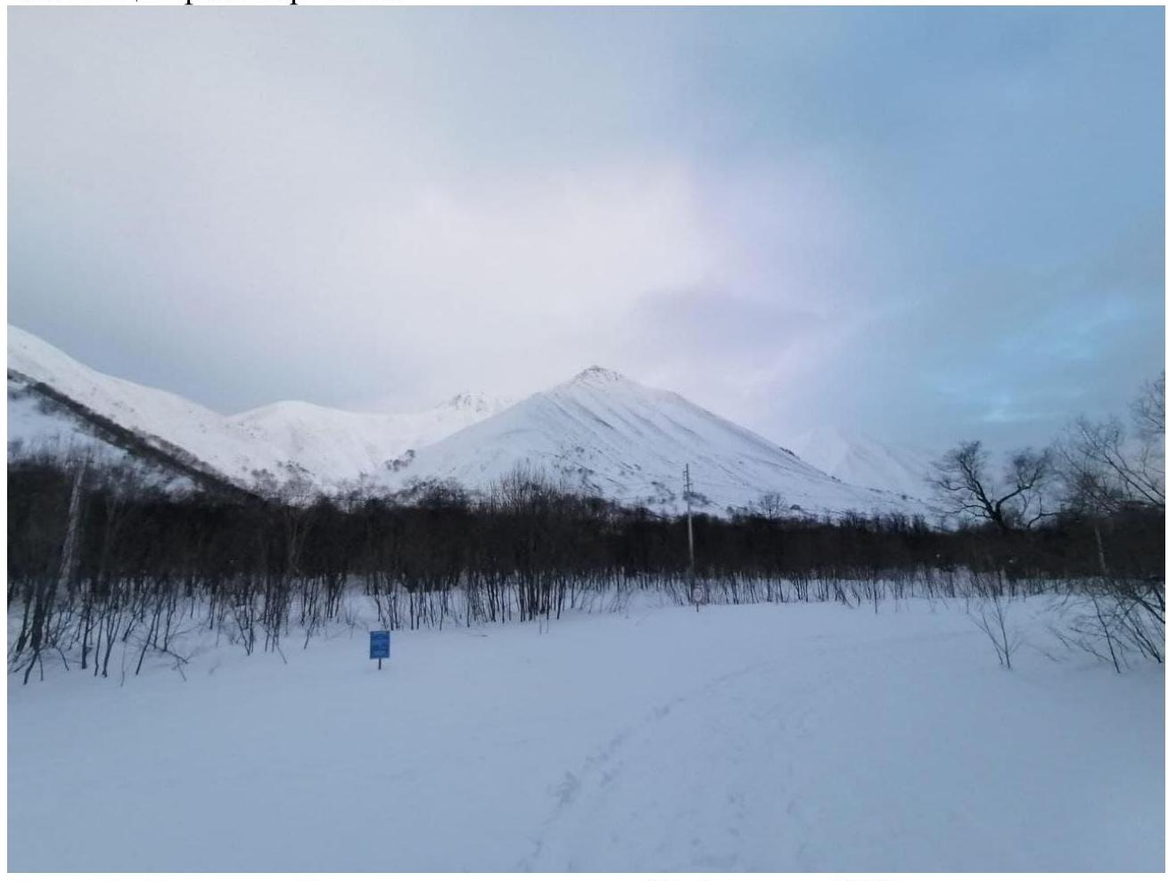
Photo 1. Gorelaya summit, taken on February 27, 2022, shot on approach to the route from the southeast, from a section of the gas pipeline road (coordinates of the shooting location 53°10′39″ N, 157°54′30″ E).
1.2. Photo of the route profile
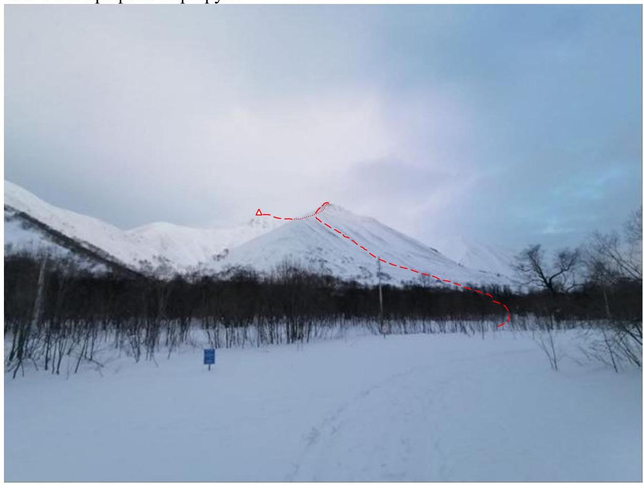
Photo 2. Profile of the route (marked with a red line, dashed line indicates a section not visible from the shooting location). Information on classified routes to the summit is not available.
1.3. Profile of the route
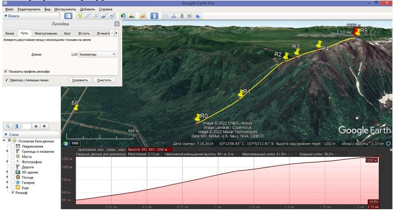
Figure 1. Profile of the route in Google Earth Pro.
1.5. Map of the area

Figure 2. Map of the ascent area indicating summits and their heights, as well as the ascent route.
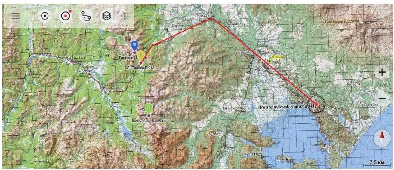
Figure 3. Map of the area.
- The red line schematically indicates the path along the Petropavlovsk-Kamchatsky — Milkovo highway
- The yellow marker indicates the base camp (72 km of the Petropavlovsk-Kamchatsky — Milkovo highway)
- The blue marker indicates the Gorelaya summit, 1237 m above sea level.
The Gorelaya summit is located northwest of Petropavlovsk-Kamchatsky. It is situated in the southern part of the Ganal Range. Among the summits entered in the classifier, slightly south of Gorelaya are: Vachkazhitsy, Vachkazhets, and Bezmyannaya.
The distance from Petropavlovsk-Kamchatsky along the Petropavlovsk-Kamchatsky — Milkovo highway is 72 km. The summit is clearly visible from the beginning of the gas pipeline road at 72 km of the highway.
Path to the start of the route:
- from Petropavlovsk-Kamchatsky along the Petropavlovsk-Kamchatsky — Milkovo highway to 72 km.
- then 1.5 km on snowshoes in a northerly direction along the gas pipeline road to the start of the ascent (R0, 53°11′26.5″ N 157°54′22.7″ E).
Total approach time from the highway — 30 minutes. Currently, there are no categorized routes to the summit.
2. Characteristics of the Route
2.1. Scheme of the route in UIAA symbols in the form of an outline on the mountain

Figure 4. Scheme of the route in UIAA symbols in the form of an outline on the mountain. Also marked (with a brown line) is the approach route along the technological passage and (with a brown dashed line) through the forest.
2.2. Technical characteristics of the route sections
| Section | Relief characteristics | Category of difficulty | Length, m | Type and number of hooks |
|---|---|---|---|---|
| R0–R1 | Snow-firn slope, angle of inclination up to 45° | 0–1 | 500 | 0 |
| R1–R2 | Couloir with snow-firn coverage on the edges and unstable snow masses towards the center, slope up to 45° | 0–1 | 700 | 0 |
| R2–R3 | Snow-firn slope with exit to rocky talus and simple rocks; slope up to 45° | 1 | 150 | 0 |
| R3–R4 | Key section. Snow-covered rocks with slope up to 60°, partially iced, separated by snow-firn tongues leading to rocky outcrops. | 2 | 300 | Key section. Belay through relief features, loops on relief. |
| R4–R5 | Ridge with snow-firn coverage, maximum slope up to 30°; snow cornices present | 0–1 | 450 | 0 |
2.3. Scheme of the route in UIAA symbols in the form of a table.
| Section | Name and number of hooks | Belay points, characteristics in symbols | Route line in UIAA symbols | Difficulty of the section in symbols | Length of the section, m | Slope, ° |
|---|---|---|---|---|---|---|
| R4–R5 | 0–1 | 450 | 30° | |||
| R3–R4 | 5/0 | Θ | 2 | 300 | 60° | |
| R2–R3 | 1 | 150 | 45° | |||
| R1–R2 | 0–1 | 700 | 45° | |||
| R0–R1 | 0–1 | 500 | 45° |
3. Characteristics of the Team's Actions
3.1. Brief description of the route passage with photo illustrations.
| Section | Description | Photo number |
|---|---|---|
| R0–R1 | Snow-firn slope, angle of inclination up to 45°. At the beginning of the section — simultaneous movement using snowshoes; with increasing slope 30° and above — simultaneous movement in crampons. | |
| R1–R2 | Couloir with snow-firn coverage on the edges and unstable snow masses towards the center, slope up to 45°. Simultaneous movement in crampons, on some sections in three steps. Choice of avalanche-safe trajectory (left side of the couloir; closer to snow-covered dwarf pine). | |
| R2–R3 | Snow-firn slope with exit to rocky talus and simple rocks; slope up to 45°. Simultaneous movement in rope teams using trekking poles and ice axe as support and self-belay on the slope. | Photo 3, 4 |
| R3–R4 | Key section. Snow-covered rocks with slope up to 60°, partially iced, separated by snow-firn tongues leading to rocky outcrops. Movement in rope teams using ice axe, with transition from simultaneous to alternate movement (similarly on descent); using belay through ice axe, as well as relief features and local loops as intermediate belay points. | Photo 5–7 |
| R4–R5 | Ridge with snow-firn coverage, maximum slope up to 30°; snow cornices present. Simultaneous movement in rope teams, with choice of safe trajectory to avoid falling from the cornice. | Photo 8 |
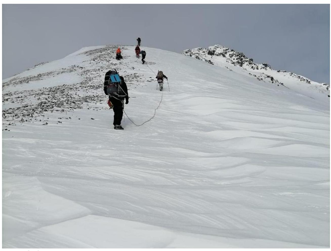
Photo 3–4. Movement on section R2–R3
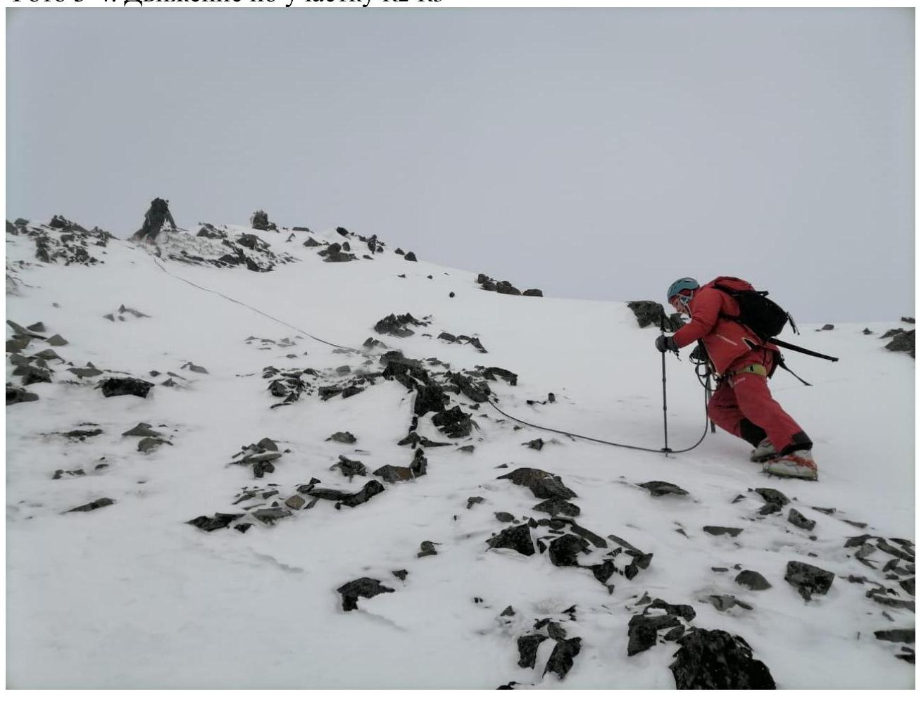
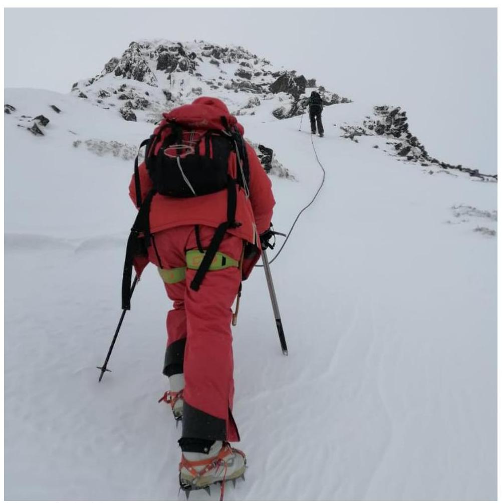
Photo 5–6. Movement on section R3–R4
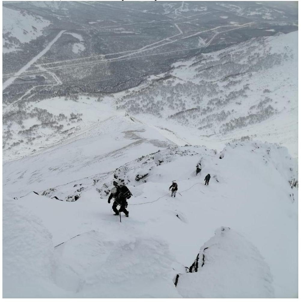
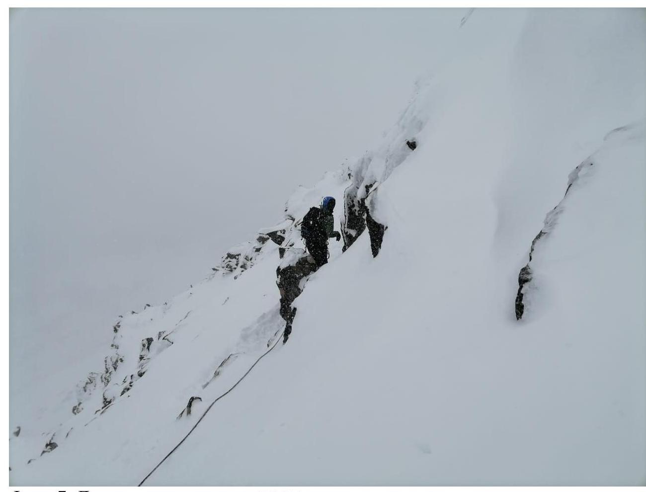
Photo 7. Movement on section R3–R4. Photo 8. Movement on section R4–R5

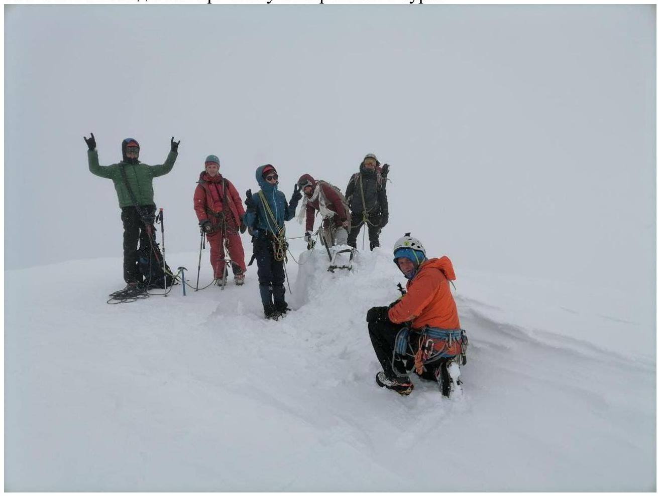
3.2. Photo of the team on the summit with a control landmark.
3.3.
The route requires close attention to avalanche risk, especially after heavy snowfall and during the off-season. It is recommended to traverse the route only with stable snow cover and with avalanche equipment available.
When fresh snow is present on the approaches, the use of snowshoes is recommended.
There is a stable cell phone signal from the "Megafon" operator on the route.
The proposed category of difficulty is correlated with a similar route in the southern part of the Kamchatka Peninsula (Vachkazhets summit, Kozelsky volcano), as well as other category 1B summits in other regions of the country.